

Mori Atlas logo
National parkDalgarup National Park

Discover mapped protected area boundaries and ecological context in Western Australia's South West.

Dalgarup National Park: Protected Jarrah Forest Landscape & Regional Geography

Dalgarup National Park represents a vital conservation area within the Jarrah Forest and Warren bioregions of southwestern Australia. This protected landscape, established as a Class A reserve, showcases characteristic jarrah-marri forest ecosystems shaped by the region's Mediterranean climate and undulating terrain. Understanding its mapped boundaries and ecological significance provides essential context for exploring the natural geography of Western Australia.

National parkWestern AustraliaJarrah ForestSouth West AustraliaProtected forestClass A reserve

Dalgarup National Park

National park

Park overview

Structured park overview, official facts, and landscape profile for Dalgarup National Park

Dalgarup National Park park facts, protected area profile, and essential visitor context

Review the core facts for Dalgarup National Park, including designation, size, terrain, visitor scale, habitats, and operating context in one park-focused overview.

About Dalgarup National Park

Dalgarup National Park protects a substantial tract of southwestern Australian forest within a region that has been heavily modified by agricultural development. The park's establishment in 2004 marked a significant addition to Western Australia's conservation estate, created as one of 19 national parks declared in the state on a single day through parliamentary legislation. The reserve sits within an area historically characterized by intensive timber harvesting and subsequent land clearing for farming, making its protection particularly valuable for maintaining ecological connectivity in the broader landscape. The park's location spanning two local government areas reflects the natural boundaries of the forest systems it encompasses, with the Jarrah Forest bioregion dominating the higher ridgelines and the Warren bioregion occupying the lower, wetter valleys.

Quick facts and research context for Dalgarup National Park

Dalgarup National Park is a Class A reserve established in December 2004 as part of a broader expansion of Western Australia's national park system. The park protects forested landscapes within two recognized bioregions: the Jarrah Forest bioregion, characterized by its towering jarrah and marri woodlands, and the Warren bioregion, known for its higher rainfall and dense forest cover. The reserve represents an important corridor of intact native vegetation in an area that has experienced significant land clearing for agriculture and settlement in surrounding regions.

Protection and recognition

Verifying the official terrestrial designation history and boundary framework for the park.

Dalgarup National Park Protection Status and Conservation Designation

Dalgarup National Park has maintained its official terrestrial protection status since its establishment in 2004. Users can analyze the documented regional boundaries and designated management scope to understand how the park integrates into the wider national network of protected areas.

Protection details

Protection scope
Terrestrial
Designated year
2004
Transboundary protection
No
Park context

Deeper park guide and search-rich context for Dalgarup National Park

Dalgarup National Park history, landscape, wildlife, and travel context

Explore Dalgarup National Park through its history, landscape character, ecosystems, wildlife, conservation priorities, cultural context, and seasonal travel timing in a structured park guide built for atlas discovery and search intent.

Dalgarup National Park history and protected-area timeline

Dalgarup National Park was formally established on 8 December 2004 when the Parliament of Western Australia passed legislation creating the reserve as Class A reserve No. 47885. This declaration formed part of a significant expansion of Western Australia's national park network that day, with 19 new national parks added to the state's protected area system. The Class A classification represents the highest level of protection under Western Australian legislation, providing strong statutory safeguards against future land use changes or development within the reserve boundaries.

Dalgarup National Park landscape and geographic character

The park occupies terrain within the Jarrah Forest and Warren bioregions of southwestern Australia, a landscape shaped by ancient geological processes and characterized by laterite soils and undulating topography. The Jarrah Forest bioregion is dominated by open forest dominated by jarrah (Eucalyptus marginata) and marri (Corymbia calophylla), with an understory of various shrubs and grasses adapted to the Mediterranean climate. The Warren bioregion, receiving higher annual rainfall, supports denser forest growth and moister ecological communities. The terrain within the park reflects the broader southwestern Australian landscape, with gentle slopes and valleys draining seasonal watercourses through the forest.

Dalgarup National Park ecosystems, habitats, and plant life

The Jarrah Forest and Warren bioregions together represent one of the world's Mediterranean climate biodiversity hotspots, containing numerous plant and animal species found nowhere else on Earth. These bioregions support complex ecological communities adapted to the region's wet winters and dry summers, with many species exhibiting specialized relationships with the fire-prone environment. The forests of southwestern Australia are recognized internationally for their high level of endemism, with numerous eucalypt species, flowering plants, and invertebrates unique to the region. The protected forest within Dalgarup National Park contributes to the conservation of these communities in an area where much of the original vegetation has been cleared for agriculture.

Dalgarup National Park conservation status and protection priorities

Dalgarup National Park represents an important contribution to conservation of southwestern Australia's unique forest ecosystems. The establishment of the park in 2004 helped address historical gaps in the protected area network, preserving representative samples of forest communities that had been extensively cleared for agricultural expansion. The Class A reserve status provides robust legal protection, while the park's location within a broader forested landscape helps maintain ecological corridors connecting multiple protected areas. The forests of the Jarrah Forest and Warren bioregions are under continuing pressure from changing land use and climate impacts, making the protected area within Dalgarup National Park a valuable stronghold for biodiversity conservation.

Top sights and standout views in Dalgarup National Park

Dalgarup National Park protects a significant area of southwestern Australia's characteristic jarrah-marri forest ecosystems within a region that has experienced substantial vegetation loss. The park's establishment as a Class A reserve in 2004 represents a commitment to maintaining the ecological integrity of forest communities in the South West land division. The park lies within two recognized bioregions, providing protection for ecological communities adapted to the region's Mediterranean climate and seasonal fire regime.
Monthly climate preview

Long term historical averages tracking annual temperature and precipitation cycles

Dalgarup National Park Monthly Climate Normals and Weather Patterns

Long term climatology at Dalgarup National Park reveals a pattern of warm, dry conditions in the surrounding region contrasted with cooler, wetter intervals where daily precipitation peaks. Comparing these specific temperature ranges and moisture gradients month by month provides deeper insight into the regional weather cycle.
Annual mean15 °C
10 °C22 °C
Jan21°
Feb22°
Mar20°
Apr17°
May13°
Jun11°
Jul10°
Aug10°
Sep11°
Oct13°
Nov16°
Dec19°
Warmest month
February

21.5 °C

Coolest month
July

10 °C

Wettest month
July

4.3 mm/day

Driest month
February

0.5 mm/day

Park location guide

Geography guide, regional context, and park location map for Dalgarup National Park

Dalgarup National Park park geography, regions, and map view in Australia

Understand where Dalgarup National Park sits in Australia through a broader geographic reading of the surrounding landscape, nearby location context, and its mapped position within the national park landscape.

How Dalgarup National Park fits into Australia

Australia is a constitutional monarchy and federal parliamentary democracy comprising six states and ten territories. With a population of nearly 28 million, it is one of the world's most urbanised countries, with most people concentrated on the eastern seaboard. The country has a high Human Development Index and is known for its cultural diversity, ancient Aboriginal heritage, and unique wildlife.

Wider geography shaping Dalgarup National Park in Australia

Australia occupies the entire Australian continent, the island of Tasmania, and numerous smaller islands. It is the world's flattest and driest inhabited continent, featuring vast deserts in the interior (the Outback), tropical rainforests along the eastern coast, and a coastline bordering the Indian and Pacific Oceans.

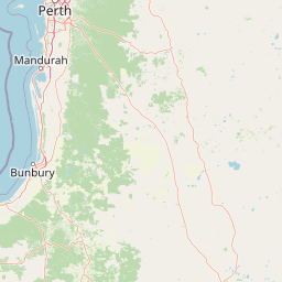
Map view of Dalgarup National Park

Use this park location map to pinpoint Dalgarup National Park in Australia, understand its exact geographic position, and read its mapped placement within the surrounding landscape more clearly.

Pigeon | © OpenStreetMap contributors
Park atlas

Discover connected conservation landscapes and regional park geography across Western Australia's South West.

Explore Other National Parks and Protected Areas Near Dalgarup National Park

Explore a curated list of national parks and protected areas near Dalgarup National Park, highlighting other conservation landscapes across Western Australia's South West region. Compare mapped terrain, ecological communities, and the broader geographic context of protected forests within the Jarrah Forest and Warren bioregions.
National parkWestern Australia
20 km away#1 closest

Southwest

Easter National Park: Protected Jarrah Forest Landscape Atlas

Explore its mapped terrain and regional geography.

Easter National Park serves as a protected national park in Western Australia, preserving crucial jarrah forest ecosystems within the Warren bioregion. As part of the Southwest Australia biodiversity hotspot, it contributes to a contiguous block of protected land safeguarding the region's distinctive woodland and forest communities. Users can explore its mapped boundaries and understand its role within the broader South West Australian geography, offering a detailed look at a representative forest reserve.

Area
29.85 km²
Established
2004
IUCN
II
Relief
Lowland
National parkAustralia
22 km away#2 closest

Southwest

Milyeannup National Park: Explore its Protected Landscape and Geographic Atlas Context

Discover the mapped terrain and boundaries of this Australian national park.

Milyeannup National Park offers a unique focus for atlas-based geographic exploration. This entry details the park's identity as a protected area, highlighting its landscape context and mapped geographic features within Australia. Use this resource to understand its role in the national park system and its specific place within the broader landscape.

Area
186.92 km²
Established
2004
Scope
Terrestrial
Forest
Mostly forested
National parkWestern Australia
25 km away#3 closest

Southeast

Greater Kingston National Park: A National Park in Western Australia's Diverse Geography

Explore mapped boundaries and regional landscape context.

Greater Kingston National Park represents a protected landscape within the vast expanse of Western Australia. As a national park, it contributes to the structured understanding of conservation areas and natural terrain across the state. This dedicated entry provides essential geographic context, allowing for detailed exploration of the park's mapped boundaries and its role within the broader regional geography of Western Australia. Discover its identity as a protected natural area.

Area
210.92 km²
Established
2004
Climate
Temperate
Scope
Terrestrial
National parkWestern Australia
26 km away#4 closest

West

Blackwood River National Park: Protected Area in Western Australia's Geography

Explore mapped boundaries and natural terrain.

Blackwood River National Park is a key protected area within the vast geographic expanse of Western Australia. This park's designation as a national park underscores its importance for conservation and landscape preservation. Users can explore its precisely mapped boundaries to understand its footprint and its contribution to the regional natural landscape context, offering a grounded perspective on protected lands within Australia.

Area
204.75 km²
Established
2004
IUCN
II
Relief
Upland
National parkAustralia
28 km away#5 closest

Southwest

Hilliger National Park: Western Australian Protected Jarrah Forest and Memorial Landscape

Mapped boundaries of a vital national park in the South West region.

Hilliger National Park stands as a testament to forest conservation in Western Australia's South West. This 16,962-hectare national park, established in 2004, protects representative old-growth jarrah forest ecosystems and honors a significant firefighting legacy. Explore its terrain and its geographic placement within a broader network of protected lands, offering a concrete example of conservation strategy in the region. The park's mapped area contributes valuable data to the understanding of regional natural landscapes.

Area
169.62 km²
Established
2004
Climate
Temperate
Scope
Terrestrial
National parkWestern Australia
29 km away#6 closest

South

Greater Beedelup National Park: Western Australia's National Park Landscape

Discover Protected Areas and Regional Geography

Explore Greater Beedelup National Park, a key protected landscape within Western Australia. This national park offers a focus for understanding mapped natural features and the regional distribution of conservation areas. It serves as a vital point for atlas-based discovery, providing structured insights into the park's geographic setting and its identity as a protected natural area.

Area
17.83 km²
Established
1915
IUCN
II
Relief
Upland
National parkAustralia
34 km away#7 closest

West

Wiltshire-Butler National Park: Mapped Jarrah Forest Landscape in Western Australia

Explore protected boundaries and regional geographic context

Wiltshire-Butler National Park stands as a protected natural area celebrated for its representation of Western Australia's iconic jarrah forest ecosystems. This National Park, created in 2004, offers rich opportunities for atlas-based discovery, focusing on its distinct landscape character, mapped park boundaries, and its geographical placement within the broader South West region. Understanding its terrain and conservation significance provides valuable insight into the protected lands of the Jarrah Forest bioregion.

Area
116.45 km²
Established
2004
IUCN
II
Relief
Highland
National parkWestern Australia
36 km away#8 closest

Southeast

Sir James Mitchell National Park: National Park, Western Australia - Geographic Atlas View

Mapped protected area with regional landscape context.

Gain a structured understanding of Sir James Mitchell National Park as a key protected landscape within Western Australia. This atlas entry focuses on the park's geographic extent, its status as a national park, and its position within the diverse regional geography of Western Australia, offering clear insights for map-based exploration and conservation landscape analysis.

Area
2.47 km²
Established
1969
IUCN
II
Access
Access unknown

Common questions about visiting, size, designation, and location context for Dalgarup National Park

Dalgarup National Park FAQs for park facts, access, geography, and protected area context

Find quick answers about Dalgarup National Park, including protected-area facts, park geography, trail and visitor context, and how the park fits into its surrounding country and regional landscape.
MoriAtlas Explorer

Continue Your Protected Areas Search Across the Global Atlas

Deepen your exploration by continuing the structured search for national parks and protected areas worldwide. Utilize the comprehensive filtering capabilities to compare different conservation landscapes and refine your understanding of global park geography. Discover more about the distribution and characteristics of protected natural areas.

Global natural geography