
Why Davies Creek National Park stands out
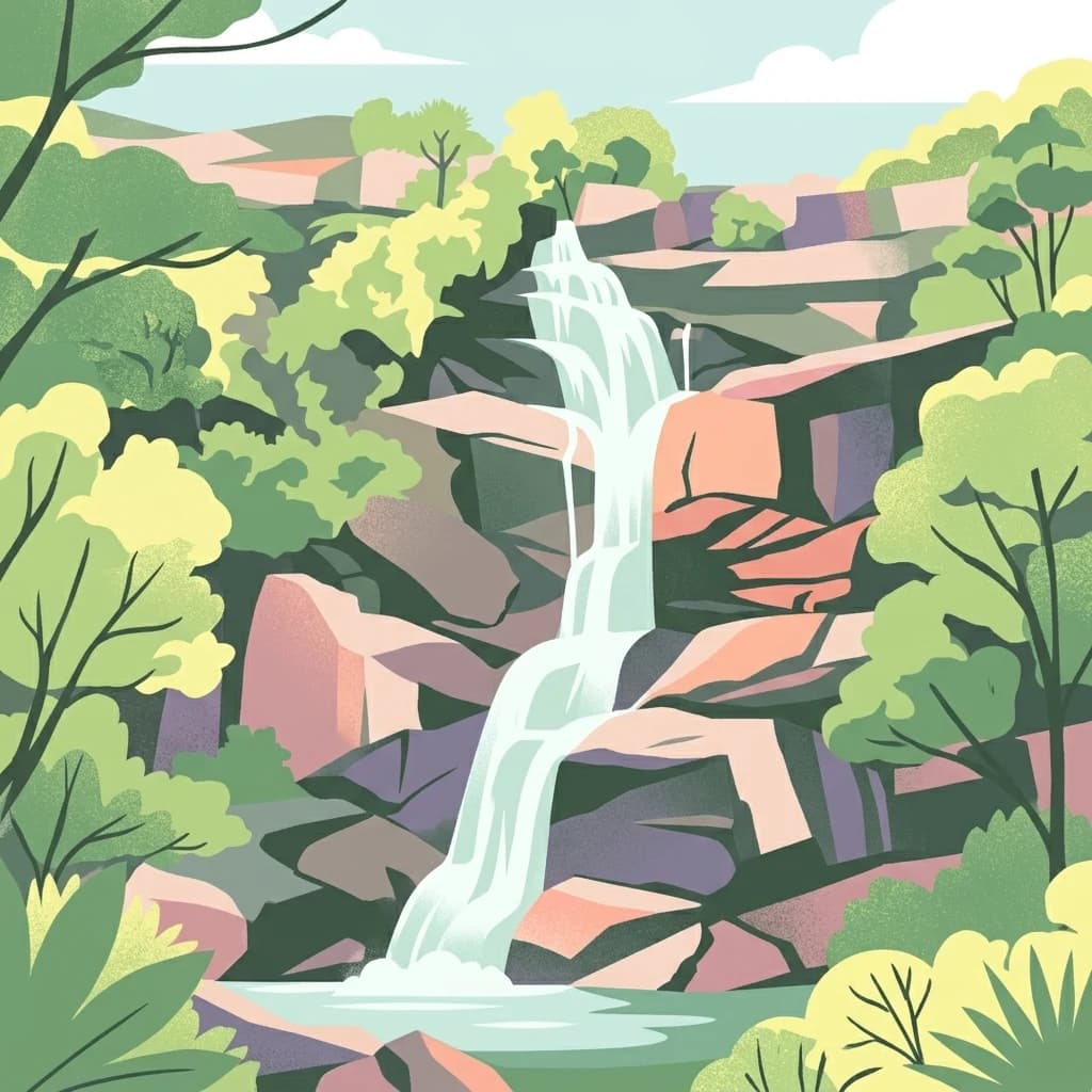
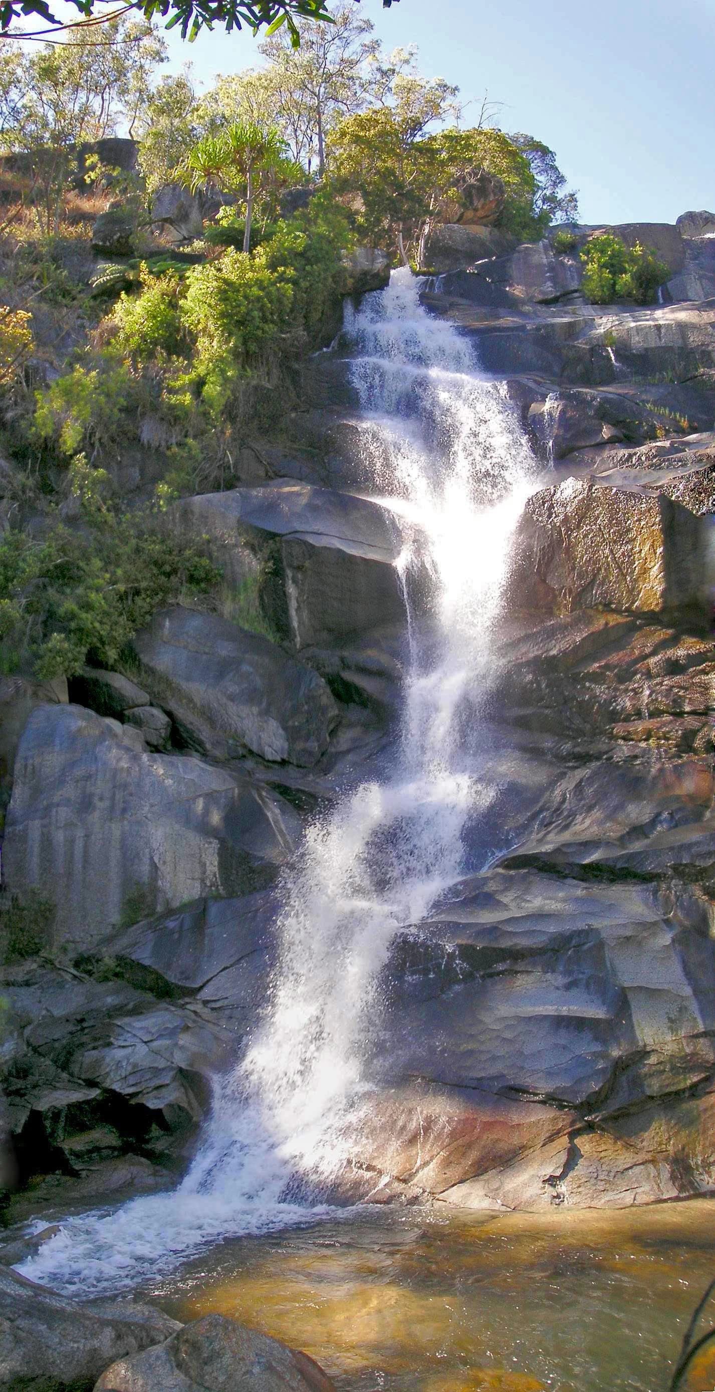
Davies Creek National Park is best known for its dramatic granite outcrops and the scenic Davies Creek Falls, where granite boulders create a picturesque waterfall setting amid otherwise tropical terrain. The park holds particular conservation fame as a stronghold for the endangered northern bettong, a small marsupial whose primary population in Australia survives within this protected area. The park also claims distinction for being home to the world's largest bird-eating and barking spiders, with specimens recorded at up to 16 centimeters in diameter, representing an unusual wildlife attraction for such a small protected area. This combination of striking geological features, rare mammal conservation, and remarkable invertebrate fauna gives Davies Creek a distinctive identity despite its modest footprint.
Davies Creek National Park history and protected-area timeline
Davies Creek National Park was established in 1971 as part of Queensland's expanding protected area network during a period of increased recognition of the need to preserve unique landscapes and threatened species habitat. The park was created specifically to protect the granite outcrop environment and the populations of native species, particularly the northern bettong, that depended on these specialized habitats. At the time of establishment, the Atherton Tableland region was experiencing ongoing land clearing for agriculture, making the reservation of remaining natural areas increasingly urgent. The selection of Davies Creek for national park status reflected growing scientific understanding of the area's ecological significance, particularly regarding the endangered marsupial populations. Management by the Queensland Parks and Wildlife Service has continued since the park's creation, with conservation of the northern bettong remaining a primary objective throughout the park's operational history. The park has maintained its protective status for over five decades, surviving various pressures from surrounding agricultural development to remain a refuge for native species.
Davies Creek National Park landscape and geographic character
The landscape of Davies Creek National Park is defined by its prominent granite outcrops, which form the most visually striking feature of the protected area. These massive granite domes and boulder fields create a terrain unlike the typical deeply weathered landscapes of the Wet Tropics, instead presenting a more exposed, rocky environment with thin soils and specialized vegetation adapted to harsh conditions. The Davies Creek itself cuts through this granite terrain, dropping over a series of boulders to form the Davies Creek Falls, a waterfall of approximately 15 meters that represents a focal point for park visitors. The creek originates in the elevated Lamb Range and flows northward through the park before joining the Barron River system, providing permanent water through the landscape. Between the rocky outcrops, the park supports open eucalypt woodland with a grassy understory, creating a savanna-like appearance that contrasts sharply with the dense rainforests found at lower elevations nearby. The combination of exposed granite, water features, and woodland creates a varied but compact landscape that supports distinct ecological communities within a small geographic area.
Davies Creek National Park ecosystems, habitats, and plant life
The nature of Davies Creek National Park reflects its position at the intersection of multiple bioregions, combining elements of the Wet Tropics and Einasleigh Uplands into a unique ecological assemblage. The open eucalypt woodland that dominates much of the park supports a diverse understory of grasses and shrubs, creating habitat that differs substantially from the closed rainforests that characterize lower elevations in the region. Granite outcrop areas support specialized rock communities adapted to extreme conditions, including lichens, mosses, and drought-tolerant plant species that can survive on thin soils and exposed positions. The riparian corridor along Davies Creek provides more mesic conditions, supporting paperbark trees and aquatic vegetation along the watercourse. This variety of habitats within a small area supports remarkable biodiversity, with five rare or threatened species recorded within the park boundaries. The park's position on the Atherton Tableland also places it in a transition zone where tropical and temperate species overlap, creating ecological interest beyond what the small area might suggest.
Davies Creek National Park wildlife and species highlights
The wildlife of Davies Creek National Park is notable for the presence of several rare and threatened species, with the northern bettong being the most significant conservation priority. This small marsupial, also known as a rat-kangaroo, has its main Australian population surviving within this park, making Davies Creek crucial for species survival. The bettong occupies the open woodland and forest edges, feeding on fungi, roots, and vegetation in a role that contributes to soil health and seed dispersal. Beyond mammals, the park supports diverse birdlife associated with eucalypt woodland, including various honeyeaters, parrots, and raptors that use the habitat for foraging and nesting. The invertebrate fauna includes remarkable species, with the world's largest bird-eating and barking spiders recorded in the park, reaching up to 16 centimeters in diameter. These large spiders represent an unusual wildlife attraction, though they remain largely hidden during daylight hours. Reptiles and smaller mammals occupy the various microhabitats throughout the park, from rock crevices to tree hollows, creating a wildlife community of conservation interest well beyond what the small park size might suggest.
Davies Creek National Park conservation status and protection priorities
Davies Creek National Park serves as an important conservation refuge within the heavily modified agricultural landscape of the Atherton Tableland. The park's primary conservation significance lies in its role as habitat for the endangered northern bettong, a species that has suffered substantial range reduction across its former distribution. Protection of this population within a secure national park provides essential assurance against further decline, though the species remains vulnerable to threats including climate change, fire, and potential disease. The presence of five rare or threatened species within the park elevates its conservation value considerably, justifying ongoing management investment despite the small area. The granite outcrop habitats represent a specialized environment that is not well-protected elsewhere in the region, making Davies Creek's reservation important for representing this rare habitat type. The park contributes to the broader Wet Tropics conservation network, connecting with larger protected areas to support landscape-scale biodiversity conservation in Far North Queensland.
Davies Creek National Park cultural meaning and human context
Davies Creek National Park lies within the traditional Country of Indigenous peoples who have occupied the Atherton Tableland region for thousands of years. The specific Traditional Owner groups for this area would have utilized the granite outcrop environments and the creek corridor for various resources, though detailed historical documentation of Indigenous use specific to the park area is limited in the available sources. The landscape would have held cultural significance for local Aboriginal communities, with particular sites potentially associated with the water features and rock formations found throughout the park. European settlement of the Atherton Tableland began in the late nineteenth century, with agricultural conversion dramatically altering the surrounding landscape while the Davies Creek area remained largely undeveloped due to the rocky terrain. The reservation of the area as a national park in 1971 reflects a later recognition of both cultural and natural values, though the primary focus has been on biodiversity conservation rather than cultural heritage management.
Top sights and standout views in Davies Creek National Park
Davies Creek Falls stands as the centerpiece attraction, where granite boulders channel the creek into a 15-meter cascade visible from a two-kilometer walking trail. The dramatic granite outcrops create a distinctive landscape unlike typical Wet Tropics terrain, offering scenic views and interesting geological features. The endangered northern bettong population represents a rare wildlife conservation opportunity, with the park serving as a critical stronghold for this marsupial. The presence of the world's largest bird-eating and barking spiders adds an unusual invertebrate highlight that distinguishes this park from others in the region. Open eucalypt woodland provides habitat for diverse birdlife and offers a pleasant setting for bushwalking and nature observation.
Best time to visit Davies Creek National Park
The park can be visited throughout the year, though the dry season from May to October generally offers more comfortable conditions for walking and outdoor activities. During the wet season from November to April, higher rainfall can affect trail conditions and access, though the waterfall flow may be more impressive during this period. The Atherton Tableland sits at elevation, meaning temperatures are cooler than the coastal areas near Cairns, making the park accessible even during the hotter months. Visitors should note that creek water must be boiled for at least five minutes before drinking, reflecting the need for caution regarding water quality in the park environment.
