Why Douala-Edéa National Park stands out
Douala-Edéa is best known for its extensive mangrove forest system, which represents one of the most significant coastal wetland ecosystems in Central Africa. The park protects critical habitat for forest elephants, several primate species including chimpanzees and the endangered red-eared nose-spotted guenon, and serves as a refuge for West African manatees, sea turtles, and dolphins. The combination of tropical lowland forest, mangrove swamps, and coastal lagoon environments creates a remarkably diverse ecological mosaic that supports both terrestrial and marine biodiversity. The area\'s scientific significance was recognized as early as 1971 when Cameroon designated it as a wildlife park for research purposes.
Douala-Edéa National Park history and protected-area timeline
The Douala-Edéa protected area has a history stretching back nearly a century, beginning with its establishment as a wildlife reserve in 1932. Cameroon designated the reserve as a wildlife park for scientific purposes in 1971, reflecting early recognition of its ecological and research value. By 1974, the reserve had a dedicated conservator and guard post, establishing basic institutional infrastructure for its management. However, the upgrade to full national park status was significantly delayed due to the discovery of oil in Cameroon\'s coastal areas, which raised questions about the area\'s resource potential and complicated the conversion process. As of 2000, the reserve covered approximately 160,000 hectares, though subsequent expansions brought the total area to over 2,700 square kilometers. In October 2018, after decades of advocacy for stronger protection, Douala-Edéa was finally elevated to national park status, providing it with enhanced legal protections and institutional recognition within Cameroon\'s protected area system.
Douala-Edéa National Park landscape and geographic character
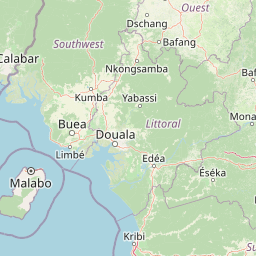
The physical landscape of Douala-Edéa National Park is defined by its coastal setting at the mouth of Cameroon\'s largest river system, the Sanaga River. The terrain consists primarily of low-lying tropical coastal plain, with extensive mangrove swamps lining the river estuaries and tidal channels. The park encompasses Lake Tissongo, a significant lagoon system connected to the Sanaga River\'s south bank through a five-kilometer tidal channel, creating complex hydrological connections between river and marine environments. The mangrove forests form a distinctive coastal缓冲区 against the Bight of Biafra, with the park situated directly opposite the island of Bioko in Equatorial Guinea. The landscape transitions from dense tropical lowland forest on the higher ground tobrackish mangrove ecosystems in the tidal zones, with the Mouanko area between the Sanaga and Wouri estuaries representing particularly extensive mangrove coverage.
Douala-Edéa National Park ecosystems, habitats, and plant life
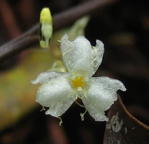
The ecological character of Douala-Edéa is defined by the coexistence of two major habitat types: tropical lowland equatorial forest covering approximately 80 percent of the reserve, and Atlantic mangrove forests comprising about 15 percent of the territory. The mangrove ecosystem is particularly significant, with the Mouanko section between the Sanaga and Wouri estuaries holding roughly 15,000 hectares of mangrove forest. These coastal wetlands form a critical buffer against coastal erosion while serving as a refuge for the majority of local marine and aquatic species during at least portions of their lifecycle. The forest interior supports diverse plant communities characteristic of Central African lowland ecosystems. The ecological significance of these habitats has been recognized for decades, leading to the area\'s designation as a wildlife park for scientific purposes in 1971.
Douala-Edéa National Park wildlife and species highlights
Douala-Edéa supports a remarkable array of wildlife species across its terrestrial, wetland, and marine environments. Large mammals include forest elephants and several primate species such as chimpanzees, various monkeys including black colobus, and the red-capped mangabey, which was reported as common in the reserve during the 1970s. The endangered red-eared nose-spotted guenon has been recorded in the Lombé section at densities of two to three groups per square kilometer. Antelope species present include sitatunga and blue duiker. The aquatic environment supports West African manatees, sea turtles, dolphins, crocodiles, and alligators, along with numerous fish species. Birdlife is diverse, with both terrestrial and water bird species represented. However, wildlife populations face significant pressure from hunting, with central chimpanzees in particular threatened by hunters, and overall protection remains inadequate with poaching widespread throughout the reserve.
Douala-Edéa National Park conservation status and protection priorities
The conservation significance of Douala-Edéa stems from its role as a coastal ecosystem protecting remarkable biodiversity across multiple habitat types. The mangrove forests are recognized as critical infrastructure, providing natural protection against coastal erosion while supporting the vast majority of local marine and aquatic species at some point in their lifecycle. Despite this recognized importance, the reserve has faced persistent conservation challenges. Mangrove forests are threatened by logging for construction timber and firewood used in fish smoking operations, while urban infrastructure development encroaches on sensitive areas. Illegal loggers were expelled from the park in 1976, but ongoing pressures remain. Wildlife protection has been particularly weak, with poaching widespread and animal populations poorly protected. The elevation to national park status in 2018 represents an opportunity for strengthened conservation management, though the transition from reserve to full national park protection is still relatively recent.
Douala-Edéa National Park cultural meaning and human context
The Douala-Edéa area is home to local communities whose livelihoods are closely tied to the coastal and forest ecosystems. Mouanko serves as the main town within the reserve, situated on the north shore of the Sanaga River. Traditional fishing communities rely on the river and coastal waters, while the mangrove forests provide resources for both timber and fish smoking operations. The relationship between local communities and the park\'s natural resources creates both conservation challenges and opportunities, as sustainable use of forest and marine resources remains important for local livelihoods. The park\'s proximity to Cameroon\'s largest city, Douala, and the town of Edéa means that human pressures on the ecosystem are significant and ongoing.
Top sights and standout views in Douala-Edéa National Park
Douala-Edéa stands out as Cameroon\'s premier coastal protected area, combining extensive tropical forest with one of Central Africa\'s most significant mangrove ecosystems. The park\'s location at the Sanaga River mouth creates unique hydrological conditions supporting exceptional biodiversity. Notable highlights include forest elephant populations, diverse primates including the endangered red-eared nose-spotted guenon, and critical habitat for West African manatees and sea turtles. The transformation from wildlife reserve to national park in 2018 marks a new chapter in the park\'s conservation history, though the transition brings both opportunities and ongoing challenges in managing this ecologically important coastal landscape.
Best time to visit Douala-Edéa National Park
The best time to visit Douala-Edéa would typically correspond to the dry season in Cameroon\'s coastal regions, which generally runs from November to March. During this period, reduced rainfall makes wildlife observation easier and access to certain areas more manageable. However, the park\'s coastal mangrove environment remains accessible year-round, and the wet season brings its own ecological rewards with increased bird activity and fuller water systems. Visitors should note that as a relatively new national park with ongoing conservation challenges, infrastructure and access information may be limited, and planned visits should involve coordination with local conservation authorities.