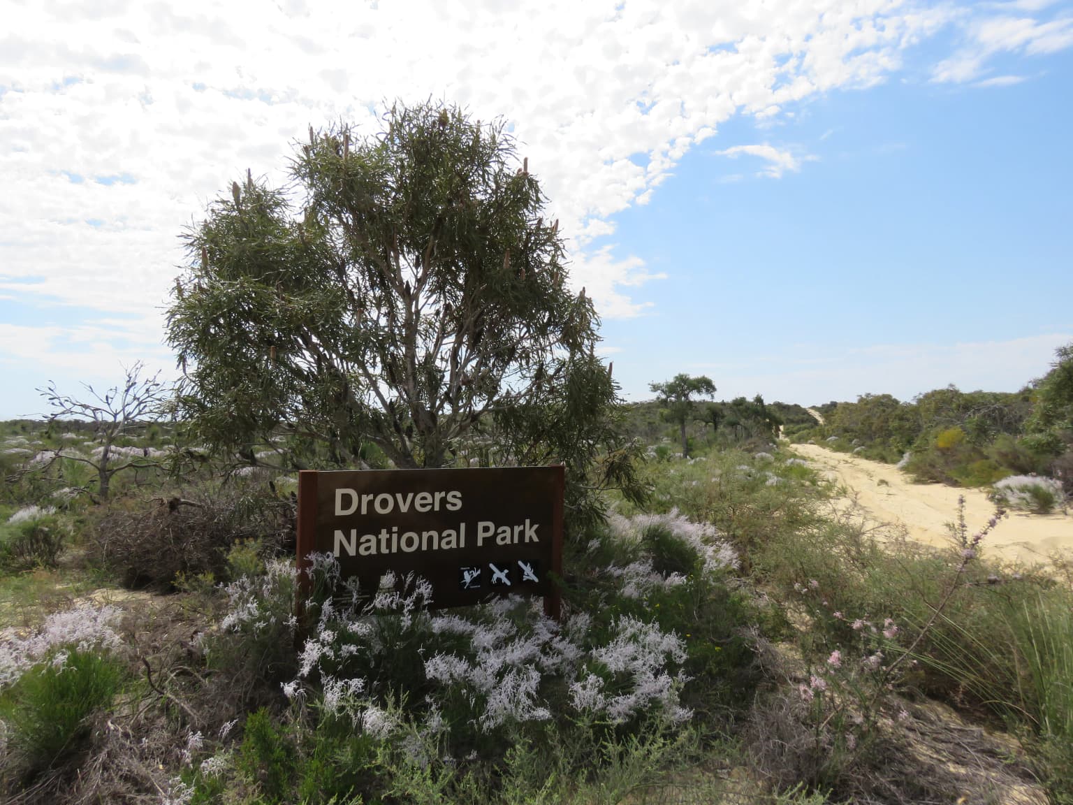
Why Drovers Cave National Park stands out
Drovers Cave National Park is best known for its limestone cave system, which is unusual for the Wheatbelt region and represents a distinctive geological feature in this part of Western Australia. The caves, particularly Drovers Cave itself, hold historical significance as a resting point for drovers moving livestock along the Canning Stock Route during the late 19th and early 20th centuries. The park's name directly reflects this pastoral heritage. Hastings Cave within the park is notable for containing fossil deposits, adding a paleontological dimension to the site's significance.
Drovers Cave National Park history and protected-area timeline
The Drovers Cave area has a documented history of human visitation dating back to the late 19th century. The first known visit by a drover occurred in 1886, when a stockman signed the cave wall, leaving a record of his passage through the region. Between 1930 and 1940, the cave saw regular use by drovers and explorers moving through the area along the Canning Stock Route, which served as a vital link between the pastoral lands of the interior and the coastal settlements. The cave was formally surveyed in 1973, and following this assessment it was gazetted as part of Drovers Cave National Park that same year. The park was formally established in 1972, with the cave survey confirming its significance as a geological and historical site worthy of protection.
Drovers Cave National Park landscape and geographic character
The landscape of Drovers Cave National Park is defined by its limestone geology, which contrasts sharply with the surrounding Wheatbelt farmland. The limestone bedrock has been eroded over geological time to form a network of caves and underground passages, with Drovers Cave being the most prominent. The surface landscape features Mediterranean-style scrub and low woodland adapted to the semi-arid conditions of the region. The terrain is relatively flat, typical of the Wheatbelt, but the presence of cave entrances and karst features adds geological interest. The park sits at relatively low elevation within the region, with the limestone formations extending both at the surface and underground.
Drovers Cave National Park ecosystems, habitats, and plant life
The park supports scrub and woodland vegetation characteristic of the Western Australian Wheatbelt, adapted to the region's Mediterranean climate with wet winters and dry summers. Native flora includes shrub banksia species, one-sided bottlebrush and parrot bush, which provide habitat and food sources for the park's wildlife. The limestone environment creates specialized niches for flora adapted to the alkaline soils and the unique conditions of the cave entrances and overhangs. The park's vegetation forms an important remnant of native scrub in a region that has been extensively cleared for agriculture.
Drovers Cave National Park wildlife and species highlights
Drovers Cave National Park is home to a range of Australian wildlife adapted to the semi-arid conditions of the Wheatbelt. Mammals present include emus, which are a prominent feature of the landscape, honey possums, western pygmy possums, short-beaked echidnas and western grey kangaroos. The park also supports birdlife including Australian bustards, which are characteristic of open woodland and scrubland habitats. Reptiles are also present, reflecting the diverse faunal communities that persist in remnant vegetation patches within the agricultural landscape. The caves themselves provide shelter for various species, though the interior access is restricted for safety reasons.
Drovers Cave National Park conservation status and protection priorities
The park represents a conservation priority as a remnant of native vegetation and geological features within the heavily cleared Wheatbelt region of Western Australia. The limestone cave system provides habitat for specialized species and contains paleontological resources in the form of fossils found in caves such as Hastings Cave. The management approach, which includes securing cave entrances with screens, reflects the dual goals of protecting public safety and preserving the caves from vandalism. The protection of the cave system also safeguards the historical heritage associated with the Canning Stock Route and early droving activities in the region.
Drovers Cave National Park cultural meaning and human context
Drovers Cave National Park carries significant cultural heritage value related to the droving tradition that was central to Western Australia's pastoral industry. The Canning Stock Route, which passes near the park, was one of Australia's most important early stock routes, enabling the movement of livestock from the inland pastoral stations to coastal markets. The cave provided a convenient stop for drovers travelling this route, and the practice of signing the cave wall by visitors has created a historical record of passage through the region. The park's name directly commemorates this droving heritage, making it a site where geological, natural and cultural histories intersect.
Top sights and standout views in Drovers Cave National Park
The limestone cave system at Drovers Cave National Park, with its network of passages including Hastings, Moora, Old River and Mystery Caves, represents the park's primary highlight. The historical connection to the Canning Stock Route and the droving tradition adds cultural significance that distinguishes this park from other Western Australian protected areas. Fossil deposits in Hastings Cave provide an additional layer of scientific interest, while the remnant native vegetation supporting wildlife including emus, kangaroos and honey possums offers nature observation opportunities.
Best time to visit Drovers Cave National Park
The best time to visit Drovers Cave National Park is during the cooler months of autumn and spring in Western Australia, when daytime temperatures are more comfortable for outdoor exploration. The Mediterranean climate of the Wheatbelt means that summer temperatures can be high, making outdoor activities less pleasant. Winter brings reliable rainfall which can affect access to some areas, though the park remains accessible. Visitors should be aware that cave access is restricted for safety reasons, with screens in place at many cave entrances.