Why El Rey National Park stands out
El Rey National Park is best known for protecting the Southern Andean Yungas, a globally significant biodiversity hotspot that spans the subtropical mountain forests of northwestern Argentina. The park preserves a complete elevational gradient from foothill forests to cloud forest zones, showcasing five distinct vegetation levels that transition from tropical to more temperate conditions. Its most iconic resident is the tapir, or anta, the largest terrestrial mammal in South America, which inhabits the forest understory and feeds on aquatic vegetation. The park also protects transition environments that connect the Yungas with adjacent ecosystems, creating a corridor of ecological continuity through a region where biodiversity is concentrated along the Andes.
El Rey National Park history and protected-area timeline
El Rey National Park was established as part of Argentina's national parks system to preserve the ecological integrity of the Southern Andean Yungas region. The creation of the park reflected growing recognition during the mid-to-late twentieth century of the need to protect the unique biodiversity found in the Yungas ecosystems, which were under pressure from agricultural expansion and logging. The park's establishment also acknowledged the cultural significance of the region, recognizing that the indigenous communities who historically inhabited these lands had developed sustainable relationships with the environment over generations.
The park's name and identity are deeply connected to the local cultural landscape, reflecting the historical presence of indigenous groups who were the oldest inhabitants of the Yungas region. These farming communities maintained agricultural systems adapted to the mountain environment, and their archaeological traces remain within the park boundaries, providing evidence of the long human history in this landscape.
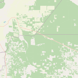
El Rey National Park landscape and geographic character
The physical landscape of El Rey National Park is defined by the dramatic topography of the Argentine Yungas, where the eastern slopes of the Andes give way to rugged mountainous terrain dissected by numerous watercourses. The park's elevation range from 750 to 2,000 meters creates a dramatic vertical landscape that transitions from subtropical foothill environments through increasingly humid and cloud-shrouded forest zones. Steep ridges and valleys characterize the terrain, with rivers, brooks, and lakes distributed throughout the park, providing aquatic habitats that contrast with the surrounding forest.
The visual character of the landscape combines the deep greens of humid forest cover with the lighter greens of more open woodland areas, creating a varied tapestry of vegetation across the slopes. Water features including streams and small lakes are prominent elements in the landscape, their presence supporting both the forest ecosystem and the wildlife that depends on aquatic resources. The interplay of topography, water, and vegetation creates scenic diversity that is characteristic of the Yungas region.
El Rey National Park ecosystems, habitats, and plant life
The ecological character of El Rey National Park is defined by its position within the Southern Andean Yungas, a biodiversity-rich ecoregion that represents the southernmost extent of the Yungas forest ecosystem. The park's five distinct vegetation levels reflect the changing environmental conditions across its elevation range, from the lower slopes where more thermophilic species dominate through the cloud forest zones where atmospheric moisture is continuously high. Each level supports characteristic plant communities, with species composition shifting to reflect temperature gradients, humidity levels, and structural characteristics of the forest.
The warm climate and annual rainfall of 500 to 700 millimeters provide the moisture necessary to sustain the Yungas' characteristic forest types, where epiphytes, lianas, and dense understory vegetation characterize the humid zones. The transition environments protected within the park are particularly significant, as they represent the ecological boundaries where Yungas vegetation interacts with adjacent ecosystems, creating areas of high species turnover and ecological interest. These transition zones also serve as movement corridors for wildlife species that require access to multiple habitat types.
El Rey National Park wildlife and species highlights
El Rey National Park supports a diverse fauna that reflects the ecological richness of the Yungas ecoregion. The park is home to several notable mammal species, most prominently the tapir (anta), South America's largest native mammal, which can weigh up to 300 kilograms and inhabits the forest understory and riparian areas where it feeds on aquatic plants. The park also protects populations of anteaters and peccaries, representing the diversity of medium and large mammals that occupy the Yungas forest ecosystem.
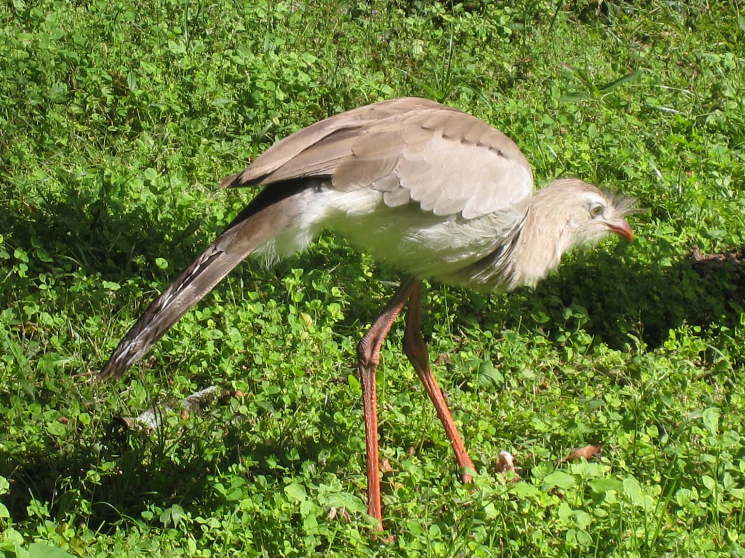
The aquatic environments within the park, including rivers, brooks, and lakes, support fish populations that represent an important component of the park's biodiversity. These water bodies also attract the tapir and other species that depend on aquatic resources, creating ecological relationships between the terrestrial and aquatic components of the ecosystem. The birdlife of the park includes species such as Cariama cristata, which has been documented within the protected area and represents the diverse avifauna that inhabits the Yungas forests and forest edges.
El Rey National Park conservation status and protection priorities
El Rey National Park plays a critical role in the conservation of the Southern Andean Yungas, an ecoregion that faces ongoing pressures from agricultural conversion, logging, and infrastructure development throughout its range. By protecting a representative sample of this ecosystem, the park contributes to the preservation of biodiversity patterns that are concentrated along the Andean slopes and represent globally significant concentrations of species endemism. The park's protection of transition environments adds further conservation value, as these ecological boundaries often host species assemblages that depend on the combination of conditions found where different habitat types meet.
The establishment and management of the park as part of Argentina's national parks system reflects the national commitment to preserving the country's natural heritage, with the protected area managed by the Administración de Parques Nacionales. The park's designation as IUCN Category II confirms its status as a national park meeting international standards for protected area management and ecological representation.
El Rey National Park cultural meaning and human context
The cultural landscape of El Rey National Park carries the imprint of indigenous communities who inhabited the Yungas region long before the establishment of protected area status. These farmer groups represent the oldest inhabitants of the Yungas, having developed agricultural systems and settlement patterns adapted to the mountain environment over many generations. The archaeological sites found within the park provide physical evidence of this long human presence, documenting the historical relationships between indigenous peoples and the Yungas landscape.
The cultural context of the park adds dimension to its conservation significance, acknowledging that the Yungas region has been shaped by both natural ecological processes and human land use over extended time periods. This recognition of indigenous cultural heritage adds another layer of value to the protected area, complementing its ecological significance with historical and cultural dimensions that reflect the deep connections between local communities and their environment.
Top sights and standout views in El Rey National Park
El Rey National Park protects one of the most representative samples of the Southern Andean Yungas in Argentina, preserving complete elevational gradients that showcase the transition from foothill forest to cloud forest environments. The park provides crucial habitat for the tapir, South America's largest mammal, a species that serves as an emblematic representative of Yungas fauna. The five distinct vegetation levels within the park demonstrate the ecological complexity of the Yungas, where species assemblages shift across elevation to create a vertically stratified forest ecosystem. The presence of archaeological sites documenting indigenous occupation adds cultural depth to the park's natural values.
Best time to visit El Rey National Park
The park can be visited throughout the year, though the warm climate and seasonal rainfall patterns influence the visitor experience. The months with more consistent rainfall create the humid conditions that sustain the cloud forest character, while the forest remains green and active throughout the year in this subtropical environment. Visitors interested in wildlife observation may find the dry season months offer easier access to water sources where animals congregate, though the Yungas' year-round moisture supports consistent wildlife activity across seasons.