
Mori Atlas logo
National parkLaguna de La Restinga National Park

Discover the labyrinthine mangrove channels and rich avian geography of this Caribbean national park.

Laguna de La Restinga National Park: Venezuela's Coastal Wetland and Mangrove Protected Landscape

(Parque Nacional Laguna de la Restinga)

Laguna de La Restinga National Park represents a crucial protected coastal landscape in Venezuela, centered on a vast, shallow salt lagoon bordered by extensive mangrove forests. This national park, established in 1974, offers a unique atlas exploration of 18 kilometers of winding channels threading through mangrove islands, creating a distinctive labyrinthine terrain. Its designation as a Ramsar Wetland of International Importance underscores its critical role in supporting diverse waterfowl and marine ecosystems within the broader geographic context of Isla Margarita.

WetlandMangroveRamsar SiteBirdwatchingCoastal Protected AreaCaribbean Islands
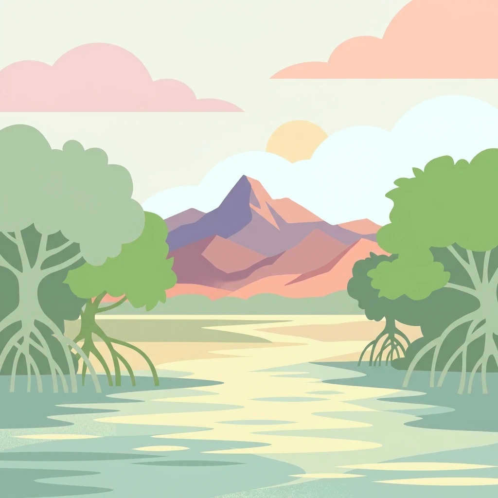
Illustration of mangrove trees in a wetland with a mountain range and sunset sky

Laguna de La Restinga National Park

National park

Park overview

Structured park overview, official facts, and landscape profile for Laguna de La Restinga National Park

Laguna de La Restinga National Park park facts, protected area profile, and essential visitor context

Review the core facts for Laguna de La Restinga National Park, including designation, size, terrain, visitor scale, habitats, and operating context in one park-focused overview.

About Laguna de La Restinga National Park

Laguna de La Restinga National Park protects a remarkable coastal wetland ecosystem on the eastern side of Isla Margarita, Venezuela's premier Caribbean island destination. The park's central feature is a large saline lagoon separated from the Caribbean Sea to the north by a natural bar of sand and sea shells, while a broad channel to the south connects the lagoon with open waters. The park lies between the main body of Margarita Island and the Macanao Peninsula, connected only by a thin land bar stretching approximately 24 kilometres. The shallow lagoon, with its intricate network of channels and mangrove islands, creates a unique aquatic landscape that draws both scientific interest and visitor fascination. The surrounding dry forest environment and the contrast between the lush mangrove wetlands and the semi-arid terrestrial landscape contribute to the park's distinctive character. The park's management focuses on preserving this complex wetland system while enabling controlled visitor access through the boat tour experiences that have become synonymous with the destination.

Quick facts and research context for Laguna de La Restinga National Park

Laguna de La Restinga National Park encompasses 188 square kilometres of coastal wetland on Isla Margarita, Venezuela's largest Caribbean island. The protected area was established by government decree on 6 February 1974 and is administered by INPARQUES, Venezuela's national parks institute. The lagoon reaches a maximum depth of 2.4 metres and contains mangrove forests covering 910 hectares, with red mangrove, black mangrove, and white mangrove as the dominant species. The climate is arid to semi-arid with mean annual temperature of 27°C and annual precipitation between 300 and 400 millimetres. The park is classified as an Important Bird Area due to its significance for both resident and migratory bird populations.

Protection and recognition

Documenting the official conservation framework and international wetland recognition

Laguna de La Restinga National Park Protection Status and Ramsar Designation

Map-based exploration of Laguna de La Restinga National Park reveals a complex mixed protection scope established to manage the coastal geography. Structured geographic data highlights the park's international importance as a designated Ramsar wetland site under global conservation frameworks.

International recognition

Protection details

Protection scope
Mixed
Transboundary protection
No
Park context

Deeper park guide and search-rich context for Laguna de La Restinga National Park

Laguna de La Restinga National Park history, landscape, wildlife, and travel context

Explore Laguna de La Restinga National Park through its history, landscape character, ecosystems, wildlife, conservation priorities, cultural context, and seasonal travel timing in a structured park guide built for atlas discovery and search intent.

Why Laguna de La Restinga National Park stands out

Laguna de La Restinga is best known for its extensive mangrove ecosystem and outstanding significance as a bird habitat. The lagoon supports impressive populations of waterfowl including flamingos, scarlet ibises, frigatebirds, herons, and egrets. The mangrove-fringed channels provide a striking visual landscape where visitors can traverse the labyrinth of waterways by motorboat. The park's designation as a Ramsar Wetland underscores its international importance as a coastal wetland ecosystem. The three endemic land species found here, including a subspecies of deer, rabbit, and snake, highlight the ecological distinctiveness of Margarita Island's isolated environment.
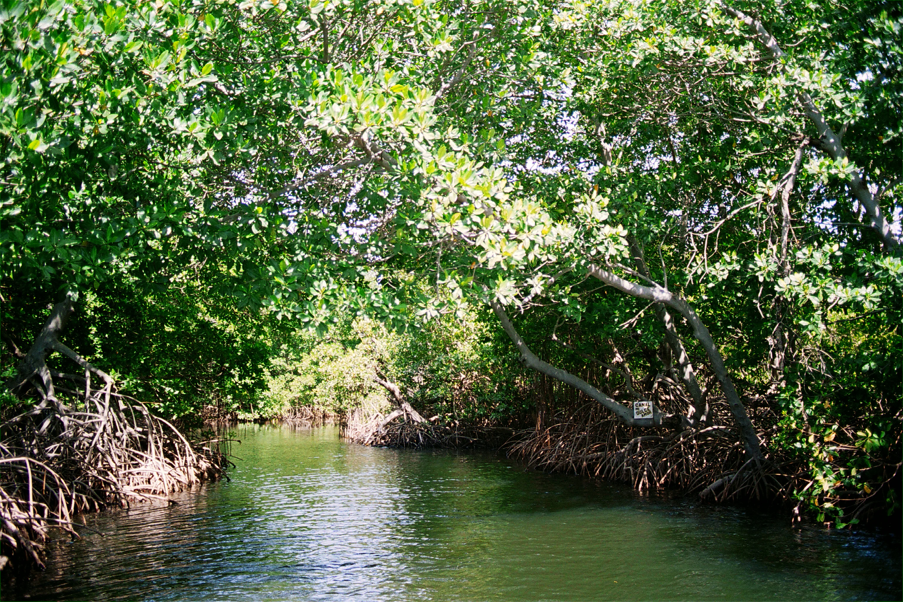
A narrow waterway surrounded by dense green mangrove trees with sunlight filtering through the canopy
Mangrove-lined waterway within Laguna de La Restinga National Park

Laguna de La Restinga National Park history and protected-area timeline

Laguna de La Restinga was established as a national park on 6 February 1974 through a Venezuelan government decree, initially covering an area of 10,700 hectares. The park's creation reflected growing recognition of the ecological importance of coastal wetland ecosystems in Venezuela. In 1996, the park received international recognition through its designation as a Ramsar Wetland of International Importance, acknowledging its significant role in global biodiversity conservation. This designation formalized the park's status as a critical habitat for migratory waterfowl and other wetland-dependent species. The park's administration falls under INPARQUES, Venezuela's national institute for parks, which manages visitor access and conservation activities within the protected area.

Laguna de La Restinga National Park landscape and geographic character

The physical landscape of Laguna de La Restinga centers on its characteristic salt lagoon, a shallow body of water reaching a maximum depth of approximately 2.4 metres. The lagoon is ringed by dense mangrove forests that create a green border along much of the shoreline, while several mangrove islands rise from within the lagoon itself. Eighteen kilometres of natural channels wind through the mangrove system, providing water circulation and creating the distinctive navigational routes that visitors explore by boat. The northern boundary consists of a sand and shell bar that separates the lagoon from the Caribbean Sea, while the western coastline features rocky sections with cliffs and small beaches. The terrestrial landscape surrounding the wetland consists of semi-desert tropical terrain covered by xerophytic vegetation, thornwood, and shrub forest typical of the Venezuelan Dry Forest province. The contrast between the aquatic mangrove environment and the dry upland areas defines the park's visual character.
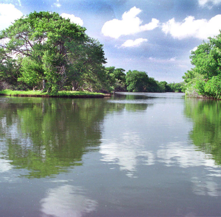
Lagoon surrounded by green trees with reflections in the water under a partly cloudy sky
Calm lagoon reflecting green trees and sky in Laguna de La Restinga National Park

Laguna de La Restinga National Park ecosystems, habitats, and plant life

The ecological character of Laguna de La Restinga is defined by its mangrove wetland ecosystem within the broader context of the Venezuelan Dry Forest biogeographical province. The mangrove forests represent the dominant habitat, covering 910 hectares and consisting primarily of red mangrove, black mangrove, and white mangrove species. These mangroves provide critical ecosystem functions including shoreline stabilization, nutrient cycling, and nursery habitat for marine species. The shallow lagoon waters support diverse fish communities, while the root systems of mangroves host oyster populations. The surrounding arid land features xerophytic plants adapted to the semi-desert conditions with mean annual precipitation of only 300 to 400 millimetres. The park's classification as an Important Bird Area reflects the exceptional avifauna value of the wetland system.
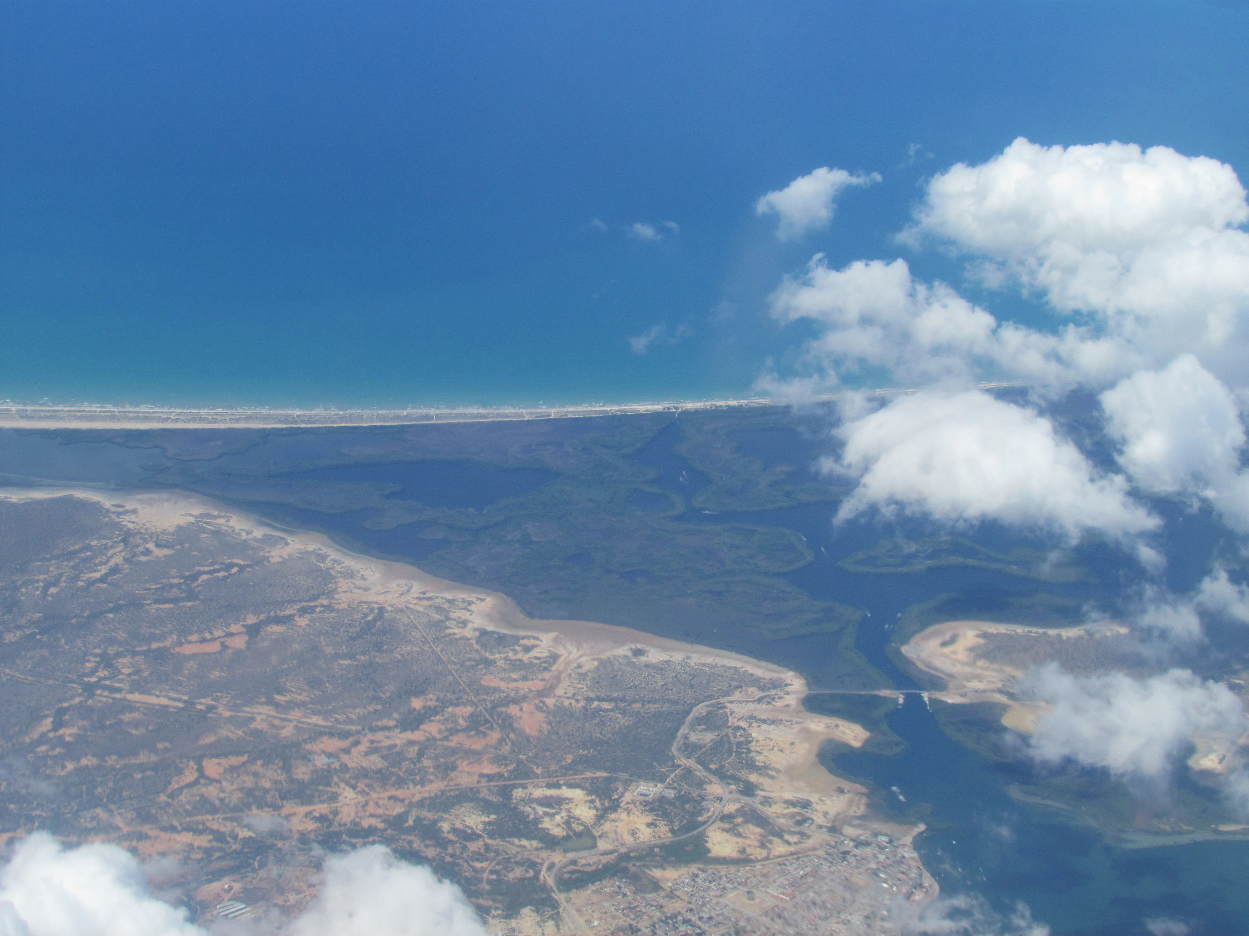
Aerial view showing coastal landscape with water bodies, land areas, and clouds
Aerial view of Laguna de La Restinga National Park, Venezuela

Laguna de La Restinga National Park wildlife and species highlights

The wildlife of Laguna de La Restinga is notable for both its diversity and the presence of endemic species. The lagoon waters support populations of red snapper, gruntfish, sardines, swordfish, and black mullet, while oysters cling to the exposed roots of mangrove trees. The birdlife is particularly significant, with the lagoon serving as a feeding ground for numerous species including scarlet ibis, red-legged tinamous, frigatebirds, blue herons, green herons, great egrets, ground doves, cormorants, and flamingos. The presence of flamingos and scarlet ibises, with their striking red plumage, adds vivid color to the wetland landscape. Of particular note are the three endemic land species found within the park: a subspecies of deer, a subspecies of rabbit, and a subspecies of snake, all demonstrating the evolutionary isolation of Margarita Island's fauna.
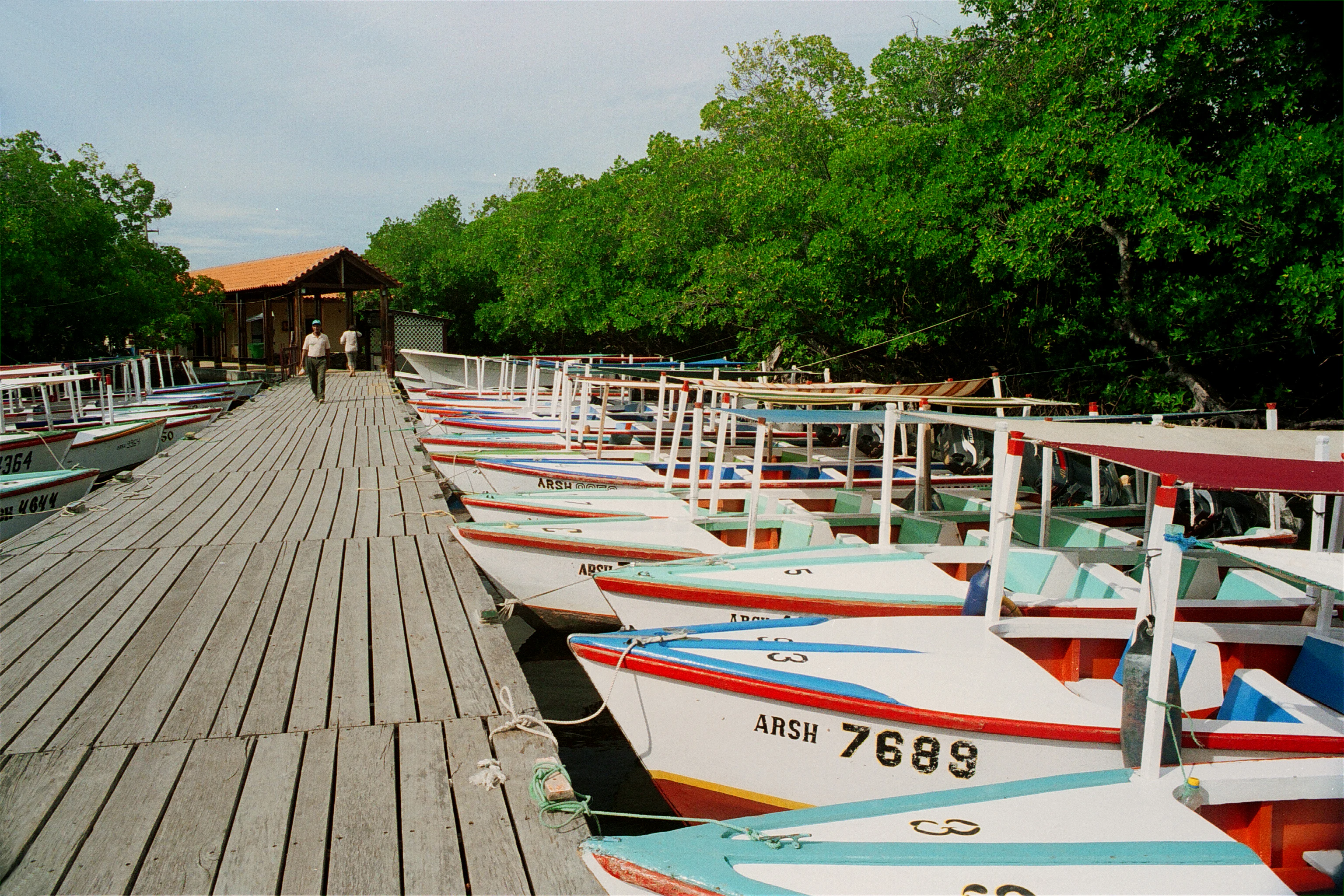
Wooden pier with colorful boats docked along the side, two people walking in the distance, green trees in the background
Colorful boats docked along the wooden pier at Laguna de La Restinga National Park

Laguna de La Restinga National Park conservation status and protection priorities

Laguna de La Restinga holds significant conservation importance at both national and international levels. The park's designation as a Ramsar Wetland of International Importance in 1996 recognizes its essential role in the global network of significant wetlands, particularly for migratory waterfowl. Its classification as an Important Bird Area further underscores its value as habitat for both resident and migratory bird populations. The mangrove ecosystem provides critical environmental services including coastal protection, water filtration, and carbon sequestration. The presence of endemic subspecies highlights the evolutionary significance of the isolated Margarita Island environment. Conservation challenges include managing visitor impacts while maintaining the ecological integrity of the wetland system.

Laguna de La Restinga National Park cultural meaning and human context

Laguna de La Restinga lies on Isla Margarita, Venezuela's principal Caribbean island and a region with distinct cultural identity shaped by its maritime history and island geography. The park's landscape has been shaped by traditional activities including fishing, which remains connected to local communities. The boat tours that visitors experience today reflect a continuation of maritime traditions, with boats bearing names that evoke local culture and romance. The narrow land bar connecting the main island to the Macanao Peninsula represents a historically significant geographical feature that influenced human settlement patterns on the island. The surrounding Nueva Esparta state reflects the colonial and post-colonial development of Venezuela's coastal regions.
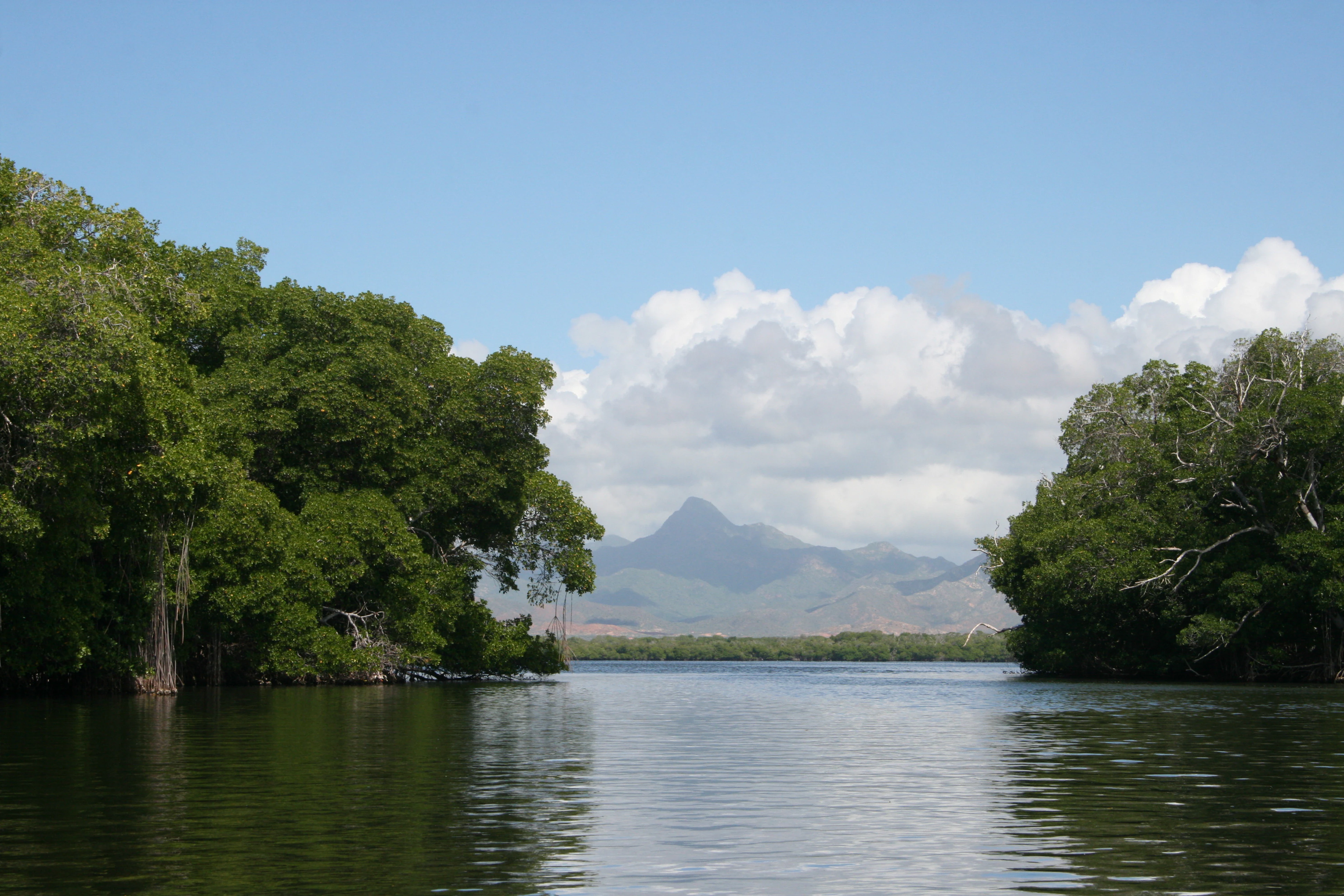
Calm lagoon waters surrounded by dense mangrove trees with mountains in the background under a partly cloudy sky
Panoramic view of Laguna de La Restinga National Park featuring calm lagoon waters surrounded by dense mangrove forests with distant mountains under a partly cloudy sky

Top sights and standout views in Laguna de La Restinga National Park

The hallmark experience at Laguna de La Restinga involves navigating the lagoon's mangrove channels by motorboat, passing through waterways with evocative names that reflect local culture. The park's Ramsar Wetland status and Important Bird Area designation confirm its exceptional ecological significance. The vivid scarlet ibises and elegant flamingos represent flagship species that draw ornithological interest. The extensive mangrove forest, covering nearly a thousand hectares, forms the ecological core of the park. The endemic subspecies of deer, rabbit, and snake found only on Margarita Island underscore the ecological uniqueness of this protected area.
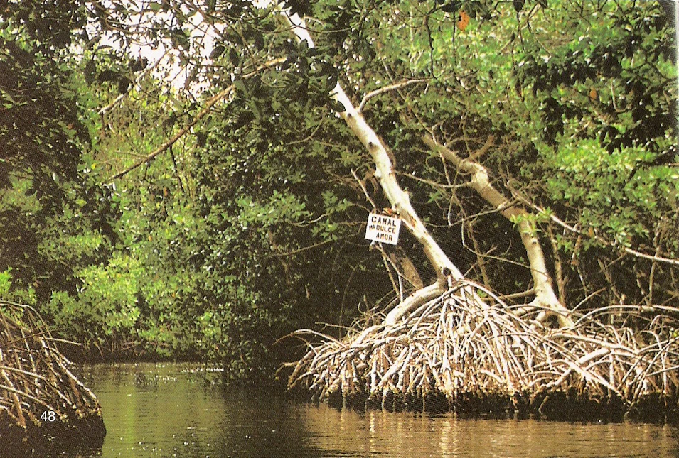
A canal with calm water surrounded by dense mangrove trees, a signpost, and exposed roots of mangrove trees
Canal within Laguna de La Restinga National Park showing mangrove roots and waterway

Best time to visit Laguna de La Restinga National Park

The optimal period for visiting Laguna de La Restinga falls within the dry season spanning approximately December through April, when precipitation is minimal and visitor conditions are most comfortable. During these months, water levels in the lagoon tend to be more stable and wildlife viewing opportunities are enhanced as birds concentrate around remaining water sources. The cooler temperatures of the winter months offer more comfortable conditions for exploring the waterways. However, the park remains accessible year-round, and each season presents different characteristics of the wetland environment. Visitors planning trips should consider that the semi-arid climate means that even the wetter months experience relatively limited rainfall compared to tropical rainforest regions.
Monthly climate preview

Long-term representative temperature and monthly precipitation tracking for Venezuela

Laguna de La Restinga National Park Climate Normals and Annual Weather Patterns

Representative coordinate records show sustained monthly average temperatures ranging from 25.33 to 27.93 degrees Celsius alongside varied daily precipitation levels. Examining the complete twelve-month climatology data provides a structured baseline for understanding long-term environmental patterns across the protected landscape.
Annual mean27 °C
25 °C28 °C
Jan26°
Feb25°
Mar26°
Apr26°
May27°
Jun27°
Jul27°
Aug27°
Sep28°
Oct28°
Nov27°
Dec26°
Warmest month
September

27.9 °C

Coolest month
February

25.3 °C

Wettest month
August

4.3 mm/day

Driest month
March

0.6 mm/day

Park location guide

Geography guide, regional context, and park location map for Laguna de La Restinga National Park

Laguna de La Restinga National Park park geography, regions, and map view in Venezuela

Understand where Laguna de La Restinga National Park sits in Venezuela through a broader geographic reading of the surrounding landscape, nearby location context, and its mapped position within the national park landscape.

How Laguna de La Restinga National Park fits into Venezuela

Venezuela is a country in northern South America with coastline along the Caribbean Sea and Atlantic Ocean. It borders Colombia, Brazil, Guyana, and Trinidad and Tobago. The country has an area of approximately 916,445 km² and a population of about 31.8 million. Caracas is the capital and largest city. Venezuela consists of 23 states and the Capital District.

Wider geography shaping Laguna de La Restinga National Park in Venezuela

Venezuela is located on the northern coast of South America. The continental territory is bordered by the Caribbean Sea and Atlantic Ocean to the north, Colombia to the west, Brazil to the south, and Guyana to the east. Trinidad and Tobago lies to the northeast. The country includes various islands and islets in the Caribbean Sea known as the Federal Dependencies.

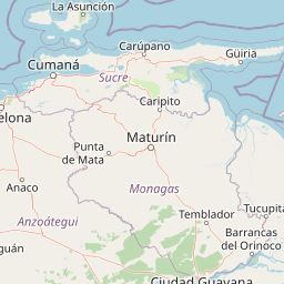
Map view of Laguna de La Restinga National Park

Use this park location map to pinpoint Laguna de La Restinga National Park in Venezuela, understand its exact geographic position, and read its mapped placement within the surrounding landscape more clearly.

Pigeon | © OpenStreetMap contributors
Recorded earthquake history

Review Historical Seismic Activity Near Laguna de La Restinga National Park

Consult the MoriAtlas catalogue of recorded earthquakes linked to the location of Laguna de La Restinga National Park. This index provides essential historical perspective on regional seismic patterns by detailing event timing and epicentre data for the area surrounding this coastal wetland.

Laguna de La Restinga National Park Earthquake History

Catalogued events

11 events

Strongest magnitude

Magnitude 5.2

Most recent event

Oct 17, 2020

This history includes earthquakes recorded inside the park or within 50 km of its borders

Examine the characteristic salt lagoon, intricate mangrove channels, and diverse coastal habitats that define this protected area on Isla Margarita.

Laguna de La Restinga National Park: Visual Exploration of Coastal Wetland Landscapes and Mangrove Habitats

Explore visual imagery of Laguna de La Restinga National Park to understand its unique ecological composition, from the dense mangrove forests and winding channels to the surrounding semi-arid coastal terrain. These visual resources offer crucial insight into the park's wetland habitats, distinct landscape character, and overall protected area environment.

A narrow waterway surrounded by dense green mangrove trees with sunlight filtering through the canopy

Waterway surrounded by green vegetation under a clear blue sky

Lagoon surrounded by green trees with reflections in the water under a partly cloudy sky

Aerial view showing coastal landscape with water bodies, land areas, and clouds

Wooden pier with colorful boats docked along the side, two people walking in the distance, green trees in the background

A small boat with a canopy on calm water surrounded by dense mangrove trees with exposed roots

Calm lagoon waters surrounded by dense mangrove trees with mountains in the background under a partly cloudy sky

A canal with calm water surrounded by dense mangrove trees, a signpost, and exposed roots of mangrove trees

Mangrove trees with exposed roots bordering calm water with a partially visible sign in the background

Park atlas

Compare protected landscapes and map the regional spread of parks, tracing diverse terrain beyond Laguna de La Restinga National Park's coastal wetlands.

Explore Other National Parks and Protected Areas Near Laguna de La Restinga National Park

Explore other national parks and protected areas with geographical proximity or similar wetland and coastal characteristics to Laguna de La Restinga National Park. Compare these protected landscapes to understand regional conservation patterns and the diverse ecosystems within Venezuela's Caribbean island geography.
National parkNueva Esparta
Park boundaries overlap#1 closest

Southeast

Parque nacional Laguna de La Restinga: Protected Coastal Lagoon and Island Geography

Wetland ecosystems of Nueva Esparta, Venezuela

Parque nacional Laguna de La Restinga protects an extensive coastal lagoon bordered by dense mangrove forests and arid coastal scrub on Isla de Margarita. This critical wetland habitat serves as a biological bridge between the two halves of the island, offering a complex network of channels and sandy flats that support diverse coastal species and marine turtle nesting sites.

Area
188.62 km²
Established
1974
IUCN
II
Relief
Lowland
Natural monumentNueva Esparta
0.2 km away#2 closest

Southeast

Monumento natural Tetas de María Guevara: Protected Land and Coastal Geography

Analyzing the arid hills and mangrove lagoons of Isla de Margarita

Spanning 1,670 hectares in the Municipio Tubores, Monumento natural Tetas de María Guevara features a distinctive silhouette formed by twin hills. This protected landscape provides critical geographic contrast, pairing dry scrubland terrain with vital coastal wetland systems. The area serves as a significant natural reference point and ecological component within the broader Nueva Esparta island region.

Area
16.7 km²
Established
1974
Relief
Upland
Climate
Arid
National parkNueva Esparta
6.6 km away#3 closest

East

Cerro El Copey National Park: Mapped Protected Area in Nueva Esparta

Explore the geographic context and landscape of this national park.

Cerro El Copey National Park offers a distinct protected landscape within Nueva Esparta, Venezuela. This page details the park's geographic identity, its mapped boundaries, and its significance as a national park. Investigate the terrain and regional context to understand the protected area's ecological and geographical footprint, providing essential data for atlas-driven exploration.

Area
71 km²
Established
1974
IUCN
II
Relief
Mountain
National parkSucre
55 km away#4 closest

Southwest

Mochima National Park: Venezuela National Park Protected Landscape Atlas

Explore Sucre's mapped conservation boundaries.

Mochima National Park stands as a distinct national park within the Sucre region, offering a focal point for understanding protected landscapes and their geographic context. This entry provides specific details relevant to atlas exploration, allowing for a clear view of the park's mapped boundaries and its contribution to the national park system. Engage with the mapped terrain and regional geography that define this conservation area.

Area
949.35 km²
Established
1973
IUCN
II
Visitors
500K annual
National parkMonagas
87 km away#5 closest

Southeast

Cueva del Guácharo National Park: Venezuela's Protected Natural Landscape

Mapping protected areas and natural terrain in Monagas.

Cueva del Guácharo National Park represents a distinct protected landscape within Venezuela's Monagas region. This entry provides essential context for understanding the park's geographic scope, mapped boundaries, and role as a national park. It is designed to facilitate detailed atlas exploration of protected natural areas and their regional landscape context, offering a foundation for understanding Venezuela's conservation geography.

Area
627 km²
Established
1975
IUCN
II
Relief
Mountain
National parkSucre State
116 km away#6 closest

East

Turuépano National Park: National Park Protected Landscape and Geographic Context

Explore the mapped boundaries and natural terrain of Sucre State's national park.

Investigate Turuépano National Park, a protected national park situated within Sucre State, Venezuela. This entry provides detailed geographic context and information on its mapped protected-area boundaries, essential for understanding its role in the region's natural landscape atlas. Explore the specific terrain and protected land features that define this significant Venezuelan park.

Area
726 km²
Established
1991
IUCN
II
Relief
Lowland
National parkSucre
150 km away#7 closest

East

Península de Paria National Park: Venezuela's Protected Landscape Geography and Atlas Context

Explore mapped park boundaries and regional geographic setting.

Discover Península de Paria National Park, a vital protected area within the Sucre region of Venezuela. This page offers a detailed look at the park's geographic identity, focusing on its mapped boundaries and its significance as a national park for atlas-based exploration. Understand its landscape context and its contribution to Venezuela's network of protected lands, providing a clear geographic overview for researchers and explorers.

Area
375 km²
Established
1978
IUCN
II
Relief
Mountain
Watercolor painting of a lagoon surrounded by green vegetation and mountains in the background
National parkMiranda State
178 km away#8 closest

Southwest

Laguna de Tacarigua National Park: Protected Area and Miranda State Geography

Mapped natural landscape and park boundaries in Venezuela.

Laguna de Tacarigua National Park is a designated national park offering critical protected landscape features within Miranda State. This park provides essential context for understanding Venezuela's protected areas, with a focus on its mapped boundaries and regional geographic setting. Dive into the atlas-style details to comprehend its place in the natural landscape.

Area
391 km²
Established
1974
IUCN
II
Relief
Lowland

Common questions about visiting, size, designation, and location context for Laguna de La Restinga National Park

Laguna de La Restinga National Park FAQs for park facts, access, geography, and protected area context

Find quick answers about Laguna de La Restinga National Park, including protected-area facts, park geography, trail and visitor context, and how the park fits into its surrounding country and regional landscape.
MoriAtlas Explorer

Continue Your Protected Areas Search Across the Global Atlas

Deepen your exploration by continuing the structured search for national parks and protected areas worldwide. Utilize the comprehensive filtering capabilities to compare different conservation landscapes and refine your understanding of global park geography. Discover more about the distribution and characteristics of protected natural areas.

Global natural geography