
Why Laguna de Tacarigua National Park stands out
Laguna de Tacarigua National Park is best known for its exceptional coastal lagoon ecosystem and extensive mangrove forests that form dense islands within the lagoon itself. The park represents a critical habitat for numerous bird species, including various herons and egrets that populate the wetland areas. The restinga, or coastal sand barrier, that separates the lagoon from the sea is a distinctive landscape feature, formed by longshore currents running along the coast. The park's combination of marine, brackish, and terrestrial habitats within a relatively compact area makes it an important site for coastal ecosystem conservation in northern Venezuela.
Laguna de Tacarigua National Park history and protected-area timeline
Laguna de Tacarigua National Park was established in 1974 as part of Venezuela's expanding network of protected areas during a period when the country was developing its national park system to preserve significant natural landscapes and ecosystems. The designation recognized the ecological importance of the coastal lagoon system and its surrounding environments, which had long served as important fishing grounds and natural resources for local communities. The park's creation reflected growing environmental awareness in Venezuela during the 1970s, a decade that saw the establishment of several new protected areas aimed at conserving the country's diverse ecosystems, from Andean páramos to Caribbean coastal zones. As a national park with IUCN Category II status, the area receives formal protection under Venezuelan law, though management challenges related to water flow, salinity management, and human use of the lagoon and surrounding lands continue to require ongoing attention.
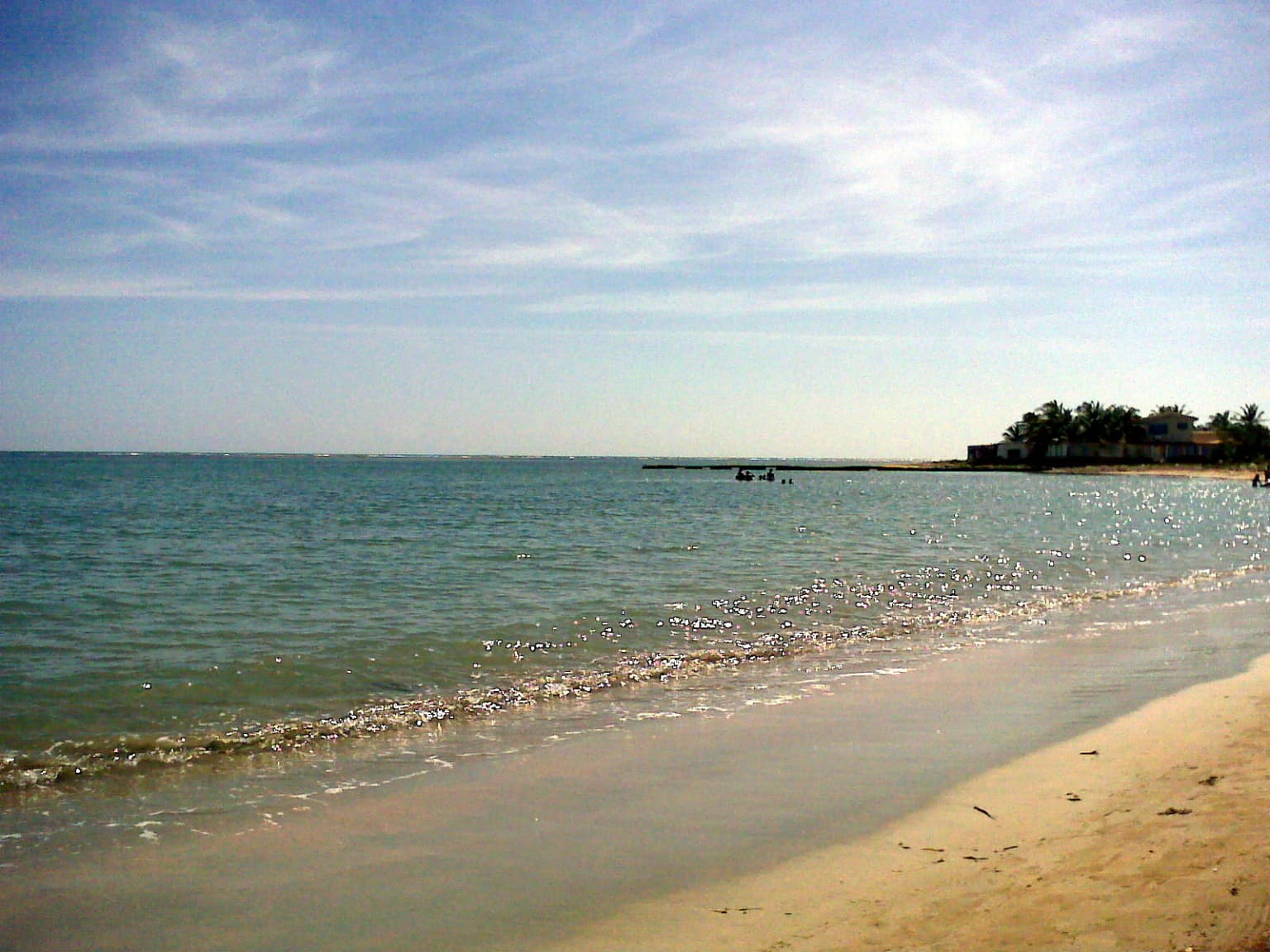
Laguna de Tacarigua National Park landscape and geographic character
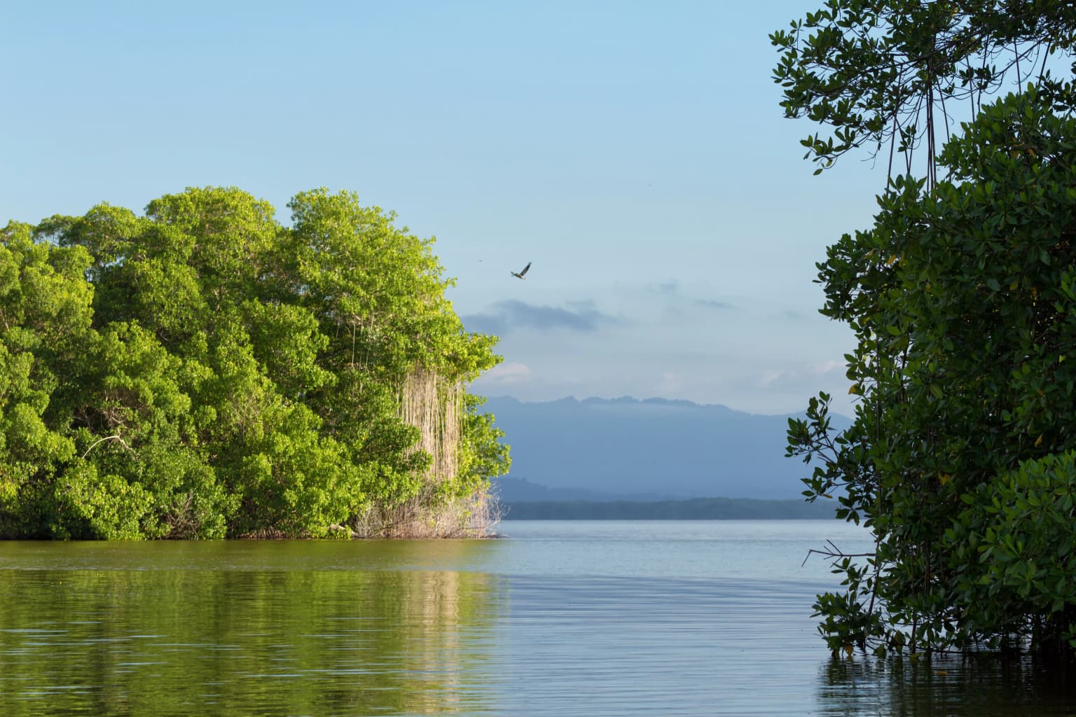
The landscape of Laguna de Tacarigua National Park is defined by the interplay between its central lagoon, the coastal barrier that separates it from the Caribbean Sea, and the surrounding terrestrial environments. The lagoon itself presents a vast, relatively shallow body of brackish water covering thousands of hectares, with its surface often reflecting the sky and surrounding vegetation. The restinga, or coastal sand barrier, creates a distinctive linear landscape feature running parallel to the coast, varying in width and elevation while supporting specialized beach and dune vegetation. To the north lies the open marine environment, while the southern portions of the park transition into rolling terrain covered by dry tropical forests. The mangrove forests represent a particularly striking element of the landscape, growing not only along the lagoon margins but also forming dense forested islands that rise from the shallow waters toward the center of the lagoon. These mangroves create a complex, interwoven environment of roots, foliage, and open water channels that distinguishes the park's visual character.
Laguna de Tacarigua National Park ecosystems, habitats, and plant life
The park encompasses three principal ecosystems that create a rich environmental mosaic: the shallow brackish lagoon itself, the dry forest areas to the south, and the sandy beach barrier or reef zone along the coast. The mangrove forests, covering approximately 4,000 hectares, represent one of the most ecologically significant components of the park, providing critical habitat, nursery grounds, and filter functions for the lagoon system. These mangroves grow along the banks and even form dense islands within the lagoon, creating complex habitat structures that support diverse species. The dry forest areas contain characteristic tropical dry forest species adapted to seasonal moisture patterns, while the marine zone and coastal barrier support their own distinct communities. The brackish nature of the lagoon water, resulting from the mixing of fresh water from rivers and streams with saltwater entering through the mouth, creates conditions that support specialized organisms adapted to varying salinity levels.
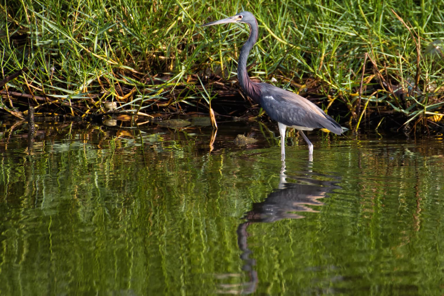
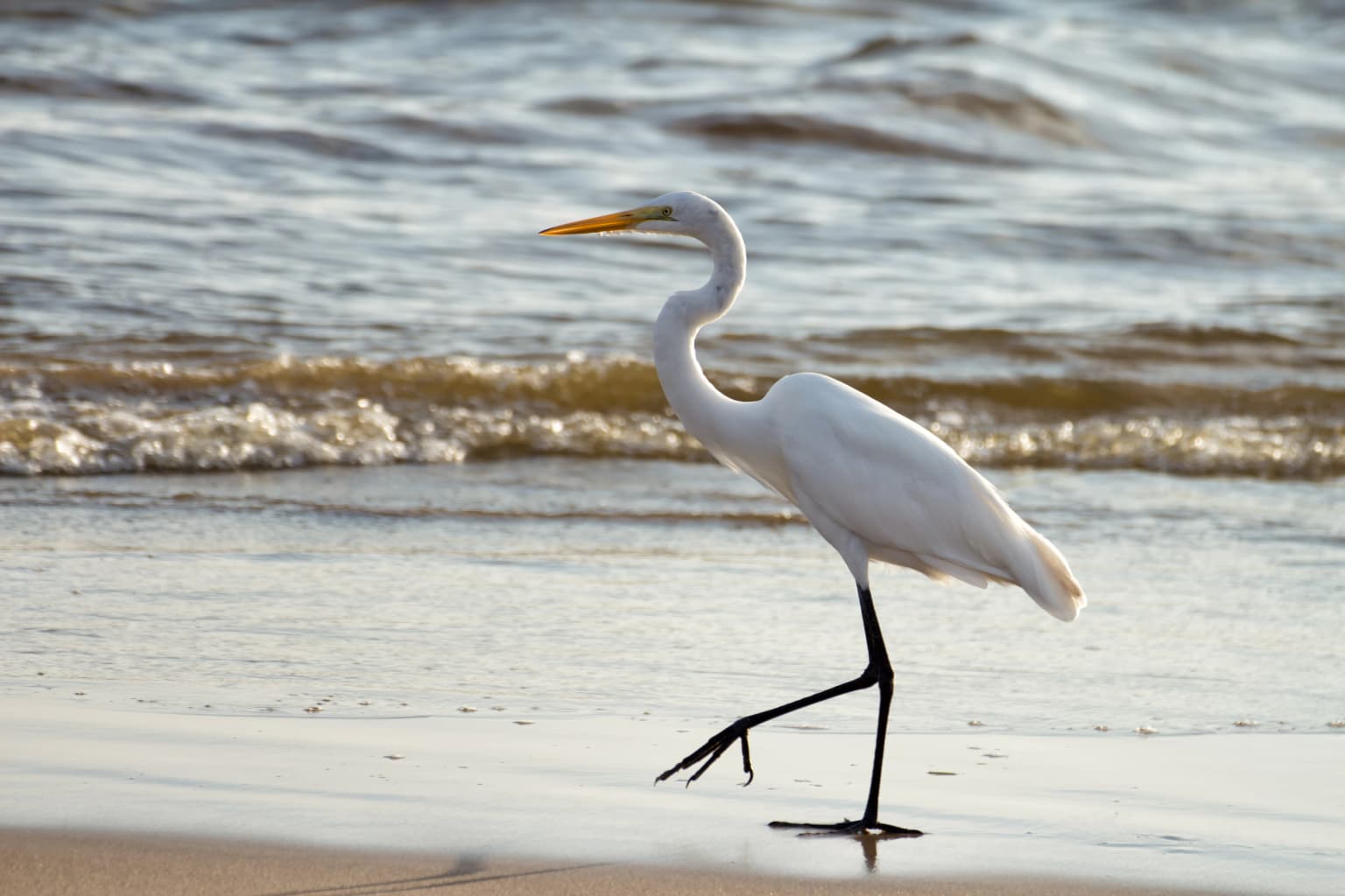
Laguna de Tacarigua National Park wildlife and species highlights
Laguna de Tacarigua National Park supports significant bird populations, with the lagoon and its surrounding mangrove forests providing important feeding and nesting habitat for various waterbird species. The documentation from the park includes observations of tricolored herons and great egrets, both characteristic species of wetland environments in the Caribbean region. These wading birds utilize the shallow waters and mangrove areas for foraging, finding abundant fish and invertebrate prey in the lagoon and its vegetated edges. The diverse habitat types within the park, spanning from open water to dense mangrove forest to dry forest, support a range of species beyond waterbirds as well, including fish that utilize the lagoon as a nursery area, reptiles adapted to wetland environments, and various terrestrial species in the forest areas.
Laguna de Tacarigua National Park conservation status and protection priorities
The protection of Laguna de Tacarigua National Park reflects the ecological significance of Venezuela's coastal lagoon systems, which serve as critical interfaces between terrestrial, freshwater, and marine environments. The park's mangrove forests provide important ecosystem services including shoreline stabilization, water filtration, carbon storage, and habitat provision for commercially and ecologically important species. The coastal lagoon functions as a natural buffer against storm surge and coastal erosion while also serving as a nursery ground for fish species that support both local fisheries and broader marine food webs. As a protected area with national park status, the site receives institutional recognition and legal protection, though the challenges of managing water flow, maintaining the mouth connection to the sea, and balancing human use with conservation objectives require ongoing management attention.
Laguna de Tacarigua National Park cultural meaning and human context
The park is located near the town of Laguna de Tacarigua, from which it takes its name, and the broader region has a history of human settlement and use of coastal resources. The lagoon and its waters have traditionally supported fishing activities for local communities, with the shallow, productive waters providing habitat for fish species that have been harvested by generations of residents. The coastal areas have served as transportation corridors and settlement zones throughout the region's history, with the barrier beach offering natural protection for communities along this stretch of Venezuela's Caribbean coast. The park's establishment in 1974 formalized protections for the area while creating a framework for balancing continued local use with conservation objectives.
Top sights and standout views in Laguna de Tacarigua National Park
The park's defining highlight is its exceptional coastal lagoon ecosystem, one of Venezuela's largest and most ecologically significant lagoon systems on the Caribbean coast. The extensive mangrove forests, covering thousands of hectares and forming island forests within the lagoon itself, represent a rare and important habitat type in the region. The coastal barrier, or restinga, stretching nearly 29 kilometers along the coast, creates a distinctive landscape feature and provides additional habitat diversity. The park's three-ecosystem structure, combining lagoon, dry forest, and marine environments within a single protected area, creates remarkable biodiversity in a relatively compact area.
Best time to visit Laguna de Tacarigua National Park
The park can be visited year-round, though the dry season from December through April typically offers more stable weather conditions for exploration of the coastal areas. The wet season from May through November brings increased rainfall to the region, which affects water levels in the lagoon and the flow of rivers feeding the system. Visitors interested in bird observation may find different species more active during different seasons, with the dry season often providing clearer conditions for wildlife viewing. The lagoon's salinity levels fluctuate with rainfall patterns and river flow, which can affect both the ecological character of the system and the availability of certain species for observation.