

Mori Atlas logo
National parkLochinvar National Park

Discover the mapped boundaries and distinct wetland-savanna geography of this vital protected area.

Lochinvar National Park: Zambia's Premier Floodplain National Park and Protected Landscape

Lochinvar National Park represents a significant protected landscape within Zambia, meticulously preserving the unique ecosystem of the southern Kafue Flats. This national park covers 428 square kilometers of floodplains, marshes, and woodlands, serving as a critical habitat for endemic species like the Kafue lechwe and over 400 recorded bird species. Its geography, defined by the Kafue River's seasonal inundation and contrasted by termite-mounded woodlands, offers a distinct natural setting for atlas-style exploration and understanding of protected area dynamics.

floodplainwetlandbirdwatchingKafue lechweantelopesavanna

Lochinvar National Park

National park

Park overview

Structured park overview, official facts, and landscape profile for Lochinvar National Park

Lochinvar National Park park facts, protected area profile, and essential visitor context

Review the core facts for Lochinvar National Park, including designation, size, terrain, visitor scale, habitats, and operating context in one park-focused overview.

About Lochinvar National Park

Lochinvar National Park occupies a distinctive position within Zambia's protected area network as a guardian of the southern Kafue Flats floodplain ecosystem. The park's location along the Kafue River creates a dynamic environment where seasonal flooding shapes vegetation patterns, wildlife distributions, and the overall ecological character of the landscape. The northern boundary follows the river's course, while the southern areas rise into wooded hills, creating a transition from wetland to woodland savanna that supports diverse habitats within a relatively compact area. The Chunga Lagoon serves as a central wetland feature, attracting enormous concentrations of waterfowl and providing critical feeding grounds for migratory species. Beyond its ecological significance, the park contains evidence of human history, including Neolithic settlement remains and an Iron Age village on Sebanzi Hill, where ancient baobab trees and caves add cultural depth to the landscape. Hot springs and echoing rocks provide additional points of interest, while the old colonial-style farmhouse now functions as the park's lodge, offering visitors a glimpse into the area's more recent history. The park shares strong ecological similarities with Blue Lagoon National Park on the northern side of the Kafue River, and together these protected areas form a conservation corridor for the floodplain system.

Quick facts and research context for Lochinvar National Park

Lochinvar National Park is located southwest of Lusaka in Zambia, on the southern bank of the Kafue River near the town of Monze. The park covers 428 square kilometres and was established in 1972 as a protected area for the Kafue Flats floodplain ecosystem. It is classified as IUCN Category II (national park) and managed by the Zambia Wildlife Authority. The park protects critical habitat for the Kafue lechwe, a regionally endemic antelope species, and supports exceptional birdlife with more than 400 documented species. The landscape features a mix of seasonal floodplain, lagoon systems, marshes, and drier woodland savanna with termite mound clusters.

Protection and recognition

Mapping the documented terrestrial scope, designation framework, and management boundaries.

Lochinvar National Park Protection Status and Protected Area Designation

Exploring the documented protection status of Lochinvar National Park reveals the official terrestrial scope and geographic boundaries established to safeguard this regional environment. Comparing international designations and regional management parameters provides critical context for understanding the conservation framework of this protected landscape.

Protection details

Protection scope
Terrestrial
Transboundary protection
No
Park context

Deeper park guide and search-rich context for Lochinvar National Park

Lochinvar National Park history, landscape, wildlife, and travel context

Explore Lochinvar National Park through its history, landscape character, ecosystems, wildlife, conservation priorities, cultural context, and seasonal travel timing in a structured park guide built for atlas discovery and search intent.

Why Lochinvar National Park stands out

Lochinvar is best known for its extraordinary concentrations of Kafue lechwe, a distinctive antelope species found nowhere else in such numbers. The floodplain supports one of the largest remaining populations of this endemic species, making it a flagship for the Kafue Flats ecosystem. The park is equally celebrated for its birdlife, with over 400 species including substantial waterfowl populations and migratory birds that converge on the Chunga Lagoon and marsh areas. The unique ecological balance, where antelope and birds thrive in the relative absence of larger predators, gives the park a particularly accessible wildlife viewing character.

Lochinvar National Park history and protected-area timeline

Lochinvar National Park was established in 1972, designated from a former ranch that had operated in the area during Zambia's colonial period. The conversion of grazing land to protected area status reflected a growing recognition of the Kafue Flats' ecological importance and the need to conserve the unique wetland ecosystem. The park was created to protect the floodplain habitats and the populations of Kafue lechwe that had historically populated the area. Management responsibility falls to the Zambia Wildlife Authority, which oversees conservation activities and visitor management. The park's establishment came during a period when Zambia was expanding its national park network to include representative samples of the country's major ecosystems, with particular attention to wetland and floodplain systems that had been largely unprotected.

Lochinvar National Park landscape and geographic character

The landscape of Lochinvar National Park is defined by the Kafue Flats floodplain, a vast expanse of seasonal wetlands that transforms dramatically between wet and dry seasons. The northern boundary follows the Kafue River, which channels water from the highlands into broad floodplain areas that spread across the park's central portions. The Chunga Lagoon represents the largest permanent water body, a shallow, reed-fringed wetland that supports extraordinary concentrations of waterfowl and provides critical dry-season refuges for aquatic wildlife. Surrounding the lagoons and flood channels are expansive marshes and seasonal wetlands that drain and refill with the river's flow patterns. The park's southern areas transition into drier woodland dominated by Faidherbia albida and Combretum trees, a landscape sculptured by numerous termite mounds that rise from the savanna floor. In the far south, low wooded hills provide elevated terrain that escapes the seasonal flooding affecting lower areas, creating a distinct ecological zone with different species assemblages. This combination of wetland, marsh, and woodland creates a visually varied landscape that changes substantially with the seasons.

Lochinvar National Park ecosystems, habitats, and plant life

The nature of Lochinvar National Park centres on the Kafue Flats floodplain ecosystem, one of Zambia's most productive and ecologically significant wetlands. The seasonal flooding creates a dynamic habitat mosaic where water levels rise and fall, exposing fresh grazing areas and replenishing the lagoons and marshes that support the park's wildlife. The floodplain supports specialized vegetation adapted to periodic inundation, while the surrounding woodland areas feature Faidherbia albida, a distinctive species that retains its foliage through the dry season when other trees drop their leaves. The termite mounds scattered across the woodland areas create microhabitats that support different plant and animal communities, acting as islands of elevated ground during the wet season. The ecological character is defined by the interplay between aquatic and terrestrial environments, with the flood cycle driving population dynamics for both invertebrates and vertebrates.

Lochinvar National Park wildlife and species highlights

Lochinvar National Park supports remarkable wildlife populations, with the Kafue lechwe standing as the most iconic species. This medium-sized antelope has evolved to thrive in the floodplain environment, with populations that expand onto the exposed grasslands as waters recede and retreat to higher ground during the wet season. The park holds significant populations of blue wildebeest, kudu, and oribi, while the southern woodland areas provide habitat for bushbuck, baboon, bushpig, and vervet monkey. The birdlife is exceptional, with over 400 species recorded including diverse waterfowl that congregate around the Chunga Lagoon and marsh areas. Large numbers of migratory waterfowl visit the park seasonally, taking advantage of the productive wetland feeding grounds. The relative absence of larger predators, which were largely eliminated by ranchers in the area before the park's establishment, has allowed antelope and bird populations to achieve unusually high densities, creating exceptional wildlife viewing opportunities.

Lochinvar National Park conservation status and protection priorities

Lochinvar National Park plays a critical role in conserving the Kafue Flats ecosystem, one of Zambia's most important wetland systems. The park protects significant populations of Kafue lechwe, a species whose range is largely confined to the Kafue Flats region, making this protection essential for the species' long-term survival. The floodplain habitats provide ecosystem services including water filtration, flood regulation, and carbon sequestration, while supporting biological productivity that extends well beyond the park's boundaries. Bird conservation is particularly significant, with the park serving as a crucial stopover anddry-season refuge for migratory waterfowl moving through the African flyway. The dual protection of wetland and woodland habitats within a single protected area creates a conservation model that addresses multiple ecosystem types.

Lochinvar National Park cultural meaning and human context

The landscape of Lochinvar contains evidence of human occupation spanning thousands of years. Archaeological sites include remains of a Neolithic settlement and an Iron Age village located on Sebanzi Hill, where ancient human communities established settlements in proximity to the floodplain's resources. The hill is also notable for caves that were used by past inhabitants, as well as ancient baobab trees that have witnessed generations of human activity in the area. These archaeological and historical features add cultural layers to the park's natural values, connecting contemporary visitors to the long history of human interaction with this landscape. The park's name derives from a Scottish loch, reflecting the colonial-era naming practices that characterized much of Zambia's administrative history.

Top sights and standout views in Lochinvar National Park

Lochinvar National Park offers exceptional wildlife viewing in a landscape where large herds of Kafue lechwe graze the floodplain alongside substantial bird populations. The Chunga Lagoon provides spectacular waterfowl viewing, particularly during migratory seasons when thousands of birds congregate on the wetland. The contrast between the open floodplain and the termite-mounded woodland creates a visually diverse environment that supports different wildlife experiences within a compact area. The park's archaeological sites on Sebanzi Hill offer unique cultural exploration opportunities, with caves, ancient baobabs, and Iron Age village remains accessible to visitors. The colonial-era farmhouse lodge provides historic accommodation within the park itself.

Best time to visit Lochinvar National Park

The optimal time to visit Lochinvar National Park depends on the experience sought. The dry season from May to October offers easier wildlife viewing as vegetation thins and animals concentrate around remaining water sources, with the floodplain transforming from a lush wetland to exposed grasslands where herds become more visible. The wet season from November to April brings dramatic landscape changes as the floodplain fills with water, creating excellent birdwatching conditions when migratory species arrive in large numbers. The floodplain's transformation between seasons means that each visit offers a distinctly different perspective on the park's ecological character.

Monthly climate preview

Long-term monthly temperature and precipitation patterns across the landscape

Lochinvar National Park Climate Normals and Annual Temperature Rhythm

Lochinvar National Park exhibits a measured annual temperature and precipitation rhythm based on historical coordinates from 1991 to 2020. Reviewing the complete monthly climate normals clarifies long-term averages for temperature and rainfall across the protected area.
Annual mean23 °C
18 °C27 °C
Jan23°
Feb23°
Mar23°
Apr22°
May21°
Jun18°
Jul18°
Aug21°
Sep24°
Oct27°
Nov27°
Dec24°
Warmest month
October

27.2 °C

Coolest month
July

17.6 °C

Wettest month
January

6.2 mm/day

Driest month
July

0 mm/day

Park location guide

Geography guide, regional context, and park location map for Lochinvar National Park

Lochinvar National Park park geography, regions, and map view in Zambia

Understand where Lochinvar National Park sits in Zambia through a broader geographic reading of the surrounding landscape, nearby location context, and its mapped position within the national park landscape.

How Lochinvar National Park fits into Zambia

Zambia is a landlocked nation in Southern Africa with a population of approximately 20 million people. The country is bordered by eight countries and features diverse geography ranging from the Zambezi River to vast plateaus. Lusaka serves as the capital and largest city, while the Copperbelt Province in the north drives much of the economy through copper mining.

Wider geography shaping Lochinvar National Park in Zambia

Zambia is located in Southern Africa and is landlocked, bordered by eight countries: Democratic Republic of the Congo to the north, Tanzania to the northeast, Malawi to the east, Mozambique to the southeast, Zimbabwe and Botswana to the south, Namibia to the southwest, and Angola to the west. The country features varied terrain including the Zambezi River plain in the south, plateaus in the central and northern regions, and the Muchinga Mountains in the northeast. Lake Tanganyika forms part of the northern border.

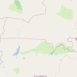
Map view of Lochinvar National Park

Use this park location map to pinpoint Lochinvar National Park in Zambia, understand its exact geographic position, and read its mapped placement within the surrounding landscape more clearly.

Pigeon | © OpenStreetMap contributors
Natural feature types

Explore the Geographic Features and Mapped Landscapes of Lochinvar National Park

Navigate the complex terrain of Lochinvar National Park by browsing its network of named natural features. This MoriAtlas collection provides a deeper look at the interplay between Zambian wetland ecosystems and woodland areas, creating a clear picture of the region's diverse physical geography.
Recorded earthquake history

Explore Historical Earthquake Records Near Lochinvar National Park

Visit the dedicated earthquake catalogue to view recorded seismic events in the vicinity of Lochinvar National Park. MoriAtlas provides a clear, structured overview of historical data to support regional geographic research, ensuring accurate tracking of past events occurring across the southern Kafue Flats.

Lochinvar National Park Earthquake Records

Catalogued events

1 event

Strongest magnitude

Magnitude 3.3

Most recent event

Nov 15, 1992

This history includes earthquakes recorded inside the park or within 50 km of its borders

Park atlas

Explore the diverse protected landscapes and unique wetland ecosystems adjacent to Zambia's Kafue Flats region.

Discover Nearby Protected Areas and National Parks around Lochinvar National Park, Zambia

Expand your exploration from Lochinvar National Park by browsing other protected areas within Zambia, revealing parks with comparable floodplain ecosystems or distinct regional savanna landscapes. Compare diverse conservation landscapes, trace the geographic spread of protected environments, and understand interconnected ecosystems through detailed atlas views.
National parkSouth Africa
About 32 km away#1 closest

North

Blue Lagoon National Park: National Park Atlas and Mapped Wetland Geography

Discover the protected landscape and fauna of Zambia's Kafue Flats.

Blue Lagoon National Park is a critical protected area recognized for its unique wetland and floodplain environment within South Africa's extensive Kafue Flats system. Established in 1976, this national park offers significant opportunities for atlas-driven exploration of its mapped geography and protected landscape. Visitors can learn about the park's ecological significance, its characteristic terrain of lagoons and marshes, and its importance as a sanctuary for endemic wildlife and diverse bird species, contributing valuable context to the broader regional atlas.

Area
500 km²
Established
1976
IUCN
II
Relief
Lowland
National parkZambia
97 km away#2 closest

West

Kafue National Park: Zambia's Key National Park for Geographic and Protected Area Exploration

Mapped boundaries and landscape context in southern Africa.

Kafue National Park represents a vital component of Zambia's protected lands, offering a distinct perspective for atlas-driven geographic exploration. This national park's identity is tied to its extensive mapped boundaries and its contribution to the regional landscape of southern Africa. Users engaging with this entry can uncover the protected area's specific geographic context and map-based details, enhancing their understanding of conservation landscapes.

Area
22,400 km²
IUCN
II
Relief
Lowland
Climate
Tropical
National parkLusaka Province
About 119 km away#3 closest

East

Lusaka National Park: Protected Woodland Habitat and Geographic Context in Lusaka Province

Zambia's smallest national park, mapping natural terrain near the capital.

Lusaka National Park, Zambia's newest national park, offers a contained yet representative example of the woodland ecosystems found on the Lusaka plateau. This protected landscape, covering 6,715 hectares, is entirely fenced, creating a distinct conservation area within Lusaka Province. Its establishment over a former forest reserve highlights a unique approach to upgrading protected lands. Explore the park's mapped terrain and understand its significance as an accessible natural enclave amid regional development, providing a focused view of central Zambian woodland environments.

Area
67.15 km²
Established
2011
IUCN
II
Climate
Tropical
National parkZimbabwe
About 172 km away#4 closest

Southeast

Matusadona National Park: Zimbabwe's National Park Landscape Atlas and Geographic Context

Mapped boundaries and regional terrain for Matusadona National Park.

Matusadona National Park presents a vital component of Zimbabwe's protected land inventory. This detail page offers an atlas-centric view, highlighting the park's mapped geographic features and its distinct landscape character. It is designed to facilitate a structured understanding of Matusadona National Park as a specific protected area, providing essential context for regional geography and natural landscape exploration without delving into visitor logistics or park operations.

Area
1,400 km²
Established
1975
Relief
Mixed relief
Climate
Subtropical
National parkZimbabwe
195 km away#5 closest

East

Mana Pools National Park: Zimbabwe National Park Atlas and Protected Floodplain Landscapes

Explore a World Heritage protected area with iconic baobab forests.

Mana Pools National Park presents a profound example of a preserved African wilderness, recognized globally for its ecological integrity. As a UNESCO World Heritage Site, this protected landscape along the Zambezi River in Zimbabwe is defined by its four permanent pools, vast sandbanks, and distinctive forests. The park's geography supports exceptional wildlife congregations, particularly during the dry season, offering a unique atlas-level perspective on floodplain ecosystems and conservation value.

Area
2,196 km²
IUCN
II
Relief
Lowland
Scope
Terrestrial
National parkLusaka Province
200 km away#6 closest

East

Lower Zambezi National Park: Mapped Protected Area and Regional Geography

Lusaka Province National Park Landscape Context

Lower Zambezi National Park represents a key protected landscape within Zambia, specifically situated in Lusaka Province. This park's detail page focuses on its role as a national park, offering insights into its geographic contours, mapped park boundaries, and its overall context within the regional geography. Engage with structured data to understand the natural landscape characteristics and the atlas-relevant distribution of this protected area.

Area
4,092 km²
Established
1983
IUCN
II
Relief
Mixed relief
National parkZimbabwe
About 212 km away#7 closest

Southeast

Chizarira National Park: Zimbabwe's Remote Protected Landscape on the Zambezi Escarpment

Explore rugged mountains, deep gorges, and unique woodland ecosystems.

Chizarira National Park offers an unparalleled exploration of wilderness and dramatic geography within Zimbabwe. Situated along the imposing Zambezi Escarpment, its landscape is characterized by a 600-meter drop, rugged mountains, and deep river gorges carved by perennial streams. This protected area, known for its remote appeal and rich leopard populations, provides a distinct view of miombo and mopane woodlands, contributing to its unique ecological identity within the regional geography.

Area
2,000 km²
Established
1975
IUCN
II
Relief
Mountain
National parkSouthern Province
About 250 km away#8 closest

Southwest

Mosi-oa-Tunya National Park: National Park Exploration and Geographic Atlas

Mapped boundaries and protected landscape context in Southern Province, Zambia.

Gain a comprehensive understanding of Mosi-oa-Tunya National Park, a designated national park in Zambia's Southern Province. This entry focuses on its protected area identity, mapped geographic scope, and its position within the regional atlas. Discover the essential landscape context and the structured geographic information that defines this important conservation area, providing a factual foundation for atlas-based exploration.

Area
66 km²
IUCN
II
Climate
Subtropical
Access
Easy access

Common questions about visiting, size, designation, and location context for Lochinvar National Park

Lochinvar National Park FAQs for park facts, access, geography, and protected area context

Find quick answers about Lochinvar National Park, including protected-area facts, park geography, trail and visitor context, and how the park fits into its surrounding country and regional landscape.
MoriAtlas Explorer

Continue Your Protected Areas Search Across the Global Atlas

Deepen your exploration by continuing the structured search for national parks and protected areas worldwide. Utilize the comprehensive filtering capabilities to compare different conservation landscapes and refine your understanding of global park geography. Discover more about the distribution and characteristics of protected natural areas.

Global natural geography
