
Why Marojejy National Park stands out
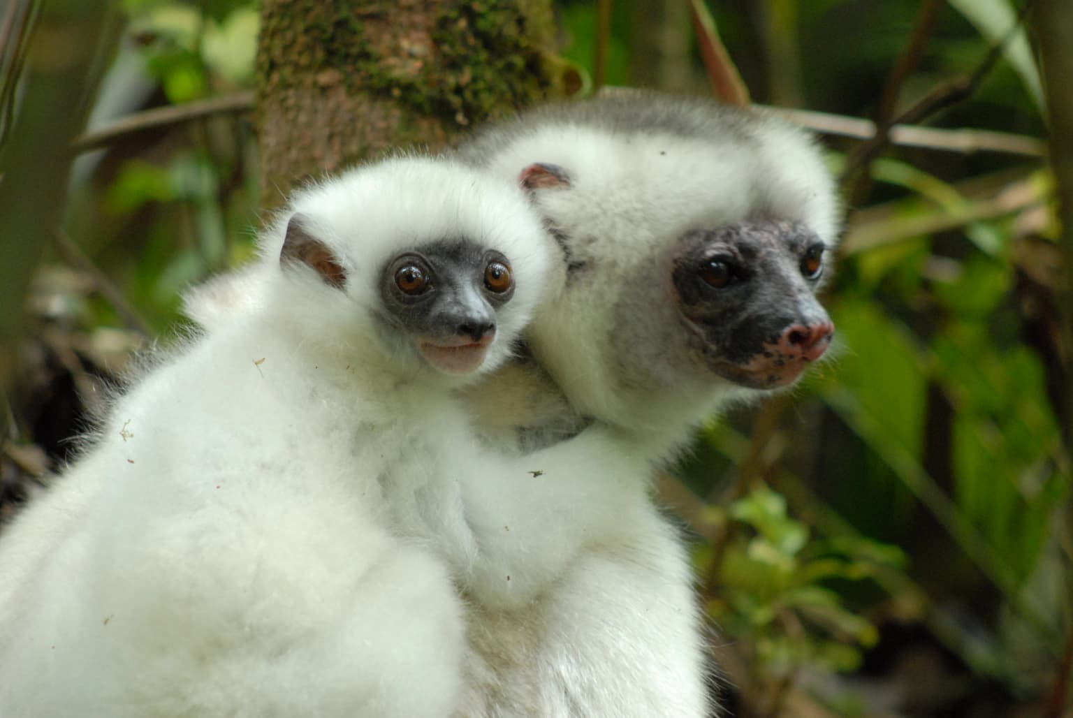
Marojejy is best known for protecting the critically endangered silky sifaka, a critically endangered lemur listed among The World's 25 Most Endangered Primates since 2000, with fewer than 1,000 individuals remaining in the wild. The park is also famous for the helmet vanga, considered the iconic bird species, and for its remarkable altitudinal gradient that allows visitors to traverse multiple distinct ecosystems within a single trek. The mountain is celebrated as one of Madagascar's highest but most accessible peaks, with a single trail leading through three camps to the summit. The New York Times and Smithsonian Magazine have both praised Marojejy for its dense jungly rainforests, sheer high cliffs, and endemic plants and animals found nowhere else on Earth.
Marojejy National Park history and protected-area timeline
The scientific history of Marojejy began in 1937 when L.-J. Arragon of the Service Géographique de Madagascar first ascended Marojejy Est, though he conducted no field research during this visit. The massif remained undescribed geologically until 1948 when French botanist Jean-Henri Humbert from the National Museum of Natural History in Paris explored the mountains. Between November 1948 and November 1950, Humbert spent five months collecting 4,039 herbarium specimens, and in 1955 he published the book "A Marvel of Nature" in which he declared the massif the most impressive range in all of Madagascar. His enthusiasm led to Marojejy being set aside as one of Madagascar's strict nature reserves in 1952, with access restricted to research scientists. In 1998, following pressure from conservation organizations including WWF, the reserve was converted to a national park to allow ecotourism as a sustainable alternative to resource extraction. The park was inscribed as part of the World Heritage Site Rainforests of the Atsinanana in 2007, though the site was added to the World Heritage in Danger list in 2010 due to illegal logging pressures.
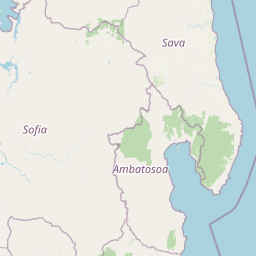
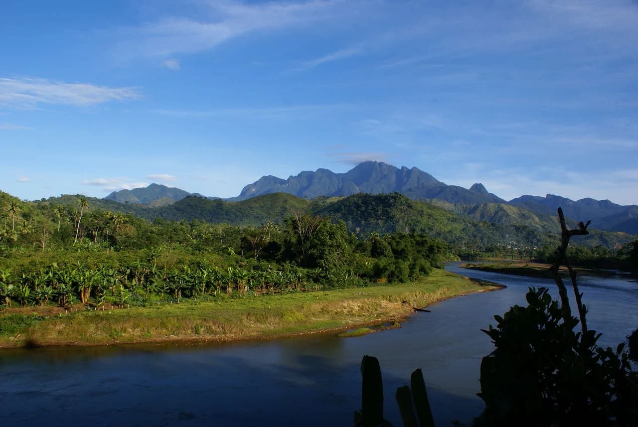
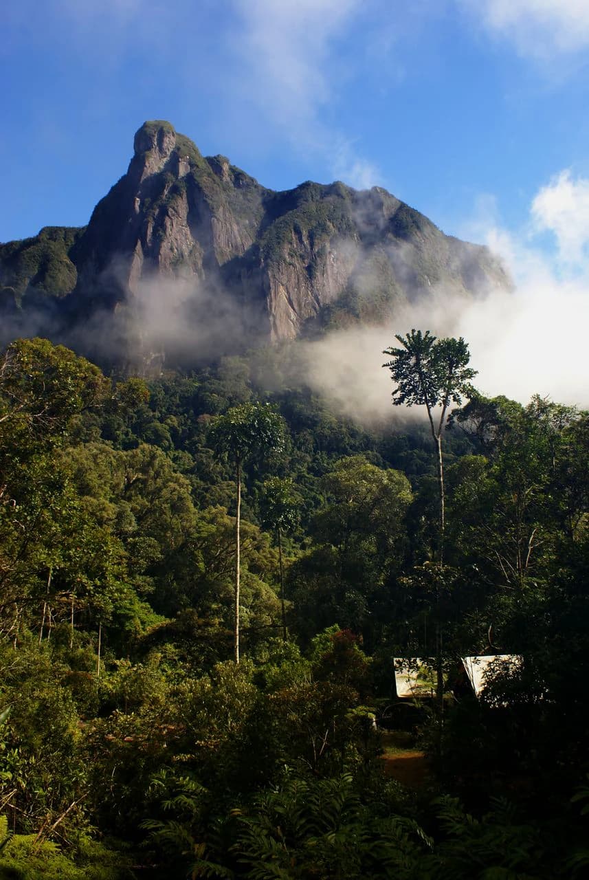
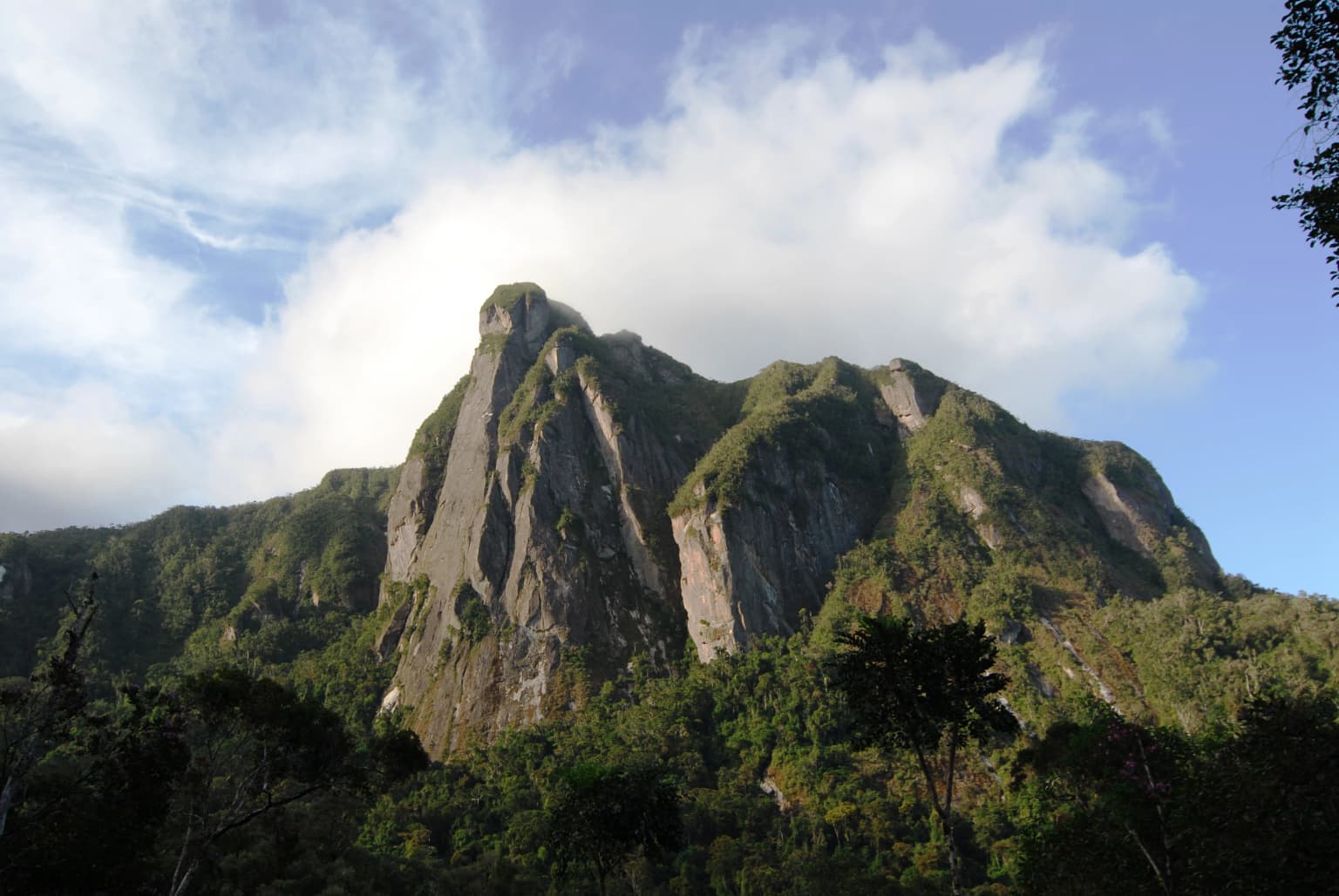
Marojejy National Park landscape and geographic character
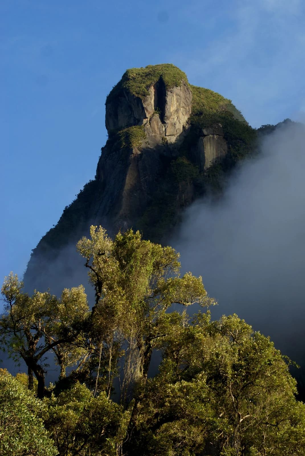
The Marojejy Massif forms the core of the park, with its crests creating an east-west line with distinct peaks along an irregular structure of parallel or divergent crest lines broken by steep slopes. The highest peaks, including Ambatotsondrona, are composed primarily of gneiss bedrock that formed over 500 million years ago during the Precambrian beneath an ancient mountain range. The gneiss consists of alternating bands of light and dark colored minerals, with the light minerals being more resistant to weathering, creating the asymmetric character of the peaks with moderate dips on northern slopes and near-vertical cliffs on southern faces. The mountains feed several drainage basins, including the Lokoho River from western and southern slopes and the Androranga River from northern slopes, both flowing to the Indian Ocean near Sambava. The terrain creates dramatic changes in microclimate and habitat over short distances, with the rapid transition from warm lowland rainforest through montane forest to cloud forest and finally to the unique montane scrub at the highest elevations being a defining characteristic of the landscape.
Marojejy National Park ecosystems, habitats, and plant life
The vegetation of Marojejy is extraordinarily diverse due to the variety of microclimates created by the steep topography and altitudinal range. Over 2,000 species of flowering plants have been documented in the park, with at least four plant families found at all elevations. The park contains four distinct forest types, each with characteristic species composition and structure. The lowland rainforest below 800 meters supports the highest species diversity with canopy trees reaching 25-35 meters, while the moist montane rainforest between 800-1,400 meters features smaller trees and abundant tree ferns. The sclerophyllous montane cloud forest at 1,400-1,800 meters has gnarled, stunted trees reaching only 10-15 meters maximum, with dense moss and lichen covering branches. Above 1,800 meters, the montane scrub represents the only remaining undisturbed mountain scrub in Madagascar, with vegetation reaching only 2 meters in height due to cool temperatures, high winds, and poor soils. The park contains 35 species of palms, several critically endangered and found only at Marojejy, as well as over 275 fern species including 18 tree ferns.
Marojejy National Park wildlife and species highlights
Marojejy National Park is home to exceptional biodiversity with at least 118 species of birds, 148 species of reptile and amphibian, and 11 species of lemur documented within its boundaries. The park is most famous for the silky sifaka, a critically endangered lemur listed among The World's 25 Most Endangered Primates since 2000, with fewer than 1,000 individuals remaining in the wild and none in captivity. Ten other lemur species also inhabit the park, including the nocturnal aye-aye, which has only been recorded once. The helmet vanga is considered the iconic bird species of the park, while 75 of the 118 bird species are forest-dwelling birds endemic to Madagascar, a total exceeding any other mountain site in Madagascar. The Madagascar serpent-eagle, not seen since 1932, was rediscovered in Marojejy in 1990. The park also supports the fossa, Madagascar's largest carnivore, at least 15 species of tenrec, seven species of native rodent, and the Madagascar sucker-footed bat. Reptile and amphibian diversity is the highest of any protected area in Madagascar, with 17 species found only in Marojejy including several chameleon species.
Marojejy National Park conservation status and protection priorities
Marojejy faces significant conservation challenges despite its protected status. Illegal logging of precious hardwoods, particularly rosewood and palisandre, has been a persistent problem, with an estimated 52,000 tons of rosewood logged in 2009 alone, with roughly one-third coming from Marojejy. The park was briefly closed in 2009 during the political crisis but has since reopened. Slash-and-burn agriculture, hunting of lemurs, mining of semi-precious gemstones, and wood collection continue to pressure the park's boundaries. The population in the surrounding region has tripled over 30 years to over 100,000 people by 2003, with approximately 200,000 people living within 40 kilometers of the park by 2003. Conservation organizations including the Lemur Conservation Foundation, Duke Lemur Center, and Madagascar National Parks have implemented community-based initiatives promoting afforestation and sustainable alternatives to mining, slash-and-burn agriculture, and wood collection. The Sava Region remains the poorest in Madagascar, creating ongoing pressure on natural resources.
Marojejy National Park cultural meaning and human context
The Andapa Basin surrounding Marojejy was extremely remote until the mid-1800s when refugees from the Merina Kingdom settled the area, followed by another wave fleeing French colonists nearly 50 years later and a small group from Réunion after World War I who came to grow vanilla. The population remained small until the early 1970s when the Andapa-Sambava road was completed, connecting the region to the coast and encouraging agricultural development. The dominant ethnic groups are the Tsimihety, the first settlers, and the Betsimisaraka. Local communities traditionally utilize forest materials for architecture, pirogues, fiber for weaving, firewood, traditional medicine, and flavoring drinks. Most residents are subsistence rice farmers practicing both irrigated paddies and slash-and-burn agriculture. The region is among the poorest in Madagascar, with food insecurity particularly severe between January and April before the main rice harvest.
Top sights and standout views in Marojejy National Park
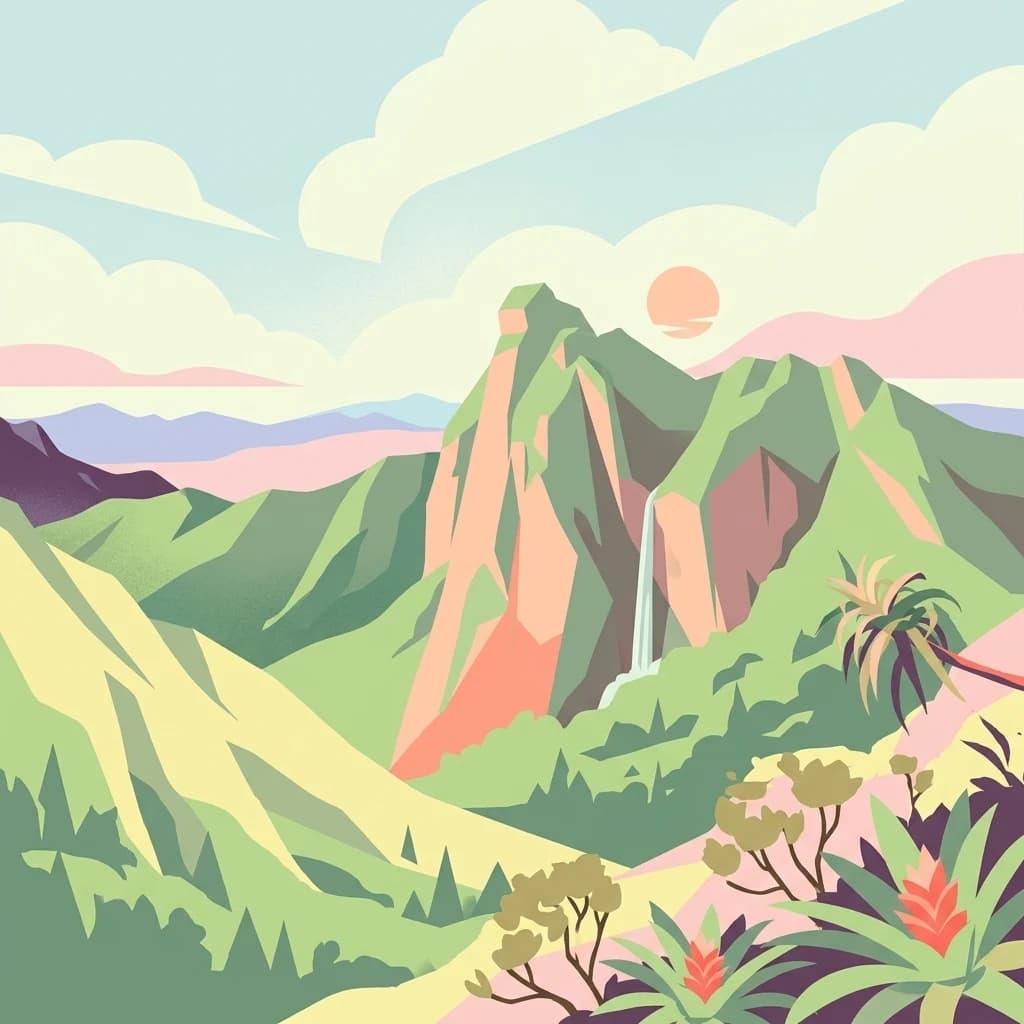
The park's single trail system offers a remarkable journey through dramatically different ecosystems, from lowland rainforest through montane forest to cloud forest and finally to montane scrub near the summit. The three camps along the route provide opportunities to observe different wildlife at each elevation, with Camp Marojejia reportedly the best location for spotting the silky sifaka. The climb to the summit at 2,132 meters stretches two kilometers and takes four to five hours, rewarding hikers with views of the surrounding mountains and access to the unique high-altitude scrub. The park offers wooden chalets and bungalows at its three camps, a rare feature among Madagascar's national parks, along with kitchen facilities and basic bedding. The helmet vanga and other endemic birds, chameleons including the panther chameleon, and diverse frog species are among the wildlife highlights. The geological features such as Ambatotsondrona, or Leaning Rock, add to the dramatic scenery.