
Mori Atlas logo
National parkMeerkat National Park

Mapping the protected boundaries and natural terrain of this national park in Northern Cape.

Meerkat National Park National Park: Protected Landscape and Geographic Atlas Exploration

Meerkat National Park represents a key protected area within South Africa's vast Northern Cape province, an arid region known for its expansive natural landscapes. This page serves as an entry point for understanding the park's specific geographic context, its mapped protected boundaries, and its role as a national park within the broader regional atlas. Explore the terrain and conservation landscape that defines Meerkat National Park, providing a foundation for structured geographic discovery.

Radio AstronomyKaroo BiomeQuiver TreesBirdwatchingEndemic SpeciesSemi-Desert
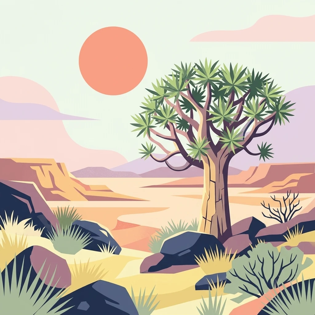
Digital illustration of desert landscape with quiver tree, rocks, and distant mountains under orange sun

Meerkat National Park

National park

Park overview

Structured park overview, official facts, and landscape profile for Meerkat National Park

Meerkat National Park park facts, protected area profile, and essential visitor context

Review the core facts for Meerkat National Park, including designation, size, terrain, visitor scale, habitats, and operating context in one park-focused overview.

About Meerkat National Park

Meerkat National Park represents a pioneering model that integrates world-class scientific infrastructure with landscape-scale ecological conservation. The park's creation was driven by the need to protect the Karoo's radio frequency environment, which is uniquely suitable for radio astronomy due to its low levels of human-made electromagnetic interference. The South African government designated the area under the Astronomy Geographic Advantage Act of 2007, recognizing its strategic importance for international astronomical research. Beyond its scientific mandate, the park provides critical habitat protection for three previously unprotected ecoregions, notably expanding protection of the Nama Karoo from approximately 1.5 percent to 2 percent of its original extent. The park is administered by South African National Parks in partnership with the National Research Foundation, with access restricted to pre-selected days throughout the year to minimize disturbance to both wildlife and astronomical operations.

Quick facts and research context for Meerkat National Park

Meerkat National Park spans 135,245 hectares in the Northern Cape, making it one of South Africa's larger national parks. Located in the Karoo Hoogland and Kareeberg municipalities, the park is situated near the town of Carnarvon. The area was designated as a national park in March 2020 through a partnership between the National Research Foundation, the Square Kilometre Array project, and South African National Parks. The park's primary purpose is dual: protecting the sensitive radio astronomy environment necessary for the Square Kilometre Array while preserving the Karoo's unique ecological systems and species.

Protection and recognition

Analyzing the official geographic boundaries and conservation management scope of the terrestrial reserve

Documented Protection Status and Terrestrial Designation of Meerkat National Park

Meerkat National Park holds a terrestrial protection status focused on preserving its unique physical environment and natural geography. Reviewing the official designation framework and boundary records helps clarify the park's formal place among regional conservation systems.

Protection details

Protection scope
Terrestrial
Transboundary protection
No
Park context

Deeper park guide and search-rich context for Meerkat National Park

Meerkat National Park history, landscape, wildlife, and travel context

Explore Meerkat National Park through its history, landscape character, ecosystems, wildlife, conservation priorities, cultural context, and seasonal travel timing in a structured park guide built for atlas discovery and search intent.

Why Meerkat National Park stands out

Meerkat National Park is best known for hosting the MeerKAT array, a cutting-edge radio telescope facility that forms the southern component of the Square Kilometre Array. Beyond its astronomical significance, the park protects some of the last remaining quiver tree forests in the region, a vulnerable species that has become emblematic of the Nama Karoo. The park also stands out for its exceptional bird diversity, with between 215 and 264 bird species recorded, including two endemic species: the red lark and Sclater's lark. Its location within an internationally recognized radio quiet zone makes it one of the few places on Earth where sensitive astronomical observations can be conducted with minimal interference.
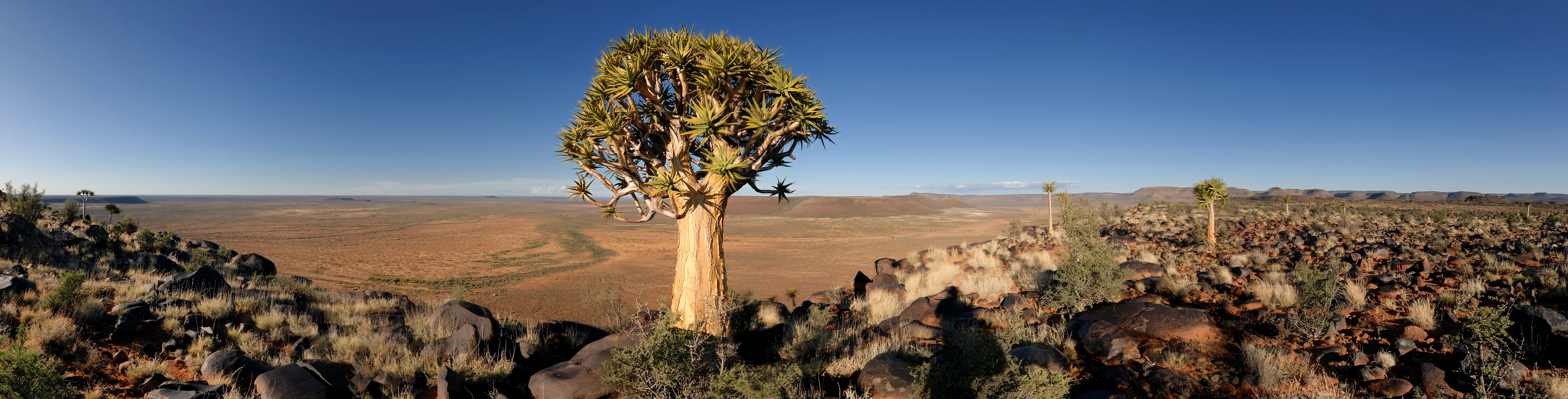
A quiver tree stands prominently in the foreground of a vast open landscape with rocky outcrops and a clear blue sky in Meerkat National Park, South Africa.
Spectacular landscape in Meerkat National Park featuring a quiver tree and vast open plains under a clear blue sky.

Meerkat National Park history and protected-area timeline

The establishment of Meerkat National Park represents a landmark achievement in South African conservation history. The National Research Foundation purchased privately owned rangeland in the Karoo region and removed livestock from the area before placing it under the protection of South African National Parks. In March 2020, the park was formally declared, adding 3.4 percent to South Africa's national park estate in a single designation. The creation was the result of a partnership between the National Research Foundation, the Square Kilometre Array organization, and South African National Parks. The timing coincided with the expansion of the MeerKAT telescope array, which had been operational since 2018. One of the key objectives driving the park's establishment was the protection of three vulnerable ecoregions, particularly the Nama Karoo, along with the conservation of quiver tree forests and other threatened species in the region.

Meerkat National Park landscape and geographic character

The park occupies a dramatic expanse of semi-arid Karoo terrain characterized by vast, open plains, ancient geological formations, and sparse but resilient vegetation. The landscape features gently undulating terrain interspersed with rocky outcrops and occasional drainage lines. The region lies at elevations suitable for astronomical observation, with clear, dark skies that are essential for radio astronomy. Five distinct vegetation types occur within the park boundaries: Bushmanland Basin Shrubland, the aquatic Bushmanland Vloere zone, Northern Upper Karoo, Upper Karoo Hardeveld, and Western Upper Karoo vegetation. The park's visual character is defined by the iconic quiver tree, an aloe species that forms distinctive forests in certain areas, creating one of the most photographically recognizable landscapes in the Karoo. The geological substrate contributes to the park's stark beauty, with exposures of ancient rock formations visible across the terrain.

Meerkat National Park ecosystems, habitats, and plant life

The ecological character of Meerkat National Park is defined by its position within the Nama Karoo, a semi-desert biome known for its high degree of endemism. The park supports five principal vegetation types, each adapted to the region's low rainfall and extreme temperature variations. A total of 223 plant species have been documented within the park boundaries, representing the diversity of this harsh but biologically significant environment. The removal of livestock and invasive mesquite trees during the park's establishment has allowed natural vegetation communities to recover, contributing to improved ecosystem function. The park's aquatic zones, though limited, provide important habitat for specialized species. The quiver tree forests represent a particularly significant vegetation feature, as these populations face vulnerability from climate change and habitat degradation across their range.

Meerkat National Park wildlife and species highlights

Meerkat National Park supports remarkable biodiversity despite its harsh environmental conditions. The park hosts between 215 and 264 bird species, including 25 near-endemic species and two entirely endemic species: the red lark and Sclater's lark. Notable bird species include the black harrier, kori bustard, martial eagle, secretarybird, and Verreaux's eagle. Mammal diversity includes 29 documented species, among them aardvark, aardwolf, black-backed jackal, caracal, crested porcupine, rock hyrax, springbok, and steenbok. The herpetofauna is particularly well-represented with 29 species, including six amphibian species and 23 reptile species. Reptile diversity includes multiple tortoise species, geckos, snakes, and lizards adapted to the Karoo's extreme conditions.

Meerkat National Park conservation status and protection priorities

The establishment of Meerkat National Park represents a significant conservation achievement for South Africa. The park was created with the explicit goal of expanding protection for three ecoregions that were severely under-protected, particularly the Nama Karoo, which had only 1.5 percent of its original extent in protected status before this designation. The addition of the park increased national parks coverage by 3.4 percent in a single expansion. The park protects vulnerable quiver tree forests and other threatened species within its boundaries. Additionally, the protection of the radio quiet zone supports scientific research that requires the world's clearest electromagnetic environment, creating a unique conservation rationale that extends beyond terrestrial ecology to encompass astronomical science.

Meerkat National Park cultural meaning and human context

While Meerkat National Park is primarily defined by its scientific and ecological significance, the Karoo landscape has been inhabited by indigenous peoples for millennia. The region holds archaeological evidence of human occupation, and the Nama language names for local features reflect deep historical connections to the land. The park's establishment also represents a more recent chapter in South Africa's scientific heritage, positioning the country as a hub for international astronomical research through the Square Kilometre Array project.

Top sights and standout views in Meerkat National Park

The MeerKAT radio telescope array stands as the park's most distinctive feature, a world-leading scientific instrument that has already delivered groundbreaking astronomical discoveries. The quiver tree forests provide a visually striking counterpoint to the technological landscape, representing natural heritage spanning thousands of years. The exceptional bird diversity, particularly the endemic lark species, makes the park significant for ornithologists and birdwatchers. The park's role in expanding Karoo ecosystem protection addresses a critical conservation gap in South Africa's protected area network.

Best time to visit Meerkat National Park

The Karoo experiences extreme seasonal variation, with hot summers and cold winters. The most comfortable time for visiting is during the cooler months from April to September, when daytime temperatures are moderate and conditions are suitable for outdoor exploration. Summer months from October to March can bring intense heat, though this is also when the park's vegetation is most vibrant. Visitors should note that access to the park is restricted to pre-selected days throughout the year, requiring advance planning. The dry winter months often provide clearer skies, though the primary astronomical operations continue year-round regardless of season.
Monthly climate preview

Track historic temperature fluctuations and minimal precipitation in the Northern Cape.

Meerkat National Park Weather by Month and Long-Term Climate Profile

Long-term observations at the representative coordinate of 1000 meters show hot dry periods peaking above 40 degrees Celsius alongside sub-zero winter minimums. Accessing the complete twelve-month profile reveals detailed daily temperature distributions and precipitation averages to help trace the full seasonal cycle.
Annual mean19 °C
10 °C27 °C
Jan27°
Feb26°
Mar24°
Apr19°
May14°
Jun10°
Jul10°
Aug12°
Sep16°
Oct20°
Nov22°
Dec25°
Warmest month
January

26.9 °C

Coolest month
July

9.6 °C

Wettest month
March

1 mm/day

Driest month
August

0.2 mm/day

Park location guide

Geography guide, regional context, and park location map for Meerkat National Park

Meerkat National Park park geography, regions, and map view in South Africa

Understand where Meerkat National Park sits in South Africa through a broader geographic reading of the surrounding landscape, nearby location context, and its mapped position within the national park landscape.

How Meerkat National Park fits into South Africa

South Africa is the southernmost country in Africa, spanning 1.22 million km² with a population of over 63 million. The country operates with three capital cities, Pretoria (executive), Cape Town (legislative), and Bloemfontein (judicial), and is renowned for its biodiversity, national parks, and multicultural society.

Wider geography shaping Meerkat National Park in South Africa

South Africa occupies the southernmost region of Africa, with coastline along both the Atlantic Ocean to the west and the Indian Ocean to the east. The interior features elevated plateaus including the Highveld, with the Drakensberg escarpment marking the eastern highlands. The country shares borders with Namibia, Botswana, Zimbabwe, Mozambique, Eswatini, and Lesotho.

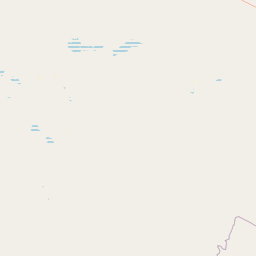
Map view of Meerkat National Park

Use this park location map to pinpoint Meerkat National Park in South Africa, understand its exact geographic position, and read its mapped placement within the surrounding landscape more clearly.

Pigeon | © OpenStreetMap contributors

Location context for Meerkat National Park

Northern Cape

Discover the distinctive semi-arid Karoo terrain, iconic quiver tree forests, and diverse habitats of this South African protected area through imagery.

Meerkat National Park Photos and Scenery: Explore Karoo Landscapes and Protected Area Visuals

Browse a curated collection of Meerkat National Park photos to visually grasp its vast semi-arid Karoo landscapes and distinctive features. These images provide essential geographic context, revealing the unique geological formations, sparse vegetation, and the iconic quiver tree forests that define this significant South African protected area.

A quiver tree stands prominently in the foreground of a vast open landscape with rocky outcrops and a clear blue sky in Meerkat National Park, South Africa.

Park atlas

Compare regional protected areas, trace mapped geography, and discover adjacent conservation landscapes near Meerkat National Park.

Explore Other National Parks and Protected Areas Near Meerkat National Park in the Karoo

Expand your view beyond Meerkat National Park to browse other national parks and protected areas across South Africa's Karoo region and Northern Cape province. Compare distinct ecological zones, unique geological formations, and the broader geographic context of these conservation landscapes, aiding a deeper atlas-style park discovery.
Wildlife reserveWestern Cape
About 175 km away#1 closest

Southeast

Karoo National Park Wildlife Reserve: Mapped Boundaries and Geographic Context

Explore the protected landscape of this Western Cape wildlife reserve.

Karoo National Park stands as a protected wildlife reserve, offering insights into the natural geography of South Africa's Western Cape. This detail page provides an atlas view of its protected landscape, mapping its boundaries and situating it within its regional context. Engage with the park's identity as a conservation area and understand its geographic significance for dedicated exploration.

Area
767.9 km²
Established
1979
Relief
Mountain
Climate
Arid
Watercolor illustration showing a mountain range with green hills and pink flowers
National parkNorthern Cape
About 187 km away#2 closest

Southwest

Tankwa Karoo National Park National Park: Mapped Protected Landscape in Northern Cape

Explore regional geography and protected area boundaries.

Tankwa Karoo National Park is a key protected area situated in the vast Northern Cape region of South Africa. This entry provides a detailed atlas perspective, focusing on the park's mapped geography and its significance as a national park. Understand the park's landscape context and its position within the broader regional geography for informed exploration and geographic discovery.

Area
1,436 km²
Established
1986
Relief
Upland
Climate
Arid
Nature reserveNorthern Cape
About 240 km away#3 closest

West

Oorlogskloof Nature Reserve; Protected Mountain Landscapes and River Gorges of Northern Cape

A diverse protected area featuring Karoo-fynbos biome transitions.

Oorlogskloof Nature Reserve presents a dramatic study in regional geography, characterized by deep river canyons, exposed rock shelves, and vast semi-desert plateaus. Located near the edge of the Knersvlakte, the reserve creates a refuge where seasonal waterfalls and rocky basins provide essential freshwater habitats. This atlas entry focuses on the interplay between its steep cliff formations and the surrounding Northern Cape plains, offering a comprehensive view of the terrain and ecological diversity.

Area
47.76 km²
Established
1971
Relief
Mountain
Scope
Terrestrial
National parkNorthern Cape
About 250 km away#4 closest

Northwest

Augrabies Falls National Park: A South African National Park Defined by Granite Gorge and Semi-Desert Terrain

Explore the mapped natural landscape and protected boundaries.

Augrabies Falls National Park in South Africa's Northern Cape Province is a key protected area known for its thundering waterfall on the Orange River and the profound granite gorge carved over millennia. The park's semi-desert environment showcases the distinctive quiver trees and geological landmarks like Moon Rock, offering a unique landscape context. Understand its protected status and geographic significance within the arid Nama-Karoo biome through detailed mapping and landscape information.

Area
820 km²
Established
1966
IUCN
II
Relief
Upland
Nature reserveNorthern Cape
About 260 km away#5 closest

Northeast

Witsand Nature Reserve: Protected Sand Dunes and Northern Cape Regional Geography

A remote arid plateau and singing sand landscape

Witsand Nature Reserve encompasses a 3,500 hectare protected area set atop a rocky plateau in the Northern Cape. Known for its distinctive red Kalahari-style dunes that produce acoustic booming sounds, the reserve offers a unique look at the arid interior of South Africa through a lens of quiet, expansive geography and remote terrain.

Area
31.7 km²
Established
1994
Relief
Upland
Climate
Arid
Nature reserveWestern Cape
About 278 km away#6 closest

Southwest

Matjiesrivier Nature Reserve: Botanical Diversity and San Rock Art in Western Cape

A protected landscape bridging fynbos and karoo ecosystems

Matjiesrivier Nature Reserve represents a critical conservation landscape in South Africa, known for the transition between mountain terrain and semi-arid basins. The reserve protects unique slate-based soil habitats that sustain a blend of Cape Floral Kingdom vegetation and hardy karoo species. Visitors and researchers recognize this area for its high density of San rock art sites, offering a deep cultural look into the Late Stone Age history of the Western Cape.

Area
128 km²
Established
1995
Water
Minor water
Wildlife reserveWestern Cape
About 285 km away#7 closest

Southwest

Cederberg Wilderness Area: Geographic Overview of Western Cape Protected Landscapes

Mapped sandstone peaks and diverse fynbos wilderness.

The Cederberg Wilderness Area represents a rugged mountain range defined by its resistant Peninsula Formation sandstone and complex geological history. Encompassing dramatic rock formations, ancient caves, and unique botanical endemics, the area offers a study in the intersection of mountainous terrain and the Cape Floral Region. Understand the regional context and physical geography that shape this protected sanctuary.

Area
710 km²
Established
1973
Relief
Mountain
Climate
Mediterranean
National parkNorthern Cape
About 320 km away#8 closest

Northeast

Mokala National Park: Protected Landscape within South Africa's Northern Cape Region

Discover its geographic context and mapped park boundaries.

Mokala National Park stands as a notable protected area within the expansive Northern Cape province of South Africa. This national park provides a focal point for understanding regional geography and landscape context, enabling users to explore its mapped terrain and protected boundaries. Engage with detailed geographic information to appreciate its role in the broader conservation atlas and discover the unique attributes of this natural landscape.

Area
196.11 km²
Established
2007
IUCN
II
Relief
Mixed relief

Common questions about visiting, size, designation, and location context for Meerkat National Park

Meerkat National Park FAQs for park facts, access, geography, and protected area context

Find quick answers about Meerkat National Park, including protected-area facts, park geography, trail and visitor context, and how the park fits into its surrounding country and regional landscape.
MoriAtlas Explorer

Continue Your Protected Areas Search Across the Global Atlas

Deepen your exploration by continuing the structured search for national parks and protected areas worldwide. Utilize the comprehensive filtering capabilities to compare different conservation landscapes and refine your understanding of global park geography. Discover more about the distribution and characteristics of protected natural areas.

Global natural geography