
Why Sai Yok National Park stands out
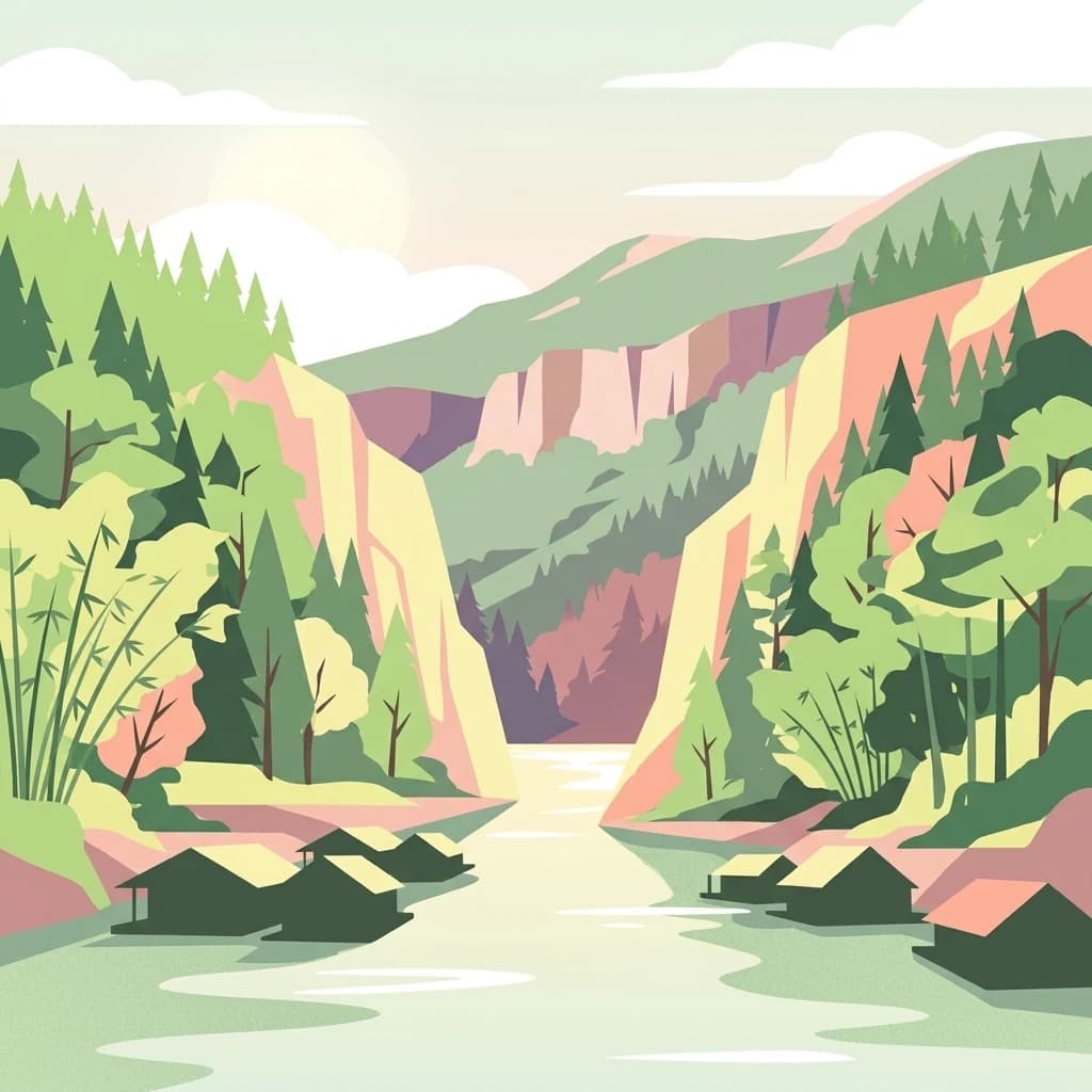
Sai Yok National Park is best known for its dramatic limestone landscape of the Tenasserim Range, which features numerous waterfalls cascading from cliff faces into the Khwae Noi River valley. The park contains the famous Sai Yok Noi waterfall, also called Khao Phang Waterfall, which is the most visited attraction in the park and sits alongside the historic Death Railway tracks. The park is also renowned for its cave systems, particularly Tham Lawa with its five large caverns containing impressive stalactite and stalagmite formations, and Tham Dao Wadueng with eight chambers discovered in 1972. Additionally, the park is famous as the location where scenes from the 1978 film The Deer Hunter were filmed, adding cultural significance to its natural landscape.
Sai Yok National Park history and protected-area timeline
Sai Yok National Park was officially established on 27 October 1980 when its declaration was published in the Royal Gazette, making it Thailand's 19th national park. However, the region has a much longer and more complex human history. During World War II, the area was the site of intense activity as Japanese forces constructed the Burma Railway, also known as the Death Railway, connecting Thailand and Myanmar. Remains of bridges along this railway and traces of prisoner-of-war camps still exist within the park boundaries, serving as somber reminders of this period. In 1978, the park gained international cultural recognition when filmmakers for the Academy Award-winning movie The Deer Hunter chose locations within Sai Yok to film the controversial Russian roulette sequences, though this claim requires citation verification. The establishment of the national park represented Thailand's growing commitment to conserving its natural heritage, recognizing that the unique limestone forests and river valleys of the Sai Yok region required formal protection to ensure their survival for future generations.
Sai Yok National Park landscape and geographic character
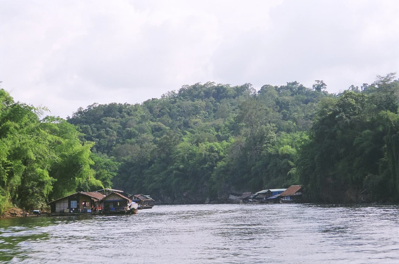
The landscape of Sai Yok National Park is defined by the dramatic geological features of the Tenasserim Range, a mountain system that extends southward from Myanmar into western Thailand. The park's terrain is characterized by steep limestone cliffs and rugged peaks, with the highest point being Khao Ro Rae at 1,132 meters. These karst formations have created an intricate landscape of gorges, ridges, and valleys through which the Khwae Noi River flows. The river has carved its way through the limestone over millennia, creating the valley that today provides access to the park's interior. The combination of vertical limestone cliffs and the meandering river creates visually stunning scenery, particularly where waterfalls cascade from the cliff faces. The park's elevation gradient from the river valley up to the mountain peaks supports diverse habitats, while the limestone geology has produced numerous cave systems including the extensive Tham Lawa complex, which extends 500 meters underground with five major caverns. The landscape varies from dense forest-covered slopes to exposed cliff faces and rocky outcrops, creating a mosaic of terrain types that defines Sai Yok's distinctive character.
Sai Yok National Park ecosystems, habitats, and plant life
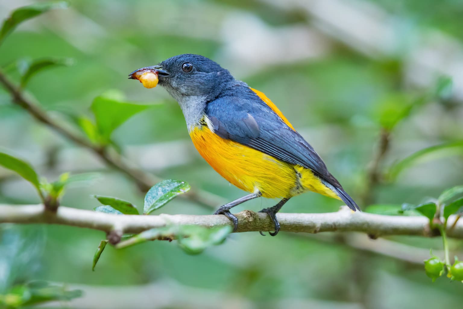
The ecological character of Sai Yok National Park reflects the transitional nature of its location between tropical and subtropical zones within the Tenasserim region. The forest composition is dominated by mixed deciduous forest, which covers approximately 85 percent of the park's area and includes species such as Pterocarpus macrocarpus, Lagerstroemia tomentosa, and Schleichera oleosa. Dry evergreen forest accounts for about 13 percent of the area, featuring species like Dipterocarpus alatus, Castanopsis, and Schima wallichii. The remaining 2 percent consists of dry dipterocarp forest with species including Dipterocarpus tuberculatus and Quercus kerrii. This forest diversity supports a remarkable range of biodiversity, with the park providing habitat for at least 24 mammal species, 209 bird species, numerous reptiles, amphibians, and fish. The limestone caves create unique microhabitats, particularly for bat species including Kitti's hog-nosed bat, which at around 2 grams is considered the world's smallest mammal and was first documented in the park in 1973. The Khwae Noi River and its tributaries support aquatic ecosystems and provide important water resources for the broader landscape.
Sai Yok National Park wildlife and species highlights
Sai Yok National Park supports a remarkable diversity of wildlife despite its relatively moderate size. The park's mammal population includes several large and charismatic species, with Bengal tigers and Indochinese leopards representing apex predators in the ecosystem. Asian elephants roam the forest in search of food, while clouded leopards, sun bears, and Asian black bears occupy the more remote mountain areas. Herbivores including gaur, banteng, sambar deer, and Malayan tapir are regularly recorded within the park boundaries. Primates are represented by white-handed gibbons and various Presbytis species. The park is particularly notable for Kitti's hog-nosed bat, discovered in 1973 and found only in specific limestone caves including Tham Kang Kao within the park and adjacent areas in Kanchanaburi Province and Myanmar. Bird diversity is exceptional, with 209 species from 61 families documented, including the great slaty woodpecker, oriental pied-hornbill, and mountain imperial-pigeon among the notable non-passerine species. The park's rivers and wetlands support reptile species including the Asian narrow-headed softshell turtle and big-headed turtle, while amphibians include the giant Asian river frog and Malayan flying frog.
Sai Yok National Park conservation status and protection priorities
Sai Yok National Park plays a crucial role in Thailand's conservation network as part of the Western Forest Complex, a coordinated system of protected areas spanning the border region with Myanmar. This complex represents one of Southeast Asia's most important areas for biodiversity conservation, providing corridors that allow wildlife to move between protected zones and maintain genetic connectivity across the landscape. The park's designation as an IUCN Category II protected area reflects its primary purpose of preserving natural ecosystems while allowing for sustainable visitor use. The protection of the Khwae Noi River watershed is particularly important, as the river supports both wildlife habitat and human communities downstream. Conservation challenges include managing visitor impact at popular attractions like Sai Yok Noi waterfall while maintaining habitat integrity for sensitive species. The presence of endangered mammals including tigers, leopards, and elephants requires ongoing monitoring and anti-poaching efforts, while the protection of Kitti's hog-nosed bat populations in specific cave sites represents a specialized conservation priority requiring careful management of human access to these sensitive habitats.
Sai Yok National Park cultural meaning and human context
Sai Yok National Park contains significant cultural and historical elements beyond its natural value. The most prominent is the legacy of the Burma Railway, constructed during World War II by forced labor under Japanese occupation. Remains of bridges and camp structures provide physical evidence of this历史 within the park boundaries. The nearby Hellfire Pass Memorial, located about 35 kilometers west of Sai Yok Noi waterfall, serves as a museum and tribute to those who died during the railway's construction and has become an important site for historical reflection and education. The park also contains the Krasae Cave, a small Buddhist shrine located next to a section of the original Death Railway tracks, representing the intersection of natural landscape with religious and historical significance. The Khwae Noi River itself carries cultural weight, being intimately associated with the WWII history and the famous Bridge over the River Kwai. Local communities in the surrounding area maintain connections to the park through tourism employment and traditional land uses that predate the protected area designation.
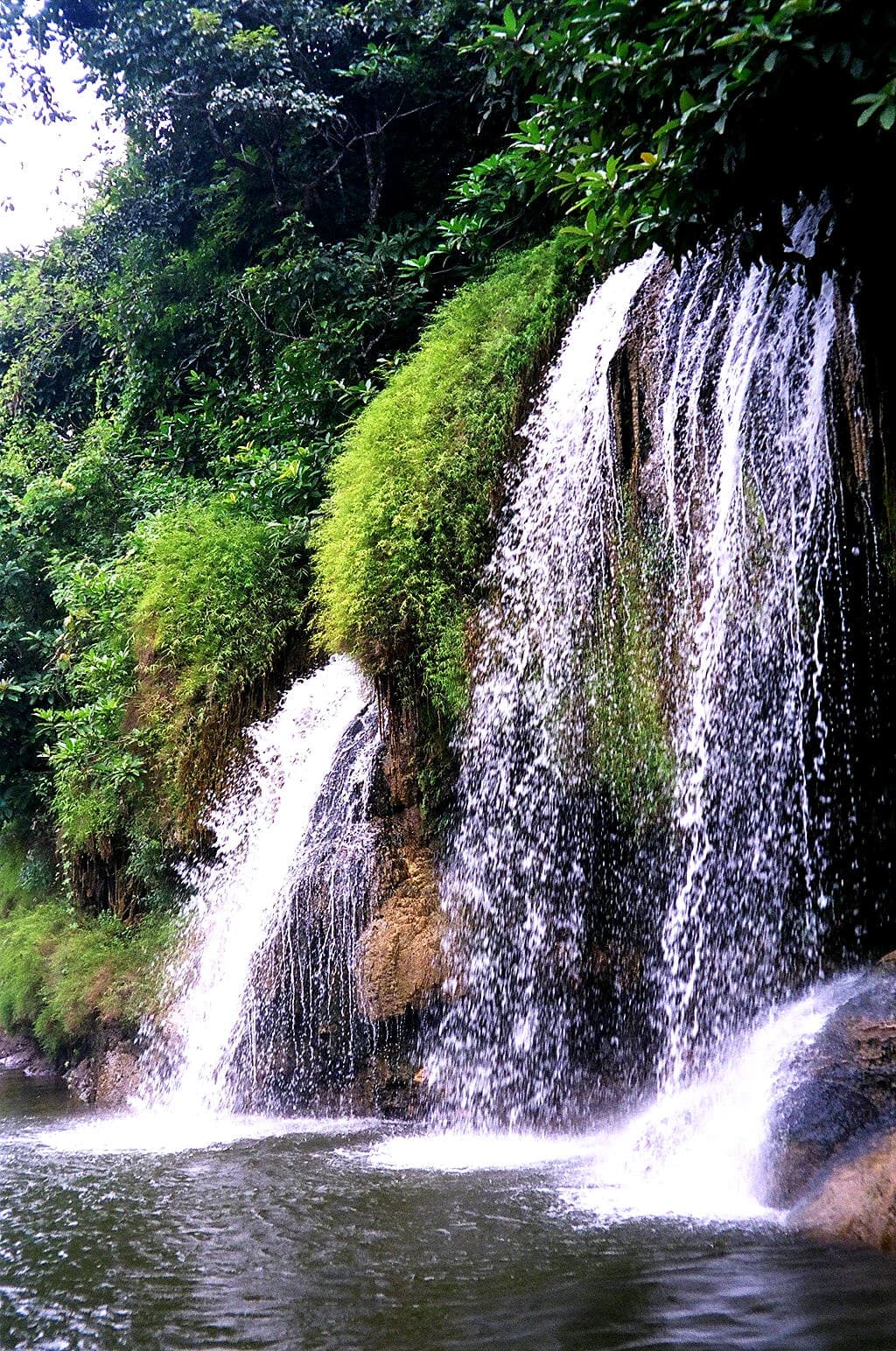
Top sights and standout views in Sai Yok National Park
Sai Yok National Park offers visitors a compelling combination of natural beauty, geological wonders, and historical significance. The Sai Yok Noi waterfall stands as the park's signature attraction, where limestone cliffs collapse to form a 15-meter cascade that has become a beloved destination for both Thai and international visitors. The cave systems, particularly Tham Lawa with its five interconnected caverns featuring impressive stalactite and stalagmite formations extending 500 meters underground, offer exploration opportunities for adventurous visitors. The Khwae Noi River provides a scenic backdrop for boat trips and photography, with the surrounding limestone cliffs creating a distinctive landscape unlike other Thai national parks. The park's wildlife viewing opportunities, particularly for birds with over 200 species documented, attract nature enthusiasts. The historical dimension adds depth to a visit, with the proximity to Death Railway sites and the Hellfire Pass Memorial allowing visitors to connect with the region's wartime history while enjoying the natural environment. The park's location within the Western Forest Complex also offers the possibility of combining a visit with other nearby protected areas for those seeking a broader exploration of Thailand's western forest region.
Best time to visit Sai Yok National Park
The optimal time to visit Sai Yok National Park depends on what visitors hope to experience. The cool season from November through mid-February offers the most comfortable temperatures for hiking and outdoor exploration, with average lows around 15.4°C making daytime activities pleasant. This period coincides with the dry season, when trails are easier to navigate and waterfall flow may be reduced but still present. The hot season from April to mid-May brings higher temperatures, with April being the warmest month, which can make physical activities challenging during midday but offers the advantage of fewer visitors at popular sites. The rainy season from mid-May through October brings increased water flow to waterfalls, making them more spectacular, though afternoon thunderstorms are common and some trails may become slippery or inaccessible. The wet season also corresponds with the park's lushest vegetation and the best conditions for birdwatching as migratory species arrive. For those interested in wildlife viewing, the transition periods between seasons often offer good opportunities as animals become more active near water sources.