
Why Sierra de San Pedro Mártir National Park stands out
This park is best known for its unique position as one of the few pine forests on the Baja California peninsula, representing a critical island of montane ecology surrounded by desert. The critically endangered San Pedro Mártir cypress is endemic to this mountain range, found nowhere else on Earth. The park serves as vital habitat for bighorn sheep populations and has become the primary site for California condor reintroduction in Mexico through international conservation partnerships. The dramatic granite peaks, particularly Picacho del Diablo, and the presence of Mexico's premier astronomical observatory at 2,800 meters elevation add further distinction to this protected landscape.
Sierra de San Pedro Mártir National Park history and protected-area timeline
The Sierra de San Pedro Mártir region was first explored by Europeans in 1701 when Jesuit missionary Eusebio Francisco Kino, traveling under Dominican orders, ventured into these mountains. The indigenous peoples of the region had long occupied these lands before European arrival. The Dominicans later established the Misión San Pedro Mártir de Verona in the southern portion of what is now the park, though only ruins remain of this colonial-era religious site. The national park itself was officially created by decree on April 26, 1947, making it one of Mexico's older protected areas. The National Astronomical Observatory began operations in the mid-1970s, taking advantage of the exceptional atmospheric conditions at high elevation: clear skies, low humidity, minimal light pollution, and limited radio interference. This facility now houses Mexico's largest optical telescope with a 2.12-meter diameter mirror, establishing the site as the second most important astronomical observatory in Latin America.
Sierra de San Pedro Mártir National Park landscape and geographic character
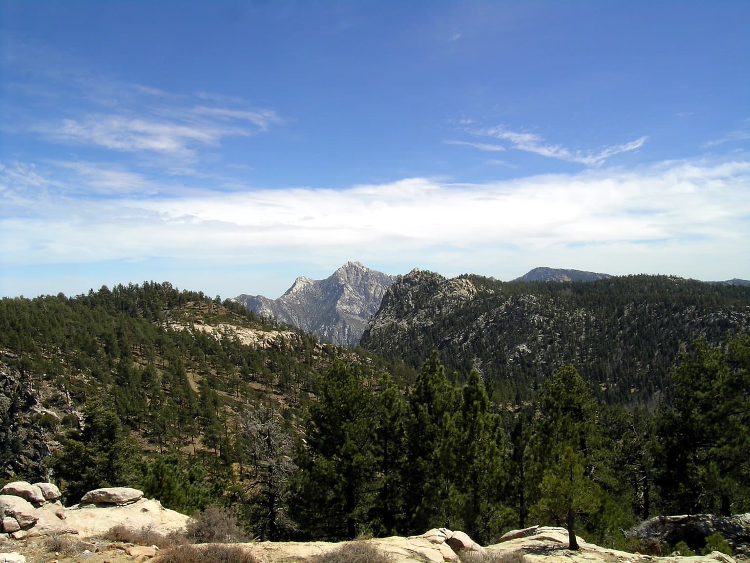
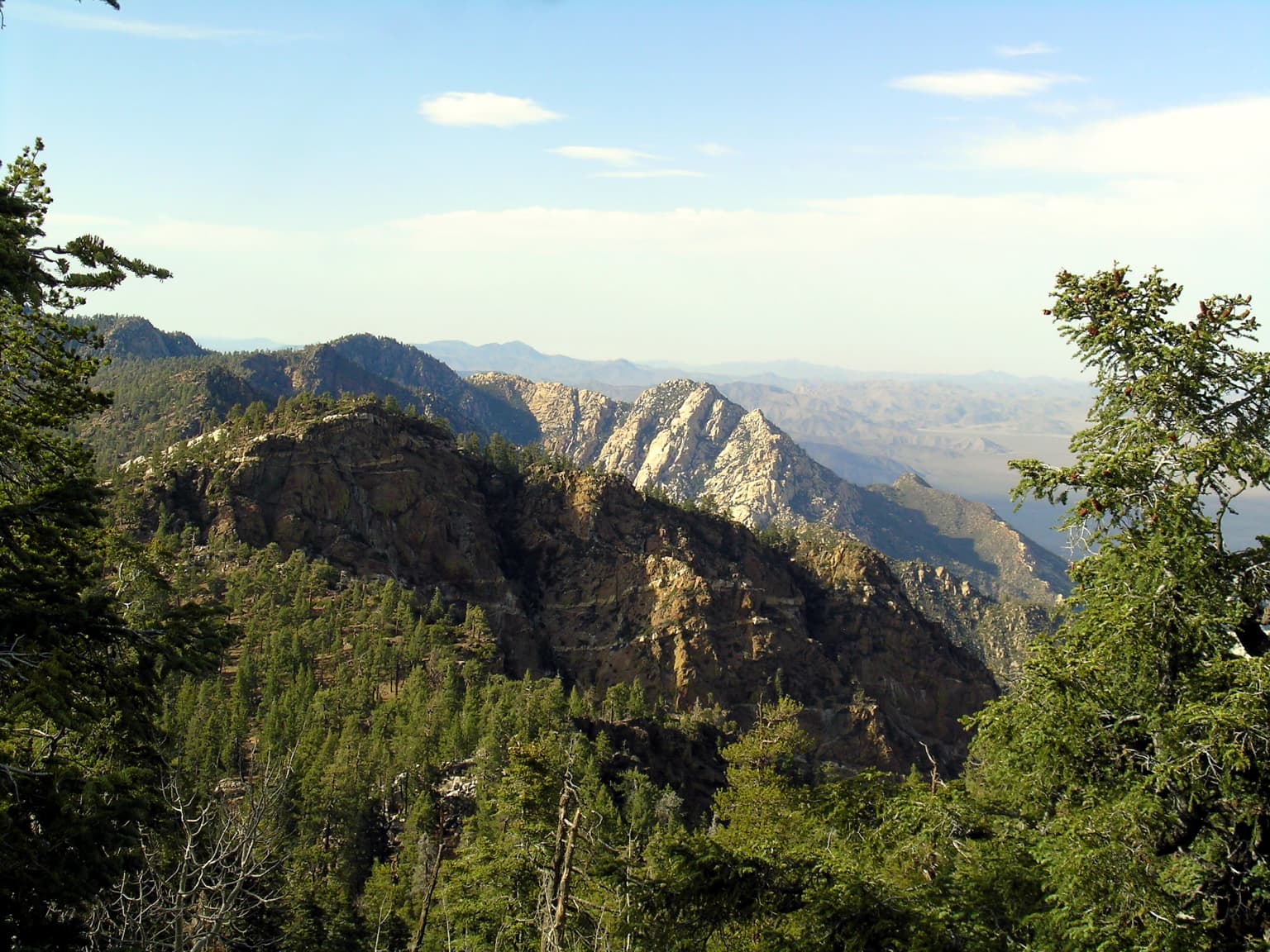
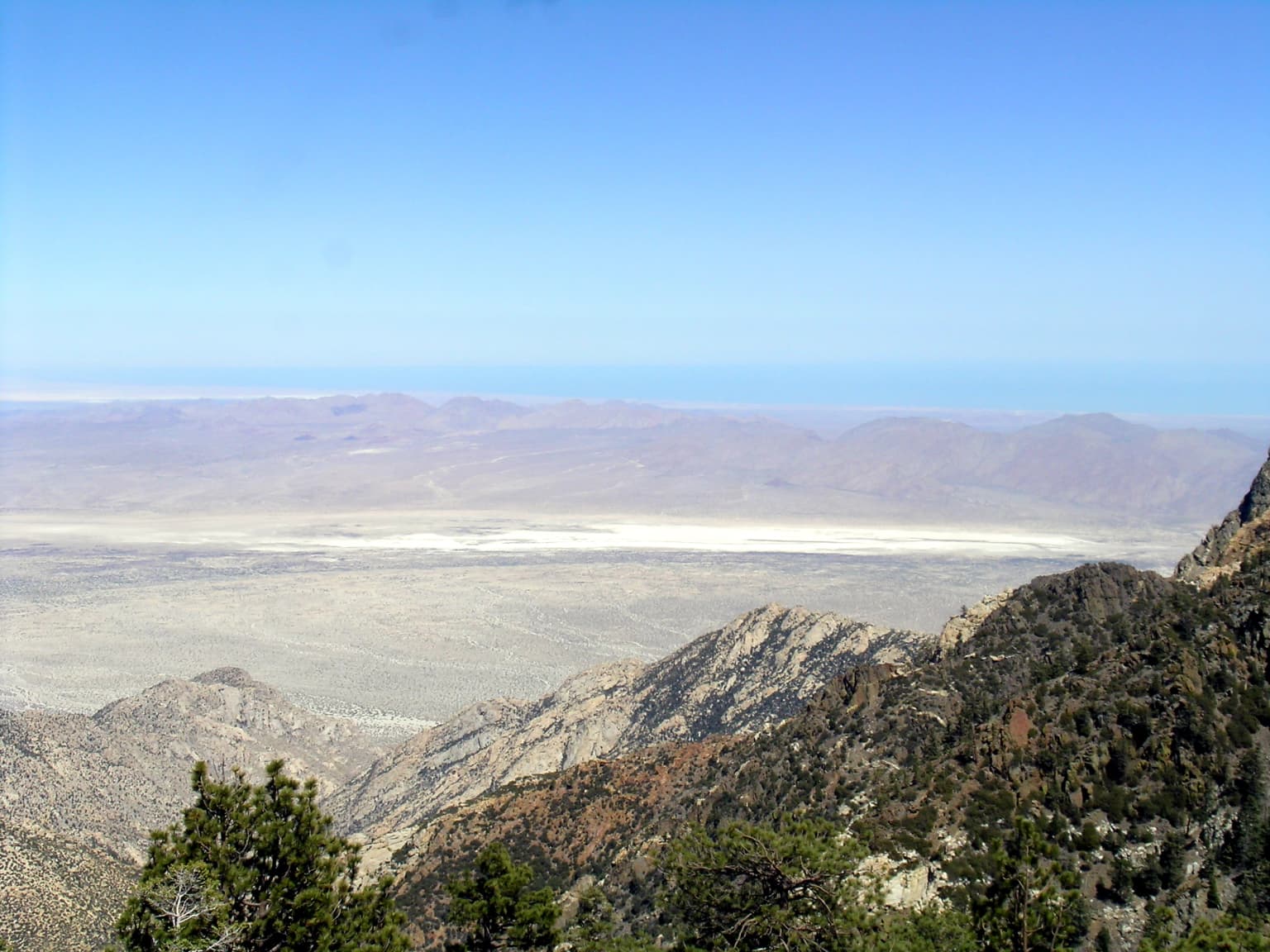
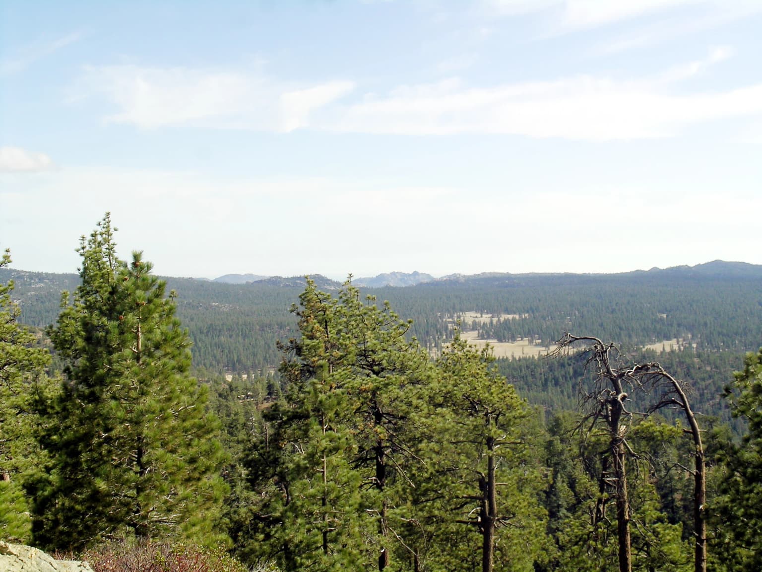
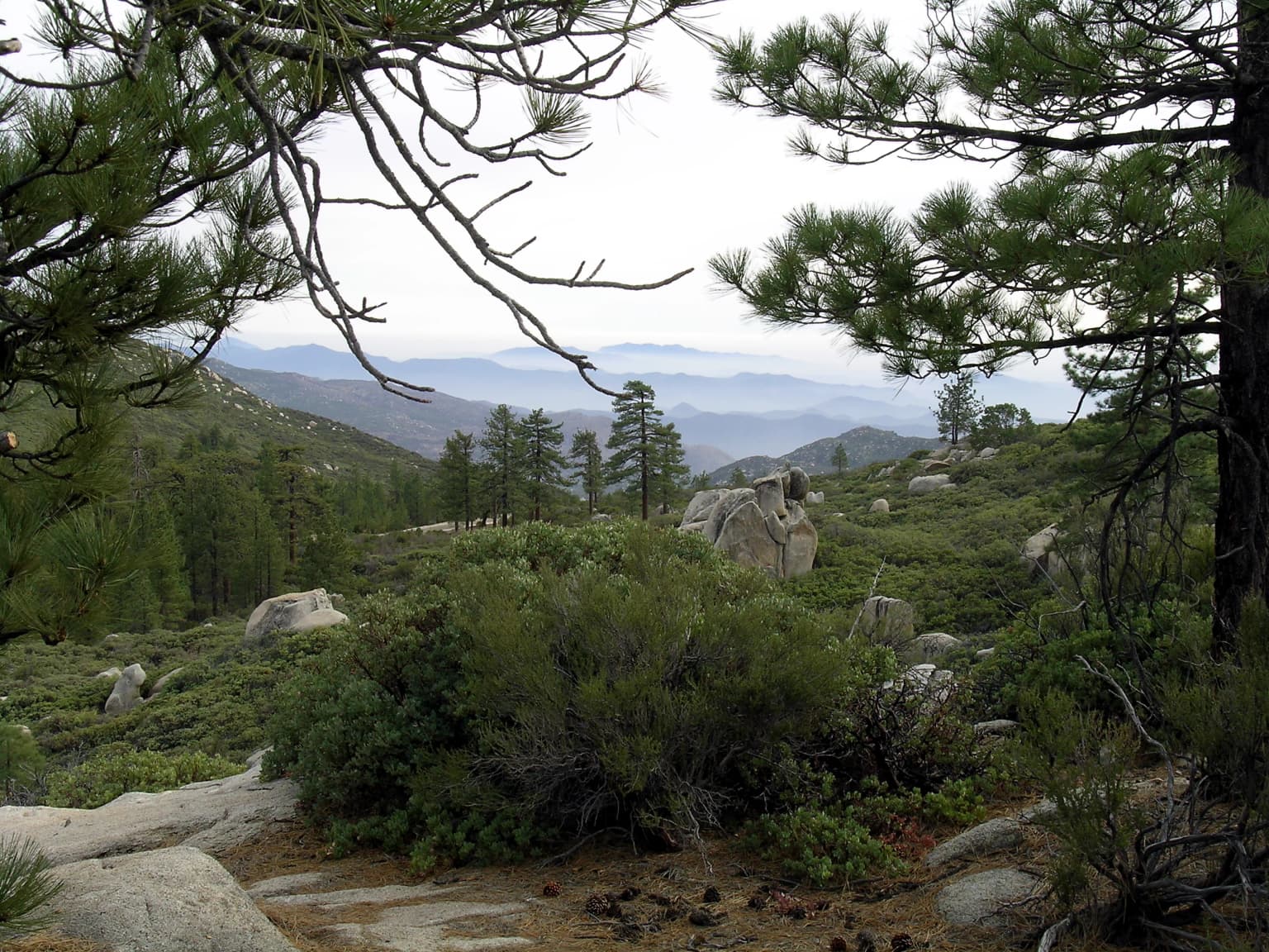
The Sierra de San Pedro Mártir is a rugged mountain range characterized by dramatic topological changes, deep canyons, and imposing granite rock formations. The landscape rises sharply from the surrounding desert plains, creating a striking visual contrast that has led to the park being described as a mountain oasis. Picacho del Diablo, also known as Devil's Peak, dominates the eastern portion of the park as the highest point in all of Baja California, its summit reaching 3,096 meters. The terrain features numerous abrupt elevation changes across short distances, with the landscape transitioning from desert shrub at lower elevations through chaparral and oak woodland to conifer forest at higher elevations. The granite composition of the mountains creates distinctive rock formations and boulder-strewn slopes throughout the park.
Sierra de San Pedro Mártir National Park ecosystems, habitats, and plant life
The Sierra de San Pedro Mártir supports a distinctive montane forest ecosystem that differs fundamentally from the flora found elsewhere in Mexico. The pine-oak forests at middle and higher elevations share strong botanical connections with the Laguna Mountains and San Jacinto Mountains of southern California, reflecting the historical connection between these landmasses. Conifers predominate at higher elevations, with species including Pinus lambertiana (sugar pine), Pinus quadrifolia, Pinus jeffreyi (Jeffrey pine), Abies concolor (white fir), and Tecate cypress. The critically endangered San Pedro Mártir cypress is endemic to this range, found nowhere else on the planet. Oak trees intermingle with conifers at middle elevations, while the lower elevations transition into chaparral and desert shrub communities. The California fan palm reaches its southern distribution limit here, marking the southern extent of this palm species.
Sierra de San Pedro Mártir National Park wildlife and species highlights
The park supports remarkable mammalian diversity despite its relatively compact size. Bighorn sheep inhabit the rocky terrain and represent one of the park's flagship species, while mule deer are commonly observed throughout the forest zones. Predators including cougars and bobcats maintain ecological balance, while smaller mammals such as ringtail cats, coyotes, rabbits, and squirrels are widespread. More than thirty species of bats occupy the park's caves and roosting sites. The avian community is equally diverse, featuring bald eagles, golden eagles, various falcon species, woodpeckers, black vultures, and crows. The California condor reintroduction program represents perhaps the most significant wildlife conservation achievement in the park's history. Captive-born condors have been successfully released into the wild here, with the second generation receiving the Kiliwa name inyaa, meaning sun, reflecting the local indigenous cultural connection to this restoration effort.
Sierra de San Pedro Mártir National Park conservation status and protection priorities
Sierra de San Pedro Mártir National Park plays a crucial conservation role as one of the last intact montane forest ecosystems on the Baja California peninsula. The critically endangered San Pedro Mártir cypress depends entirely on this protected area for its survival, making the park globally significant for this species. The bighorn sheep populations benefit from the protected habitat that allows these mountain-dwelling ungulates to maintain viable numbers. The California condor reintroduction program has brought an iconic species back to its historic range after an absence of nearly seven decades, demonstrating the potential for ecological restoration in protected landscapes. The park's high elevation location, surrounded by desert, creates a relatively isolated ecological island that requires active management to maintain its biodiversity values.
Sierra de San Pedro Mártir National Park cultural meaning and human context
The Sierra de San Pedro Mártir holds significance for the indigenous peoples of the region, particularly the Kiliwa language community whose ancestral lands encompass this territory. The naming of the second generation of reintroduced California condors as inyaa, meaning sun in Kiliwa, demonstrates the ongoing connection between local communities and the landscape. European exploration began with Jesuit missionaries in the early eighteenth century, followed by Dominican establishment of the Misión San Pedro Mártir de Verona, whose ruins still exist within the park boundaries. The Spanish name of the range honors Saint Peter the Martyr, the Dominican saint after whom the mission was named.
Top sights and standout views in Sierra de San Pedro Mártir National Park
The combination of exceptional ecological diversity, dramatic mountain scenery, and scientific infrastructure makes Sierra de San Pedro Mártir uniquely significant. The highest peak in Baja California offers challenging trekking opportunities, while the California condor reintroduction program provides rare wildlife viewing possibilities for visitors. The National Astronomical Observatory represents a different kind of wilderness appreciation, where the dark mountain skies enable astronomical discovery. The endemic San Pedro Mártir cypress and the remnant pine forest ecosystem represent biological treasures that exist in few other places on Earth.
Best time to visit Sierra de San Pedro Mártir National Park
The park can be visited year-round, though spring and fall offer the most comfortable conditions for outdoor exploration. Summer months bring warm temperatures in the lower elevations while the high country remains pleasant. Winter brings snow to the higher elevations, creating beautiful alpine scenery but potentially limiting access to some trails. The clearer skies during the dry season typically run from October through May, offering better visibility for landscape photography and wildlife observation. Visitors should be prepared for dramatic temperature variations depending on elevation, as conditions at the summit can differ substantially from the desert approaches.