
Why Sumapaz National Park stands out
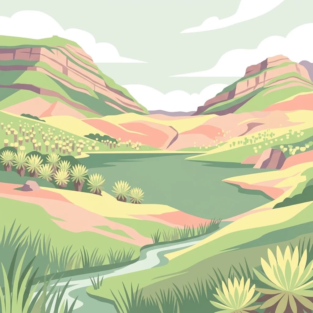
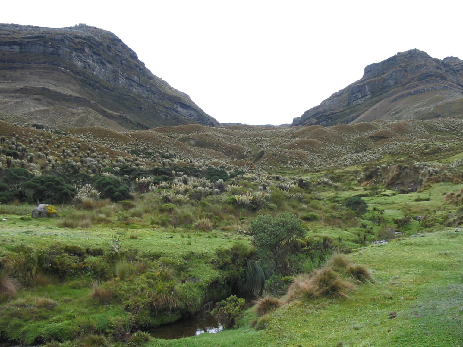
Sumapaz is best known as the largest páramo ecosystem on Earth, a globally unique high-altitude tropical grassland that exists only in the Colombian and Venezuelan Andes. The park is famous for its distinctive Espeletia plants, also called frailejones, which form iconic silvery-leaved rosettes across the landscape. The area serves as a critical water catchment for Bogotá and surrounding regions, with its spongy vegetation and soil acting as a natural reservoir system. The spectacular glacial lakes, particularly Chisaca Lake set within a cirque basin, showcase the region's geological heritage from past glaciations.
Sumapaz National Park history and protected-area timeline
The history of Sumapaz is deeply intertwined with both indigenous heritage and colonial exploration. The Muisca people, who inhabited the Bogotá savanna region before Spanish conquest, considered the páramo a sacred domain associated with the divine forces of creation and the origin of humanity. According to their beliefs, the area was a place where ordinary humans were not permitted to enter. During the 16th century, German conquistador Nikolaus Federmann led an expedition across Sumapaz in search of the legendary El Dorado, suffering heavy losses as men and horses perished from the extreme cold. The Spanish colonizers named the region País de la Niebla, or Country of Fog, due to the persistent low cloud cover that dramatically reduces visibility. The first scientific exploration came in 1799 when Alexander von Humboldt made the initial botanical and geological descriptions of the páramo, drawing comparisons to Alpine geomorphology. Subsequent scientific contributions came from José Cuatrecasas in the early 20th century, who conducted pioneering research on the tree line and páramo vegetation, and later from Ernesto Guhl and Thomas van der Hammen, who conducted decades of research on the ecosystem's plant communities. The area was formally protected as a national park in 1977.
Sumapaz National Park landscape and geographic character
The landscape of Sumapaz is characterized by its high-altitude plateau terrain, glacial valleys, and numerous alpine lakes formed by past glaciation. The eastern portion of the park features dramatic fault-scarped landscapes composed of ancient Devonian metamorphic rocks, creating rugged alpine scenery. The western areas feature softer Oligocene sedimentary formations that produce more rolling terrain. Throughout the páramo, glacial debris from Quaternary glaciations creates a complex terrain of moraines, cirques, and outwash plains. Chisaca Lake, one of the most notable water bodies, sits within a glacial cirque formed by the retreat of glaciers following the Santa María glaciation. The terrain is interspersed with numerous shallow wetlands and ponds called chucuas or chupaderos, which can appear deceptively benign but pose real hazards to visitors as the sticky mud can trap the unwary. The highest point in the park is Nevado del Sumapaz at 4,306 meters, a remnant of volcanic activity in the region.
Sumapaz National Park ecosystems, habitats, and plant life
The páramo ecosystem of Sumapaz represents a globally irreplaceable habitat characterized by its unique combination of tropical location and alpine conditions. The vegetation is dominated by tussock grasses, cushion plants, and the iconic Espeletia genus, with over 200 species of vascular plants recorded from the area. The Espeletias, commonly known as frailejones, are emblematic of the Colombian páramo and have evolved specialized adaptations including water-storing stems, reflective leaf surfaces, and rosette growth forms that protect the growing point from frost damage. Extensive areas are covered by Sphagnum moss, which plays a critical role in water retention and nutrient cycling. The park sits at the crossroads of the Orinoco and Magdalena River basins, making it a critical hydrological node. The acidic, coarse-grained soils have high permeability that favors groundwater recharge, though the low temperatures and slow decomposition rates result in limited soil fertility. The ecosystem's position on the thermal equator generates high precipitation, while the endemic vegetation acts as a sponge, regulating moisture and feeding aquifers that supply the Bogotá region.
Sumapaz National Park wildlife and species highlights
Despite the harsh conditions, Sumapaz supports a distinctive fauna adapted to the high-altitude environment. The most celebrated resident is the spectacled bear, an endangered species that inhabits the páramo and depends heavily on the fruits of Puya boyacana and the stems of Espeletia plants for sustenance. Other mammals found in the park include the little red brocket deer, tapir, and coati. The bird community features notable species such as the golden eagle and torrent duck, along with the páramo duck, a species adapted to the high-altitude aquatic environments. The park's lakes and wetlands support populations of introduced rainbow trout, while the streams contain various native fish species. The wildlife, while less diverse than lower-elevation tropical forests, represents a specialized assemblage uniquely adapted to the extreme conditions of the páramo environment.
Sumapaz National Park conservation status and protection priorities
Sumapaz National Park was established in 1977 to protect what is recognized as the largest and most ecologically significant páramo ecosystem on Earth. The park's conservation importance stems from its extraordinary biodiversity, with high levels of plant endemism, and its critical role as a water source for the Bogotá metropolitan area and surrounding regions. The páramo vegetation acts as a natural sponge and water filter, with the peat-forming Sphagnum moss and deep soils storing enormous quantities of water that are released slowly into streams and aquifers. However, the park faces significant conservation challenges including pressure from human settlements, cattle ranching, and agricultural expansion, particularly potato cultivation. An estimated 10,000 head of cattle graze within the protected area, and the natural forest line has been severely altered by logging and intensive grazing. Efforts to enforce protection have included military presence to address past guerrilla activity, though this has raised concerns about potential damage to sensitive vegetation.
Sumapaz National Park cultural meaning and human context
The páramo holds profound cultural significance for the Muisca people, who inhabited the Bogotá savanna region before the Spanish conquest. In Muisca cosmology, Sumapaz was considered a sacred realm associated with the divine creation forces and the origin of humanity, a domain where ordinary people were not permitted to enter. The area was linked to the myth of Bachué, one of the creation narratives of the Muisca civilization. Following the Spanish conquest, the region became known as País de la Niebla, a name that reflects both the persistent fog and the mystique of this remote high-altitude landscape. Today, small communities including San Juan de Sumapaz, Nazareth, Santa Rosa, and El Hato exist within the park boundaries, with populations facing significant poverty and limited access to services. The tension between traditional land use and conservation goals represents an ongoing challenge for park management.
Top sights and standout views in Sumapaz National Park
Sumapaz offers visitors an otherworldly high-altitude landscape unlike anything else in the tropics. The vast expanses of silvery-leaved Espeletia plants stretching to the horizon create one of Colombia's most iconic natural scenes. Glacial lakes such as Chisaca provide stunning alpine scenery, while the opportunity to observe the endangered spectacled bear in its natural habitat draws wildlife enthusiasts from around the world. The park serves as a living laboratory for understanding tropical alpine ecosystems and the unique adaptations that allow life to thrive at extreme altitudes near the equator. The dramatic weather, with rapid changes from clear skies to dense fog and sudden temperature drops, adds to the sense of wilderness and remoteness.
Best time to visit Sumapaz National Park
The optimal time to visit Sumapaz coincides with the drier period from December through February, when sunlight reaches its peak and visibility improves. However, visitors should be prepared for intense ultraviolet radiation at these high altitudes. The rainy season extends for most of the year, with the páramo frequently shrouded in fog and the ground remaining saturated with moisture. The climate can change rapidly, with short periods of relatively warm weather giving way to freezing conditions within hours. The harsh conditions mean that visitors should come prepared with proper cold-weather gear, sturdy footwear, and awareness of the terrain hazards posed by the marshy chucuas. Those seeking to experience the park's distinctive character should plan for the reality that weather will be a significant factor in any visit.