Mori Atlas logo
National parkBarranyi (North Island) National Park

Discover the mapped boundaries and coastal terrain of this unique Northern Territory island national park.

Barranyi (North Island) National Park: Northern Territory National Park Geography and Protected Landscape Context

Barranyi (North Island) National Park represents a remote protected landscape situated in the Gulf of Carpentaria, off the coast of Australia's Northern Territory. This national park encompasses low-lying island terrain characterized by beaches and coastal dunes, offering a distinctive tropical island environment. Understanding its geography provides context for its protected area status and its role as a conservation landscape within the broader Northern Territory region.

Island parkGulf of CarpentariaNorthern TerritoryRemote wildernessAboriginal partnershipCoastal ecosystem

Barranyi (North Island) National Park

National park

Park overview

Structured park overview, official facts, and landscape profile for Barranyi (North Island) National Park

Barranyi (North Island) National Park park facts, protected area profile, and essential visitor context
Review the core facts for Barranyi (North Island) National Park, including designation, size, terrain, visitor scale, habitats, and operating context in one park-focused overview.

About Barranyi (North Island) National Park

Barranyi (North Island) National Park protects a coastal island environment in the far north of the Northern Territory, situated within the Gulf of Carpentaria. The park encompasses the island itself along with surrounding coastal waters, creating a protected area that spans both terrestrial and marine components. The island's terrain is characterized by low elevation, coastal beaches, and areas of subtle dune formation, with vegetation adapted to the tropical island setting. The establishment of the park in 1992 reflected a commitment to preserving the natural values of the island while acknowledging the cultural connections that Aboriginal traditional owners maintain with the landscape. Access to the park requires travel to the remote Gulf region, typically via the town of Borroloola on the mainland, and visitors should be prepared for a wilderness experience with limited infrastructure. The park forms part of a network of protected areas in the Gulf of Carpentaria region that collectively contribute to the conservation of northern Australian coastal and island ecosystems.

Quick facts and research context for Barranyi (North Island) National Park

Barranyi (North Island) National Park occupies roughly 54 square kilometres in the Gulf of Carpentaria, making it a modest but significant protected island in Australia's northern territory. The island lies approximately 737 kilometres southeast of Darwin, with the nearest settlement at Borroloola on the mainland coast. The park was formally established on 27 March 1992 and is classified as an IUCN Category II protected area, reflecting its national park status. Management responsibilities are shared between the Parks and Wildlife Commission of the Northern Territory and Aboriginal traditional land owners, reflecting the dual natural and cultural values of the site.

Park context

Deeper park guide and search-rich context for Barranyi (North Island) National Park

Barranyi (North Island) National Park history, landscape, wildlife, and travel context
Explore Barranyi (North Island) National Park through its history, landscape character, ecosystems, wildlife, conservation priorities, cultural context, and seasonal travel timing in a structured park guide built for atlas discovery and search intent.

Why Barranyi (North Island) National Park stands out

Barranyi (North Island) National Park is best known as a remote, sparsely vegetated island protected area in the Gulf of Carpentaria. The island's significance derives from its combination of coastal island ecosystems, its location within a broader region of Aboriginal land, and its relative wilderness character away from developed areas. While not a major tourist destination due to its remote location, the park represents an important example of island conservation in tropical northern Australia and embodies the partnership between government protected area management and Indigenous land stewardship that characterizes many northern Territory parks.

Barranyi (North Island) National Park history and protected-area timeline

Barranyi (North Island) National Park was officially established on 27 March 1992, creating formal protected area status for the island within the broader landscape of the Gulf of Carpentaria. The park's establishment reflected recognition of both natural values and the cultural significance of the island to Aboriginal traditional owners. In the decades since its declaration, management of the park has operated through a partnership model involving the Parks and Wildlife Commission of the Northern Territory and the Aboriginal traditional land owners, a framework common to many protected areas across the Territory. This collaborative approach to park management acknowledges Indigenous peoples' ongoing connection to Country and integrates traditional knowledge into conservation planning. The park's relatively recent establishment compared to many other Australian national parks reflects the particular history of land tenure and recognition in the Gulf region.

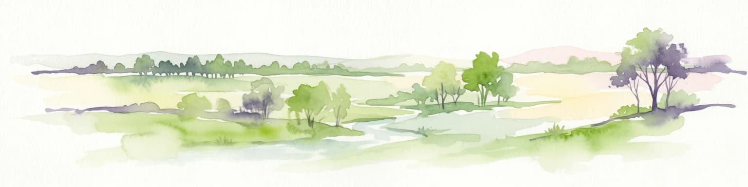
Barranyi (North Island) National Park landscape and geographic character

The landscape of Barranyi (North Island) National Park is defined by its island setting in the Gulf of Carpentaria. The island presents a low-profile coastal terrain with beaches along its margins and gentle dune formations in some areas. The overall topography remains modest in elevation, reflecting the island's geological character. Vegetation across the island is adapted to the tropical climate and coastal conditions, typically consisting of species suited to sandy soils and salt-exposed environments. The surrounding marine waters of the Gulf of Carpentaria form an integral part of the park's setting, with the coastal interface between land and sea creating the characteristic island environment. This remote island landscape sits within the broader context of the northern Australian coast, a region distinguished by its vast landscapes, extensive coastlines, and distinctive tropical environments.

Barranyi (North Island) National Park ecosystems, habitats, and plant life

The natural environment of Barranyi (North Island) National Park reflects the island's position in the Gulf of Carpentaria, a region with distinctive tropical marine and coastal ecosystems. The island supports vegetation communities adapted to coastal conditions, including species that tolerate sandy substrates, salt exposure, and the seasonal patterns of the tropics. The surrounding Gulf waters support marine life typical of northern Australian coastal environments. While detailed species inventories are limited in available sources, the park's island setting createshabitats that differ from the adjacent mainland, supporting coastal birdlife, marine species in surrounding waters, and terrestrial fauna adapted to island environments. The combination of terrestrial and marine elements within the protected area creates a coherent island ecosystem that benefits from the legal protection afforded by national park status.

Barranyi (North Island) National Park wildlife and species highlights

The wildlife of Barranyi (North Island) National Park is shaped by its island location in the Gulf of Carpentaria. Coastal bird species are likely present along the island's beaches and shoreline areas, while the surrounding marine environment supports fish and other marine life common to northern Australian gulf waters. The island's terrestrial fauna includes species adapted to coastal island conditions, though the sparse vegetation suggests a relatively limited terrestrial species community compared to more vegetated islands. The park's protected status helps preserve these wildlife values by maintaining the island's relatively unmodified condition and limiting development pressures that could otherwise impact habitat quality.

Barranyi (North Island) National Park conservation status and protection priorities

Barranyi (North Island) National Park represents an important contribution to the network of protected areas in the Gulf of Carpentaria region. The national park designation provides legal protection for the island's natural values, restricting activities that could damage ecosystems or introduce invasive species. The park's management model, involving both government protected area authorities and Aboriginal traditional owners, reflects contemporary best practice in Australian conservation that recognizes Indigenous peoples as partners in land management. The protected status helps ensure that the island's coastal environments, terrestrial habitats, and surrounding marine areas remain in relatively natural condition, contributing to broader conservation outcomes in northern Australia.

Barranyi (North Island) National Park cultural meaning and human context

Barranyi (North Island) National Park holds significant cultural value for Aboriginal traditional owners whose connection to the island predates the park's formal establishment. The inclusion of Aboriginal traditional land owners as partners in park management reflects the recognition that Indigenous peoples maintain ongoing relationships with Country that extend beyond the western concept of protected area boundaries. The park's name derives from an Aboriginal language, with Barranyi representing the indigenous designation for the island. This cultural dimension adds depth to the protected area, positioning it not merely as a nature reserve but as a place of living Indigenous heritage where traditional connections to land, sea, and story continue to be maintained.

Top sights and standout views in Barranyi (North Island) National Park

The highlights of Barranyi (North Island) National Park centre on its remote island character and the opportunity to experience a relatively unmodified tropical island environment in Australia's far north. The park offers access to coastal scenery including beaches and shoreline areas, with the surrounding Gulf waters adding to the island experience. The cultural significance of the site, reflected in its Aboriginal name and the involvement of traditional owners in management, provides a dimension of meaning beyond pure natural landscape values. Visitors seeking a genuine wilderness experience away from more developed destinations will find in Barranyi a park that remains true to its remote character, with access requiring the initiative to travel to one of Australia's more isolated protected areas.

Best time to visit Barranyi (North Island) National Park

The optimal time to visit Barranyi (North Island) National Park aligns with the dry season that prevails across the Northern Territory, typically spanning from May through October. During these months, conditions are generally cooler and drier, with reduced humidity and more comfortable temperatures for outdoor exploration. The dry season also corresponds with lower risk of monsoonal rainfall that can affect accessibility and travel in the tropics. Visitors should note that the remote location of the island requires careful planning, including arrangements for travel to the Borroloola area and onward to the park. The hot wet season from November to April brings higher temperatures, humidity, and rainfall, which can make outdoor activity more challenging and affect access to the area.

Park location guide

Geography guide, regional context, and park location map for Barranyi (North Island) National Park

Barranyi (North Island) National Park park geography, regions, and map view in Australia
Understand where Barranyi (North Island) National Park sits in Australia through a broader geographic reading of the surrounding landscape, nearby location context, and its mapped position within the national park landscape.

How Barranyi (North Island) National Park fits into Australia

Australia is a constitutional monarchy and federal parliamentary democracy comprising six states and ten territories. With a population of nearly 28 million, it is one of the world's most urbanised countries, with most people concentrated on the eastern seaboard. The country has a high Human Development Index and is known for its cultural diversity, ancient Aboriginal heritage, and unique wildlife.

Wider geography shaping Barranyi (North Island) National Park in Australia

Australia occupies the entire Australian continent, the island of Tasmania, and numerous smaller islands. It is the world's flattest and driest inhabited continent, featuring vast deserts in the interior (the Outback), tropical rainforests along the eastern coast, and a coastline bordering the Indian and Pacific Oceans.

Map view of Barranyi (North Island) National Park

Use this park location map to pinpoint Barranyi (North Island) National Park in Australia, understand its exact geographic position, and read its mapped placement within the surrounding landscape more clearly.

Pigeon | © OpenStreetMap contributors

Location context for Barranyi (North Island) National Park

Northern Territory
Park atlas

Browse adjacent coastal landscapes and other island protected areas for deeper geographic comparison.

Explore Other National Parks and Protected Areas Near Barranyi (North Island) National Park
Explore other national parks and protected areas near Barranyi (North Island) National Park, tracing coastal landscapes and island ecosystems across Australia's remote Northern Territory. Compare the geographic context and conservation approaches of these protected areas to deepen your atlas-style understanding of northern Australia's unique natural heritage.
National parkQueensland

Errk Oykangand National Park: Queensland's Remote Tropical Savanna National Park

Explore mapped protected area boundaries and savanna landscapes.

Errk Oykangand National Park, located in far-north Queensland, Australia, protects a vast area of tropical savanna. This national park, established in 1977, showcases the unique Mitchell grass downs and savanna woodland ecosystems characteristic of the Gulf Country region. Its landscape features gently undulating plains, seasonal waterways, and a distinctive climate, offering a representative sample of this remote wilderness. The park's co-management arrangement highlights a commitment to Indigenous land stewardship and cultural recognition within Australia's protected area network.

Area
371 km²
Established
1977
IUCN
II
National parkNorthern Territory

Garig Gunak Barlu National Park: Northern Territory's Remote Protected Coastal Wilderness & Map Atlas

Explore its unique marine protected area and mapped landscape context.

Garig Gunak Barlu National Park is a significant protected coastal wilderness, covering the entire Cobourg Peninsula in Australia's Northern Territory. This national park designation protects extensive terrestrial landscapes alongside vital adjacent marine waters. The park is renowned for its comprehensive safeguarding of marine turtle habitats and its designation as a Ramsar Wetland, emphasizing its ecological importance. Understanding Garig Gunak Barlu National Park involves exploring its mapped protected boundaries and its role as a crucial element of Northern Territory's protected landscapes, offering a unique atlas-style view of coastal conservation.

Area
2,260.06 km²
Established
2000
IUCN
II
National parkNorthern Territory

Charles Darwin National Park: Discover its Mapped Landscape, WWII Bunkers, and Larrakia Heritage

Northern Territory protected area with significant historical and geographic context.

Charles Darwin National Park represents a distinct protected landscape in Australia's Northern Territory, offering a rich tapestry of natural beauty and historical significance. This national park is renowned for its well-preserved World War II concrete bunker complex, serving as a direct link to Australia's wartime past. Beyond its military history, the park encompasses tropical savanna woodlands and coastal terrains that provide panoramic views of Darwin Harbour. Its indigenous heritage, including ancient shell middens, highlights thousands of years of Larrakia land use, making it a layered geographic and cultural discovery point.

Area
13.03 km²
Established
1998
IUCN
II
National parkQueensland

Marpa National Park: Queensland Island Protected Area with Vital Bird Habitat

Explore its sandstone islands, marine life, and ecological significance.

Marpa National Park is a protected national park composed of three distinct sandstone islands off the coast of Queensland's Cape York Peninsula. Recognized for its importance as a critical habitat for coastal bird species and a nesting ground for green turtles, the park represents a significant marine ecosystem. Its restricted access and collaborative management with the Lama Lama people underscore its dual role as an ecological sanctuary and a culturally important indigenous protected area, preserving untouched island landscapes.

Area
0.43 km²
Established
1989
IUCN
II
Relief
Lowland
National parkQueensland

Piper Islands National Park: Queensland National Park with Critical Seabird Colonies

Explore mapped boundaries and landscape context for this Great Barrier Reef island sanctuary.

Piper Islands National Park in Queensland is a protected area comprising four coral cays vital for significant seabird nesting populations. Recognized as an Important Bird Area, these islands showcase distinct mangrove and Pisonia forest ecosystems against the backdrop of the inner northern Great Barrier Reef. The park's protected landscape offers a unique glimpse into the ecological importance of these small, dynamic coastal landforms within a world-heritage marine setting.

Area
0.07 km²
Established
1989
IUCN
II
National parkQueensland

Wuthara Island National Park: Protected Island Geography in Queensland's Coral Sea

Explore mapped coastal landscape and protected area context.

Wuthara Island National Park is a significant protected area located in the Coral Sea, contributing to Queensland's network of national parks. Its island geography and position within the Great Barrier Reef Marine Park region offer a unique perspective on coastal landscape conservation. This page provides detailed information to help users understand the park's role as a protected national park and its specific contribution to the mapped geography of tropical Australia.

Area
1.09 km²
Established
1990
IUCN
II
National parkQueensland

Hann Tableland National Park: Queensland's Upland Forest National Park

Explore mapped boundaries and unique protected landscape.

Hann Tableland National Park, located in Queensland, Australia, is a protected area safeguarding a unique upland forest landscape within the Einasleigh Uplands. This national park is particularly notable for its conservation efforts for threatened marsupial species, including the northern greater glider and northern quoll, alongside the buff-breasted button-quail. Its relatively remote character and undeveloped natural environment offer a wilderness experience distinct from more accessible parks. Discover the mapped geography and protected-area context of Hann Tableland National Park, a vital component of northern Queensland's conservation landscape.

Area
108.2 km²
Established
1989
IUCN
II
National parkQueensland

Forty Mile Scrub National Park: Queensland National Park Atlas Exploration

Discover protected terrain shaped by ancient volcanic streams.

Forty Mile Scrub National Park is a national park in Queensland, Australia, recognized for its unique protected landscape defined by ancient volcanic stream systems and a rare semi-evergreen vine thicket. This isolated pocket of relict vegetation, sustained by permanent spring-fed waterways, stands as a significant ecological refuge within the Mulga Lands bioregion. Exploring this park offers a deep dive into regional geography and the mapped context of one of Australia's important conservation areas, highlighting its evolutionary significance and distinct natural terrain.

Area
63.3 km²
Established
1970
IUCN
II
Relief
Lowland

Common questions about visiting, size, designation, and location context for Barranyi (North Island) National Park

Barranyi (North Island) National Park FAQs for park facts, access, geography, and protected area context
Find quick answers about Barranyi (North Island) National Park, including protected-area facts, park geography, trail and visitor context, and how the park fits into its surrounding country and regional landscape.
MoriAtlas Explorer

Continue Your Protected Areas Search Across the Global Atlas

Deepen your exploration by continuing the structured search for national parks and protected areas worldwide. Utilize the comprehensive filtering capabilities to compare different conservation landscapes and refine your understanding of global park geography. Discover more about the distribution and characteristics of protected natural areas.

Global natural geography