Mori Atlas logo
National parkGarig Gunak Barlu National Park

Discover mapped park boundaries and unique marine biodiversity within this Northern Territory landscape.

Garig Gunak Barlu National Park: A Remote Northern Territory National Park & Protected Coastal Wilderness

Garig Gunak Barlu National Park represents a vast protected coastal wilderness area occupying the entirety of the Cobourg Peninsula in Australia's Northern Territory. This national park encompasses both land and adjacent marine waters, totaling approximately 2,260 square kilometers. Established through the merger of former national and marine parks, the name itself reflects the Garig language's terms for land and deep water, highlighting the characteristic blend of terrestrial landscapes and surrounding ocean. Its remote location, northeast of Darwin, makes it a prime destination for understanding protected coastal geography and mapped wilderness.

Coastal WildernessMarine Protected AreaRamsar WetlandNorthern TerritoryTurtle HabitatIndigenous Co-management

Garig Gunak Barlu National Park

National park

Park overview

Structured park overview, official facts, and landscape profile for Garig Gunak Barlu National Park

Garig Gunak Barlu National Park park facts, protected area profile, and essential visitor context
Review the core facts for Garig Gunak Barlu National Park, including designation, size, terrain, visitor scale, habitats, and operating context in one park-focused overview.

About Garig Gunak Barlu National Park

Garig Gunak Barlu National Park represents a comprehensive protected area encompassing the Cobourg Peninsula and its surrounding marine environments in the remote top end of the Northern Territory. The park's establishment in 2000 marked a significant milestone in Australian conservation by merging the former Gurig National Park with the Cobourg Marine Park, creating a unified coastal protection system that safeguards both land and sea. The park's name carries deep cultural significance, originating from the Garig language spoken by local Aboriginal people, with 'gunak' translating to land and 'barlu' meaning deep water, capturing the essence of this peninsula landscape surrounded by oceanic waters. The area is characterized by its relative remoteness, lying approximately 216 kilometers northeast of Darwin, with access primarily via boat or aircraft. The park administration works in partnership with the Iwaidja people, who hold traditional ownership of the land, ensuring that cultural values remain integrated with modern conservation management.

Quick facts and research context for Garig Gunak Barlu National Park

Garig Gunak Barlu National Park covers the Cobourg Peninsula and surrounding islands in the Northern Territory, making it one of Australia's largest coastal protected areas. The park was established in 2000 and is jointly managed by the Parks and Wildlife Commission of the Northern Territory and the Iwaidja Aboriginal traditional land owners. The park protects a Ramsar-listed wetland site designated in 1974, recognizing its international significance as a coastal and marine habitat. Six species of Australian marine turtles inhabit the surrounding waters, representing all species found in Australian waters.

Park context

Deeper park guide and search-rich context for Garig Gunak Barlu National Park

Garig Gunak Barlu National Park history, landscape, wildlife, and travel context
Explore Garig Gunak Barlu National Park through its history, landscape character, ecosystems, wildlife, conservation priorities, cultural context, and seasonal travel timing in a structured park guide built for atlas discovery and search intent.

Why Garig Gunak Barlu National Park stands out

Garig Gunak Barlu is best known for its extraordinary marine biodiversity and its status as a remote coastal wilderness. The surrounding ocean contains all six species of Australian marine turtles, a remarkable ecological distinction that places this park among the most significant turtle habitats in the country. The park's Ramsar-listed wetland status further underscores its international importance as a coastal ecosystem. The combination of pristine terrestrial landscapes, surrounding marine environments, and the cultural connection to the Iwaidja people makes this one of the Northern Territory's most ecologically and culturally significant protected areas.

Garig Gunak Barlu National Park history and protected-area timeline

The modern protected area was established in 2000 when the former Gurig National Park and Cobourg Marine Park were merged to create Garig Gunak Barlu National Park. This consolidation reflected a growing recognition that effective coastal conservation requires protection of both terrestrial and marine environments as interconnected ecosystems. Prior to European settlement, the Cobourg Peninsula was inhabited by the Iwaidja people, whose connection to this landscape extends back thousands of years. European exploration of the region occurred during the nineteenth century, with the area later becoming subject to various forms of pastoral and resource use. The designation of the Cobourg Peninsula as a Ramsar Wetland in 1974 provided early international recognition of the area's ecological significance, particularly for its coastal and marine habitats. The park's management operates under a joint arrangement between the Parks and Wildlife Commission of the Northern Territory and Aboriginal traditional owners, representing one of several Indigenous co-management arrangements in the Northern Territory's protected area system.

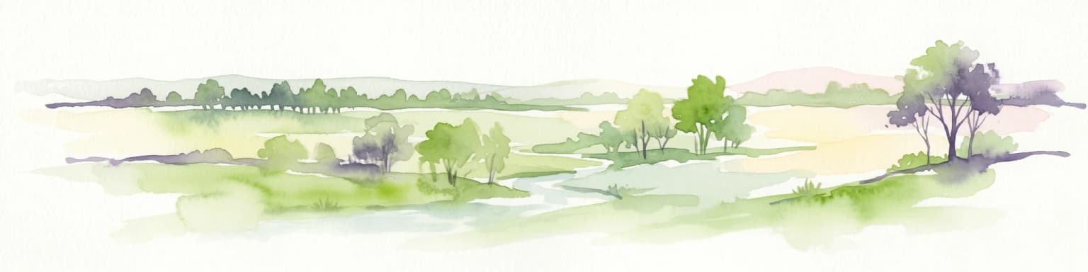
Garig Gunak Barlu National Park landscape and geographic character

The park encompasses the entire Cobourg Peninsula, a distinct landform extending into the Arafura Sea in the northern part of the Northern Territory. The peninsula features low-lying coastal terrain typical of tropical northern Australia, with extensive areas of coastal vegetation, mangroves, and beach systems. Within the park's boundaries lie several islands including Burford Island, the Sir George Hope Islands chain (comprising Greenhill, Wangoindjung, Warldagawaji, Morse, and Wunmiyi islands), Mogogout Island, and Endyalgout Island to the south of the peninsula. The park also encompasses adjacent marine waters, extending protection into the surrounding ocean environment. The landscape transitions from mainland coastal plains to island ecosystems, creating a diverse mix of terrestrial and marine habitats. While the terrain is not mountainous, the peninsula's extent into the sea creates a distinctive coastal setting characterized by the interplay between land and water environments.

Garig Gunak Barlu National Park ecosystems, habitats, and plant life

The ecological character of Garig Gunak Barlu is defined by its tropical coastal setting and the integration of terrestrial and marine environments. The park's Ramsar-listed status recognizes its significance as a coastal wetland ecosystem of international importance. The surrounding marine waters support an extraordinary concentration of marine life, with all six species of Australian marine turtles found in the area. These include green sea turtles, hawksbill sea turtles, flatback sea turtles, leatherback sea turtles, and olive ridley sea turtles, making this one of the most significant turtle nesting and foraging habitats in Australia. The ocean waters also support populations of sharks and cetaceans, while the coastal zones are inhabited by saltwater crocodiles. On land, the park contains over 200 species of birds, reflecting the diversity of habitats from coastal beaches to woodland areas.

Garig Gunak Barlu National Park wildlife and species highlights

Garig Gunak Barlu hosts an remarkable assembly of wildlife, particularly in its marine environments. The surrounding ocean contains all six species of marine turtles that occur in Australian waters, representing a remarkable concentration of turtle biodiversity within a single protected area. These species include green sea turtles, hawksbill sea turtles, flatback sea turtles, leatherback sea turtles, and olive ridley sea turtles. The marine environment also supports populations of various shark species and cetaceans, the collective term for whales, dolphins, and porpoises. Along the coastline, saltwater crocodiles inhabit the estuarine and coastal waters, representing one of Australia's most iconic and dangerous wildlife species. The terrestrial environments support significant bird diversity with over 200 species recorded within the park, along with several mammal species. This combination of marine and terrestrial wildlife, particularly the presence of all Australian marine turtle species, makes the park exceptionally significant for wildlife conservation.

Garig Gunak Barlu National Park conservation status and protection priorities

The park holds significant conservation value through multiple designations and its comprehensive protection of both terrestrial and marine ecosystems. Its Ramsar Wetland designation since 1974 recognizes the international importance of the Cobourg Peninsula's coastal and marine habitats under the Ramsar Convention on Wetlands. The IUCN Category II classification as a national park provides formal recognition of the area's national significance for biodiversity conservation. The park's management model, involving joint management between government conservation authorities and the Iwaidja traditional land owners, represents an important approach to integrating Indigenous knowledge and values into protected area management. The protection of all six Australian marine turtle species within a single protected area represents an exceptional conservation achievement, ensuring the preservation of these threatened marine reptiles across their life cycles.

Garig Gunak Barlu National Park cultural meaning and human context

The cultural landscape of Garig Gunak Barlu is deeply connected to the Iwaidja people, the Aboriginal traditional land owners of the Cobourg Peninsula. The park's name itself derives from the Garig language, demonstrating the enduring connection between this landscape and Indigenous language and culture. The word 'gunak' meaning land and 'barlu' meaning deep water reflects a cultural understanding of the landscape that encompasses both terrestrial and marine environments as interconnected. The Iwaidja people have maintained a continuous connection to this peninsula over thousands of years, and their traditional knowledge and practices continue to inform contemporary land management. The joint management arrangement between government authorities and traditional owners represents a meaningful integration of Indigenous perspectives into the conservation and management of this significant landscape.

Top sights and standout views in Garig Gunak Barlu National Park

Garig Gunak Barlu stands out as one of Australia's most significant protected coastal wilderness areas, distinguished by its comprehensive protection of both land and sea environments. The park protects all six species of Australian marine turtles within its waters, a remarkable concentration of marine turtle biodiversity found nowhere else in the country. Its Ramsar Wetland designation since 1974 reflects over five decades of international recognition for the area's coastal ecosystem values. The joint management arrangement with the Iwaidja traditional owners represents a model of integrating Indigenous cultural values with modern conservation practice. The park's remote location and limited access ensure that it remains one of Australia's more pristine and uncrowded national parks, offering visitors an authentic wilderness experience in the tropical north.

Best time to visit Garig Gunak Barlu National Park

The optimal time to visit Garig Gunak Barlu coincides with the Australian dry season, typically from May through October, when conditions are most favorable for outdoor exploration. During this period, rainfall is minimal and temperatures are generally comfortable for outdoor activities. The wet season, from November to April, brings higher temperatures, increased humidity, and significant rainfall that can affect access and visitor conditions. Saltwater crocodiles are present year-round in coastal waters, requiring constant vigilance during any water-related activities. The park's remote location means that visitors should plan carefully for self-sufficiency and be aware that facilities and services are limited compared to more accessible parks.

Park location guide

Geography guide, regional context, and park location map for Garig Gunak Barlu National Park

Garig Gunak Barlu National Park park geography, regions, and map view in Australia
Understand where Garig Gunak Barlu National Park sits in Australia through a broader geographic reading of the surrounding landscape, nearby location context, and its mapped position within the national park landscape.

How Garig Gunak Barlu National Park fits into Australia

Australia is a constitutional monarchy and federal parliamentary democracy comprising six states and ten territories. With a population of nearly 28 million, it is one of the world's most urbanised countries, with most people concentrated on the eastern seaboard. The country has a high Human Development Index and is known for its cultural diversity, ancient Aboriginal heritage, and unique wildlife.

Wider geography shaping Garig Gunak Barlu National Park in Australia

Australia occupies the entire Australian continent, the island of Tasmania, and numerous smaller islands. It is the world's flattest and driest inhabited continent, featuring vast deserts in the interior (the Outback), tropical rainforests along the eastern coast, and a coastline bordering the Indian and Pacific Oceans.

Map view of Garig Gunak Barlu National Park

Use this park location map to pinpoint Garig Gunak Barlu National Park in Australia, understand its exact geographic position, and read its mapped placement within the surrounding landscape more clearly.

Pigeon | © OpenStreetMap contributors

Location context for Garig Gunak Barlu National Park

Northern Territory
Park atlas

Explore the Regional Context of Protected Coastal Wilderness and Marine Parks Beyond Garig Gunak Barlu National Park

Explore Surrounding Protected Areas and National Parks Near Garig Gunak Barlu National Park
Discover additional national parks and protected areas near Garig Gunak Barlu National Park, covering coastal wilderness, island ecosystems, and significant marine conservation zones. Compare their distinct park geography, trace regional protected area distribution, and explore how they collectively shape Northern Australia's unique environments.
National parkNorthern Territory

Charles Darwin National Park: Discover its Mapped Landscape, WWII Bunkers, and Larrakia Heritage

Northern Territory protected area with significant historical and geographic context.

Charles Darwin National Park represents a distinct protected landscape in Australia's Northern Territory, offering a rich tapestry of natural beauty and historical significance. This national park is renowned for its well-preserved World War II concrete bunker complex, serving as a direct link to Australia's wartime past. Beyond its military history, the park encompasses tropical savanna woodlands and coastal terrains that provide panoramic views of Darwin Harbour. Its indigenous heritage, including ancient shell middens, highlights thousands of years of Larrakia land use, making it a layered geographic and cultural discovery point.

Area
13.03 km²
Established
1998
IUCN
II
National parkLautém District

Nino Konis Santana National Park: Protected Landscape and Biodiversity Atlas

Explore the unique geography and marine ecosystems of Timor-Leste's first national park.

Nino Konis Santana National Park is a critical protected area at the eastern tip of Timor-Leste, spanning terrestrial forests, wetlands, and a significant marine zone within the Coral Triangle. This national park provides a unique atlas-driven view of rich biodiversity, including endemic bird species and vibrant coral reefs. Its landscape is deeply intertwined with ancient cultural sites and traditional settlements, offering a comprehensive understanding of its ecological and historical geographic context. Discover the mapped boundaries and protected area features that define this important conservation landscape.

Area
1,236 km²
Established
2007
IUCN
II
National parkNorthern Territory

Barranyi (North Island) National Park: Northern Territory Island Protected Area and Landscape Context

Explore mapped geography and unique island terrain.

Barranyi (North Island) National Park is a remote national park in the Northern Territory, distinguished by its island setting in the Gulf of Carpentaria. The park's landscape features low coastal terrain, beaches, and dune formations, embodying a protected island ecosystem. Discover its mapped boundaries and geographic context within the vast northern Australian region, offering a specific example of island conservation and Indigenous land stewardship.

Area
53.81 km²
Established
1992
IUCN
II
National parkWestern Australia

Windjana Gorge National Park: Ancient Devonian Reef Gorge Landscape Exploration

Explore mapped geography and fossil-rich sandstone formations.

Windjana Gorge National Park offers an unparalleled opportunity to explore a protected landscape defined by its ancient Devonian reef origins. Situated in Western Australia, this national park protects a dramatic gorge carved through fossil-rich sandstone, revealing a 375-million-year-old geological past. Examine the mapped park boundaries and the unique contours of this ancient reef system, providing crucial context for understanding the natural history and landscape evolution of the Kimberley region.

Area
20.5 km²
Established
1971
IUCN
II
Relief
Lowland
National parkWestern Australia

Tunnel Creek National Park: Ancient Devonian Reef Caves and Aboriginal Heritage

Discover Western Australia's ancient geological and cultural protected landscape.

Tunnel Creek National Park offers a unique glimpse into geological time and Aboriginal heritage, centered on an ancient underground river flowing through the Napier Range. This National Park features one of Western Australia's oldest cave systems, carved from fossilized Devonian reef limestone dating back 350 million years. Explore the remarkable 750-meter cave tunnel, marvel at its speleothems, and appreciate the significant rock art that tells stories of its cultural past. The park's protected status safeguards this extraordinary geological formation and its historical narratives for continued exploration.

Area
0.91 km²
Established
1992
IUCN
II
National parkQueensland

Errk Oykangand National Park: Queensland's Remote Tropical Savanna National Park

Explore mapped protected area boundaries and savanna landscapes.

Errk Oykangand National Park, located in far-north Queensland, Australia, protects a vast area of tropical savanna. This national park, established in 1977, showcases the unique Mitchell grass downs and savanna woodland ecosystems characteristic of the Gulf Country region. Its landscape features gently undulating plains, seasonal waterways, and a distinctive climate, offering a representative sample of this remote wilderness. The park's co-management arrangement highlights a commitment to Indigenous land stewardship and cultural recognition within Australia's protected area network.

Area
371 km²
Established
1977
IUCN
II
National parkEast Nusa Tenggara

Kelimutu National Park: Volcanic Terrain and Colored Crater Lakes in East Nusa Tenggara

Explore the mapped geography of this unique Indonesian national park.

Kelimutu National Park represents a remarkable protected landscape in East Nusa Tenggara, Indonesia, distinguished by its volcanic origins and the famed three colored lakes of Mount Kelimutu. This national park protects diverse montane forests and offers a unique insight into the region's geological wonders. Its geography features volcanic slopes and the iconic caldera, making it a significant point of interest for atlas-driven exploration of protected natural areas.

Area
50 km²
Established
1992
IUCN
II
National parkQueensland

Piper Islands National Park: Queensland National Park with Critical Seabird Colonies

Explore mapped boundaries and landscape context for this Great Barrier Reef island sanctuary.

Piper Islands National Park in Queensland is a protected area comprising four coral cays vital for significant seabird nesting populations. Recognized as an Important Bird Area, these islands showcase distinct mangrove and Pisonia forest ecosystems against the backdrop of the inner northern Great Barrier Reef. The park's protected landscape offers a unique glimpse into the ecological importance of these small, dynamic coastal landforms within a world-heritage marine setting.

Area
0.07 km²
Established
1989
IUCN
II

Common questions about visiting, size, designation, and location context for Garig Gunak Barlu National Park

Garig Gunak Barlu National Park FAQs for park facts, access, geography, and protected area context
Find quick answers about Garig Gunak Barlu National Park, including protected-area facts, park geography, trail and visitor context, and how the park fits into its surrounding country and regional landscape.
MoriAtlas Explorer

Continue Your Protected Areas Search Across the Global Atlas

Deepen your exploration by continuing the structured search for national parks and protected areas worldwide. Utilize the comprehensive filtering capabilities to compare different conservation landscapes and refine your understanding of global park geography. Discover more about the distribution and characteristics of protected natural areas.

Global natural geography