Mori Atlas logo
National parkCharles Darwin National Park

Discover mapped terrain and historical context within this key Australian national park.

Charles Darwin National Park: Protected Landscape, WWII Heritage, and Northern Territory Geography

Charles Darwin National Park, located in Australia's Northern Territory, offers a unique protected landscape near Darwin city. This national park combines significant World War II military heritage, including preserved concrete bunkers, with the indigenous cultural connections of the Larrakia people. Explore its tropical savanna woodlands, coastal views, and trail systems that reveal the region's natural and historical geography, making it a vital point for atlas-driven discovery.

WWII heritageIndigenous cultural sitesTropical savannaCoastal landscapesBushwalkingMountain biking

Charles Darwin National Park

National park

Park overview

Structured park overview, official facts, and landscape profile for Charles Darwin National Park

Charles Darwin National Park park facts, protected area profile, and essential visitor context
Review the core facts for Charles Darwin National Park, including designation, size, terrain, visitor scale, habitats, and operating context in one park-focused overview.

About Charles Darwin National Park

Charles Darwin National Park occupies a distinctive position in Australia's protected area network as a site where natural landscape, indigenous heritage, and military history intersect within a compact coastal setting near a major city. Located just southeast of Darwin, the park rises from coastal plains to provide visitors with sweeping vistas across Darwin Harbour while protecting significant tracts of tropical woodland and ephemeral wetland environments. The park's establishment in 1998 formalized protection for an area that had long been valued by the Larrakia people, whose presence in the region extends back thousands of years, evidenced by the shell middens scattered throughout the park's interior. The visible WWII-era infrastructure represents a more recent chapter in the landscape's history, when Darwin served as a critical Allied staging point in the Pacific theater and the area was fortified with a network of concrete observation posts and command bunkers. These structures remain largely intact and have been integrated into the park's visitor experience through interpretive signage and the converted visitor center bunker. The park's compact size and proximity to Darwin make it a significant recreational asset for residents and visitors alike, offering developed trail networks suitable for walking and mountain biking within a landscape that feels distinctly remote despite being minutes from a major urban center.

Quick facts and research context for Charles Darwin National Park

Charles Darwin National Park lies in the Northern Territory of Australia, directly adjacent to the city of Darwin, making it one of the most accessible protected areas in the region. Established on 8 April 1998 under the management of the Parks and Wildlife Commission of the Northern Territory, the park covers 13.03 square kilometers of coastal terrain. The area holds dual significance as both a conservation reserve protecting tropical woodland and wetland habitats and as a cultural landscape containing evidence of Larrakia indigenous occupation through shell middens, as well as a preserved World War II military installation network.

Park context

Deeper park guide and search-rich context for Charles Darwin National Park

Charles Darwin National Park history, landscape, wildlife, and travel context
Explore Charles Darwin National Park through its history, landscape character, ecosystems, wildlife, conservation priorities, cultural context, and seasonal travel timing in a structured park guide built for atlas discovery and search intent.

Why Charles Darwin National Park stands out

Charles Darwin National Park is best known for its well-preserved World War II concrete bunker complex, which represents one of the most intact wartime defense installations in northern Australia. One of these bunkers has been adapted to serve as a visitor center, housing displays of wartime memorabilia and providing interpretive context about the site's military history. The park is also notable for its Larrakia cultural heritage, particularly the ancient shell middens found within the park boundaries that demonstrate thousands of years of indigenous land use. Additionally, the park provides some of the most accessibleviews of Darwin city and harbour from its elevated lookouts.

Charles Darwin National Park history and protected-area timeline

The history of Charles Darwin National Park spans multiple periods of human occupation and use, beginning with the long-standing presence of the Larrakia people, who have maintained cultural connections to the Darwin region for millennia. Archaeological evidence of this indigenous heritage is visible throughout the park in the form of shell middens, which represent traditional food preparation and consumption sites where the Larrakia harvested and processed marine resources from the nearby coast. These middens provide tangible evidence of the area's importance to indigenous communities and remain culturally significant to the Larrakia people today. The more recent historical layer comes from World War II, when Darwin served as a vital military and logistical hub for Allied operations in the Pacific. The park area was fortified with concrete bunkers and observation posts as part of the broader coastal defense network protecting the harbor and city. Following the war, the area saw informal recreational use before formal protection was established in 1998, when the park was declared under the Parks and Wildlife Commission of the Northern Territory. The park's naming honors Charles Darwin, the renowned naturalist whose scientific work and connection to Australian natural history provides an appropriate thematic link to the area's ecological significance.

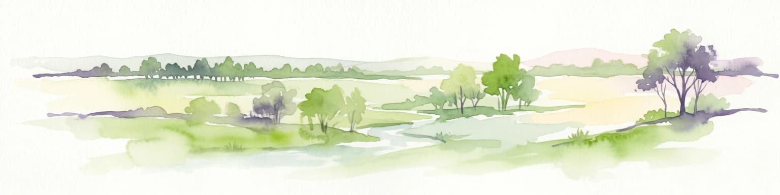
Charles Darwin National Park landscape and geographic character

Charles Darwin National Park occupies a coastal setting in the Northern Territory characterized by gently undulating terrain rising from low-lying plains near the shoreline to more elevated sections offering panoramic views. The park's landscape reflects the broader characteristics of the Darwin region, featuring tropical savanna woodland interspersed with patches of denser vegetation in drainage lines and low-lying areas that retain moisture during the wet season. The terrain supports a mix of open woodland dominated by eucalypts and melaleuca species, with understory vegetation that varies between dense thickets of native grasses and more open shrubland depending on fire history and seasonal conditions. Coastal sections feature mangrove influences in tidal zones, while permanent and seasonal wetlands provide habitat diversity within the park's boundaries. The landscape's visual character is strongly shaped by the pronounced wet and dry seasons of the tropics, with the terrain appearing markedly different between the lush green of the wet season and the golden-brown dryness of the dry.

Charles Darwin National Park ecosystems, habitats, and plant life

The natural environment of Charles Darwin National Park reflects the tropical savanna biome that dominates the Darwin region, supporting a range of habitats within its relatively compact area. The park's vegetation communities include open eucalypt woodland, melaleuca swamp forest, coastal grassland, and mangrove fringes along tidal boundaries. This habitat diversity supports a corresponding variety of wildlife, including numerous bird species adapted to tropical woodland environments, reptiles such as goannas and snakes, and various mammal species including possums and flying foxes. The park's conservation significance extends beyond its visible wildlife to include the protection of intact vegetation communities that remain largely unmodified despite the area's proximity to urban development. The Larrakia people's continued association with the land through the park's management adds cultural value to the ecological systems preserved within its boundaries.

Charles Darwin National Park wildlife and species highlights

Charles Darwin National Park supports wildlife populations typical of the Northern Territory's tropical savanna ecosystems. Birdlife is particularly diverse, with numerous species of parrots, honeyeaters, and waterbirds found throughout the park's various habitats. The woodland areas provide foraging and nesting habitat for rainbow lorikeets, galahs, and various honeyeater species, while the wetland and coastal areas attract waterbirds including egrets, jabiru, and various duck species. Reptile populations include goannas that are commonly seen moving through the woodland, various snake species adapted to the tropical environment, and turtles in the park's wetland areas. Mammals present include northern brushtail possums, several bat species including flying foxes that roost in the woodland, and occasional dingoes passing through the area. The park's trail network and open fire trails create habitat edges that benefit some species while the intact vegetation core provides refuge for more cryptic wildlife.

Charles Darwin National Park conservation status and protection priorities

Charles Darwin National Park contributes to conservation outcomes in the Darwin region by protecting a segment of tropical savanna ecosystem that would otherwise face development pressure given its proximity to the city. The park preserves vegetation communities that provide habitat corridors connecting to broader natural areas, supporting wildlife movement through the urban-fringe landscape. The protection of shell middens and indigenous cultural sites adds a cultural conservation dimension that extends beyond purely ecological values. The park's management through the Parks and Wildlife Commission of the Northern Territory incorporates both biodiversity protection and cultural heritage preservation, with ongoing consultation with Larrakia traditional owners. The preserved WWII infrastructure adds a non-renewable heritage conservation element to the park's protection mandate, representing physical evidence of a significant period in Australian history that would be lost without formal protection.

Charles Darwin National Park cultural meaning and human context

The cultural landscape of Charles Darwin National Park encompasses both indigenous and post-colonial heritage that gives the area deeper significance beyond its natural and recreational values. The Larrakia people are the traditional owners of the Darwin region, and their connection to the park's landscape is evidenced by the shell middens found throughout the area. These middens represent thousands of years of sustainable marine resource use and demonstrate the Larrakia's deep knowledge of the local environment. The park's management recognizes this ongoing cultural connection through the inclusion of Aboriginal traditional land owners in governance arrangements. The World War II heritage represents a different layer of human history, when Darwin was transformed from a small tropical outpost into a critical Allied military base. The preserved bunkers and military infrastructure provide tangible connections to this transformative period in Australian history, when northern Australia became a frontline in the Pacific theater.

Top sights and standout views in Charles Darwin National Park

The World War II bunker complex stands as the park's most distinctive feature, with the visitor center bunker providing interpretive access to this military heritage through displays and contextual information. The park's lookouts offer easily accessible panoramic views of Darwin city and harbor, providing visitors with a sense of the landscape's relationship to the urban area while remaining immersed in natural surroundings. The trail network, including fire trails suitable for bushwalking and the dedicated mountain bike trail maintained by the Darwin Off-Road Cyclists Club, provides varied recreational opportunities within a compact area. The annual Earthdance festival brings community events into the park, creating cultural gatherings that reflect the park's role as a community space. The Larrakia cultural heritage, particularly the visible shell middens, provides educational opportunities for visitors interested in understanding the long human history of the Darwin region.

Best time to visit Charles Darwin National Park

Charles Darwin National Park can be visited throughout the year, though the dry season from May to October generally offers more comfortable conditions for outdoor exploration. During the dry season, temperatures are milder, rainfall is minimal, and trail conditions are good, making this the most popular time for visitors. The wet season from November to April brings higher temperatures, humidity, and rainfall that can affect trail accessibility and visitor comfort, though the landscape becomes lusher and wildlife activity often increases around water sources. Visitors seeking to avoid crowds may find the shoulder seasons of April and November offer a balance between favorable weather and lower visitor numbers. The park's proximity to Darwin means it can be visited as a half-day excursion regardless of season, though early morning visits are recommended during the hotter months to avoid midday heat.

Park location guide

Geography guide, regional context, and park location map for Charles Darwin National Park

Charles Darwin National Park park geography, regions, and map view in Australia
Understand where Charles Darwin National Park sits in Australia through a broader geographic reading of the surrounding landscape, nearby location context, and its mapped position within the national park landscape.

How Charles Darwin National Park fits into Australia

Australia is a constitutional monarchy and federal parliamentary democracy comprising six states and ten territories. With a population of nearly 28 million, it is one of the world's most urbanised countries, with most people concentrated on the eastern seaboard. The country has a high Human Development Index and is known for its cultural diversity, ancient Aboriginal heritage, and unique wildlife.

Wider geography shaping Charles Darwin National Park in Australia

Australia occupies the entire Australian continent, the island of Tasmania, and numerous smaller islands. It is the world's flattest and driest inhabited continent, featuring vast deserts in the interior (the Outback), tropical rainforests along the eastern coast, and a coastline bordering the Indian and Pacific Oceans.

Map view of Charles Darwin National Park

Use this park location map to pinpoint Charles Darwin National Park in Australia, understand its exact geographic position, and read its mapped placement within the surrounding landscape more clearly.

Pigeon | © OpenStreetMap contributors

Location context for Charles Darwin National Park

Northern Territory
Park atlas

Trace connected protected landscapes and regional park geography across Australia's Northern Territory.

Discover Other National Parks and Protected Areas Near Charles Darwin National Park
Continue your exploration from Charles Darwin National Park by browsing other national parks and protected areas across Australia's Northern Territory. Compare diverse tropical savanna, coastal landscapes, and historical sites to understand the broader regional context of protected lands.
National parkNorthern Territory

Garig Gunak Barlu National Park: Northern Territory's Remote Protected Coastal Wilderness & Map Atlas

Explore its unique marine protected area and mapped landscape context.

Garig Gunak Barlu National Park is a significant protected coastal wilderness, covering the entire Cobourg Peninsula in Australia's Northern Territory. This national park designation protects extensive terrestrial landscapes alongside vital adjacent marine waters. The park is renowned for its comprehensive safeguarding of marine turtle habitats and its designation as a Ramsar Wetland, emphasizing its ecological importance. Understanding Garig Gunak Barlu National Park involves exploring its mapped protected boundaries and its role as a crucial element of Northern Territory's protected landscapes, offering a unique atlas-style view of coastal conservation.

Area
2,260.06 km²
Established
2000
IUCN
II
National parkLautém District

Nino Konis Santana National Park: Protected Landscape and Biodiversity Atlas

Explore the unique geography and marine ecosystems of Timor-Leste's first national park.

Nino Konis Santana National Park is a critical protected area at the eastern tip of Timor-Leste, spanning terrestrial forests, wetlands, and a significant marine zone within the Coral Triangle. This national park provides a unique atlas-driven view of rich biodiversity, including endemic bird species and vibrant coral reefs. Its landscape is deeply intertwined with ancient cultural sites and traditional settlements, offering a comprehensive understanding of its ecological and historical geographic context. Discover the mapped boundaries and protected area features that define this important conservation landscape.

Area
1,236 km²
Established
2007
IUCN
II
National parkNorthern Territory

Barranyi (North Island) National Park: Northern Territory Island Protected Area and Landscape Context

Explore mapped geography and unique island terrain.

Barranyi (North Island) National Park is a remote national park in the Northern Territory, distinguished by its island setting in the Gulf of Carpentaria. The park's landscape features low coastal terrain, beaches, and dune formations, embodying a protected island ecosystem. Discover its mapped boundaries and geographic context within the vast northern Australian region, offering a specific example of island conservation and Indigenous land stewardship.

Area
53.81 km²
Established
1992
IUCN
II
National parkWestern Australia

Windjana Gorge National Park: Ancient Devonian Reef Gorge Landscape Exploration

Explore mapped geography and fossil-rich sandstone formations.

Windjana Gorge National Park offers an unparalleled opportunity to explore a protected landscape defined by its ancient Devonian reef origins. Situated in Western Australia, this national park protects a dramatic gorge carved through fossil-rich sandstone, revealing a 375-million-year-old geological past. Examine the mapped park boundaries and the unique contours of this ancient reef system, providing crucial context for understanding the natural history and landscape evolution of the Kimberley region.

Area
20.5 km²
Established
1971
IUCN
II
Relief
Lowland
National parkWestern Australia

Tunnel Creek National Park: Ancient Devonian Reef Caves and Aboriginal Heritage

Discover Western Australia's ancient geological and cultural protected landscape.

Tunnel Creek National Park offers a unique glimpse into geological time and Aboriginal heritage, centered on an ancient underground river flowing through the Napier Range. This National Park features one of Western Australia's oldest cave systems, carved from fossilized Devonian reef limestone dating back 350 million years. Explore the remarkable 750-meter cave tunnel, marvel at its speleothems, and appreciate the significant rock art that tells stories of its cultural past. The park's protected status safeguards this extraordinary geological formation and its historical narratives for continued exploration.

Area
0.91 km²
Established
1992
IUCN
II
National parkEast Nusa Tenggara

Kelimutu National Park: Volcanic Terrain and Colored Crater Lakes in East Nusa Tenggara

Explore the mapped geography of this unique Indonesian national park.

Kelimutu National Park represents a remarkable protected landscape in East Nusa Tenggara, Indonesia, distinguished by its volcanic origins and the famed three colored lakes of Mount Kelimutu. This national park protects diverse montane forests and offers a unique insight into the region's geological wonders. Its geography features volcanic slopes and the iconic caldera, making it a significant point of interest for atlas-driven exploration of protected natural areas.

Area
50 km²
Established
1992
IUCN
II
National parkQueensland

Errk Oykangand National Park: Queensland's Remote Tropical Savanna National Park

Explore mapped protected area boundaries and savanna landscapes.

Errk Oykangand National Park, located in far-north Queensland, Australia, protects a vast area of tropical savanna. This national park, established in 1977, showcases the unique Mitchell grass downs and savanna woodland ecosystems characteristic of the Gulf Country region. Its landscape features gently undulating plains, seasonal waterways, and a distinctive climate, offering a representative sample of this remote wilderness. The park's co-management arrangement highlights a commitment to Indigenous land stewardship and cultural recognition within Australia's protected area network.

Area
371 km²
Established
1977
IUCN
II
National parkEast Nusa Tenggara

Manupeu Tanah Daru National Park: National Park Protected Landscape and East Nusa Tenggara Geography

Discover its mapped boundaries and regional atlas context.

Delve into the protected landscape of Manupeu Tanah Daru National Park, a significant national park situated within East Nusa Tenggara. This dedicated page provides detailed geographic context, focusing on the park's mapped boundaries and its contribution to the regional natural landscape. Understand its identity as a protected area and explore its place within the broader atlas of global conservation lands, fostering a deeper appreciation for its distinct geographic characteristics.

Area
879.84 km²
Established
1998
IUCN
II

Common questions about visiting, size, designation, and location context for Charles Darwin National Park

Charles Darwin National Park FAQs for park facts, access, geography, and protected area context
Find quick answers about Charles Darwin National Park, including protected-area facts, park geography, trail and visitor context, and how the park fits into its surrounding country and regional landscape.
MoriAtlas Explorer

Continue Your Protected Areas Search Across the Global Atlas

Deepen your exploration by continuing the structured search for national parks and protected areas worldwide. Utilize the comprehensive filtering capabilities to compare different conservation landscapes and refine your understanding of global park geography. Discover more about the distribution and characteristics of protected natural areas.

Global natural geography