Mori Atlas logo
National parkBugong National Park

Discover mapped protected area boundaries, varied terrain, and unique ecosystems within New South Wales.

Bugong National Park: A Strict Nature Reserve of Biodiversity and Landscape in Australia

Bugong National Park represents a critical protected natural landscape within Australia's diverse geography. This dedicated national park encompasses distinct plateau and steep valley terrains, shaped by Bugong Creek and the Shoalhaven River catchment. Its conservation significance is underscored by its role in safeguarding unique biodiversity, including the endemic rockwarbler, and providing essential habitat for numerous threatened species. Exploring Bugong National Park offers insight into a protected area vital for both its ecological integrity and its place within the regional Australian atlas.

strict nature reservewet forestsdry forestsNew South WalesShoalhaven regionendangered species

Bugong National Park

National park

Park overview

Structured park overview, official facts, and landscape profile for Bugong National Park

Bugong National Park park facts, protected area profile, and essential visitor context
Review the core facts for Bugong National Park, including designation, size, terrain, visitor scale, habitats, and operating context in one park-focused overview.

About Bugong National Park

Bugong National Park represents a significant protected area in the southeastern Australian landscape, established in 2001 as part of broader regional forest conservation efforts in southern New South Wales. The park occupies a strategic position in the Shoalhaven region, with its two disjunct sections spanning terrain that ranges from gentle plateau areas below the Cambewarra range to steeply incised valleys. The landscape is characterized by a complex network of waterways including Bugong Creek, Kellets Creek, and portions of the Shoalhaven River system. The park sits within the traditional country of the Jerrinja Tribe, acknowledging the long-standing indigenous connection to this landscape. Currently, Bugong operates as a strict nature reserve with limited development, reflecting its conservation prioritization. While no visitor facilities currently exist, the park supports bushwalking as its primary recreational activity, with plans underway for future visitor infrastructure including a campground and interpretive center at a former quarry site along Lower Bugong Road.

Quick facts and research context for Bugong National Park

Bugong National Park is a strict nature reserve in the Shoalhaven region of New South Wales, established in 2001. The park covers 1,022 hectares of wet and dry forest terrain, spanning a plateau below the Cambewarra range and steep valleys. It sits within the traditional territory of the Jerrinja Tribe and contains sections of Bugong Creek, Kellets Creek, and the Shoalhaven River. The park is managed by the NSW National Parks and Wildlife Service and currently has no visitor facilities, though development of a campground and visitor center is planned.

Park context

Deeper park guide and search-rich context for Bugong National Park

Bugong National Park history, landscape, wildlife, and travel context
Explore Bugong National Park through its history, landscape character, ecosystems, wildlife, conservation priorities, cultural context, and seasonal travel timing in a structured park guide built for atlas discovery and search intent.

Why Bugong National Park stands out

Bugong National Park is best known for its significant biodiversity and严格的自然保护区 status. It protects the only bird species restricted to New South Wales, the rockwarbler, and provides habitat for the endangered broad-headed snake and 14 vulnerable species including the glossy black cockatoo, koala, and yellow-bellied glider. The park's diverse forest habitats support over 60 bird species, 24 mammal species, 16 reptile species, and 12 amphibian species. Notably, the park once supported the brush-tailed rock-wallaby until its local extinction in 1999, and there are ongoing considerations for potential reintroduction if invasive fox populations can be controlled.

Bugong National Park history and protected-area timeline

Bugong National Park was established on January 1, 2001, becoming the 153rd national park in New South Wales alongside Tallaganda National Park. The park was created through the southern New South Wales Regional Forest Agreement, which represented a comprehensive framework for balancing conservation values with sustainable forest management across the region. Prior to its national park designation, the land existed as Crown land. The establishment of Bugong was complemented by the creation of the adjacent Tapitallee Nature Reserve, forming part of a connected conservation landscape. The park is linked to the larger Morton National Park through intervening Crown land, suggesting potential for future expansion of the protected area network. The land holds significance as the traditional territory of the Jerrinja Tribe, representing indigenous heritage that predates European settlement and contemporary conservation designation.

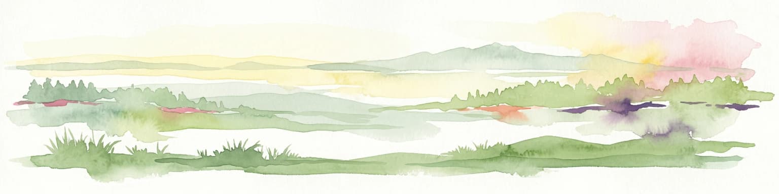
Bugong National Park landscape and geographic character

The physical landscape of Bugong National Park is defined by its varied topography and watercourse systems. The park consists of two geographically separate sections, with a smaller northern portion and a substantially larger southern area. Approximately half of the park occupies a relatively flat plateau surface situated below the prominent Cambewarra range, providing more accessible terrain. The remainder of the park comprises steeply sloping valleys that have been carved by the watercourses flowing through the area. These valleys contain portions of Bugong Creek and Kellets Creek, both of which contribute to the broader Shoalhaven River catchment. The combination of plateau and valley terrain creates a heterogeneous landscape supporting distinct microclimates and vegetation communities across relatively short distances.

Bugong National Park ecosystems, habitats, and plant life

The ecological character of Bugong National Park is defined by its diverse forest communities spanning wet and dry forest types. The park supports a large variety of plant species adapted to these contrasting moisture regimes, from moisture-laden valleys to more xeric plateau areas. A notable botanical feature is the presence of the endangered Nowra heath myrtle, a rare plant species that finds suitable habitat within the park's boundaries. However, the park faces ecological challenges from invasive species, particularly mistflower along Bugong Creek, where this aggressive introduced plant threatens to displace native vegetation communities. The forest structure varies from tall wet sclerophyll forests in the valleys to more open dry sclerophyll communities on the plateau, creating a mosaic of habitats that supports the park's remarkable biodiversity.

Bugong National Park wildlife and species highlights

Bugong National Park supports an impressive array of wildlife, with more than 60 bird species, 24 mammal species, 16 reptile species, and 12 amphibian species recorded within its boundaries. The park holds particular significance for the rockwarbler, a bird species that is endemic to New South Wales and represents the only bird species restricted entirely to that state. Among the reptiles, the park provides habitat for the endangered broad-headed snake, a species that relies on specific rock-outcrop habitat for shelter. The protected area supports fourteen vulnerable species, including several notable birds such as the glossy black cockatoo, gang-gang cockatoo, and little lorikeet. Mammalian residents include the koala, yellow-bellied glider, spotted-tail quoll, and long-nosed potoroo, while flying mammals are represented by several bat species including the grey-headed flying fox and eastern freetail-bat. The park has historical significance for the brush-tailed rock-wallaby, which was recorded in the park until 1999 when populations were extirpated primarily through predation by introduced foxes. Invasive mammals including foxes, wild dogs, rabbits, deer, and goats currently occur within the park and represent ongoing management challenges.

Bugong National Park conservation status and protection priorities

Bugong National Park is designated as an IUCN Category Ia protected area, representing the strictest form of nature reserve protection. This classification reflects the park's primary purpose of preserving biodiversity in as undisturbed a state as possible. The park protects significant populations of threatened species, with one endangered species, the broad-headed snake, and fourteen vulnerable species receiving formal protection within its boundaries. The presence of the Nowra heath myrtle adds botanical significance to the conservation values. However, the park faces ongoing ecological pressures from invasive species, both plant and animal. Mistflower threatens native plant communities along watercourses, while foxes, wild dogs, rabbits, deer, and goats impact native fauna and ecosystem processes. The historical extirpation of the brush-tailed rock-wallaby illustrates the severity of these pressures, but also presents a potential conservation opportunity through targeted fox control and species reintroduction programs.

Bugong National Park cultural meaning and human context

Bugong National Park lies within the traditional country of the Jerrinja Tribe, representing the ongoing indigenous connection to this landscape that predates European colonization of Australia. This cultural heritage acknowledgment reflects the broader recognition of Aboriginal association with protected landscapes across New South Wales. The park's establishment in 2001, following the Regional Forest Agreement process, represents a more recent chapter in the land's protective history, though it builds upon the long relationship between Indigenous peoples and the Shoalhaven region's natural environment.

Top sights and standout views in Bugong National Park

The conservation significance of Bugong National Park is underscored by its strict nature reserve status and the presence of multiple threatened species. The rockwarbler, found only in New South Wales, represents a unique biological highlight, while the broad-headed snake and fourteen vulnerable species demonstrate the park's importance for wildlife protection. The diverse forest habitats spanning wet and dry types create ecological variety within a relatively compact protected area. The park's landscape diversity, from plateau to steep valleys traversed by creek systems, offers visual and ecological contrast. The possibility of restoring the extirpated brush-tailed rock-wallaby through invasive species management represents a forward-looking conservation opportunity.

Best time to visit Bugong National Park

As a strict nature reserve with limited infrastructure, Bugong National Park offers a wilderness-oriented visitor experience. The park can be explored year-round, though bushwalking conditions may vary with seasonal weather patterns. The cooler months typically provide comfortable conditions for hiking the park's trails, while the warmer periods may offer opportunities for wildlife observation in the valley areas. Visitors interested in birdwatching may find the diverse avian communities active throughout the year, though seasonal variations in species composition may occur. The lack of current visitor facilities means that visitors should be prepared for a self-sufficient experience appropriate to the park's strict nature reserve character.

Park location guide

Geography guide, regional context, and park location map for Bugong National Park

Bugong National Park park geography, regions, and map view in Australia
Understand where Bugong National Park sits in Australia through a broader geographic reading of the surrounding landscape, nearby location context, and its mapped position within the national park landscape.

How Bugong National Park fits into Australia

Australia is a constitutional monarchy and federal parliamentary democracy comprising six states and ten territories. With a population of nearly 28 million, it is one of the world's most urbanised countries, with most people concentrated on the eastern seaboard. The country has a high Human Development Index and is known for its cultural diversity, ancient Aboriginal heritage, and unique wildlife.

Wider geography shaping Bugong National Park in Australia

Australia occupies the entire Australian continent, the island of Tasmania, and numerous smaller islands. It is the world's flattest and driest inhabited continent, featuring vast deserts in the interior (the Outback), tropical rainforests along the eastern coast, and a coastline bordering the Indian and Pacific Oceans.

Map view of Bugong National Park

Use this park location map to pinpoint Bugong National Park in Australia, understand its exact geographic position, and read its mapped placement within the surrounding landscape more clearly.

Pigeon | © OpenStreetMap contributors

Location context for Bugong National Park

New South Wales
Park atlas

Explore adjacent national parks and related protected landscapes across southeastern New South Wales.

Discover More National Parks and Protected Areas Near Bugong National Park in New South Wales
Browse a curated selection of national parks and other protected areas situated in close geographic proximity or within the broader ecological context of Bugong National Park in New South Wales. This atlas view helps you compare distinct conservation landscapes, mapped terrain, and regional park geography for continued exploration.
National parkNew South Wales

Budderoo National Park: Protected Landscape Exploration in New South Wales

Mapping the protected area and its regional geographic context.

Gain a clear understanding of Budderoo National Park as a protected national park situated within New South Wales. This detail page focuses on its mapped geographic features and protected landscape characteristics, providing critical context for atlas-based discovery. Explore the park's position within the broader regional geography of Australia and appreciate its identity as a conservation landscape.

Area
72.19 km²
Established
1986
IUCN
II
Climate
Subtropical
National parkNew South Wales

Jerrawangala National Park: Protected Landscape Identity and New South Wales Geographic Context

Explore its mapped terrain and regional protected area distribution.

Jerrawangala National Park stands as a distinct protected natural area within the geography of New South Wales. This resource details its protected landscape character and its position within the broader regional atlas. Users can understand the park's mapped boundaries and its role in conservation landscapes, offering a concrete geographic anchor for exploration. Dive into the specifics of this national park's setting and its contribution to understanding the natural terrain of Australia.

Relief
Upland
Climate
Temperate
Access
Remote access
Scope
Terrestrial
National parkNew South Wales

Seven Mile Beach National Park: New South Wales National Park, Coastal Delta & Bird Habitat Exploration

Explore the mapped terrain and protected landscapes of this significant Australian coastal park.

Seven Mile Beach National Park offers a fascinating case study in coastal geography and protected area management, situated within New South Wales, Australia. The park's landscape is defined by the Shoalhaven River delta, showcasing a unique environment of tidal flats, islands, and a substantial sand barrier. This ecosystem supports significant populations of migratory waders and seabirds, making it a noteworthy site for ornithological interest and broader conservation studies. Understanding this park's atlas representation reveals its distinct littoral rainforest and its role within the regional protected land network.

Area
8.981 km²
Established
1971
IUCN
II
Relief
Lowland
National parkNew South Wales

Jervis Bay National Park: National Park Protected Landscape and Geographic Context

Explore New South Wales's protected natural terrain and mapped boundaries.

Jervis Bay National Park represents a distinct protected landscape within New South Wales, offering rich opportunities for geographic discovery. This entry details the park's specific location, its mapped natural terrain, and its significance as a protected national park. Understand its role in the regional geography and explore its boundaries through structured atlas information, providing a clear view of its environmental context.

Area
48.57 km²
Established
1995
IUCN
II
Relief
Lowland
National parkNew South Wales

Bungonia National Park: National Park Protected Area Geography and Landscape Context in New South Wales

Mapped boundaries and regional terrain of this Australian national park.

Access detailed geographic information for Bungonia National Park, a significant protected area designated as a national park in New South Wales, Australia. This entry focuses on its mapped boundaries, regional landscape context, and how it fits into the wider atlas of protected lands. Understand the park's terrain and geographic significance through structured, map-driven exploration tools.

Area
15 km²
Established
2010
IUCN
II
Relief
Mountain
National parkJervis Bay Territory

Booderee National Park and Botanic Gardens: Australia's Protected Landscape Atlas Entry

Mapped geographic context within Jervis Bay Territory's national park.

Booderee National Park and Botanic Gardens is a key protected area in Australia, situated within the Jervis Bay Territory. This national park serves as a vital component of the region's geography, providing a clearly mapped landscape for atlas exploration. Understanding its specific protected-area boundaries and the surrounding natural terrain context is essential for a comprehensive geographic overview of this Australian conservation landscape.

Area
63.12 km²
Established
1992
IUCN
II
Relief
Lowland
National parkNew South Wales

Bangadilly National Park: Protected Sandstone Plateau and Gorge Landscape in NSW

Explore its unique terrain and Wingecarribee River geography.

Bangadilly National Park, situated in New South Wales, is a critical protected area characterized by its striking sandstone plateau and gorge formations bordering the Wingecarribee River. As a strict nature reserve, it safeguards a significant transition zone for local flora and provides essential habitat for numerous rare and threatened species, making it a key site for understanding regional landscape ecology and protected area distribution in Australia.

Area
21.35 km²
Established
2001
IUCN
Ia
Relief
Mixed relief
Watercolor landscape illustration showing green fields, trees, hills, and pastel sky
National parkNew South Wales

Morton National Park: A Protected Landscape of Waterfalls and Dissected Plateaus in New South Wales

Explore its mapped boundaries and regional geographic context.

Morton National Park is a nationally recognized protected area within New South Wales, Australia, celebrated for its striking natural features and geographic significance. The park's landscape is characterized by a dramatic dissected plateau, giving rise to impressive waterfall systems such as Fitzroy Falls and Belmore Falls that cascade into deep gorges. As a key component of the Southern Highlands' natural heritage, Morton National Park provides a rich subject for atlas exploration, offering insights into regional terrain, protected land distribution, and the unique interplay of natural elements within this Australian national park.

Area
1,997.45 km²
Established
1967
IUCN
II
Relief
Mixed relief

Common questions about visiting, size, designation, and location context for Bugong National Park

Bugong National Park FAQs for park facts, access, geography, and protected area context
Find quick answers about Bugong National Park, including protected-area facts, park geography, trail and visitor context, and how the park fits into its surrounding country and regional landscape.
MoriAtlas Explorer

Continue Your Protected Areas Search Across the Global Atlas

Deepen your exploration by continuing the structured search for national parks and protected areas worldwide. Utilize the comprehensive filtering capabilities to compare different conservation landscapes and refine your understanding of global park geography. Discover more about the distribution and characteristics of protected natural areas.

Global natural geography