Mori Atlas logo
National parkBundjalung National Park

Discover the unique coastal landscapes and Bundjalung heritage of this New South Wales national park.

Bundjalung National Park: Protected Area Map and Geographic Atlas Entry

Bundjalung National Park in New South Wales, Australia, represents a vital protected area defined by its distinctive coastal plains, heathland ecosystems, and striking coffee rock formations. This page serves as a detailed geographic entry for Bundjalung National Park, offering insights into its mapped boundaries, landscape context, and significance within the Australian protected lands atlas. Explore the unique natural features and cultural heritage that shape this important national park.

Coastal HeathlandBeachesBundjalung HeritageRock PlatformsCoffee Rock FormationsNSW North Coast

Bundjalung National Park

National park

Park overview

Structured park overview, official facts, and landscape profile for Bundjalung National Park

Bundjalung National Park park facts, protected area profile, and essential visitor context
Review the core facts for Bundjalung National Park, including designation, size, terrain, visitor scale, habitats, and operating context in one park-focused overview.

About Bundjalung National Park

Bundjalung National Park occupies a significant stretch of the NSW north coast, protecting coastal environments that have sustained the Bundjalung people for countless generations. The park's landscape is characterised by a low-lying coastal plain that gives way to dune systems and beaches, backed by areas of dense heathland that thrive in the nutrient-poor sandy soils. The park's northern section near Ten Mile Beach contains the unusual coffee rock formations, where darkly cemented sand layers create striking features on the shoreline. Along the southern Iluka peninsula, a series of rocky headlands project into the Tasman Sea, creating small but pristine crescent beaches of white sand. Each headland supports exposed rock platforms that have been carved by wave action over millennia, and these platforms contain rock pools that shelter diverse intertidal communities including sea stars, crabs, and small fish. The park provides a range of visitor facilities including camping areas at Black Rocks near Ten Mile Beach and at Woody Head, which offers cabins, hot showers, and a kiosk. Six picnic areas are distributed throughout the park, including Gummi Garra near Evans Head, Shark Bay, Old Ferry Crossing, Back Beach, Frazers Reef, and Iluka Bluff.

Quick facts and research context for Bundjalung National Park

Bundjalung National Park spans 210 square kilometres along the northern New South Wales coast, established in 1980 and managed by the NSW National Parks and Wildlife Service. The park protects coastal plain, heathland, and beach environments between Iluka and Evans Head, featuring notable coffee rock formations at its northern beaches and wave-cut rock platforms with marine rock pools at its southern headlands. The park is named after the Bundjalung Nation, the Traditional Owners whose cultural connection to the land predates European settlement by thousands of years. A unique feature of the park is the RAAF bombing range in its north-eastern section, which has been active since World War II and has paradoxically preserved a large area from human development.

Park context

Deeper park guide and search-rich context for Bundjalung National Park

Bundjalung National Park history, landscape, wildlife, and travel context
Explore Bundjalung National Park through its history, landscape character, ecosystems, wildlife, conservation priorities, cultural context, and seasonal travel timing in a structured park guide built for atlas discovery and search intent.

Why Bundjalung National Park stands out

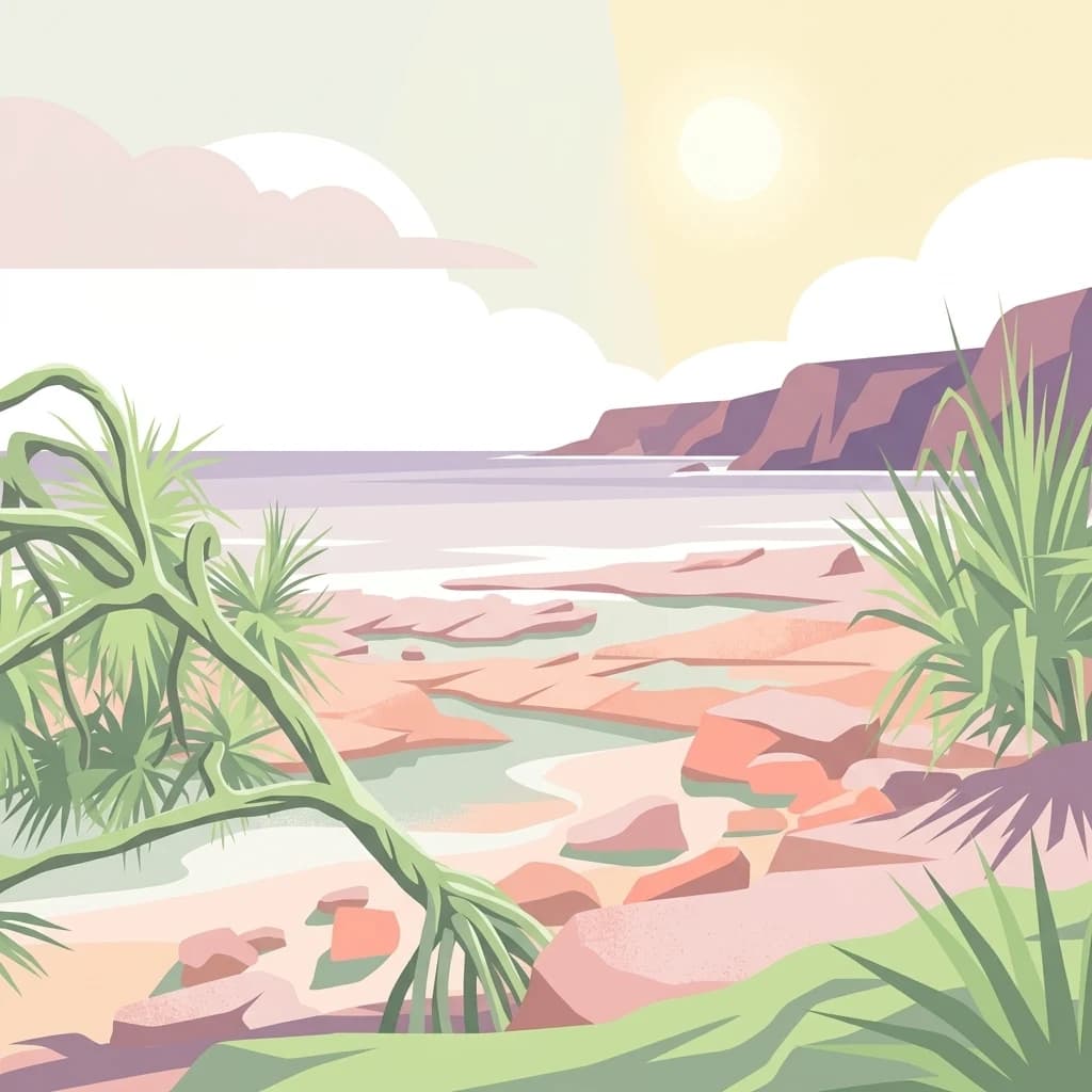
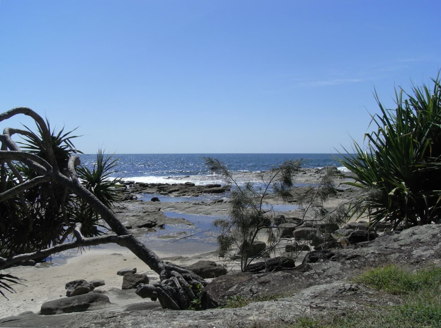
Bundjalung National Park is best known for its distinctive coffee rock formations that appear on the beaches at the northern end of the park, a rare geological feature created by cemented sand deposits that resemble dark coffee grounds. The park is also renowned for its cultural significance to the Bundjalung people, with dual-language signage at park entrances marking the continued connection between the Traditional Owners and the land. The southern Iluka peninsula features a dramatic sequence of closely spaced headlands creating crescent-shaped white sand beaches, each with wave-cut rock platforms containing vibrant marine rock pools. The park's extensive coastal heathland, while less spectacular than the subtropical rainforests found in nearby reserves, represents a increasingly rare and threatened ecosystem type in the region.

Bundjalung Welcome Sign
Sign in Bundjalung language, located near Nimbin Rocks.

Bundjalung National Park history and protected-area timeline

Bundjalung National Park was established in 1980, formalising protection for the coastal environments that had been part of the Bundjalung people's country for millennia. The park was named to recognise and honour the Bundjalung Nation as the Traditional Owners of the land, acknowledging a connection that extends back thousands of years before European colonisation of the region. The park's creation reflected a growing recognition in the late 1970s and early 1980s of the need to preserve representative coastal ecosystems along the NSW coast. A notable feature of the park's history is the presence of the RAAF bombing range in its north-eastern portion, which predates the park's gazettal and has remained active since World War II as a training facility. While such military use might seem incompatible with conservation, the range has had the unintended consequence of preserving a large area from development and human disturbance, creating an exclusion zone that has functioned as a de facto wildlife sanctuary. The park continues to work with Bundjalung Traditional Owners on joint management arrangements and cultural interpretation.

Bundjalung National Park landscape and geographic character

The physical landscape of Bundjalung National Park presents a classic NSW north coast character, with a generally low and gently undulating terrain dominated by coastal plain and dune systems. The park's beaches range from the long continuous sweep of Ten Mile Beach along the northern section to the smaller, more secluded crescent beaches tucked between headlands along the Iluka peninsula. The coffee rock formations represent one of the park's most distinctive geological features, consisting of darkly cemented sand that has been compacted into resistant layers that protrude from the beach profile. These formations are particularly evident at the northern beaches near the Black Rocks camping area. The southern portion of the park features a more dramatic topography where the Iluka peninsula presents a succession of headlands separated by small pocket beaches. Each headland terminates in wave-cut rock platforms that extend offshore, having been sculpted by the persistent action of the Tasman Sea. These platforms are interspersed with deep crevices and channels that trap water at low tide, creating the characteristic rock pool environment. The inland areas of the park are characterised by heathland vegetation that dominates the sandy soils, with occasional paperbark swamps and woodland patches in the more sheltered depressions.

Bundjalung National Park ecosystems, habitats, and plant life

The ecological character of Bundjalung National Park is defined by its coastal heathland ecosystems, a vegetation type that has become increasingly restricted across the NSW coast. The heathland is characterised by dense, low-growing shrubs including banksias, wattles, and tea-trees that are adapted to the nutrient-poor, sandy soils and the fire-prone nature of the coastal environment. This heathland supports a diverse community of bird species, including honeyeaters, fairy-wrens, and raptors that forage in the vegetation or hunt over the open heath. The park's freshwater environments include paperbark swamps and ephemeral drainage lines that provide habitat for frogs, reptiles, and aquatic birds. The marine environment along the park's coastline is equally significant, with the rock platforms at the southern headlands supporting rich communities of marine invertebrates, algae, and fish that inhabit the rock pools. The RAAF bombing range exclusion zone has inadvertently provided additional protection for terrestrial wildlife in the north-eastern portion of the park, creating an area where human disturbance has been minimal for decades.

Bundjalung National Park wildlife and species highlights

Bundjalung National Park supports a variety of wildlife adapted to its coastal heathland and beach environments. The heathland provides important habitat for numerous bird species, with honeyeaters attracted to the Banksia and Grevillea flowers, and ground-dwelling birds such as fairy-wrens and scrubfowl moving through the undergrowth. Birds of prey including wedgetail eagles and whistling kites can be seen soaring over the heathland and coastal areas, hunting for small mammals and reptiles. The park's beaches and rock platforms support marine bird species including oystercatchers and terns that feed in the intertidal zones. The rock pools along the Iluka peninsula provide habitat for a range of marine species including various fish, crabs, sea stars, and gastropod molluscs that are adapted to the constantly changing conditions of the intertidal zone. Kangaroos and wallabies are commonly observed in the more open heathland areas, particularly in the cooler parts of the day.

Bundjalung National Park conservation status and protection priorities

Bundjalung National Park contributes to the conservation of increasingly rare coastal heathland ecosystems along the NSW north coast. The protection of this coastal strip ensures the preservation of habitats for numerous plant and animal species that depend on the heathland environment, including several species of birds that are endemic to or particularly associated with this vegetation type. The park's marine environments, including the rock platforms and beach systems, are protected as part of the national park estate, preserving important coastal processes and intertidal communities. The management approach recognises the Bundjalung people's connection to the land and incorporates their cultural knowledge into conservation planning. The presence of the RAAF bombing range has created an unusual conservation outcome, with the restricted access zone having effectively protected a significant area from the development and disturbance that has affected much of the surrounding coastline.

Bundjalung National Park cultural meaning and human context

Bundjalung National Park is profoundly connected to the Bundjalung Nation, whose Traditional Owners have maintained a continuous connection to this coastal country for thousands of years. The park's name itself acknowledges this deep cultural heritage, and the park contains places and sites of significance to Bundjalung people that are protected and managed in partnership with Traditional Owners. Dual-language signage at park entrances, displaying both English and Bundjalung language, represents a visible recognition of this ongoing connection and serves as an educational tool for visitors. The cultural landscape encompasses not only ceremonial and sacred sites but also the broader patterns of use and management that the Bundjalung people have applied to this country over generations. Contemporary park management seeks to incorporate Bundjalung knowledge and perspectives, recognising that cultural heritage and natural values are interconnected in the landscape.

Top sights and standout views in Bundjalung National Park

The coffee rock formations at Ten Mile Beach represent a unique geological feature rarely found elsewhere on the Australian coast, with dark cemented sand layers creating an otherworldly appearance on the shoreline. The Iluka peninsula offers a spectacular succession of headlands and crescent beaches, with the rocky platforms providing excellent opportunities for exploring marine life in the rock pools. Woody Head camping area provides a comfortable base with cabins and facilities while maintaining a nature-focused experience close to the beach. The park's cultural significance is embodied in its Bundjalung heritage, with the dual-language signage and ongoing Traditional Owner involvement providing a meaningful connection to Aboriginal history and contemporary culture. The relative remoteness and lack of heavy visitation compared to more famous NSW national parks offers a more tranquil coastal experience.

Best time to visit Bundjalung National Park

The park can be visited year-round, though autumn and spring typically offer the most comfortable conditions for outdoor activities with mild temperatures and lower humidity than the summer months. Summer in the region can bring hot and humid weather with occasional heavy rainfall, while winter generally experiences milder temperatures but may include stronger winds and more frequent wet days. The beach and rock pool environments are most pleasant during the warmer months from late spring through early autumn, when water temperatures are suitable for swimming and the rock pools are easily accessible. Wildlife viewing in the heathland is often most productive during the early morning or late afternoon when birds are most active, regardless of the season. Those interested in cultural interpretation should check for any guided programs or events that may be scheduled through the NSW National Parks visitor centre.

Park location guide

Geography guide, regional context, and park location map for Bundjalung National Park

Bundjalung National Park park geography, regions, and map view in Australia
Understand where Bundjalung National Park sits in Australia through a broader geographic reading of the surrounding landscape, nearby location context, and its mapped position within the national park landscape.

How Bundjalung National Park fits into Australia

Australia is a constitutional monarchy and federal parliamentary democracy comprising six states and ten territories. With a population of nearly 28 million, it is one of the world's most urbanised countries, with most people concentrated on the eastern seaboard. The country has a high Human Development Index and is known for its cultural diversity, ancient Aboriginal heritage, and unique wildlife.

Wider geography shaping Bundjalung National Park in Australia

Australia occupies the entire Australian continent, the island of Tasmania, and numerous smaller islands. It is the world's flattest and driest inhabited continent, featuring vast deserts in the interior (the Outback), tropical rainforests along the eastern coast, and a coastline bordering the Indian and Pacific Oceans.

Map view of Bundjalung National Park

Use this park location map to pinpoint Bundjalung National Park in Australia, understand its exact geographic position, and read its mapped placement within the surrounding landscape more clearly.

Pigeon | © OpenStreetMap contributors

Location context for Bundjalung National Park

New South Wales

Explore the diverse protected landscapes of New South Wales' north coast, including pristine beaches and rare heathland ecosystems.

Bundjalung National Park: Coastal Scenery, Heathland, and Coffee Rock Landscapes
Explore Bundjalung National Park's diverse landscapes visually, highlighting its distinctive coffee rock formations, vast coastal heathland, and the dynamic wave-cut platforms of the Iluka peninsula. These images serve as an essential atlas, providing critical insight into the park's unique protected ecosystems and geographic features within this significant New South Wales conservation area.

Bundjalung Welcome Sign

Bundjalung National Park Woody Head Lookout

Park atlas

Compare Connected Protected Landscapes and Regional Park Geography Across the NSW North Coast

Explore Other Coastal Protected Areas and National Parks Near Bundjalung National Park
After exploring Bundjalung National Park, continue mapping the unique coastal heathland and coffee rock formations by examining other national parks and protected areas across the NSW North Coast. This regional view allows users to compare adjacent conservation landscapes, trace the geographic spread of similar coastal ecosystems, and discover how connected reserves contribute to Australia's broader park atlas.
National parkNew South Wales

Broadwater National Park: Protected Coastal Wilderness and Geographic Atlas Entry

Coastal rainforest, wetlands, migratory bird habitats, and unique geology.

Broadwater National Park presents a rich protected-area identity within New South Wales, Australia, characterized by its diverse mosaic of coastal rainforests, freshwater swamps, and eucalyptus woodlands. This national park is notable for its unique Coffee Rocks geological formation and its crucial role as a refuge for migratory birds, offering a compelling focus for geographic exploration and atlas-based understanding. Discover the mapped extent and ecological significance of this significant protected landscape.

Area
421 km²
Established
1974
IUCN
II
National parkNew South Wales

Fortis Creek National Park: A Protected Valley Landscape in Northern New South Wales

Mapped protected area boundaries and regional geographic context.

Fortis Creek National Park preserves a significant valley and creek environment in northern New South Wales, Australia. Established in 1997, it serves as a protected area safeguarding representative riparian and valley ecosystems. The park's landscape, characterized by draining creek corridors toward the Clarence River basin, offers a glimpse into the natural terrain of eastern Australia, distinct from more commonly known coastal or alpine regions.

Area
78 km²
Established
1997
IUCN
II
Scope
Terrestrial
National parkNew South Wales

Mount Pikapene National Park: Protected Area with Tall Moist Rainforests in New South Wales

Explore the mapped terrain and regional geography of this national park.

Mount Pikapene National Park is a key protected area in New South Wales, recognized for its distinctive tall moist rainforests, a rare ecological community within the Northern Tablelands. The park's landscape features hilly terrain, with Big Sugarloaf marking its highest point at 525 meters. As a national park managed by the National Parks and Wildlife Service, it safeguards significant forest ecosystems and offers valuable insights into the protected geography of eastern Australia's natural heritage.

Area
26.3 km²
Established
1999
IUCN
II
National parkNew South Wales

Mount Jerusalem National Park: Ancient Volcanic Terrain and Protected Landscape Discovery in New South Wales

Explore its mapped geography and Albert's lyrebird habitat.

Mount Jerusalem National Park stands as a key protected area within the dramatic landscape of New South Wales. Situated on the eroded outer rim of the ancient Tweed Caldera, the park showcases distinctive volcanic terrain shaped over millions of years. Its protected boundaries encompass vital habitats, notably supporting significant populations of Albert's lyrebird, and contribute to the watershed dynamics of the Tweed, Brunswick, and Richmond River systems, offering a rich focus for geographic and landscape exploration.

Area
52 km²
Established
1995
IUCN
II
National parkNew South Wales

Toonumbar National Park: Australia's Gondwanan Rainforest Heritage and Volcanic Geography

Explore the mapped protected landscape and ancient ecosystems of this New South Wales national park.

Toonumbar National Park represents a significant component of the Gondwana Rainforests of Australia World Heritage Site, offering a profound look into ancient forest ecosystems. Its landscape is sculpted by ancient volcanic activity, creating dramatic peaks and fertile terrain that supports remarkable biodiversity. This protected area in New South Wales provides critical habitat for numerous threatened species within its extensive subtropical and temperate rainforests, making it a key destination for understanding Australia's natural heritage and geographic context.

Area
149.1 km²
Established
1995
IUCN
II
National parkNorthern Tablelands

Chaelundi National Park: Landmark Old-Growth Forest Protection in the Northern Tablelands

Mapped protected area landscape and regional geography.

Chaelundi National Park stands as a vital component of protected natural landscapes on Australia's Northern Tablelands. This national park is celebrated for its extensive old-growth forest, a direct result of significant environmental legal battles that highlighted its ecological importance. With declared wilderness areas covering thousands of hectares, the park offers a substantial glimpse into the region's conservation values and the complex interplay between landscape, law, and protected land status, providing rich context for geographic exploration.

Area
191.74 km²
Established
1997
IUCN
II
National parkNew South Wales

Yabbra National Park: A Protected Natural Landscape within New South Wales' Northern Rivers Region

Explore mapped terrain and regional park geography.

Gain insight into Yabbra National Park, a conservation area covering 88.9 square kilometers of undulating terrain in New South Wales. This protected landscape provides a detailed look at regional Australian geography, focusing on its mapped boundaries and natural features. Understand its role as a national park within the Northern Rivers region, offering a foundation for structured geographic discovery and landscape context.

Area
88.9 km²
Established
1999
IUCN
II
National parkNew South Wales

Ulidarra National Park: New South Wales Strict Nature Reserve and Wildlife Sanctuary

Explore its elevation range, mapped forest ecosystems, and protected habitats.

Ulidarra National Park represents a small yet ecologically vital protected area within New South Wales, Australia. Classified as a strict nature reserve, it preserves significant old-growth eucalyptus forests and intact rainforests across a notable elevation gradient. The park is recognized for providing critical habitat for species like koalas and various native birds, making it a key site for understanding regional wildlife diversity and protected landscape conservation through detailed mapping and geographic context.

Area
6.8 km²
Established
1999
IUCN
Ia

Common questions about visiting, size, designation, and location context for Bundjalung National Park

Bundjalung National Park FAQs for park facts, access, geography, and protected area context
Find quick answers about Bundjalung National Park, including protected-area facts, park geography, trail and visitor context, and how the park fits into its surrounding country and regional landscape.
MoriAtlas Explorer

Continue Your Protected Areas Search Across the Global Atlas

Deepen your exploration by continuing the structured search for national parks and protected areas worldwide. Utilize the comprehensive filtering capabilities to compare different conservation landscapes and refine your understanding of global park geography. Discover more about the distribution and characteristics of protected natural areas.

Global natural geography