Mori Atlas logo
National parkJigme Dorji National Park

Discover the vast geography and diverse ecosystems of this unique Himalayan national park.

Jigme Dorji National Park: Bhutan's Premier Protected Landscape and Map Atlas

Jigme Dorji National Park represents a monumental protected area in the Kingdom of Bhutan, established to preserve its extraordinary biodiversity and dramatic Himalayan geography. This national park spans over 4,300 square kilometers, encompassing a remarkable range of altitudes and climate zones, from subtropical foothills to permanent snow fields. Users can explore its mapped boundaries and understand its role as a crucial sanctuary for iconic wildlife and a vital part of Bhutan's natural and cultural heritage.

Himalayan national parkMountain wildernessSnow leopard habitatGlacial landscapeCultural heritage siteAlpine ecosystems

Jigme Dorji National Park

National park

Park overview

Structured park overview, official facts, and landscape profile for Jigme Dorji National Park

Jigme Dorji National Park park facts, protected area profile, and essential visitor context
Review the core facts for Jigme Dorji National Park, including designation, size, terrain, visitor scale, habitats, and operating context in one park-focused overview.

About Jigme Dorji National Park

Jigme Dorji National Park represents one of Bhutan's most significant conservation achievements, protecting a vast tract of the Himalayan kingdom's northern wilderness. Established in 1974, the park spans approximately 4,316 square kilometers, making it the second-largest national park in Bhutan. The protected area encompasses an extraordinary range of altitudes from 1,400 meters in the lower valleys to over 7,000 meters in the high peaks, which allows it to include all three of Bhutan's climate zones within a single boundary. This vertical diversity creates habitat conditions for remarkable biodiversity, from subtropical broadleaf forests through temperate conifer zones to alpine meadows and permanent snow. The park's territory covers virtually all of Gasa District along Bhutan's northern border, extending into the northern reaches of Thimphu, Paro, Punakha, and Wangdue Phodrang Districts. Within this rugged terrain live approximately 6,500 people in about 1,000 households, whose traditional subsistence agriculture and animal husbandry practices have shaped the landscape for generations. The park has been designated as a tentative site on Bhutan's Tentative List for potential UNESCO World Heritage inscription, reflecting its outstanding universal value.

Quick facts and research context for Jigme Dorji National Park

Jigme Dorji National Park occupies almost the entire Gasa District along Bhutan's northern border, making it one of the most remote and rugged protected areas in the kingdom. The park's territory extends across five districts and encompasses dramatic Himalayan terrain including high mountain peaks, glacial valleys, and pristine river systems. Its location at the intersection of temperate and alpine zones gives it extraordinary ecological significance, supporting both subtropical and alpine biodiversity within a single protected landscape. The park serves as a critical watershed for major river systems including the Mo Chhu, Wangdi Chhu, and Pa Chhu, which originate from glacial lakes within its boundaries. Jigme Dorji is recognized as a tentative UNESCO World Heritage Site.

Park context

Deeper park guide and search-rich context for Jigme Dorji National Park

Jigme Dorji National Park history, landscape, wildlife, and travel context
Explore Jigme Dorji National Park through its history, landscape character, ecosystems, wildlife, conservation priorities, cultural context, and seasonal travel timing in a structured park guide built for atlas discovery and search intent.

Why Jigme Dorji National Park stands out

Jigme Dorji National Park is renowned for its exceptional biodiversity and dramatic Himalayan scenery. It provides sanctuary for 37 known mammal species including several of the world's most endangered animals: the snow leopard, Bengal tiger, clouded leopard, red panda, and the unique Bhutan takin, which is the nation's national animal. The park is also significant for its cultural landscape, encompassing sacred mountain peaks worshipped as homes of local deities, and historic fortresses including Lingshi Dzong and Gasa Dzong. The park contains some of Bhutan's most notable glaciers, including Thorthormi, Luggye, and Teri Kang, which have been the focus of significant glacial lake outburst flood mitigation efforts. This combination of ecological significance, cultural heritage, and geological importance makes Jigme Dorji one of Bhutan's most important protected areas.

Jigme Dorji National Park history and protected-area timeline

Jigme Dorji National Park was established in 1974, representing one of Bhutan's earliest efforts to formally protect its natural heritage through national park designation. The park was named in honor of the late King Jigme Dorji Wangchuck, who reigned from 1952 to 1972 and is remembered for his pioneering role in Bhutan's development and environmental stewardship. At its founding, the park covered a substantial territory that reflected Bhutan's commitment to maintaining its forest cover and protecting its unique Himalayan ecosystems. The establishment came during a period when Bhutan was beginning to formalize its approach to protected area management, drawing on the successful model of Royal Manas National Park established earlier. Over the decades since its creation, Jigme Dorji has faced evolving challenges including the impacts of climate change on its glacial systems and the need to balance conservation with the livelihoods of resident communities. The park's listing as a tentative site for UNESCO World Heritage status reflects its recognition as a place of outstanding cultural and natural significance.

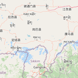
Jigme Dorji National Park landscape and geographic character

The landscape of Jigme Dorji National Park is defined by the dramatic topography of the Bhutanese Himalayas, characterized by steep mountain ridges, deep river valleys, and towering peaks that exceed 7,000 meters. The park encompasses portions of some of Bhutan's most sacred mountains, including Mount Jomolhari and Mount Jitchu Drake, which rise as imposing sentinels along the border with Tibet. These peaks are surrounded by extensive glacial terrain, with glaciers descending from the high permanent snowfields into the valleys below. The park contains numerous glacial lakes, some of which have been the focus of concern due to their potential for dangerous outburst floods. The river systems originating within the park, including the Mo Chhu, Wangdi Chhu, and Pa Chhu, carve through the terrain creating verdant valleys that support human settlement and diverse vegetation. The landscape transitions dramatically across the park's elevation gradient, from the subtropical forests of the lower foothills through the temperate zones dominated by conifers and broadleaf species to the sparse alpine vegetation and rock and ice of the high peaks.

Jigme Dorji National Park ecosystems, habitats, and plant life

The ecological diversity of Jigme Dorji National Park is extraordinary, reflecting its position spanning multiple climate zones and its extraordinary altitudinal range. The park supports a rich variety of forest types, from subtropical broadleaf forests in the lower elevations through temperate mixed forests to subalpine conifer forests and alpine meadows at higher elevations. The diverse habitats created by this vertical zonation support remarkable plant and animal diversity, making the park one of Bhutan's most biologically significant protected areas. The park is distinguished as the only place in Bhutan where all four of the nation's national symbols coexist: the takin (national animal), blue poppy (national flower), raven (national bird), and cypress (national tree). This concentration of symbolic species reflects the broader ecological richness of the area and the importance of protecting this Himalayan wilderness.

Jigme Dorji National Park wildlife and species highlights

Jigme Dorji National Park provides critical habitat for at least 37 known mammal species, including a remarkable concentration of endangered and threatened animals. The park is one of the most important strongholds for the snow leopard in the Himalayas, supporting a population of this elusive and iconic big cat. The endangered Bengal tiger also occurs within the park's boundaries, while the clouded leopard represents another significant predator species. The park protects the Bhutan takin, the distinctive goat-antelope that serves as Bhutan's national animal and is found nowhere else in such concentrated populations. Other notable mammals include the red panda, Himalayan black bear, bharal (Himalayan blue sheep), black musk deer, Himalayan serow, sambar deer, and the Himalayan goral. The park also supports more than 300 bird species, making it an important area for avian diversity in the Himalayan region. The presence of the spotted linsang and Ussuri dhole adds to the remarkable carnivore community within the protected area.

Jigme Dorji National Park conservation status and protection priorities

Jigme Dorji National Park holds significant conservation importance both for Bhutan and for the broader Himalayan region. The park protects critical habitat for numerous endangered species including snow leopards, Bengal tigers, and red pandas, making it essential for the survival of these threatened animals. Its location at the headwaters of major river systems gives it importance beyond its boundaries, as the forests and wetlands within the park help regulate water flow and protect watersheds that support downstream communities. The park's glaciers, while being impacted by climate change and contributing to the threat of glacial lake outburst floods, also represent important water resources for the region. Conservation efforts within the park include monitoring of glacial lake levels and efforts to reduce flood risks, as well as programs to manage human-wildlife conflict and support sustainable livelihoods for resident communities. The park's designation as a tentative UNESCO World Heritage Site reflects its recognition as an area of outstanding universal value requiring international protection.

Jigme Dorji National Park cultural meaning and human context

Jigme Dorji National Park contains a rich cultural landscape shaped by centuries of human habitation and spiritual significance. The sacred mountains of Mount Jomolhari and Mount Jitchu Drake are worshipped as the homes of local deities, reflecting the deep spiritual connection between the people of this region and the Himalayan landscape. The historic fortresses of Lingshi Dzong and Gasa Dzong stand as testaments to the region's importance in Bhutan's history, serving both as religious centers and defensive structures. These dzongs, built in traditional Bhutanese architectural style, continue to hold cultural significance for local communities. The rivers flowing through the park, including the Mo Chhu, Wangdi Chhu, and Pa Chhu, originate from glacial lakes in the high mountains and have supported human settlement in the valleys below for generations. The approximately 6,500 people living within the park's boundaries maintain traditional lifestyles centered on subsistence agriculture and animal husbandry, living in harmony with the landscape that has sustained their ancestors.

Top sights and standout views in Jigme Dorji National Park

Jigme Dorji National Park offers a unique combination of Himalayan wilderness, exceptional biodiversity, and cultural heritage within a single protected area. The opportunity to observe snow leopards in their natural habitat makes this one of the world's premier destinations for wilderness trekking and wildlife viewing. The park's dramatic scenery, with its towering peaks, glacial valleys, and pristine rivers, provides breathtaking backdrops for exploration. The cultural sites within the park, including sacred mountains and historic dzongs, offer insights into Bhutan's rich heritage and spiritual traditions. The presence of Bhutan's four national symbols within a single protected area demonstrates the park's extraordinary ecological significance. For those interested in geology and climate change, the park's glaciers and glacial lakes provide important insights into Himalayan glacial dynamics and the challenges of environmental change.

Best time to visit Jigme Dorji National Park

The most favorable time to visit Jigme Dorji National Park is during the spring months of March through May and the autumn months of September through November. Spring brings moderate temperatures and the blooming of rhododendrons and other flowering plants that add color to the landscape, while autumn typically offers clear skies and excellent visibility of the mountain peaks. The summer monsoon season from June to August brings heavy rainfall to the lower elevations and can make trekking difficult, though the high alpine areas may remain accessible. Winter months from December to February bring cold temperatures and snow to higher elevations, which can limit access to some areas but offer the opportunity to experience the park's serene winter character. Visitors planning treks should be aware that the park's high elevation and remote location require proper preparation and should consider working with local guides familiar with the terrain and conditions.

Park location guide

Geography guide, regional context, and park location map for Jigme Dorji National Park

Jigme Dorji National Park park geography, regions, and map view in Bhutan
Understand where Jigme Dorji National Park sits in Bhutan through a broader geographic reading of the surrounding landscape, nearby location context, and its mapped position within the national park landscape.

How Jigme Dorji National Park fits into Bhutan

Bhutan, officially the Kingdom of Bhutan, is a landlocked country in South Asia situated in the Eastern Himalayas. With a population of approximately 727,000 and an area of 38,394 km², it is a constitutional monarchy ruled by the Wangchuck dynasty. The country is known for its Gross National Happiness philosophy, pristine mountain landscapes, and commitment to preserving its Buddhist culture.

Wider geography shaping Jigme Dorji National Park in Bhutan

Bhutan is located in the Eastern Himalayas in South Asia, bordered by China to the north and northwest and India to the south and southeast. The country's terrain is predominantly mountainous with steep valleys, ranging from elevations around 100 meters in the southern foothills to peaks exceeding 7,000 meters in the northern highlands. The major river systems flow southward from the Himalayas into India's Brahmaputra basin.

Map view of Jigme Dorji National Park

Use this park location map to pinpoint Jigme Dorji National Park in Bhutan, understand its exact geographic position, and read its mapped placement within the surrounding landscape more clearly.

Pigeon | © OpenStreetMap contributors

Location context for Jigme Dorji National Park

Gasa DistrictParo DistrictPunakha DistrictThimphu DistrictWangdue Phodrang District
Park atlas

Browse mapped geography and compare conservation landscapes surrounding this iconic Bhutanese wilderness.

Discover Other Himalayan National Parks and Protected Areas Near Jigme Dorji National Park
Explore a curated list of national parks and protected areas geographically close to Jigme Dorji National Park, spanning diverse Himalayan ecosystems and significant cultural landscapes. Compare adjacent conservation efforts and trace the regional spread of protected terrain, offering valuable context for atlas-style discovery across the Bhutanese Himalayas.
Wildlife reserveBhutan

Motithang Takin Preserve: Bhutan Wildlife Reserve with Unique Protected Landscape Context

Explore the mapped geography and national animal sanctuary.

The Motithang Takin Preserve offers a unique glimpse into Bhutan's dedication to its national animal, the takin. This wildlife reserve, located near the capital city, provides a defined protected area where the distinctive goat-antelope thrives. By examining the preserve's mapped boundaries and its forested terrain, users gain insight into Bhutan's approach to conservation and the cultural significance of this iconic species within the Himalayan landscape.

Area
0.034 km²
IUCN
IV
Wildlife reserveBhutan

Phibsoo Wildlife Sanctuary: Bhutan's Wildlife Reserve Atlas and Geographic Identity

Mapping the protected landscape and natural terrain of this Bhutanese sanctuary.

Delve into the specifics of Phibsoo Wildlife Sanctuary, a protected wildlife reserve situated within the geographic expanse of Bhutan. This park detail page focuses on its identity as a conservation landscape, offering insights into its mapped terrain and its significance within the broader regional geography of the Eastern Himalayas. Understand the protected boundaries and the unique natural context that Phibsoo Wildlife Sanctuary represents.

Area
268.93 km²
Established
2009
IUCN
IV
National parkAlipurduar district

Jaldapara National Park: India's Premier Grassland and Rhino Conservation Landscape

Explore mapped boundaries and savanna terrain in Alipurduar district.

Jaldapara National Park is a protected national park in India's Alipurduar district, celebrated for its expansive rolling grasslands and significant population of Indian one-horned rhinoceros. This protected area showcases a distinctive savanna landscape, an unusual feature among Indian national parks, interspersed with riverine forests. Its elevation of 61 meters above sea level positions it at the edge of the Eastern Himalayas, offering a unique geographic setting for understanding regional biodiversity and conservation efforts.

Area
216.51 km²
Established
2014
IUCN
II
National parkBhutan

Phrumsengla National Park: Protected Landscape and Geographic Context in Bhutan

Explore mapped boundaries and diverse Himalayan terrain.

Phrumsengla National Park serves as a vital protected area within Bhutan, characterized by its extensive altitudinal range and varied landscape. Spanning from subtropical valleys to alpine zones, the park showcases a remarkable transition of ecosystems, including significant old-growth fir forests. Its location and unique geographic features make it an important component of any study of the region's protected lands and Himalayan geography, offering rich data for atlas exploration and understanding natural landscapes.

Area
905.05 km²
Established
1998
IUCN
II
Relief
Mountain
National parkDarjeeling District

Singalila National Park: A High-Altitude Protected Landscape on the Eastern Himalayan Ridge

Explore mapped terrain and alpine park geography in Darjeeling District.

Singalila National Park represents a crucial protected natural landscape within the Eastern Himalayas, located in India's Darjeeling District. Defined by its dramatic ridgeline that ascends to over 4,000 meters, the park offers a unique alpine environment with stunning panoramic views. Its designation as a national park highlights its importance for conservation and its role in the regional geographic atlas. Discover the mapped boundaries and ecological context of this remarkable mountain wilderness, from its dense forests to its open alpine meadows.

Area
78.6 km²
Established
1986
IUCN
II
Wildlife reserveTrashigang District

Sakteng Wildlife Sanctuary: Protected Area and Wildlife Reserve in Bhutan's Trashigang District

Mapping the mountainous terrain and unique temperate ecosystems.

Sakteng Wildlife Sanctuary is a vital protected area in eastern Bhutan, recognized as a wildlife reserve. Spanning approximately 742 square kilometers within Trashigang District, it features a dramatic mountainous terrain characterized by steep valleys and alpine meadows. The sanctuary's landscape transitions from forested slopes to subalpine conifer forests, representing Bhutan's easternmost temperate ecosystems and offering rich geographic context for atlas exploration.

Area
742.46 km²
Established
2003
IUCN
IV
National parkWest Garo Hills district

Nokrek National Park: Protected Mountain Landscape and Regional Geography

Explore its mapped boundaries and diverse natural terrain.

Nokrek National Park is a vital protected mountain wilderness situated in the West Garo Hills district, Meghalaya, India. Its rugged terrain, characterized by ancient geological formations and dense evergreen forests, supports remarkable biodiversity. As a key component of the Nokrek Biosphere Reserve, it offers a unique glimpse into the region's ecological significance, serving as an important source for major rivers and a sanctuary for diverse flora and fauna.

Area
47.48 km²
Established
1986
IUCN
II
Relief
Mountain
National parkAssam

Orang National Park: Assam's Key Floodplain Protected Landscape

Explore mapped boundaries and terrain context of this national park.

Orang National Park, located in Assam, India, is a significant protected area celebrated for its unique alluvial floodplain terrain and critical role in conservation. This national park provides a focused atlas-style view of grassland and wetland ecosystems, essential habitats for iconic species like the great Indian one-horned rhinoceros and Bengal tiger. Its geographical setting along the Brahmaputra River contributes to a dynamic landscape, offering rich context for understanding protected area distribution and regional natural features. Discover the mapped boundaries and ecological significance of this important protected land.

Area
78.81 km²
Established
1985
IUCN
II
Relief
Lowland

Common questions about visiting, size, designation, and location context for Jigme Dorji National Park

Jigme Dorji National Park FAQs for park facts, access, geography, and protected area context
Find quick answers about Jigme Dorji National Park, including protected-area facts, park geography, trail and visitor context, and how the park fits into its surrounding country and regional landscape.
MoriAtlas Explorer

Continue Your Protected Areas Search Across the Global Atlas

Deepen your exploration by continuing the structured search for national parks and protected areas worldwide. Utilize the comprehensive filtering capabilities to compare different conservation landscapes and refine your understanding of global park geography. Discover more about the distribution and characteristics of protected natural areas.

Global natural geography