Mori Atlas logo
National parkNokrek National Park

Explore the mapped boundaries and unique terrain of this critical biodiversity hotspot.

Nokrek National Park: Protected Mountain Landscape Atlas & Geography in West Garo Hills district

Nokrek National Park represents a significant protected mountain wilderness located within the West Garo Hills district of Meghalaya, India. This protected area serves as a core component of the Nokrek Biosphere Reserve, recognized for its exceptional biodiversity and unique citrus genetic resources. Users can explore its rugged, hilly terrain, ancient geological formations, and lush evergreen forests, gaining a deeper understanding of its geographic context and ecological importance within the broader atlas.

National ParkBiosphere ReserveMountain ForestPrimate HabitatCitrus Gene SanctuaryImportant Bird Area

Nokrek National Park

National park

Park overview

Structured park overview, official facts, and landscape profile for Nokrek National Park

Nokrek National Park park facts, protected area profile, and essential visitor context
Review the core facts for Nokrek National Park, including designation, size, terrain, visitor scale, habitats, and operating context in one park-focused overview.

About Nokrek National Park

Nokrek National Park occupies a special place in India's protected area network as the westernmost national park in the country and the core zone of the Nokrek Biosphere Reserve in Meghalaya. The park's establishment in 1986 reflected growing recognition of the region's extraordinary ecological significance, where the convergence of tropical and subtropical ecosystems creates exceptional biodiversity. The UNESCO designation of the Nokrek Biosphere Reserve in 2009 elevated the area's conservation profile internationally, acknowledging its role as a repository of genetic resources and a model for community-inclusive conservation. The park's terrain is characterized by steep ridges and valleys carved from ancient Precambrian crystalline rocks, with the Nokrek ridge forming a prominent topographic feature visible from the surrounding villages. The drainage system originating from the Nokrek Range feeds the Simsang River, which sustains agricultural communities across the Garo Hills before flowing into Bangladesh. The park's forests range from moist semi-evergreen to evergreen formations, creating a complex habitat matrix that supports remarkable species diversity. Management of the park involves coordination between the State Forest Department and local communities, particularly for the buffer and transition zones spanning over 772 square kilometers where community land ownership shapes conservation outcomes.

Quick facts and research context for Nokrek National Park

Nokrek National Park spans 47.48 square kilometers in West Garo Hills district, Meghalaya, at approximately 25°32′N 90°7′E. The park was established in 1986 and designated as a UNESCO Biosphere Reserve in 2009. It is managed by the East and West Garo Hills Wildlife Division of the Meghalaya State Forest Department, with administrative headquarters in Tura. The park contains the mother germplasm of Citrus indica, the only known wild citrus species in India, leading to the establishment of a National Citrus Gene Sanctuary within the reserve. An Eco-Sensitive Zone covering 224 square kilometers was notified around the park in July 2023.

Park context

Deeper park guide and search-rich context for Nokrek National Park

Nokrek National Park history, landscape, wildlife, and travel context
Explore Nokrek National Park through its history, landscape character, ecosystems, wildlife, conservation priorities, cultural context, and seasonal travel timing in a structured park guide built for atlas discovery and search intent.

Why Nokrek National Park stands out

Nokrek National Park is best known for its exceptional biodiversity significance, particularly its population of seven primate species including the Western Hoolock gibbon and the rare stump-tailed macaque. The park gained international scientific importance with the discovery of Citrus indica, the wild ancestor of cultivated citrus varieties, within its boundaries. It serves as a critical habitat for Asian elephants and hosts eight species of felids ranging from Bengal tigers to marbled cats. As an Important Bird Area, the park protects populations of Oriental Pied Hornbills, Great Pied Hornbills, and serves as a migratory corridor for Black Storks and Amur Falcons. The Nokrek region is also notable as the geological source of the Simsang River, a vital watercourse for the Garo Hills ecosystem.

Male Western Hoolock Gibbon
Wild male Western Hoolock gibbon (Hoolock hoolock) near Sonja Wildlife Rescue Centre, West Garo Hills, Meghalaya, India.

Nokrek National Park history and protected-area timeline

Nokrek National Park was formally established in 1986 as part of India's expanding network of protected areas during the country's intensified conservation efforts in the latter decades of the twentieth century. The creation of the park responded to the need to protect the unique biodiversity of the Garo Hills region, which had faced increasing pressures from shifting cultivation and resource extraction. The designation as a biosphere reserve followed in 2009 when UNESCO added the Nokrek Biosphere Reserve to its World Network, recognizing the area's significance as a conservation model integrating protection, sustainable use, and community participation. The discovery of Citrus indica, the wild citrus species, within the Nokrek Range in the late twentieth century prompted the establishment of the National Citrus Gene Sanctuary-cum-Biosphere Reserve, further cementing the area's importance for agricultural science and food security. More recently, the Government of India notified an Eco-Sensitive Zone extending 224 square kilometers around the park in July 2023, introducing stricter environmental regulations on development activities in the surrounding area.

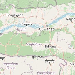
Nokrek National Park landscape and geographic character

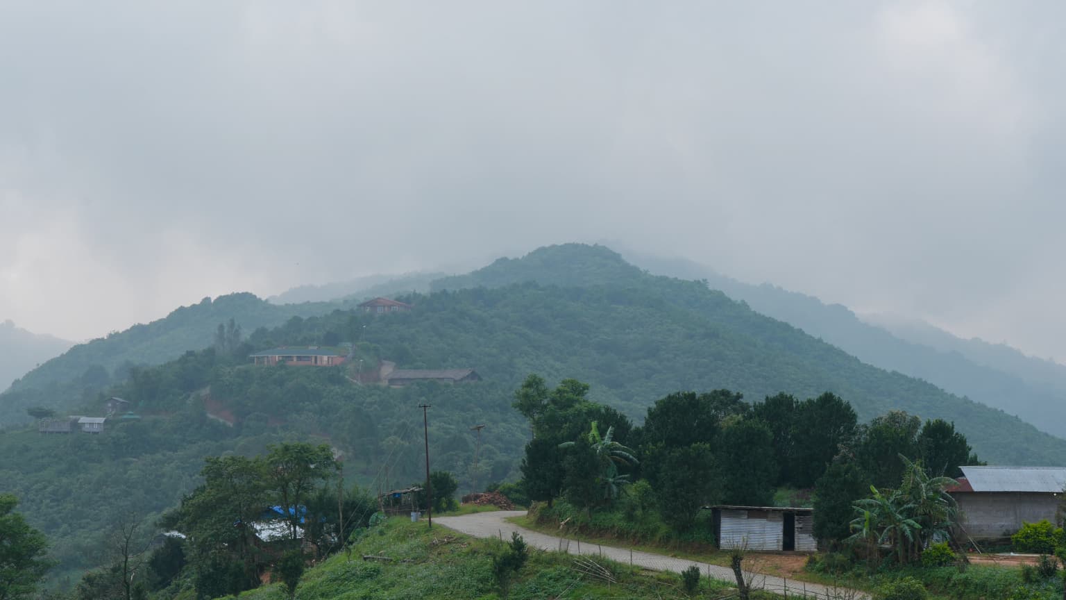
The physical landscape of Nokrek National Park is dominated by rugged hilly terrain formed through Precambrian geological processes. The underlying bedrock consists primarily of metamorphic rocks including gneiss, granulite, migmatite, and amphibolite, with notable banded iron formations indicating the region's ancient geological history. These crystalline rocks are intruded by basic and ultra-basic bodies that contribute to the mineral diversity of the area. The soil composition throughout most of the reserve is red loam, though local variations include clayey to sandy loam textures. The soils are characterized by high organic matter and nitrogen content, though they are deficient in phosphate and potash, supporting the lush forest growth that covers the area. The Nokrek Range forms the central spine of the park, with the ridge providing dramatic views from villages like Daribokgre at its base. Scattered throughout the park are notable geological features including rock outcrops and seasonal waterfalls such as Wachi Dare and Simsang Dare. The drainage network fed by the Nokrek Range includes numerous streams that eventually contribute to the Simsang River system.

Orange Orchard, Daribokgre
Orange orchard in Daribokgre, East Garo Hills, Meghalaya, India.

Nokrek National Park ecosystems, habitats, and plant life

The natural ecosystems of Nokrek National Park reflect the park's position in a biogeographic transition zone between tropical and subtropical formations. The vegetation consists primarily of moist semi-evergreen and evergreen forests with a dense canopy of tall, lush green trees creating a multi-layered structure. The forest ecosystem supports exceptional biodiversity, with particular significance for citrus genetic resources. The discovery of Citrus indica, locally known as Mungkin Narang, within the Nokrek Range represents a scientific milestone as the only wild citrus species recorded in India. This finding led to the establishment of the National Citrus Gene Sanctuary, protecting the genetic diversity of citrus cultivars with global implications for agriculture. The park's location within the Garo Hills region places it at a biodiversity hotspot recognized for its endemism and species richness. The ecosystem services provided by the Nokrek forests extend beyond species protection to include watershed function, with the range serving as the source area for rivers critical to downstream communities in both India and Bangladesh.

Nature and habitats in Nokrek National Park
Natural habitats and ecological features found across Nokrek National Park.

Nokrek National Park wildlife and species highlights

Nokrek National Park supports remarkable wildlife diversity, particularly notable for its primate community comprising seven species. The Western Hoolock gibbon is the most commonly observed primate, with its distinctive calls echoing through the forest canopy across the Nokrek area. The rare stump-tailed macaque frequents the main trek to the peak, while the pig-tailed macaque also occurs within the park boundaries. The park holds significant conservation importance for large mammals, with the Asian elephant presence confirmed through camera trap recordings by the State Forest Department. The gaur, India's largest wild cattle, and the common leopard inhabit the park's forests. The Nokrek region historically generated interest due to an unconfirmed report of red panda in the 1960s, though no verified sightings have occurred since. The park claims a remarkable diversity of eight cat species, from the Royal Bengal tiger to the marbled cat, though the current status of tigers remains uncertain. The reptile fauna includes numerous snake species such as the Burmese python, king cobra, spectacled cobra, and various non-venomous species including vine snakes and flying snakes. As an Important Bird Area, Nokrek protects species including Oriental and Great Pied Hornbills, white-cheeked hill partridge, kalij pheasant, grey peacock-pheasant, and seasonal visitors like black storks and Amur falcons during migration.

Nokrek National Park conservation status and protection priorities

Nokrek National Park represents a cornerstone of conservation in northeastern India, serving as both a biodiversity repository and a model for integrated landscape conservation through its biosphere reserve designation. The UNESCO recognition in 2009 acknowledged the park's successful integration of strict protection in the core zone with sustainable community use in the buffer and transition zones spanning approximately 772 square kilometers. The protection of Citrus indica germplasm has international significance, as the National Citrus Gene Sanctuary provides genetic material crucial for citrus breeding programs worldwide. The 2023 notification of the Eco-Sensitive Zone introduced additional regulatory framework, prohibiting new hotel construction within one kilometer of the park boundary, commercial mining, stone quarrying, major hydroelectric projects, and discharge of effluents into water bodies. Conservation challenges include managing community lands in the buffer zone where the State Forest Department has limited authority, balancing tourism with protection, and addressing uncertainties regarding flagship species like the Bengal tiger. The park's Important Bird Area status further underscores its role in protecting migratory species and endemic bird populations.

Nokrek National Park cultural meaning and human context

The Nokrek National Park exists within the cultural landscape of the Garo people, an indigenous community whose traditional territories encompass the Garo Hills region of Meghalaya. The park's name itself derives from Garo language, reflecting the deep historical connection between the community and this mountain landscape. Notable sites within the park carry cultural significance, including Matcha Nokpante, described as meeting places of tigers, indicating traditional understanding of the park's wildlife. The village of Daribokgre serves as the last settlement before the northern aspect of the park and functions as a base camp for researchers, tourists, and travelers, demonstrating the ongoing relationship between local communities and the protected area. Similarly, the southern aspect of the park can be accessed through villages like Anchigre and Dana Adugre, where traditional land use practices continue alongside conservation efforts. The community ownership of lands in the buffer and transition zones represents a distinctive aspect of the park's management model, where local communities retain significant authority over land use decisions outside the core protected area.

Top sights and standout views in Nokrek National Park

Nokrek National Park offers visitors access to one of India's least-explored wilderness areas with exceptional biodiversity, dramatic mountain scenery, and cultural experiences in Garo villages. The trek to Nokrek Peak provides sweeping views across the Garo Hills landscape, while the forest trails offer opportunities to observe Western Hoolock gibbons, Asian elephants, and over 150 bird species. The park's botanical significance centered on Citrus indica makes it a destination of interest for those curious about the origins of citrus cultivation. The waterfall trails to Wachi Dare and Simsang Dare showcase the park's hydrological beauty. Community-managed homestays in Daribokgre and surrounding villages provide authentic cultural immersion and support local livelihoods. The 2023 Eco-Sensitive Zone regulations ensure that development around the park remains controlled, preserving its wild character.

Best time to visit Nokrek National Park

The optimal time to visit Nokrek National Park corresponds to the cooler, drier months from October through March, when weather conditions are most favorable for trekking and wildlife observation. The post-monsoon period brings clearer skies and reduced forest density, improving visibility for birdwatching and primate viewing. November to February offers the most comfortable temperatures for hiking to Nokrek Peak and exploring the park's trail network. The summer months from April to June bring warmer conditions and increased vegetation density, though this period coincides with breeding season activity for many species. The monsoon season from June to September brings heavy rainfall that can make trails difficult and access challenging, though the lush green landscapes during this period offer a different wilderness experience. The Amur falcon migration and black stork passage occur during specific seasonal periods, offering birdwatching opportunities for those timing their visit accordingly.

Park location guide

Geography guide, regional context, and park location map for Nokrek National Park

Nokrek National Park park geography, regions, and map view in India
Understand where Nokrek National Park sits in India through a broader geographic reading of the surrounding landscape, nearby location context, and its mapped position within the national park landscape.

How Nokrek National Park fits into India

India is a South Asian country bordered by the Indian Ocean, Arabian Sea, and Bay of Bengal. It shares land borders with Pakistan, China, Nepal, Bhutan, Bangladesh, and Myanmar. The country has a population of over 1.4 billion people and operates as a federal parliamentary republic with its capital in New Delhi.

Wider geography shaping Nokrek National Park in India

India occupies the Indian subcontinent in South Asia, bordered by the Arabian Sea to the southwest, the Bay of Bengal to the southeast, and the Indian Ocean to the south. It shares land borders with Pakistan to the west, China, Nepal, and Bhutan to the north, and Bangladesh and Myanmar to the east. The territory also includes the Andaman and Nicobar Islands in the Indian Ocean.

Map view of Nokrek National Park

Use this park location map to pinpoint Nokrek National Park in India, understand its exact geographic position, and read its mapped placement within the surrounding landscape more clearly.

Pigeon | © OpenStreetMap contributors

Location context for Nokrek National Park

MeghalayaWest Garo Hills district

Visual Insights into the Hilly Terrain, Lush Forests, and Unique Habitats of Meghalaya's Biodiversity Hotspot

Nokrek National Park Photos: Explore Mountain Landscapes and Protected Area Scenery
Browse a detailed visual gallery showcasing the distinctive mountain landscapes and rich forest environments of Nokrek National Park, an essential protected area in India's West Garo Hills. These images provide crucial visual context for understanding the park's rugged terrain, unique habitats, and the overall character of its biodiversity-rich protected environment.

Male Western Hoolock Gibbon

Nokrek Ridge, Daribokgre, West Garo Hills

Orange Orchard, Daribokgre

Park atlas

Compare surrounding protected landscapes, tracing geographic connections across Meghalaya's unique biodiversity.

Discover Other National Parks and Protected Landscapes Near Nokrek National Park
Continue exploring beyond Nokrek National Park to discover other national parks and protected areas across Northeast India, including significant mountain forest reserves and vital primate habitats. This regional view allows users to compare conservation landscapes, trace geographic patterns, and understand the broader ecological context of Meghalaya's unique biodiversity hotspots.
Wildlife reserveBhutan

Phibsoo Wildlife Sanctuary: Bhutan's Wildlife Reserve Atlas and Geographic Identity

Mapping the protected landscape and natural terrain of this Bhutanese sanctuary.

Delve into the specifics of Phibsoo Wildlife Sanctuary, a protected wildlife reserve situated within the geographic expanse of Bhutan. This park detail page focuses on its identity as a conservation landscape, offering insights into its mapped terrain and its significance within the broader regional geography of the Eastern Himalayas. Understand the protected boundaries and the unique natural context that Phibsoo Wildlife Sanctuary represents.

Area
268.93 km²
Established
2009
IUCN
IV
National parkAlipurduar district

Jaldapara National Park: India's Premier Grassland and Rhino Conservation Landscape

Explore mapped boundaries and savanna terrain in Alipurduar district.

Jaldapara National Park is a protected national park in India's Alipurduar district, celebrated for its expansive rolling grasslands and significant population of Indian one-horned rhinoceros. This protected area showcases a distinctive savanna landscape, an unusual feature among Indian national parks, interspersed with riverine forests. Its elevation of 61 meters above sea level positions it at the edge of the Eastern Himalayas, offering a unique geographic setting for understanding regional biodiversity and conservation efforts.

Area
216.51 km²
Established
2014
IUCN
II
National parkBhutan

Phrumsengla National Park: Protected Landscape and Geographic Context in Bhutan

Explore mapped boundaries and diverse Himalayan terrain.

Phrumsengla National Park serves as a vital protected area within Bhutan, characterized by its extensive altitudinal range and varied landscape. Spanning from subtropical valleys to alpine zones, the park showcases a remarkable transition of ecosystems, including significant old-growth fir forests. Its location and unique geographic features make it an important component of any study of the region's protected lands and Himalayan geography, offering rich data for atlas exploration and understanding natural landscapes.

Area
905.05 km²
Established
1998
IUCN
II
Relief
Mountain
National parkMoulvibazar District

Lawachara National Park: Protected National Park Landscape in Moulvibazar District

Mapped Terrain and Endangered Primate Habitat Exploration

Delve into the protected landscape of Lawachara National Park, a key national park located in the distinct undulating terrain of Moulvibazar District, Bangladesh. This area is recognized for its ecological significance, particularly as a sanctuary for endangered primates, including the critically important western hoolock gibbon population. Users can explore the park's mapped boundaries, understand its semi-evergreen forest ecosystem, and appreciate its geological features like sandstone hillocks and sandy-bedded streams, making it a valuable point of discovery for regional geography and conservation landscapes.

Area
12.5 km²
Established
1996
IUCN
II
Wildlife reserveBhutan

Motithang Takin Preserve: Bhutan Wildlife Reserve with Unique Protected Landscape Context

Explore the mapped geography and national animal sanctuary.

The Motithang Takin Preserve offers a unique glimpse into Bhutan's dedication to its national animal, the takin. This wildlife reserve, located near the capital city, provides a defined protected area where the distinctive goat-antelope thrives. By examining the preserve's mapped boundaries and its forested terrain, users gain insight into Bhutan's approach to conservation and the cultural significance of this iconic species within the Himalayan landscape.

Area
0.034 km²
IUCN
IV
National parkTripura

Clouded Leopard National Park: National Park Protected Area in Tripura's Forested Landscape

Mapped primate habitat and regional geography in Northeast India.

Clouded Leopard National Park serves as a critical protected area within Tripura, India, focusing on the conservation of its forest ecosystems and primate populations, including the Phayre's langur. As part of the larger Sepahijala Wildlife Sanctuary, its mapped boundaries contribute to the regional protected landscape. This national park offers valuable insight into the natural terrain and biodiversity specific to Northeast India, providing a unique geographic focus for atlas exploration.

Area
5.08 km²
Established
2007
IUCN
II
National parkAssam

Orang National Park: Assam's Key Floodplain Protected Landscape

Explore mapped boundaries and terrain context of this national park.

Orang National Park, located in Assam, India, is a significant protected area celebrated for its unique alluvial floodplain terrain and critical role in conservation. This national park provides a focused atlas-style view of grassland and wetland ecosystems, essential habitats for iconic species like the great Indian one-horned rhinoceros and Bengal tiger. Its geographical setting along the Brahmaputra River contributes to a dynamic landscape, offering rich context for understanding protected area distribution and regional natural features. Discover the mapped boundaries and ecological significance of this important protected land.

Area
78.81 km²
Established
1985
IUCN
II
Relief
Lowland
National parkBhutan

Jigme Dorji National Park: Bhutan's Vast Protected Landscape and Himalayan Geography

Explore mapped boundaries and diverse ecosystems within this national park.

Jigme Dorji National Park, located in the heart of Bhutan, is a testament to the country's commitment to conservation, covering over 4,300 square kilometers of pristine Himalayan terrain. This national park encompasses diverse ecosystems, from lush subtropical forests in its lower reaches to barren alpine meadows and permanent snowfields at its highest elevations. The park's extensive mapped boundaries showcase a landscape vital for unique wildlife and sacred cultural sites, offering a comprehensive view for atlas-based geographic discovery.

Area
4,316 km²
Established
1974
IUCN
II
Relief
Mountain

Common questions about visiting, size, designation, and location context for Nokrek National Park

Nokrek National Park FAQs for park facts, access, geography, and protected area context
Find quick answers about Nokrek National Park, including protected-area facts, park geography, trail and visitor context, and how the park fits into its surrounding country and regional landscape.
MoriAtlas Explorer

Continue Your Protected Areas Search Across the Global Atlas

Deepen your exploration by continuing the structured search for national parks and protected areas worldwide. Utilize the comprehensive filtering capabilities to compare different conservation landscapes and refine your understanding of global park geography. Discover more about the distribution and characteristics of protected natural areas.

Global natural geography