Mori Atlas logo
National parkLawachara National Park

Discover the unique terrain and primate conservation within this key national park in Moulvibazar District.

Lawachara National Park: Protected Landscape Geography and Mapped Boundaries in Bangladesh

Lawachara National Park represents a significant protected natural landscape within Bangladesh, offering a detailed view of semi-evergreen forest ecosystems and their geographic context. Situated in the undulating terrains of Moulvibazar District, the park's mapped boundaries encompass unique geological formations, including hillocks composed of Upper Tertiary sandstone. This national park serves as a critical habitat, particularly for endangered primate species like the western hoolock gibbon, providing a vital case study for conservation within South Asia and enriching any atlas exploration with its distinct regional geography.

National ParkSemi-Evergreen ForestEndangered PrimatesHoolock GibbonBirdwatchingProtected Forest

Lawachara National Park

National park

Park overview

Structured park overview, official facts, and landscape profile for Lawachara National Park

Lawachara National Park park facts, protected area profile, and essential visitor context
Review the core facts for Lawachara National Park, including designation, size, terrain, visitor scale, habitats, and operating context in one park-focused overview.

About Lawachara National Park

Lawachara National Park represents one of Bangladesh's most important protected forest ecosystems, situated in the country's northeastern hill forests region. The park lies within the 2,740-hectare West Bhanugach Reserved Forest and features a landscape characterized by undulating terrain with scattered hillocks reaching 10 to 50 meters in height. These formations, locally known as tila, are composed of Upper Tertiary soft sandstone. The area is traversed by numerous sandy-bedded streams, locally called nallah, with the Lawachara tributary lending its name to the park itself. The soil consists of alluvial brown sandy clay loam to clay loam dating from the Pliocene epoch, while shallow depressions forming haor wetlands add to the ecological complexity of the region. Originally, the area supported indigenous mixed tropical evergreen vegetation, much of which was removed or replaced during the 1920s. Today, the forest is predominantly secondary growth with small remnant areas of rich primary forest remaining. The park supports remarkable biodiversity, with 460 documented species including 167 plant species, 246 bird species, 20 mammal species, 6 reptile species, 4 amphibian species, and 17 insect species. The forest structure includes evergreen species such as Quercus, Syzygium, Gmelina, Dillenia, Grewia, and Ficus in the understory, while the upper canopy features tall deciduous trees including Tectona, Artocarpus chama, Tetrameles, Hopea odorata, Toona ciliata, and Pygenum. Bamboo groves of jai bansh and muli bansh dominate the undergrowth along with various fern species and epiphytes.

Quick facts and research context for Lawachara National Park

Lawachara National Park spans 1,250 hectares in Moulvibazar District, Sylhet Division, Bangladesh. The park was officially established on July 7, 1996 under the Wildlife Act of 1974. The terrain features low hillocks known locally as tila, composed of soft sandstone, and is crossed by several sandy-bedded streams. The forest is classified as semi-evergreen biome with mixed deciduous elements, representing secondary growth with small remnant areas of primary forest. The climate is warm and humid year-round, with temperatures ranging from 26.8°C in February to 36.1°C in June.

Park context

Deeper park guide and search-rich context for Lawachara National Park

Lawachara National Park history, landscape, wildlife, and travel context
Explore Lawachara National Park through its history, landscape character, ecosystems, wildlife, conservation priorities, cultural context, and seasonal travel timing in a structured park guide built for atlas discovery and search intent.

Why Lawachara National Park stands out

Lawachara National Park is best known for its population of western hoolock gibbons, one of the world's 25 most endangered primates. The park supports the largest surviving gibbon population in Bangladesh, with approximately 62 individuals in 17 groups recorded in a 2007 census. This population is considered critically important as it may represent the last viable group of western hoolocks likely to survive into the next century. The park is also notable for its diverse birdlife with 246 recorded species and several other endangered primates including Phayre's leaf monkey, Bengal slow loris, and capped langur.

Lawachara National Park history and protected-area timeline

Lawachara National Park was officially declared a national park by the Bangladesh government on July 7, 1996, under the provisions of the Wildlife Act of 1974. The protected area was established within the larger West Bhanugach Reserved Forest, which encompasses 2,740 hectares total. Prior to formal protection, the region's original indigenous mixed tropical evergreen vegetation had been significantly altered during the 1920s when much of the forest was removed or replaced. The establishment of the park marked a critical step in preserving what remained of the semi-evergreen and mixed deciduous forest ecosystem in this part of Bangladesh. In 2008, the park became the center of controversy when the Bangladesh government permitted US-based Chevron Corporation to conduct 3D seismic exploration within the park boundaries. This decision drew criticism from environmental groups who argued it violated municipal conservation laws. The exploration involved explosions that allegedly frightened wildlife and caused a hoolock gibbon to die while attempting to flee. The incident followed an earlier 1997 gas field explosion at Magurchara that destroyed 2.8 square kilometers of the West Bhanugach Reserved Forest. The park has been managed primarily through the Nishorgo project, funded by USAID, though this project has faced criticism for its relationship with corporate interests.

Lawachara National Park landscape and geographic character

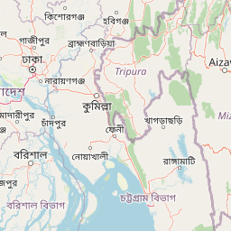
The physical landscape of Lawachara National Park is characterized by undulating terrain dotted with scattered hillocks locally called tila, which rise 10 to 50 meters above the surrounding terrain. These hillocks are composed primarily of Upper Tertiary soft sandstone, giving the landscape a distinctive geological character. The park is crossed by numerous sandy-bedded streams known locally as nallah, one of which, the Lawachara tributary, provides the park's name. The soil composition consists of alluvial brown sandy clay loam to clay loam, geological deposits dating from the Pliocene epoch. The region also features shallow depressions that fill with water to form haor wetlands, which are characteristic of this area of northeastern Bangladesh. The low-lying areas of the park are subject to seasonal flooding, contributing to the ecological diversity of the protected area.

Lawachara National Park ecosystems, habitats, and plant life

The forest ecosystem of Lawachara National Park represents a semi-evergreen forest biome combined with mixed deciduous forest elements. The vegetation structure is complex, with an understory of evergreen species including Quercus, Syzygium, Gmelina, Dillenia, Grewia, and Ficus, while the upper canopy is dominated by tall deciduous trees such as Tectona, Artocarpus chama, Tetrameles, Hopea odorata, Toona ciliata, and Pygenum. The undergrowth features dense bamboo groves of jai bansh (Bambusa burmanica) and muli bansh (Melocanna baccifera), along with numerous fern species and epiphytes. A 2010 botanical study documented 159 plant species belonging to 123 genera and 60 families, including 78 tree species, 14 shrub species, 42 herb species, and 25 climber species. The forest is predominantly secondary growth, having regenerated after significant clearing in the 1920s, though small remnant areas of rich primary forest persist. The park's location in northeastern Bangladesh places it within a region of significant ecological importance for the country, supporting species assemblages more typical of tropical forest ecosystems than the more commonly associated deltaic landscapes of Bangladesh.

Lawachara National Park wildlife and species highlights

Lawachara National Park supports an impressive array of wildlife, with 460 documented species across multiple taxonomic groups. The park is particularly significant for its primate population, hosting six non-human primate species including the western hoolock gibbon, one of the world's 25 most endangered primates. A 2007 census recorded only 62 individuals in 17 groups within Lawachara and the greater West Bhanugach Reserved Forest, representing the largest surviving gibbon population in Bangladesh. Other primates include Phayre's leaf monkey, Bengal slow loris, and capped langur. The mammal population also includes barking deer, wild boar, leopard cat, and Chinese pangolin. The park's 246 bird species make it a significant ornithological destination, while reptiles include the Burmese python. The amphibian and insect diversity adds to the overall biodiversity significance of this protected area.

Lawachara National Park conservation status and protection priorities

Lawachara National Park holds significant conservation importance for Bangladesh and globally. The park protects the largest remaining population of western hoolock gibbons in Bangladesh, a species listed among the world's 25 most endangered primates. This population is considered critical as it likely represents the last viable group that will survive into the next century. The protected area preserves remnants of semi-evergreen and mixed deciduous forest in a country where such ecosystems have been heavily degraded. The park also protects threatened plant species including Bridelia retusa, Zanthoxylum rhetsa, Alstonia scholaris, Phyllanthus emblica, Cassia fistula, Oroxylum indicum, Semecarpus anacardium, and Garuga pinnata. However, the park has faced significant conservation challenges, including the 2008 Chevron seismic exploration controversy that drew criticism for its potential impacts on wildlife. The incident followed earlier gas field explosions that destroyed substantial forest area in 1997. Management is primarily conducted through the Nishorgo project, funded by USAID, though questions have been raised about the compatibility of conservation goals with industrial activities within the protected area.

Lawachara National Park cultural meaning and human context

The area surrounding Lawachara National Park is home to approximately eighteen villages, with two, Punji and Lawachara Punji, located within the park boundaries. Indigenous peoples in the region include the Khasi, Tripuri, and Monipori communities. The remaining population consists largely of Muslim migrants from Noakhali District, Comilla District, and Assam. Registered forest villagers hold certain rights within the reserve, including wood collection for fuel and building materials, hunting, betel leaf production, livestock grazing, harvesting of forest products, and limited agriculture in allocated land. A mosque called Lawachara Jame Mosque located off the Srimangal-Bhanugach Road serves the local community.

Top sights and standout views in Lawachara National Park

Lawachara National Park offers visitors the opportunity to encounter one of Bangladesh's most significant primate populations in a semi-evergreen forest setting. The park's network of trails allows exploration through varied terrain featuring hillocks, streams, and wetland depressions. The western hoolock gibbon population, representing the largest remaining group in Bangladesh, remains the park's most notable conservation asset. The diverse birdlife with over 240 species provides excellent birdwatching opportunities, while the mixed forest ecosystem supports other endangered primates including Phayre's leaf monkey and Bengal slow loris. The proximity to Sreemangal, known as the tea capital of Bangladesh, makes the park accessible to visitors exploring the northeastern region.

Best time to visit Lawachara National Park

The best time to visit Lawachara National Park is during the cooler winter months from November through February, when temperatures are more comfortable for outdoor exploration. The climate in this region remains warm and humid throughout the year, with February averaging around 26.8°C and the hottest period in June reaching 36.1°C. The park experiences high humidity year-round and frequent rains, with the monsoon season bringing increased precipitation that may affect trail accessibility. Visitors should be prepared for humid conditions regardless of when they visit, and those seeking to observe wildlife may find the dry season offers better opportunities for sightings as animals congregate around remaining water sources.

Park location guide

Geography guide, regional context, and park location map for Lawachara National Park

Lawachara National Park park geography, regions, and map view in Bangladesh
Understand where Lawachara National Park sits in Bangladesh through a broader geographic reading of the surrounding landscape, nearby location context, and its mapped position within the national park landscape.

How Lawachara National Park fits into Bangladesh

Bangladesh, officially the People's Republic of Bangladesh, is a South Asian country known for its high population density and deltaic geography formed by the Ganges-Brahmaputra river system. It gained independence from Pakistan in 1971 following a liberation war. The country operates as a unitary parliamentary republic with Dhaka as its capital and largest city, while Chittagong serves as the second-largest city and main port.

Wider geography shaping Lawachara National Park in Bangladesh

Bangladesh occupies the delta region at the confluence of the Ganges, Brahmaputra, and Meghna rivers in South Asia. The country shares land borders with India to the north, west, and east, and Myanmar to the southeast, while its southern boundary is along the Bay of Bengal. The terrain is predominantly low-lying deltaic plain, making it susceptible to flooding. The country is separated from Bhutan and Nepal by the Siliguri Corridor and from China by the Indian state of Sikkim.

Map view of Lawachara National Park

Use this park location map to pinpoint Lawachara National Park in Bangladesh, understand its exact geographic position, and read its mapped placement within the surrounding landscape more clearly.

Pigeon | © OpenStreetMap contributors

Location context for Lawachara National Park

Moulvibazar DistrictSylhet Division
Park atlas

Explore the rich geographic spread of protected areas and conservation landscapes surrounding Lawachara National Park in northeastern Bangladesh.

Discover Nearby Protected Landscapes and National Parks Around Lawachara National Park
Browse other national parks and protected areas in the region surrounding Lawachara National Park, tracing their mapped geography and distinct conservation features across northeastern Bangladesh. Compare varied park landscapes, forest types, and wildlife habitats to understand the broader ecological context and protected area network.
National parkTripura

Clouded Leopard National Park: National Park Protected Area in Tripura's Forested Landscape

Mapped primate habitat and regional geography in Northeast India.

Clouded Leopard National Park serves as a critical protected area within Tripura, India, focusing on the conservation of its forest ecosystems and primate populations, including the Phayre's langur. As part of the larger Sepahijala Wildlife Sanctuary, its mapped boundaries contribute to the regional protected landscape. This national park offers valuable insight into the natural terrain and biodiversity specific to Northeast India, providing a unique geographic focus for atlas exploration.

Area
5.08 km²
Established
2007
IUCN
II
National parkChittagong District

Baroiyadhala National Park: A Vital Wildlife Corridor and Protected Forest Landscape in Bangladesh

Discover its terrain, mapped boundaries, and regional significance.

Baroiyadhala National Park, situated in Bangladesh's Chittagong District, stands as a critical national park dedicated to preserving forest ecosystems and functioning as an essential wildlife corridor. The park's undulating terrain and dense vegetation are vital for supporting threatened species and maintaining habitat connectivity. This page offers an atlas-style exploration of Baroiyadhala National Park, detailing its protected area status, geographic context within the Chittagong region, and its significance for conservation in South Asia, providing a rich understanding of its natural landscape.

Area
29.34 km²
Established
2010
IUCN
II
National parkRangamati District

Kaptai National Park: Protected Landscape and Geographic Context in Rangamati District

Explore its mixed evergreen forest and lakeside terrain.

Kaptai National Park is a crucial protected area located in Bangladesh's Rangamati District, renowned for its mixed evergreen forests and unique position adjacent to Kaptai Lake. This detail page provides an atlas-oriented perspective on the park's geographic identity, mapped boundaries, and its role within the diverse Chittagong Hill Tracts region. Understand the terrain, from rolling hills to lakeside environments, and appreciate its conservation significance as a national park.

Area
54.64 km²
Established
1999
IUCN
II
Climate
Subtropical
National parkWest Garo Hills district

Nokrek National Park: Protected Mountain Landscape and Regional Geography

Explore its mapped boundaries and diverse natural terrain.

Nokrek National Park is a vital protected mountain wilderness situated in the West Garo Hills district, Meghalaya, India. Its rugged terrain, characterized by ancient geological formations and dense evergreen forests, supports remarkable biodiversity. As a key component of the Nokrek Biosphere Reserve, it offers a unique glimpse into the region's ecological significance, serving as an important source for major rivers and a sanctuary for diverse flora and fauna.

Area
47.48 km²
Established
1986
IUCN
II
Relief
Mountain
National parkAssam

Orang National Park: Assam's Key Floodplain Protected Landscape

Explore mapped boundaries and terrain context of this national park.

Orang National Park, located in Assam, India, is a significant protected area celebrated for its unique alluvial floodplain terrain and critical role in conservation. This national park provides a focused atlas-style view of grassland and wetland ecosystems, essential habitats for iconic species like the great Indian one-horned rhinoceros and Bengal tiger. Its geographical setting along the Brahmaputra River contributes to a dynamic landscape, offering rich context for understanding protected area distribution and regional natural features. Discover the mapped boundaries and ecological significance of this important protected land.

Area
78.81 km²
Established
1985
IUCN
II
Relief
Lowland
National parkCox's Bazar District

Medhakachhapia National Park: Protected Mangrove Landscape and Geography in Cox's Bazar

Mapping the boundaries of a unique coastal Bangladesh National Park.

Medhakachhapia National Park is a distinct protected area in Cox's Bazar District, Bangladesh, renowned for its old-growth Rhizophora apiculata mangrove forest. Spanning approximately 396 hectares, it serves as a crucial habitat and represents a specific type of tropical coastal landscape. This park's designation as a national park highlights its conservation importance, particularly its role in protecting some of Bangladesh's most mature mangrove stands. Explore its geographic context and protected status for a deeper understanding of its natural landscape.

Area
3.959 km²
Established
2008
IUCN
IV
Wildlife reserveBhutan

Phibsoo Wildlife Sanctuary: Bhutan's Wildlife Reserve Atlas and Geographic Identity

Mapping the protected landscape and natural terrain of this Bhutanese sanctuary.

Delve into the specifics of Phibsoo Wildlife Sanctuary, a protected wildlife reserve situated within the geographic expanse of Bhutan. This park detail page focuses on its identity as a conservation landscape, offering insights into its mapped terrain and its significance within the broader regional geography of the Eastern Himalayas. Understand the protected boundaries and the unique natural context that Phibsoo Wildlife Sanctuary represents.

Area
268.93 km²
Established
2009
IUCN
IV
Wildlife reserveTrashigang District

Sakteng Wildlife Sanctuary: Protected Area and Wildlife Reserve in Bhutan's Trashigang District

Mapping the mountainous terrain and unique temperate ecosystems.

Sakteng Wildlife Sanctuary is a vital protected area in eastern Bhutan, recognized as a wildlife reserve. Spanning approximately 742 square kilometers within Trashigang District, it features a dramatic mountainous terrain characterized by steep valleys and alpine meadows. The sanctuary's landscape transitions from forested slopes to subalpine conifer forests, representing Bhutan's easternmost temperate ecosystems and offering rich geographic context for atlas exploration.

Area
742.46 km²
Established
2003
IUCN
IV

Common questions about visiting, size, designation, and location context for Lawachara National Park

Lawachara National Park FAQs for park facts, access, geography, and protected area context
Find quick answers about Lawachara National Park, including protected-area facts, park geography, trail and visitor context, and how the park fits into its surrounding country and regional landscape.
MoriAtlas Explorer

Continue Your Protected Areas Search Across the Global Atlas

Deepen your exploration by continuing the structured search for national parks and protected areas worldwide. Utilize the comprehensive filtering capabilities to compare different conservation landscapes and refine your understanding of global park geography. Discover more about the distribution and characteristics of protected natural areas.

Global natural geography