Mori Atlas logo
National parkKaptai National Park

Discover Bangladesh's unique highland forest ecosystems and their mapped protected areas.

Kaptai National Park: Protected Landscape, Atlas Context, and Geographic Boundaries in Rangamati District

Kaptai National Park represents a significant protected landscape within Bangladesh's southeastern Rangamati District. Established as a national park, it safeguards approximately 54.64 square kilometers of mixed evergreen forest in the ecologically rich Chittagong Hill Tracts. This atlas-focused entry details the park's unique geographic position adjacent to Kaptai Lake, offering insights into its rolling hills, valley terrain, and the interplay between its highland forest ecosystems and the largest man-made lake in Bangladesh.

National ParkMixed Evergreen ForestAsian ElephantsChittagong Hill TractsLakeside LandscapeWildlife Conservation

Kaptai National Park

National park

Park overview

Structured park overview, official facts, and landscape profile for Kaptai National Park

Kaptai National Park park facts, protected area profile, and essential visitor context
Review the core facts for Kaptai National Park, including designation, size, terrain, visitor scale, habitats, and operating context in one park-focused overview.

About Kaptai National Park

Kaptai National Park represents one of Bangladesh's most significant protected areas for highland forest conservation, occupying a critical position in the country's otherwise heavily deltaic and low-lying geography. The park is situated within Rangamati District, the most forested region of Bangladesh, where the ancient Archean and Precambrian rock formations of the Himalayan orogeny give way to a landscape of isolated hills and elongated valleys. The establishment of the protected area in 1999 reflected growing recognition that Bangladesh's remaining forest cover, particularly in the Chittagong Hill Tracts, required formal conservation status to prevent further degradation from agricultural expansion, timber extraction, and grazing pressure. The park's location on the margins of Kaptai Lake, created in the 1960s through dam construction on the Karnaphuli River, adds a liminal quality to the protected area where forest meets open water, creating diverse habitat transitions that support specialized wildlife communities. The mixed evergreen forest that dominates the park contains a mix of species adapted to the sub-humid conditions of the region, with the canopy reaching heights of 20 to 30 meters in mature stands.

Quick facts and research context for Kaptai National Park

Kaptai National Park spans 5,464.78 hectares in Rangamati Hill District, the only district in Bangladesh with a predominantly tribal population. The park was established in 1999 under the management of the Bangladesh Forest Department and is classified as an IUCN Category II protected area. Its forest ecosystem is characterized as mixed evergreen forest, representing a transition zone between tropical and subtropical vegetation zones. The park sits at elevations ranging from approximately 50 to 300 meters above sea level, with the terrain marked by undulating hills and narrow valleys that drain into Kaptai Lake. The surrounding region has a population of approximately 3,000 people, many of whom belong to indigenous communities with traditional connections to the forested landscape.

Park context

Deeper park guide and search-rich context for Kaptai National Park

Kaptai National Park history, landscape, wildlife, and travel context
Explore Kaptai National Park through its history, landscape character, ecosystems, wildlife, conservation priorities, cultural context, and seasonal travel timing in a structured park guide built for atlas discovery and search intent.

Why Kaptai National Park stands out

Kaptai National Park is best known for its population of wild Asian elephants, which remain a flagship species for the protected area despite significant human pressure on the landscape. The park also gained scientific prominence in 2014 when the large blue flycatcher, a bird species previously unrecorded in Bangladesh, was sighted within its boundaries, highlighting the park's role as a refuge for rare and localized species. The park's mixed evergreen forest harbors commercially valuable teak trees, while its position on the edge of Kaptai Lake creates a scenic backdrop of forested hills rising from the water's edge that has become emblematic of the Chittagong Hill Tracts. The interplay between terrestrial forest and the lake environment gives the park a dual character as both a mountain forest preserve and a lakeside landscape.

Kaptai National Park history and protected-area timeline

Kaptai National Park was formally established in 1999 through designation by the Bangladesh Forest Department, reflecting the government's commitment to preserving remaining areas of natural forest in the Chittagong Hill Tracts. The park's creation came during a period of significant environmental change in Bangladesh, as the country recognized the need to balance development pressures in its eastern hill regions with conservation imperatives. The protected area was carved from the broader forested landscape that historically covered much of the Chittagong Division, much of which had already been converted to agriculture or degraded by logging and shifting cultivation. Kaptai Lake, which lies adjacent to and partially within the park's boundaries, was created in the early 1960s with the construction of the Kaptai Dam, an engineering project that flooded extensive areas of forest and displaced local communities while creating the largest inland water body in Bangladesh. The establishment of the national park provided formal legal protection for portions of the remaining forest, though enforcement has remained challenging due to the park's location near population centers and the economic pressures facing local communities.

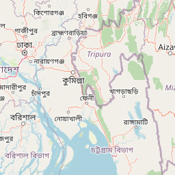
Kaptai National Park landscape and geographic character

The landscape of Kaptai National Park is defined by its position within the Chittagong Hill Tracts, a region of isolated hills and narrow valleys that rises sharply from the surrounding lowlands. The terrain consists of rounded, steep-sided hills with elevations typically ranging from 50 to 300 meters above sea level, composed of ancient crystalline rocks that form the foothills of the Burmese-Arakan mountain system. Between the hills, narrow valleys contain seasonal streams and drainage channels that feed into Kaptai Lake, creating a dendritic drainage pattern across the park. The lake itself, spanning approximately 68,000 hectares at full pool level, dominates the western boundary of the park, its dark waters contrasting with the dense green forest covering the hillslopes. The forest canopy is dominated by tall evergreen species that form a relatively continuous cover across the hills, with gaps created by natural tree falls or human clearing. Along the lake margins, the forest transitions into riparian vegetation and areas of floating aquatic vegetation, while exposed rocky outcrops occur on some hill crests where soil cover is thin.

Kaptai National Park ecosystems, habitats, and plant life

The ecological character of Kaptai National Park is defined by its mixed evergreen forest ecosystem, which represents a transition between tropical and subtropical forest types. The forest contains a diverse assemblage of tree species, including the commercially significant teak (Tectona grandis) alongside numerous native hardwood species in the Dipterocarpaceae and other families. The canopy structure varies from dense and continuous in valley bottoms to more open and patchy on exposed ridges, creating microhabitat diversity that supports different plant communities. The forest supports a complex food web from canopy-dwelling primates and birds to ground-dwelling mammals and reptiles, though the overall species diversity is lower than in comparable forests in neighboring countries due to the park's relatively small size and isolation. The aquatic interface with Kaptai Lake adds a significant dimension to the park's ecological value, providing foraging habitat for water birds and supporting fish populations that represent an important protein source for local communities. The park falls within a region that receives relatively high annual rainfall compared to much of Bangladesh, supporting the evergreen character of the forest even during the dry season.

Kaptai National Park wildlife and species highlights

Kaptai National Park supports a diverse community of wildlife, though comprehensive surveys of the park's fauna are limited. The park is notable for its population of wild Asian elephants (Elephas maximus), which represent a conservation priority given the species' endangered status and the pressure on its habitat across South and Southeast Asia. Elephant herds use the forest for foraging and movement, though their presence brings them into frequent conflict with local farmers whose crops are damaged during foraging raids. The bird fauna includes the jungle myna, a common species in the park's forest edge and open areas, while the 2014 sighting of the large blue flycatcher marked a significant range extension for this species within Bangladesh. The reptile community includes species such as the tawny cat snake, a nocturnal predator that hunts in the forest canopy and understory. Small mammals, including various species of primates, rodents, and carnivores, occupy different ecological niches within the forest, though the park's fauna remains under-documented relative to similar protected areas in the region.

Kaptai National Park conservation status and protection priorities

Kaptai National Park faces significant conservation challenges that threaten both its ecological integrity and its capacity to sustain wildlife populations. The primary threats include illicit felling of valuable timber species, particularly teak, which has been extracted from the area despite its protected status. Intensive collection of fuel wood, ranging from gathering dead wood to harvesting branches and even entire trees, places continuous pressure on the forest's carbon cycling and nutrient dynamics. Overgrazing by livestock belonging to communities living adjacent to the park degrades understory vegetation and compacts soil along trails, while also increasing the risk of disease transmission between domestic and wild animals. The expansion of human settlement along the park's boundaries over the past three decades, driven by drought and regional civil unrest, has increased the footprint of agriculture and reduced the effective buffer zone around the core protected area. Conservation efforts must balance the needs of local communities, particularly indigenous groups with traditional land use patterns, with the imperative to maintain forest cover and wildlife habitat.

Kaptai National Park cultural meaning and human context

Kaptai National Park is situated within the Rangamati Hill District, which is unique in Bangladesh for its predominantly tribal population and distinctive cultural landscape. The region has been home to various indigenous communities for centuries, whose traditional land use practices including shifting cultivation and forest resource gathering have shaped the landscape. The park's location adjacent to Kaptai Lake adds cultural significance, as the lake was created through displacement of local communities in the 1960s and now forms an important economic resource for fishing communities. Kaptai City, which lies within and adjacent to the national park boundary, represents a population center where approximately 60 local residents are employed as tourism service providers, creating a direct economic connection between the park and community livelihoods. The park receives visitors throughout the year who come to experience the scenic beauty of the forested hills rising from the lake and to observe wildlife, though the tourism infrastructure remains limited relative to more developed protected areas in the region.

Top sights and standout views in Kaptai National Park

Kaptai National Park offers visitors the opportunity to experience Bangladesh's only significant highland forest ecosystem in a dramatic lakeside setting. The park's wild elephant populations, while difficult to observe reliably, represent a remarkable conservation achievement in a country where natural forest is extremely limited. The sighting of the large blue flycatcher in 2014 demonstrated that the park continues to yield new discoveries for Bangladeshi ornithology, suggesting that further research may reveal additional species of conservation interest. The contrast between the dark waters of Kaptai Lake and the lush green forested hills creates one of the most photographed landscapes in southeastern Bangladesh. The park provides opportunities for boat-based lake exploration, wildlife observation along forest trails, and cultural engagement with local indigenous communities. For visitors seeking to understand Bangladesh's natural heritage beyond the famous Sundarbans mangrove forest, Kaptai offers a fundamentally different wilderness experience centered on evergreen forest and highland terrain.

Best time to visit Kaptai National Park

The optimal time to visit Kaptai National Park spans from October through March, when the region experiences its dry season and temperatures are moderate. During these months, the forest vegetation is relatively accessible and wildlife viewing conditions improve as animals congreg more readily around water sources. The post-monsoon period from October to November offers the advantage of fresh, green forest growth following the rainy season, though some trails may still be affected by residual moisture. December through February represents the coolest period, with comfortable temperatures for outdoor activities and relatively clear skies. The summer months from April through June bring higher temperatures and the beginning of the monsoon season, which can make forest walks uncomfortable and increase the risk of landslides on steeper trails. The monsoon season from July through September brings heavy rainfall to the Chittagong Hill Tracts, transforming the landscape but limiting visitor access and increasing safety concerns for lake-based activities.

Park location guide

Geography guide, regional context, and park location map for Kaptai National Park

Kaptai National Park park geography, regions, and map view in Bangladesh
Understand where Kaptai National Park sits in Bangladesh through a broader geographic reading of the surrounding landscape, nearby location context, and its mapped position within the national park landscape.

How Kaptai National Park fits into Bangladesh

Bangladesh, officially the People's Republic of Bangladesh, is a South Asian country known for its high population density and deltaic geography formed by the Ganges-Brahmaputra river system. It gained independence from Pakistan in 1971 following a liberation war. The country operates as a unitary parliamentary republic with Dhaka as its capital and largest city, while Chittagong serves as the second-largest city and main port.

Wider geography shaping Kaptai National Park in Bangladesh

Bangladesh occupies the delta region at the confluence of the Ganges, Brahmaputra, and Meghna rivers in South Asia. The country shares land borders with India to the north, west, and east, and Myanmar to the southeast, while its southern boundary is along the Bay of Bengal. The terrain is predominantly low-lying deltaic plain, making it susceptible to flooding. The country is separated from Bhutan and Nepal by the Siliguri Corridor and from China by the Indian state of Sikkim.

Map view of Kaptai National Park

Use this park location map to pinpoint Kaptai National Park in Bangladesh, understand its exact geographic position, and read its mapped placement within the surrounding landscape more clearly.

Pigeon | © OpenStreetMap contributors

Location context for Kaptai National Park

Chittagong DivisionRangamati District
Park atlas

Trace connected protected landscapes and diverse forest ecosystems across the Chittagong Hill Tracts and surrounding regions.

Discover Other National Parks and Protected Areas Near Kaptai National Park
Continue your exploration from Kaptai National Park to browse a curated list of other national parks and significant protected areas across the Chittagong Hill Tracts region. Comparing these diverse conservation landscapes reveals the broader geographic spread of unique forest habitats and aquatic environments in southeastern Bangladesh.
National parkChittagong District

Baroiyadhala National Park: A Vital Wildlife Corridor and Protected Forest Landscape in Bangladesh

Discover its terrain, mapped boundaries, and regional significance.

Baroiyadhala National Park, situated in Bangladesh's Chittagong District, stands as a critical national park dedicated to preserving forest ecosystems and functioning as an essential wildlife corridor. The park's undulating terrain and dense vegetation are vital for supporting threatened species and maintaining habitat connectivity. This page offers an atlas-style exploration of Baroiyadhala National Park, detailing its protected area status, geographic context within the Chittagong region, and its significance for conservation in South Asia, providing a rich understanding of its natural landscape.

Area
29.34 km²
Established
2010
IUCN
II
National parkCox's Bazar District

Medhakachhapia National Park: Protected Mangrove Landscape and Geography in Cox's Bazar

Mapping the boundaries of a unique coastal Bangladesh National Park.

Medhakachhapia National Park is a distinct protected area in Cox's Bazar District, Bangladesh, renowned for its old-growth Rhizophora apiculata mangrove forest. Spanning approximately 396 hectares, it serves as a crucial habitat and represents a specific type of tropical coastal landscape. This park's designation as a national park highlights its conservation importance, particularly its role in protecting some of Bangladesh's most mature mangrove stands. Explore its geographic context and protected status for a deeper understanding of its natural landscape.

Area
3.959 km²
Established
2008
IUCN
IV
National parkTripura

Clouded Leopard National Park: National Park Protected Area in Tripura's Forested Landscape

Mapped primate habitat and regional geography in Northeast India.

Clouded Leopard National Park serves as a critical protected area within Tripura, India, focusing on the conservation of its forest ecosystems and primate populations, including the Phayre's langur. As part of the larger Sepahijala Wildlife Sanctuary, its mapped boundaries contribute to the regional protected landscape. This national park offers valuable insight into the natural terrain and biodiversity specific to Northeast India, providing a unique geographic focus for atlas exploration.

Area
5.08 km²
Established
2007
IUCN
II
National parkChin State

Natmataung National Park: Protected Mountain Landscape and Biodiversity Atlas in Chin State

Explore the mapped terrain and elevational gradients of Mount Victoria.

Natmataung National Park, located in Chin State, Myanmar, offers a profound encounter with dramatic mountainous terrain and exceptional biodiversity. As a protected national park, it safeguards Mount Victoria, the highest peak in the region, and a remarkable ecological gradient spanning diverse forest types. This page provides an atlas-focused view of its geography, highlighting the steep ridgelines, deep valleys, and unique habitats that define this significant protected landscape and its role in watershed protection.

Area
723 km²
Established
2010
IUCN
II
National parkMoulvibazar District

Lawachara National Park: Protected National Park Landscape in Moulvibazar District

Mapped Terrain and Endangered Primate Habitat Exploration

Delve into the protected landscape of Lawachara National Park, a key national park located in the distinct undulating terrain of Moulvibazar District, Bangladesh. This area is recognized for its ecological significance, particularly as a sanctuary for endangered primates, including the critically important western hoolock gibbon population. Users can explore the park's mapped boundaries, understand its semi-evergreen forest ecosystem, and appreciate its geological features like sandstone hillocks and sandy-bedded streams, making it a valuable point of discovery for regional geography and conservation landscapes.

Area
12.5 km²
Established
1996
IUCN
II
National parkWest Bengal

Sundarbans National Park: UNESCO World Heritage Mangrove National Park in West Bengal

Explore its tidal geography and mapped protected boundaries.

Sundarbans National Park is a vital protected area on the Ganges Delta, recognized globally as the world's largest mangrove forest and a UNESCO World Heritage Site. Located in West Bengal, this national park features a unique estuarine geography characterized by intricate tidal channels and distributaries that define its landscape. Its protected boundaries safeguard a complex ecosystem, offering rich opportunities for atlas-driven exploration of its distinctive natural terrain and coastal wetland significance.

Area
1,330.1 km²
Established
1984
IUCN
II
National parkWest Garo Hills district

Nokrek National Park: Protected Mountain Landscape and Regional Geography

Explore its mapped boundaries and diverse natural terrain.

Nokrek National Park is a vital protected mountain wilderness situated in the West Garo Hills district, Meghalaya, India. Its rugged terrain, characterized by ancient geological formations and dense evergreen forests, supports remarkable biodiversity. As a key component of the Nokrek Biosphere Reserve, it offers a unique glimpse into the region's ecological significance, serving as an important source for major rivers and a sanctuary for diverse flora and fauna.

Area
47.48 km²
Established
1986
IUCN
II
Relief
Mountain
National parkAssam

Orang National Park: Assam's Key Floodplain Protected Landscape

Explore mapped boundaries and terrain context of this national park.

Orang National Park, located in Assam, India, is a significant protected area celebrated for its unique alluvial floodplain terrain and critical role in conservation. This national park provides a focused atlas-style view of grassland and wetland ecosystems, essential habitats for iconic species like the great Indian one-horned rhinoceros and Bengal tiger. Its geographical setting along the Brahmaputra River contributes to a dynamic landscape, offering rich context for understanding protected area distribution and regional natural features. Discover the mapped boundaries and ecological significance of this important protected land.

Area
78.81 km²
Established
1985
IUCN
II
Relief
Lowland

Common questions about visiting, size, designation, and location context for Kaptai National Park

Kaptai National Park FAQs for park facts, access, geography, and protected area context
Find quick answers about Kaptai National Park, including protected-area facts, park geography, trail and visitor context, and how the park fits into its surrounding country and regional landscape.
MoriAtlas Explorer

Continue Your Protected Areas Search Across the Global Atlas

Deepen your exploration by continuing the structured search for national parks and protected areas worldwide. Utilize the comprehensive filtering capabilities to compare different conservation landscapes and refine your understanding of global park geography. Discover more about the distribution and characteristics of protected natural areas.

Global natural geography