Mori Atlas logo
National parkNatmataung National Park

Discover the mapped terrain and biodiversity of Myanmar's highest peak, Mount Victoria.

Natmataung National Park: Protected Mountain Landscape and Geographic Context in Chin State

Natmataung National Park represents a vital protected wilderness area in western Myanmar's Chin State, centered around the imposing Mount Victoria. This national park encompasses a dramatic gradient of mountain landscapes, from its lower valleys to the region's highest summit, providing a rich context for atlas-based geographic discovery. Users can explore the park's extensive mapped boundaries, understand its role in watershed protection, and appreciate the unique terrain that supports remarkable biodiversity and significant cultural heritage.

ASEAN Heritage ParkImportant Bird AreaMountain ParkChin HillsBiodiversity HotspotWatershed Protection

Natmataung National Park

National park

Park overview

Structured park overview, official facts, and landscape profile for Natmataung National Park

Natmataung National Park park facts, protected area profile, and essential visitor context
Review the core facts for Natmataung National Park, including designation, size, terrain, visitor scale, habitats, and operating context in one park-focused overview.

About Natmataung National Park

Natmataung National Park represents one of Myanmar's most significant protected areas, preserving the mountainous heart of Chin State where the country's western highlands rise dramatically from the central lowlands. The park encompasses a landscape of extraordinary topographic complexity, with steep mountain slopes, deep V-shaped valleys, and sharp ridgelines creating a mosaic of microclimates and ecological zones. Mount Victoria, known locally as Nat Ma Taung or Khaw-nu-soum, meaning "Mother of Spirits" or "Great Mountain Goddess," forms the spiritual and geographic centerpiece of the protected area. The park's elevation range of over 2,300 meters supports a continuum of forest types from lowland dipterocarp forests through mixed deciduous, pine, and oak-rhododendron communities to montane evergreen forest near the summit. This ecological diversity makes Natmataung one of Myanmar's most botanically rich areas, with surveys documenting more than 800 plant species. The park serves critical watershed functions, feeding tributaries that flow into the Myittha and Lemro Rivers before reaching the Irrawaddy, making its protection vital for downstream communities across a significant portion of western Myanmar.

Quick facts and research context for Natmataung National Park

Natmataung National Park is located in Chin State, western Myanmar, within Mindat and Kanpetlet townships. The protected area covers 72,300 hectares of mountainous terrain centered on Mount Victoria, which rises to 3,070 meters. Established in 2010 as a national park, with prior watershed protection beginning in 1994, the park was designated an ASEAN Heritage Park in 2012 and an Important Bird Area in 2004. The park is managed by Myanmar's Nature and Wildlife Conservation Division and supports exceptional biodiversity across multiple forest types due to its dramatic elevation range.

Park context

Deeper park guide and search-rich context for Natmataung National Park

Natmataung National Park history, landscape, wildlife, and travel context
Explore Natmataung National Park through its history, landscape character, ecosystems, wildlife, conservation priorities, cultural context, and seasonal travel timing in a structured park guide built for atlas discovery and search intent.

Why Natmataung National Park stands out

Natmataung National Park is best known for protecting Mount Victoria, the highest peak in Chin State, and the exceptional biodiversity concentrated along its elevational gradient. The park is the stronghold of the white-browed nuthatch, a bird species endemic to this region, and supports significant populations of Western hoolock gibbons, clouded leopards, and gaurs. Its designation as an ASEAN Heritage Park recognizes the park's importance as a biodiversity corridor and watershed for the Irrawaddy River basin. The cultural significance of Nat Ma Taung as a sacred mountain revered in traditional Chin animist beliefs adds to the park's distinctive identity.

Natmataung National Park history and protected-area timeline

The protection history of Natmataung National Park reflects evolving approaches to conservation in Myanmar. The area first received formal protection in 1994 when it was designated for watershed conservation purposes, recognizing the critical role these mountain forests play in regulating water flow to rivers that sustain communities across Chin State and beyond. This initial designation acknowledged that the forests surrounding Mount Victoria perform essential ecological functions in capturing and filtering precipitation, releasing water gradually to downstream tributaries, and preventing soil erosion on the steep terrain. In 2010, the Myanmar government elevated the protection status to national park, formalizing comprehensive conservation management for the area. The park achieved regional recognition in 2012 when it was declared an ASEAN Heritage Park, joining a network of protected areas across Southeast Asia recognized for their outstanding ecological and cultural significance. This designation reflects the park's importance not just within Myanmar but as a component of the broader regional conservation landscape, with the ASEAN Heritage Parks program promoting transboundary cooperation and knowledge-sharing for the management of the region's most significant protected areas.

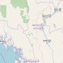
Natmataung National Park landscape and geographic character

The landscape of Natmataung National Park is defined by the rugged mountainous terrain of the Chin Hills, a subrange of the broader Indo-Burman mountain system that extends along Myanmar's western border. The park's terrain presents a dramatic topography of steep mountain slopes, deep valleys carved by seasonal streams, and sharp ridgelines that orient north-south along the main spine of the Chin Hills. Elevations range from 740 meters in the lower valleys to 3,070 meters at the summit of Mount Victoria, creating a vertical span of over 2,300 meters that encompasses remarkable climatic and ecological variation. The mountain's steep-sided peaks and ridges were formed through complex geological processes that have produced rocky outcrops, cliff faces, and boulder-strewn slopes particularly common near the higher elevations. The park's drainage patterns flow generally westward through a network of streams and small rivers that eventually connect to the Myittha and Lemro Rivers, part of the larger Irrawaddy River watershed that dominates Myanmar's central geography.

Natmataung National Park ecosystems, habitats, and plant life

The ecological character of Natmataung National Park is defined by its remarkable elevational gradient, which supports a succession of forest types across a relatively compact area. At lower elevations, typically below 1,000 meters, the park encompasses lowland dipterocarp forests dominated by trees of the Dipterocarpaceae family, interspersed with mixed deciduous forests that include species from the Verbenaceae and Rubiaceae families. As elevation increases, the forest transitions through zones of pine-dominated woodland and into oak-rhododendron forest, where evergreen oaks form a canopy accompanied by diverse rhododendron species that contribute seasonal color when they bloom. The highest elevations support montane evergreen forest with dense, humid conditions favoring epiphytic plants including numerous fern and orchid species. This vertical zonation creates remarkable biodiversity concentration, with the park documenting more than 800 plant species, including significant populations of ferns, orchids, and rhododendrons. The forest structure also provides essential ecosystem services, with the park's watersheds feeding tributaries that connect to the Irrawaddy River system, making the protected area critical for downstream water security across western Myanmar.

Natmataung National Park wildlife and species highlights

Natmataung National Park supports exceptional wildlife diversity, with documented populations representing mammalian, avian, reptilian, amphibian, and invertebrate groups. The park is particularly significant for its bird fauna, with approximately 299 species recorded within its boundaries, including the white-browed nuthatch, a small passerine endemic to this region that has become the park's flagship species. The white-browed nuthatch occupies a restricted range centered on the Chin Hills, making Natmataung crucial for the species' long-term survival. Mammalian inhabitants include several species of significant conservation concern, particularly the Western hoolock gibbon, which inhabits the forest canopy in family groups, the clouded leopard, a cryptic and rare predator that occupies the forest's middle stories, and the gaur, the largest wild cattle species in Asia, which grazes in forest clearings and grassy areas. The park also supports at least 23 amphibian species, 65 reptile species, and 77 butterfly species, contributing to its overall biodiversity significance.

Natmataung National Park conservation status and protection priorities

Natmataung National Park faces several conservation challenges common to protected areas in developing regions, despite its formal protection status and ASEAN Heritage Park designation. Shifting cultivation, locally known as taungya, remains a significant driver of deforestation and habitat fragmentation within and adjacent to park boundaries, as agricultural expansion into forest areas continues to modify the landscape. Illegal hunting poses particular threats to species including bears and serow, which are targeted for their meat and body parts. Resource extraction for firewood and building materials puts pressure on the park's forest resources, while road development increases both habitat disturbance and access for poachers into previously remote areas. The park is managed by the Nature and Wildlife Conservation Division of Myanmar's Ministry of Environmental Conservation and Forestry, with current conservation efforts often supported by international organizations and focusing on sustainable livelihoods for local communities and community-based forest management approaches. The ASEAN Heritage Park designation provides a framework for regional cooperation in addressing transboundary conservation challenges and promoting best practices in protected area management.

Natmataung National Park cultural meaning and human context

Natmataung National Park holds profound cultural significance for the Chin ethnic groups who have inhabited these mountains for generations. The park lies within the ancestral lands of several Chin tribes, including the D'ai, M'uun, and Upu, whose traditional communities and cultural practices are interwoven with the landscape. At the heart of this cultural relationship is Nat Ma Taung itself, known locally as Khaw-nu-soum or Khonuamthung, which translates as "Mother of Spirits" or "Great Mountain Goddess." This sacred significance reflects traditional animist beliefs that associate the peak with guardian spirits who dwell on the mountain, making it a site of ongoing spiritual importance even as other aspects of traditional culture evolve. The broader Chin region is also known for the distinctive facial tattoos worn by women, a cultural identity practice that was once considered a mark of beauty but has become increasingly rare among younger generations. These cultural elements give the park significance beyond its ecological value, connecting conservation efforts to the preservation of living cultural traditions tied to this mountainous landscape.

Top sights and standout views in Natmataung National Park

Natmataung National Park offers a rare combination of spectacular mountain scenery, exceptional biodiversity, and deep cultural significance within a protected area that remains relatively undiscovered by international visitors. The ascent of Mount Victoria provides hikers with access to panoramic views from the highest peak in Chin State, while the elevational gradient creates opportunities to experience multiple forest types within a single visit. The chance to observe the endemic white-browed nuthatch in its natural habitat represents a significant draw for birdwatchers and nature enthusiasts, while the presence of Western hoolock gibbons, clouded leopards, and gaurs demonstrates the park's conservation value for large mammal species. The cultural dimension of the park, from sacred mountain traditions to the fading practice of facial tattoos among Chin women, provides additional context for understanding this landscape as a living cultural landscape rather than merely a natural reserve. The park's status as an ASEAN Heritage Park also signals its regional importance within Southeast Asia's conservation network.

Best time to visit Natmataung National Park

The most favorable time to visit Natmataung National Park falls during the dry season from November through April, when rainfall is minimal and trail conditions are most suitable for hiking and wildlife observation. The cooler months from December to February offer particularly comfortable conditions for exploring the park's mountainous terrain, with temperatures at higher elevations remaining moderate during the day and dropping significantly at night. During this period, the forest canopies are less dense, making wildlife observation somewhat easier, and the risk of encountering leeches and other wet-season challenges is reduced. The monsoon season from May through October brings heavy rainfall to the Chin Hills, making many trails difficult or dangerous to navigate and increasing the risk of landslides on steep slopes. Visitors interested in seeing rhododendrons in bloom should note that these flowering plants typically display their most dramatic displays during the spring months of March and April, adding natural color to the mountain landscapes.

Park location guide

Geography guide, regional context, and park location map for Natmataung National Park

Natmataung National Park park geography, regions, and map view in Myanmar
Understand where Natmataung National Park sits in Myanmar through a broader geographic reading of the surrounding landscape, nearby location context, and its mapped position within the national park landscape.

How Natmataung National Park fits into Myanmar

Myanmar is a Southeast Asian country with a rich history dating back to the Pagan Kingdom era. It is the largest country by area in Mainland Southeast Asia and is characterized by diverse ethnic groups, with the Bamar as the majority. The country operates under a military-led government and uses the Burmese language as its official language.

Wider geography shaping Natmataung National Park in Myanmar

Myanmar is located in northwest Southeast Asia, bordered by India and Bangladesh to the northwest, China to the northeast, Laos and Thailand to the east and southeast, and the Andaman Sea and Bay of Bengal to the south and southwest. The terrain includes mountains, plains, and river valleys centered around the Irrawaddy River.

Map view of Natmataung National Park

Use this park location map to pinpoint Natmataung National Park in Myanmar, understand its exact geographic position, and read its mapped placement within the surrounding landscape more clearly.

Pigeon | © OpenStreetMap contributors

Location context for Natmataung National Park

Chin State
Park atlas

Explore the regional geography of protected areas near Natmataung National Park, comparing mountain landscapes and conservation zones.

Discover Nearby National Parks and Protected Areas Beyond Natmataung National Park, Exploring Related Chin Hills Landscapes
After exploring Natmataung National Park's mountain terrain and biodiversity, browse other national parks and protected areas sharing similar Chin Hills landscapes or critical conservation roles. Comparing these adjacent protected landscapes provides deeper geographic context, revealing regional conservation efforts and the interconnectedness of Myanmar's mountain ecosystems.
National parkSagaing Region

Alaungdaw Kathapa National Park: National Park with Mapped Boundaries in Sagaing Region

Explore its protected landscape and regional geography.

Alaungdaw Kathapa National Park is a protected natural area situated in Myanmar's Sagaing Region. This national park is defined by its specific geographic boundaries and serves as a key component within the regional landscape atlas. Its designation highlights its importance for conservation and offers insights into the natural terrain and protected area distribution, providing a focused entry for geographic study.

Area
1,403 km²
Established
1989
IUCN
II
Relief
Mountain
National parkIndia

Phawngpui National Park: An Indian National Park's Protected Landscape and Geography

Explore its mapped boundaries and regional natural terrain.

Phawngpui National Park stands as a distinct protected area within India, contributing significantly to the nation's atlas of natural landscapes. Its designation as a national park underscores its importance for understanding regional geography and mapped terrain. This profile focuses on the park's specific protected-area identity and its role in the broader geographic context of India, offering clear insights for landscape and park map discovery.

Area
50 km²
Established
1992
IUCN
II
Visitors
469 annual
National parkCox's Bazar District

Medhakachhapia National Park: Protected Mangrove Landscape and Geography in Cox's Bazar

Mapping the boundaries of a unique coastal Bangladesh National Park.

Medhakachhapia National Park is a distinct protected area in Cox's Bazar District, Bangladesh, renowned for its old-growth Rhizophora apiculata mangrove forest. Spanning approximately 396 hectares, it serves as a crucial habitat and represents a specific type of tropical coastal landscape. This park's designation as a national park highlights its conservation importance, particularly its role in protecting some of Bangladesh's most mature mangrove stands. Explore its geographic context and protected status for a deeper understanding of its natural landscape.

Area
3.959 km²
Established
2008
IUCN
IV
Relief
Lowland
National parkBangladesh

Himchari National Park: A Protected National Park within Bangladesh's Delta Geography

Mapped protected area and landscape context in South Asia.

Himchari National Park represents a vital protected natural area contributing to the rich geography of Bangladesh. As a national park, it offers users a focal point for understanding mapped landscapes and the distribution of conservation lands within the South Asian delta region. Exploring this entity provides insight into the country's protected areas and their unique environmental settings for structured atlas discovery.

Area
17.29 km²
Established
1980
IUCN
IV
Relief
Upland
National parkRangamati District

Kaptai National Park: Protected Landscape and Geographic Context in Rangamati District

Explore its mixed evergreen forest and lakeside terrain.

Kaptai National Park is a crucial protected area located in Bangladesh's Rangamati District, renowned for its mixed evergreen forests and unique position adjacent to Kaptai Lake. This detail page provides an atlas-oriented perspective on the park's geographic identity, mapped boundaries, and its role within the diverse Chittagong Hill Tracts region. Understand the terrain, from rolling hills to lakeside environments, and appreciate its conservation significance as a national park.

Area
54.64 km²
Established
1999
IUCN
II
Climate
Subtropical
National parkChamphai

Murlen National Park: Mapped Protected Landscape and Regional Geographic Context

National Park discovery in Champhai, India.

Delve into the specifics of Murlen National Park, a key protected area situated in the Champhai region. This entry focuses on its identity as a National Park, providing critical information about its geographic placement and mapped boundaries. Understanding Murlen National Park within its regional landscape context is fundamental for comprehensive atlas-based exploration of India's protected areas.

Area
200 km²
Established
1991
IUCN
II
Relief
Mountain
National parkChittagong District

Baroiyadhala National Park: A Vital Wildlife Corridor and Protected Forest Landscape in Bangladesh

Discover its terrain, mapped boundaries, and regional significance.

Baroiyadhala National Park, situated in Bangladesh's Chittagong District, stands as a critical national park dedicated to preserving forest ecosystems and functioning as an essential wildlife corridor. The park's undulating terrain and dense vegetation are vital for supporting threatened species and maintaining habitat connectivity. This page offers an atlas-style exploration of Baroiyadhala National Park, detailing its protected area status, geographic context within the Chittagong region, and its significance for conservation in South Asia, providing a rich understanding of its natural landscape.

Area
29.34 km²
Established
2010
IUCN
II
Climate
Tropical
National parkBangladesh

Nijhum Dweep National Park: A Protected Landscape in Bangladesh's Geographic Atlas

Explore the mapped boundaries and regional setting of this national park.

Nijhum Dweep National Park is a key protected area situated within the deltaic geography of Bangladesh. This detailed entry provides insight into its mapped landscape, natural terrain, and its significance as a national park. Understand its geographic context and explore its protected boundaries as part of a broader atlas of natural areas, offering a factual basis for understanding this unique South Asian landscape.

Area
163.52 km²
Established
2001
IUCN
IV
Relief
Lowland

Common questions about visiting, size, designation, and location context for Natmataung National Park

Natmataung National Park FAQs for park facts, access, geography, and protected area context
Find quick answers about Natmataung National Park, including protected-area facts, park geography, trail and visitor context, and how the park fits into its surrounding country and regional landscape.
MoriAtlas Explorer

Continue Your Protected Areas Search Across the Global Atlas

Deepen your exploration by continuing the structured search for national parks and protected areas worldwide. Utilize the comprehensive filtering capabilities to compare different conservation landscapes and refine your understanding of global park geography. Discover more about the distribution and characteristics of protected natural areas.

Global natural geography