Mori Atlas logo
National parkAlitash National Park

Discover the mapped boundaries and lowland woodland ecosystems of this key protected area.

Alitash National Park: A Protected Landscape in Ethiopia's North Gondar Zone

Alitash National Park represents a significant protected landscape within Ethiopia's North Gondar Zone. Covering 2,665.7 square kilometers, this national park is defined by its lowland woodland and savanna ecosystems, creating a unique geographic setting. Its expansive terrain, marked by seasonal river valleys and the distinctive Twin Mountains of Amadog, offers a rich context for understanding protected areas and their ecological importance. The park's designation as a national park underscores its role in conserving vital natural habitats and wildlife populations.

National ParkLowland WoodlandTransboundary ConservationWildlife ConservationAfrican ElephantLion Population

Alitash National Park

National park

Park overview

Structured park overview, official facts, and landscape profile for Alitash National Park

Alitash National Park park facts, protected area profile, and essential visitor context
Review the core facts for Alitash National Park, including designation, size, terrain, visitor scale, habitats, and operating context in one park-focused overview.

About Alitash National Park

Alitash National Park represents one of Ethiopia's newer protected areas, established in 2006 to conserve the nation's lowland woodland ecosystems in the northwestern Amhara Region. The park occupies a significant expanse of terrain in the North Gondar Zone, approximately 1,080 kilometers from Addis Ababa, adjacent to the Sudanese border. The protected area derives its name from the Alatash River, which has its source within the park and flows across the landscape toward Sudan, linking the Ethiopian park with the adjacent Dinder National Park in a transboundary conservation arrangement. The landscape comprises predominantly flat terrain with subtle elevation variations between 520 and 920 meters above sea level, punctuated by the distinctive Twin Mountains of Amadog in the southwestern corner. This mountainous feature adds visual and ecological diversity to an otherwise uniform lowland setting. The park's lowland woodland character distinguishes it from Ethiopia's more famous highland protected areas, representing the nation's commitment to preserving its diverse ecological zones from the Ethiopian plateau down to the Sudan borderlands.

Quick facts and research context for Alitash National Park

Alitash National Park spans 2,665.7 square kilometers in northwestern Ethiopia's Amhara Region, established in 2006 under management of the Ethiopian Wildlife Conservation Authority. The park protects lowland woodland ecosystems at elevations between 520 and 920 meters, featuring flat terrain with scattered hills, seasonal rivers, and the Twin Mountains of Amadog. The park shares a border with Sudan's Dinder National Park, forming a transboundary conservation area. Notable wildlife includes populations of African elephant, leopard, greater kudu, lesser kudu, and approximately 200 lions discovered in 2016. The park hosts 204 bird species and 37 mammal species within its diverse habitats of seasonal wetlands, riverine ecosystems, and deciduous woodlands.

Park context

Deeper park guide and search-rich context for Alitash National Park

Alitash National Park history, landscape, wildlife, and travel context
Explore Alitash National Park through its history, landscape character, ecosystems, wildlife, conservation priorities, cultural context, and seasonal travel timing in a structured park guide built for atlas discovery and search intent.

Why Alitash National Park stands out

Alitash National Park is best known for its significant lion population, discovered in 2016 and believed to be of Central African origin, representing an important conservation finding for Ethiopia. The park protects extensive lowland woodland ecosystems that support remarkable biodiversity, including African elephants, leopards, and substantial populations of both greater and lesser kudu. Its location adjacent to Sudan's Dinder National Park creates one of East Africa's few transboundary protected area complexes, offering protection to wildlife populations that move freely across the international border. The diverse birdlife, with over 200 species including parrots, eagles, vultures, and herons, thrives in the seasonal woodland habitats.

Alitash National Park history and protected-area timeline

Alitash National Park was officially established in 2006 by the Ethiopian government through the Ethiopian Wildlife Conservation Authority, representing a relatively recent addition to Ethiopia's national park system. The establishment reflected growing recognition of the ecological significance of Ethiopia's lowland woodland ecosystems in the western border regions. Prior to formal protection, the area served as a wildlife corridor connecting with Sudan's Dinder National Park, and local communities maintained traditional land-use patterns across the landscape. The creation of the park formalized protection for wildlife populations that had historically moved freely across the Ethiopia-Sudan border region. A significant development occurred in 2016 when researchers documented a population of approximately 200 lions within the park, a discovery of considerable conservation importance given the declining lion populations across Africa. The findings suggested these lions may represent a Central African genetic lineage, potentially making them a distinct population warranting specific conservation attention.

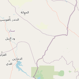
Alitash National Park landscape and geographic character

Alitash National Park presents a landscape of gently undulating terrain characteristic of lowland woodland environments in the Ethiopian-Sudanese border region. The terrain is predominantly flat with elevation ranging from 520 to 920 meters above sea level, creating a relatively uniform topography broken only by scattered hills and the notable Twin Mountains of Amadog situated in the southwestern corner of the park. Seasonal rivers cross the landscape, flowing through defined river valleys that provide ecological corridors and water sources for wildlife. The vegetation transitions between deciduous woodlands, open grasslands, and areas of denser tree cover, creating a mosaic of habitats across the park's extensive 2,665.7 square kilometer extent. The park contains seasonal wetlands that fill during rainy periods and dry to productive grazing areas, supporting the park's wildlife populations throughout the annual cycle. The Twin Mountains of Amadog represent the most prominent topographical feature, rising above the otherwise level terrain and providing visual distinction to this corner of the protected area.

Alitash National Park ecosystems, habitats, and plant life

The nature of Alitash National Park centers on its representation of Ethiopia's lowland woodland ecosystems, a habitat type that supports remarkable biodiversity despite its seemingly uniform appearance. The park encompasses several distinct habitat types including seasonal wetlands, riverine ecosystems along seasonal rivers, wooded grasslands, and diverse deciduous woodlands that cover the majority of the protected area. These habitats together create productive environments for both resident and migratory species. The riverine corridors provide crucial water sources and movement pathways for larger mammals, while the woodland areas offer cover and feeding grounds for numerous bird and mammal species. The seasonal wetlands cycle between flooded and dry conditions, creating dynamic ecological conditions that support different communities throughout the year. This habitat diversity within a relatively contiguous landscape makes Alitash significant for maintaining ecological connectivity across the Ethiopia-Sudan border region.

Alitash National Park wildlife and species highlights

Alitash National Park supports significant wildlife populations across its diverse habitats, with documented records of 37 mammal species and 204 bird species within its boundaries. The mammalian fauna includes notable large mammals such as African elephants and leopards, representing apex species of conservation importance. Both greater kudu and lesser kudu occur in substantial numbers, thriving in the woodland and grassland environments. The 2016 discovery of approximately 200 lions represented a major finding, with genetic analysis suggesting these lions may belong to a Central African population rather than the East African lions found elsewhere in Ethiopia. The reptile community includes seven documented species: Egyptian cobra, black mamba, Nile monitor, and rock python represent the more notable reptilian residents. The avifauna is particularly diverse, with over 200 species including parrots, various eagles, plovers, herons, egrets, ibises, buzzards, vultures, and cormorants. These bird species are particularly concentrated in the seasonal woodland areas and near water sources within the park.

Alitash National Park conservation status and protection priorities

Alitash National Park contributes to Ethiopia's conservation portfolio by protecting lowland woodland ecosystems that receive less attention than the country's famous highland parks and wildlife reserves. The park's transboundary relationship with Sudan's Dinder National Park creates a contiguous protected area spanning the international border, allowing wildlife populations to maintain genetic connectivity across a large landscape. The 2016 discovery of a substantial lion population of potentially distinct Central African origin adds significant conservation value to the protected area, suggesting it may harbor unique genetic resources not found elsewhere in Ethiopia. The park protects critical habitat for African elephants, a species facing mounting pressures across its range. By preserving seasonal wetlands, riverine corridors, and deciduous woodlands, Alitash maintains ecological processes that support diverse communities of mammals, birds, and reptiles within the Ethiopia-Sudan borderlands.

Alitash National Park cultural meaning and human context

Alitash National Park occupies a region with historical significance in the broader Ethiopian highlands-to-lowlands transition zone. The park lies within the North Gondar Zone, an area with deep historical connections to the ancient Ethiopian kingdom of Gondar and the broader Amhara cultural region. The local communities in the surrounding areas maintain traditional agricultural and pastoral practices that have shaped the landscape over generations. The Alatash River, after which the park is named, represents an important water source that flows from the Ethiopian highlands across the border into Sudan, linking the two countries through shared water resources. The park's establishment formalized protection for an area that had functioned as a wildlife corridor connecting Ethiopian and Sudanese landscapes, reflecting the natural continuity of ecosystems across the border region.

Top sights and standout views in Alitash National Park

Alitash National Park offers distinctive features that set it apart within Ethiopia's protected area system. The 2016 discovery of approximately 200 lions represents one of the most significant recent wildlife findings in Ethiopia, with the population potentially representing a Central African genetic lineage. The park's transboundary connection with Sudan's Dinder National Park creates one of East Africa's few international conservation complexes, enabling wildlife movement across the Ethiopia-Sudan border. The Twin Mountains of Amadog provide the park's most prominent geographic feature while the extensive lowland woodlands support populations of African elephant, leopard, greater kudu, and lesser kudu. With 204 documented bird species, the park offers substantial ornithological interest, particularly in its seasonal wetlands and riverine habitats where waterbirds congregate.

Best time to visit Alitash National Park

The optimal time to visit Alitash National Park aligns with Ethiopia's dry season, typically from October through April, when wildlife viewing opportunities improve as animals concentrate around remaining water sources. The landscape remains accessible during these months, with reduced vegetation density making wildlife easier to observe. The wet season from June to September transforms the park's appearance as seasonal wetlands fill and grasslands green, creating lush conditions but potentially affecting road accessibility within the park. Birdwatching remains productive throughout the year, though the dry season offers easier access to waterbird congregations near remaining water bodies.

Park location guide

Geography guide, regional context, and park location map for Alitash National Park

Alitash National Park park geography, regions, and map view in Ethiopia
Understand where Alitash National Park sits in Ethiopia through a broader geographic reading of the surrounding landscape, nearby location context, and its mapped position within the national park landscape.

How Alitash National Park fits into Ethiopia

Ethiopia is a landlocked federal parliamentary republic located in the Horn of Africa. With a population of approximately 135 million people, it is the 14th-most populous country in the world and the most populous landlocked country. The country is known for its ancient history, diverse ethnic groups, and the capital Addis Ababa, which lies near the East African Rift.

Wider geography shaping Alitash National Park in Ethiopia

Ethiopia is located in the Horn of Africa, bordered by Eritrea to the north, Djibouti to the northeast, Somalia to the east, Kenya to the south, South Sudan to the west, and Sudan to the northwest. The country sits on the African and Somali tectonic plates, with the East African Rift running through it. The terrain includes highlands, valleys, and lowlands.

Map view of Alitash National Park

Use this park location map to pinpoint Alitash National Park in Ethiopia, understand its exact geographic position, and read its mapped placement within the surrounding landscape more clearly.

Pigeon | © OpenStreetMap contributors

Location context for Alitash National Park

Amhara RegionNorth Gondar Zone
Park atlas

Map the regional spread of protected areas, tracing adjacent conservation landscapes and similar ecosystems near Alitash National Park.

Compare National Parks and Protected Areas Geographically Near Alitash National Park
Browse adjacent national parks and other protected areas that share geographic context, lowland woodland ecosystems, or transboundary conservation links with Alitash National Park. Such exploration reveals the regional spread of conserved landscapes, enabling an atlas-style comparison of diverse savanna, riverine, and mountain park geographies within the wider East African region.
National parkEthiopia

Didessa National Park: Protected River Valley Landscape in Ethiopia's Western Highlands

Discover dramatic escarpments, forested terrain, and waterfalls.

Explore Didessa National Park, a protected area in western Ethiopia notable for its dramatic topographical features. This national park showcases a striking landscape of steep escarpments flanking the Didessa River valley, supporting lush forest ecosystems. Key features include numerous waterfalls that contribute to the park's distinctive terrain and ecological significance. Understanding Didessa National Park offers insight into Ethiopia's protected lands and their unique geographic attributes.

Area
1,300 km²
Established
2017
IUCN
II
Relief
Lowland
National parkAfar Region

Yangudi Rassa National Park: Protected Semi-Desert National Park in Afar Region

Mapped landscape and dryland ecosystems.

Yangudi Rassa National Park represents a critical protected area within Ethiopia's Afar Region, covering extensive semi-desert and grassland terrains. The park's geography is marked by Mount Yangudi and the broad Rassa Plains, with the Awash River shaping its riverine forests and marshes. This national park offers a unique insight into dryland ecosystems and their conservation, providing a distinct mapped landscape for geographic study and exploration.

Area
4,731 km²
Established
1969
IUCN
II
National parkEthiopia

Awash National Park: Mapped Protected Boundaries and Ethiopian Regional Geography

Discover the protected landscape of this Ethiopian National Park.

Awash National Park represents a significant protected area within Ethiopia, offering a rich focus for geographic discovery. This page illuminates the park's specific mapped boundaries and its positioning within the surrounding regional geography. It serves as a detailed entry point for understanding the park's landscape character and its role as a national park in East Africa.

Area
850 km²
Established
1966
IUCN
II
National parkArsi Zone

Arsi Mountains National Park: Protected Ethiopian Highlands Landscape & Geography

Mapped protected terrain and endemic species habitat within the Arsi Zone.

Arsi Mountains National Park is a vast protected area celebrated for its significant biodiversity and distinctive Afro-alpine ecosystems. Situated in the Arsi Zone, this national park encompasses a dramatic mountain landscape central to the Ethiopian Highlands. It serves as a crucial refuge for endangered endemic species, including the mountain nyala and Ethiopian wolf, within its varied ecological zones and protected park boundaries, offering rich context for geographic exploration.

Area
10,876 km²
Established
2011
IUCN
II
National parkEthiopia

Maze National Park: Ethiopia's Essential National Park for Swayne's Hartebeest and Geothermal Wonders

Discover mapped savanna ecosystems and unique montane geography within this protected Ethiopian landscape.

Maze National Park represents a significant protected area within Ethiopia, vital for the conservation of the endangered Swayne's hartebeest. Its diverse terrain includes savanna grasslands and unique geothermal features such as active geysers, all set against a distinctive montane backdrop. This national park offers a deep dive into Ethiopia's natural heritage, providing a clear geographic identity and valuable context for landscape exploration.

Area
210 km²
Established
2005
IUCN
II
National parkEthiopia

Omo National Park: Ethiopia's Remote Protected Landscape with Rich Wildlife Spectacles

Mapped boundaries, savannah plains, and Maji Mountains terrain.

Omo National Park is a remote protected area in Ethiopia renowned for its expansive savannah, riverine woodlands, and remarkable wildlife concentrations. Covering over 4,000 square kilometers, this national park presents a landscape of sweeping plains, the vital Omo River corridor, and the dramatic Maji Mountains. The park's protected status safeguards exceptional populations of large mammals, offering a glimpse into an untamed African wilderness. Explore the mapped geography and the unique ecological zones that contribute to its significant conservation value.

Area
4,068 km²
Established
1980
IUCN
II
National parkSouth Ethiopia Regional State

Mago National Park: Protected Savanna and Riverine Ecosystems in South Ethiopia

Discover the unique landscapes and wildlife habitats mapped within this national park.

Mago National Park stands as a critical protected landscape within the South Ethiopia Regional State, characterized by its significant riverine forests, acacia savanna, and wetland environments along the Mago and Omo rivers. This national park is integral for understanding the distribution of wildlife and the geographic context of Ethiopia's natural heritage. Its mapped terrain offers insights into a landscape that supports both diverse ecosystems and unique cultural traditions, making it a vital component of the country's conservation network.

Area
2,220 km²
Established
1979
IUCN
II
National parkTadjourah Region

Day Forest National Park: Ancient Juniper Woodland and Protected Landscape in Djibouti

Discover a rare East African forest refuge with unique endemic species.

Day Forest National Park represents a critical ecological island within Djibouti's predominantly semi-desert geography. As the nation's oldest national park, it protects the largest remaining East African juniper forest, a vital sanctuary for species found nowhere else on Earth. Located in the Goda Mountains of the Tadjourah Region, its existence relies on rare localized rainfall, creating a distinctive mountainous forest environment that offers profound insights into protected landscape dynamics and regional biodiversity.

Area
15 km²
Established
1939
IUCN
II

Common questions about visiting, size, designation, and location context for Alitash National Park

Alitash National Park FAQs for park facts, access, geography, and protected area context
Find quick answers about Alitash National Park, including protected-area facts, park geography, trail and visitor context, and how the park fits into its surrounding country and regional landscape.
MoriAtlas Explorer

Continue Your Protected Areas Search Across the Global Atlas

Deepen your exploration by continuing the structured search for national parks and protected areas worldwide. Utilize the comprehensive filtering capabilities to compare different conservation landscapes and refine your understanding of global park geography. Discover more about the distribution and characteristics of protected natural areas.

Global natural geography