Mori Atlas logo
National parkAnalamazaotra National Park

Discover the mapped boundaries and protected area geography of this key Malagasy national park.

Analamazaotra National Park: Protected Rainforest Landscape and Geographic Context in Alaotra-Mangoro

Analamazaotra National Park stands as a significant protected rainforest within Madagascar's eastern Central Highlands, located in the Alaotra-Mangoro region. This national park, encompassing approximately 26 square kilometers, offers a crucial opportunity for atlas-driven exploration of its unique ecosystem and mapped terrain. Its protected landscape identity is central to understanding conservation efforts in eastern Madagascar, providing a distinct geographic anchor for regional discovery and landscape context.

MadagascarNational ParkRainforestLemur HabitatEastern HighlandsIUCN Category II

Analamazaotra National Park

National park

Park overview

Structured park overview, official facts, and landscape profile for Analamazaotra National Park

Analamazaotra National Park park facts, protected area profile, and essential visitor context
Review the core facts for Analamazaotra National Park, including designation, size, terrain, visitor scale, habitats, and operating context in one park-focused overview.

About Analamazaotra National Park

Analamazaotra National Park occupies a strategically important position in Madagascar's protected area network, located in the eastern portion of the Central Highlands within the Alaotra-Mangoro administrative region. The park's elevation and location within the island's eastern rainforest belt create conditions supporting diverse humid forest ecosystems. The 2015 elevation from special reserve to national park status marked a significant evolution in the site's management framework, combining the original conservation area with the Analamazaotra Forest Station to create a more comprehensive protected entity. The park's accessibility from Moramanga and its proximity to Andasibe make it part of a well-known circuit for visitors exploring Madagascar's eastern forest parks. The surrounding landscape includes secondary forest areas and agricultural zones, with the protected core area preserving relatively intact forest habitat. The park is governed by the Madagascar National Parks Association, the primary organization managing the nation's protected areas.

Quick facts and research context for Analamazaotra National Park

Analamazaotra National Park covers 26.53 square kilometers in the Alaotra-Mangoro region of eastern Madagascar, within the Central Highlands. The park was originally designated as a special reserve in 1970 under the name Périnet-Analamazaotra before being redesignated as a national park in 2015. It is managed by the Madagascar National Parks Association and is categorized as an IUCN protected area Category II site. The park is situated at elevations characteristic of Madagascar's eastern rainforest belt and is bordered by National Road 2, with the Analamazaotra Forest Station serving as an adjacent reforestation initiative.

Park context

Deeper park guide and search-rich context for Analamazaotra National Park

Analamazaotra National Park history, landscape, wildlife, and travel context
Explore Analamazaotra National Park through its history, landscape character, ecosystems, wildlife, conservation priorities, cultural context, and seasonal travel timing in a structured park guide built for atlas discovery and search intent.

Why Analamazaotra National Park stands out

Analamazaotra National Park is best known as a protected rainforest area in Madagascar that shelters significant populations of lemurs and other endemic wildlife characteristic of the island's eastern forest corridor. The park forms part of a critical conservation zone that connects to the larger Andasibe-Mantadia National Park, creating a contiguous protected landscape in one of Madagascar's most biodiversity-rich regions. The former special reserve status and its transformation into a national park reflect its long-standing importance as a conservation site for Madagascar's unique flora and fauna.

Lake in the Forest
Analamazaotra Reserve, Perinet, Madagascar; Scanned Slide from 1998

Analamazaotra National Park history and protected-area timeline

Analamazaotra was originally established as a special reserve in 1970, operating for decades under that protective designation while preserving the eastern Madagascar forest ecosystem within its boundaries. The site was historically known as Périnet-Analamazaotra, reflecting both the local place name and its connection to the broader Perinet area. On 21 April 2015, the Government of Madagascar issued Decree No. 2015-732, which formally transformed the special reserve into Analamazaotra National Park while incorporating the adjacent Analamazaotra Forest Station into the protected area. This consolidation reflected a broader approach to expanding and strengthening Madagascar's national park network, combining former reserve lands with active reforestation areas to create more ecologically coherent conservation units. The transformation occurred under the administration of Madagascar National Parks Association, which continues to manage the park.

Analamazaotra National Park landscape and geographic character

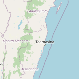
The park is situated in the eastern Central Highlands of Madagascar, a region characterized by rolling terrain and elevation changes typical of the island's interior highland margins. The landscape features humid forest vegetation adapted to the subtropical highland climate of eastern Madagascar. The terrain descends from higher ridgelines into valley areas that support denser forest growth, with streams and drainage features creating microhabitats throughout the protected area. The park is bounded to the south by National Road 2, a secondary route that provides access to Andasibe while also connecting to the railway corridor linking Antananarivo with the east coast port of Toamasina. The nearby Analamazaotra Forest Station demonstrates active reforestation efforts in the broader landscape surrounding the protected core area.

Analamazaotra National Park ecosystems, habitats, and plant life

Analamazaotra National Park protects forest habitats within one of Madagascar's most ecologically significant regions, where the eastern rainforest corridor supports exceptional biodiversity. The park's elevation range falls within the humid forest zone that characterizes much of eastern Madagascar, creating conditions suitable for numerous endemic plant and animal species. The forests within the park contribute to the broader ecological connectivity that exists across Madagascar's eastern protected area network, linking this site with adjacent parks and conservation zones. The combination of primary forest preservation within the park and active reforestation work at the neighboring forest station represents an integrated approach to maintaining forest ecosystem health in this part of Madagascar.

Analamazaotra National Park wildlife and species highlights

The park provides protected habitat for Madagascar's characteristic forest wildlife, including various lemur species that remain among the island's most iconic wildlife attractions. The eastern rainforest environment supports diverse endemic fauna adapted to the forest canopy and understory layers. As part of the larger Andasibe-Mantadia conservation landscape, Analamazaotra contributes to protecting species that depend on connected forest corridors across the eastern highlands. The park's status as a long-established protected area has allowed wildlife populations to persist in relatively intact forest habitat despite surrounding land use pressures.

Analamazaotra National Park conservation status and protection priorities

The establishment of Analamazaotra National Park reflects Madagascar's commitment to preserving its unique forest ecosystems and the endemic species they support. The park's evolution from special reserve to national park status demonstrates the country's approach to strengthening legal protection for key conservation areas. The incorporation of the Analamazaotra Forest Station into the national park boundary illustrates an integrated conservation model that combines strict protection of existing forest with active restoration of degraded areas. As an IUCN Category II protected area, the park is recognized as a national park meeting international standards for biodiversity preservation while also supporting sustainable management objectives.

Analamazaotra National Park cultural meaning and human context

The park is located in the Alaotra-Mangoro region, an area with historical ties to Madagascar's central highlands communities. The local place name Analamazaotra reflects Malagasy language origins, and the region has traditional connections to the island's interior populations. The nearby town of Moramanga and village of Andasibe serve as access points for visitors to the park, with local communities potentially benefiting from conservation-related tourism activities. The park's accessibility along National Road 2 places it within a landscape where conservation activities intersect with community land use patterns.

Top sights and standout views in Analamazaotra National Park

Analamazaotra National Park offers visitors access to protected rainforest in Madagascar's Central Highlands, with the park serving as part of a well-known circuit that includes the neighboring Andasibe-Mantadia National Park. The park's transformation in 2015 created a more comprehensive protected area that combines preserved forest with active reforestation lands. Its location approximately 27 kilometers from Moramanga makes it accessible for day visitors while maintaining meaningful conservation protection for eastern Madagascar forest ecosystems.

Best time to visit Analamazaotra National Park

The best time to visit Analamazaotra National Park aligns with Madagascar's dry season, typically from April through October, when weather conditions are more favorable for forest exploration and wildlife observation. The wet season from November through March brings higher rainfall to the eastern highlands, which can affect trail conditions and accessibility. Visitors planning trips to Madagascar's eastern parks should consider how seasonal weather patterns influence both the landscape conditions and their overall experience of the forest environment.

Park location guide

Geography guide, regional context, and park location map for Analamazaotra National Park

Analamazaotra National Park park geography, regions, and map view in Madagascar
Understand where Analamazaotra National Park sits in Madagascar through a broader geographic reading of the surrounding landscape, nearby location context, and its mapped position within the national park landscape.

How Analamazaotra National Park fits into Madagascar

Madagascar is an island nation in the Indian Ocean, positioned off the southeastern coast of Africa. As the world's fourth-largest island and second-largest island country, it stands out for its exceptional biodiversity, over 90% of its wildlife is endemic, making it one of 17 megadiverse countries. The population is approximately 32 million, with Antananarivo as both the capital and largest city.

Wider geography shaping Analamazaotra National Park in Madagascar

Madagascar lies in the Indian Ocean off the southeastern coast of Africa, separated from the mainland by the Mozambique Channel. The island is situated approximately 400 km from the African continent. As the world's fourth-largest island, it also includes numerous smaller peripheral islands.

Map view of Analamazaotra National Park

Use this park location map to pinpoint Analamazaotra National Park in Madagascar, understand its exact geographic position, and read its mapped placement within the surrounding landscape more clearly.

Pigeon | © OpenStreetMap contributors

Location context for Analamazaotra National Park

Alaotra-Mangoro

Visual reference for Analamazaotra's humid forest habitats and protected natural environment in Madagascar's Central Highlands.

Analamazaotra National Park Photos: Explore Landscapes, Scenery, and Protected Rainforest Views
Explore a visual atlas of Analamazaotra National Park's diverse landscapes, showcasing its humid rainforest terrain, endemic lemur habitats, and the distinct ecological character of Madagascar's eastern Central Highlands. These images provide essential geographic context and a deeper understanding of the park's conservation significance as a vital protected area within Madagascar's rich biodiversity corridor.

Lake in the Forest

Park atlas

Compare protected rainforest areas, tracing the regional spread of forest conservation across Madagascar's Eastern Highlands.

Explore Other National Parks and Protected Areas Near Analamazaotra National Park
Discover other national parks and protected areas situated near Analamazaotra National Park in Madagascar's Eastern Highlands, including the neighboring Andasibe-Mantadia National Park. This view allows you to compare diverse forest ecosystems, regional conservation efforts, and the geographic context of contiguous protected landscapes in one comprehensive atlas experience.
National parkMadagascar

Ranomafana National Park: Madagascar's premier Tropical Rainforest Protected Area

Explore its unique mapped geography and landscape context.

Ranomafana National Park stands as a crucial national park within Madagascar's protected lands, safeguarding a significant expanse of tropical rainforest. This page offers a deep dive into its geographic setting, detailing the mapped boundaries and the distinctive natural terrain that supports its exceptional biodiversity. Discover the atlas value of this protected landscape for understanding regional conservation and geographic context.

Area
416 km²
Established
1991
IUCN
II
National parkIhorombe Region

Isalo National Park: Explore Madagascar's Sandstone Canyons and Protected Landscape Geography

Discover unique geology, tapia woodlands, and regional park context.

Isalo National Park is a prominent protected area in Madagascar's Ihorombe Region, celebrated for its spectacular sandstone landscape. This national park features deep canyons, eroded rock domes, and striking runiform mountains, formed from ancient sedimentary deposits. The park preserves significant tapia woodlands and remarkable plant endemism, offering a rich context for understanding protected land distribution and Madagascar's unique geography. Its mapped terrain provides a visual atlas of natural wonders.

Area
815.4 km²
Established
1962
IUCN
II
Watercolor painting showing green fields, distant mountains, and a clear sky
National parkRéunion

Réunion National Park: Mapped Volcanic Landscape and Protected Area Exploration

Discover its dramatic cirques, active volcano, and endemic species.

Delve into the heart of Réunion National Park, a protected landscape renowned for its raw volcanic beauty and remarkable biodiversity. This detail page offers an atlas-driven perspective on its dramatic geological features, including the iconic cirques of Mafate, Salazie, and Cilaos, and the active Piton de la Fournaise. Understand the park's mapped boundaries and its significance as a UNESCO World Heritage site, showcasing a unique ecosystem with a high degree of endemic species found nowhere else. Explore the terrain that defines this spectacular Indian Ocean island.

Area
1,053.84 km²
Established
2007
IUCN
II
Relief
Mountain
National parkAnjouan

Mount Ntringui National Park: Protected Volcanic Landscape and Highland Geography on Anjouan

Explore its dramatic peaks, crater lake, and remnant montane forests.

Mount Ntringui National Park is a significant protected area situated in the rugged volcanic highlands of Anjouan. This national park preserves the island's highest peaks, Mount Ntringui and Mount Trindrini, alongside the unique Dzialandzé crater lake and the crucial Moya Forest. It stands as a vital refuge for endemic species and represents the last substantial tract of montane forest on Anjouan, offering deep insights into the region's unique ecology and mapped natural terrain.

Area
79.14 km²
Established
2010
IUCN
II
National parkAnjouan

Shisiwani National Park: Anjouan's Protected Marine and Island Landscape Atlas

Coastal and terrestrial protected area mapping in Comoros.

Delve into the protected landscape of Shisiwani National Park, a critical national park situated on Anjouan's Sima Peninsula in Comoros. This atlas entry details the park's combined marine and terrestrial boundaries, highlighting its vital coral reefs, mangrove forests, and unique island geography. Understand the park's role in conservation through its mapped extent and diverse natural environments, offering a clear geographic context for protected area exploration.

Area
64.97 km²
Established
2016
IUCN
II
National parkCabo Delgado Province

Quirimbas National Park: Coastal Protected Landscape and Island Archipelago Atlas

Discover marine conservation and inselberg terrain in Cabo Delgado.

Quirimbas National Park, located in Cabo Delgado Province, Mozambique, is a key protected area defined by its exceptional combination of marine and terrestrial environments. The park's geography includes eleven islands, extensive mangrove forests, and vibrant coral reefs, alongside a mainland characterized by striking inselberg formations. This national park is a vital site for understanding coastal landscape diversity, marine ecosystems, and protected-area geography within East Africa.

Area
1,430 km²
Established
1971
IUCN
II
Nature reserveMozambique

Niassa Reserve Nature Reserve: Mozambique's Expansive Protected Wilderness

Mapping the vast miombo woodlands and endemic species.

Niassa Reserve, a sprawling nature reserve in northern Mozambique, represents one of the largest miombo woodland ecosystems on Earth. Its diverse terrain encompasses dense forests, open savannahs, and riparian zones, making it a vital habitat for unique wildlife and a significant landmark in regional geography. The reserve's protected status and immense scale offer unparalleled opportunities for atlas-style exploration of its landscape and conservation importance.

Area
42,000 km²
Established
1954
IUCN
IV
National parkMozambique

Gorongosa National Park: Mozambique National Park with Diverse Rift Valley Ecosystems

Mapped protected area, savanna, and montane rainforest landscapes.

Gorongosa National Park is a premier protected area situated in Mozambique's Great African Rift Valley. This vast national park showcases an extraordinary range of natural landscapes, including extensive floodplains, acacia savannas, and rare montane rainforests within dramatic limestone gorges. Its geographic diversity is matched by its compelling narrative of ecological restoration, making it a significant site for understanding protected land dynamics and regional geography.

Area
3,770 km²
Established
1960
IUCN
II

Common questions about visiting, size, designation, and location context for Analamazaotra National Park

Analamazaotra National Park FAQs for park facts, access, geography, and protected area context
Find quick answers about Analamazaotra National Park, including protected-area facts, park geography, trail and visitor context, and how the park fits into its surrounding country and regional landscape.
MoriAtlas Explorer

Continue Your Protected Areas Search Across the Global Atlas

Deepen your exploration by continuing the structured search for national parks and protected areas worldwide. Utilize the comprehensive filtering capabilities to compare different conservation landscapes and refine your understanding of global park geography. Discover more about the distribution and characteristics of protected natural areas.

Global natural geography