Mori Atlas logo
National parkGorongosa National Park

Discover mapped terrain and diverse ecosystems across this key national park.

Gorongosa National Park: Mozambique's Protected Landscape in the Great African Rift Valley

Gorongosa National Park, a significant protected area in central Mozambique, lies within the dramatic Great African Rift Valley system. This national park covers approximately 3,770 square kilometers, encompassing a rich mosaic of landscapes ranging from seasonally flooded grasslands and acacia savannas to unique rainforests found in limestone gorges. Its geographic position dictates a remarkable diversity of ecosystems, supporting a complex web of natural terrain that is central to its identity as a vital protected landscape.

Rift Valley ecosystemSavanna protected areaWildlife restorationEcotourism destinationFreshwater wetlandsMiombo woodland

Gorongosa National Park

National park

Park overview

Structured park overview, official facts, and landscape profile for Gorongosa National Park

Gorongosa National Park park facts, protected area profile, and essential visitor context
Review the core facts for Gorongosa National Park, including designation, size, terrain, visitor scale, habitats, and operating context in one park-focused overview.

About Gorongosa National Park

Gorongosa National Park represents one of Mozambique's most ambitious conservation endeavors and a compelling case study in ecosystem restoration. Located in the heart of central Mozambique at the southern end of the Great African Rift Valley, the park protects a diverse landscape that ranges from the seasonally flooded valley floor at just 14 meters above sea level to the slopes of Mount Gorongosa at 1,863 meters. The park's defining feature is the dynamic interplay between its rivers, particularly the Vunduzi flowing from Mount Gorongosa, and the seasonal floodwaters of Lake Urema, which can expand to cover over 200 square kilometers during wet seasons before shrinking to as little as 10 square kilometers during dry periods. This constant hydrological cycle creates a complex mosaic of habitats that support remarkable biodiversity. The park's ecosystems span savanna grasslands dotted with acacia trees, dry forests on sandy soils, seasonally inundated pans, and dense thickets around termite mounds. The surrounding plateaus support characteristic miombo woodland, while the limestone gorges contain pockets of pristine rain forest. Mount Gorongosa itself harbors montane forests and riverine corridors that add further ecological complexity to this already diverse protected area.

Quick facts and research context for Gorongosa National Park

Gorongosa National Park lies in central Mozambique at the southern terminus of the Great African Rift Valley, with its valley floor situated about 21 kilometers west of Mount Gorongosa. The park features a complex hydrological system centered on Lake Urema, which expands dramatically during the rainy season and contracts substantially during the dry season. The ecosystem supports savanna as the dominant vegetation type, with significant woodland and grassland areas. The park is managed through a partnership between the Mozambican Government and the Carr Foundation, with ongoing restoration efforts focusing on rebuilding wildlife populations and developing sustainable ecotourism.

Park context

Deeper park guide and search-rich context for Gorongosa National Park

Gorongosa National Park history, landscape, wildlife, and travel context
Explore Gorongosa National Park through its history, landscape character, ecosystems, wildlife, conservation priorities, cultural context, and seasonal travel timing in a structured park guide built for atlas discovery and search intent.

Why Gorongosa National Park stands out

Gorongosa is best known for its dramatic ecological restoration story and its remarkable ecosystem diversity within a single protected area. The park harbors one of Africa's most significant wildlife comebacks, with species populations having been reduced by over 95 percent during civil war and now showing strong recovery. Its combination of valley floodplains, savanna woodlands, miombo forests, and montane rainforests on Mount Gorongosa creates an unusual concentration of habitats. The park is also notable for its leopard and African wild dog reintroduction programs and its role in regional flood moderation.

A young bushbuck with small horns resting on the ground among dry grass and palm fronds.
Young bushbuck resting in Gorongosa National Park, Mozambique.

Gorongosa National Park history and protected-area timeline

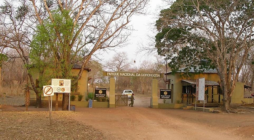
Gorongosa's formal protection began in 1920 when the Mozambique Company established a 1,000 square kilometer hunting reserve for administrators and their guests. The reserve expanded to 3,200 square kilometers in 1935 specifically to protect habitat for nyala and black rhino, both highly prized hunting trophies. By 1940, a headquarters and tourist camp had been established on the floodplain, though it was abandoned two years later due to flooding. Lions subsequently occupied the abandoned building, known as Casa dos Leões, which became a lasting tourist attraction. The area achieved national park status in 1960, and the late 1960s brought significant development including expanded visitor facilities and the first comprehensive scientific studies. An aerial survey conducted during this period documented impressive wildlife populations, including approximately 200 lions, 2,200 elephants, 14,000 buffalo, and 5,500 wildebeest. However, the Mozambican Civil War from 1977 to 1992 devastated the park. Fighting, bombing, and systematic poaching reduced large mammal populations by more than 95 percent, with elephants decimated for ivory and other species slaughtered for food. Some populations, including buffalo and sable antelope, disappeared entirely from aerial surveys for years afterward. Post-war restoration began in earnest in 2004 when the Mozambican Government partnered with the Carr Foundation, initiating infrastructure rebuilding, wildlife reintroductions, and community development programs.

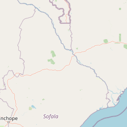
Gorongosa National Park landscape and geographic character

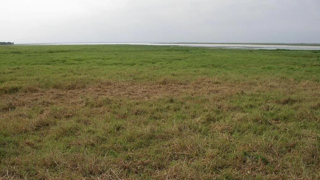
The physical landscape of Gorongosa National Park is defined by its position within the Great African Rift Valley system, a massive tectonic feature that has been forming for approximately 30 million years. The valley floor sits at low elevation, approximately 14 meters above sea level, while the surrounding terrain rises dramatically to the plateaus on either side and to Mount Gorongosa to the west. The landscape exhibits a remarkable diversity of landforms, from the flat, seasonally inundated floodplains around Lake Urema to the undulating terrain of the Cheringoma and Barue Plateaus. Limestone gorges cut into the plateaus, creating sheltered pockets where rainforests have developed. The valley's geology produces a mosaic of soil types that influences vegetation patterns across the park. The hydrological system centers on Lake Urema, a shallow body of water whose size fluctuates dramatically between wet and dry seasons, creating a constantly evolving landscape. Termite mounds are prominent features throughout the savanna, providing elevated terrain and shade for various wildlife species.

Wide grassy field with patches of brown and green vegetation extending to a distant water body under overcast sky
Grasslands and Lake Urema during dry season in Gorongosa National Park

Gorongosa National Park ecosystems, habitats, and plant life

The ecological character of Gorongosa is defined by the interplay between its diverse habitats and the seasonal rhythms of water availability. Scientists have identified three primary vegetation types: savanna covering approximately 76 percent of the park, woodlands comprising about 14 percent, and grasslands making up the remainder. The savanna consists of grass and woody species adapted to well-drained soils, while the woodlands include various forest and thicket types. The grasslands occupy areas subjected to harsh seasonal conditions that prevent tree establishment. Following the civil war, tree cover throughout the park increased significantly, likely due to the dramatic decline of large herbivores that previously kept woody vegetation in check. Mount Gorongosa adds further ecological complexity with its rainforests, montane grasslands, riverine forests, and lower elevation savanna woodlands. The valley's hydrological cycle creates distinct seasonal patterns, with the floodplains expanding and contracting and supporting different wildlife communities throughout the year.

Dirt road leading to yellow building entrance with 'PARQUE NACIONAL DA GORONGOSA' sign and parked vehicle
Entrance gate to Gorongosa National Park with signage and a vehicle on a dirt road

Gorongosa National Park wildlife and species highlights

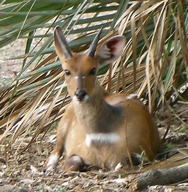
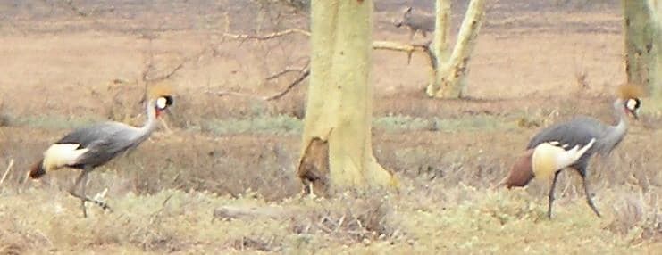
Gorongosa National Park was historically renowned for supporting some of the densest wildlife populations in Africa, including charismatic carnivores, large herbivores, and over 500 bird species. The pre-war aerial surveys documented substantial populations of lions, elephants, African buffalo, wildebeest, zebras, waterbuck, impala, hippos, eland, sable antelope, and hartebeest. The civil war devastated these populations, with some species driven locally extinct, including leopards, African wild dogs, and spotted hyenas. However, the post-war restoration has brought remarkable recovery. Leopards, absent from camera traps for 14 years, were recorded again in 2018 and reintroduction programs began in 2020. African wild dog packs from South Africa were reintroduced in 2018 and 2019, and spotted hyena reintroductions started in 2022. The park remains home to diverse wildlife including warthogs, Cape bushbuck, kudu, and numerous other species that have persisted or recovered in the decades since the conflict.

Two Grey Crowned Cranes standing in dry grass with scattered trees in the background
Grey Crowned Cranes walking in a dry grassland area of Gorongosa National Park

Gorongosa National Park conservation status and protection priorities

Gorongosa represents a significant conservation priority in southeastern Africa due to its unique combination of Rift Valley ecosystems and its role as a biodiversity corridor. The park's location at the southern end of the Great African Rift Valley places it within a biogeographically important zone. The partnership between the Mozambican Government and the Carr Foundation has made Gorongosa a model for post-conflict conservation, combining wildlife restoration with community development and sustainable ecotourism. The park's restoration has also demonstrated its value beyond biodiversity, with the protected wilderness area moderating water flow during extreme weather events such as Cyclone Idai in 2019, reducing flooding impacts on surrounding human communities. The inclusion of Mount Gorongosa within the park's boundaries in 2010 added important montane and rainforest habitat to the protected area, though this expansion has created ongoing tensions with long-term mountain residents.

Gorongosa National Park cultural meaning and human context

The Gorongosa region has a complex human history that intersects with its ecological narrative. The area was historically managed under Portuguese colonial administration through the Mozambique Company, which established the initial hunting reserve in 1920. Local communities have lived in and around the mountain for generations, and the 2010 expansion of the park to include Mount Gorongosa has created ongoing tensions between conservation objectives and resident livelihoods. The park's management strategy emphasizes developing ecotourism as a means of benefiting local communities, creating economic incentives for conservation among people who share the landscape with wildlife.

Top sights and standout views in Gorongosa National Park

The most compelling highlight of Gorongosa National Park is its extraordinary story of ecological recovery from near-total collapse during the Mozambican Civil War to a functioning ecosystem with growing wildlife populations. The park's habitat diversity, from valley floodplains to montane rainforests, supports a remarkable range of species within a single protected area. The reintroduction of apex predators including leopards, African wild dogs, and spotted hyenas has restored ecological balance. The dramatic seasonal transformation of the landscape, with Lake Urema expanding and contracting and floodplains inundating and drying, creates a dynamic visitor experience. The park also offers access to Mount Gorongosa, whose peaks and gorges contain forests found nowhere else in the region.

Best time to visit Gorongosa National Park

Gorongosa National Park can be visited throughout the year, though the experience varies significantly with the seasons. The dry season, from May to October, offers easier wildlife viewing as animals concentrate around remaining water sources and vegetation is less dense. The landscape during this period is more open and the floodplains recede, allowing access to areas that are underwater during the wet season. The wet season, from November to April, transforms the park with incoming waters and lush vegetation, creating different opportunities for birdwatching and experiencing the floodplain ecosystem at its most dynamic. The shoulder seasons of April and October often provide a balance between accessibility and seasonal character.

Park location guide

Geography guide, regional context, and park location map for Gorongosa National Park

Gorongosa National Park park geography, regions, and map view in Mozambique
Understand where Gorongosa National Park sits in Mozambique through a broader geographic reading of the surrounding landscape, nearby location context, and its mapped position within the national park landscape.

How Gorongosa National Park fits into Mozambique

Mozambique is a sovereign state in Southeast Africa spanning approximately 801,590 km² along the Indian Ocean. It borders Tanzania, Malawi, Zambia, Zimbabwe, Eswatini, and South Africa. The country gained independence in 1975 after Portuguese colonial rule and experienced a civil war from 1977 to 1992. Today it operates as a semi-presidential republic with a population of approximately 35 million people.

Wider geography shaping Gorongosa National Park in Mozambique

Mozambique occupies a coastal position along the Indian Ocean in southeastern Africa. The country shares borders with Tanzania to the north, Malawi and Zambia to the northwest, Zimbabwe to the west, and Eswatini and South Africa to the southwest. The terrain ranges from coastal plains to highlands in the west. The Mozambique Channel separates the country from Madagascar, Comoros, and Mayotte to the east.

Map view of Gorongosa National Park

Use this park location map to pinpoint Gorongosa National Park in Mozambique, understand its exact geographic position, and read its mapped placement within the surrounding landscape more clearly.

Pigeon | © OpenStreetMap contributors

Location context for Gorongosa National Park

ManicaSofala

Discover the unique scenery, terrain, and protected-area character of this Mozambican ecosystem through immersive photography.

Explore Gorongosa National Park: Visual Atlas of its Diverse Landscapes and Habitats
Gain a comprehensive visual understanding of Gorongosa National Park's remarkable ecosystems, from seasonally flooded grasslands to montane rainforests and riverine landscapes. These images provide essential geographic context, revealing the park's diverse terrain, wildlife habitats, and the dynamic seasonal changes within its protected boundaries.

A young bushbuck with small horns resting on the ground among dry grass and palm fronds.

Adult warthog with prominent tusks standing in tall grass with a warthog piglet partially visible behind it

Wide grassy field with patches of brown and green vegetation extending to a distant water body under overcast sky

Dirt road leading to yellow building entrance with 'PARQUE NACIONAL DA GORONGOSA' sign and parked vehicle

Two Grey Crowned Cranes standing in dry grass with scattered trees in the background

Waterbucks standing in a grassy savanna landscape with scattered trees

Park atlas

Gain regional context by tracing adjacent protected areas and the conservation landscapes near Gorongosa.

Explore Nearby National Parks and Protected Areas Beyond Gorongosa National Park
Continue your exploration by comparing national parks and protected areas located near Gorongosa National Park, tracing adjacent geographic zones and diverse conservation landscapes. Understanding these regional park entities provides essential atlas context, allowing you to map the geographic spread of protected landforms and broader ecosystem patterns.
National parkManica Province

Chimanimani National Park: Map of Mozambique's Highest Mountain Landscape

Explore protected highland terrain and transfrontier conservation geography.

Chimanimani National Park stands as a vital protected area in Mozambique's Manica Province, celebrated for its rugged mountain landscape and the presence of Monte Binga, the country's highest point. As the Mozambican portion of the Chimanimani Transfrontier Park, it offers critical insights into cross-border conservation efforts and the preservation of unique montane ecosystems. Discover the park's geographic context, its elevation extremes, and the significance of its protected boundaries within the regional atlas.

Area
656 km²
Established
2020
IUCN
II
Relief
Mountain
National parkZimbabwe

Nyanga National Park: Zimbabwe's Protected National Park Landscape Identity

Explore mapped boundaries and regional geography.

Nyanga National Park is a prime example of a protected landscape within Zimbabwe, offering distinct geographic features and mapped boundaries for detailed atlas exploration. As a national park, it serves as a critical point of reference for understanding the distribution of protected areas across Southeast Africa. This page provides foundational geographic context and landscape identity, allowing users to trace the park's physical presence and its role within the broader regional atlas.

Area
472 km²
Established
1926
IUCN
II
Relief
Mountain
National parkMalawi

Lengwe National Park: Malawi's Protected Landscape Atlas and Geographic Context

Mapped natural terrain and protected area boundaries in Malawi.

Lengwe National Park offers a focused look into Malawi's protected natural areas. As a designated national park, its geographic significance is highlighted through mapped boundaries and an understanding of the surrounding regional terrain. This entry provides essential context for exploring its identity as a protected landscape within southeastern Africa, contributing to a broader atlas of conservation areas.

Area
887 km²
Established
1970
IUCN
II
Climate
Tropical
National parkMozambique

Zinave National Park: A Mozambique National Park with Diverse Woodland and Savanna Landscapes

Explore its mapped terrain, riverine forests, and savanna ecosystems.

Zinave National Park in Mozambique is a significant protected area spanning 4,000 square kilometers. Its landscape comprises a rich variety of ecosystems, including miombo woodlands, mopane-dominated areas, acacia savannas, and distinct riverine forests along the Save River. This national park is strategically positioned within the Greater Limpopo Transfrontier Park, highlighting its importance for regional wildlife corridors and conservation geography. The terrain offers a unique insight into the transitional ecological zones of southern Africa, showcasing diverse natural habitats and mapping potential for its protected boundaries.

Area
4,000 km²
Established
1973
IUCN
II
Relief
Lowland
National parkTete Province

Magoe National Park: A National Park in Tete Province for Geographic and Landscape Exploration

Discover the mapped boundaries and regional geography of this protected area.

Magoe National Park serves as a crucial national park within Tete Province, providing a defined space for exploring regional geography and landscape features. This entry focuses on understanding the park's protected status and its mapped territories, offering valuable context for atlas and geographic research. Examine its location and boundaries to appreciate its role as a protected natural landscape within Mozambique.

Area
3,559 km²
Established
2013
Scope
Terrestrial
Water
Major water bodies
National parkMasvingo Province

Gonarezhou National Park: National Park Protected Landscape in Masvingo Province

Explore mapped boundaries and regional geography

Gonarezhou National Park represents a significant protected area within the geography of Masvingo Province, Zimbabwe. This page details its specific mapped boundaries and landscape context, offering a focused view for atlas-based exploration. Understand the park's natural terrain and its positioning within the regional protected lands for comprehensive geographic discovery.

Area
5,053 km²
Established
1975
IUCN
II
Relief
Mixed relief
National parkSouthern Region

Liwonde National Park: National Park in Malawi's Southern Region

Mapped Protected Area Boundaries and Geographic Context

Liwonde National Park is a designated national park situated in Malawi's Southern Region. This entry provides detailed geographic information, focusing on the park's mapped boundaries and its role within the broader atlas of protected landscapes. Explore the unique regional geography and conservation context that defines this protected area.

Area
548 km²
Established
1973
Relief
Upland
Climate
Tropical
National parkGaza Province

Banhine National Park National Park: Mapped Boundaries and Gaza Province Geographic Context

Discover the protected landscape identity of this national park.

Delve into the specifics of Banhine National Park, a designated national park situated within Gaza Province. This entry provides essential geographic details, focusing on its mapped protected area, its status as a national park, and how it fits within the broader regional geography of southern Mozambique. Understand the park's landform context and its atlas-relevant attributes for structured discovery.

Area
7,250 km²
Established
1973
IUCN
II
Relief
Lowland

Common questions about visiting, size, designation, and location context for Gorongosa National Park

Gorongosa National Park FAQs for park facts, access, geography, and protected area context
Find quick answers about Gorongosa National Park, including protected-area facts, park geography, trail and visitor context, and how the park fits into its surrounding country and regional landscape.
MoriAtlas Explorer

Continue Your Protected Areas Search Across the Global Atlas

Deepen your exploration by continuing the structured search for national parks and protected areas worldwide. Utilize the comprehensive filtering capabilities to compare different conservation landscapes and refine your understanding of global park geography. Discover more about the distribution and characteristics of protected natural areas.

Global natural geography