Mori Atlas logo
National parkMount Ntringui National Park

Discover the unique montane forest, crater lake, and dramatic peaks of this island national park.

Mount Ntringui National Park: Anjouan's Volcanic Protected Landscape and Highland Geography

(Parc National Mont Ntringui)

Mount Ntringui National Park represents a vital protected landscape in the central highlands of Anjouan, Comoros. Encompassing dramatic volcanic terrain, including the island's highest peaks, Mount Ntringui and Mount Trindrini, this national park safeguards critical montane forests and unique crater lake habitats. Its designation as a national park highlights its importance for conservation and offers a window into the island's remaining natural geography and endemic ecosystems.

volcanic landscapeisland protected areacrater lakemontane forestendemic speciesRamsar site

Mount Ntringui National Park

National park

Park overview

Structured park overview, official facts, and landscape profile for Mount Ntringui National Park

Mount Ntringui National Park park facts, protected area profile, and essential visitor context
Review the core facts for Mount Ntringui National Park, including designation, size, terrain, visitor scale, habitats, and operating context in one park-focused overview.

About Mount Ntringui National Park

Mount Ntringui National Park occupies the central volcanic highlands of Anjouan, one of the four islands comprising the Comoros archipelago in the western Indian Ocean. The park was formally established in 2010 through the Comoros National Parks Agency, representing the nation's commitment to preserving its natural heritage. The protected area spans approximately 79 square kilometers of mountainous terrain, encompassing not only the dramatic highland ridges but also the deep ravines and cirques carved by the island's perennial rivers that originate from these peaks. The landscape is defined by volcanic landforms, with the ancient crater housing Lake Dzialandzé providing a distinctive geographical feature at mid-elevation. The park serves as the primary ecological refuge for Anjouan, which has lost the vast majority of its original forest cover to agricultural expansion, timber harvesting, and grazing pressure over centuries.

Quick facts and research context for Mount Ntringui National Park

Mount Ntringui National Park is situated on Anjouan island in the Union of Comoros. The park contains two major peaks: Mount Ntringui at 1,595 meters, the highest point on the island, and Mount Trindrini at 1,474 meters. Lake Dzialandzé, a crater lake occupying two hectares at 900 meters elevation, is the island's largest lake. The Moya Forest, covering approximately 500 hectares in the park's southern sector, represents the largest remaining forest on Anjouan. The Comoros National Parks Agency administers the protected area, which holds IUCN Category II designation.

Park context

Deeper park guide and search-rich context for Mount Ntringui National Park

Mount Ntringui National Park history, landscape, wildlife, and travel context
Explore Mount Ntringui National Park through its history, landscape character, ecosystems, wildlife, conservation priorities, cultural context, and seasonal travel timing in a structured park guide built for atlas discovery and search intent.

Why Mount Ntringui National Park stands out

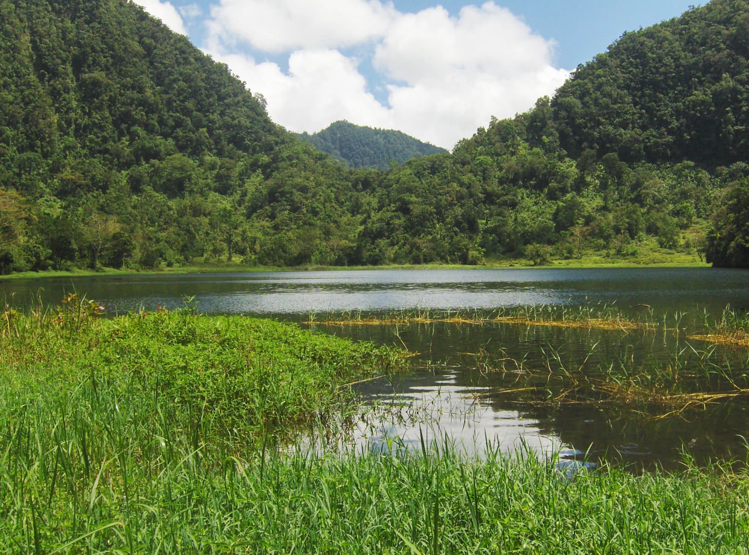
The park is best known for protecting the rugged volcanic highlands of central Anjouan, including the island's two highest peaks and the dramatic crater lake known as Lake Dzialandzé. It encompasses the last substantial forest tract on Anjouan, the Moya Forest, which contains several endemic and endangered species. The combination of montane forest, volcanic crests, and wetland habitats makes this park ecologically significant for the western Indian Ocean region.

Mount Ntringui National Park history and protected-area timeline

The park's establishment in 2010 marked a significant milestone in Comoros conservation history, formalizing protection for what remained of the island's highland ecosystems. Prior to formal designation, the area had already received international recognition when Lake Dzialandzé and surrounding wetlands were designated as a Ramsar Wetland in November 2006, reflecting the site's significance for biodiversity conservation under the Ramsar Convention on wetlands. The creation of the Comoros National Parks Agency provided the institutional framework for managing the protected area. The designation came at a critical time, as the island's remaining forests faced increasing pressure from human activities.

Mount Ntringui National Park landscape and geographic character

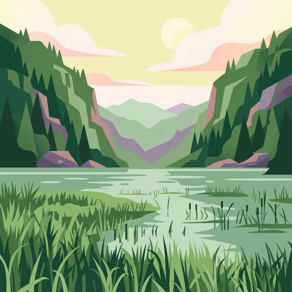
The park's landscape is characterized by volcanic mountain terrain rising dramatically from the island's central highlands. Mount Ntringui reaches 1,595 meters above sea level, making it the highest peak on Anjouan, while Mount Trindrini rises to 1,474 meters as the island's second-highest point. These twin peaks form the visual and ecological core of the park. Between and around them, deep ravines have been carved by the numerous permanent streams that originate from their slopes. Lake Dzialandzé sits at approximately 900 meters elevation in a volcanic crater on the southeastern flank of Mount Ntringui, its dark waters covering two hectares and forming Anjouan's largest lake. The terrain transitions from rocky summit ridges through forested slopes to the remnant forest tract of Moya Forest in the southern portion of the park.

Mount Ntringui National Park ecosystems, habitats, and plant life

The ecosystems within Mount Ntringui National Park represent what remains of the forest that originally covered all of Anjouan. The Moya Forest, located south of Mount Trindrini in the park's southern sector, is the largest contiguous forest remaining on the island, covering approximately 500 hectares. This forest remnant contains native vegetation communities adapted to the island's tropical montane environment. The crater lake and associated wetlands provide aquatic and riparian habitats distinct from the surrounding forested and exposed terrain. The park's elevation range, from lake level at 900 meters to the highest peaks, creates diverse microclimates and habitat zones across a relatively limited area.

Mount Ntringui National Park wildlife and species highlights

The park supports several notable species, particularly within the Moya Forest. Two species of fruit bats inhabit the forest canopy: Livingstone's flying fox (Pteropus livingstonii) and a Comoros variant of the Seychelles flying fox (Pteropus seychellensis var. comorensis). The forest also provides habitat for the Anjouan scops owl (Otus capnodes), an endemic owl species, and the mongoose lemur (Eulemur mongoz), a lemur species found only on Anjouan and the nearby island of Mohéli. Lake Dzialandzé is home to the little grebe, a small diving bird, as well as indigenous freshwater fish species that are found nowhere else in the world. This combination of endemic terrestrial and aquatic species gives the park particular conservation significance for biodiversity in the western Indian Ocean.

Mount Ntringui National Park conservation status and protection priorities

Mount Ntringui National Park represents the most important conservation site in Comoros, protecting the island's last significant forest remnants and highest biodiversity areas. The Ramsar designation in 2006 acknowledged the international importance of the wetland habitats within the park boundary. The park provides critical habitat for species with extremely restricted ranges, including several endemics found only on Anjouan. The remaining forest within the park continues to face pressures from timber harvesting and conversion to agricultural land, making active protection essential for the survival of the island's native species and ecosystems.

Mount Ntringui National Park cultural meaning and human context

Anjouan has a long history of human habitation, and the landscape within the park has been influenced by the island's rural communities over generations. The peaks of Mount Ntringui and Mount Trindrini hold local significance as the sources of many of the island's permanent water sources. The forests and waterways have historically provided resources for local populations. While the park itself does not contain major archaeological or historical structures, the landscape reflects centuries of traditional land use that have shaped both the environment and local cultural practices.

Top sights and standout views in Mount Ntringui National Park

The park's defining features include the twin volcanic peaks of Mount Ntringui and Mount Trindrini, the crater lake at Lake Dzialandzé, and the significant Moya Forest with its endemic wildlife including the mongoose lemur and Anjouan scops owl. The combination of montane forest, volcanic terrain, and wetland habitats within a single protected area creates exceptional ecological diversity. As the highest point on Anjouan, Mount Ntringui offers dramatic views across the island and Indian Ocean beyond.

Best time to visit Mount Ntringui National Park

The park can be visited throughout the year, though the cooler dry season from May through October typically offers more comfortable conditions for hiking and exploration. The mountain environment can be misty and wet during the warmer rainy season from November to April. Visitors interested in wildlife viewing may find different species more active during different seasons, though the forest wildlife is present year-round.

Park location guide

Geography guide, regional context, and park location map for Mount Ntringui National Park

Mount Ntringui National Park park geography, regions, and map view in Comoros
Understand where Mount Ntringui National Park sits in Comoros through a broader geographic reading of the surrounding landscape, nearby location context, and its mapped position within the national park landscape.

How Mount Ntringui National Park fits into Comoros

Comoros is an island nation in the Indian Ocean located at the northern end of the Mozambique Channel. It consists of three main islands: Grande Comore, Anjouan, and Mohéli. The country gained independence from France in 1975 and is a member of the Arab League, African Union, and Organisation of Islamic Co-operation. It has three official languages: Comorian, French, and Arabic.

Wider geography shaping Mount Ntringui National Park in Comoros

Comoros is situated in the Indian Ocean at the northern end of the Mozambique Channel, between Madagascar and the African mainland. The country consists of three main volcanic islands: Grande Comore, Anjouan, and Mohéli. The islands are part of the Comoro Islands archipelago.

Map view of Mount Ntringui National Park

Use this park location map to pinpoint Mount Ntringui National Park in Comoros, understand its exact geographic position, and read its mapped placement within the surrounding landscape more clearly.

Pigeon | © OpenStreetMap contributors

Location context for Mount Ntringui National Park

Anjouan
Park atlas

Trace the regional spread of protected areas in the Comoros archipelago, comparing diverse volcanic and island conservation zones.

Discover Adjacent Protected Landscapes and Parks Beyond Mount Ntringui National Park
After exploring Mount Ntringui National Park's volcanic peaks and unique montane forests, browse other nearby protected areas and island conservation landscapes within the Comoros archipelago. Comparing these parks allows you to understand the regional spread of critical habitats and conservation efforts across similar Indian Ocean island geographies.
National parkAnjouan

Shisiwani National Park: Anjouan's Protected Marine and Island Landscape Atlas

Coastal and terrestrial protected area mapping in Comoros.

Delve into the protected landscape of Shisiwani National Park, a critical national park situated on Anjouan's Sima Peninsula in Comoros. This atlas entry details the park's combined marine and terrestrial boundaries, highlighting its vital coral reefs, mangrove forests, and unique island geography. Understand the park's role in conservation through its mapped extent and diverse natural environments, offering a clear geographic context for protected area exploration.

Area
64.97 km²
Established
2016
IUCN
II
National parkCabo Delgado Province

Quirimbas National Park: Coastal Protected Landscape and Island Archipelago Atlas

Discover marine conservation and inselberg terrain in Cabo Delgado.

Quirimbas National Park, located in Cabo Delgado Province, Mozambique, is a key protected area defined by its exceptional combination of marine and terrestrial environments. The park's geography includes eleven islands, extensive mangrove forests, and vibrant coral reefs, alongside a mainland characterized by striking inselberg formations. This national park is a vital site for understanding coastal landscape diversity, marine ecosystems, and protected-area geography within East Africa.

Area
1,430 km²
Established
1971
IUCN
II
Nature reserveMozambique

Niassa Reserve Nature Reserve: Mozambique's Expansive Protected Wilderness

Mapping the vast miombo woodlands and endemic species.

Niassa Reserve, a sprawling nature reserve in northern Mozambique, represents one of the largest miombo woodland ecosystems on Earth. Its diverse terrain encompasses dense forests, open savannahs, and riparian zones, making it a vital habitat for unique wildlife and a significant landmark in regional geography. The reserve's protected status and immense scale offer unparalleled opportunities for atlas-style exploration of its landscape and conservation importance.

Area
42,000 km²
Established
1954
IUCN
IV
National parkTanzania

Nyerere National Park: Tanzania's Immense Protected Area and Rufiji River Landscape

Explore the savanna and river delta geography of this national park.

Nyerere National Park represents one of Tanzania's most significant protected areas, sprawling across southeastern regions and offering a glimpse into largely untouched wilderness. The park's identity is deeply intertwined with the Rufiji River and its expansive delta, home to one of the world's largest mangrove forest systems. As a national park, its vastness and diverse terrain provide critical habitat, making it a key point for understanding protected land distribution and regional landscape context within Tanzania.

Area
30,893 km²
Established
2019
IUCN
II
National parkAlaotra-Mangoro

Analamazaotra National Park: Protected Rainforest Ecosystem and Mapped Landscape in Alaotra-Mangoro

Explore Madagascar's Eastern Highlands protected area geography.

Analamazaotra National Park, situated in Madagascar's Alaotra-Mangoro region, represents a critical segment of the island's protected eastern rainforests. This national park is mapped as a vital conservation area, offering insights into its unique ecosystems and natural terrain. Understanding Analamazaotra National Park's geographic placement and protected boundaries provides essential context for regional landscape exploration and atlas-based geographic discovery within Madagascar.

Area
26.53 km²
Established
2015
IUCN
II
National parkMorogoro Region

Mikumi National Park: East African Savannah Protected Landscape in Morogoro Region

Mapped boundaries and regional geography for a key Tanzanian national park.

Mikumi National Park, a vital protected area in Tanzania's Morogoro Region, offers a classic savannah experience with iconic baobab trees and diverse wildlife populations. This national park is distinguished by its extensive alluvial plains, shaped by the Mkata River basin, and its significant role as a wilderness corridor connecting with the larger Selous Game Reserve. The park's terrain includes Malundwe Mountain and views of the Uluguru Mountains, providing a rich geographic backdrop for understanding East African protected lands and their atlas-style distribution.

Area
3,230 km²
Established
1964
IUCN
II
National parkKenya

Kisite-Mpunguti Marine National Park: Kenya's Coastal Protected Marine Landscape

Mapped coral reefs and diverse marine ecosystems.

As Kenya's foremost marine national park, Kisite-Mpunguti Marine National Park presents an unparalleled opportunity to explore a thriving underwater world. Its protected boundaries encompass remarkable coral formations and a rich tapestry of marine species, including diverse fish populations, sea turtles, and dolphins. This park is a cornerstone of coastal conservation, offering valuable insights into marine geography and ecosystem health for those seeking detailed landscape context.

Area
39 km²
Established
1973
IUCN
II
National parkMadagascar

Ranomafana National Park: Madagascar's premier Tropical Rainforest Protected Area

Explore its unique mapped geography and landscape context.

Ranomafana National Park stands as a crucial national park within Madagascar's protected lands, safeguarding a significant expanse of tropical rainforest. This page offers a deep dive into its geographic setting, detailing the mapped boundaries and the distinctive natural terrain that supports its exceptional biodiversity. Discover the atlas value of this protected landscape for understanding regional conservation and geographic context.

Area
416 km²
Established
1991
IUCN
II

Common questions about visiting, size, designation, and location context for Mount Ntringui National Park

Mount Ntringui National Park FAQs for park facts, access, geography, and protected area context
Find quick answers about Mount Ntringui National Park, including protected-area facts, park geography, trail and visitor context, and how the park fits into its surrounding country and regional landscape.
MoriAtlas Explorer

Continue Your Protected Areas Search Across the Global Atlas

Deepen your exploration by continuing the structured search for national parks and protected areas worldwide. Utilize the comprehensive filtering capabilities to compare different conservation landscapes and refine your understanding of global park geography. Discover more about the distribution and characteristics of protected natural areas.

Global natural geography