Mori Atlas logo
National parkBenambra National Park

Discover the mapped boundaries and landscape context of this New South Wales national park.

Benambra National Park: Protected Woodlands and Great Yambla Range Geography

Benambra National Park represents a vital protected area within New South Wales, Australia, safeguarding critical remnant box woodland ecosystems that have largely vanished from the state. Situated at the northern end of the Great Yambla Range, the park's terrain is characterized by striking cliff faces and flat-topped peaks contrasting with the surrounding agricultural regions. Its protected landscape offers unique insights into regional geography and habitat for threatened species, making it a significant site for atlas-driven exploration of Australia's natural heritage.

woodland national parksNew South Wales national parksbox woodland ecosystemsGreat Yambla Rangethreatened bird habitatAustralian protected areas

Benambra National Park

National park

Park overview

Structured park overview, official facts, and landscape profile for Benambra National Park

Benambra National Park park facts, protected area profile, and essential visitor context
Review the core facts for Benambra National Park, including designation, size, terrain, visitor scale, habitats, and operating context in one park-focused overview.

About Benambra National Park

Benambra National Park represents a significant conservation enclave in the heavily cleared agricultural landscape of the South West Slopes region. The park was established in 2001 specifically to protect remaining pockets of white box and Red Box woodlands, vegetation types that once dominated large areas of inland New South Wales but have been reduced to fragments by extensive land clearing for agriculture and grazing. The park's position at the northern end of the Great Yambla Range provides it with a distinctive landscape character. The range extends for 23 kilometres and is composed of cliff faces and flat-topped peaks formed as part of the Lachlan Fold Belt, a major geological structure in eastern Australia. The altitudinal range of 328 to 646 metres creates diverse habitat conditions across the park, from steeply sloping hills to relatively flat low-lying country in the northeast. This topographical variation supports multiple vegetation communities that together form a heterogeneous woodland ecosystem. The park is almost entirely surrounded by private agricultural land, creating an island of intact habitat within a largely cleared landscape. This isolation makes the park particularly important as a refuge for woodland-dependent species that have declined across the region.

Quick facts and research context for Benambra National Park

Benambra National Park is situated at the northern end of the Great Yambla Range in the South West Slopes of New South Wales. The park was gazetted in 2001 to protect remnant box woodland communities, though it was first declared as a forest reserve in 1879 and reclassified as state forest in 1918. The landscape features steep hills and flat-topped peaks rising to 646 metres, with the park almost entirely surrounded by private land. Access requires contacting the NSW National Parks and Wildlife Service. The park contains Morgan's Cave, reputedly used by bushranger Dan Morgan in the 1860s.

Park context

Deeper park guide and search-rich context for Benambra National Park

Benambra National Park history, landscape, wildlife, and travel context
Explore Benambra National Park through its history, landscape character, ecosystems, wildlife, conservation priorities, cultural context, and seasonal travel timing in a structured park guide built for atlas discovery and search intent.

Why Benambra National Park stands out

Benambra National Park is best known for its protection of remnant white box and Red Box woodland communities, which have been extensively cleared across New South Wales. These endangered woodland ecosystems support a remarkable diversity of threatened bird species, including the regent honeyeater, swift parrot, and black-chinned honeyeater. The park's location at the northern end of the Great Yambla Range provides dramatic cliff faces and flat-topped peaks that contrast with the surrounding agricultural landscape. The presence of the vulnerable woolly ragwort (Senecio garlandii) adds botanical significance to this relatively small protected area.

Benambra National Park history and protected-area timeline

Benambra National Park has a long history of human use and administrative changes that reflect broader patterns of land management in New South Wales. The area was initially declared a forest reserve in 1879, reflecting early colonial recognition of the region's timber resources. In May 1918, the status was changed to state forest, aligning with contemporary forestry management approaches that emphasised sustainable timber production. The transition to national park status in 2001 marked a significant shift in management priorities, from timber production to biodiversity conservation. This change was driven by increased understanding of the ecological value of remnant woodland communities and the threats they face from ongoing habitat loss and degradation. The park has a history of use for grazing and small-scale timber harvesting for firewood and fencing, activities that shaped the landscape prior to formal protection. A significant fire event in 1985 burnt the entire park after a lightning strike ignited a fire northwest of the reserve, which then burned through the park and stopped at a property adjacent to the eastern boundary. The park also contains historical heritage value through Morgan's Cave, a large cave reputedly used in the 1860s as a refuge by the notorious bushranger Dan Morgan.

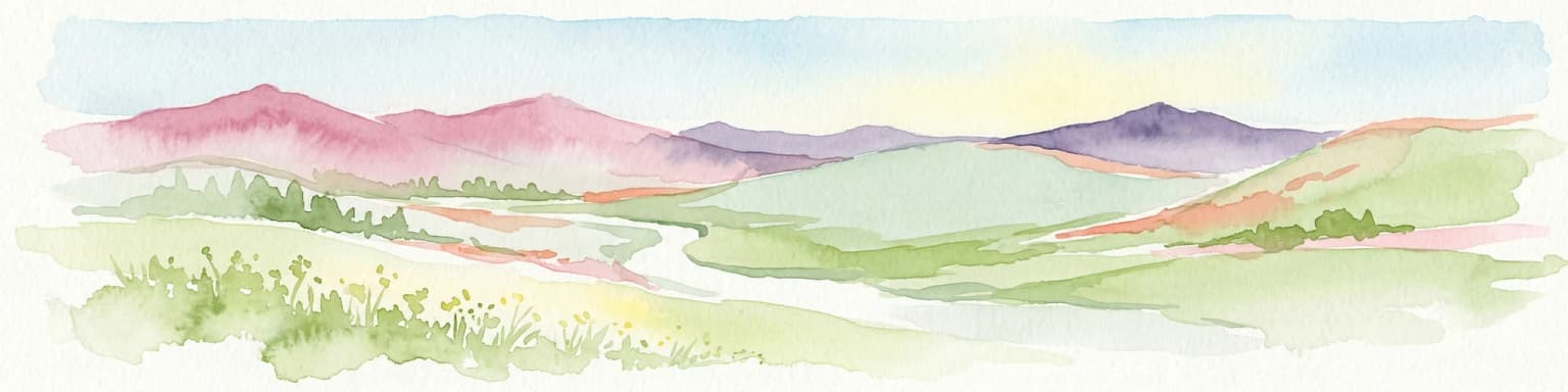
Benambra National Park landscape and geographic character

The landscape of Benambra National Park is defined by its position at the northern end of the Great Yambla Range, a prominent geological feature extending roughly 23 kilometres in length. The range is characterised by cliff faces and flat-topped peaks that rise above the surrounding agricultural plains, creating a visually distinctive backdrop. The park encompasses steeply sloping hills across most of its extent, with terrain that reflects the underlying Lachlan Fold Belt geology. Only the northeastern section of the park occupies relatively flat, low-lying country, providing contrast to the steeper hill country that dominates most of the protected area. The altitudinal range spans from 328 metres to 646 metres above sea level, giving the park considerable topographic diversity within its relatively modest 13.99 square kilometre extent. This variation in elevation and slope creates multiple microhabitats and contributes to the heterogeneity of vegetation communities found within the park.

Benambra National Park ecosystems, habitats, and plant life

The nature of Benambra National Park centres on its diverse woodland communities that represent some of the last remaining intact remnants of box woodland ecosystems in the South West Slopes region. The dominant vegetation is red box-white box dry shrub open forest, which covers approximately 69 percent of the park and represents the core conservation value of the area. This community is interspersed with several other vegetation types including red box-long-leaved box grassy forest (8 percent), red box swampy flat woodland (7 percent), Dwyer's red gum-black Cypress pine grass woodland (5 percent), and Currawang wattle-drooping she-oak shrubland (2 percent). The presence of the vulnerable woolly ragwort (Senecio garlandii) within the park adds significant botanical importance, as this species is listed as vulnerable under the NSW Biodiversity Conservation Act 2016. The park faces challenges from invasive plant species including St. John's wort, Paterson's curse, and tree of heaven, which threaten the integrity of native vegetation communities.

Benambra National Park wildlife and species highlights

Benambra National Park supports a remarkable concentration of threatened wildlife, particularly woodland-dependent bird species that have declined across much of their former range in southeastern Australia. The park provides critical habitat for at least twelve threatened bird species, including the regent honeyeater, swift parrot, black-chinned honeyeater, grey-crowned babbler, hooded robin, diamond firetail, painted honeyeater, turquoise parrot, brown treecreeper, and speckled warbler. Many of these species are dependent on intact woodland habitats for nesting and foraging, making remnant protected areas like Benambra increasingly important as regional habitat continues to be lost. The park also supports threatened mammals including the southeastern long-eared bat, squirrel glider, eastern pygmy possum, and yellow-footed antechinus. Reptiles such as the yellow-faced whipsnake are also present. The park's wildlife community faces pressure from introduced pest species including European fox, feral goat, feral cat, and European rabbit.

Benambra National Park conservation status and protection priorities

Benambra National Park was established specifically to protect remnant areas of white box and Red Box woodlands that had been extensively cleared across New South Wales. This protection addresses a major conservation challenge in the state, as these woodland communities have been reduced to scattered fragments through historical land clearing for agriculture. The park now serves as a refuge for numerous threatened species that depend on intact woodland habitats. The presence of the vulnerable woolly ragwort adds formal conservation significance under NSW legislation. However, the park faces ongoing challenges from invasive plants and animals that threaten native biodiversity. The fact that the park is almost entirely surrounded by private agricultural land creates both conservation challenges and opportunities, as the park represents an island of intact habitat within a heavily cleared landscape where woodland-dependent species have become increasingly isolated.

Benambra National Park cultural meaning and human context

The park contains Morgan's Cave, a large cave within the park that was reputedly used in the 1860s as a refuge by the notorious bushranger Daniel Morgan. This historical association adds a dimension of cultural heritage to the park's identity, connecting the landscape to stories of colonial-era bushrangers that remain part of Australian folk history. The broader South West Slopes region has a history of European settlement and agricultural development that shaped both the landscape and the surrounding land uses that now border the park. The park's history as a forest reserve from 1879 through to its declaration as a national park in 2001 reflects changing attitudes towards land management and conservation priorities in New South Wales.

Top sights and standout views in Benambra National Park

Benambra National Park provides important protection for remnant box woodland communities in a heavily cleared agricultural region. The Great Yambla Range within the park offers dramatic cliff faces and flat-topped peaks contrasting with surrounding farmland. The park supports at least twelve threatened bird species including the regent honeyeater and swift parrot, making it a significant site for woodland bird conservation. The vulnerable woolly ragwort occurs within the park, adding botanical significance. Historical heritage includes Morgan's Cave, associated with bushranger Dan Morgan. The park's isolation within private agricultural land creates both conservation challenges and emphasizes the importance of remnant habitat protection.

Best time to visit Benambra National Park

The park can be visited throughout the year, though spring and autumn typically offer comfortable temperatures for bushwalking and birdwatching activities. These seasons also coincide with flowering periods when woodland wildflowers and the vulnerable woolly ragwort may be in bloom, adding botanical interest to visits. Summer months can bring hot conditions given the inland location, while winter may offer cooler but potentially pleasant conditions for exploring the park's trails. Visitors should note that the park is almost entirely surrounded by private land and access requires contacting the NSW National Parks and Wildlife Service in advance.

Park location guide

Geography guide, regional context, and park location map for Benambra National Park

Benambra National Park park geography, regions, and map view in Australia
Understand where Benambra National Park sits in Australia through a broader geographic reading of the surrounding landscape, nearby location context, and its mapped position within the national park landscape.

How Benambra National Park fits into Australia

Australia is a constitutional monarchy and federal parliamentary democracy comprising six states and ten territories. With a population of nearly 28 million, it is one of the world's most urbanised countries, with most people concentrated on the eastern seaboard. The country has a high Human Development Index and is known for its cultural diversity, ancient Aboriginal heritage, and unique wildlife.

Wider geography shaping Benambra National Park in Australia

Australia occupies the entire Australian continent, the island of Tasmania, and numerous smaller islands. It is the world's flattest and driest inhabited continent, featuring vast deserts in the interior (the Outback), tropical rainforests along the eastern coast, and a coastline bordering the Indian and Pacific Oceans.

Map view of Benambra National Park

Use this park location map to pinpoint Benambra National Park in Australia, understand its exact geographic position, and read its mapped placement within the surrounding landscape more clearly.

Pigeon | © OpenStreetMap contributors

Location context for Benambra National Park

New South Wales
Park atlas

Compare adjacent protected landscapes and trace the regional geography of national parks surrounding Benambra National Park in New South Wales.

Parks and Protected Areas Near Benambra National Park, South West Slopes, New South Wales
After exploring Benambra National Park, browse other national parks and protected areas located within the South West Slopes region of New South Wales, Australia, to understand their diverse landscapes. Compare their unique conservation profiles and geographic spread to see how they contribute to the regional network of protected woodlands and ranges.
National parkNew South Wales

Kosciuszko National Park: Australia's Highest Alpine Terrain and Mapped Protected Landscape

Discover unique glacial landscapes and geographic context in New South Wales.

Kosciuszko National Park represents the pinnacle of Australia's alpine geography, preserving the continent's only true alpine ecosystems. This extensive national park in New South Wales features dramatic glacial landforms, including its namesake Mount Kosciuszko, Australia's highest peak. Users can explore the park's mapped boundaries, surrounding natural terrain, and unique landscape features for a comprehensive understanding of this significant protected area.

Area
6,900 km²
Established
1944
IUCN
II
Visitors
3.3M annual
National parkNew South Wales

Brindabella National Park: A Protected Mountain Landscape in New South Wales' Australian Alps

Discover its mapped terrain and regional geographic context.

Brindabella National Park offers a unique perspective on the mountainous terrain of the Brindabella Range, forming a vital protected area within the Australian Alps. Located in New South Wales, its landscape features rugged ridgelines and diverse subalpine vegetation, recognized for its national environmental significance. This park serves as a key destination for understanding protected area geography and the mapped context of Australia's high country.

Area
184.54 km²
Established
1996
IUCN
II
National parkNew South Wales

Jindalee National Park: New South Wales National Park Protecting Cypress Pine Woodlands

Explore unique mapped terrain and regional conservation landscape.

Jindalee National Park represents a vital conservation effort in New South Wales, safeguarding remaining cypress pine woodlands and Critically Endangered grassy woodland ecosystems. Situated in the South West Slopes region, its undulating terrain and drainage lines form a distinctive natural landscape. The park's designation as a national park underscores its importance for preserving threatened species habitats and offers a focused point for atlas-driven discovery of its unique protected-area character and geographic context.

Area
10.76 km²
Established
2011
IUCN
II
National parkVictoria

Alpine National Park: Victoria's Premier National Park Protected Landscape Atlas

Explore its mapped boundaries and regional geographic context.

Alpine National Park stands as a paramount example of a protected natural landscape in Victoria, Australia. As the region's largest national park, its mapped boundaries and diverse terrain offer deep insights into the broader geographic context of the Australian Alps. This dedicated entry facilitates structured discovery of its protected-area status and its importance within the mapped natural heritage of Victoria.

Area
6,474 km²
Established
1989
IUCN
II
National parkVictoria

Lower Goulburn National Park: Mapping Victoria's River Red Gum Woodlands and Riparian Protected Area

Discover unique riverine forest and protected landscape context in Victoria

Lower Goulburn National Park represents a crucial protected corridor in Victoria, Australia, primarily safeguarding magnificent stands of river red gum woodlands along the Goulburn River. This national park offers a unique opportunity to explore a well-preserved riparian ecosystem within a modified agricultural region. Understand its linear geographic layout, the distinct arboreal character of its landscape, and its role in maintaining natural river processes and wildlife connectivity. The park's identity is deeply tied to the visual spectacle of its iconic eucalyptus canopy framing the waterway, providing valuable context for its protected status and ecological importance.

Area
93.1 km²
Established
2010
IUCN
II
National parkVictoria

Lake Eildon National Park: Protected Landscape and Gold Mining Heritage in Victoria

Explore ancient volcanic terrain and mapped forest environments.

Lake Eildon National Park represents a significant protected area within Victoria's Central Highlands, offering a unique blend of natural and historical discovery. The park encompasses diverse eucalypt forests and mountainous terrain, shaped by the remnants of the ancient Cerberean Caldera supervolcano. Visitors can explore mapped park boundaries and understand the area's rich gold rush heritage, alongside the central feature of Lake Eildon itself, making it a distinctive national park for geographic and landscape context.

Area
277.5 km²
Established
1997
IUCN
II
National parkRiverina

Cocoparra National Park: Semi-Arid Hill Country and Protected Landscape in Riverina

Explore mapped geography and key natural features of this Australian national park.

Cocoparra National Park is an essential protected natural area within Australia's Riverina region, noted for its striking semi-arid landscape. The park features a prominent range of low hills, including Bingar Mountain, rising from the predominantly flat terrain. This distinctive geography, characterized by rocky sandstone ridges and characteristic woodland communities, offers valuable insights into the region's natural heritage. As an Important Bird Area, Cocoparra National Park also holds significant conservation value for its avian populations and their unique inland habitat.

Area
83.57 km²
Established
1969
IUCN
II
National parkVictoria

Snowy River National Park: Victoria's Deep Gorges and Alpine Wilderness Discovery

Explore the mapped boundaries and geographic context of this protected landscape.

Snowy River National Park in Victoria offers a profound exploration of rugged alpine terrain and striking river gorges, including the remarkable Little River Gorge. As a designated national park and wilderness area, it protects diverse ecosystems and is a vital component of the Australian Alps National Parks. Discover its geographic identity, natural landscapes, and importance as a mapped protected area for understanding Victoria's conservation network.

Area
987 km²
Established
1979
IUCN
II

Common questions about visiting, size, designation, and location context for Benambra National Park

Benambra National Park FAQs for park facts, access, geography, and protected area context
Find quick answers about Benambra National Park, including protected-area facts, park geography, trail and visitor context, and how the park fits into its surrounding country and regional landscape.
MoriAtlas Explorer

Continue Your Protected Areas Search Across the Global Atlas

Deepen your exploration by continuing the structured search for national parks and protected areas worldwide. Utilize the comprehensive filtering capabilities to compare different conservation landscapes and refine your understanding of global park geography. Discover more about the distribution and characteristics of protected natural areas.

Global natural geography