Mori Atlas logo
National parkLake Eildon National Park

Discover the ancient volcanic terrain and historic goldfields within this Victorian national park.

Lake Eildon National Park: Mapped Protected Landscape and Regional Geography in Victoria

Lake Eildon National Park in Victoria, Australia, offers a distinct geographic exploration centered around its namesake reservoir. This national park preserves remnants of the ancient Cerberean Caldera, a supervolcano whose geological impact is still visible in the rugged granite outcrops and mountainous terrain. Users can delve into the park's mapped boundaries and understand its role as a protected forest landscape within the Central Highlands region.

National ParksVictoria AustraliaLake EildonGold Mining HeritageVolcanic GeologyEucalypt Forest

Lake Eildon National Park

National park

Park overview

Structured park overview, official facts, and landscape profile for Lake Eildon National Park

Lake Eildon National Park park facts, protected area profile, and essential visitor context
Review the core facts for Lake Eildon National Park, including designation, size, terrain, visitor scale, habitats, and operating context in one park-focused overview.

About Lake Eildon National Park

Lake Eildon National Park occupies a distinctive place in Victoria's protected area network as a park centered on a large artificial reservoir while also preserving significant natural and cultural heritage. The park's five blocks, known as Enterprise, Jamieson, Jerusalem, Fraser, and Wappan, surround Lake Eildon and provide diverse visitor experiences ranging from highly developed camping areas with full amenities to remote sections accessible only by boat or on foot.

The park's location in the Central Highlands places it within one of Victoria's most vegetated and geographically varied regions. The terrain is predominantly mountainous with peaks reaching 900 meters, creating scenic landscapes that attract visitors seeking both water-based recreation on the lake and exploration of the forested upland areas. The Fraser block on the western side is the most developed, containing three campgrounds with flushing toilets, hot showers, drinking water, and gas barbecues, while the Wappan block in the northwest remains the least accessible with no public vehicle roads.

Visitor use of the park centers heavily on Lake Eildon, with power boating and water skiing being popular activities on the reservoir. The park provides access points throughout its blocks, allowing visitors to launch boats and explore the lake's many coves and inlets. Deer hunting is permitted in season within designated sections of the park, particularly in the Jerusalem block.

Quick facts and research context for Lake Eildon National Park

Lake Eildon National Park is situated in Victoria's Central Highlands, about 111 kilometers northeast of Melbourne. The park covers 27,750 hectares across five non-contiguous blocks that surround Lake Eildon. The park was established in 1997 through the merger of the former Fraser National Park and Eildon State Park. The landscape reaches elevations of 900 meters and includes remnants of the ancient Cerberean Caldera, a geological structure dating back approximately 380 million years. The park supports 34 mammal species, 89 bird species, 17 reptile species, and 10 amphibian species.

Park context

Deeper park guide and search-rich context for Lake Eildon National Park

Lake Eildon National Park history, landscape, wildlife, and travel context
Explore Lake Eildon National Park through its history, landscape character, ecosystems, wildlife, conservation priorities, cultural context, and seasonal travel timing in a structured park guide built for atlas discovery and search intent.

Why Lake Eildon National Park stands out

Lake Eildon National Park is best known for its central feature, Lake Eildon, which provides the focal point for visitor activities and defines the park's character. The park is also recognized for its significant gold mining heritage, with well-preserved sites such as Italian Gully and Sunnyslopes Hut demonstrating the area's 19th-century mining history. The geological significance of the Cerberean Caldera, a ancient supervolcano whose remnants are visible throughout the park, distinguishes it from other Victorian national parks. The park's successful koala reintroduction program, which began in 1967 with 25 animals from Phillip Island, represents a notable conservation achievement.

Lake Eildon National Park history and protected-area timeline

The land now comprising Lake Eildon National Park has a rich human history spanning thousands of years. The Goulburn River Valley was home to hundreds of members of the Taungurung people, an Aboriginal Australian group whose cultural sites and connection to the land would be dramatically altered by the creation of Lake Eildon in the 1950s. Many significant cultural sites belonging to the Taungurung were flooded as the reservoir filled, erasing important physical evidence of Aboriginal occupation and spiritual connection to the landscape.

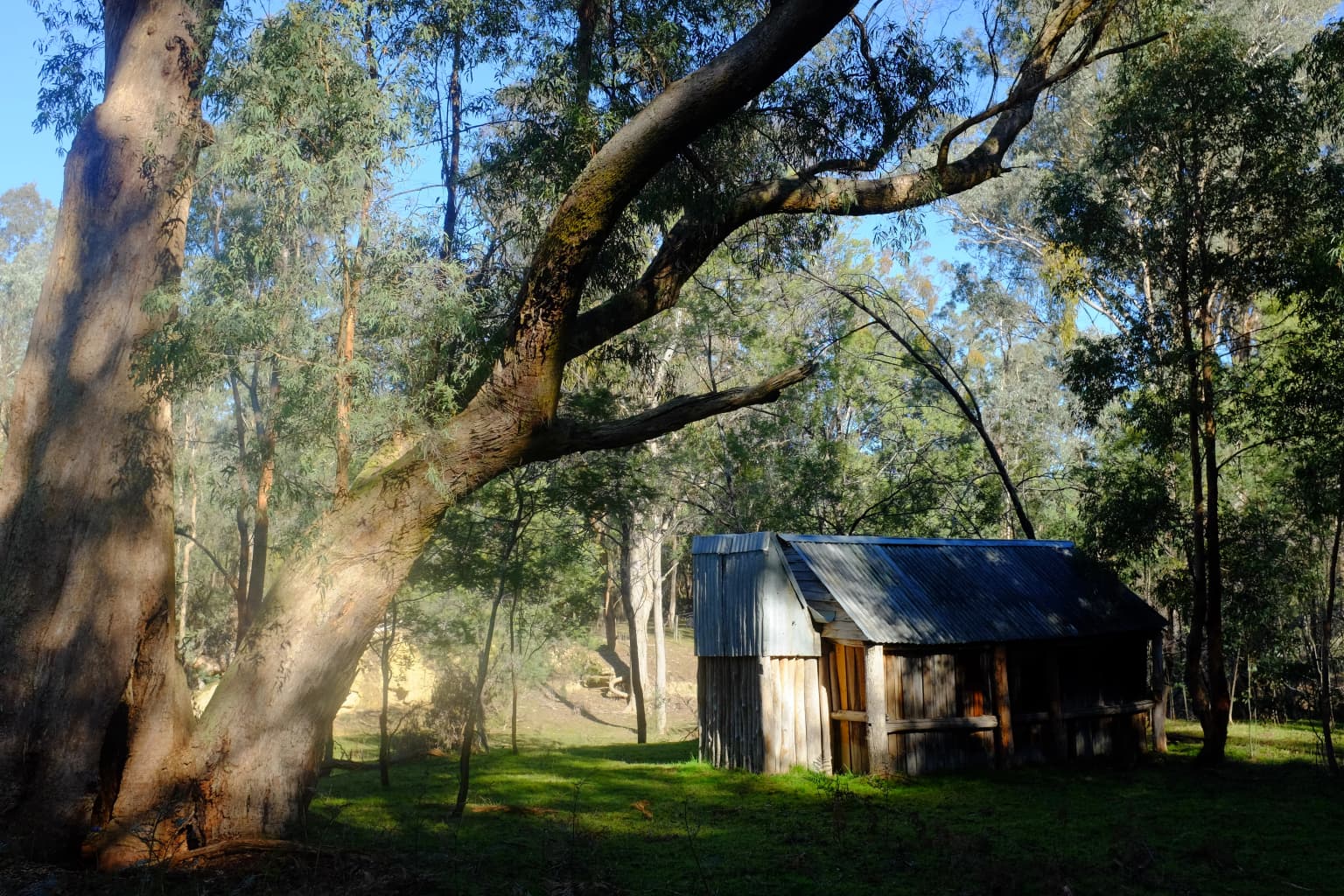
European settlement brought gold mining to the area in the 1860s during Victoria's gold rush era. The park contains numerous mine shafts, shallow diggings, and adits that document this period, with Italian Gully being one of the most significant sites. This location was originally worked in the 1870s and again in the 1930s, leaving behind mine shafts, alluvial workings, and the remains of a house and garden. Early pastoral use also left its mark on the landscape, with relics from farming operations still visible in certain areas.

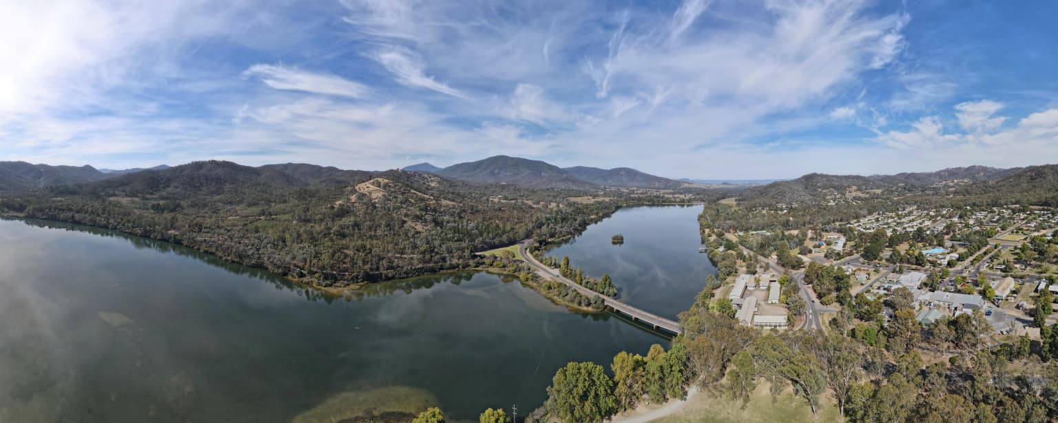
The modern protected area history began in the 1950s when the Victorian Government purchased farming properties along the Goulburn and Delatite rivers to create Lake Eildon for irrigation in the Goulburn Valley. An area of 2,670 hectares that remained above the water level was declared Fraser National Park in 1957. In 1980, an additional 24,000 hectares of state forest adjacent to the lake was reserved as Eildon State Park to protect the lake's catchment. These two protected areas were finally combined in June 1997 to create the current Lake Eildon National Park.

Lake Eildon National Park landscape and geographic character

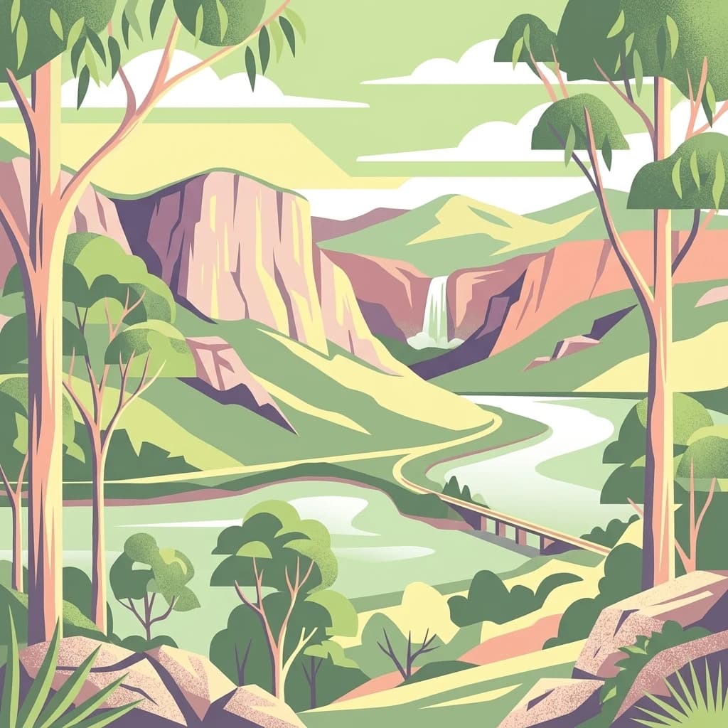
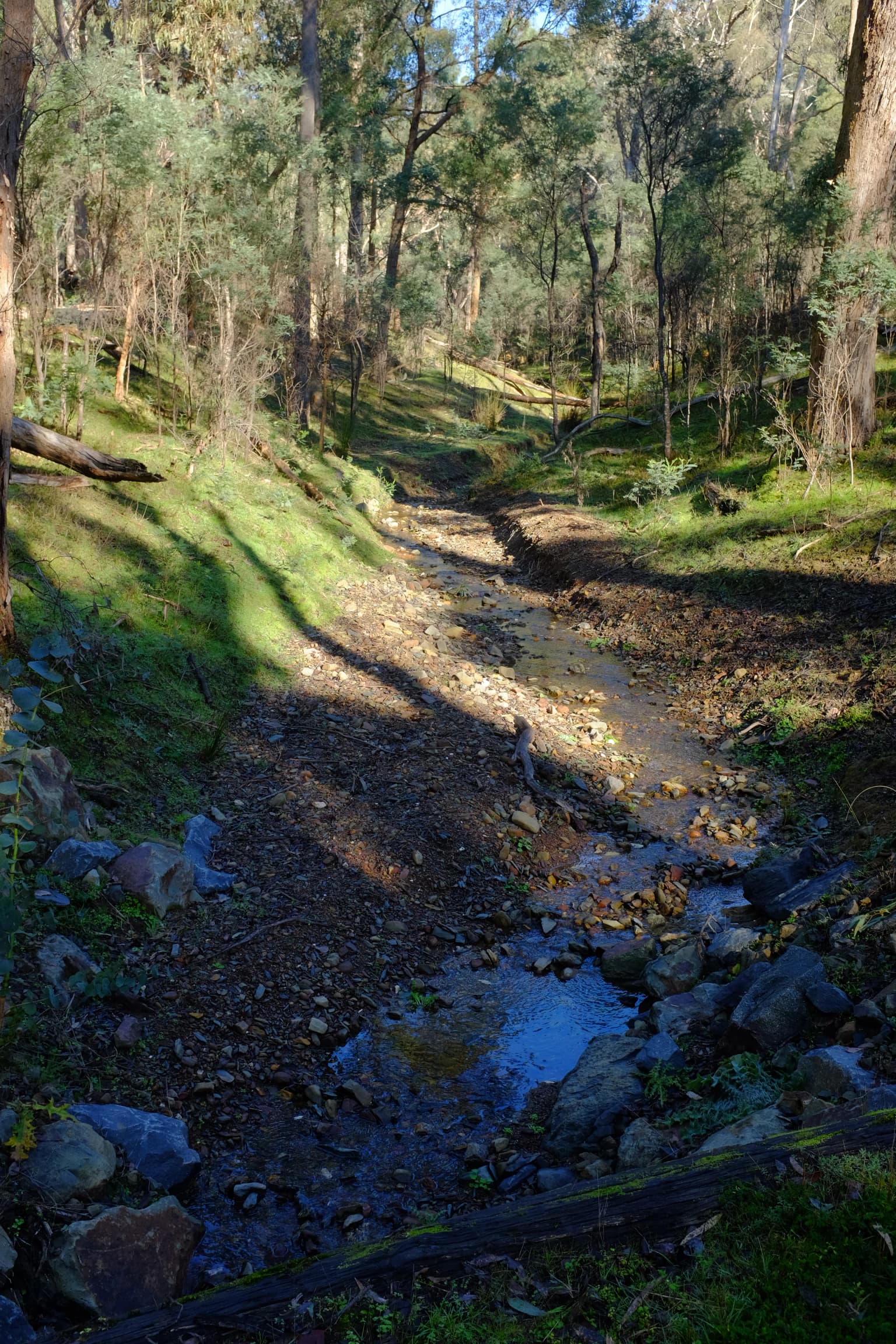
The physical landscape of Lake Eildon National Park is defined by mountainous terrain in the northern foothills of Victoria's Central Highlands. The park's peaks reach elevations of 900 meters, creating a landscape of ridges, valleys, and forested slopes that descend toward the shores of Lake Eildon. The geological foundation of the park contains remarkable features from ancient volcanic activity, specifically the Cerberean Caldera, a supervolcano approximately 27 kilometers in diameter that was active around 380 million years ago.

The Cerberean Caldera's existence is evident in scattered granite outcrops throughout the park, particularly in higher elevations. This ancient volcanic structure is of significant geological interest because the super eruption that occurred approximately 374 million years ago is believed to have contributed to the Late Devonian extinction event. The combination of ancient volcanic geology with more recent erosion and forest development creates a landscape of considerable scientific and scenic value.

The park's five blocks each present slightly different landscape characters. The Enterprise block sits in the center of Lake Eildon itself, while the Jamieson block occupies the eastern side near the township of Jamieson. The Jerusalem block takes its name from Jerusalem Creek in the southern portion of the park. The Fraser block on the western side is the most developed and accessible, while the Wappan block in the northwest remains the most remote.

Lake Eildon National Park ecosystems, habitats, and plant life

The ecological character of Lake Eildon National Park reflects its location in the Central Highlands with several distinct vegetation communities. The predominant vegetation type is dry, open eucalypt forest, which covers the majority of the park's area. This forest type is characterized by species including stringybarks and peppermints, with Red Box and Candlebark also common throughout. In areas with higher moisture availability, such as along watercourses and in valleys, riparian forest develops with different composition and structure.

Higher elevations and certain aspects support montane forest communities featuring species such as Mountain Ash and Blue Gum. These wetter forest types create a visually and ecologically distinct environment from the drier eucalypt forests that dominate lower slopes and ridgelines. The mosaic of forest types, combined with the influence of Lake Eildon and the park's numerous streams and creeks, creates a biologically diverse landscape despite the relatively uniform climate of the region.

The park's vegetation has been shaped by both natural processes and historical human activity. The creation of Lake Eildon flooded significant areas of valley vegetation, while gold mining and pastoral use left lasting modifications to certain areas. However, the majority of the park's forest cover has remained relatively intact, providing habitat for the park's native species and maintaining the natural character that visitors experience today.

Lake Eildon National Park wildlife and species highlights

Lake Eildon National Park supports a diverse community of native wildlife, with documented populations including 34 species of mammals, 89 species of birds, 17 species of reptiles, 10 species of amphibians, and three species of freshwater fish. This biodiversity reflects the variety of habitats within the park, from lakeshore environments to dry forest slopes and riparian corridors.

Among the park's mammalian residents, Eastern Grey Kangaroos are particularly common, especially around camping areas where they often become accustomed to human presence. The park is also home to Sambar Deer, which are found throughout the park's various blocks. Threatened mammal species recorded in the park include the Brush-tailed Phascogale, a small marsupial that inhabits tree hollows in dry forests. The Spotted Tree-Frog represents a threatened amphibian species present in suitable aquatic habitats.

The koala population holds special significance in the park's wildlife story. After being hunted to extinction in the region for their skins during the early 20th century, 25 koalas were reintroduced to the park from Phillip Island in 1967 and released in the Devils Cove area. This reintroduction has contributed to the broader recovery of koala populations in Victoria and demonstrates the potential for successful conservation interventions in suitable habitat.

Lake Eildon National Park conservation status and protection priorities

Lake Eildon National Park was created with the primary purpose of protecting the catchment area of Lake Eildon, which serves as a critical water storage for irrigation in the Goulburn Valley. This water resource function gives the park significant environmental importance beyond its biodiversity value, as the forests and landscapes of the park filter water and help maintain water quality for agricultural and community use downstream.

The park protects a range of habitat types that support both common and threatened species. The dry open eucalypt forests, riparian corridors, and montane forest communities each provide habitat for different species assemblages, creating a mosaic of environments that supports the park's considerable biodiversity. The presence of threatened species such as the Brush-tailed Phascogale and Spotted Tree-Frog indicates that the park serves as important habitat for species that require protected areas for their survival.

The successful koala reintroduction demonstrates how protected areas can support species recovery when appropriate management interventions are implemented. The park's multiple-use character, balancing conservation with recreational activities including water sports and hunting, reflects the broader management approach in Victoria's national park system where sustainable recreational use is accommodated within protected area frameworks.

Lake Eildon National Park cultural meaning and human context

The cultural landscape of Lake Eildon National Park reflects thousands of years of Aboriginal occupation followed by European settlement and modification. The Taungurung people, whose traditional lands encompassed the Goulburn River Valley, maintained a significant presence in the area prior to European contact. The creation of Lake Eildon in the 1950s flooded many cultural sites and traditional areas, fundamentally altering the landscape's cultural character.

European settlement brought gold mining to the area in the 1860s, with the remains of mining operations still visible throughout the park. Italian Gully represents one of the most significant mining heritage sites, with its combination of shafts, alluvial workings, and structural remnants providing tangible evidence of the gold rush period. Other sites such as Sunnyslopes Hut on the Solferino Reef demonstrate the extent of historical mining activity and the conditions faced by miners in the 19th century.

Pastoral use left additional cultural traces, with Stone's Outstation on Station Creek representing one of the best-preserved historical sites in the Fraser block. These various cultural layers demonstrate the long history of human interaction with the landscape, from Aboriginal land management and use through to gold mining and pastoralism, each leaving痕迹 that the park now preserves as part of Victoria's heritage.

Top sights and standout views in Lake Eildon National Park

Lake Eildon National Park offers several standout features that distinguish it within Victoria's protected area network. The central presence of Lake Eildon provides unique opportunities for water-based recreation in a national park setting, with the lake's 277 square kilometers offering extensive opportunities for boating, fishing, and other water activities. The park's five blocks provide diverse visitor experiences, from the developed campgrounds of the Fraser block to the remote Wappan block accessible only by bushwalking or boat.

The geological significance of the Cerberean Caldera provides a unique scientific narrative, connecting this Victorian landscape to ancient volcanic events of global significance. The gold mining heritage sites, particularly Italian Gully, offer tangible connections to Victoria's gold rush history and provide visitor interest beyond natural landscapes. The successful koala reintroduction program adds a wildlife viewing attraction that draws visitors hoping to observe these iconic marsupials in their forest habitat.

Best time to visit Lake Eildon National Park

Lake Eildon National Park can be visited throughout the year, though different seasons offer distinct experiences. The warmer months from late spring through summer (November to March) coincide with peak visitor usage and optimal conditions for water-based activities on Lake Eildon. Boat ramps throughout the park provide access for power boating, water skiing, and fishing during these months, and the developed campgrounds receive the highest visitation.

Autumn and winter months offer a different character, with cooler temperatures suitable for bushwalking and forest exploration. The park's forests display seasonal color changes during autumn, particularly in areas with deciduous species. Winter often brings misty conditions to the Central Highlands, creating atmospheric landscapes for photography and bushwalking. The less crowded conditions during these seasons allow for a more solitary park experience, though some facilities may have reduced hours or services.

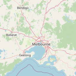
The park is accessible year-round via the Goulburn Valley Highway, with the town of Eildon providing the primary access point. Visitors planning trips should be aware that weather conditions in the highlands can change rapidly, and conditions appropriate for one season may not apply to another.

Park location guide

Geography guide, regional context, and park location map for Lake Eildon National Park

Lake Eildon National Park park geography, regions, and map view in Australia
Understand where Lake Eildon National Park sits in Australia through a broader geographic reading of the surrounding landscape, nearby location context, and its mapped position within the national park landscape.

How Lake Eildon National Park fits into Australia

Australia is a constitutional monarchy and federal parliamentary democracy comprising six states and ten territories. With a population of nearly 28 million, it is one of the world's most urbanised countries, with most people concentrated on the eastern seaboard. The country has a high Human Development Index and is known for its cultural diversity, ancient Aboriginal heritage, and unique wildlife.

Wider geography shaping Lake Eildon National Park in Australia

Australia occupies the entire Australian continent, the island of Tasmania, and numerous smaller islands. It is the world's flattest and driest inhabited continent, featuring vast deserts in the interior (the Outback), tropical rainforests along the eastern coast, and a coastline bordering the Indian and Pacific Oceans.

Map view of Lake Eildon National Park

Use this park location map to pinpoint Lake Eildon National Park in Australia, understand its exact geographic position, and read its mapped placement within the surrounding landscape more clearly.

Pigeon | © OpenStreetMap contributors

Location context for Lake Eildon National Park

Victoria
Park atlas

Trace the regional spread of protected landscapes, comparing diverse features across Victoria's Central Highlands.

Discover Other National Parks and Protected Areas Near Lake Eildon, Victoria
Continue exploring protected areas in Victoria's Central Highlands after Lake Eildon National Park, uncovering diverse eucalypt forests, mountainous terrain, and historical gold mining heritage. This atlas view facilitates comparing nearby conservation landscapes, tracing the regional spread of protected habitats and unique geological features like the ancient Cerberean Caldera.
National parkVictoria

Yarra Ranges National Park: A Protected Landscape of Towering Forests and Regional Geography

Explore mapped boundaries and the vital water catchment geography of this Australian national park.

Discover Yarra Ranges National Park, a prominent national park in Victoria, Australia, celebrated for its world-record mountain ash forests and its critical role in safeguarding Melbourne's water supply. This protected landscape showcases the complex topography of the Great Dividing Range, from dense temperate rainforests to subalpine environments. Understanding its geography and protected area boundaries provides essential context for appreciating its ecological significance and its place within the regional atlas.

Area
760 km²
Established
1995
IUCN
II
National parkVictoria

Alpine National Park: Victoria's Premier National Park Protected Landscape Atlas

Explore its mapped boundaries and regional geographic context.

Alpine National Park stands as a paramount example of a protected natural landscape in Victoria, Australia. As the region's largest national park, its mapped boundaries and diverse terrain offer deep insights into the broader geographic context of the Australian Alps. This dedicated entry facilitates structured discovery of its protected-area status and its importance within the mapped natural heritage of Victoria.

Area
6,474 km²
Established
1989
IUCN
II
National parkVictoria

Heathcote-Graytown National Park: Victoria's Key Box-Ironbark Forest Protected Area

Explore the mapped terrain and regional geography of this national park.

Heathcote-Graytown National Park stands as a critical protected area in Victoria, Australia, focused on conserving the rare box-ironbark forests that once dominated the region. Located within the Great Dividing Range, this national park provides essential habitat for woodland birds, notably the swift parrot, and offers a glimpse into the natural landscape that predates widespread agricultural development. Its inclusion in the park atlas highlights its ecological importance and contributes to a broader understanding of protected land distribution within Victoria's unique geography.

Area
128.33 km²
Established
2002
IUCN
II
Relief
Mountain
National parkVictoria

Organ Pipes National Park: Victoria's National Park for Geological Atlas Exploration

Discover unique columnar basalt formations and mapped volcanic landscapes.

Organ Pipes National Park stands as a remarkable testament to Victoria's volcanic past, preserving some of the finest examples of columnar basalt jointing in Australia. Situated within the Keilor Plains, this national park showcases dramatic geological features, including the namesake Organ Pipes, alongside ancient Silurian marine sediments, offering a layered perspective on regional geography. Its protected status ensures the conservation of this unique landscape, making it an essential destination for understanding mapped terrain and geological heritage within the Australian atlas.

Area
1.21 km²
Established
1972
IUCN
III
National parkVictoria

Morwell National Park: Victoria's Protected Wet Sclerophyll Forest and Rainforest

Mapping the diverse flora and fauna of this key national park.

Morwell National Park is a protected national park in Victoria, Australia, renowned for its significant plant diversity and the preservation of wet sclerophyll forests alongside cool temperate rainforest pockets in its gullies. Located within the Strzelecki Ranges, the park's mapped geography illustrates the varied terrain supporting these distinct forest communities. As a conservation area driven by community advocacy, it stands as a vital reserve for regional biodiversity, offering a focused study of Victoria's unique protected landscapes and their ecological significance.

Area
5.65 km²
Established
1966
IUCN
III
National parkVictoria

Lower Goulburn National Park: Mapping Victoria's River Red Gum Woodlands and Riparian Protected Area

Discover unique riverine forest and protected landscape context in Victoria

Lower Goulburn National Park represents a crucial protected corridor in Victoria, Australia, primarily safeguarding magnificent stands of river red gum woodlands along the Goulburn River. This national park offers a unique opportunity to explore a well-preserved riparian ecosystem within a modified agricultural region. Understand its linear geographic layout, the distinct arboreal character of its landscape, and its role in maintaining natural river processes and wildlife connectivity. The park's identity is deeply tied to the visual spectacle of its iconic eucalyptus canopy framing the waterway, providing valuable context for its protected status and ecological importance.

Area
93.1 km²
Established
2010
IUCN
II
National parkVictoria

Tarra-Bulga National Park: Victoria's Remnant Temperate Rainforest Protected Landscape

Explore its mapped terrain and unique geographic setting.

Tarra-Bulga National Park offers a glimpse into Victoria's past with its exceptionally preserved temperate rainforest and towering mountain ash forests. Situated in the Strzelecki Ranges, this protected area is critical for understanding regional biodiversity and landscape evolution. Explore the mapped terrain, deep valleys, and fern-filled gullies that define its unique geographic character and protected status.

Area
15.22 km²
Established
1986
IUCN
II
National parkVictoria

Greater Bendigo National Park: Victoria's Box-Ironbark Forest Protected Landscape

Mapped terrain and vital woodland bird habitats.

Greater Bendigo National Park offers a prime example of Victoria's ecologically significant box-ironbark forests, recognized as a crucial refuge for biodiversity and notable bird species like the swift parrot. Situated near Bendigo, this national park's protected landscape provides essential insights into regional geography and woodland ecosystems. Its mapped boundaries encompass a vital area for understanding the distribution and character of this unique Australian forest type.

Area
170 km²
Established
2002
IUCN
II

Common questions about visiting, size, designation, and location context for Lake Eildon National Park

Lake Eildon National Park FAQs for park facts, access, geography, and protected area context
Find quick answers about Lake Eildon National Park, including protected-area facts, park geography, trail and visitor context, and how the park fits into its surrounding country and regional landscape.
MoriAtlas Explorer

Continue Your Protected Areas Search Across the Global Atlas

Deepen your exploration by continuing the structured search for national parks and protected areas worldwide. Utilize the comprehensive filtering capabilities to compare different conservation landscapes and refine your understanding of global park geography. Discover more about the distribution and characteristics of protected natural areas.

Global natural geography