Mori Atlas logo
National parkBlue Lagoon National Park

Explore the mapped protected landscape and wetland geography of this Zambian sanctuary.

Blue Lagoon National Park: South Africa's National Park within the Kafue Flats

Blue Lagoon National Park serves as a vital protected area, representing the unique wetland and floodplain ecosystems of the Kafue Flats in Zambia. Situated approximately 100 kilometers west of Lusaka, this national park, established in 1976, offers a distinct landscape characterized by permanent lagoons, seasonal marshes, and woodland fringes. Its position within a significant floodplain system provides a unique habitat matrix, making it an important site for atlas-based exploration of regional geography and protected land context.

wetlandsKafue Flatsaccessible parkslarge mammalsbirdwatchingfloodplain

Blue Lagoon National Park

National park

Park overview

Structured park overview, official facts, and landscape profile for Blue Lagoon National Park

Blue Lagoon National Park park facts, protected area profile, and essential visitor context
Review the core facts for Blue Lagoon National Park, including designation, size, terrain, visitor scale, habitats, and operating context in one park-focused overview.

About Blue Lagoon National Park

Blue Lagoon National Park occupies a noteworthy position within Zambia's protected area network as a representative sample of the Kafue Flats ecosystem. The flats themselves constitute one of Zambia's most significant wetland systems, formed by the Kafue River as it traverses the central part of the country. The park protects a cross-section of this wider landscape, preserving both the permanent water features that characterize the northern sections and the seasonal flood grasslands that transform the terrain during the rainy season. The accessibility of the park, situated relatively close to Lusaka, has contributed to its role as a destination for visitors seeking to experience Kafue Flats wildlife without the extended travel requirements of more remote parks. The park's facilities occupy the site of a former farm, with the original farmhouse now serving as the park reception, a practical repurposing that reflects the transition of the land from agricultural use to conservation. The visitor infrastructure includes basic accommodation in the form of four chalets and a campsite positioned at the edge of the floodplain, allowing guests to experience the landscape directly.

Quick facts and research context for Blue Lagoon National Park

Blue Lagoon National Park encompasses roughly 500 square kilometers of protected wetland and savanna habitat on Zambia's Kafue Flats. The park was established in 1976 and is managed by the Zambia Wildlife Authority, holding IUCN Category II designation as a national park. It is situated in Central Province, approximately 120 kilometers by road from Lusaka, making it one of the more reachable parks in the region for visitors. The Kafue River's main channel flows approximately 10 kilometers south of the park's southern boundary, and seasonal flooding patterns shape the ecological character of the area. The former farmland that forms the park's core has been repurposed with basic visitor facilities including four chalets and a campsite.

Park context

Deeper park guide and search-rich context for Blue Lagoon National Park

Blue Lagoon National Park history, landscape, wildlife, and travel context
Explore Blue Lagoon National Park through its history, landscape character, ecosystems, wildlife, conservation priorities, cultural context, and seasonal travel timing in a structured park guide built for atlas discovery and search intent.

Why Blue Lagoon National Park stands out

Blue Lagoon National Park is particularly renowned for its substantial populations of Kafue Lechwe, a distinctive antelope species endemic to the Kafue Flats that has evolved specialized adaptations for navigating flooded terrain. The park also supports impressive concentrations of aquatic birdlife, with numerous waterfowl and wader species present throughout the year. Its accessibility from Lusaka makes it a practical destination for visitors seeking a compact wildlife experience without extensive travel, while the mix of wetland, swamp, and drier grassland habitats creates opportunities to observe species ranging from sitatunga in the marshes to zebra and buffalo on higher ground.

Blue Lagoon National Park history and protected-area timeline

Blue Lagoon National Park was established in 1976 as part of Zambia's expanding protected area network during a period when the country was formalizing conservation designations across its various ecological zones. The park was created through the conversion of previously agricultural land in the northern Kafue Flats, transforming a working farm into a protected wildlife sanctuary. The Zambia Wildlife Authority assumed management responsibility for the park, overseeing its protection and development as a destination for wildlife observation and environmental education. The repurposing of the existing farm infrastructure, particularly the conversion of the farmhouse into park reception facilities, represents a practical approach to establishing visitor services without extensive new construction. The park's designation as IUCN Category II reflects its primary function as a national park focused on ecosystem conservation and visitor experience rather than strict wilderness preservation.

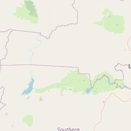
Blue Lagoon National Park landscape and geographic character

The landscape of Blue Lagoon National Park reflects the ecological character of the Kafue Flats, a vast alluvial plain formed by the Kafue River and its seasonal flooding cycles. The park encompasses a mosaic of habitat types, from permanent lagoons and seasonal floodplains to woodland areas on slightly elevated ground. The floodplain environment creates a dynamic landscape where water levels rise and fall with seasonal rainfall patterns, transforming large areas from dry grassland to shallow wetland and back again. The park's terrain is generally flat, typical of the broader flats ecosystem, with subtle variations in elevation determining which areas hold water permanently and which experience seasonal flooding. The Kafue River itself flows approximately 10 kilometers south of the park's boundary, providing the hydrological driver for the wetland character of the wider region.

Blue Lagoon National Park ecosystems, habitats, and plant life

The ecological character of Blue Lagoon National Park is defined by its position within the Kafue Flats, one of Zambia's most important wetland systems. The park protects a complex of habitats including permanent water bodies, seasonal marshes, reed beds, and adjacent woodland areas, each supporting different ecological communities. The seasonal flooding pattern shapes much of the park's natural dynamics, with large areas becoming inundated during the rainy season and gradually drying through the winter months. This cyclical flooding creates productive conditions for both aquatic and terrestrial species, supporting high biological productivity throughout the year. The wetland system provides critical habitat for species adapted to waterlogged conditions and serves as an important area within the broader Kafue Flats conservation landscape.

Blue Lagoon National Park wildlife and species highlights

The wildlife of Blue Lagoon National Park is characterized by species adapted to the wetland and savanna habitats of the Kafue Flats. The Kafue Lechwe represents the park's most distinctive large mammal, with herds frequently observed in the flooded areas where their adaptations for swimming and moving through shallow water give them an advantage over other antelope species. The sitatunga, another wetland-specialist antelope, inhabits the denser swamp areas where its retiring habits and cryptic coloring provide effective camouflage. The drier portions of the park support more typical savanna species including zebra, reedbuck, and buffalo, creating a mosaic of wildlife communities across the park's various habitats. The birdlife is particularly notable, with the park supporting a very large number of bird species, with aquatic birds being especially well represented throughout the year.

Blue Lagoon National Park conservation status and protection priorities

Blue Lagoon National Park serves as an important protected area within the Kafue Flats ecosystem, contributing to the conservation of a wetland system that faces various pressures from agricultural development and water resource utilization. The park's protection of representative Kafue Flats habitat helps maintain ecological processes and species populations that depend on the wetland environment. Its status as a national park with IUCN Category II designation reflects a management approach that balances conservation with visitor access, allowing people to experience and learn about the ecosystem while maintaining protective measures. The park works in concert with other protected areas in the Kafue Flats, including Lochinvar National Park to the south, to maintain ecological connectivity across the wetland system despite the lack of direct physical connection between them.

Blue Lagoon National Park cultural meaning and human context

Blue Lagoon National Park occupies an area that was previously in agricultural use, with the former farm infrastructure now serving visitor functions. The park exists within the broader cultural landscape of Zambia's Central Province, an area with established human communities whose relationship with the land predates the protected area designation. The Kafue Flats have historically supported both wildlife and human communities, and the park's establishment represents a formalization of conservation values in a landscape where land use continues to evolve.

Top sights and standout views in Blue Lagoon National Park

The accessibility of Blue Lagoon National Park from Lusaka makes it a practical destination for visitors seeking a compact wildlife experience in the Kafue Flats. The opportunity to observe Kafue Lechwe in their natural flooded habitat represents a particular highlight, as these endemic antelope are a flagship species of the ecosystem. The park's birdlife, especially the diversity of aquatic species, provides rewarding observation opportunities throughout the year. The straightforward logistics, with basic but functional accommodation and proximity to the capital, lower barriers for visitors wanting to experience Zambian wetland conservation.

Best time to visit Blue Lagoon National Park

The best time to visit Blue Lagoon National Park depends on what visitors hope to observe, as the seasonal changes in water levels significantly affect both landscape character and wildlife visibility. The dry season typically offers easier wildlife viewing as animals concentrate around remaining water sources and vegetation thins, while the wet season transforms the landscape into an expansive wetland with birds and antelope distributed across newly flooded areas. Visitors interested in birdlife will find productive conditions throughout the year, though the arrival of migratory species adds to the roster during certain seasons.

Park location guide

Geography guide, regional context, and park location map for Blue Lagoon National Park

Blue Lagoon National Park park geography, regions, and map view in South Africa
Understand where Blue Lagoon National Park sits in South Africa through a broader geographic reading of the surrounding landscape, nearby location context, and its mapped position within the national park landscape.

How Blue Lagoon National Park fits into South Africa

South Africa is the southernmost country in Africa, spanning 1.22 million km² with a population of over 63 million. The country operates with three capital cities, Pretoria (executive), Cape Town (legislative), and Bloemfontein (judicial), and is renowned for its biodiversity, national parks, and multicultural society.

Wider geography shaping Blue Lagoon National Park in South Africa

South Africa occupies the southernmost region of Africa, with coastline along both the Atlantic Ocean to the west and the Indian Ocean to the east. The interior features elevated plateaus including the Highveld, with the Drakensberg escarpment marking the eastern highlands. The country shares borders with Namibia, Botswana, Zimbabwe, Mozambique, Eswatini, and Lesotho.

Map view of Blue Lagoon National Park

Use this park location map to pinpoint Blue Lagoon National Park in South Africa, understand its exact geographic position, and read its mapped placement within the surrounding landscape more clearly.

Pigeon | © OpenStreetMap contributors

Location context for Blue Lagoon National Park

Central Province
Park atlas

Discover other protected wetland landscapes and regional park geography across the Kafue Flats and Zambia's Central Province.

Explore National Parks and Protected Areas Near Blue Lagoon National Park in Zambia
Continue your park exploration beyond Blue Lagoon National Park by browsing other protected areas and national parks in Zambia, comparing their unique wetland ecosystems and surrounding landscapes. Use these curated park lists to trace the regional spread of conservation efforts and map the geographic context of Zambia's notable wildlife sanctuaries.
National parkLusaka Province

Lusaka National Park: Protected Woodland Habitat and Geographic Context in Lusaka Province

Zambia's smallest national park, mapping natural terrain near the capital.

Lusaka National Park, Zambia's newest national park, offers a contained yet representative example of the woodland ecosystems found on the Lusaka plateau. This protected landscape, covering 6,715 hectares, is entirely fenced, creating a distinct conservation area within Lusaka Province. Its establishment over a former forest reserve highlights a unique approach to upgrading protected lands. Explore the park's mapped terrain and understand its significance as an accessible natural enclave amid regional development, providing a focused view of central Zambian woodland environments.

Area
67.15 km²
Established
2011
IUCN
II
Climate
Tropical
National parkZambia

Kafue National Park: Zambia's Key National Park for Geographic and Protected Area Exploration

Mapped boundaries and landscape context in southern Africa.

Kafue National Park represents a vital component of Zambia's protected lands, offering a distinct perspective for atlas-driven geographic exploration. This national park's identity is tied to its extensive mapped boundaries and its contribution to the regional landscape of southern Africa. Users engaging with this entry can uncover the protected area's specific geographic context and map-based details, enhancing their understanding of conservation landscapes.

Area
22,400 km²
IUCN
II
Relief
Lowland
Climate
Tropical
National parkZimbabwe

Mana Pools National Park: Zimbabwe National Park Atlas and Protected Floodplain Landscapes

Explore a World Heritage protected area with iconic baobab forests.

Mana Pools National Park presents a profound example of a preserved African wilderness, recognized globally for its ecological integrity. As a UNESCO World Heritage Site, this protected landscape along the Zambezi River in Zimbabwe is defined by its four permanent pools, vast sandbanks, and distinctive forests. The park's geography supports exceptional wildlife congregations, particularly during the dry season, offering a unique atlas-level perspective on floodplain ecosystems and conservation value.

Area
2,196 km²
IUCN
II
Relief
Lowland
Scope
Terrestrial
National parkLusaka Province

Lower Zambezi National Park: Mapped Protected Area and Regional Geography

Lusaka Province National Park Landscape Context

Lower Zambezi National Park represents a key protected landscape within Zambia, specifically situated in Lusaka Province. This park's detail page focuses on its role as a national park, offering insights into its geographic contours, mapped park boundaries, and its overall context within the regional geography. Engage with structured data to understand the natural landscape characteristics and the atlas-relevant distribution of this protected area.

Area
4,092 km²
Established
1983
IUCN
II
Relief
Mixed relief
National parkZimbabwe

Chizarira National Park: Zimbabwe's Remote Protected Landscape on the Zambezi Escarpment

Explore rugged mountains, deep gorges, and unique woodland ecosystems.

Chizarira National Park offers an unparalleled exploration of wilderness and dramatic geography within Zimbabwe. Situated along the imposing Zambezi Escarpment, its landscape is characterized by a 600-meter drop, rugged mountains, and deep river gorges carved by perennial streams. This protected area, known for its remote appeal and rich leopard populations, provides a distinct view of miombo and mopane woodlands, contributing to its unique ecological identity within the regional geography.

Area
2,000 km²
Established
1975
IUCN
II
Relief
Mountain
National parkSouthern Province

Mosi-oa-Tunya National Park: National Park Exploration and Geographic Atlas

Mapped boundaries and protected landscape context in Southern Province, Zambia.

Gain a comprehensive understanding of Mosi-oa-Tunya National Park, a designated national park in Zambia's Southern Province. This entry focuses on its protected area identity, mapped geographic scope, and its position within the regional atlas. Discover the essential landscape context and the structured geographic information that defines this important conservation area, providing a factual foundation for atlas-based exploration.

Area
66 km²
IUCN
II
Climate
Subtropical
Access
Easy access
National parkZimbabwe

Victoria Falls National Park: A Protected Landscape Within Zimbabwe's Geography

Atlas exploration of park boundaries and natural terrain.

Victoria Falls National Park is a key component of Zimbabwe's protected natural areas. This page provides structured information ideal for atlas-based exploration, detailing the park's geographic position and mapped landscape features. Understand its significance as a national park and its contribution to the region's conservation geography.

Area
23.4 km²
IUCN
II
Relief
Mixed relief
Climate
Tropical
National parkHwange District

Zambezi National Park: National Park within Hwange District's Geographic Landscape

Explore mapped boundaries and protected area context.

Delve into Zambezi National Park, a designated national park situated in Hwange District. This entry provides foundational geographic and landscape context, highlighting the park's protected status and its position within the regional terrain. Understand the atlas significance and mapped features of this conservation landscape for informed discovery.

Area
560 km²
Established
1979
Relief
Lowland
Climate
Subtropical

Common questions about visiting, size, designation, and location context for Blue Lagoon National Park

Blue Lagoon National Park FAQs for park facts, access, geography, and protected area context
Find quick answers about Blue Lagoon National Park, including protected-area facts, park geography, trail and visitor context, and how the park fits into its surrounding country and regional landscape.
MoriAtlas Explorer

Continue Your Protected Areas Search Across the Global Atlas

Deepen your exploration by continuing the structured search for national parks and protected areas worldwide. Utilize the comprehensive filtering capabilities to compare different conservation landscapes and refine your understanding of global park geography. Discover more about the distribution and characteristics of protected natural areas.

Global natural geography