Mori Atlas logo
National parkBwabwata National Park

Discover its savanna ecosystem, riverine landscapes, and vital role as an elephant migration corridor.

Bwabwata National Park: National Park with Mapped Boundaries and Transboundary Conservation

Bwabwata National Park stands as a significant protected landscape within Namibia's Zambezi Region, playing a crucial role in transboundary conservation efforts. This national park, extending along the Caprivi Strip, encompasses diverse savanna woodlands and riparian corridors along the Okavango and Kwando rivers. Its unique position within the Kavango-Zambezi Transfrontier Conservation Area highlights its importance as a major elephant migration route connecting Angola, Botswana, and Zambia, offering a unique focus for mapped landscape and protected area discovery.

transboundary conservationelephant migration corridorcommunity-based conservationsavanna ecosystemCaprivi StripImportant Bird Area

Bwabwata National Park

National park

Park overview

Structured park overview, official facts, and landscape profile for Bwabwata National Park

Bwabwata National Park park facts, protected area profile, and essential visitor context
Review the core facts for Bwabwata National Park, including designation, size, terrain, visitor scale, habitats, and operating context in one park-focused overview.

About Bwabwata National Park

Bwabwata National Park occupies a distinctive position in Namibia's protected area network as a large transboundary conservation landscape that bridges multiple countries and supports both wildlife conservation and human habitation. The park's location along the Caprivi Strip places it at the intersection of several major river systems and ecological zones, creating a mosaic of habitats that support remarkable biodiversity. The park was formally established in 2007 through the consolidation of the former Caprivi Game Park and Mahango Game Reserve, along with an unproclaimed area along the Cuando River, creating a contiguous protected area that facilitates regional wildlife movement. What sets Bwabwata apart is its status as a community-integrated conservation area, where resident populations are active partners in management rather than relocation candidates. The park is zoned into core conservation areas, special protection zones for controlled tourism, and a larger multiple-use area that accommodates community-based tourism, trophy hunting, human settlement and agricultural activities. This management model reflects Namibia's broader approach to reconciling conservation objectives with the livelihood needs of rural communities.

Quick facts and research context for Bwabwata National Park

Bwabwata National Park is located in northeastern Namibia along the Caprivi Strip, spanning the Zambezi and Kavango East regions. The park covers 6,274 square kilometers and was established in 2007 by merging the former Caprivi Game Park and Mahango Game Reserve. It is bounded by the Okavango River to the west and the Kwando River to the east, with Angola to the north and Botswana to the south. The park serves as a crucial transboundary corridor for elephant migration between Botswana and Angola, supporting significant populations of large mammals including buffalo, hippo, antelope species, and predators. The park is managed by Namibia's Ministry of Environment and Tourism and incorporates community-based tourism through local conservancies.

Park context

Deeper park guide and search-rich context for Bwabwata National Park

Bwabwata National Park history, landscape, wildlife, and travel context
Explore Bwabwata National Park through its history, landscape character, ecosystems, wildlife, conservation priorities, cultural context, and seasonal travel timing in a structured park guide built for atlas discovery and search intent.

Why Bwabwata National Park stands out

Bwabwata National Park is best known as a transboundary wildlife corridor connecting Angola, Botswana, Namibia and Zambia within the Kavango-Zambezi Transfrontier Conservation Area. The park supports one of the most significant elephant migration routes in southern Africa, with herds regularly moving between Namibia, Angola, Botswana and Zambia. It is also notable for its integrated community conservation model, where approximately 5,500 residents, primarily from the Khwe San minority group, participate in park management and benefit from tourism revenue. The Mahango Area and Kavango River corridor have been recognized as an Important Bird Area supporting globally threatened species and exceptional avian diversity.

Bwabwata National Park history and protected-area timeline

The area that now comprises Bwabwata National Park has undergone several transformations in its protection status and management since the mid-twentieth century. It was first proclaimed as Caprivi Nature Park in 1963, subsequently becoming Caprivi Game Reserve in 1966 and upgraded to Caprivi Game Park in 1968. During Namibia's war of independence from South African rule, the South African Defence Force occupied the area and conservation officials were prohibited from entering or managing the park. Following Namibia's independence in 1990, the new Namibian government commissioned studies to assess the fauna and flora and developed plans to accommodate both biodiversity protection and the existing resident population of approximately 5,500 people. Mahango Game Reserve to the west of the park was proclaimed in 1989. In 2007, the Caprivi Game Park, Mahango Game Reserve and an unproclaimed area along the Cuando River were united to form Bwabwata National Park. The park also gained tragic notoriety in November 2013 when LAM Mozambique Airlines Flight 470 was deliberately crashed by its captain in the park, resulting in the deaths of all 33 passengers and crew on board.

Bwabwata National Park landscape and geographic character

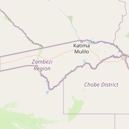
Bwabwata National Park encompasses a diverse landscape characterized by low vegetated sand dunes interspersed with ancient drainage lines known as omiramba. The terrain extends across the Caprivi Strip, a narrow eastern extension of Namibia that runs between Angola and Botswana. The park is bounded to the west by the Okavango River and to the east by the Kwando River, both of which create riparian corridors and seasonal floodplains that contrast with the surrounding woodland habitats. The park measures approximately 40 kilometers from north to south and 190 kilometers from west to east, creating an elongated protected area that follows the orientation of the Caprivi Strip. The landscape includes North-eastern Kalahari Woodland, Caprivi Mopane Woodland, Riverine Woodlands along the major rivers, Okavango Valley areas, and the Caprivi Floodplains. The southern boundary with Botswana features three veterinary standard fences designed to prevent the spread of cattle diseases such as foot-and-mouth disease, while the remainder of the park remains largely unfenced to permit wildlife movement.

Bwabwata National Park ecosystems, habitats, and plant life

Bwabwata National Park is located within the Tree and Shrub Savanna biome and supports a complex mosaic of vegetation types that reflect the interplay of moisture gradients from the major river systems and the underlying Kalahari sand substrates. The park's vegetation includes North-eastern Kalahari Woodland dominated by species such as Zambezi teak and wild seringa, Caprivi Mopane Woodland featuring false mopane and mopane species, Riverine Woodlands along the Okavango and Kwando rivers, Okavango Valley ecosystems, and the Caprivi Floodplains that experience seasonal inundation. The vegetation supports the park's role as a crucial trans-boundary link for wildlife movement between Angola, Botswana, Namibia and Zambia, particularly for elephants that migrate between these countries. However, research has documented biodiversity losses in the park between 1996 and 2019 attributed to woody plant encroachment, a regional phenomenon affecting savanna ecosystems across southern Africa.

Bwabwata National Park wildlife and species highlights

Bwabwata National Park supports significant populations of large mammals and represents an important corridor for regional wildlife migrations. African elephants regularly move between Namibia, Angola, Botswana and Zambia through the park, making it a critical link in the transboundary conservation network. The park sustains populations of Cape buffalo, hippopotamus, roan antelope, sable antelope, tsessebe, Chapman's zebra, blue wildebeest, common reedbuck, red lechwe, sitatunga and Nile crocodile. Main predators include lion, leopard, cheetah and spotted hyena. The Mahango Area and Kavango River in western Bwabwata have been designated as an internationally Important Bird Area, supporting globally threatened bird species and exceptional avian diversity. Notable bird species include black-winged pratincole, slaty egret, wattled crane, African skimmer, African pygmy-goose, coppery-tailed coucal, white-backed night heron, rufous-bellied heron, Allen's gallinule, Dickinson's kestrel, southern ground hornbill, and various warblers and cisticolas.

Bwabwata National Park conservation status and protection priorities

Bwabwata National Park plays a central role in the Kavango-Zambezi Transfrontier Conservation Area, a massive transboundary conservation initiative involving Angola, Botswana, Namibia, Zambia and Zimbabwe. The park forms a critical corridor for elephant movement from Botswana into Angola and Zambia, supporting regional wildlife migration patterns that would otherwise be fragmented by human settlement and agricultural development. The park's integrated management approach, which accommodates both biodiversity conservation and the livelihoods of approximately 5,500 resident people, represents an innovative model for conservation in populated landscapes. Management priorities include conserving important habitats, safeguarding wildlife corridors, providing income for rural residents, and developing sustainable tourism. The park is zoned into core conservation areas, special protection zones, and a multiple-use area, with specific designations for Kwando, Buffalo and Mahango as special protection areas. Fire management is employed as an ecological tool, though challenges have been noted in achieving effective fire regime outcomes.

Bwabwata National Park cultural meaning and human context

Bwabwata National Park is notable for its resident population of approximately 5,500 people, primarily from the Khwe San bushmen minority group, who live within the park boundaries and participate actively in its management. Most residents live in Omega village in the central part of the park alongside several smaller settlements. The resident communities have formed the Kyaramacan Association to represent their interests and manage income from tourism operations, including the Ngoabaca campsite and a small lodge, as well as revenue from trophy hunting and the sale of devil's claw, a medicinal plant sold internationally. This community-integrated approach reflects Namibia's broader conservation philosophy that recognizes the rights and contributions of indigenous communities in protected area management. The park lies along the historic Caprivi Strip, named after German colonial administrator Leo von Caprivi, and the area has been inhabited by San peoples for generations before the establishment of formal protected area boundaries.

Top sights and standout views in Bwabwata National Park

Bwabwata National Park stands out as one of Namibia's few protected areas that successfully integrates resident communities into conservation management while maintaining significant wildlife populations and transboundary ecological connectivity. The park's position at the heart of the Kavango-Zambezi Transfrontier Conservation Area makes it a vital corridor for elephant migrations between Botswana, Angola and Zambia. The Mahango Area supports exceptional bird diversity with species such as wattled crane, slaty egret and southern ground hornbill. Visitors can experience the park through community-operated campsites including Ngoabaca, Nambwa and Bum Hill, which provide direct economic benefits to local conservancies. The landscape features a striking contrast between riverine environments along the Okavango and Kwando and the surrounding Kalahari woodland savanna.

Best time to visit Bwabwata National Park

The optimal time to visit Bwabwata National Park is during the dry season from May to October, when wildlife congregates around the permanent water sources along the Okavango and Kwando rivers, making animal sightings more predictable. The wet season from November to April brings green vegetation and migratory bird species but animals become more dispersed across the landscape. The park can be accessed via the Trans-Caprivi Highway that runs between Rundu and Katima Mulilo, with minor roads including the C48 that connects to Botswana. Visitors traveling off the main road require permits and must use designated routes, with all-wheel drive vehicles recommended for the sandy roads near the river areas. The community-operated campsites offer opportunities for immersive experiences with local Khwe communities.

Park location guide

Geography guide, regional context, and park location map for Bwabwata National Park

Bwabwata National Park park geography, regions, and map view in Namibia
Understand where Bwabwata National Park sits in Namibia through a broader geographic reading of the surrounding landscape, nearby location context, and its mapped position within the national park landscape.

How Bwabwata National Park fits into Namibia

Namibia is a sovereign country in Southern Africa that gained independence from South Africa in 1990. It is the driest country in sub-Saharan Africa, characterized by the Namib Desert along its coast. The population is approximately 3 million, with Windhoek as the capital and largest city. Namibia operates as a unitary semi-presidential republic with a multi-party system.

Wider geography shaping Bwabwata National Park in Namibia

Namibia occupies 825,615 km2 in Southern Africa, making it the 34th largest country in the world. It is bordered by the Atlantic Ocean to the west, Angola and Zambia to the north, Botswana to the east, and South Africa to the south. The country features the Namib Desert along its coastal region, with varied terrain including savannas, mountains, and plateaus inland. A notable geographic feature is that Zimbabwe lies less than 200 metres away along the Zambezi river near Kazungula in the northeast.

Map view of Bwabwata National Park

Use this park location map to pinpoint Bwabwata National Park in Namibia, understand its exact geographic position, and read its mapped placement within the surrounding landscape more clearly.

Pigeon | © OpenStreetMap contributors

Location context for Bwabwata National Park

Kavango EastZambezi Region
Park atlas

Compare Bwabwata National Park's vital ecological corridor within the Kavango-Zambezi TFCA with other nearby national parks and protected areas.

Bwabwata National Park: Explore Adjacent Protected Areas and Regional Parks
Explore other national parks and protected areas found near Bwabwata National Park, spanning Namibia's Caprivi Strip and the broader Kavango-Zambezi Transfrontier Conservation Area. Comparing these protected landscapes reveals interconnected ecosystems, varied conservation models, and critical wildlife migration routes across this vital transboundary region.
National parkAngola

Luengue-Luiana National Park: Angola's Premier Protected Woodland and Floodplain Ecosystem

Mapping crucial habitats for large mammals and avian wildlife.

Luengue-Luiana National Park is a vital protected landscape in southeastern Angola, covering an immense area that transitions from open woodland ecosystems to vast, seasonal floodplain grasslands. As a cornerstone of the Kavango-Zambezi Transfrontier Conservation Area, it facilitates critical wildlife movements and supports significant populations of large mammals. Its geography provides essential habitat, particularly within the extensive wetland wilderness and riparian zones along the Cuando River, making it a significant site for regional biodiversity and atlas exploration.

Area
42,000 km²
Established
2011
IUCN
II
National parkBotswana

Chobe National Park: Botswana National Park Atlas and Mapped Landscape Explorer

Discover Botswana's diverse protected areas and unique savanna wetlands.

Chobe National Park represents a cornerstone of protected land discovery in Botswana, offering an unparalleled glimpse into a landscape shaped by dynamic water systems and iconic wildlife. This national park is not merely a destination; it is a vital ecosystem supporting vast elephant populations and showcasing a remarkable variety of terrain from riverine floodplains to savanna marshes. Understanding Chobe National Park through its mapped boundaries and regional geographic context reveals its significance as a protected natural area with diverse habitats supporting critical conservation efforts.

Area
11,700 km²
Established
1967
IUCN
II
National parkNamibia

Khaudum National Park: Namibia's Remote Kalahari Protected Landscape and Predatory Wildlife

Explore mapped boundaries and seasonal river ecosystems.

Khaudum National Park is a substantial protected landscape in northeastern Namibia, deep within the Kalahari Desert. This remote national park encompasses over 3,800 square kilometers of dry forest and acacia woodland, dissected by three major Omuramba dry river systems. It is globally recognized for its thriving populations of large predators like lions and spotted hyenas, alongside significant numbers of elephants and giraffes. The park's unique semi-arid terrain and biodiversity make it a key destination for understanding regional protected-area geography and landscape context.

Area
3,842 km²
IUCN
II
National parkBotswana

Nxai Pan National Park: Botswana's Iconic Baobab Forests and Salt Pan Landscape

Explore mapped boundaries and unique regional geography.

Nxai Pan National Park offers a compelling glimpse into Botswana's unique semi-arid ecosystems, characterized by the expansive, salt-crusted Nxai Pan itself and the iconic Baines Baobabs dotting its edges. As a protected national park, it represents a significant conservation landscape within the Kalahari Desert region. Understanding its geography involves appreciating the stark visual contrasts, seasonal wetland transformations, and the vast openness of the salt pan environment.

Area
2,578 km²
Established
1992
IUCN
Ib
National parkZimbabwe

Kazuma Pan National Park: Zimbabwe National Park Atlas and Protected Landscape Exploration

Unique plains landscape with reliable dry-season wildlife viewing.

Kazuma Pan National Park offers a rare glimpse into Zimbabwe's expansive grassy plains and vital pans, creating a unique protected landscape. This national park is critical for understanding regional wildlife migrations and the geographic context of conservation areas in northwestern Zimbabwe, providing an essential entry point for atlas-based exploration of its terrain and ecological significance.

Area
313 km²
Established
1975
IUCN
II
National parkSouth Africa

Blue Lagoon National Park: National Park Atlas and Mapped Wetland Geography

Discover the protected landscape and fauna of Zambia's Kafue Flats.

Blue Lagoon National Park is a critical protected area recognized for its unique wetland and floodplain environment within South Africa's extensive Kafue Flats system. Established in 1976, this national park offers significant opportunities for atlas-driven exploration of its mapped geography and protected landscape. Visitors can learn about the park's ecological significance, its characteristic terrain of lagoons and marshes, and its importance as a sanctuary for endemic wildlife and diverse bird species, contributing valuable context to the broader regional atlas.

Area
500 km²
Established
1976
IUCN
II
National parkZimbabwe

Chizarira National Park: Zimbabwe's Remote Protected Landscape on the Zambezi Escarpment

Explore rugged mountains, deep gorges, and unique woodland ecosystems.

Chizarira National Park offers an unparalleled exploration of wilderness and dramatic geography within Zimbabwe. Situated along the imposing Zambezi Escarpment, its landscape is characterized by a 600-meter drop, rugged mountains, and deep river gorges carved by perennial streams. This protected area, known for its remote appeal and rich leopard populations, provides a distinct view of miombo and mopane woodlands, contributing to its unique ecological identity within the regional geography.

Area
2,000 km²
Established
1975
IUCN
II
Relief
Mountain
National parkNorth Western Province

West Lunga National Park: Protected Evergreen Forest in Zambia's North Western Province

Mapped boundaries of rare Zambezian Cryptosepalum dry forests

West Lunga National Park stands as a testament to Zambia's unique ecological treasures, recognized as its sole national park predominantly covered by dense evergreen forest. This protected area is a vital sanctuary for the rare Zambezian Cryptosepalum dry forests, representing the largest contiguous forest of its kind outside equatorial Africa. Exploring this park reveals a landscape defined by the dense canopy of mukwe trees, sandy terrain, and a profound sense of remote wilderness, offering distinct atlas and geographic discovery.

Area
1,700 km²
IUCN
II

Common questions about visiting, size, designation, and location context for Bwabwata National Park

Bwabwata National Park FAQs for park facts, access, geography, and protected area context
Find quick answers about Bwabwata National Park, including protected-area facts, park geography, trail and visitor context, and how the park fits into its surrounding country and regional landscape.
MoriAtlas Explorer

Continue Your Protected Areas Search Across the Global Atlas

Deepen your exploration by continuing the structured search for national parks and protected areas worldwide. Utilize the comprehensive filtering capabilities to compare different conservation landscapes and refine your understanding of global park geography. Discover more about the distribution and characteristics of protected natural areas.

Global natural geography