Mori Atlas logo
National parkCape Upstart National Park

Discover the mapped boundaries and Indigenous heritage of this notable national park.

Cape Upstart National Park: Queensland's Dramatic Coastal Protected Landscape

Cape Upstart National Park represents a vital protected landscape within the Queensland region of Australia, anchored by a prominent headland that defines its striking coastal geography. This national park offers an unparalleled opportunity to explore a unique intersection of dramatic natural terrain, including rugged sandstone ridges and coastal dunes, alongside a landscape deeply rich with the thousands-year-old cultural heritage of the Juru People. As a significant conservation area, it provides a key point of discovery for understanding protected lands, their geographic context, and their cultural significance within the broader Australian atlas.

coastal landscapesIndigenous heritageNorth Queenslandheadlandsprotected areasNative Title

Cape Upstart National Park

National park

Park overview

Structured park overview, official facts, and landscape profile for Cape Upstart National Park

Cape Upstart National Park park facts, protected area profile, and essential visitor context
Review the core facts for Cape Upstart National Park, including designation, size, terrain, visitor scale, habitats, and operating context in one park-focused overview.

About Cape Upstart National Park

Cape Upstart National Park occupies a distinctive position along the North Queensland coast, protecting a landscape of significant natural and cultural value. The park's central feature is Cape Upstart itself, a prominent headland that forms part of the dramatic coastal scenery characteristic of the Whitsunday Region. The terrain encompasses a mix of coastal dunes, rocky headlands, and vegetated slopes that descend toward the Coral Sea. This combination of terrestrial and marine environments contributes to the park's ecological diversity. The park's establishment in 1969 reflected growing recognition of the need to protect Queensland's coastal natural areas while preserving their associated cultural values. Management of the park falls to Queensland Parks and Wildlife Service, which works to balance conservation objectives with sustainable visitor access. The landscape provides habitat for a variety of coastal and woodland species adapted to the tropical conditions of this region.

Quick facts and research context for Cape Upstart National Park

Cape Upstart National Park is located in the Whitsunday Region of Queensland, Australia, near the small locality of Guthalungra. The park covers approximately 84.80 square kilometers and was formally established in 1969 under the management of Queensland Parks and Wildlife Service. The area is notable for its coastal headland terrain, with Cape Upstart itself forming a prominent geological feature along the eastern Queensland coastline. The park is situated in a tropical to subtropical climate zone typical of North Queensland coastal areas. In 2011, the Federal Court of Australia recognized the Juru People's Native Title over the park, representing the successful culmination of a twenty-year legal journey that began in 1992.

Park context

Deeper park guide and search-rich context for Cape Upstart National Park

Cape Upstart National Park history, landscape, wildlife, and travel context
Explore Cape Upstart National Park through its history, landscape character, ecosystems, wildlife, conservation priorities, cultural context, and seasonal travel timing in a structured park guide built for atlas discovery and search intent.

Why Cape Upstart National Park stands out

Cape Upstart National Park is particularly known for its dramatic coastal landscape featuring a prominent headland that juts into the Coral Sea, creating a striking natural landmark visible from offshore. The park is equally significant for its deep Indigenous heritage, being the traditional Country of the Juru People whose cultural connection to this landscape extends back thousands of years. The area contains numerous archaeological sites including shell middens in the sand dunes, sacred women's areas such as Worrungu Bay, and ceremonial stone arrangements near Mine Island that are central to the Gubulla Munda Dreaming. The recognition of Native Title over the park in 2011 marked a landmark achievement for the Juru People and highlights the park's importance as a place where cultural and natural heritage intersect.

Cape Upstart National Park history and protected-area timeline

The history of Cape Upstart spans both deep Indigenous heritage and more recent European involvement. The Juru Clan of the Birri-Gubba Tribal Group have lived on Cape Upstart for thousands of years, maintaining a continuous connection to this Country that is reflected in the numerous archaeological sites found throughout the area. European naming of thecape occurred on 5 June 1770 when Lieutenant James Cook, sailing aboard HM Bark Endeavour, named the feature during his voyage along Australia's eastern coast. European settlement in the area developed slowly, with semi-permanent huts beginning to appear on the western foreshores in the early twentieth century, primarily constructed by settlers from the nearby Burdekin farming community. By the start of the twenty-first century, these had largely been replaced by permanent structures serving recreational purposes, with a small permanent population also establishing residency. The contemporary era brought significant legal recognition when, in 2011, Justice Rares of the Federal Court of Australia recognized that the Juru People retained Native Title over Cape Upstart National Park. This outcome represented the completion of a twenty-year struggle that began in 1992, initiated by elder Peter Prior (Gulumba) and ultimately concluded by his daughter Renarta Prior (Gootha) in 2012.

Cape Upstart National Park landscape and geographic character

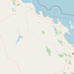
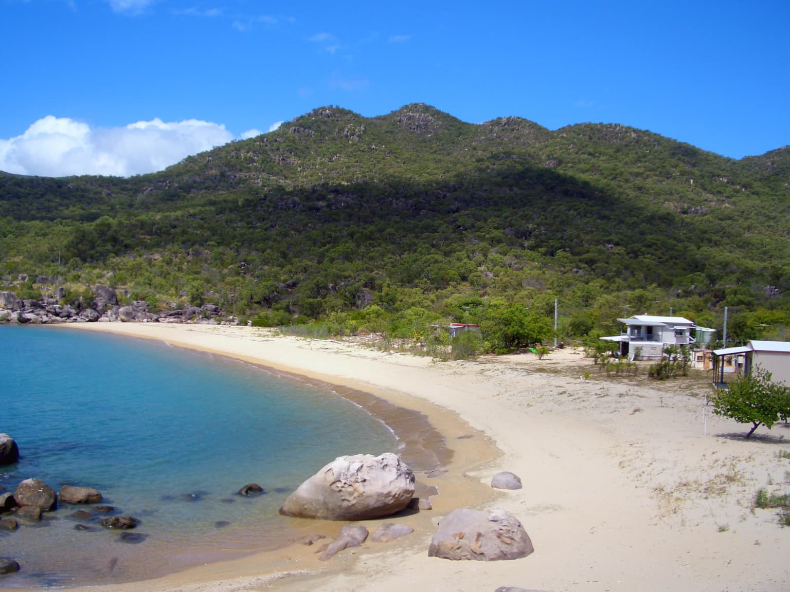
The landscape of Cape Upstart National Park is defined by its dramatic coastal setting and the prominent headland that gives the area its name. Cape Upstart rises prominently from the coastline, creating a distinctive landmark visible to vessels traveling along this section of the Queensland coast. The terrain includes rugged sandstone formations that characterize the headland area, while the park also encompasses coastal dune systems that contain important archaeological deposits. Mine Island and other smaller islands offshore contribute to the scenic character of the area, with the stone arrangements on Mine Island holding cultural significance. The western foreshores offer more sheltered terrain where vegetation communities transition from coastal strand species to woodland and forest types typical of North Queensland. The combination of headland, islands, dunes, and coastal plains creates a diverse landscape that supports various habitat types.

Cape Upstart National Park ecosystems, habitats, and plant life

The park's location in tropical North Queensland positions it within a region of considerable ecological diversity. The coastal environment supports vegetation communities adapted to the salt-laden winds and seasonal conditions of the shoreline, while the more sheltered inland areas support woodland and forest ecosystems. The transitional nature of the landscape between headland and coastal plain creates varied microhabitats that support different plant assemblages. The coastal waters adjacent to the park contribute to the broader marine biodiversity of the Great Barrier Reef region, though the park itself focuses on terrestrial and near-shore coastal environments. The dune systems, while significant for their archaeological content, also support specialized plant species adapted to the challenging sandy substrate conditions.

Cape Upstart National Park wildlife and species highlights

The source material provides limited specific detail regarding wildlife within the park, though the broader North Queensland coastal region is known for diverse fauna. The varied habitat types present, from headland vegetation to coastal dunes and woodland areas, would support corresponding assemblages of birdlife, reptiles, and small mammals. The marine environment adjacent to the park contributes to the broader coastal and nearshore biodiversity of the area. The proximity to the Great Barrier Reef Marine Park indicates that the coastal waters support reef and pelagic species, though focused wildlife documentation specific to Cape Upstart National Park is not extensively detailed in the available source material.

Cape Upstart National Park conservation status and protection priorities

Cape Upstart National Park holds IUCN Category II designation, classifying it as a national park and reflecting its significance within Australia's protected area network. The establishment of the park in 1969 represented an early commitment to protecting Queensland's coastal natural areas. The recognition of Native Title in 2011 introduced an additional dimension to conservation management, acknowledging the Juru People's ongoing connection to the land and their role in ongoing stewardship of the area. The combination of natural habitat protection and cultural heritage preservation positions the park as a site where multiple conservation values intersect. The management approach must consider both ecological objectives and the traditional knowledge and practices of the Juru People who maintain cultural connections to Country.

Cape Upstart National Park cultural meaning and human context

Cape Upstart National Park holds profound cultural significance as the traditional Country of the Juru Clan of the Birri-Gubba Tribal Group. This connection extends back thousands of years and is deeply embedded in the landscape through archaeological evidence and living cultural traditions. The sand dunes of Cape Upstart contain numerous shell middens that demonstrate the long-term presence and resource use of the Juru People. Sacred sites within the park include the women's area at Worrungu Bay and the stone arrangements near Mine Island, which the senior elder has consistently stated were never fish traps but rather important ceremonial grounds used for initiation ceremonies. These stone arrangements relate to the Gubulla Munda Dreaming, the creation story of the Juru and Birri-Gubba People, which describes the paths taken by Gubulla Munda, the Carpet Snake totem, when creating the land and islands inhabited by the Juru people. The successful Native Title recognition in 2011 affirmed this enduring connection and established a framework for the Juru People's ongoing involvement in managing their traditional lands.

Top sights and standout views in Cape Upstart National Park

The defining highlights of Cape Upstart National Park include its spectacular coastal headland that forms a prominent landmark along the North Queensland coast. The park offers visitors the opportunity to experience a landscape where dramatic geology meets tropical coastal environments. The archaeological and cultural significance of the area sets it apart from many other protected areas, with the Juru People's thousands-year connection to Country evident in middens, sacred sites, and ceremonial locations. The successful Native Title recognition provides an important example of Indigenous land rights and collaborative conservation management. The Gubulla Munda Dreaming connections, particularly the stone arrangements near Mine Island, represent living cultural heritage that continues to hold meaning for the Juru community.

Park location guide

Geography guide, regional context, and park location map for Cape Upstart National Park

Cape Upstart National Park park geography, regions, and map view in Australia
Understand where Cape Upstart National Park sits in Australia through a broader geographic reading of the surrounding landscape, nearby location context, and its mapped position within the national park landscape.

How Cape Upstart National Park fits into Australia

Australia is a constitutional monarchy and federal parliamentary democracy comprising six states and ten territories. With a population of nearly 28 million, it is one of the world's most urbanised countries, with most people concentrated on the eastern seaboard. The country has a high Human Development Index and is known for its cultural diversity, ancient Aboriginal heritage, and unique wildlife.

Wider geography shaping Cape Upstart National Park in Australia

Australia occupies the entire Australian continent, the island of Tasmania, and numerous smaller islands. It is the world's flattest and driest inhabited continent, featuring vast deserts in the interior (the Outback), tropical rainforests along the eastern coast, and a coastline bordering the Indian and Pacific Oceans.

Map view of Cape Upstart National Park

Use this park location map to pinpoint Cape Upstart National Park in Australia, understand its exact geographic position, and read its mapped placement within the surrounding landscape more clearly.

Pigeon | © OpenStreetMap contributors

Location context for Cape Upstart National Park

QueenslandWhitsunday Region
Park atlas

Map regional protected areas and coastal conservation landscapes across North Queensland

Discover Other National Parks and Protected Areas Near Cape Upstart National Park
After exploring Cape Upstart National Park, discover an expanded list of national parks and protected areas within its surrounding North Queensland region. Compare their diverse coastal terrains, Indigenous heritage sites, and conservation values to deepen your understanding of the local protected landscapes.
National parkQueensland

Mount Aberdeen National Park: A Queensland National Park with Unique Cloud Forest and Granite Peaks

Explore mapped terrain and protected landscape context in North Queensland.

Mount Aberdeen National Park represents a significant protected landscape in Queensland, defined by its striking granite peaks and an ecologically vital tropical cloud forest. This national park covers 29.10 square kilometers, showcasing unique flora such as hoop pine forests and rare red gum-snow grass communities. Its geographical position and unusual highland environment create a distinctive natural asset within the broader regional geography, offering valuable insights into Australia's protected area network and diverse ecosystems.

Area
29.1 km²
Established
1967
IUCN
II
National parkQueensland

Holbourne Island National Park: Queensland Coastal Wildlife Sanctuary and Maritime Atlas Entry

Explore the mapped geography and protected landscape of this small island national park.

Holbourne Island National Park, situated off the Queensland coast, serves as a vital protected area focused on coastal wildlife conservation. This 34-hectare national park is recognized for its importance as a natural bird sanctuary and a critical nesting ground for sea turtles, offering a focused point of discovery for marine ecosystem protection. Its landscape, characterized by coastal vegetation and rock formations, also holds a unique maritime history, notably tied to the SS Gothenburg shipwreck, making it a compelling destination for understanding Australia's island protected areas and their regional geographic context within the Coral Sea.

Area
0.34 km²
Established
1982
IUCN
II
National parkQueensland

Whitsunday Islands National Park: Iconic Queensland National Park with Tropical Island Landscapes

Explore mapped protected boundaries and diverse coastal geography.

Whitsunday Islands National Park encompasses a remarkable collection of 74 islands off Queensland's coast, celebrated for their pristine tropical island landscapes and iconic Whitehaven Beach. This national park provides a unique opportunity to explore Australia's protected coastal and marine environments, offering detailed geographic context, mapped island topography, and insights into the park's role within the Great Barrier Reef World Heritage Area.

Area
170 km²
Established
1944
IUCN
II
National parkQueensland

Pinnacles National Park: Queensland's Iconic Granite Formations and Protected Landscape

Explore mapped terrain and endangered species habitats.

Pinnacles National Park, situated in Queensland, Australia, is renowned for its spectacular granite batholith formations that create a distinctive rocky terrain. This national park, established in 2011, plays a crucial role in conserving the dry tropical woodland ecosystem and protecting species such as the Sannantha papillosa plant and the black-throated finch. Explore the mapped landscape of this significant protected area within the Hervey Range, offering a unique contrast of ancient geology and natural bushland.

Area
13.37 km²
Established
2011
IUCN
II
National parkQueensland

Repulse Island National Park: Queensland's Coastal Protected Area and Mapped Geography

Explore this key national park's mapped boundaries and island landscape.

Repulse Island National Park is an important protected natural area offering unique insights into coastal island geography within Queensland's expansive conservation network. Established as a national park, it signifies a commitment to preserving representative natural landscapes. This page focuses on the mapped boundaries, regional geographic context, and the protected landscape identity of Repulse Island National Park, providing a detailed entry point for atlas-driven discovery of Australia's protected areas.

Area
1.51 km²
Established
1994
IUCN
II
Scope
Terrestrial
National parkQueensland

Eungella National Park: National Park Protected Landscape and Queensland Geography

Explore mapped boundaries and regional landscape context.

Gain a detailed understanding of Eungella National Park as a protected landscape within Queensland. This page focuses on its mapped boundaries and geographic positioning, offering an atlas-oriented view for those interested in regional park discovery. Delve into the specific natural terrain and protected area context that characterizes Eungella National Park, enhancing your geographic comprehension.

Area
517 km²
Established
1941
IUCN
II
National parkQueensland

Smith Islands National Park: Queensland Coastal Protected Area Map

Discover the mapped geography and island landscapes of North Queensland.

Smith Islands National Park represents a significant protected island landscape off the coast of Queensland, Australia. This page allows for detailed exploration of its geographic features, mapped boundaries, and role as a national park within the North Queensland region's atlas of natural areas. Understand the unique character of these tropical islands and their place within Australia's network of preserved coastal environments.

Area
18.7 km²
IUCN
II
Scope
Terrestrial
National parkQueensland

Halifax Bay Wetlands National Park: Queensland's Vital Spawning Grounds and Coastal Wetlands

Mapped protected boundaries and tropical wetland ecosystems.

Halifax Bay Wetlands National Park represents a crucial component of Queensland's protected areas, focusing on the conservation of coastal wetland and shallow marine habitats. This national park is renowned for its role as a primary spawning ground for numerous fish species of significant ecological and economic importance, such as barramundi. Its landscape, characterized by mangrove ecosystems and tidal flats, offers a distinct perspective on tropical coastal environments within the Australian geographic atlas. Discover the mapped extent and ecological value of this important marine conservation site.

Area
4.47 km²
Established
1994
IUCN
II

Common questions about visiting, size, designation, and location context for Cape Upstart National Park

Cape Upstart National Park FAQs for park facts, access, geography, and protected area context
Find quick answers about Cape Upstart National Park, including protected-area facts, park geography, trail and visitor context, and how the park fits into its surrounding country and regional landscape.
MoriAtlas Explorer

Continue Your Protected Areas Search Across the Global Atlas

Deepen your exploration by continuing the structured search for national parks and protected areas worldwide. Utilize the comprehensive filtering capabilities to compare different conservation landscapes and refine your understanding of global park geography. Discover more about the distribution and characteristics of protected natural areas.

Global natural geography