Mori Atlas logo
National parkMount Aberdeen National Park

Discover the mapped boundaries and unique ecological landscape of this North Queensland national park.

Mount Aberdeen National Park: Queensland's Distinct Granite Peaks and Cloud Forest Atlas

Mount Aberdeen National Park offers a distinct protected landscape within Queensland, Australia, characterized by dramatic granite peaks and an unusual tropical cloud forest ecosystem. This national park, situated northwest of Brisbane, protects an area of 29.10 square kilometers featuring Mount Aberdeen at 901 meters and Highlander's Bonnet at 624 meters. Its geographic isolation and elevation support unique vegetation communities, including rare hoop pine forests and the only regional occurrence of cloud forest, making it a significant site for landscape and botanical discovery.

National ParkQueenslandCloud ForestGranite PeaksHoop Pine ForestEndemic Vegetation

Mount Aberdeen National Park

National park

Park overview

Structured park overview, official facts, and landscape profile for Mount Aberdeen National Park

Mount Aberdeen National Park park facts, protected area profile, and essential visitor context
Review the core facts for Mount Aberdeen National Park, including designation, size, terrain, visitor scale, habitats, and operating context in one park-focused overview.

About Mount Aberdeen National Park

Mount Aberdeen National Park represents a significant conservation area in North Queensland, protecting a mountainous landscape of granite peaks that rises distinctly from the surrounding lowland terrain. The park's two sections, Mount Aberdeen and Highlander's Bonnet, form isolated highland habitats that support ecological communities largely absent from the broader region. The tropical cloud forest at the summit of Mount Aberdeen constitutes the only occurrence of this habitat type in the area, existing due to the unique microclimatic conditions created by the mountain's elevation and exposure. The slopes support extensive hoop pine forests, a species of conifer valued for its timber and ecological role in Australian forests. In the more sheltered valleys and lower slopes, semi-evergreen vine thicket forms a distinctive subtropical dry broadleaf forest community. The absence of public access roads and facilities has meant the park remains relatively undisturbed, preserving its ecological integrity despite increasing pressure on Queensland's natural landscapes.

Quick facts and research context for Mount Aberdeen National Park

Mount Aberdeen National Park lies in North Queensland, Australia, protecting two granite peaks with elevations of 901 meters and 624 meters. The park was established in two phases, with the Mount Aberdeen section dedicated in 1952 and the Highlander's Bonnet section added in 1967. It contains the sole regional occurrence of tropical cloud forest at the summit of Mount Aberdeen. The park features large areas of hoop pine on the slopes, semi-evergreen vine thicket in sheltered areas, and a red gum-snow grass community found nowhere else in Queensland. No public access road or facilities exist within the park.

Park context

Deeper park guide and search-rich context for Mount Aberdeen National Park

Mount Aberdeen National Park history, landscape, wildlife, and travel context
Explore Mount Aberdeen National Park through its history, landscape character, ecosystems, wildlife, conservation priorities, cultural context, and seasonal travel timing in a structured park guide built for atlas discovery and search intent.

Why Mount Aberdeen National Park stands out

The park is best known for protecting the only tropical cloud forest occurrence in the region, an ecological enclave supported by the summit conditions of Mount Aberdeen. The hoop pine forests covering the slopes of both peaks represent significant old-growth vegetation, while the unusual red gum-snow grass community found nowhere else in Queensland demonstrates the park's botanical uniqueness. These features, combined with the granite-dominated landscape rising abruptly from the surrounding terrain, make Mount Aberdeen a distinctive protected area in the Queensland park system.

Mount Aberdeen National Park history and protected-area timeline

The Mount Aberdeen section of the park was dedicated in 1952, establishing initial protection for the mountain's unique ecosystems. The Highlander's Bonnet section followed in 1967, expanding the protected area to encompass the second granite peak and connecting the two highland habitats. The establishment of these protected areas reflected growing recognition in mid-twentieth century Australia of the need to preserve distinctive mountain ecosystems and endemic vegetation communities. Queensland Parks and Wildlife Service has administered the park since its establishment, maintaining the protected status while acknowledging the challenges of access and management inherent to the rugged terrain. The park's designation as a national park under IUCN Category II reflects its national significance as a conservation estate.

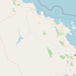
Mount Aberdeen National Park landscape and geographic character

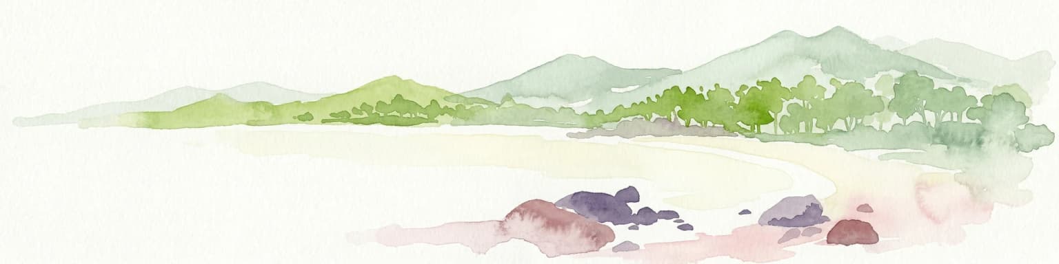
The park is characterized by two prominent granite peaks that rise abruptly from the coastal lowlands of North Queensland. Mount Aberdeen reaches 901 meters above sea level, while Highlander's Bonnet stands at 624 meters. Both peaks are composed of exposed granite, with rocky summit areas and steep slopes descending to the surrounding terrain. The granite geology creates distinctive boulder fields, tors, and cliff formations characteristic of Queensland's ancient continental landscapes. The mountain slopes support forest cover that contrasts sharply with the more open vegetation of the surrounding lowlands. The combination of elevation, granite substrate, and relative isolation has allowed ecological communities to develop that are distinct from the regional norm.

Mount Aberdeen National Park ecosystems, habitats, and plant life

The park protects several distinctive ecological communities that reflect its unique position in the Queensland landscape. The tropical cloud forest at Mount Aberdeen's summit represents the only occurrence of this habitat type in the region, supported by persistent moisture and reduced temperature fluctuations at high elevation. Large areas of hoop pine occupy the slopes of both peaks, forming tall forest that provides habitat and substrate for numerous species. The semi-evergreen vine thicket found in sheltered areas represents subtropical dry broadleaf forest, adapted to seasonal conditions and protected from extreme weather by the surrounding terrain. Most distinctive is the red gum-snow grass community, a vegetation association found nowhere else in Queensland, indicating the park's botanical significance and the unique environmental conditions it protects.

Mount Aberdeen National Park wildlife and species highlights

The park supports several mammal species typical of Queensland's forests, including eastern grey kangaroos, common wallaroos, and koalas. The rocky terrain provides habitat for unadorned rock wallabies, while northern quolls occupy the granite crevices and boulder fields. The park also contains the Mt Elliott grey ant at its southern limit, representing the edge of this species' distribution range. The diverse habitats, from cloud forest to pine forests to rocky outcrops, support varying faunal communities that contribute to the park's biodiversity value.

Mount Aberdeen National Park conservation status and protection priorities

Mount Aberdeen National Park serves as a critical refuge for ecological communities that cannot survive in the surrounding modified landscape. The protection of the only regional tropical cloud forest occurrence represents a conservation priority of regional significance, as this habitat type is inherently limited in distribution and vulnerable to disturbance. The red gum-snow grass community found exclusively within the park demonstrates the area's role as a site of botanical endemism. The absence of public access infrastructure has inadvertently protected the park from recreational impacts that affect more accessible protected areas, preserving its ecological integrity.

Mount Aberdeen National Park cultural meaning and human context

The park exists within the traditional lands of various Aboriginal peoples of North Queensland, though detailed cultural context is not well documented in the available sources. The granite peaks and their distinctive appearance would have held significance in traditional indigenous geography, as such landmarks often did in Queensland's cultural landscape.

Top sights and standout views in Mount Aberdeen National Park

The park's defining feature is its tropical cloud forest at Mount Aberdeen's summit, the only occurrence of this habitat in the region. The hoop pine forests covering the slopes represent significant old-growth conifer communities. The red gum-snow grass community found nowhere else in Queensland demonstrates unique botanical value. The two granite peaks rising from the surrounding landscape create scenic mountain terrain unusual in coastal Queensland.

Best time to visit Mount Aberdeen National Park

The best time to experience Mount Aberdeen would typically be during the cooler, drier months from April to September when weather conditions are most stable and access to similar areas in Queensland is most comfortable. However, the park has no public access road or facilities, limiting visitation opportunities and requiring careful planning for any visit. The wet season from November to March brings higher rainfall that sustains the cloud forest but may make terrain conditions more difficult.

Park location guide

Geography guide, regional context, and park location map for Mount Aberdeen National Park

Mount Aberdeen National Park park geography, regions, and map view in Australia
Understand where Mount Aberdeen National Park sits in Australia through a broader geographic reading of the surrounding landscape, nearby location context, and its mapped position within the national park landscape.

How Mount Aberdeen National Park fits into Australia

Australia is a constitutional monarchy and federal parliamentary democracy comprising six states and ten territories. With a population of nearly 28 million, it is one of the world's most urbanised countries, with most people concentrated on the eastern seaboard. The country has a high Human Development Index and is known for its cultural diversity, ancient Aboriginal heritage, and unique wildlife.

Wider geography shaping Mount Aberdeen National Park in Australia

Australia occupies the entire Australian continent, the island of Tasmania, and numerous smaller islands. It is the world's flattest and driest inhabited continent, featuring vast deserts in the interior (the Outback), tropical rainforests along the eastern coast, and a coastline bordering the Indian and Pacific Oceans.

Map view of Mount Aberdeen National Park

Use this park location map to pinpoint Mount Aberdeen National Park in Australia, understand its exact geographic position, and read its mapped placement within the surrounding landscape more clearly.

Pigeon | © OpenStreetMap contributors

Location context for Mount Aberdeen National Park

Queensland
Park atlas

Compare Granite Peaks, Cloud Forests, and Unique Protected Landscapes in North Queensland

Discover Parks Near Mount Aberdeen National Park: Explore North Queensland's Protected Areas
Expand your exploration beyond Mount Aberdeen National Park by browsing other protected areas and national parks that feature similar granite landscapes or unique Queensland ecosystems. Compare regional park geography and conservation efforts across a wider spread of protected zones, deepening your understanding of North Queensland's diverse natural terrain.
Watercolor painting showing a coastal scene with sand, rocks, green trees, and mountains in the background
National parkQueensland

Cape Upstart National Park: Dramatic Queensland Coastal Protected Landscape

Explore Indigenous heritage and mapped terrain of this national park.

Cape Upstart National Park is a distinguished protected area in North Queensland, notable for its spectacular coastal headland that serves as a landmark against the Coral Sea. This park is a testament to the enduring connection between Indigenous heritage and natural landscapes, holding profound cultural significance for the Juru People whose ancestral lands it encompasses. Users can explore its mapped boundaries, diverse terrain from sandstone ridges to coastal dunes, and the intersection of geological features with deep cultural narratives, making it a crucial point for understanding protected area identity and regional geography.

Area
84.8 km²
Established
1969
IUCN
II
Relief
Lowland
National parkQueensland

Gloucester Island National Park: A National Park within Queensland's Diverse Geography

Mapped protected area and natural landscape context.

Gloucester Island National Park represents a distinct protected landscape in Queensland, Australia. This entry focuses on its identity as a national park, providing atlas-level detail on its geographic scope and mapped boundaries. Understand how this protected area fits within the broader natural terrain and regional geography of northeastern Australia, offering a unique lens for map-based exploration and discovery.

Area
29.6 km²
Established
1994
IUCN
II
Relief
Lowland
National parkQueensland

Dryander National Park: Queensland's Protected Landscape and Geographic Identity

Mapped boundaries and natural terrain context in Queensland.

Delve into the protected landscape of Dryander National Park, a significant national park located in Queensland, Australia. This entry provides essential geographic context, detailing the park's boundaries and its representation within the broader regional atlas of protected areas. Understand its role as a mapped natural landscape contributing to the unique geography of Queensland, ideal for detailed exploration without travel logistics.

Area
118.82 km²
Established
1938
IUCN
II
Relief
Mountain
National parkQueensland

Holbourne Island National Park: Queensland Coastal Wildlife Sanctuary and Maritime Atlas Entry

Explore the mapped geography and protected landscape of this small island national park.

Holbourne Island National Park, situated off the Queensland coast, serves as a vital protected area focused on coastal wildlife conservation. This 34-hectare national park is recognized for its importance as a natural bird sanctuary and a critical nesting ground for sea turtles, offering a focused point of discovery for marine ecosystem protection. Its landscape, characterized by coastal vegetation and rock formations, also holds a unique maritime history, notably tied to the SS Gothenburg shipwreck, making it a compelling destination for understanding Australia's island protected areas and their regional geographic context within the Coral Sea.

Area
0.34 km²
Established
1982
IUCN
II
Relief
Lowland
National parkQueensland

Conway National Park: Queensland National Park Geographic Exploration and Protected Landscape

Mapped boundaries and regional natural terrain of this Australian national park.

Delve into Conway National Park, a key protected area situated in Queensland, Australia. This national park offers rich geographic discovery, allowing for detailed exploration of its mapped landscape and protected boundaries. Understand its role within the broader atlas of Australian natural regions, appreciating its specific landscape characteristics and its contribution to the regional geography of northeastern Australia.

Area
225 km²
Established
1938
IUCN
II
Relief
Lowland
National parkQueensland

Molle Islands National Park: Queensland National Park Atlas and Protected Landscape Identity

Mapped boundaries and regional geographic context within northeastern Australia.

Molle Islands National Park is a designated national park located in Queensland, Australia. This dedicated atlas entry provides an understanding of its protected landscape character, focusing on its mapped geographic boundaries and its position within the regional context of northeastern Australia. Explore how this protected area contributes to the broader understanding of Queensland's natural geography and conservation lands.

Area
18 km²
IUCN
II
Climate
Tropical
Access
Moderate access
National parkQueensland

Whitsunday Islands National Park: Iconic Queensland National Park with Tropical Island Landscapes

Explore mapped protected boundaries and diverse coastal geography.

Whitsunday Islands National Park encompasses a remarkable collection of 74 islands off Queensland's coast, celebrated for their pristine tropical island landscapes and iconic Whitehaven Beach. This national park provides a unique opportunity to explore Australia's protected coastal and marine environments, offering detailed geographic context, mapped island topography, and insights into the park's role within the Great Barrier Reef World Heritage Area.

Area
170 km²
Established
1944
IUCN
II
Relief
Lowland
National parkQueensland

Eungella National Park: National Park Protected Landscape and Queensland Geography

Explore mapped boundaries and regional landscape context.

Gain a detailed understanding of Eungella National Park as a protected landscape within Queensland. This page focuses on its mapped boundaries and geographic positioning, offering an atlas-oriented view for those interested in regional park discovery. Delve into the specific natural terrain and protected area context that characterizes Eungella National Park, enhancing your geographic comprehension.

Area
517 km²
Established
1941
IUCN
II
Relief
Mountain

Common questions about visiting, size, designation, and location context for Mount Aberdeen National Park

Mount Aberdeen National Park FAQs for park facts, access, geography, and protected area context
Find quick answers about Mount Aberdeen National Park, including protected-area facts, park geography, trail and visitor context, and how the park fits into its surrounding country and regional landscape.
MoriAtlas Explorer

Continue Your Protected Areas Search Across the Global Atlas

Deepen your exploration by continuing the structured search for national parks and protected areas worldwide. Utilize the comprehensive filtering capabilities to compare different conservation landscapes and refine your understanding of global park geography. Discover more about the distribution and characteristics of protected natural areas.

Global natural geography