Mori Atlas logo
National parkHomevale National Park

Discover the rugged terrain, towering spires, and ancient geological heritage of this protected area in Central Queensland.

Homevale National Park: Dramatic Sandstone Landscapes and Permian Fossil Atlas

Homevale National Park, located in Australia's Isaac Region, presents a remarkable protected landscape characterized by dramatic sandstone cliffs, jagged peaks, and weathered spires. Established to preserve its unique geological heritage, the park holds significant paleontological discoveries, including fossilized sea shells from the Permian period, offering tangible evidence of ancient marine environments. This page provides an atlas-style exploration of its mapped boundaries, unique terrain, and scientific importance within Central Queensland.

Central QueenslandCliff landscapesPermian fossilsSandstone formationsPlateau terrainPastoral heritage

Homevale National Park

National park

Park overview

Structured park overview, official facts, and landscape profile for Homevale National Park

Homevale National Park park facts, protected area profile, and essential visitor context
Review the core facts for Homevale National Park, including designation, size, terrain, visitor scale, habitats, and operating context in one park-focused overview.

About Homevale National Park

Homevale National Park occupies a significant position among Queensland's protected areas, preserving a landscape of considerable geological and historical character. Located in the Isaac Region of Central Queensland, the park lies approximately 821 kilometres by road northwest of Brisbane, placing it within the broader context of inland Queensland's semi-arid to subtropical environments. The park's terrain is dominated by elevated sandstone formations that create a memorable landscape of vertical cliffs, pointed peaks and isolated spires rising from the plateau surface. This distinctive topography provides the park with a visual identity that sets it apart from the more typical eucalyptus woodlands and savanna landscapes found in many other Queensland national parks. The presence of fossilised sea shells within the park boundaries confirms that portions of this now-inland area were once covered by shallow seas during the Permian geological period, making the location significant for understanding the ancient geological history of central Queensland.

Quick facts and research context for Homevale National Park

Homevale National Park is located in Central Queensland's Isaac Region, covering an area of 218 square kilometres at an average elevation of 436 metres. The terrain features a distinctive landscape of cliffs, peaks and rock spires that define the park's visual character. The area was gazetted as a national park in 1995 following its use as a pastoral grazing station, with subsequent boundary adjustments made in 1996, 2009 and 2024. The park contains Permian-period fossils, providing evidence of an ancient sea that once covered this part of inland Queensland. The historic Homevale homestead remains within the park on Homevale Homestead Road, with conservation plans underway for its preservation.

Park context

Deeper park guide and search-rich context for Homevale National Park

Homevale National Park history, landscape, wildlife, and travel context
Explore Homevale National Park through its history, landscape character, ecosystems, wildlife, conservation priorities, cultural context, and seasonal travel timing in a structured park guide built for atlas discovery and search intent.

Why Homevale National Park stands out

Homevale National Park is best known for two intertwined characteristics: its dramatic sandstone landscape of cliffs, peaks and spires that creates a striking visual presence across the central Queensland plateau, and its significant paleontological finds of Permian-period fossilised sea shells. These fossils, dating from 280 to 225 million years ago, represent some of the oldest tangible evidence of the ancient marine environments that once existed in this region. The combination of the park's rugged topographical features with its scientific fossil heritage makes it distinctive among Queensland's protected areas, offering both landscape appreciation and educational value regarding the region's deep geological history.

Homevale National Park history and protected-area timeline

The land now comprising Homevale National Park was historically known as Homevale pastoral station, where cattle grazing operations were conducted across the property. The transition from pastoral use to environmental protection occurred in 1995 when the area was gazetted as a national park under the Nature Conservation Act 1992, specifically through the Nature Conservation (Protected Areas) Amendment (No.5) 1995 regulation. This designation marked the formal recognition of the area's natural and geological values beyond its agricultural utility. The park's boundaries have undergone adjustments several times since establishment, with modifications occurring in 1996, 2009 and most recently in 2024, reflecting ongoing refinement of the protected area boundary. As of 2024, the original homestead complex from the pastoral station era remains standing within the national park boundaries at coordinates 21°26′24″S 148°31′33″E, representing a tangible link to the property's pastoral history. The Queensland Parks and Wildlife Service has indicated that conservation plans are to be developed for the homestead structure, suggesting potential future interpretation of this historical aspect of the park.

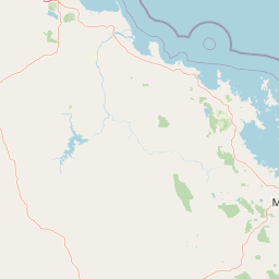
Homevale National Park landscape and geographic character

The landscape of Homevale National Park is defined by its elevated terrain averaging 436 metres above sea level and the prominent sandstone formations that create the park's characteristic scenery. The terrain features a series of cliffs, rocky peaks and isolated spires that rise from the surrounding plateau, creating a dramatic skyline visible across the central Queensland region. These formations appear to represent ancient remnant features of geological processes that have shaped the landscape over tens of millions of years. The combination of vertical cliff faces, angular peaks and weathered spires gives the park a rugged and somewhat austere appearance compared to the more heavily vegetated landscapes found in coastal and mountain regions of Queensland. The park's physical character reflects the broader geology of central Queensland, where sandstone and conglomerate formations create distinctive landforms across the inland areas.

Homevale National Park ecosystems, habitats, and plant life

The nature of Homevale National Park centres on its geological heritage rather than extensive biodiversity documentation. The most scientifically significant natural feature of the park is the presence of fossilised sea shells embedded in the terrain, representing marine deposits from the Permian period between 280 and 225 million years ago. These fossils provide evidence that this currently inland area was once covered by shallow seas during the late Paleozoic era, a time when much of what is now central Queensland lay beneath marine waters. The fossil discoveries connect the park to the broader scientific understanding of Queensland's geological history and the ancient environments that existed long before the region's current semi-arid conditions developed. The park's vegetation patterns generally reflect the central Queensland environment, though detailed habitat documentation is limited in available sources.

Homevale National Park conservation status and protection priorities

Homevale National Park serves as a protected area preserving both geological and historical values within Central Queensland. The park's designation as an IUCN Category II national park reflects its status as a protected landscape where natural values are maintained while allowing for appropriate management of the area's heritage features. The preservation of Permian-period fossils within the park boundaries represents a significant conservation priority, as these fossil deposits provide scientific windows into ancient marine environments that no longer exist in the region. The ongoing boundary adjustments to the park, with modifications occurring in 1996, 2009 and 2024, demonstrate active management of the protected area and refinement of conservation boundaries. The presence of the historic homestead within the park boundaries presents a unique conservation consideration, requiring balance between preserving pastoral heritage and maintaining the area's natural values. Conservation planning for the homestead reflects the integrated approach to managing both cultural and natural heritage within the national park framework.

Homevale National Park cultural meaning and human context

Homevale National Park contains elements of Queensland's pastoral heritage that distinguish it from purely natural conservation areas. The Homevale pastoral station operated on this land prior to the area's declaration as a national park in 1995, and the physical remnants of that pastoral era remain visible within the park boundaries today. The homestead complex, still situated at its original location on Homevale Homestead Road, represents the human occupation and agricultural use of this central Queensland landscape across the twentieth century and earlier. This pastoral heritage coexists with the area's geological significance, creating a layered landscape where ancient fossil beds and more recent human history intersect. The decision to retain the homestead within the national park rather than remove all pastoral infrastructure reflects an approach that acknowledges the region's human history as part of its overall character.

Top sights and standout views in Homevale National Park

The highlights of Homevale National Park centre on its dramatic sandstone landscape of cliffs, peaks and spires that dominates the central Queensland plateau, and the scientific importance of Permian-period fossils discovered within the park. The park offers a distinctive visual landscape quite different from typical Queensland national parks, with its vertical cliff faces and weathered rock spires creating memorable geological scenery. The fossilised sea shells from 280 to 225 million years ago provide tangible evidence of ancient marine environments and make the park significant for geological education and interpretation. The preserved homestead from the pastoral station era adds historical dimension to the park experience, representing the more recent human history of the land. The park's location in Central Queensland, approximately 821 kilometres from Brisbane, places it within a region of Australia known for its vast landscapes and mineral resources.

Best time to visit Homevale National Park

Specific seasonal visitation guidance is not detailed in available source material for Homevale National Park. The park's central Queensland location suggests that visitors should consider the region's subtropical to semi-arid climate patterns when planning trips, with attention to summer heat and potential wet-season conditions that may affect access or comfort. The rugged terrain of cliffs, peaks and spires may present different experiences depending on seasonal conditions, though detailed guidance on optimal visitation periods would require additional source material beyond the current Wikipedia entry.

Park location guide

Geography guide, regional context, and park location map for Homevale National Park

Homevale National Park park geography, regions, and map view in Australia
Understand where Homevale National Park sits in Australia through a broader geographic reading of the surrounding landscape, nearby location context, and its mapped position within the national park landscape.

How Homevale National Park fits into Australia

Australia is a constitutional monarchy and federal parliamentary democracy comprising six states and ten territories. With a population of nearly 28 million, it is one of the world's most urbanised countries, with most people concentrated on the eastern seaboard. The country has a high Human Development Index and is known for its cultural diversity, ancient Aboriginal heritage, and unique wildlife.

Wider geography shaping Homevale National Park in Australia

Australia occupies the entire Australian continent, the island of Tasmania, and numerous smaller islands. It is the world's flattest and driest inhabited continent, featuring vast deserts in the interior (the Outback), tropical rainforests along the eastern coast, and a coastline bordering the Indian and Pacific Oceans.

Map view of Homevale National Park

Use this park location map to pinpoint Homevale National Park in Australia, understand its exact geographic position, and read its mapped placement within the surrounding landscape more clearly.

Pigeon | © OpenStreetMap contributors

Location context for Homevale National Park

Isaac RegionQueensland
Park atlas

Trace regional geology and compare mapped protected areas, expanding discovery beyond Homevale National Park's distinctive sandstone landscape.

Explore Other National Parks and Protected Areas Near Homevale National Park in Central Queensland, Australia
After exploring Homevale National Park's unique sandstone cliffs and Permian fossil heritage, continue your geographic discovery by browsing other national parks and protected areas in Central Queensland. This regional view allows for comparing diverse conservation landscapes, understanding connected geological features, and charting the spread of Australia's protected natural areas.
National parkQueensland

Eungella National Park: National Park Protected Landscape and Queensland Geography

Explore mapped boundaries and regional landscape context.

Gain a detailed understanding of Eungella National Park as a protected landscape within Queensland. This page focuses on its mapped boundaries and geographic positioning, offering an atlas-oriented view for those interested in regional park discovery. Delve into the specific natural terrain and protected area context that characterizes Eungella National Park, enhancing your geographic comprehension.

Area
517 km²
Established
1941
IUCN
II
National parkQueensland

Reliance Creek National Park: Preserving Queensland's Coastal Palm Forest Ecosystem

Mapped protected landscape on Queensland's central coast.

Reliance Creek National Park is a critical conservation site in Queensland, safeguarding the most significant remaining area of coastal palm forest. This compact national park protects a unique subtropical ecosystem that has largely vanished from the surrounding regional landscape. Users can explore its precise location and geographic context, understanding its importance as a preserved natural heritage and a testament to the original coastal plain environment.

Area
0.14 km²
Established
1980
IUCN
II
National parkQueensland

Cape Hillsborough National Park: Queensland's Volcanic Peninsula National Park

Mapped geography and protected landscape context in Central Queensland.

Cape Hillsborough National Park is a notable protected area defined by its unique volcanic peninsula landform in Queensland. Its rugged terrain features dense rainforest interiors that contrast with the surrounding coastal environments and tidal zones. As a national park, it offers an excellent opportunity to study landscape context, mapped geological features, and the distribution of protected natural areas within the Central Queensland region.

Area
10.22 km²
Established
1985
IUCN
II
National parkQueensland

Round Top Island National Park: Protected Island Landscape in Queensland

Explore mapped boundaries and regional conservation context.

Round Top Island National Park preserves the natural character of a small coastal island in Queensland's Coral Sea region. This national park offers a clear example of an entire island protected area, contributing to the broader atlas of Australian conservation landscapes. Understanding its mapped boundaries and its place within North Queensland's geography provides insight into the diversity of protected island ecosystems preserved for their ecological significance.

Area
0.19 km²
IUCN
II
Relief
Mixed relief
Scope
Mixed
National parkMackay Region

Cape Palmerston National Park: Coastal Protected Area and Geographic Context in Mackay Region

Mapped landscape, dune systems, and mangrove ecosystems.

Delve into the protected landscape of Cape Palmerston National Park, a significant national park in Australia's Mackay Region. This page offers detailed insights into its geographic identity, characterized by 28 kilometers of pristine coastline, dynamic sand dunes, and extensive mangrove forests. Understand its position within the Central Mackay Coast bioregion and explore the mapped boundaries of this diverse protected area, from its beaches to the inland woodland habitats and wetland basins, providing essential atlas context for this unique coastal environment.

Area
71.9 km²
Established
1976
IUCN
II
Relief
Mixed relief
National parkQueensland

Repulse Island National Park: Queensland's Coastal Protected Area and Mapped Geography

Explore this key national park's mapped boundaries and island landscape.

Repulse Island National Park is an important protected natural area offering unique insights into coastal island geography within Queensland's expansive conservation network. Established as a national park, it signifies a commitment to preserving representative natural landscapes. This page focuses on the mapped boundaries, regional geographic context, and the protected landscape identity of Repulse Island National Park, providing a detailed entry point for atlas-driven discovery of Australia's protected areas.

Area
1.51 km²
Established
1994
IUCN
II
Scope
Terrestrial
National parkQueensland

West Hill National Park: Explore Queensland's National Park Geography and Mapped Protected Boundaries

Central Queensland Protected Landscape and Atlas Context

West Hill National Park represents a key protected area within Queensland's natural environment network. As a national park, it offers insights into the region's geography and landscape character, contributing to a structured understanding of protected lands. Explore the mapped boundaries and discover its specific place within the atlas of Australian parks, providing context for its conservation significance in central Queensland.

Area
10.8 km²
Established
1971
IUCN
II
National parkQueensland

Smith Islands National Park: Queensland Coastal Protected Area Map

Discover the mapped geography and island landscapes of North Queensland.

Smith Islands National Park represents a significant protected island landscape off the coast of Queensland, Australia. This page allows for detailed exploration of its geographic features, mapped boundaries, and role as a national park within the North Queensland region's atlas of natural areas. Understand the unique character of these tropical islands and their place within Australia's network of preserved coastal environments.

Area
18.7 km²
IUCN
II
Scope
Terrestrial

Common questions about visiting, size, designation, and location context for Homevale National Park

Homevale National Park FAQs for park facts, access, geography, and protected area context
Find quick answers about Homevale National Park, including protected-area facts, park geography, trail and visitor context, and how the park fits into its surrounding country and regional landscape.
MoriAtlas Explorer

Continue Your Protected Areas Search Across the Global Atlas

Deepen your exploration by continuing the structured search for national parks and protected areas worldwide. Utilize the comprehensive filtering capabilities to compare different conservation landscapes and refine your understanding of global park geography. Discover more about the distribution and characteristics of protected natural areas.

Global natural geography