Mori Atlas logo
National parkCape Hillsborough National Park

Discover the mapped boundaries and natural terrain of this Queensland coastal national park.

Cape Hillsborough National Park: Volcanic Peninsula Protected Landscape and Geographic Atlas

Cape Hillsborough National Park represents a striking volcanic peninsula within Queensland, Australia, offering a distinct protected landscape where dense rainforest meets the coast. This national park provides a unique geographic focal point for understanding coastal terrain and regional natural environments. Explore its mapped boundaries and volcanic geological origins to gain a deeper appreciation for its place in the broader Australian atlas.

rainforestvolcanic landscapecoastal protected areaQueensland national parkswildlife habitatbirdwatching

Cape Hillsborough National Park

National park

Park overview

Structured park overview, official facts, and landscape profile for Cape Hillsborough National Park

Cape Hillsborough National Park park facts, protected area profile, and essential visitor context
Review the core facts for Cape Hillsborough National Park, including designation, size, terrain, visitor scale, habitats, and operating context in one park-focused overview.

About Cape Hillsborough National Park

Cape Hillsborough National Park represents a significant protected area along Queensland's central coast, offering a concentrated showcase of volcanic peninsula ecology within a relatively small footprint. The park's volcanic origins are evident in its topography, with the peninsula forming a prominent landform that projects into the Coral Sea. The interior supports substantial rainforest vegetation, a characteristic that makes this park distinctive among Queensland's coastal protected areas. The proximity to Mackay, approximately 40 kilometers to the southeast, makes this park accessible for day visitors while maintaining its natural character. In 2010, the park was expanded by 204 hectares on National Parks Day, demonstrating ongoing commitment to conservation of this coastal ecosystem. The park's location within the O'Connell River catchment and the Central Mackay Coast bioregion positions it as an important node in the regional conservation network.

Quick facts and research context for Cape Hillsborough National Park

Cape Hillsborough National Park is located in Central Queensland along the O'Connell River water catchment area within the Central Mackay Coast bioregion. The park was named by explorer James Cook during his 1770 Pacific voyage, honoring Wills Hill, Earl of Hillsborough. Annual precipitation averages 1106 millimeters, supporting the park's rainforest ecosystems. The park's biodiversity includes approximately 140 bird species, 22 mammal species, 25 reptile species, and 8 amphibian species.

Park context

Deeper park guide and search-rich context for Cape Hillsborough National Park

Cape Hillsborough National Park history, landscape, wildlife, and travel context
Explore Cape Hillsborough National Park through its history, landscape character, ecosystems, wildlife, conservation priorities, cultural context, and seasonal travel timing in a structured park guide built for atlas discovery and search intent.

Why Cape Hillsborough National Park stands out

Cape Hillsborough is best known for its dramatic volcanic peninsula landscape where dense rainforest meets dramatic coastline. The park's most distinctive feature is the combination of its geological origins creating a peninsula with steep coastal edges and sheltered forest interiors. The intertidal zones feature notable sand bubbler crabs that leave characteristic patterns on beach sand during low tide, and the tidal rocky pools harbor diverse marine creatures. The park serves as an important refuge for coastal and forest birdlife in the Central Queensland region.

Cape Hillsborough National Park history and protected-area timeline

Cape Hillsborough National Park was established in 1985 through formal protection measures implemented by the Queensland state government. The park's naming derives from its geographical position at Cape Hillsborough, which was named by Lieutenant James Cook during his first voyage through the Pacific in 1770. Cook named the geographical feature in honor of Wills Hill, Earl of Hillsborough, who served as President of the Board of Trade and Plantations during two periods in the mid-18th century. The park's management falls under the Queensland Parks and Wildlife Service, which oversees conservation and visitor services. A notable expansion occurred in 2010 when 204 hectares were added to the park on National Parks Day, strengthening protection of the peninsula's ecosystems.

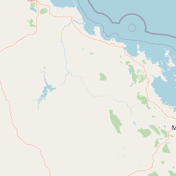
Cape Hillsborough National Park landscape and geographic character

The landscape of Cape Hillsborough National Park is defined by its volcanic peninsula formation, which rises to a maximum elevation of 267 meters above sea level. The peninsula's geology creates a distinctive landform where steep coastal slopes meet the sea on multiple sides. The interior of the peninsula is heavily vegetated with rainforest, creating a dense forest canopy that contrasts sharply with the surrounding coastal terrain. The park features beach areas and rocky tidal pools along its coastline, where volcanic rock formations interact with tidal processes. The annual precipitation of 1106 millimeters sustains the rainforest environments that cover the majority of the peninsula's surface.

Cape Hillsborough National Park ecosystems, habitats, and plant life

The natural environment of Cape Hillsborough National Park encompasses a blend of coastal and rainforest ecosystems within the Central Mackay Coast bioregion. The park's rainforest interior represents a significant habitat type along this section of the Queensland coast, supported by the consistent annual rainfall. The vegetation transitions from dense forest on the slopes to coastal strands along the shoreline. The O'Connell River water catchment area influences the park's hydrological character, with freshwater inputs contributing to the ecological diversity. This combination of volcanic soil, consistent moisture, and coastal exposure creates favorable conditions for diverse plant and animal communities.

Cape Hillsborough National Park wildlife and species highlights

Cape Hillsborough National Park supports a notable diversity of wildlife, with approximately 140 bird species recorded within its boundaries. The mammal population includes 22 species, while reptile diversity encompasses 25 species and amphibians account for 8 species. The intertidal zones feature sand bubbler crabs that create distinctive patterns on beach sand during low tide, a characteristic natural phenomenon visible to visitors exploring the shoreline. Rocky tidal pools provide habitat for various marine invertebrates and small creatures that adapt to the twice-daily tidal changes. The forest interior supports arboreal and ground-dwelling species typical of Queensland rainforest environments.

Cape Hillsborough National Park conservation status and protection priorities

The conservation significance of Cape Hillsborough National Park lies in its protection of a volcanic peninsula ecosystem that would otherwise face development pressure along Queensland's central coast. The park preserves both coastal and rainforest habitats within a regional context where such combinations are relatively uncommon. The 2010 expansion by 204 hectares demonstrates active management commitment to strengthening ecological protection. The park's location within a defined bioregion and water catchment area reinforces its role in broader landscape conservation planning. Protection of the peninsula's volcanic formations and associated vegetation communities provides ongoing habitat for the park's documented biodiversity.

Cape Hillsborough National Park cultural meaning and human context

The naming of Cape Hillsborough reflects the park's historical connection to European exploration of the Queensland coast. Lieutenant James Cook named this geographic feature in 1770 during his first voyage through the Pacific, choosing to honor Wills Hill, Earl of Hillsborough, a prominent British government official of the period. This naming represents one of many coastal locations along eastern Australia that carry names from the Cook era, documenting early European engagement with the Queensland landscape. The indigenous cultural context of the area falls within the traditional lands of local Aboriginal peoples, though the source material provides limited detail on this dimension.

Top sights and standout views in Cape Hillsborough National Park

The volcanic peninsula setting creates Cape Hillsborough's primary visual highlight, with rainforest-covered slopes descending to coastal shores. The tidal pools along the coastline provide interactive natural exploration opportunities, while the sand bubbler crab activity during low tide offers a distinctive wildlife observation experience. The park's compact size allows visitors to experience multiple ecosystem types within a single visit, from forest trails to beach walks. The proximity to Mackay makes this an accessible nature destination for those exploring Central Queensland.

Best time to visit Cape Hillsborough National Park

The park can be visited throughout the year given Queensland's generally warm climate, though the summer months from December to February bring higher temperatures and increased rainfall typical of the wet season. The winter months from June to August generally offer more comfortable conditions for bushwalking and extended exploration. The dry season period from April to October typically provides more predictable weather for outdoor activities. Visitors interested in observing marine life in the tidal pools should plan their visit around low tide periods, which vary throughout the lunar cycle.

Park location guide

Geography guide, regional context, and park location map for Cape Hillsborough National Park

Cape Hillsborough National Park park geography, regions, and map view in Australia
Understand where Cape Hillsborough National Park sits in Australia through a broader geographic reading of the surrounding landscape, nearby location context, and its mapped position within the national park landscape.

How Cape Hillsborough National Park fits into Australia

Australia is a constitutional monarchy and federal parliamentary democracy comprising six states and ten territories. With a population of nearly 28 million, it is one of the world's most urbanised countries, with most people concentrated on the eastern seaboard. The country has a high Human Development Index and is known for its cultural diversity, ancient Aboriginal heritage, and unique wildlife.

Wider geography shaping Cape Hillsborough National Park in Australia

Australia occupies the entire Australian continent, the island of Tasmania, and numerous smaller islands. It is the world's flattest and driest inhabited continent, featuring vast deserts in the interior (the Outback), tropical rainforests along the eastern coast, and a coastline bordering the Indian and Pacific Oceans.

Map view of Cape Hillsborough National Park

Use this park location map to pinpoint Cape Hillsborough National Park in Australia, understand its exact geographic position, and read its mapped placement within the surrounding landscape more clearly.

Pigeon | © OpenStreetMap contributors

Location context for Cape Hillsborough National Park

Mackay RegionQueensland
Park atlas

Trace the regional spread of diverse protected landscapes, including coastal zones and volcanic terrains across Queensland.

Explore National Parks and Protected Areas Geographically Near Cape Hillsborough
Browse other national parks and protected areas situated near Cape Hillsborough National Park, comparing their distinct coastal, volcanic, and rainforest environments. This allows users to trace the geographic context and understand the varied conservation landscapes across the broader Queensland region.
National parkQueensland

Reliance Creek National Park: Preserving Queensland's Coastal Palm Forest Ecosystem

Mapped protected landscape on Queensland's central coast.

Reliance Creek National Park is a critical conservation site in Queensland, safeguarding the most significant remaining area of coastal palm forest. This compact national park protects a unique subtropical ecosystem that has largely vanished from the surrounding regional landscape. Users can explore its precise location and geographic context, understanding its importance as a preserved natural heritage and a testament to the original coastal plain environment.

Area
0.14 km²
Established
1980
IUCN
II
National parkQueensland

Repulse Island National Park: Queensland's Coastal Protected Area and Mapped Geography

Explore this key national park's mapped boundaries and island landscape.

Repulse Island National Park is an important protected natural area offering unique insights into coastal island geography within Queensland's expansive conservation network. Established as a national park, it signifies a commitment to preserving representative natural landscapes. This page focuses on the mapped boundaries, regional geographic context, and the protected landscape identity of Repulse Island National Park, providing a detailed entry point for atlas-driven discovery of Australia's protected areas.

Area
1.51 km²
Established
1994
IUCN
II
Scope
Terrestrial
National parkQueensland

Smith Islands National Park: Queensland Coastal Protected Area Map

Discover the mapped geography and island landscapes of North Queensland.

Smith Islands National Park represents a significant protected island landscape off the coast of Queensland, Australia. This page allows for detailed exploration of its geographic features, mapped boundaries, and role as a national park within the North Queensland region's atlas of natural areas. Understand the unique character of these tropical islands and their place within Australia's network of preserved coastal environments.

Area
18.7 km²
IUCN
II
Scope
Terrestrial
National parkQueensland

Round Top Island National Park: Protected Island Landscape in Queensland

Explore mapped boundaries and regional conservation context.

Round Top Island National Park preserves the natural character of a small coastal island in Queensland's Coral Sea region. This national park offers a clear example of an entire island protected area, contributing to the broader atlas of Australian conservation landscapes. Understanding its mapped boundaries and its place within North Queensland's geography provides insight into the diversity of protected island ecosystems preserved for their ecological significance.

Area
0.19 km²
IUCN
II
Relief
Mixed relief
Scope
Mixed
National parkQueensland

Eungella National Park: National Park Protected Landscape and Queensland Geography

Explore mapped boundaries and regional landscape context.

Gain a detailed understanding of Eungella National Park as a protected landscape within Queensland. This page focuses on its mapped boundaries and geographic positioning, offering an atlas-oriented view for those interested in regional park discovery. Delve into the specific natural terrain and protected area context that characterizes Eungella National Park, enhancing your geographic comprehension.

Area
517 km²
Established
1941
IUCN
II
National parkQueensland

South Cumberland Islands National Park: Queensland's Dramatic Granite Island Protected Landscape

Explore its unique mapped geography and natural terrain.

South Cumberland Islands National Park, situated in Queensland, Australia, is a remarkable collection of islands characterized by dramatic granite landscapes, steep interior slopes cloaked in tropical rainforest, and surrounding coral fringing reefs. As the largest island, Scawfell Island rises to a prominent 397-metre peak, showcasing the island group's significant geological features and contributing to its distinct protected landscape identity within the Whitsunday region. Understanding this park offers insight into the mapped natural context of Australia's coastal protected areas.

Area
21.8 km²
IUCN
II
Relief
Mountain
Climate
Subtropical
National parkIsaac Region

Homevale National Park: Central Queensland's Protected Sandstone and Fossil Landscape

Explore dramatic cliffs, peaks, and ancient Permian fossil sites.

Homevale National Park in Australia's Isaac Region is a testament to geological time and conservation. Its landscape is defined by striking sandstone formations, including dramatic cliffs, rugged peaks, and distinctive spires. Beyond its visual appeal, the park is scientifically vital for its Permian-period fossil discoveries, dating back 280 to 225 million years. This protected area offers a unique glimpse into ancient marine environments and the geological evolution of Central Queensland, making it a key destination for atlas-driven landscape discovery.

Area
218 km²
Established
1995
IUCN
II
National parkMackay Region

Cape Palmerston National Park: Coastal Protected Area and Geographic Context in Mackay Region

Mapped landscape, dune systems, and mangrove ecosystems.

Delve into the protected landscape of Cape Palmerston National Park, a significant national park in Australia's Mackay Region. This page offers detailed insights into its geographic identity, characterized by 28 kilometers of pristine coastline, dynamic sand dunes, and extensive mangrove forests. Understand its position within the Central Mackay Coast bioregion and explore the mapped boundaries of this diverse protected area, from its beaches to the inland woodland habitats and wetland basins, providing essential atlas context for this unique coastal environment.

Area
71.9 km²
Established
1976
IUCN
II
Relief
Mixed relief

Common questions about visiting, size, designation, and location context for Cape Hillsborough National Park

Cape Hillsborough National Park FAQs for park facts, access, geography, and protected area context
Find quick answers about Cape Hillsborough National Park, including protected-area facts, park geography, trail and visitor context, and how the park fits into its surrounding country and regional landscape.
MoriAtlas Explorer

Continue Your Protected Areas Search Across the Global Atlas

Deepen your exploration by continuing the structured search for national parks and protected areas worldwide. Utilize the comprehensive filtering capabilities to compare different conservation landscapes and refine your understanding of global park geography. Discover more about the distribution and characteristics of protected natural areas.

Global natural geography