Mori Atlas logo
National parkGüeppi-Sekime National Park

Discover mapped park boundaries and regional geography of this vital Amazonian national park.

Güeppi-Sekime National Park: Peru's Protected Landscape in the Amazon Basin

Güeppi-Sekime National Park represents a significant protected area within Peru's vast Amazonian territory, offering a deep dive into tropical forest ecosystems and their complex geography. This national park, situated on the Ecuador border, showcases a landscape of rolling hills and seasonal floodplains, crucial for conservation and regional ecological connectivity. As a key component of the western Amazon basin's protected lands, Güeppi-Sekime National Park provides essential habitat and serves as a vital link in a broader network of wilderness areas.

Amazon rainforestNational parkPeru protected areasAmazonian biodiversityTropical forestTransboundary conservation

Güeppi-Sekime National Park

National park

Park overview

Structured park overview, official facts, and landscape profile for Güeppi-Sekime National Park

Güeppi-Sekime National Park park facts, protected area profile, and essential visitor context
Review the core facts for Güeppi-Sekime National Park, including designation, size, terrain, visitor scale, habitats, and operating context in one park-focused overview.

About Güeppi-Sekime National Park

Güeppi-Sekime National Park represents one of Peru's significant protected areas in the western Amazon, established to conserve the biological diversity of the Loreto region's forest ecosystems. The park's location on the Ecuadorian border positions it as part of a transboundary conservation framework for the Amazon basin. Its terrain features a mix of rolling upland areas and low-lying wetlands that experience seasonal flooding, creating diverse ecological niches throughout the year. The protected area provides sanctuary for numerous species ranging from large mammals to intricate bird communities, supporting ecological processes that maintain the health of the broader Amazonian landscape. The park's establishment reflects Peru's commitment to preserving its portion of the world's most biodiverse tropical forest ecosystem.

Quick facts and research context for Güeppi-Sekime National Park

Güeppi-Sekime National Park covers 2,036 square kilometers of Amazonian forest in northeastern Peru, within Putumayo Province of the Loreto Region. The park sits at approximately 0.48 degrees south latitude and 74.91 degrees west longitude, directly adjacent to the Ecuador border. The area experiences a warm and humid tropical climate with average temperatures around 25.5°C and annual precipitation between 2,500 and 2,800 millimeters. The park is administered by SERNANP, Peru's national protected areas service, and was elevated from reserved zone to national park status in 2012.

Park context

Deeper park guide and search-rich context for Güeppi-Sekime National Park

Güeppi-Sekime National Park history, landscape, wildlife, and travel context
Explore Güeppi-Sekime National Park through its history, landscape character, ecosystems, wildlife, conservation priorities, cultural context, and seasonal travel timing in a structured park guide built for atlas discovery and search intent.

Why Güeppi-Sekime National Park stands out

Güeppi-Sekime National Park is best known for its population of endangered megafauna, including jaguars and giant otters. The park serves as a critical habitat for the pink river dolphin, a species facing significant threats from illegal fishing practices in the Amazon basin. The area supports exceptional bird diversity, with notable species including the harpy eagle, red-and-green macaw, king vulture, and agami heron. The combination of hill forests and seasonally flooded wetlands creates a mosaic of habitats that supports both terrestrial and aquatic species.

Güeppi-Sekime National Park history and protected-area timeline

The Güeppi Reserved Zone was established in March 1997, initially covering approximately 6,260 square kilometers of forest in the Loreto Region. This early designation recognized the ecological significance of the area and provided initial protection for its biodiversity. Over the following years, the boundaries and administrative status of the protected area were refined, leading to the modification of both the name and the extent of the zone. In 2012, the area was granted full national park status, elevating its protection level and formalizing its role within Peru's national protected areas system. The transition from reserved zone to national park reflected growing recognition of the area's conservation value and the need for robust protection measures.

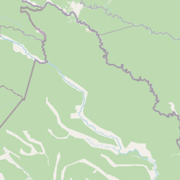
Güeppi-Sekime National Park landscape and geographic character

The landscape of Güeppi-Sekime National Park consists of a combination of hills and seasonally flooded lowlands characteristic of the western Amazon basin. The terrain features rolling upland areas that rise above the surrounding terrain, interspersed with lower-lying zones that become inundated during periods of high rainfall. This topographic variation creates a heterogeneous landscape supporting different forest types and ecological communities. The area's position in northeastern Peru places it within the transition zone between Andean-influenced landscapes and the vast Amazonian lowlands, contributing to its ecological diversity. The forests that cover the park range from terra firme upland forests to floodplain communities adapted to the seasonal water fluctuations.

Güeppi-Sekime National Park ecosystems, habitats, and plant life

The park supports a rich array of plant species typical of Amazonian forests, including numerous tree species that form the structure of the tropical canopy. Species such as Socratea exorrhiza, known as the walking palm due to its unique root structure, and the rose-colored flowered Brownea grandiceps are found throughout the area. The forest also contains valuable timber species including Cedrela odorata and various members of the Ocotea genus. Mauritia flexuosa, the iconic Mauritia palm, occurs in wetland areas, while numerous epiphytes, ferns, and understory plants complete the complex botanical community. The combination of hill forests and flooded areas creates a mosaic of habitats supporting high plant diversity.

Güeppi-Sekime National Park wildlife and species highlights

Güeppi-Sekime National Park is home to remarkable wildlife diversity, particularly in its avian and mammalian fauna. The park contains populations of endangered large mammals including the jaguar, the largest cat species in the Americas, and the giant otter, a social freshwater predator that inhabits the park's waterways. The pink river dolphin inhabits the aquatic systems within the park, though this species faces threats from illegal fishing practices. The bird community is exceptionally diverse, featuring the harpy eagle, one of the largest and most powerful raptors in the world, as well as colorful parrots like the red-and-green macaw, the distinctive white-throated toucan, and the striking king vulture. Reptiles including the black caiman, a large crocodilian species, are also present in the park's waterways.

Güeppi-Sekime National Park conservation status and protection priorities

The park holds IUCN Category II protected area status, reflecting its designation as a national park with primary objectives of ecosystem conservation and environmental protection. The transition from reserved zone to national park in 2012 demonstrated increased institutional commitment to safeguarding the area's biodiversity. The park faces conservation challenges including the illegal use of pink river dolphins as fishing bait, a practice that threatens this endangered aquatic species despite being prohibited. Conservation efforts within the park contribute to broader regional strategies for protecting Amazonian biodiversity and maintaining ecological connectivity across the Peru-Ecuador border.

Güeppi-Sekime National Park cultural meaning and human context

The region within and surrounding Güeppi-Sekime National Park is home to indigenous communities including the Quichua, Secoya, and Bora peoples. These native groups have traditionally inhabited and managed the lands that now fall within the protected area, maintaining cultural practices and knowledge systems tied to the Amazonian environment. The presence of these communities highlights the human dimension of conservation in the region and the importance of recognizing indigenous rights and traditional land use patterns in protected area management.

Top sights and standout views in Güeppi-Sekime National Park

Güeppi-Sekime National Park offers exceptional opportunities to encounter some of the Amazon's most iconic wildlife in a relatively pristine setting. The chance to observe jaguars and giant otters in their natural habitat, combined with the spectacular avifauna including harpy eagles and macaws, makes this park significant for wildlife enthusiasts. The seasonal flooding creates dynamic landscapes that support both aquatic and terrestrial ecosystems, providing visitors with diverse ecological experiences. As a transboundary protected area adjacent to Ecuador, the park contributes to regional conservation networks protecting the Amazonian environment.

Best time to visit Güeppi-Sekime National Park

The park's tropical climate produces distinct wet and dry seasons that influence visitor experiences. The warm and humid conditions persist throughout the year, with temperatures averaging 25.5°C. Annual rainfall ranges between 2,500 and 2,800 millimeters, with the wettest periods generally occurring during the first half of the year. The dry season typically offers more accessible conditions for wildlife viewing as animals concentrate around remaining water sources, while the wet season reveals the flooded forest landscape in its full expression. Visitors planning trips should consider how seasonal conditions affect accessibility and wildlife viewing opportunities.

Park location guide

Geography guide, regional context, and park location map for Güeppi-Sekime National Park

Güeppi-Sekime National Park park geography, regions, and map view in Peru
Understand where Güeppi-Sekime National Park sits in Peru through a broader geographic reading of the surrounding landscape, nearby location context, and its mapped position within the national park landscape.

How Güeppi-Sekime National Park fits into Peru

Peru is a megadiverse country in western South America with a population of over 34 million. It spans three distinct geographic regions: the Pacific coastal desert in the west, the Andes mountains running north to south, and the Amazon rainforest in the east. The country has one of the longest histories of civilization in the world, tracing back to the Caral-Supe civilization of the 10th millennium BCE, and was home to the Inca Empire before Spanish colonization in the 16th century.

Wider geography shaping Güeppi-Sekime National Park in Peru

Peru is located in western South America along the Pacific coast. The country encompasses three major geographic regions: the coastal desert plains along the Pacific, the Andes mountain range extending from north to southeast, and the Amazon basin rainforest in the eastern interior. It shares borders with Ecuador and Colombia to the north, Brazil to the east, Bolivia to the southeast, and Chile to the south.

Map view of Güeppi-Sekime National Park

Use this park location map to pinpoint Güeppi-Sekime National Park in Peru, understand its exact geographic position, and read its mapped placement within the surrounding landscape more clearly.

Pigeon | © OpenStreetMap contributors

Location context for Güeppi-Sekime National Park

Loreto RegionPutumayo Province
Park atlas

Discover connected protected landscapes in Peru and the broader Western Amazon basin, mapping shared ecosystems.

Explore Other National Parks Near Güeppi-Sekime National Park and the Peruvian Amazon
Browse national parks and protected areas geographically connected to Güeppi-Sekime National Park, including conservation landscapes throughout the Peruvian Amazon and along the Ecuador border. Compare diverse Amazonian ecosystems, trace the regional spread of protected areas, and map critical wildlife habitats for further geographic discovery.
National parkEcuador

Sumaco Napo-Galeras National Park: Ecuador's Volcanic National Park Landscape

Explore protected areas and biodiversity in the Andean-Amazon transition.

Sumaco Napo-Galeras National Park protects a dramatic volcanic landscape in Ecuador, showcasing a significant elevation gradient that supports diverse cloud forest and Amazonian rainforest habitats. This national park is recognized for its endemic species and rich avifauna, offering a compelling case study for understanding protected land geography and ecological transitions within South America.

Area
2,067.49 km²
Established
1994
IUCN
II
Protected areaNariño

La Corota Island Flora Sanctuary: A Unique Protected Area within Colombia's Nariño Region

Explore its Andean cloud forest landscape and mapped island geography.

La Corota Island Flora Sanctuary is a critical protected area in Nariño, Colombia, celebrated for its distinctive status as the country's only lake island ecosystem supporting old-growth Andean cloud forest. This compact sanctuary provides a unique landscape context, safeguarding endemic plant species and diverse birdlife within its mapped boundaries. Its presence within Laguna de la Cocha highlights a special convergence of wetland and forest geography, offering insights for atlas exploration of protected lands.

Area
0.152 km²
Established
1977
IUCN
II
National parkLoreto Region

Yaguas National Park: A Vast Protected Amazonian Landscape in Peru's Loreto Region

Mapping unique transboundary conservation and tropical biodiversity.

Yaguas National Park represents a monumental addition to Peru's protected lands, safeguarding an immense area of Amazonian rainforest within the Loreto Region. Its designation as a national park underscores its ecological importance as part of a critical international conservation corridor. This page provides detailed geographic context, showcasing the park's mapped boundaries, its characteristic lowland tropical forest terrain, and its role in preserving the rich biodiversity of the Amazon basin.

Area
8,689 km²
Established
2018
IUCN
II
National parkEcuador

Podocarpus National Park: Ecuador's Diverse National Park and Protected Landscape

Discover elfin forests, paramo, and over 100 lagoons.

Podocarpus National Park, situated in southeastern Ecuador, stands as a prime example of a protected natural area at a unique biogeographic crossroads. This national park spans dramatic elevational zones, from montane rain forests to high-elevation paramo ecosystems dotted with more than 100 lagoons, offering rich mapped landscape exploration. Its significance lies in the convergence of four distinct ecological systems, contributing to exceptional biodiversity and a rich tapestry of natural terrain.

Area
1,462.8 km²
Established
1982
IUCN
II
National parkAmazonas Department

Amacayacu National Natural Park: Amazonian Flooded Forest and Protected Landscape Atlas

Mapped protected area boundaries and regional geography in Amazonas, Colombia.

Discover the intricate landscape of Amacayacu National Natural Park, a key protected area within Colombia's Amazonas Department. This page offers detailed geographic context, focusing on its vast Amazonian rainforest, the dynamic Amazon River influence, and the unique ecology of its flooded forest terrain. Explore mapped park boundaries, key river systems like Tarapoto Lake, and the protected zones crucial for Amazon river dolphin and primate habitats, providing a rich atlas view of this vital natural reserve.

Area
2,935 km²
Established
1975
IUCN
II
National parkZamora Chinchipe

Yacurí National Park: Protected Andean Lakes and Volcanic Landscape in Zamora Chinchipe

Discover highland geography and the ancient Inca Trail.

Yacurí National Park is a key protected landscape in Ecuador's southern Andes, celebrated for its remarkable collection of over 46 high-altitude lakes set within dramatic volcanic terrain. Situated in Zamora Chinchipe province, the park preserves a vital stretch of the Inca Trail, complete with archaeological sites. This national park offers a rich exploration of Andean geography, páramo ecosystems, and significant cultural heritage, making it a cornerstone of the region's protected areas.

Area
431 km²
Established
2009
IUCN
II
National parkGuainía Department

Puinawai Natural Reserve National Park: Mapped Protected Landscape in Guainía Department

Explore exceptional Amazonian biodiversity and pristine natural terrain.

Puinawai Natural Reserve is a sprawling national park situated in the remote Guainía Department of Colombia. As one of the largest and most ecologically intact protected areas in the Amazon basin, it preserves a unique mosaic of humid tropical rainforest, tropical open savanna, and transitional zones. The park's immense size and isolation contribute to its remarkable state of preservation, offering a significant opportunity for atlas-driven discovery of its mapped boundaries, diverse ecosystems, and complex hydrological geography at the Amazon-Orinoco divide.

Area
10,925 km²
Established
1989
IUCN
II
National parkPeru

Cerros de Amotape National Park: Peru's Protected Pacific Tropical Forest Atlas

Explore mapped boundaries and diverse terrain of this unique landscape.

Cerros de Amotape National Park stands as a significant protected area within Peru, meticulously preserving remnants of the Tumbes-Piura dry forests and Pacific tropical forests. Situated within the Cordillera de los Amotapes, the park features a dynamic landscape from riverine habitats to elevated mountain terrain. This park detail page offers an atlas-style view, focusing on its geographic context, mapped protected boundaries, and its importance as a conservation corridor for unique biodiversity.

Area
1,515.61 km²
Established
1975
IUCN
II

Common questions about visiting, size, designation, and location context for Güeppi-Sekime National Park

Güeppi-Sekime National Park FAQs for park facts, access, geography, and protected area context
Find quick answers about Güeppi-Sekime National Park, including protected-area facts, park geography, trail and visitor context, and how the park fits into its surrounding country and regional landscape.
MoriAtlas Explorer

Continue Your Protected Areas Search Across the Global Atlas

Deepen your exploration by continuing the structured search for national parks and protected areas worldwide. Utilize the comprehensive filtering capabilities to compare different conservation landscapes and refine your understanding of global park geography. Discover more about the distribution and characteristics of protected natural areas.

Global natural geography