Mori Atlas logo
Protected areaLa Corota Island Flora Sanctuary

Discover the mapped boundaries and distinct landscape of Colombia's only lake island with old-growth cloud forest.

La Corota Island Flora Sanctuary: Unique Andean Cloud Forest Protected Area in Nariño

(Santuario de Flora Isla de la Corota)

La Corota Island Flora Sanctuary stands as a singular protected area within Colombia's Nariño department, uniquely situated as the nation's sole lake island preserving ancient Andean cloud forest. This compact sanctuary, set within Laguna de la Cocha, offers an unparalleled glimpse into a rare ecosystem, protecting endemic flora and vital waterfowl habitats. Its distinctive island geography and ecological significance make it a key destination for understanding regional natural landscapes through an atlas-focused lens.

Andean cloud forestLake islandBirdwatchingRamsar wetlandFlora sanctuaryEcotourism

La Corota Island Flora Sanctuary

Protected area

Park overview

Structured park overview, official facts, and landscape profile for La Corota Island Flora Sanctuary

La Corota Island Flora Sanctuary park facts, protected area profile, and essential visitor context
Review the core facts for La Corota Island Flora Sanctuary, including designation, size, terrain, visitor scale, habitats, and operating context in one park-focused overview.

About La Corota Island Flora Sanctuary

La Corota Island Flora Sanctuary occupies a distinctive place in Colombia's protected area network as the smallest natural park within the National System of Protected Areas. The sanctuary encompasses the entire island within Laguna de la Cocha, a high-altitude lake situated in the Andean region of Nariño department in southwestern Colombia. The island's isolation has allowed its cloud forest to persist relatively undisturbed, preserving an ecosystem type that has been heavily altered across the Colombian Andes. Visitors reach the sanctuary from the nearby city of Pasto, the regional capital, which serves as the primary gateway for exploring this ecological preserve. The sanctuary features two interpretive hiking trails, the 550-meter El Quiche trail and the shorter 200-meter La Totora trail, allowing visitors to traverse the island's forest habitats and learn about its ecological communities. The boardwalk that traverses the island provides accessible passage through this sensitive environment while minimizing impact on the forest understory. Despite its small footprint, the sanctuary functions as an important educational and research site, offering opportunities to study Andean cloud forest dynamics in a contained island ecosystem.

Quick facts and research context for La Corota Island Flora Sanctuary

La Corota Island Flora Sanctuary sits on a natural island in Laguna de la Cocha, near the city of Pasto in Nariño department, southwestern Colombia. At just under 16 hectares, it is the smallest unit of Colombia's National Natural Park System. The sanctuary protects the country's only lake island with remaining old-growth Andean forest, representing a rare example of intact cloud forest ecosystem in a lacustrine setting. It was established as a flora and fauna sanctuary in 1977 and received Ramsar Wetland designation in 2001, recognizing its international significance as a biodiversity hotspot.

Park context

Deeper park guide and search-rich context for La Corota Island Flora Sanctuary

La Corota Island Flora Sanctuary history, landscape, wildlife, and travel context
Explore La Corota Island Flora Sanctuary through its history, landscape character, ecosystems, wildlife, conservation priorities, cultural context, and seasonal travel timing in a structured park guide built for atlas discovery and search intent.

Why La Corota Island Flora Sanctuary stands out

La Corota Island is best known as the only lake island in Colombia featuring old-growth Andean cloud forest, a rare ecosystem type that persists in very few protected areas nationwide. The sanctuary serves as a critical refuge for endemic subtropical cloud forest plant species and supports important populations of waterfowl and birdlife. Its compact size contrasts with its ecological richness, offering visitors an intimate experience of Andean forest ecology in a dramatic island setting surrounded by mountain waters. The sanctuary has also gained recognition as one of Colombia's most visited national parks, drawing ecotourism and birdwatching enthusiasts.

Wooden steps and black metal railings leading through a dense tropical forest with tall trees and dappled sunlight
Wooden boardwalk trail with metal railings winding through dense forest canopy in La Corota Island Flora Sanctuary

La Corota Island Flora Sanctuary history and protected-area timeline

La Corota Island was designated as a flora and fauna sanctuary on June 6, 1977, establishing its formal protection within Colombia's National Natural Park System. At the time of its establishment, the sanctuary represented an effort to preserve the remaining old-growth cloud forest on the island, which represented a unique and irreplaceable ecological resource in the Colombian context. The designation recognized that the island harbored plant communities and ecological processes found nowhere else in the national park network. In 2001, the sanctuary received additional recognition through its designation as a Ramsar Wetland, acknowledging the international significance of its aquatic and forest ecosystems. This dual designation as both a national protected area and a Ramsar site reflects the sanctuary's ecological complexity, encompassing both terrestrial forest and the surrounding lake waters that provide critical habitat for waterfowl and aquatic species. The sanctuary's prominence has grown over the decades, with visitor numbers reaching approximately 28,000 in 2018, making it one of the most visited parks in the Colombian protected area system.

La Corota Island Flora Sanctuary landscape and geographic character

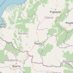
The sanctuary is set within Laguna de la Cocha, a scenic high-altitude lake surrounded by the mountainous terrain of the Nariño department in Colombia's southwestern Andean region. La Corota Island rises from the lake's waters as a forested dome, its slopes covered in dense cloud forest that creates a striking contrast against the open water. The island represents the only lake island in Colombia that retains old-growth Andean forest, a landscape feature of significant ecological and scenic value. The surrounding water area of approximately four hectares falls within the sanctuary's boundaries, protecting the lake habitat around the island. The overall terrain of the island is characterized by gentle slopes supporting the cloud forest, with the highest points offering views across the lake to the surrounding Andean landscape. The combination of island forest and lake waters creates a distinctive landscape that differs markedly from the continental forest reserves found elsewhere in Colombia's Andean region.

La Corota Island Flora Sanctuary ecosystems, habitats, and plant life

The ecological character of La Corota Island is defined by its subtropical Andean cloud forest, a moist forest type that forms where persistent mist and cloud cover create conditions of high humidity and moderate temperatures. This forest type supports a distinctive suite of plant species adapted to the cool, moist conditions of the high-altitude Andean environment. The sanctuary protects several endemic plant species including Hieronyma macrocarpa, Eugenia stipitata, Befaria glauca, Hesperomeles glabrata, and Drymis granantesis, representing a collection of species that find their stronghold in the island's protected forests. The cloud forest on the island exists in relatively intact condition, representing what remains of forest types that once covered much of the surrounding Andean landscape but have been largely converted to agriculture and pasture. The surrounding lake waters add ecological complexity, supporting aquatic habitats for fish, amphibians, and waterfowl that use the sanctuary's protected waters for feeding and breeding.

La Corota Island Flora Sanctuary wildlife and species highlights

The wildlife community of La Corota Island encompasses both forest-dwelling species and aquatic organisms associated with the surrounding lake. Among mammals, the sanctuary supports the soft-furred Oldfield mouse and various bat species (Chiroptera), representing the small mammal component of the island's terrestrial fauna. The lake environment attracts diverse waterfowl, with the Andean coot (Fulica ardesiaca) and pied-billed grebe among the more visible aquatic birds. The bird community of the sanctuary is notably diverse, featuring species such as the black-crowned night heron, rufous-collared sparrow, red-crested cotinga, great thrush, glossy-black thrush, spectacled whitestart, golden-fronted whitestart, slaty brushfinch, sparkling violetear, and collared Inca. This bird diversity makes the sanctuary particularly attractive to birdwatchers, who visit specifically to observe both resident forest species and migratory waterfowl that use the lake as a seasonal habitat. The aquatic environment also supports fish and amphibian populations, adding to the overall biodiversity value of the protected area.

La Corota Island Flora Sanctuary conservation status and protection priorities

La Corota Island Flora Sanctuary represents a conservation priority at multiple scales due to its unique ecological character and limited distribution. As the only lake island in Colombia with old-growth Andean cloud forest, the sanctuary preserves an ecosystem type that has nearly vanished from the surrounding landscape. The dual designation as a national protected area and a Ramsar Wetland reflects the international recognition of its ecological significance, particularly for waterfowl habitat and wetland conservation. The sanctuary's small size makes it vulnerable to external pressures, but its island isolation provides a degree of protection from the land-use change that has transformed continental Andean forests. The preservation of the cloud forest also contributes to watershed protection for Laguna de la Cocha, as the forest cover helps regulate water quality and flows into the lake. Conservation of this island ecosystem also carries educational and research value, offering a contained natural laboratory for studying Andean cloud forest ecology, succession dynamics, and species interactions in a relatively undisturbed setting.

La Corota Island Flora Sanctuary cultural meaning and human context

La Corota Island sits within the cultural landscape of Nariño, a department in southwestern Colombia with strong indigenous heritage and Spanish colonial history. The lake, Laguna de la Cocha, has historically served as a resource for local communities, and the island itself carries cultural significance as a natural landmark in the regional landscape. The sanctuary is managed as part of Colombia's National System of Protected Areas, with oversight provided through the national parks service. The proximity to Pasto, the departmental capital, connects the sanctuary to the administrative and cultural life of the region. Ecotourism at La Corota represents a contemporary use of the landscape that balances conservation with public enjoyment and environmental education, allowing visitors to experience the island's natural values while supporting protection of its ecological resources.

Top sights and standout views in La Corota Island Flora Sanctuary

La Corota Island stands out as Colombia's smallest national park yet one of its most visited, offering an intimate encounter with Andean cloud forest on a scenic island lake setting. The sanctuary provides access to two short hiking trails that wind through old-growth forest, while boardwalks protect the understory while allowing visitors to experience the forest environment. Birdwatching opportunities are exceptional, with over a dozen species including thrushes, whitestarts, and the colorful collared Inca readily observed in the forest canopy. The island's status as the only lake island in Colombia with intact cloud forest makes it a unique destination for understanding Andean ecological systems. The Ramsar designation highlights the international importance of the wetland surrounding the island, where waterfowl congregate among the emergent vegetation.

Best time to visit La Corota Island Flora Sanctuary

The sanctuary can be visited throughout the year, though the visitor experience varies with the Andean seasons. The dry season, typically from December through March, often provides clearer skies and more comfortable conditions for hiking the island trails. The wet season brings frequent mist and cloud that contribute to the cloud forest character, creating an atmospheric experience where the forest is often shrouded in moisture. Wildlife viewing may be most productive during the drier months when birds are more active and visible in the canopy. The lake environment remains accessible year-round, and the sanctuary's small size means that a visit of a few hours is sufficient to experience the main features of the island. Peak visitation tends to coincide with Colombian holiday periods and weekends, so those seeking a quieter experience may prefer weekday visits.

Park location guide

Geography guide, regional context, and park location map for La Corota Island Flora Sanctuary

La Corota Island Flora Sanctuary park geography, regions, and map view in Colombia
Understand where La Corota Island Flora Sanctuary sits in Colombia through a broader geographic reading of the surrounding landscape, nearby location context, and its mapped position within the national park landscape.

How La Corota Island Flora Sanctuary fits into Colombia

Colombia is a presidential republic located in the northern part of South America. It spans approximately 1.14 million km² and has a population of around 52 million. The country features the Andes mountain range, extensive Amazon rainforest, and coastal regions on both the Caribbean and Pacific. Spanish is the official language, and Bogotá serves as the capital and largest city.

Wider geography shaping La Corota Island Flora Sanctuary in Colombia

Colombia is located in the northwestern part of South America, bordering the Caribbean Sea to the north and the Pacific Ocean to the west. Its mainland neighbors are Venezuela to the east, Brazil to the southeast, Peru and Ecuador to the south and southwest, and Panama to the northwest. The terrain is diverse, featuring the Andes mountain range in the west, Amazon rainforest in the south and east, and coastal plains along both oceans.

Map view of La Corota Island Flora Sanctuary

Use this park location map to pinpoint La Corota Island Flora Sanctuary in Colombia, understand its exact geographic position, and read its mapped placement within the surrounding landscape more clearly.

Pigeon | © OpenStreetMap contributors

Location context for La Corota Island Flora Sanctuary

Nariño

Browse essential images of this Andean cloud forest island, showcasing its rare habitats, protected waters, and distinctive terrain.

Visual Guide to La Corota Island Flora Sanctuary: Explore Colombian Cloud Forest Landscapes and Unique Island Scenery
Explore high-quality park photography of La Corota Island Flora Sanctuary, visually discovering its unique old-growth Andean cloud forest, tranquil lake surroundings, and diverse island ecosystems. Understanding these protected landscapes through imagery offers a clearer perspective on the sanctuary's ecological significance and its distinctive visual identity within Colombia's national parks.

Wooden steps and black metal railings leading through a dense tropical forest with tall trees and dappled sunlight

Park atlas

Map the diverse protected areas across Colombia's Nariño department and broader Andean region, offering geographic context.

Discover Other National Parks and Protected Areas Near La Corota Island Flora Sanctuary
Explore national parks and protected areas across the Andean region, expanding your view beyond La Corota Island Flora Sanctuary to trace varied conservation landscapes. This geographic context helps you compare different protected area types, understand their unique terrain, and deepen your understanding of regional conservation efforts in Colombia.
Watercolor illustration of a mountain range with a lake in the foreground, green fields, and a colorful sky
Protected areaColombia

Galeras Protected Area: Exploring Colombia's Mapped Natural Landscapes

Discover the geography and protected terrain of Galeras.

The Galeras protected area in Colombia offers a distinct opportunity for geographic exploration, focusing on its defined boundaries and the natural landscape it encompasses. This resource details the park's setting within the Colombian geography, providing a map-centric view of its protected status. Understanding Galeras contributes to a broader appreciation of protected lands across South America and their unique terrain.

Relief
Mountain
Climate
Alpine
Access
Highly restricted
National parkNariño Department

Doña Juana-Cascabel Volcanic Complex National Natural Park: National Park with Mapped Protected Landscape

Explore its volcanic terrain and geographic context in Nariño Department.

Doña Juana-Cascabel Volcanic Complex National Natural Park is a designated National Park offering rich opportunities for geographic exploration. Situated within Nariño Department, this protected landscape provides a unique lens through which to study regional natural features and mapped conservation boundaries. Its presence within Colombia's protected areas network makes it a key point of reference for understanding national park geography and landscape context.

Area
0.267 km²
Established
2007
IUCN
II
Relief
Mountain
National parkColombia

Serranía de Los Churumbelos Auka-Wasi National Natural Park: Colombia's Protected Landscape Atlas

Mapped national park boundaries and regional geography.

Understand Serranía de Los Churumbelos Auka-Wasi National Natural Park through its geographic context and protected landscape features. This atlas view highlights the park's mapped boundaries and its significance within Colombia's natural geography, offering detailed insights into its protected status and regional terrain.

Area
562 km²
Established
2007
IUCN
II
Relief
Mountain
National parkCauca Department

Puracé National Natural Park: National Park Discovery and Geographic Context in Cauca Department

Explore its mapped protected landscape and regional natural geography.

Puracé National Natural Park offers a rich opportunity for geographic discovery within Colombia's Cauca Department. As a designated national park, its protected landscape serves as a key point of reference for understanding regional natural geography. This atlas-focused entry provides insight into the park's mapped boundaries and its significance as a protected area, facilitating a deeper comprehension of Colombia's conservation territories and natural terrain.

Area
830 km²
Established
1961
IUCN
II
Relief
Mountain
National parkEcuador

Sumaco Napo-Galeras National Park: Ecuador's Volcanic National Park Landscape

Explore protected areas and biodiversity in the Andean-Amazon transition.

Sumaco Napo-Galeras National Park protects a dramatic volcanic landscape in Ecuador, showcasing a significant elevation gradient that supports diverse cloud forest and Amazonian rainforest habitats. This national park is recognized for its endemic species and rich avifauna, offering a compelling case study for understanding protected land geography and ecological transitions within South America.

Area
2,067.49 km²
Established
1994
IUCN
II
Relief
Mountain
National parkCauca Department

Munchique National Natural Park: National Park with Key Protected Landscape Features

Explore mapped geography and protected area context.

Munchique National Natural Park is a designated National Park offering a distinct protected landscape within Colombia's Cauca Department. This page provides essential context for understanding its geographic footprint, regional setting, and its significance as a mapped natural area. Dive into the atlas details and explore the unique geography that defines this protected entity.

Area
440 km²
Established
1977
IUCN
II
Relief
Mountain
National parkCotopaxi Province

Cotopaxi National Park: Ecuador's Mapped Protected Landscape and Regional Geography

Explore the geographic context of this national park.

Cotopaxi National Park represents a key protected landscape within Ecuador, located in Cotopaxi Province. This page facilitates detailed exploration of the park's mapped boundaries and its contribution to the regional geography. Understand the specific characteristics of this national park as part of a broader atlas of protected areas and natural terrains.

Area
333.93 km²
Established
1975
IUCN
II
Relief
Mountain
Watercolor painting of green hills, trees, and distant mountains under a light sky
National parkValle del Cauca Department

Farallones de Cali National Park: Protected Landscape and Geographic Atlas

Explore mapped boundaries and regional context.

Farallones de Cali National Park offers a distinct protected landscape within Valle del Cauca Department. This page provides atlas-level detail on its geographic scope and mapped features, crucial for understanding its regional context. Dive into the protected-area specifics to grasp the natural terrain and conservation landscape that defines this significant Colombian national park.

Area
1,500 km²
Established
1968
IUCN
II
Relief
Mountain

Common questions about visiting, size, designation, and location context for La Corota Island Flora Sanctuary

La Corota Island Flora Sanctuary FAQs for park facts, access, geography, and protected area context
Find quick answers about La Corota Island Flora Sanctuary, including protected-area facts, park geography, trail and visitor context, and how the park fits into its surrounding country and regional landscape.
MoriAtlas Explorer

Continue Your Protected Areas Search Across the Global Atlas

Deepen your exploration by continuing the structured search for national parks and protected areas worldwide. Utilize the comprehensive filtering capabilities to compare different conservation landscapes and refine your understanding of global park geography. Discover more about the distribution and characteristics of protected natural areas.

Global natural geography