Mori Atlas logo
National parkAmacayacu National Natural Park

Discover the unique flooded forest terrain and mapped park boundaries of this Amazonian national park.

Amacayacu National Natural Park: Protected Landscape and Geographic Atlas in Amazonas, Colombia

(Parque Nacional Natural Amacayacu)

Amacayacu National Natural Park represents a significant protected landscape within Colombia's Amazonas Department, offering a deep dive into the Amazon basin's unique geography. Spanning approximately 2,935 square kilometers, this national park is defined by its pristine Amazonian rainforest, the dynamic influence of the Amazon River, and its seasonally flooded forest ecosystems. MoriAtlas provides structured map-based exploration of Amacayacu's terrain, from river islands to the intricate watercourses, enabling a detailed understanding of its protected area status and ecological significance.

Amazon rainforestNational parkFlooded forestRiver islandsWildlife observationTropical wilderness

Amacayacu National Natural Park

National park

Park overview

Structured park overview, official facts, and landscape profile for Amacayacu National Natural Park

Amacayacu National Natural Park park facts, protected area profile, and essential visitor context
Review the core facts for Amacayacu National Natural Park, including designation, size, terrain, visitor scale, habitats, and operating context in one park-focused overview.

About Amacayacu National Natural Park

Amacayacu National Natural Park represents one of Colombia's most significant protected areas within the Amazon basin, serving as a corridor for wildlife movement and a refuge for species adapted to the complex flooded forest ecosystem. The park's location along the Amazon River places it at the heart of the world's largest tropical rainforest, a region that holds an estimated 10% of all species on Earth despite covering less than 5% of the planet's land surface. The protected area encompasses a mosaic of habitats that shift dramatically between wet and dry seasons, when the river rises to flood vast tracts of forest and transforms the landscape into an archipelago of tree-covered islands and waterways. This seasonal flooding regime sustains an extraordinary concentration of fish, aquatic mammals, and flood-adapted wildlife, making the park particularly important for maintaining ecological processes that depend on the river's natural cycle. The park is administered by Colombia's National System of Protected Areas (SINAP) and operates as an IUCN Category II protected area, reflecting its designation as a national park with primary conservation objectives. Visitor infrastructure within the park is designed to maintain minimal environmental impact, with traditional maloca accommodations offering overnight stays in communal structures where travelers sleep in hammocks suspended beneath thatched roofs, echoing indigenous Amazonian architecture.

Quick facts and research context for Amacayacu National Natural Park

Amacayacu National Natural Park protects a sprawling tract of Amazonian wilderness in southern Colombia's Amazonas Department, covering roughly 2,935 square kilometers along the Amazon River. The park encompasses both permanently flooded várzea forests and higher-ground tierra firme forest, with annual flooding during the wet season transforming vast sections of the protected area into an interconnected aquatic landscape. The region experiences consistently warm temperatures with minimal variation, ranging from 26 to 28 degrees Celsius throughout the year. The park was formally established in 1975 following a decade of advocacy by American conservationist Julia Allen Field, who built a research station called La Manigua and lobbied Colombian authorities for permanent protection. The park is home to the Ticuna people, one of the region's oldest indigenous groups, who continue to maintain cultural practices and community presence within the protected boundaries.

Park context

Deeper park guide and search-rich context for Amacayacu National Natural Park

Amacayacu National Natural Park history, landscape, wildlife, and travel context
Explore Amacayacu National Natural Park through its history, landscape character, ecosystems, wildlife, conservation priorities, cultural context, and seasonal travel timing in a structured park guide built for atlas discovery and search intent.

Why Amacayacu National Natural Park stands out

Amacayacu is most renowned for its exceptional Amazonian biodiversity and the opportunity to experience the Amazon River's flooded forest ecosystem up close. The park offers visitors a chance to navigate the main Amazon channel and explore river islands where troops of monkeys congregate, particularly on Isla de los Micos (Island of Monkeys), where several primate species can be observed in their natural habitat. The most iconic wildlife experience in the park involves boat excursions to Tarapoto Lake, one of the few permanent freshwater lakes in the Colombian Amazon, where visitors can observe the endangered Amazon river dolphin (boto) in its natural environment. The flooded forest landscapes, where giant Victoria Regia water lilies anchor the riverbanks, create one of the most visually striking and ecologically significant scenes in all of Amazonia, demonstrating the intimate connection between the river's seasonal pulse and the forest's ecology.

Amacayacu National Natural Park history and protected-area timeline

Amacayacu National Natural Park emerged from a pioneering conservation initiative in the early 1970s led by American conservationist Julia Allen Field, who established a research station called La Manigua on the Cothué River in 1970. Field, founder and president of the organization Amazonia 2000, approached INDERENA (Colombia's Institute for Natural Resources, now the National Institute of Renewable Natural Resources and Environment) to request the creation of a protected forest and wildlife sanctuary that would encompass the area around her research station and protect species including jaguars from the pressures of the international skin trade. In 1975, Julio Carrizosa, Director of INDERENA, successfully secured the establishment of Amacayacu National Park, protecting approximately 4,220 square kilometers of jungle and implementing a courageous ban on hunting for commercial purposes, particularly targeting the trade in jaguar, ocelot, and deer skins that had previously fueled the local economy. The formal declaration was announced on September 30, 1975, in Tarapacá, with Chief of Forestry Fidel Castillo and Mayor Alirir Muñoz acknowledging Field's instrumental role in inspiring the park's creation. The park's creation marked an important moment in Colombian conservation history, demonstrating the potential for international collaboration to protect Amazonian ecosystems.

Amacayacu National Natural Park landscape and geographic character

The physical landscape of Amacayacu is defined by the Amazon River's omnipresent influence, which shapes everything from the forest structure to the visual character of the terrain. The park's elevation ranges between 200 and 300 meters above sea level, creating relatively flat terrain characteristic of the Amazon basin, where ancient sediments have created vast low-lying floodplains. During the wet season, typically from December through May, the Amazon River swells dramatically, submerging extensive areas of forest and transforming the landscape into a complex network of channels, lagoons, and temporary islands. The riverbanks feature distinctive vegetation adapted to both inundation and exposure, with stands of ceiba trees and Mauritia palms marking the transitional zones between permanent water and seasonally flooded land. The landscape includes both várzea forest (flooded forest subject to annual sediment deposition) and tierra firme forest (higher ground that never floods), creating a mosaic of ecosystems that supports different assemblages of plants and animals. River islands within the park's boundaries shift in size and shape over time as the Amazon's powerful currents erode and deposit sediments, creating dynamic landforms that serve as important habitats for nesting birds and spawning fish.

Amacayacu National Natural Park ecosystems, habitats, and plant life

The ecological character of Amacayacu reflects the extraordinary biodiversity of the Amazon basin, where species richness reaches its global maximum in the seasonally flooded forest habitats that dominate the protected area. The várzea forests that cover much of the park's lower elevations experience annual flooding that brings nutrient-rich sediments from the Andes, creating extraordinarily productive ecosystems where fish populations explode during the high-water period and trees develop complex buttress root systems to stabilize in saturated soils. The park's position along a major tributary of the Amazon places it within a corridor that connects protected areas across international boundaries, allowing for the movement of species across the broader Amazon landscape. Vegetation in the park includes hundreds of tree species, with emergent canopy species reaching 50 meters or more in height, while the forest floor supports a diverse understory of palms, ferns, and flowering plants that thrive in the dim light beneath the continuous canopy. The Amazon's flood pulse creates a dynamic ecological cycle where different species exploit resources at different times, from fish that spawn in the flooded forest to primates that feed on fruiting trees that become accessible only when water levels rise.

Amacayacu National Natural Park wildlife and species highlights

Amacayacu provides critical habitat for an exceptional diversity of wildlife, with the park's location along the Amazon River and its mosaic of flooded and non-flooded forests supporting numerous species of conservation significance. The park is renowned for its primate populations, particularly on islands like Isla de los Micos where troops of squirrel monkeys, howler monkeys, and other species concentrate and can be observed from river boats passing through the area. The Amazon river dolphin, locally known as the boto, represents one of the park's most iconic species, with excursions to Tarapoto Lake offering reliable opportunities to observe these intelligent marine mammals in their freshwater environment. The flooded forest habitats support important populations of fish-eating birds, including herons, cormorants, and the distinctive hoatzin, while the forest canopy harbors toucans, parrots, and numerous understory bird species. The park's significance for scientific research is demonstrated by the extensive zoological specimen collection that has been assembled from the area, providing valuable documentation of the region's biodiversity.

Amacayacu National Natural Park conservation status and protection priorities

Amacayacu National Natural Park plays a vital role in Colombia's conservation strategy for the Amazon region, protecting a substantial portion of the country's flooded forest ecosystems within a formal protected area framework. The park's designation as an IUCN Category II protected area reflects its primary objective of preserving natural ecosystems while allowing for sustainable visitor use and environmental education. The protection of this vast tract of Amazonian forest contributes to broader conservation goals across the Amazon basin, where maintaining connectivity between protected areas is essential for the long-term survival of wide-ranging species like jaguars, giant river otters, and Amazonian primates. The park's history reflects evolving conservation approaches in Colombia, from the early emphasis on banning commercial hunting to contemporary approaches that integrate indigenous communities like the Ticuna people into conservation planning. The seasonal flooding that characterizes the park's ecology creates unique conservation challenges, as the dynamic nature of the Amazon River requires management approaches that accommodate natural processes rather than attempting to stabilize artificial conditions.

Amacayacu National Natural Park cultural meaning and human context

The cultural landscape of Amacayacu includes the presence of the Ticuna people, one of the oldest indigenous groups in the Colombian Amazon, who continue to inhabit and maintain cultural practices within portions of the park's territory. The Ticuna have historically lived in harmony with the Amazon River's seasonal rhythms, developing sophisticated knowledge of fish migration patterns, forest regeneration cycles, and the use of floodplain resources that reflects thousands of years of accumulated ecological understanding. The name Amacayacu itself encodes indigenous knowledge, with the Quechua translation "River of the Hammocks" referencing the elevated sleeping platforms that allow families to remain safe and dry during the annual flooding that transforms the landscape. Traditional village structures within the park, including the communal maloca buildings where multiple families sleep in hammocks, represent architectural adaptations perfectly suited to the tropical environment and the social organization of Amazonian communities. The park's management approaches increasingly recognize the importance of indigenous presence in maintaining both cultural continuity and effective conservation outcomes, as traditional land management practices have shaped the forest in ways that support biodiversity.

Top sights and standout views in Amacayacu National Natural Park

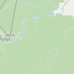
Amacayacu National Natural Park offers visitors an authentic Amazonian experience in one of the most accessible and well-protected sections of the Colombian Amazon. The highlights of a visit include boat excursions along the Amazon River to observe flooded forests and wildlife, with stops at islands where troops of monkeys congregate and where Victoria Regia water lilies create a surreal aquatic landscape. The journey to Tarapoto Lake for Amazon river dolphin encounters represents the park's signature wildlife experience, offering visitors the chance to observe these protected cetaceans in the wild. Accommodation in traditional maloca structures provides an immersive cultural experience, with the sound of the forest and river creating an atmospheric backdrop for overnight stays. The park's proximity to Leticia, the capital of the Amazonas Department, makes it relatively accessible compared to more remote Amazonian destinations, while still maintaining the wilderness character that defines the Amazon experience.

Best time to visit Amacayacu National Natural Park

The optimal time to visit Amacayacu depends on what experiences visitors prioritize, as the Amazon's seasonal cycle creates distinctly different conditions between wet and dry seasons. The wet season, typically from December through May, brings higher water levels that flood extensive areas of forest, making boat excursions more extensive and enabling access to flooded areas that are inaccessible during drier months. This period offers excellent opportunities for wildlife observation as animals concentrate on higher ground and the flooded forest creates ideal conditions for dolphin watching. The dry season, from June through November, exposes river beaches and creates easier walking conditions on terra firma forest trails, with clearer water making fish and underwater observation more straightforward. Throughout the year, temperatures remain consistently warm between 26 and 28 degrees Celsius, with humidity remaining high regardless of season. Visitors should be prepared for mosquitoes, particularly during evening hours, and should wear protective clothing when exploring during dawn and dusk periods.

Park location guide

Geography guide, regional context, and park location map for Amacayacu National Natural Park

Amacayacu National Natural Park park geography, regions, and map view in Colombia
Understand where Amacayacu National Natural Park sits in Colombia through a broader geographic reading of the surrounding landscape, nearby location context, and its mapped position within the national park landscape.

How Amacayacu National Natural Park fits into Colombia

Colombia is a presidential republic located in the northern part of South America. It spans approximately 1.14 million km² and has a population of around 52 million. The country features the Andes mountain range, extensive Amazon rainforest, and coastal regions on both the Caribbean and Pacific. Spanish is the official language, and Bogotá serves as the capital and largest city.

Wider geography shaping Amacayacu National Natural Park in Colombia

Colombia is located in the northwestern part of South America, bordering the Caribbean Sea to the north and the Pacific Ocean to the west. Its mainland neighbors are Venezuela to the east, Brazil to the southeast, Peru and Ecuador to the south and southwest, and Panama to the northwest. The terrain is diverse, featuring the Andes mountain range in the west, Amazon rainforest in the south and east, and coastal plains along both oceans.

Map view of Amacayacu National Natural Park

Use this park location map to pinpoint Amacayacu National Natural Park in Colombia, understand its exact geographic position, and read its mapped placement within the surrounding landscape more clearly.

Pigeon | © OpenStreetMap contributors

Location context for Amacayacu National Natural Park

Amazonas Department
Park atlas

Explore the regional protected-area geography, comparing other significant conservation landscapes adjacent to Amacayacu.

Discover Other National Parks and Protected Areas Near Amacayacu National Natural Park
After exploring Amacayacu National Natural Park, continue your discovery by browsing other national parks and protected areas situated within its broader Amazonian region. Comparing these mapped protected landscapes provides valuable geographic context for understanding contiguous conservation efforts and the diverse ecosystems across the wider Amazon basin.
National parkLoreto Region

Yaguas National Park: A Vast Protected Amazonian Landscape in Peru's Loreto Region

Mapping unique transboundary conservation and tropical biodiversity.

Yaguas National Park represents a monumental addition to Peru's protected lands, safeguarding an immense area of Amazonian rainforest within the Loreto Region. Its designation as a national park underscores its ecological importance as part of a critical international conservation corridor. This page provides detailed geographic context, showcasing the park's mapped boundaries, its characteristic lowland tropical forest terrain, and its role in preserving the rich biodiversity of the Amazon basin.

Area
8,689 km²
Established
2018
IUCN
II
National parkPeru

Sierra del Divisor National Park: Peru's Sacred Amazonian Protected Landmark

Explore dramatic mountain terrain and protected lowland rainforest.

Sierra del Divisor National Park in Peru is a vital protected area conserving over 1.35 million hectares of Amazon rainforest. Characterized by the unique Sierra del Divisor mountain range and the sacred pyramid peak of Cerro El Cono, the park offers a distinct landscape within the broader Amazon basin. As one of Peru's newer national parks, it represents a significant commitment to preserving critical biodiversity corridors and understanding the geographic context of protected lands in a region facing environmental pressures.

Area
13,544.8 km²
Established
2015
IUCN
II
National parkPeru

Güeppi-Sekime National Park: Protected National Park Atlas in Peru

Mapped landscape and regional geography of this Amazonian protected area.

Güeppi-Sekime National Park is a prominent protected area in Peru, recognized as a national park safeguarding a substantial expanse of tropical forest. Its landscape is characterized by diverse terrain, including rolling hills and seasonally inundated lowlands, vital for a rich tapestry of flora and fauna. The park's strategic location on the Ecuador border underscores its importance for transboundary conservation and ecological connectivity within the western Amazon basin. This page offers detailed information on its protected area identity, geographic context, and the mapped natural features that define this significant conservation landscape.

Area
2,036 km²
Established
2012
IUCN
II
National parkGuainía Department

Puinawai Natural Reserve National Park: Mapped Protected Landscape in Guainía Department

Explore exceptional Amazonian biodiversity and pristine natural terrain.

Puinawai Natural Reserve is a sprawling national park situated in the remote Guainía Department of Colombia. As one of the largest and most ecologically intact protected areas in the Amazon basin, it preserves a unique mosaic of humid tropical rainforest, tropical open savanna, and transitional zones. The park's immense size and isolation contribute to its remarkable state of preservation, offering a significant opportunity for atlas-driven discovery of its mapped boundaries, diverse ecosystems, and complex hydrological geography at the Amazon-Orinoco divide.

Area
10,925 km²
Established
1989
IUCN
II
National parkAmazonas

Serranía de la Neblina National Park: The World's Highest Tepui and Cloud Forest Protected Landscape

Explore its mist-shrouded peaks and deep canyons.

Serranía de la Neblina National Park is a paramount protected area in Venezuela's Amazonas state, famed for its highest tepui mountain. Established in 1978, this vast national park sprawls across 13,600 square kilometers of untamed Amazonian terrain. Its iconic Serranía de la Neblina is continuously wrapped in fog, presenting a unique landscape rich in endemic species and geological wonders like the Baría Grande Canyon. Discover its mapped geography and critical role in Guayanan Highlands conservation.

Area
13,600 km²
Established
1978
IUCN
II
National parkEcuador

Sumaco Napo-Galeras National Park: Ecuador's Volcanic National Park Landscape

Explore protected areas and biodiversity in the Andean-Amazon transition.

Sumaco Napo-Galeras National Park protects a dramatic volcanic landscape in Ecuador, showcasing a significant elevation gradient that supports diverse cloud forest and Amazonian rainforest habitats. This national park is recognized for its endemic species and rich avifauna, offering a compelling case study for understanding protected land geography and ecological transitions within South America.

Area
2,067.49 km²
Established
1994
IUCN
II
National parkAmazonas

Parima Tapirapecó National Park: Venezuela's Largest Protected Area within the Guayanan Highlands

Explore its vast geographic extent and critical Orinoco River basin landscape.

Parima Tapirapecó National Park is an expansive protected territory in Venezuela's Amazonas region, holding the title of the country's largest national park and ranking among the world's most significant protected lands. Its geography is defined by the ancient Guayanan Highlands, protecting the vital headwaters of the Orinoco River and a mosaic of tropical forests and savannas. This park offers deep insights into landscape preservation on a grand scale, crucial for understanding regional geography and protected area distribution.

Area
38,290 km²
Established
1991
IUCN
II
Scope
Terrestrial
National parkAmazonas

Yapacana National Park: Ancient Geology and Botanical Significance in Venezuela's Amazonas

Discover the dramatic plateau landscapes and unique flora of this protected national park.

Delve into the distinct geography and protected landscape identity of Yapacana National Park, a significant national park within Venezuela's Amazonas region. This page serves as a comprehensive atlas entry, detailing the park's core features, including its iconic Yapacana hill, a dramatic tepui formation representative of the ancient Guayana Shield. Understand the park's geological heritage and its exceptional botanical value, marked by unique floristic connections, all within the context of its Amazonian basin setting.

Area
3,200 km²
Established
1978
IUCN
II

Common questions about visiting, size, designation, and location context for Amacayacu National Natural Park

Amacayacu National Natural Park FAQs for park facts, access, geography, and protected area context
Find quick answers about Amacayacu National Natural Park, including protected-area facts, park geography, trail and visitor context, and how the park fits into its surrounding country and regional landscape.
MoriAtlas Explorer

Continue Your Protected Areas Search Across the Global Atlas

Deepen your exploration by continuing the structured search for national parks and protected areas worldwide. Utilize the comprehensive filtering capabilities to compare different conservation landscapes and refine your understanding of global park geography. Discover more about the distribution and characteristics of protected natural areas.

Global natural geography