Mori Atlas logo
National parkPuinawai Natural Reserve

Discover one of Colombia's largest and most intact protected areas at a critical Amazon-Orinoco hydrological divide.

Puinawai Natural Reserve National Park: Mapped Protected Landscape & Guainía Department Geography

(Reserva Nacional Natural Puinawai)

Puinawai Natural Reserve, a vast national park in Colombia's Guainía Department, represents one of the most ecologically preserved territories within the Amazon basin. Spanning over 10,925 square kilometres, this protected landscape is defined by its pristine rainforest, savanna mosaics, and transitional ecosystems at a significant biogeographical crossroads. Its protected boundaries encompass a critical hydrological divide between the Amazon and Orinoco river systems, making it a key area for understanding regional geography and immense biodiversity.

Amazon rainforestNational parkGuyana ShieldTropical savannaRiver basinIndigenous territory

Puinawai Natural Reserve

National park

Park overview

Structured park overview, official facts, and landscape profile for Puinawai Natural Reserve

Puinawai Natural Reserve park facts, protected area profile, and essential visitor context
Review the core facts for Puinawai Natural Reserve, including designation, size, terrain, visitor scale, habitats, and operating context in one park-focused overview.

About Puinawai Natural Reserve

Puinawai Natural Reserve represents one of Colombia's most significant protected areas, both for its ecological value and its sheer scale. Located in the far northeastern corner of Colombia within the Guainía Department, the reserve occupies a transitional zone between the Amazon rainforest proper and the Guiana Shield highlands, creating a unique blend of ecosystems that supports exceptional biodiversity. The protected area was established in 1989 simultaneously with the formal recognition of three indigenous territories, reflecting the close integration between the reserve's management and the ancestral lands of local communities who have maintained sustainable relationships with this landscape for generations. The reserve's geographical position at the headwaters of multiple river systems gives it outsized importance for downstream water quality and regional hydrological cycles across vast stretches of both the Amazon and Orinoco basins. Though the reserve is not open to conventional tourism, it serves as a critical corridor for wildlife movement and maintains ecological connectivity across a landscape that remains among the least disturbed in northern South America.

Quick facts and research context for Puinawai Natural Reserve

Puinawai Natural Reserve spans 10,925 square kilometres in the Amazon Region of Colombia, making it the country's second-largest national park. The reserve sits at elevations between 200 and 380 metres above sea level in the Guainía Department, with the town of Inírida serving as the nearest population centre. The landscape is characterized by hot and humid tropical conditions with minimal seasonal variation throughout the year. The reserve encompasses portions of both the Amazon River and Orinoco River basins, with major waterways including the Guainía River, Isana River, Cuyari River, and Inírida River traversing the protected area.

Park context

Deeper park guide and search-rich context for Puinawai Natural Reserve

Puinawai Natural Reserve history, landscape, wildlife, and travel context
Explore Puinawai Natural Reserve through its history, landscape character, ecosystems, wildlife, conservation priorities, cultural context, and seasonal travel timing in a structured park guide built for atlas discovery and search intent.

Why Puinawai Natural Reserve stands out

Puinawai Natural Reserve is distinguished by its extraordinary biodiversity and remarkable state of ecological preservation. The reserve harbours 419 endemic plant species, with 176 of these species endemic to the broader Guyana Shield region, representing one of the highest concentrations of restricted plant diversity in the Amazon. The protected area encompasses a complex mosaic of humid tropical rainforest, tropical open savanna, and transitional ecological zones, creating a diverse habitat matrix that supports both Amazonian and Guianan species assemblages. The reserve's isolation has historically limited human impact, preserving intact ecosystems that have remained largely undisturbed.

Puinawai Natural Reserve history and protected-area timeline

Puinawai Natural Reserve was established in September 1989 as part of Colombia's expansion of its national park system during the late twentieth century. The creation of the reserve coincided with the formal recognition of three indigenous territories within the same geographic area, establishing a model of co-management where traditional indigenous lands received formal legal protection alongside the national park designation. This dual recognition acknowledged that the local indigenous communities had for centuries practiced forms of land use and resource management that were compatible with, and indeed supportive of, the maintenance of ecological integrity. The establishment of the reserve represented a strategic expansion of Colombia's Amazon conservation frontier into the previously under-protected Guainía Department, which at the time remained one of the least开发和度最高的地区之一.

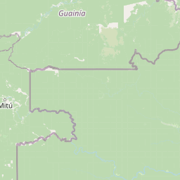
Puinawai Natural Reserve landscape and geographic character

The physical landscape of Puinawai Natural Reserve is characterized by its low-lying terrain, with elevations ranging from 200 to 380 metres above sea level across the protected area. The terrain consists largely of gently undulating plains and low ridges that form part of the broader Amazon floodplain system, punctuated by occasional higher ground that supports distinct vegetation communities. Multiple river channels traverse the reserve, including the Guainía River, Isana River, Cuyari River, and Inírida River, creating a dendritic drainage pattern that shapes local topography and vegetation distribution. The rivers belong to two major basins, with the Guainía, Isana, and Cuyari flowing into the Amazon system while the Inírida carries its waters northward to the Orinoco, placing the reserve at a critical hydrological crossroads.

Puinawai Natural Reserve ecosystems, habitats, and plant life

The ecological character of Puinawai Natural Reserve is defined by a complex mosaic of humid tropical rainforest, tropical open savanna, and ecological transition zones. The primary forest type consists of tall evergreen rainforest adapted to the hot, humid conditions with minimal seasonal variation in temperature and precipitation. These forests support extraordinary plant diversity, with 419 species identified as endemic to the reserve and 176 of these species restricted to the Guyana Shield region, representing a remarkable concentration of restricted biodiversity. The savanna enclaves within the rainforest matrix support distinct plant communities adapted to periodic fire and more pronounced dry seasons, creating ecological diversity that adds to the reserve's overall conservation significance. The combination of Amazonian and Guianan biotic influences, coupled with habitat heterogeneity created by the savanna-forest mosaic, makes this area particularly important for maintaining evolutionary processes and species persistence.

Puinawai Natural Reserve wildlife and species highlights

The fauna of Puinawai Natural Reserve remains relatively poorly documented compared to more accessible Colombian protected areas, but the reserve is recognized as supporting significant populations of Amazonian wildlife. The presence of extensive intact forest, the influence of multiple river systems, and the diversity of habitats all contribute to the likelihood of diverse animal communities including numerous bird species, mammals adapted to forest and savanna environments, and aquatic species in the riverine systems. The local indigenous communities have historically maintained sustainable relationships with wildlife populations, and the reserve's inaccessibility has provided additional protection for species that might otherwise face hunting pressure. The Guyana Shield endemism evident in the plant communities suggests similarly restricted faunal elements may also be present, though detailed surveys remain limited.

Puinawai Natural Reserve conservation status and protection priorities

Puinawai Natural Reserve represents one of the most important conservation areas in Colombia due to its vast size, exceptional state of preservation, and unique ecological character. With only approximately 1% of the reserve affected by deforestation, it ranks among the most intact large protected areas in the Amazon region, providing a critical reference ecosystem for understanding pre-disturbance Amazonian ecology. The reserve protects a significant portion of the Guyana Shield flora, with 176 plant species found nowhere else on Earth, making it a global priority for biodiversity conservation. The dual designation of the protected area alongside indigenous territories creates a management framework that integrates traditional ecological knowledge with modern conservation science, potentially offering lessons for landscape-scale protection in other regions. The reserve's position at the hydrological divide between Amazon and Orinoco basins adds additional significance for maintaining downstream ecosystem function across an enormous geographical area.

Puinawai Natural Reserve cultural meaning and human context

The cultural context of Puinawai Natural Reserve is intimately connected to the indigenous peoples whose ancestral territories the reserve encompasses and coincides with. Three distinct indigenous territories were formally recognized at the same time as the reserve's establishment in 1989, reflecting the historical presence and continued relevance of indigenous communities in this remote corner of Colombia. These communities have maintained sustainable relationships with the landscape for generations, and their traditional land management practices have contributed to the remarkable preservation of ecological integrity that characterizes the reserve today. The reserve thus represents not merely a state-imposed conservation designation but rather a recognition of existing indigenous stewardship systems that have demonstrably maintained biodiversity and ecosystem function over extended time periods.

Top sights and standout views in Puinawai Natural Reserve

Puinawai Natural Reserve stands as Colombia's second-largest national park and one of the most ecologically intact large protected areas in the entire Amazon basin. The reserve protects an exceptional concentration of endemic biodiversity, including 419 plant species found nowhere else in the world and 176 species restricted to the Guyana Shield. Its landscape encompasses a diverse mosaic of humid tropical rainforest, savanna, and transitional zones at a critical biogeographical crossroads between Amazonian and Guianan ecosystems. The protected area serves as a hydrological divide between the Amazon and Orinoco river basins, underscoring its regional significance for maintaining water cycles across vast areas of northern South America.

Best time to visit Puinawai Natural Reserve

Puinawai Natural Reserve is not open to the public for conventional tourism, which limits visitor access considerations. The climate is consistently hot and humid year-round with minimal seasonal variation, and any visit would require special arrangements through Colombia's national parks service and coordination with local indigenous communities. The dry season, typically from December through March, may offer slightly more accessible conditions for any authorized scientific or cultural visits, though the reserve's remote location and lack of tourism infrastructure make it one of the most difficult Colombian parks to access.

Park location guide

Geography guide, regional context, and park location map for Puinawai Natural Reserve

Puinawai Natural Reserve park geography, regions, and map view in Colombia
Understand where Puinawai Natural Reserve sits in Colombia through a broader geographic reading of the surrounding landscape, nearby location context, and its mapped position within the national park landscape.

How Puinawai Natural Reserve fits into Colombia

Colombia is a presidential republic located in the northern part of South America. It spans approximately 1.14 million km² and has a population of around 52 million. The country features the Andes mountain range, extensive Amazon rainforest, and coastal regions on both the Caribbean and Pacific. Spanish is the official language, and Bogotá serves as the capital and largest city.

Wider geography shaping Puinawai Natural Reserve in Colombia

Colombia is located in the northwestern part of South America, bordering the Caribbean Sea to the north and the Pacific Ocean to the west. Its mainland neighbors are Venezuela to the east, Brazil to the southeast, Peru and Ecuador to the south and southwest, and Panama to the northwest. The terrain is diverse, featuring the Andes mountain range in the west, Amazon rainforest in the south and east, and coastal plains along both oceans.

Map view of Puinawai Natural Reserve

Use this park location map to pinpoint Puinawai Natural Reserve in Colombia, understand its exact geographic position, and read its mapped placement within the surrounding landscape more clearly.

Pigeon | © OpenStreetMap contributors

Location context for Puinawai Natural Reserve

Guainía Department
Park atlas

Map the regional spread of protected areas and conservation landscapes surrounding Puinawai Natural Reserve.

Discover Nearby Protected Landscapes: Puinawai Natural Reserve and Related Amazonian Parks
Explore other national parks and protected areas across the Amazon basin and eastern Colombia, allowing for geographic comparison with Puinawai Natural Reserve. Uncover diverse conservation landscapes and regional park geography, providing deeper atlas context for this highly biodiverse section of northern South America.
National parkAmazonas

Yapacana National Park: Ancient Geology and Botanical Significance in Venezuela's Amazonas

Discover the dramatic plateau landscapes and unique flora of this protected national park.

Delve into the distinct geography and protected landscape identity of Yapacana National Park, a significant national park within Venezuela's Amazonas region. This page serves as a comprehensive atlas entry, detailing the park's core features, including its iconic Yapacana hill, a dramatic tepui formation representative of the ancient Guayana Shield. Understand the park's geological heritage and its exceptional botanical value, marked by unique floristic connections, all within the context of its Amazonian basin setting.

Area
3,200 km²
Established
1978
IUCN
II
National parkVichada Department

El Tuparro National Natural Park: Mapped Protected Landscape in Colombia's Vichada Department

Explore the geography and savanna terrain of this Orinoco basin national park.

El Tuparro National Natural Park stands as a significant protected area in the Vichada Department, embodying the ecological richness of Colombia's Llanos Orientales. Its landscape comprises extensive tropical savannas, striking gallery forests along major rivers like the Orinoco, and dramatic rapids. This page provides an atlas-focused view of El Tuparro National Natural Park, detailing its geographic boundaries and its importance as a conservation corridor within the region, crucial for understanding South American protected lands.

Area
5,480 km²
Established
1970
IUCN
II
National parkAmazonas

Serranía de la Neblina National Park: The World's Highest Tepui and Cloud Forest Protected Landscape

Explore its mist-shrouded peaks and deep canyons.

Serranía de la Neblina National Park is a paramount protected area in Venezuela's Amazonas state, famed for its highest tepui mountain. Established in 1978, this vast national park sprawls across 13,600 square kilometers of untamed Amazonian terrain. Its iconic Serranía de la Neblina is continuously wrapped in fog, presenting a unique landscape rich in endemic species and geological wonders like the Baría Grande Canyon. Discover its mapped geography and critical role in Guayanan Highlands conservation.

Area
13,600 km²
Established
1978
IUCN
II
National parkAmazonas

Parima Tapirapecó National Park: Venezuela's Largest Protected Area within the Guayanan Highlands

Explore its vast geographic extent and critical Orinoco River basin landscape.

Parima Tapirapecó National Park is an expansive protected territory in Venezuela's Amazonas region, holding the title of the country's largest national park and ranking among the world's most significant protected lands. Its geography is defined by the ancient Guayanan Highlands, protecting the vital headwaters of the Orinoco River and a mosaic of tropical forests and savannas. This park offers deep insights into landscape preservation on a grand scale, crucial for understanding regional geography and protected area distribution.

Area
38,290 km²
Established
1991
IUCN
II
Scope
Terrestrial
National parkLoreto Region

Yaguas National Park: A Vast Protected Amazonian Landscape in Peru's Loreto Region

Mapping unique transboundary conservation and tropical biodiversity.

Yaguas National Park represents a monumental addition to Peru's protected lands, safeguarding an immense area of Amazonian rainforest within the Loreto Region. Its designation as a national park underscores its ecological importance as part of a critical international conservation corridor. This page provides detailed geographic context, showcasing the park's mapped boundaries, its characteristic lowland tropical forest terrain, and its role in preserving the rich biodiversity of the Amazon basin.

Area
8,689 km²
Established
2018
IUCN
II
National parkAmazonas Department

Amacayacu National Natural Park: Amazonian Flooded Forest and Protected Landscape Atlas

Mapped protected area boundaries and regional geography in Amazonas, Colombia.

Discover the intricate landscape of Amacayacu National Natural Park, a key protected area within Colombia's Amazonas Department. This page offers detailed geographic context, focusing on its vast Amazonian rainforest, the dynamic Amazon River influence, and the unique ecology of its flooded forest terrain. Explore mapped park boundaries, key river systems like Tarapoto Lake, and the protected zones crucial for Amazon river dolphin and primate habitats, providing a rich atlas view of this vital natural reserve.

Area
2,935 km²
Established
1975
IUCN
II
National parkVenezuela

Sierra Nevada National Park: Venezuela's Majestic Alpine Protected Landscape and Park Boundaries

Explore the highest peaks and glacial terrain of this Venezuelan national park.

Delve into Sierra Nevada National Park, a premier protected area situated in the high Venezuelan Andes. This national park protects a vast expanse of dramatic alpine terrain, including Pico Bolívar and numerous glacial valleys. Understand its mapped boundaries and the unique paramo and cloud forest ecosystems that define this significant natural landscape within Venezuela, offering rich context for atlas-style geographic discovery.

Area
2,764.46 km²
Established
1952
IUCN
II
National parkPeru

Güeppi-Sekime National Park: Protected National Park Atlas in Peru

Mapped landscape and regional geography of this Amazonian protected area.

Güeppi-Sekime National Park is a prominent protected area in Peru, recognized as a national park safeguarding a substantial expanse of tropical forest. Its landscape is characterized by diverse terrain, including rolling hills and seasonally inundated lowlands, vital for a rich tapestry of flora and fauna. The park's strategic location on the Ecuador border underscores its importance for transboundary conservation and ecological connectivity within the western Amazon basin. This page offers detailed information on its protected area identity, geographic context, and the mapped natural features that define this significant conservation landscape.

Area
2,036 km²
Established
2012
IUCN
II

Common questions about visiting, size, designation, and location context for Puinawai Natural Reserve

Puinawai Natural Reserve FAQs for park facts, access, geography, and protected area context
Find quick answers about Puinawai Natural Reserve, including protected-area facts, park geography, trail and visitor context, and how the park fits into its surrounding country and regional landscape.
MoriAtlas Explorer

Continue Your Protected Areas Search Across the Global Atlas

Deepen your exploration by continuing the structured search for national parks and protected areas worldwide. Utilize the comprehensive filtering capabilities to compare different conservation landscapes and refine your understanding of global park geography. Discover more about the distribution and characteristics of protected natural areas.

Global natural geography