Mori Atlas logo
National parkParima Tapirapecó National Park

Discover the geographic context of Venezuela's largest national park and its significant ecosystem boundaries.

Parima Tapirapecó National Park: Vast Protected Landscape and Orinoco River Headwaters in Amazonas

Parima Tapirapecó National Park represents an immense protected area within Venezuela's Amazonas state, recognized as the nation's largest and among the world's most extensive national parks. This protected landscape is crucial for safeguarding the headwaters of the mighty Orinoco River and encompasses significant geographical features of the ancient Guayanan Highlands. Its vast scale protects diverse ecosystems, from dense tropical rainforests to savannas, providing critical habitat and a profound sense of regional geographic importance for atlas exploration.

National ParkGuayana RegionOrinoco River BasinYanomami TerritoryAmazon RainforestGuayanan Highlands

Parima Tapirapecó National Park

National park

Park overview

Structured park overview, official facts, and landscape profile for Parima Tapirapecó National Park

Parima Tapirapecó National Park park facts, protected area profile, and essential visitor context
Review the core facts for Parima Tapirapecó National Park, including designation, size, terrain, visitor scale, habitats, and operating context in one park-focused overview.

About Parima Tapirapecó National Park

Parima Tapirapecó National Park stands as one of the most significant protected areas in South America, not merely for its extraordinary size but for the ecological and cultural wealth it encompasses. The park occupies a strategic position in the southern Venezuelan Amazon, where the Parima Mountains rise as part of the ancient Guayanan shield formation. This geological heritage has created a complex landscape of rolling uplands, steep ridges, and extensive valley systems that channel the waters feeding the Orinoco River system. The park's boundaries enclose territory that has sustained Yanomami communities for generations, making it not only an ecological sanctuary but a living cultural landscape where traditional indigenous practices continue alongside natural processes. The sheer scale of the protected area means that visitors and researchers encounter remarkable ecological diversity within a single unified landscape, from gallery forests along watercourses to the broader savanna ecosystems that characterize the higher Parima uplands. The park remains largely undeveloped, with access limited to the town of La Esmeralda as the nearest population center.

Quick facts and research context for Parima Tapirapecó National Park

Located in the Atabapo and Río Negro municipalities of Amazonas state in southern Venezuela, Parima Tapirapecó covers 38,290 km² making it the largest protected area in Venezuela and one of the biggest national parks globally. The park was established in 1991 under the management of INPARQUES and holds IUCN category II designation. It protects the headwaters of the Orinoco River, the nation's longest waterway, while also preserving the territory and cultural heritage of the Yanomami ethnic group. The area falls within the Guayanan Highlands moist forests ecoregion, characterized by evergreen forest cover transitioning to savanna at higher elevations in the Parima Mountains.

Park context

Deeper park guide and search-rich context for Parima Tapirapecó National Park

Parima Tapirapecó National Park history, landscape, wildlife, and travel context
Explore Parima Tapirapecó National Park through its history, landscape character, ecosystems, wildlife, conservation priorities, cultural context, and seasonal travel timing in a structured park guide built for atlas discovery and search intent.

Why Parima Tapirapecó National Park stands out

Parima Tapirapecó is most notably recognized for its extraordinary scale, representing the largest national park in Venezuela and one of the most extensive protected areas in the Western Hemisphere. The park is famous for safeguarding the Orinoco River's headwaters, a critical hydrological system that sustains ecosystems across much of northern South America. It also holds profound significance as the ancestral territory of the Yanomami people, one of the largest indigenous groups in the Brazilian-Venezuelan Amazon. The park's location within the Guayanan Highlands, a region of exceptional biodiversity and ancient geological formations, further distinguishes it as a conservation landmark of international importance.

Parima Tapirapecó National Park history and protected-area timeline

Parima Tapirapecó was established on August 1, 1991, designated as Venezuela's premier protected area in recognition of its ecological significance and the need to preserve the territorial integrity of the Yanomami people. The park's creation reflected a growing awareness during the late 1980s and early 1990s of the importance of protecting large-scale ecosystems rather than isolated fragments. At nearly 38,300 square kilometers, the park was sized to encompass entire watersheds and ecological systems, following emerging conservation science that emphasized connectivity and landscape-level protection. The establishment also came during a period when international attention focused on indigenous rights and the recognition that effective conservation in tropical regions required integrating indigenous territorial claims with protected area management. The governing body, INPARQUES (Instituto Nacional de Parques), assumed management responsibility for the park, working within Venezuela's national park system framework that dates to the 1950s establishment of the first Venezuelan national parks.

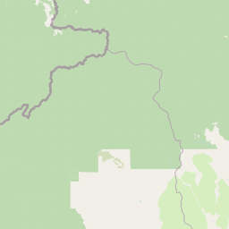
Parima Tapirapecó National Park landscape and geographic character

The physical landscape of Parima Tapirapecó reflects the ancient Guayanan Highlands region, characterized by deeply weathered Precambrian shield geology that forms distinctive upland terrain throughout the park. The Parima Mountains, which give the park part of its name, rise in the southern portion of the protected area, creating a complex terrain of ridges, valleys, and elevated plateaus. Elevation differences create environmental gradients that influence vegetation patterns across the park, with lower elevations supporting dense lowland evergreen forests while higher areas transition into submontane and montane forest types. The southern Parima uplands contain extensive areas of savanna, largely secondary in nature, that contrast with the forest-covered valleys and lower slopes. The headwaters of the Orinoco River system pass through the park, with numerous streams and tributaries originating in the highland areas and converging to form the great river that eventually flows north across Venezuela to the Atlantic.

Parima Tapirapecó National Park ecosystems, habitats, and plant life

The park's ecological character is defined by its position within the Guayanan Highlands moist forests ecoregion, one of the most biodiverse regions in South America. The primary vegetation types include extensive evergreen lowland forests that dominate the valley floors and lower slopes, characterized by tall trees, multiple canopy layers, and extraordinary species diversity. As elevation increases, the vegetation transitions through submontane forest zones to montane forest communities adapted to cooler, cloudier conditions at higher elevations. The southern portions of the park, particularly in the Parima uplands, contain large areas of savanna grassland, much of which represents secondary growth following past disturbance. These savannas provide important habitat heterogeneity within the larger forest matrix, supporting different ecological communities and species assemblages than the closed forest environments. The combination of forest types, elevation gradients, and the savanna enclaves creates a mosaic of habitats within the park's boundaries.

Parima Tapirapecó National Park wildlife and species highlights

The wildlife of Parima Tapirapecó reflects the exceptional biodiversity of the Guayanan region, with the park supporting populations of many iconic Amazonian and highland species. The extensive forest environments provide habitat for numerous primate species, including howler monkeys and spider monkeys, while the more open savanna areas support different community compositions. Large mammals including jaguars and tapirs occupy the diverse habitats, with the park's name referencing the tapir (Tapirapecó translates to 'tapir place' in the Yanomami language). Birdlife is particularly diverse, with the park's elevation gradient and habitat mosaic supporting numerous species from lowland rainforest birds to highland specializations. The waterways and riparian corridors provide habitat for aquatic species and serve as movement corridors through the landscape.

Parima Tapirapecó National Park conservation status and protection priorities

Parima Tapirapecó represents a conservation landmark of global significance, designated as an IUCN Category II protected area reflecting its primary purpose of ecosystem preservation. The park's extraordinary size makes it one of the most important large-scale conservation areas in the tropics, providing space for natural processes to continue without significant human interference. The protection of Orinoco headwaters carries immense importance for downstream ecosystems and human communities across Venezuela, as the river system supports enormous biological productivity and provides water resources for millions of people. The integration of Yanomami territorial interests within the park's management framework demonstrates a conservation model that recognizes indigenous peoples as essential partners in ecosystem preservation. The Guayanan Highlands moist forests ecoregion, of which the park forms a core protected component, is recognized as a global biodiversity hotspot requiring conservation attention.

Parima Tapirapecó National Park cultural meaning and human context

Parima Tapirapecó holds profound cultural significance as the ancestral homeland of the Yanomami people, one of the largest indigenous groups remaining in the Amazon region. The Yanomami have inhabited this territory for generations, maintaining traditional lifestyles that include hunting, gathering, and rotational agriculture adapted to the local environment. Their presence gives the park exceptional cultural dimension, as it represents not merely a natural area but a living cultural landscape where indigenous knowledge systems, traditional practices, and unique ways of understanding the environment continue to operate. The park's establishment was intended to protect both the natural environment and the cultural integrity of the Yanomami communities, recognizing that their traditional land use practices and territorial relationships with the landscape form an integral part of what the park preserves. The name Tapirapecó itself derives from the Yanomami language, reflecting the deep connection between the indigenous communities and this territory.

Top sights and standout views in Parima Tapirapecó National Park

The defining highlights of Parima Tapirapecó include its distinction as Venezuela's largest national park and one of the five largest protected areas worldwide, offering unparalleled scale for ecosystem protection. The park protects the headwaters of the Orinoco, one of South America's great river systems, making it critical for downstream ecological and human systems. Its location within the Guayanan Highlands provides access to a remarkable diversity of habitats across elevation gradients. The presence of the Yanomami people as active stewards of the landscape adds irreplaceable cultural dimension to the park's conservation value. The Parima Mountains provide scenic and scientific interest as part of the ancient Guayanan shield formation.

Best time to visit Parima Tapirapecó National Park

Visiting Parima Tapirapecó requires consideration of the tropical climate characteristic of the southern Venezuelan Amazon. The dry season from December through April typically offers more accessible conditions for exploration, with reduced precipitation and more manageable trail conditions. The wet season from May through November brings heavier rainfall that can restrict movement in some areas but also reveals the park's landscapes in full verdant expression. Temperature patterns remain relatively consistent year-round due to the equatorial location, though higher elevations in the Parima Mountains may feel noticeably cooler. Visitors should be prepared for remote conditions with limited infrastructure, and should plan their visit in coordination with park authorities to ensure safe and appropriate access to this sensitive cultural and ecological landscape.

Park location guide

Geography guide, regional context, and park location map for Parima Tapirapecó National Park

Parima Tapirapecó National Park park geography, regions, and map view in Venezuela
Understand where Parima Tapirapecó National Park sits in Venezuela through a broader geographic reading of the surrounding landscape, nearby location context, and its mapped position within the national park landscape.

How Parima Tapirapecó National Park fits into Venezuela

Venezuela is a country in northern South America with coastline along the Caribbean Sea and Atlantic Ocean. It borders Colombia, Brazil, Guyana, and Trinidad and Tobago. The country has an area of approximately 916,445 km² and a population of about 31.8 million. Caracas is the capital and largest city. Venezuela consists of 23 states and the Capital District.

Wider geography shaping Parima Tapirapecó National Park in Venezuela

Venezuela is located on the northern coast of South America. The continental territory is bordered by the Caribbean Sea and Atlantic Ocean to the north, Colombia to the west, Brazil to the south, and Guyana to the east. Trinidad and Tobago lies to the northeast. The country includes various islands and islets in the Caribbean Sea known as the Federal Dependencies.

Map view of Parima Tapirapecó National Park

Use this park location map to pinpoint Parima Tapirapecó National Park in Venezuela, understand its exact geographic position, and read its mapped placement within the surrounding landscape more clearly.

Pigeon | © OpenStreetMap contributors

Location context for Parima Tapirapecó National Park

Amazonas
Park atlas

Explore Related Protected Areas, Guayanan Highlands Geography, and Orinoco River Basin Landscapes

Discover Other National Parks Near Parima Tapirapecó National Park, Venezuela's Largest Protected Area
Browse national parks and protected landscapes located near Parima Tapirapecó National Park, Venezuela's monumental conservation zone in the Guayanan Highlands and Orinoco headwaters. Compare diverse ecosystems, hydrological features, and the regional spread of adjacent conservation sites to understand the broader Amazonian protected geography.
National parkAmazonas

Serranía de la Neblina National Park: The World's Highest Tepui and Cloud Forest Protected Landscape

Explore its mist-shrouded peaks and deep canyons.

Serranía de la Neblina National Park is a paramount protected area in Venezuela's Amazonas state, famed for its highest tepui mountain. Established in 1978, this vast national park sprawls across 13,600 square kilometers of untamed Amazonian terrain. Its iconic Serranía de la Neblina is continuously wrapped in fog, presenting a unique landscape rich in endemic species and geological wonders like the Baría Grande Canyon. Discover its mapped geography and critical role in Guayanan Highlands conservation.

Area
13,600 km²
Established
1978
IUCN
II
National parkAmazonas

Yapacana National Park: Ancient Geology and Botanical Significance in Venezuela's Amazonas

Discover the dramatic plateau landscapes and unique flora of this protected national park.

Delve into the distinct geography and protected landscape identity of Yapacana National Park, a significant national park within Venezuela's Amazonas region. This page serves as a comprehensive atlas entry, detailing the park's core features, including its iconic Yapacana hill, a dramatic tepui formation representative of the ancient Guayana Shield. Understand the park's geological heritage and its exceptional botanical value, marked by unique floristic connections, all within the context of its Amazonian basin setting.

Area
3,200 km²
Established
1978
IUCN
II
National parkGuainía Department

Puinawai Natural Reserve National Park: Mapped Protected Landscape in Guainía Department

Explore exceptional Amazonian biodiversity and pristine natural terrain.

Puinawai Natural Reserve is a sprawling national park situated in the remote Guainía Department of Colombia. As one of the largest and most ecologically intact protected areas in the Amazon basin, it preserves a unique mosaic of humid tropical rainforest, tropical open savanna, and transitional zones. The park's immense size and isolation contribute to its remarkable state of preservation, offering a significant opportunity for atlas-driven discovery of its mapped boundaries, diverse ecosystems, and complex hydrological geography at the Amazon-Orinoco divide.

Area
10,925 km²
Established
1989
IUCN
II
National parkVichada Department

El Tuparro National Natural Park: Mapped Protected Landscape in Colombia's Vichada Department

Explore the geography and savanna terrain of this Orinoco basin national park.

El Tuparro National Natural Park stands as a significant protected area in the Vichada Department, embodying the ecological richness of Colombia's Llanos Orientales. Its landscape comprises extensive tropical savannas, striking gallery forests along major rivers like the Orinoco, and dramatic rapids. This page provides an atlas-focused view of El Tuparro National Natural Park, detailing its geographic boundaries and its importance as a conservation corridor within the region, crucial for understanding South American protected lands.

Area
5,480 km²
Established
1970
IUCN
II
National parkVenezuela

Caura National Park: Venezuela's Largest Protected Area in the Guianan Highlands

Mapped boundaries of an immense tropical rainforest basin.

Caura National Park represents Venezuela's most extensive protected territory, established in 2017 to encompass the vast Caura River basin. This national park preserves a critical tropical rainforest ecosystem within the Guianan Highlands, contributing significantly to the Orinoco River's watershed. Its creation is the result of long-standing conservation efforts aimed at protecting millions of hectares of biodiverse landscape, offering a unique opportunity for understanding the geographic scope and ecological importance of large-scale protected areas.

Area
75,340 km²
Established
2017
IUCN
II
Climate
Tropical
National parkPotaro-Siparuni

Kaieteur National Park: Iconic South American Waterfall and Protected Forest Landscape

Discover the unique geography and mapped boundaries of this Guiana Shield natural wonder.

Kaieteur National Park is a significant protected area in Guyana, celebrated globally for Kaieteur Falls, the world's largest single-drop waterfall by volume. This national park preserves over 242 square miles of untouched tropical rainforest, offering critical habitat for endemic species and a profound example of the Guiana Shield's ancient geological formations and diverse ecosystems. Its location deep within the Potaro-Siparuni Region underscores its role as a vital bastion of wilderness and a landmark in South American protected landscapes.

Area
630 km²
Established
1929
IUCN
II
Protected areaGuyana

Kanashen Protected Area: Geographic Identity and Mapped Boundaries in Guyana

Explore the mapped landscape and protected land context.

Kanashen Protected Area serves as a critical point of geographic discovery within Guyana, offering detailed insights into its protected boundaries and natural landscape. This entry focuses on providing a structured, atlas-driven understanding of Kanashen, emphasizing its role within the regional geography of South America. Users can explore how this protected area fits into the larger mapped context, appreciating its specific terrain and conservation significance.

Area
6,485.67 km²
IUCN
VI
National parkAmazonas Department

Amacayacu National Natural Park: Amazonian Flooded Forest and Protected Landscape Atlas

Mapped protected area boundaries and regional geography in Amazonas, Colombia.

Discover the intricate landscape of Amacayacu National Natural Park, a key protected area within Colombia's Amazonas Department. This page offers detailed geographic context, focusing on its vast Amazonian rainforest, the dynamic Amazon River influence, and the unique ecology of its flooded forest terrain. Explore mapped park boundaries, key river systems like Tarapoto Lake, and the protected zones crucial for Amazon river dolphin and primate habitats, providing a rich atlas view of this vital natural reserve.

Area
2,935 km²
Established
1975
IUCN
II

Common questions about visiting, size, designation, and location context for Parima Tapirapecó National Park

Parima Tapirapecó National Park FAQs for park facts, access, geography, and protected area context
Find quick answers about Parima Tapirapecó National Park, including protected-area facts, park geography, trail and visitor context, and how the park fits into its surrounding country and regional landscape.
MoriAtlas Explorer

Continue Your Protected Areas Search Across the Global Atlas

Deepen your exploration by continuing the structured search for national parks and protected areas worldwide. Utilize the comprehensive filtering capabilities to compare different conservation landscapes and refine your understanding of global park geography. Discover more about the distribution and characteristics of protected natural areas.

Global natural geography