Mori Atlas logo
National parkKaieteur National Park

Discover the mapped boundaries and unique geographic context of Guyana's largest protected area.

Kaieteur National Park: Iconic Waterfall and Pristine Tropical Forest Landscape

Kaieteur National Park, located in Guyana's Potaro-Siparuni Region, stands as a monumental protected wilderness. This national park is defined by the awe-inspiring Kaieteur Falls, a 741-foot single-drop waterfall renowned for its immense water volume and dramatic setting. Beyond the falls, the park encompasses over 242 square miles of dense tropical rainforest, forming a critical refuge for endemic species and showcasing the raw beauty of the Guiana Shield's natural terrain.

WaterfallTropical RainforestSouth AmericaGuiana ShieldEndemic SpeciesWilderness

Kaieteur National Park

National park

Park overview

Structured park overview, official facts, and landscape profile for Kaieteur National Park

Kaieteur National Park park facts, protected area profile, and essential visitor context
Review the core facts for Kaieteur National Park, including designation, size, terrain, visitor scale, habitats, and operating context in one park-focused overview.

About Kaieteur National Park

Kaieteur National Park represents Guyana's flagship protected area and stands as one of South America's most significant conservation landscapes. The park's creation was motivated by the need to preserve Kaieteur Falls and the extraordinary biological wealth of the surrounding forest ecosystem. The Guianan moist forests ecoregion, of which the park forms a核心 part, is recognized as one of the most biodiverse regions on the planet, housing thousands of plant species, hundreds of bird species, and numerous endemic amphibians, reptiles, and mammals. The park's interior location, far from the populated coastal belt, has helped preserve its wilderness character despite relatively limited infrastructure. Visitors to the park primarily come to witness Kaieteur Falls, which can be approached via a short trail from the adjacent Kaieteur International Airport. The falls plunge over a sandstone cliff into a deep gorge, creating a perpetually misty spectacle that has captivated travelers and scientists alike since the region was first explored by European expeditions in the 19th century. The park's management framework under the Kaieteur National Park Act specifically addresses protection of natural resources, biodiversity preservation, and recognition of the Amerindian communities whose traditional territories overlap with the protected area.

Quick facts and research context for Kaieteur National Park

Kaieteur National Park occupies 630 square kilometers of pristine Guianan moist forest in central Guyana. The park was established in 1929 as a small 5-square-mile reserve centered on Kaieteur Falls and expanded to its current size in 1999 through a Presidential Order. The falls themselves drop 741 feet in a single plunge, making them the tallest single-drop waterfall in the world by height and the largest by water volume. The park sits at approximately 5.217°N latitude and 59.417°W longitude in the Potaro-Siparuni Region. The protected area is recognized as an IUCN Category II national park and is accessible via Kaieteur International Airport.

Park context

Deeper park guide and search-rich context for Kaieteur National Park

Kaieteur National Park history, landscape, wildlife, and travel context
Explore Kaieteur National Park through its history, landscape character, ecosystems, wildlife, conservation priorities, cultural context, and seasonal travel timing in a structured park guide built for atlas discovery and search intent.

Why Kaieteur National Park stands out

Kaieteur National Park is world-renowned for Kaieteur Falls, a towering 741-foot single-drop waterfall that ranks among the most powerful and picturesque waterfalls on the planet. The falls possess the greatest single-drop height and are considered the largest waterfall by volume anywhere on earth. Beyond the falls, the park protects an exceptional concentration of endemic species, including the golden rocket frog (Anomaloglossus beebei), which breeds exclusively within the leaves of the bromeliad Brocchinia micrantha found nowhere else in the world. The park also safeguards one of the last remaining tracts of untouched Guianan moist forest, a biodiversity hotspot containing numerous species found nowhere else on Earth.

Kaieteur National Park history and protected-area timeline

Kaieteur National Park was originally established in 1929 as a small 5-square-mile reserve protecting Kaieteur Falls and immediately surrounding forest. For seven decades, the park remained a relatively compact protected area, though its designation as Guyana's national park gave it significant symbolic importance as the country's primary wilderness showcase. In 1999, the park's boundaries were dramatically expanded through a Presidential Order, increasing its area from 5 square miles to 242 square miles (from approximately 10 km² to 630 km²). This expansion was intended to provide better ecological protection for the broader forest ecosystem surrounding the falls and to create meaningful buffer zones for the protected core area. The Kaieteur National Park Act provides the legal framework for the park's protection, specifically mandating conservation of natural resources, unique natural features, Amazonian biodiversity, and the interests of Amerindian communities who have lived in the region for generations. The Act established the Kaieteur National Park Commission to oversee administration and management. More recently, the park has faced challenges from illegal mining activities, particularly in 2017 and 2023, when villagers from the Chenapau community were accused of conducting mining operations within park boundaries, raising ongoing questions about the balance between local livelihoods and conservation protection.

Kaieteur National Park landscape and geographic character

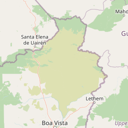
The landscape of Kaieteur National Park is dominated by the dramatic sandstone escarpment over which Kaieteur Falls plunges 741 feet into the Potaro River gorge. The surrounding terrain consists of undulating tropical forest on the Pakaraima Plateau, with the park's elevation ranging from approximately 1,000 to 2,000 feet above sea level. The underlying geological formations are primarily sandstones and conglomerates of the Roraima Group, ancient Precambrian rocks that form the distinctive flat-topped mountains characteristic of the Guiana Shield. The Potaro River, which carries the enormous volume of water that makes Kaieteur Falls so spectacular, has carved a deep canyon through the plateau, creating dramatic cliffs and rocky outcrops. The forest surrounding the falls is dense and humid, with canopy heights reaching 100 feet or more. The region experiences typical tropical rainfall patterns, with the area receiving substantial precipitation throughout the year that feeds the falls and maintains the lush forest environment.

Kaieteur National Park ecosystems, habitats, and plant life

Kaieteur National Park occupies a critical position within the Guianan moist forests ecoregion, one of the most species-rich biomes in the Western Hemisphere. The park protects extensive tracts of primary tropical rainforest that have remained largely untouched by development. The ecoregion is characterized by extraordinarily high levels of plant and animal endemism, with numerous species found nowhere else on Earth. The park's bromeliad flora is particularly notable, with over 80 species documented, creating specialized microhabitats for unique amphibian species. The understory is dominated by a dense layer of ferns, palms, and shade-tolerant flowering plants, while the canopy supports a diverse community of trees, lianas, and epiphytes. The forest structure varies with topography, with valley bottoms supporting more mesic vegetation and ridge tops hosting species adapted to drier conditions. The park's streams and waterfalls create unique riparian habitats that support specialized aquatic organisms.

Kaieteur National Park wildlife and species highlights

The wildlife of Kaietur National Park reflects the extraordinary biodiversity of the Guianan moist forests, with numerous species found nowhere else in the world. The park is particularly notable for its amphibian diversity, including the iconic golden rocket frog (Anomaloglossus beebei), a tiny and brilliantly colored species that has become a symbol of the park's conservation significance. This frog breeds exclusively in the water-holding leaves of the bromeliad Brocchinia micrantha, a relationship so specialized that the frog's entire life cycle depends on this single plant species, which is itself found only within the park. Birdlife is exceptionally diverse, with the Guianan shield providing habitat for hundreds of resident species and seasonal migrants. The forest canopy supports toucans, macaws, and numerous tyrant flycatcher species, while the understory harbors antbirds, ovenbirds, and motmots. Mammals present include various primates, sloths, anteaters, and the elusive jaguar, though sighting opportunities are rare given the dense forest cover.

Kaieteur National Park conservation status and protection priorities

Kaieteur National Park represents Guyana's primary contribution to the global protected area network and serves as a critical stronghold for Guianan biodiversity. The park's IUCN Category II designation reflects its role as a national park managed primarily for ecosystem conservation and recreation. The Kaieteur National Park Act provides legal foundation for protecting the region's natural resources, unique features, and biodiversity, while also acknowledging the rights of Amerindian communities who have traditionally inhabited the area. The park protects numerous endemic species whose survival depends on the conservation of this specific forest ecosystem, most notably the golden rocket frog whose entire global range is confined to the park's bromeliad habitat. Conservation challenges include pressure from illegal mining, particularly as gold prices have incentivized encroachments into the protected area. Management efforts must balance the dual goals of preserving the park's ecological integrity while addressing the economic needs of local communities whose livelihoods depend on forest resources.

Kaieteur National Park cultural meaning and human context

Kaieteur National Park contains lands of significance to several Amerindian communities who have inhabited the forests of the Potaro-Siparuni Region for millennia. The Kaieteur National Park Act specifically recognizes these indigenous communities and their relationship with the land as part of the rationale for protection. The Chenapau community, located near the park's boundaries, represents one of the groups whose traditional territory overlaps with the protected area. The relationship between park management and indigenous communities has become increasingly complex, particularly regarding access to natural resources and questions of traditional land use. The 2023 protests by Chenapau villagers regarding mining rights highlighted the ongoing tensions between conservation objectives and local livelihood needs within and around the protected area. The park also holds cultural significance beyond indigenous communities, as Kaieteur Falls has been a destination of wonder for visitors since the earliest European explorations of Guyana in the 19th century.

Top sights and standout views in Kaieteur National Park

Kaieteur Falls, the park's centerpiece, is a superlative natural feature that ranks among the world's most impressive waterfalls and serves as the primary draw for visitors. The falls' 741-foot single-drop height and extraordinary water volume make them unique among global waterfalls. The golden rocket frog represents one of the most specialized and localized species on Earth, its entire global population confined to the park's bromeliad habitats. The expansion of the park in 1999 created meaningful protection for the broader forest ecosystem beyond the falls themselves. The park's location deep in Guyana's interior, accessible via dedicated air service, provides a wilderness experience largely unavailable elsewhere in the country. The Guianan moist forests surrounding the falls represent one of the world's most biodiverse ecosystems.

Best time to visit Kaieteur National Park

Kaieteur National Park can be visited throughout the year, though the optimal period generally falls between February and April when rainfall is somewhat reduced and the falls remain spectacular due to continued water flow from the wet season. The dry season from September to November also offers good conditions, though visitor services may be more limited. The Guianan climate is consistently warm and humid year-round, with temperatures in the mid-80s Fahrenheit. The wet season, roughly from May to August, brings heavier rainfall which can make some trails more challenging but also results in the most powerful flow over the falls. Regardless of season, visitors should expect tropical conditions and be prepared for both heat and periodic rain. The park's accessibility via Kaieteur International Airport makes it feasible to visit on day trips from Georgetown, though overnight stays allow for deeper exploration of the trails and more extended wildlife observation.

Park location guide

Geography guide, regional context, and park location map for Kaieteur National Park

Kaieteur National Park park geography, regions, and map view in Guyana
Understand where Kaieteur National Park sits in Guyana through a broader geographic reading of the surrounding landscape, nearby location context, and its mapped position within the national park landscape.

How Kaieteur National Park fits into Guyana

Guyana, officially the Co-operative Republic of Guyana, is a developing country on the northern coast of South America. It is part of The Guianas and the Commonwealth Caribbean, and is the only English-speaking nation in mainland South America. The country is known for its low population density, diverse ethnic composition, and membership in CARICOM.

Wider geography shaping Kaieteur National Park in Guyana

Guyana is located on the northern coast of South America, bordering the Atlantic Ocean to the north, Suriname to the east, Brazil to the south and southwest, and Venezuela to the west. The country is part of The Guianas region and has a land area of 214,969 km², making it the third-smallest sovereign state in mainland South America.

Map view of Kaieteur National Park

Use this park location map to pinpoint Kaieteur National Park in Guyana, understand its exact geographic position, and read its mapped placement within the surrounding landscape more clearly.

Pigeon | © OpenStreetMap contributors

Location context for Kaieteur National Park

Potaro-Siparuni
Park atlas

Browse neighboring protected landscapes across the Guiana Shield and compare similar conservation areas in South America.

Discover Other National Parks and Protected Areas Near Kaieteur National Park
Explore additional national parks and protected areas within the Guianan moist forests ecoregion, tracing other wilderness reserves and biodiversity hotspots across South America. Compare the unique geographic features and conservation landscapes surrounding Kaieteur National Park, providing deeper atlas context for the region's diverse protected terrain.
Protected areaGuyana

Kanashen Protected Area: Geographic Identity and Mapped Boundaries in Guyana

Explore the mapped landscape and protected land context.

Kanashen Protected Area serves as a critical point of geographic discovery within Guyana, offering detailed insights into its protected boundaries and natural landscape. This entry focuses on providing a structured, atlas-driven understanding of Kanashen, emphasizing its role within the regional geography of South America. Users can explore how this protected area fits into the larger mapped context, appreciating its specific terrain and conservation significance.

Area
6,485.67 km²
IUCN
VI
National parkSuriname

Brownsberg Nature Park: Suriname National Park with Tropical Forest and Waterfall Landscapes

Mapped geography and protected landscape context.

Brownsberg Nature Park stands as a vital protected landscape within Suriname, distinguished by its central mountain, tropical forest ecosystems, and scenic waterfalls such as Leo Waterfall. The park's location overlooking the vast Brokopondo Reservoir provides a unique geographic setting, making it an important destination for atlas and map-based exploration of Suriname's natural heritage. Understanding Brownsberg Nature Park offers insight into the Neotropical biodiversity and terrain characteristic of the Guianan moist forests.

Area
122 km²
Established
1969
IUCN
II
National parkAmazonas

Parima Tapirapecó National Park: Venezuela's Largest Protected Area within the Guayanan Highlands

Explore its vast geographic extent and critical Orinoco River basin landscape.

Parima Tapirapecó National Park is an expansive protected territory in Venezuela's Amazonas region, holding the title of the country's largest national park and ranking among the world's most significant protected lands. Its geography is defined by the ancient Guayanan Highlands, protecting the vital headwaters of the Orinoco River and a mosaic of tropical forests and savannas. This park offers deep insights into landscape preservation on a grand scale, crucial for understanding regional geography and protected area distribution.

Area
38,290 km²
Established
1991
IUCN
II
Scope
Terrestrial
National parkVenezuela

Caura National Park: Venezuela's Largest Protected Area in the Guianan Highlands

Mapped boundaries of an immense tropical rainforest basin.

Caura National Park represents Venezuela's most extensive protected territory, established in 2017 to encompass the vast Caura River basin. This national park preserves a critical tropical rainforest ecosystem within the Guianan Highlands, contributing significantly to the Orinoco River's watershed. Its creation is the result of long-standing conservation efforts aimed at protecting millions of hectares of biodiverse landscape, offering a unique opportunity for understanding the geographic scope and ecological importance of large-scale protected areas.

Area
75,340 km²
Established
2017
IUCN
II
Climate
Tropical
Watercolor painting of a landscape with rolling hills, green trees, and soft color gradients
National parkFrench Guiana

Guiana Amazonian Park National Park: French Guiana's Expansive Protected Rainforest

Explore mapped boundaries and regional geographic context.

Guiana Amazonian Park, a cornerstone of protected land in French Guiana, offers a profound exploration of untamed Amazonian rainforest. As the largest national park in the European Union, it showcases a vast, remote ecosystem characterized by towering trees and intricate river systems. This page provides detailed context on its geographic placement within French Guiana and its significance as a major protected landscape for atlas-based discovery and understanding of tropical forest conservation.

Area
20,300 km²
Established
2007
IUCN
II
Relief
Lowland
Nature reserveFrench Guiana

Nouragues Nature Reserve: Protected Nature Reserve Landscape within French Guiana's Amazon

Mapped geography featuring a distinct inselberg formation.

Nouragues Nature Reserve stands as a critical protected area within French Guiana, safeguarding a significant expanse of pristine lowland tropical rainforest. Its most defining characteristic is the Nouragues Inselberg, a colossal granite formation that dramatically punctuates the dense forest canopy. This reserve is not only a testament to conservation efforts but also a globally recognized hub for tropical forest ecology research. Exploring Nouragues Nature Reserve offers a unique lens into the natural processes and geological features of the Guiana Shield ecosystems.

Area
1,000 km²
Established
1995
IUCN
IV
National parkAmazonas

Yapacana National Park: Ancient Geology and Botanical Significance in Venezuela's Amazonas

Discover the dramatic plateau landscapes and unique flora of this protected national park.

Delve into the distinct geography and protected landscape identity of Yapacana National Park, a significant national park within Venezuela's Amazonas region. This page serves as a comprehensive atlas entry, detailing the park's core features, including its iconic Yapacana hill, a dramatic tepui formation representative of the ancient Guayana Shield. Understand the park's geological heritage and its exceptional botanical value, marked by unique floristic connections, all within the context of its Amazonian basin setting.

Area
3,200 km²
Established
1978
IUCN
II
National parkAmazonas

Serranía de la Neblina National Park: The World's Highest Tepui and Cloud Forest Protected Landscape

Explore its mist-shrouded peaks and deep canyons.

Serranía de la Neblina National Park is a paramount protected area in Venezuela's Amazonas state, famed for its highest tepui mountain. Established in 1978, this vast national park sprawls across 13,600 square kilometers of untamed Amazonian terrain. Its iconic Serranía de la Neblina is continuously wrapped in fog, presenting a unique landscape rich in endemic species and geological wonders like the Baría Grande Canyon. Discover its mapped geography and critical role in Guayanan Highlands conservation.

Area
13,600 km²
Established
1978
IUCN
II

Common questions about visiting, size, designation, and location context for Kaieteur National Park

Kaieteur National Park FAQs for park facts, access, geography, and protected area context
Find quick answers about Kaieteur National Park, including protected-area facts, park geography, trail and visitor context, and how the park fits into its surrounding country and regional landscape.
MoriAtlas Explorer

Continue Your Protected Areas Search Across the Global Atlas

Deepen your exploration by continuing the structured search for national parks and protected areas worldwide. Utilize the comprehensive filtering capabilities to compare different conservation landscapes and refine your understanding of global park geography. Discover more about the distribution and characteristics of protected natural areas.

Global natural geography