Mori Atlas logo
Nature reserveNouragues Nature Reserve

Discover the mapped geography and unique inselberg terrain of this vital research site.

Nouragues Nature Reserve: Protected Tropical Rainforest Landscape in French Guiana

(Réserve Naturelle des Nouragues)

Nouragues Nature Reserve represents a significant protected tropical rainforest area within French Guiana, encompassing approximately 1,000 square kilometers of pristine Amazonian forest. This reserve is renowned for its dramatic Nouragues Inselberg, a massive granite dome that rises distinctively above the surrounding canopy, serving as a unique geological landmark and a crucial platform for scientific study. As one of the second-largest nature reserves in France, it preserves an essential tract of lowland tropical rainforest, offering unparalleled insight into natural ecosystems and regional geography.

Tropical RainforestInselbergAmazonFrench GuianaScientific ResearchProtected Area

Nouragues Nature Reserve

Nature reserve

Park overview

Structured park overview, official facts, and landscape profile for Nouragues Nature Reserve

Nouragues Nature Reserve park facts, protected area profile, and essential visitor context
Review the core facts for Nouragues Nature Reserve, including designation, size, terrain, visitor scale, habitats, and operating context in one park-focused overview.

About Nouragues Nature Reserve

Nouragues Nature Reserve represents one of the most significant protected areas in French Guiana and the wider Amazon basin. The reserve's establishment in 1995 marked a major commitment to preserving the region's extraordinary biological wealth and geological heritage. Its location in the heart of the Guiana Shield, one of the oldest and most stable geological formations on Earth, provides conditions for exceptional biodiversity accumulation over millions of years. The reserve's inaccessibility to general public visitation has inadvertently contributed to its conservation value, maintaining ecological processes largely free from recreational pressure. The Nouragues Inselberg itself serves as a biological island within the forest, creating unique microclimates and supporting specialized plant and animal communities adapted to the harsh conditions of exposed rock faces. Scientific research conducted from the reserve's permanent camps has contributed substantially to understanding tropical forest dynamics, canopy ecology, and Amazonian biodiversity patterns.

Quick facts and research context for Nouragues Nature Reserve

Nouragues Nature Reserve spans 1,000 square kilometers of untouched tropical rainforest in French Guiana, France. Established on December 18, 1995, it holds IUCN Category IV protection status for habitat and species management. The reserve is managed by France's National Forests Office and is the second-largest nature reserve in French territory. The prominent Nouragues Inselberg reaches 430 meters in height, providing a distinctive landmark and research vantage point. The reserve is located in the communes of Régina and Roura, with the nearest settlement being Régina.

Park context

Deeper park guide and search-rich context for Nouragues Nature Reserve

Nouragues Nature Reserve history, landscape, wildlife, and travel context
Explore Nouragues Nature Reserve through its history, landscape character, ecosystems, wildlife, conservation priorities, cultural context, and seasonal travel timing in a structured park guide built for atlas discovery and search intent.

Why Nouragues Nature Reserve stands out

Nouragues Nature Reserve is best known for its dramatic granite inselberg rising from the Amazonian rainforest, one of the most iconic geological features in French Guiana. The reserve serves as a living laboratory for tropical forest research, with CNRS maintaining permanent research camps that host approximately 40 scientific expeditions annually. Its protected status preserves one of the last large tracts of untouched lowland tropical rainforest in the region. The reserve represents a rare example of near-pristine Amazonian ecosystems in a European-administered territory, offering scientists unparalleled opportunities to study tropical biodiversity with minimal human disturbance.

Nouragues Nature Reserve history and protected-area timeline

Nouragues Nature Reserve was formally established on December 18, 1995, through French governmental action to protect the exceptional tropical forest ecosystems of central French Guiana. The creation of the reserve reflected growing recognition of the ecological significance of the Guiana Shield region and the need to preserve representative samples of Amazonian biodiversity. Prior to formal protection, the area had limited human occupation due to its remote location and challenging terrain, leaving the forest largely intact compared to more accessible regions that had experienced logging or agricultural conversion. The National Forests Office assumed management responsibility, implementing a conservation framework aligned with IUCN Category IV guidelines for habitat and species management areas. The establishment of CNRS research facilities on the Nouragues Inselberg provided scientific justification for the reserve's boundaries and continues to inform management decisions.

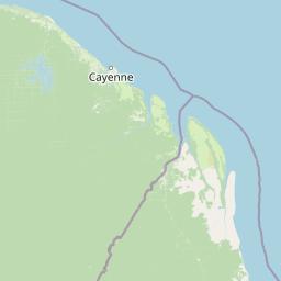
Nouragues Nature Reserve landscape and geographic character

The landscape of Nouragues Nature Reserve is dominated by lowland tropical rainforest covering undulating terrain typical of the Guiana Shield region. The most distinctive landscape feature is the Nouragues Inselberg, a massive granite dome rising abruptly 430 meters above the surrounding forest canopy. This inselberg, or monolithic mountain, creates a dramatic skyline visible from considerable distances and serves as a defining geographical landmark for the reserve. The terrain around the inselberg is characterized by steep rock faces, boulder fields, and areas of exposed bedrock interspersed with forest. The forest itself exhibits the layered structure typical of Amazonian lowland rainforests, with a dense canopy reaching 30 to 40 meters and occasional emergent trees rising above the general canopy level. Rivers and streams drain the interior areas, though the reserve is not characterized by extensive wetland systems.

Nouragues Nature Reserve ecosystems, habitats, and plant life

The nature of Nouragues Nature Reserve centers on its old-growth tropical rainforest ecosystem, one of the most biodiverse habitats on Earth. The Guiana Shield region is recognized as a global biodiversity hotspot, and the reserve protects a representative sample of these extraordinary biological communities. The forest displays the complex vertical stratification characteristic of Amazonian ecosystems, with distinct layers supporting specialized communities of plants and animals. The inselberg creates additional ecological diversity through its exposed rock habitats, which support drought-resistant plant species and provide vantage points for avian species. The forest canopy harbors countless epiphytic species, including orchids, bromeliads, and ferns, while the understory contains a diverse shrub and seedling layer. The region's climate supports year-round biological activity, with the rainforest maintaining its green appearance throughout all seasons.

Nouragues Nature Reserve wildlife and species highlights

The wildlife of Nouragues Nature Reserve reflects the exceptional biodiversity of the Amazonian forest. While comprehensive species inventories remain incomplete, the reserve is known to support populations of neotropical primate species, including various monkey species that move through the canopy. The bird communities are particularly diverse, with numerous species of antbirds, tyrant flycatchers, and other passerines occupying different forest strata. The inselberg provides habitat for species adapted to cliff and rock face environments, while the forest interior supports jaguars and other large mammals, though these species are rarely observed due to their cryptic nature and low population densities. The river systems within the reserve support aquatic turtle populations and fish species adapted to the dark-stained waters typical of the region.

Nouragues Nature Reserve conservation status and protection priorities

Nouragues Nature Reserve plays a critical role in conserving representative examples of Amazonian biodiversity within French territory. Its IUCN Category IV designation reflects its primary function as a habitat and species management area, emphasizing active conservation rather than purely passive protection. The reserve protects one of the largest remaining tracts of intact lowland forest in French Guiana, a region that has experienced increasing pressure from mining, logging, and agricultural expansion in more accessible areas. The presence of ongoing scientific research through CNRS operations contributes to conservation knowledge while providing monitoring data on ecosystem health and species populations. The restricted access policy helps minimize human disturbance and maintains ecological processes in a relatively natural state.

Nouragues Nature Reserve cultural meaning and human context

The name Nouragues derives from Amerindian origins, reflecting the indigenous heritage of the Guiana region prior to European colonization. The area was traditionally inhabited by various Carib and Arawak-speaking peoples who utilized the forest and its resources. The granite inselberg likely held cultural significance for these indigenous communities, as similar formations often feature in indigenous cosmologies and traditional land use patterns. Contemporary management of the reserve operates within the broader context of French Guiana's unique political status as an overseas department with significant local autonomy. The reserve's research function builds upon France's long tradition of tropical forest scientific exploration, with French Guiana serving as a natural laboratory for understanding Amazonian ecosystems.

Top sights and standout views in Nouragues Nature Reserve

The Nouragues Inselberg stands as the reserve's most spectacular highlight, a monolithic granite mountain rising dramatically from the rainforest and offering panoramic views from its summit. The scientific research conducted at the reserve has produced substantial contributions to tropical forest ecology, making it a landmark site in the global scientific community. The near-pristine condition of the forest provides rare opportunities to observe natural ecological processes in an essentially unmodified Amazonian ecosystem. The reserve's status as the second-largest protected area in France underscores its significance within the national conservation framework.

Best time to visit Nouragues Nature Reserve

As a closed scientific reserve with restricted access, general visitation is not permitted at Nouragues Nature Reserve. For authorized research visits, the dry season from roughly August to November typically offers more comfortable field conditions with reduced rainfall, though the rainforest maintains its green character year-round. The wet season brings higher humidity and more frequent rainfall, which can affect helicopter access to the inselberg camps. Research expeditions are planned according to scientific objectives rather than tourism considerations, with the CNRS managing access for legitimate research purposes.

Park location guide

Geography guide, regional context, and park location map for Nouragues Nature Reserve

Nouragues Nature Reserve park geography, regions, and map view in France
Understand where Nouragues Nature Reserve sits in France through a broader geographic reading of the surrounding landscape, nearby location context, and its mapped position within the national park landscape.

How Nouragues Nature Reserve fits into France

France is a unitary semi-presidential republic and one of the world's largest economies. It borders Belgium, Luxembourg, Germany, Switzerland, Italy, Monaco, Andorra, and Spain, with a maritime border to the United Kingdom. The country is known for its cultural influence, art, cuisine, and political history spanning centuries.

Wider geography shaping Nouragues Nature Reserve in France

France is located in Western Europe. Metropolitan France extends from the Rhine to the Atlantic Ocean and from the Mediterranean Sea to the English Channel and North Sea. The country borders Belgium, Luxembourg, Germany, Switzerland, Italy, Monaco, Andorra, Spain, and has a maritime border with the United Kingdom.

Map view of Nouragues Nature Reserve

Use this park location map to pinpoint Nouragues Nature Reserve in France, understand its exact geographic position, and read its mapped placement within the surrounding landscape more clearly.

Pigeon | © OpenStreetMap contributors

Location context for Nouragues Nature Reserve

French Guiana
Park atlas

Trace the geographic spread of protected areas and national parks across the Guiana Shield.

Explore Other Protected Areas and National Parks Near Nouragues Nature Reserve in French Guiana
Continue your exploration from Nouragues Nature Reserve to browse nearby protected areas and national parks within French Guiana and the Guiana Shield. This geographic context helps you compare diverse tropical rainforests, unique inselberg formations, and other significant conservation landscapes.
Watercolor painting of a landscape with rolling hills, green trees, and soft color gradients
National parkFrench Guiana

Guiana Amazonian Park National Park: French Guiana's Expansive Protected Rainforest

Explore mapped boundaries and regional geographic context.

Guiana Amazonian Park, a cornerstone of protected land in French Guiana, offers a profound exploration of untamed Amazonian rainforest. As the largest national park in the European Union, it showcases a vast, remote ecosystem characterized by towering trees and intricate river systems. This page provides detailed context on its geographic placement within French Guiana and its significance as a major protected landscape for atlas-based discovery and understanding of tropical forest conservation.

Area
20,300 km²
Established
2007
IUCN
II
Relief
Lowland
National parkSuriname

Brownsberg Nature Park: Suriname National Park with Tropical Forest and Waterfall Landscapes

Mapped geography and protected landscape context.

Brownsberg Nature Park stands as a vital protected landscape within Suriname, distinguished by its central mountain, tropical forest ecosystems, and scenic waterfalls such as Leo Waterfall. The park's location overlooking the vast Brokopondo Reservoir provides a unique geographic setting, making it an important destination for atlas and map-based exploration of Suriname's natural heritage. Understanding Brownsberg Nature Park offers insight into the Neotropical biodiversity and terrain characteristic of the Guianan moist forests.

Area
122 km²
Established
1969
IUCN
II
Protected areaGuyana

Kanashen Protected Area: Geographic Identity and Mapped Boundaries in Guyana

Explore the mapped landscape and protected land context.

Kanashen Protected Area serves as a critical point of geographic discovery within Guyana, offering detailed insights into its protected boundaries and natural landscape. This entry focuses on providing a structured, atlas-driven understanding of Kanashen, emphasizing its role within the regional geography of South America. Users can explore how this protected area fits into the larger mapped context, appreciating its specific terrain and conservation significance.

Area
6,485.67 km²
IUCN
VI
National parkPotaro-Siparuni

Kaieteur National Park: Iconic South American Waterfall and Protected Forest Landscape

Discover the unique geography and mapped boundaries of this Guiana Shield natural wonder.

Kaieteur National Park is a significant protected area in Guyana, celebrated globally for Kaieteur Falls, the world's largest single-drop waterfall by volume. This national park preserves over 242 square miles of untouched tropical rainforest, offering critical habitat for endemic species and a profound example of the Guiana Shield's ancient geological formations and diverse ecosystems. Its location deep within the Potaro-Siparuni Region underscores its role as a vital bastion of wilderness and a landmark in South American protected landscapes.

Area
630 km²
Established
1929
IUCN
II
National parkAmazonas

Parima Tapirapecó National Park: Venezuela's Largest Protected Area within the Guayanan Highlands

Explore its vast geographic extent and critical Orinoco River basin landscape.

Parima Tapirapecó National Park is an expansive protected territory in Venezuela's Amazonas region, holding the title of the country's largest national park and ranking among the world's most significant protected lands. Its geography is defined by the ancient Guayanan Highlands, protecting the vital headwaters of the Orinoco River and a mosaic of tropical forests and savannas. This park offers deep insights into landscape preservation on a grand scale, crucial for understanding regional geography and protected area distribution.

Area
38,290 km²
Established
1991
IUCN
II
Scope
Terrestrial
National parkVenezuela

Caura National Park: Venezuela's Largest Protected Area in the Guianan Highlands

Mapped boundaries of an immense tropical rainforest basin.

Caura National Park represents Venezuela's most extensive protected territory, established in 2017 to encompass the vast Caura River basin. This national park preserves a critical tropical rainforest ecosystem within the Guianan Highlands, contributing significantly to the Orinoco River's watershed. Its creation is the result of long-standing conservation efforts aimed at protecting millions of hectares of biodiverse landscape, offering a unique opportunity for understanding the geographic scope and ecological importance of large-scale protected areas.

Area
75,340 km²
Established
2017
IUCN
II
Climate
Tropical
National parkAmazonas

Serranía de la Neblina National Park: The World's Highest Tepui and Cloud Forest Protected Landscape

Explore its mist-shrouded peaks and deep canyons.

Serranía de la Neblina National Park is a paramount protected area in Venezuela's Amazonas state, famed for its highest tepui mountain. Established in 1978, this vast national park sprawls across 13,600 square kilometers of untamed Amazonian terrain. Its iconic Serranía de la Neblina is continuously wrapped in fog, presenting a unique landscape rich in endemic species and geological wonders like the Baría Grande Canyon. Discover its mapped geography and critical role in Guayanan Highlands conservation.

Area
13,600 km²
Established
1978
IUCN
II
National parkAmazonas

Yapacana National Park: Ancient Geology and Botanical Significance in Venezuela's Amazonas

Discover the dramatic plateau landscapes and unique flora of this protected national park.

Delve into the distinct geography and protected landscape identity of Yapacana National Park, a significant national park within Venezuela's Amazonas region. This page serves as a comprehensive atlas entry, detailing the park's core features, including its iconic Yapacana hill, a dramatic tepui formation representative of the ancient Guayana Shield. Understand the park's geological heritage and its exceptional botanical value, marked by unique floristic connections, all within the context of its Amazonian basin setting.

Area
3,200 km²
Established
1978
IUCN
II

Common questions about visiting, size, designation, and location context for Nouragues Nature Reserve

Nouragues Nature Reserve FAQs for park facts, access, geography, and protected area context
Find quick answers about Nouragues Nature Reserve, including protected-area facts, park geography, trail and visitor context, and how the park fits into its surrounding country and regional landscape.
MoriAtlas Explorer

Continue Your Protected Areas Search Across the Global Atlas

Deepen your exploration by continuing the structured search for national parks and protected areas worldwide. Utilize the comprehensive filtering capabilities to compare different conservation landscapes and refine your understanding of global park geography. Discover more about the distribution and characteristics of protected natural areas.

Global natural geography