Mori Atlas logo
National parkGuiana Amazonian Park

Discover the geographic scope and mapped boundaries of this immense Amazonian rainforest.

Guiana Amazonian Park National Park: A Vast Protected Landscape in French Guiana

(Parc amazonien de Guyane)

Guiana Amazonian Park represents the largest national park within France and the European Union, safeguarding an extraordinary expanse of pristine Amazonian rainforest across French Guiana. Established to protect this vital ecosystem, the park's nearly 34,000 square kilometer territory forms a critical component of the Guiana Shield's natural heritage. Its remoteness, primarily accessed by river or air, has preserved unparalleled biodiversity and intact forest landscapes, offering a unique opportunity for geographic discovery and understanding of large-scale protected area dynamics.

Amazon rainforestNational parkFrench GuianaTropical forestBiodiversity hotspotProtected area
Illustration of a mountainous rainforest scene featuring waterfalls, a winding river, and evergreen trees under a bright sky

Guiana Amazonian Park

National park

Park overview

Structured park overview, official facts, and landscape profile for Guiana Amazonian Park

Guiana Amazonian Park park facts, protected area profile, and essential visitor context
Review the core facts for Guiana Amazonian Park, including designation, size, terrain, visitor scale, habitats, and operating context in one park-focused overview.

About Guiana Amazonian Park

Guiana Amazonian Park represents France's commitment to global biodiversity conservation and serves as the centerpiece of European Union environmental protection in the Amazon basin. The park was created to preserve the exceptional natural heritage of French Guiana's Amazonian forests while also supporting the traditional ways of life of indigenous communities who have inhabited these lands for centuries.

The park's establishment followed a complex political process that began at the 1992 Earth Summit in Rio de Janeiro, when President François Mitterrand initiated the project. After initial rejection in 1997 due to inadequate consultation with local populations, the process gained momentum following the Twenké agreement of 1998, which recognized the land rights of Amerindian and Businengue (Marooon) communities. The final decree was published in early 2006, and the park officially came into existence on February 28, 2007.

Unlike many European parks, Guiana Amazonian Park faces unique management challenges due to its immense size, inaccessibility, and the presence of traditional communities whose livelihoods depend on forest resources. The park's charter, approved in 2013, emphasizes sustainable development that respects both conservation goals and the cultural practices of indigenous inhabitants. The park participates in regional conservation initiatives, particularly through the RENFORESAP project that coordinates protection efforts across the Guiana Shield with neighboring Guyana and Suriname.

Quick facts and research context for Guiana Amazonian Park

Guiana Amazonian Park covers nearly 34,000 square kilometers of Amazonian forest in French Guiana, making it the largest national park in France and the European Union. The park was established in February 2007 following initiatives launched at the 1992 Earth Summit in Rio de Janeiro. It is administered by the French Office for Biodiversity and features a core protection zone of 20,300 square kilometers where gold mining is strictly prohibited. The park is home to remarkable biodiversity, including over 500 bird species, 182 mammal species, 133 reptile species, and 90 amphibian species, as well as between 4,000 and 5,000 vascular plant species. The nearest settlement is Maripasoula, and access is primarily by aircraft or along the Maroni and Oyapock rivers.

Park context

Deeper park guide and search-rich context for Guiana Amazonian Park

Guiana Amazonian Park history, landscape, wildlife, and travel context
Explore Guiana Amazonian Park through its history, landscape character, ecosystems, wildlife, conservation priorities, cultural context, and seasonal travel timing in a structured park guide built for atlas discovery and search intent.

Why Guiana Amazonian Park stands out

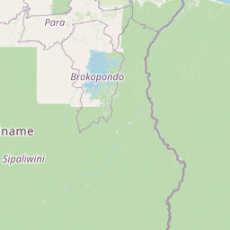
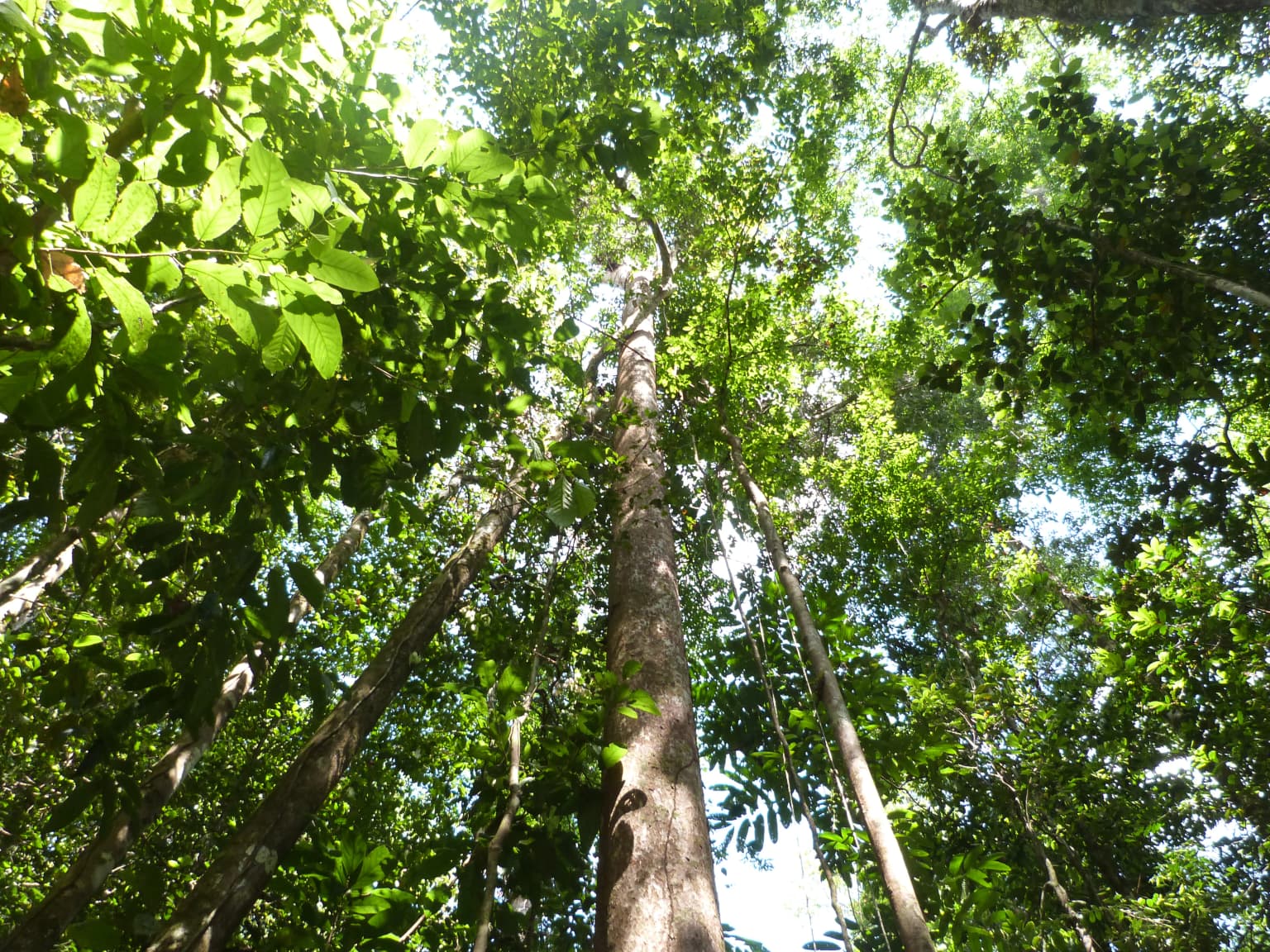
Guiana Amazonian Park is best known for its status as the largest protected area in the European Union and one of the world's great tropical forest parks. It protects a vast expanse of intact Amazonian rainforest featuring extraordinary biodiversity, with some 1,200 tree species recorded within its boundaries and a single hectare often containing more tree species than all of metropolitan France. The park's landscape is characterized by towering emergent trees reaching 55 to 65 meters, including iconic species like the sandbox tree (Hura crepitans) and kapok tree (Ceiba pentandra). Its river systems, particularly the Maroni River, provide access through otherwise impenetrable forest, while the park's inselbergs such as Mont Galbao and Susu Bella offer dramatic granite outcrops rising above the canopy.

Silky Anteater (Cyclopes didactylus) with brown fur clinging to a tree branch against a blue sky background
Silky Anteater clinging to a tree branch in a forest setting

Guiana Amazonian Park history and protected-area timeline

The creation of Guiana Amazonian Park traces its origins to the 1992 Earth Summit in Rio de Janeiro, where French President François Mitterrand championed the idea of establishing a national park in French Guiana to protect the Amazonian forest. Following this initial impulse, a protocol of agreement was signed in June 1992 by the presidents of the regional and departmental assemblies of French Guiana, along with French ministers responsible for the Environment, Overseas Departments and Territories, and Agriculture and Forestry.

In 1993, the Mission for the Creation of the French Guiana National Park was established to develop the project. However, a first proposal put forward in late 1995 was rejected in December 1997 because of insufficient consultation with local communities. This setback led to a more inclusive approach, culminating in the Twenké agreement of June 21, 1998, which formally recognized the rights of indigenous Amerindian peoples and the Businengue (Maroons) living within the proposed park boundaries.

The final project was presented in early 2006, and the decree relating to the park project was published in the Official Journal of the French Republic on March 6, 2006, at which time the name was changed to Guiana Amazonian Park. Despite resistance from some local and regional authorities, the park's creation was formalized by decree on February 27 or 28, 2007, and the governing body held its first meeting on June 7, 2007.

Guiana Amazonian Park landscape and geographic character

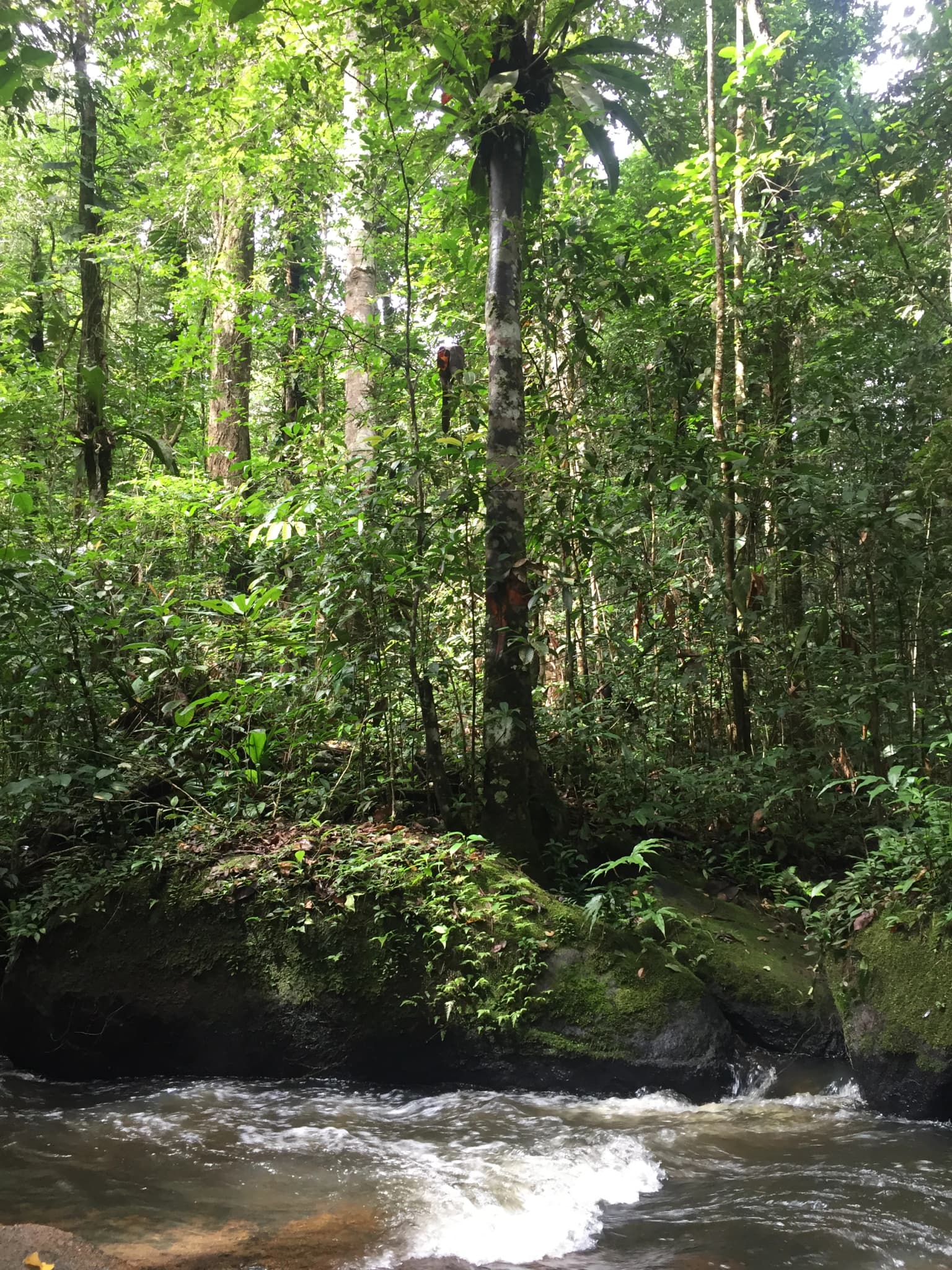
The landscape of Guiana Amazonian Park is dominated by continuous tropical rainforest that covers virtually the entire protected area. The terrain is characterized by a gently undulating plateau with isolated granite inselbergs rising dramatically from the forest canopy. Montagne Bellevue serves as the park's highest point, while other notable geological features include Mont Galbao and the Susu Bella inselberg.

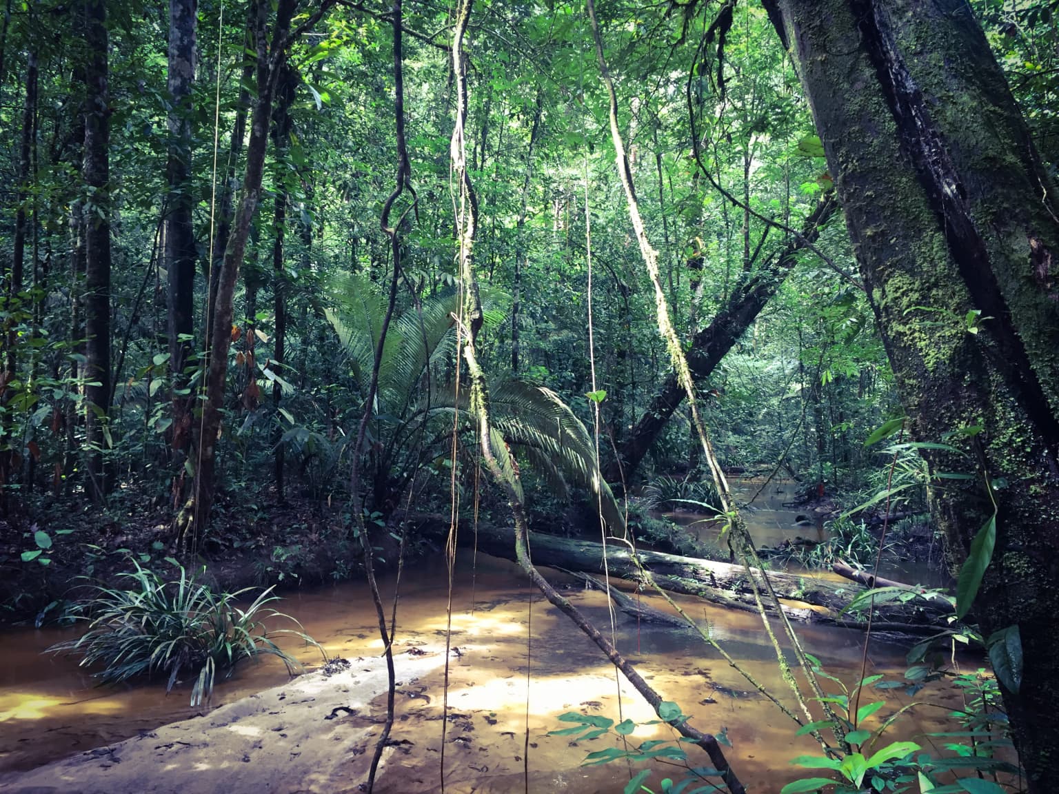
The forest structure features a complex vertical stratification, with emergents towering 55 to 65 meters above the canopy, creating a distinctive landscape of interlocking crowns and clear vertical tiers. The largest trees include the sandbox tree and kapok tree, whose buttressed roots and massive trunks are characteristic of lowland Amazonian forest. Throughout the park, rivers including the Maroni (Maroni River) and Oyapock (Oyapock River) form dendritic drainage patterns that have carved valleys into the otherwise flat terrain.

The park includes portions of the Monts d'Arawa range and encompasses diverse forest types that vary with moisture regimes. The southern areas tend to be drier and feature more lianas and bamboo, while wetter zones contain dense understory palm communities. The Maroni River, which forms part of the park's western boundary, serves as a critical transportation corridor and provides dramatic views of the forest from its banks.

Tall rainforest trees with dense green foliage forming a canopy, sunlight filtering through leaves
Rainforest canopy viewed from below in Guiana Amazonian Park

Guiana Amazonian Park ecosystems, habitats, and plant life

The ecological significance of Guiana Amazonian Park cannot be overstated, as it protects a substantial portion of the Amazonian forest within French Guiana, representing roughly 41% of the department's territory. The park contains between 4,000 and 5,000 vascular plant species, including more than 1,200 tree species representing families such as Lecythidaceae, Sapotaceae, Fabaceae, Burseraceae, Chrysobalanaceae, and Lauraceae.

The forest exhibits remarkable structural complexity, with up to six distinct vertical layers supporting extraordinary biodiversity. One hectare of Guianan Amazonian forest frequently contains more tree species than are found across all of metropolitan France, making this one of the most species-rich forests on Earth. The park encompasses several forest types, including seasonally flooded várzea forests along river margins, igapó forests in permanently waterlogged areas, and terra firme forests on well-drained soils.

The French source notes that the southern portions of the park contain drier forest types characterized by more lianas, bamboo, and members of the Burseraceae family, while wetter zones feature dense understory palm communities. This mosaic of habitats contributes to the park's exceptional species diversity and ecological complexity.

Tropical rainforest with dense green vegetation, muddy stream, and fallen tree trunk
Dense rainforest scene with muddy stream in Guiana Amazonian Park

Guiana Amazonian Park wildlife and species highlights

Guiana Amazonian Park supports an extraordinary vertebrate fauna that ranks among the richest in the Amazon basin. The park hosts 90 amphibian species, 133 reptile species, over 520 bird species (more than 500 within the park itself), and 182 mammal species, in addition to more than 200 freshwater fish species.

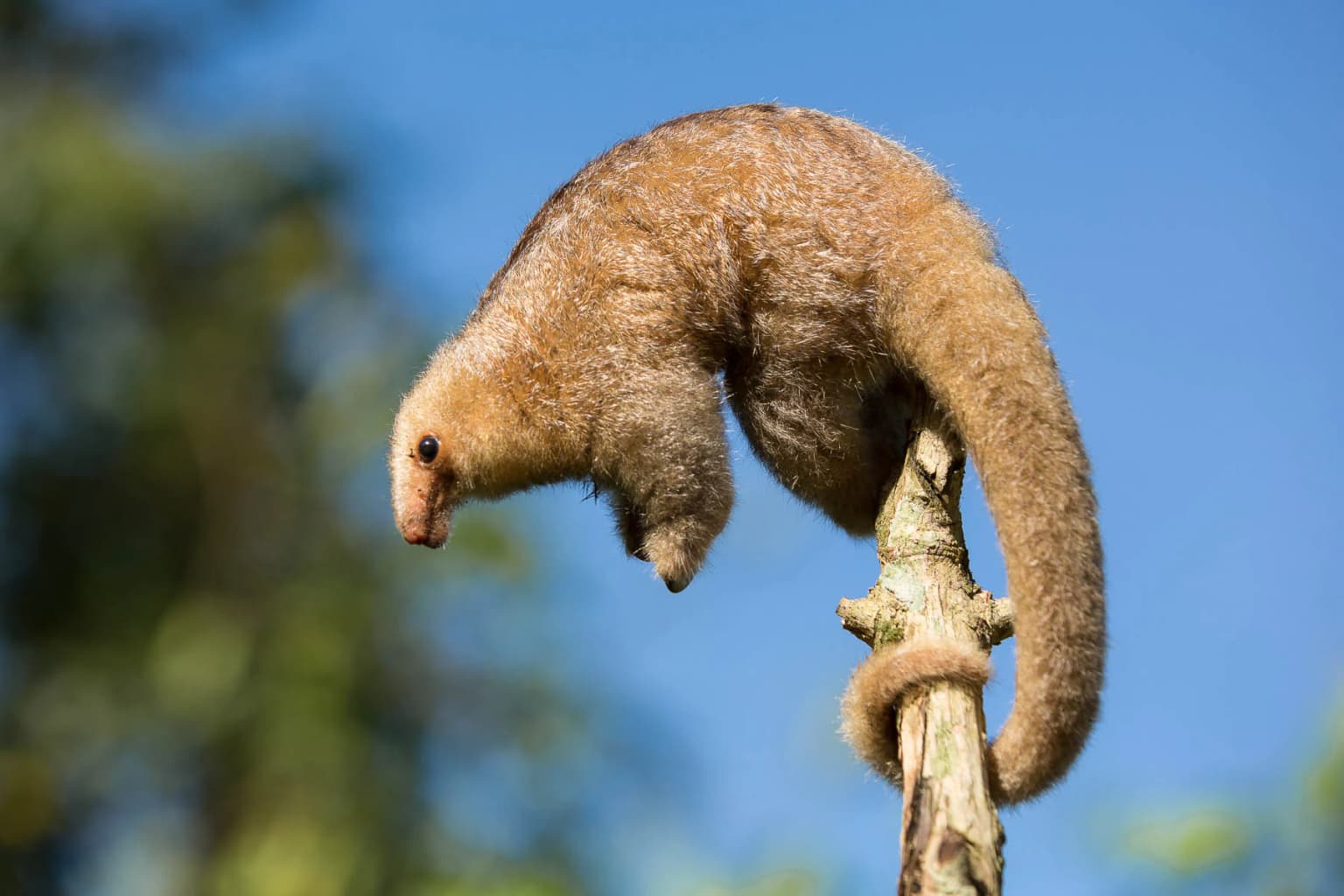
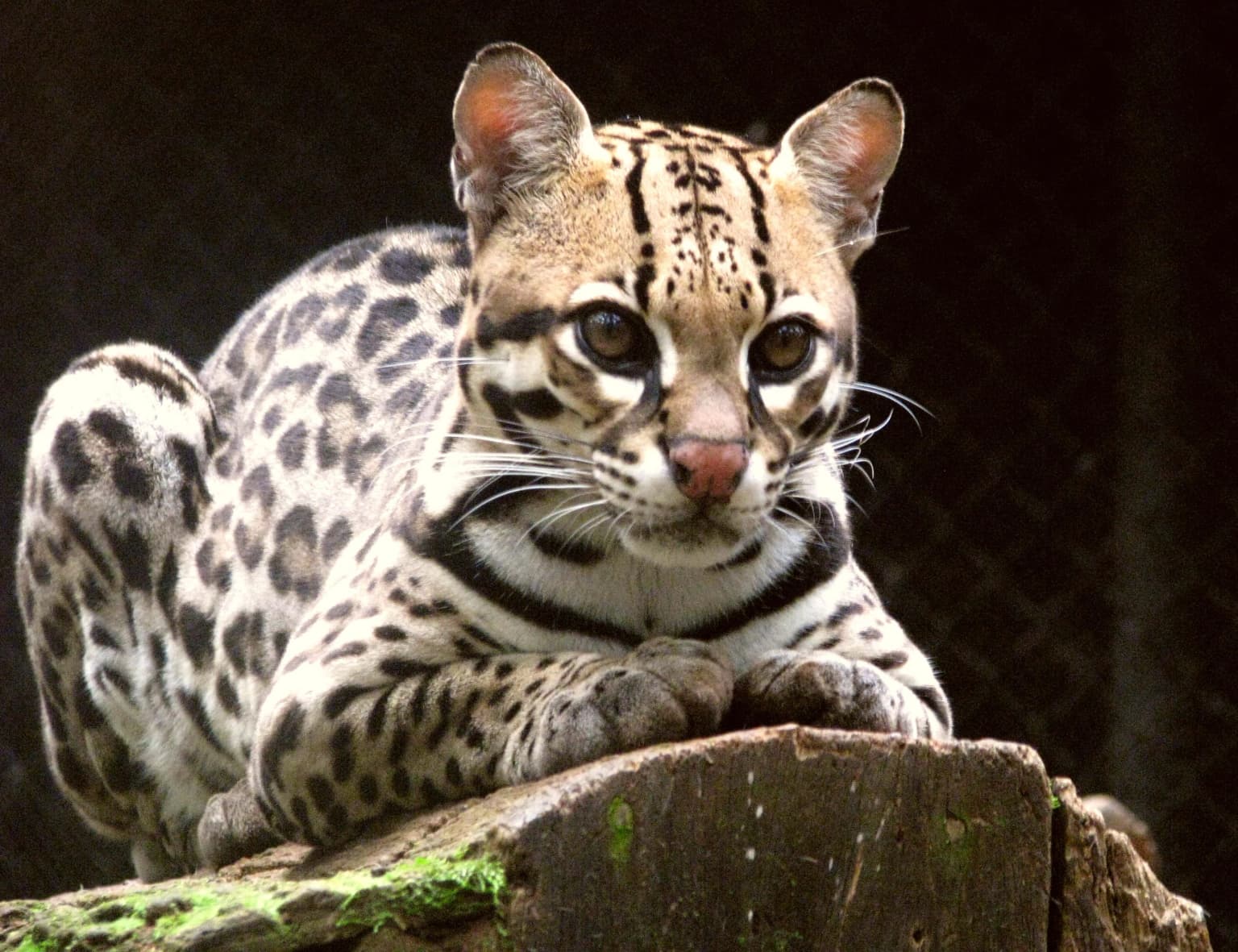
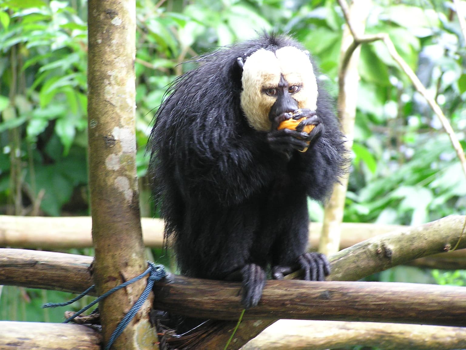
Mammal diversity includes numerous Neotropical primates such as the Guyanan red howler, wedge-capped capuchin, tufted capuchin, white-faced saki, golden-handed tamarin, and red-faced spider monkey. Felines are well represented with ocelot, margay, and jaguarundi, while the park also supports the elusive bush dog. Other notable mammals include giant anteater, silky anteater, several armadillo species including the giant armadillo, and a remarkable diversity of opossums including the unusual water opossum.

The bat fauna exceeds 100 species and plays a critical ecological role in seed dispersal, particularly for early-successional plants in the genera Cecropia, Solanum, and Vismia that rapidly colonize forest gaps. Bird diversity is equally impressive with more than 500 species recorded within the park, while the reptile fauna includes numerous snakes, lizards, and crocodilians adapted to the forest floor and aquatic environments.

Ocelot with spotted coat lying on a moss-covered log
Ocelot resting on a mossy log in Guiana Amazonian Park

Guiana Amazonian Park conservation status and protection priorities

Guiana Amazonian Park represents a critical component of global biodiversity conservation, forming part of the largest contiguous protected tropical forest area in the world when combined with adjacent Tumucumaque National Park in Brazil. The park's core zone of 20,300 square kilometers benefits from maximal protection where gold mining is strictly prohibited, helping to preserve both forest cover and water quality in the region's river systems.

The park faces significant conservation challenges, including pressure from illegal gold mining (orpaillage) that has degraded forest and river ecosystems in French Guiana. The establishment of the park and subsequent operations such as Operation Anaconda and Operation Harpie represent ongoing efforts to combat environmental crime and protect the park's integrity. The park's management also addresses the complex balance between conservation and the traditional livelihoods of indigenous communities, whose relationship with the forest predates the park's establishment.

The park participates in regional conservation coordination through the RENFORESAP initiative (Renforcer le réseau des aires protégées du plateau des Guyanes), which aims to improve biodiversity protection across the Guiana Shield through cooperation with Guyana and Suriname. Priority species for conservation include the saki satan (Chiropotes satanas) and the frog species Anomaloglossus degranvillei, both considered threatened and requiring targeted protection efforts.

Guiana Amazonian Park cultural meaning and human context

Guiana Amazonian Park encompasses lands traditionally inhabited by indigenous Amerindian and Maroon (Businengue) communities whose presence in the region predates European colonization by millennia. The park's territory includes areas belonging to the Aluku, Wayana, Wayampi, and Teko peoples in the communes of Camopi, Maripasoula, and Papaïchton.

The Twenké agreement of June 1998 was a landmark recognition of these communities' rights within the future park, establishing a framework for co-existence between conservation objectives and traditional land use. Notably, the territories of the Wayana and Teko peoples were excluded from the core protection zone due to their objections to restrictions on their free movement and sacred areas, illustrating the complex negotiation required to establish the park.

The park's management framework explicitly acknowledges the need to support communities that traditionally derive their livelihoods from the forest, taking into account their traditional way of life while contributing to social, economic, and cultural development within the framework of sustainable development. This approach reflects France's commitment to respecting indigenous rights while pursuing conservation goals, distinguishing Guiana Amazonian Park from purely exclusionary conservation models.

A White-faced Saki-Monkey with black fur and a white face eating an orange fruit while perched on a wooden structure in a lush green forest.
White-faced Saki-Monkey eating fruit in the Guiana Amazonian Park.

Top sights and standout views in Guiana Amazonian Park

Guiana Amazonian Park stands as the largest national park in France and the European Union, protecting an estimated 41% of French Guiana's territory. Combined with Brazil's Tumucumaque National Park, it forms the largest tropical forest protected area on Earth. The park contains extraordinary biodiversity with over 1,200 tree species, more than 500 bird species, 182 mammal species, and 4,000-5,000 vascular plant species. Access is only possible by aircraft or along the Maroni and Oyapock rivers by traditional pirogue, preserving its wilderness character. The park features trails near Saül village including options adapted for visitors with reduced mobility as part of the "Amazon for All" program, with notable destinations including Mont Galbao, Susu Bella inselberg, and Gobaya Soula falls.

A river with white water flows through a dense, lush green rainforest with tall trees and moss-covered rocks
River flowing through dense rainforest in Guiana Amazonian Park

Best time to visit Guiana Amazonian Park

Guiana Amazonian Park can be visited year-round, though the optimal period generally spans from late August through November when rainfall is lower and wildlife viewing conditions improve. The wet season from December to July brings heavier rainfall that can affect trail accessibility and river travel, though the forest remains accessible throughout the year. The dry season offers better conditions for wildlife observation as animals concentrate around remaining water sources, while the wet season showcases the forest's full flowering and provides a different but equally compelling experience. Visitors should note that access to the park requires either a light aircraft flight to Saül or a multi-day pirogue journey up the Maroni River from the coast, making logistics an important planning consideration regardless of when one chooses to visit.

Park location guide

Geography guide, regional context, and park location map for Guiana Amazonian Park

Guiana Amazonian Park park geography, regions, and map view in France
Understand where Guiana Amazonian Park sits in France through a broader geographic reading of the surrounding landscape, nearby location context, and its mapped position within the national park landscape.

How Guiana Amazonian Park fits into France

France is a unitary semi-presidential republic and one of the world's largest economies. It borders Belgium, Luxembourg, Germany, Switzerland, Italy, Monaco, Andorra, and Spain, with a maritime border to the United Kingdom. The country is known for its cultural influence, art, cuisine, and political history spanning centuries.

Wider geography shaping Guiana Amazonian Park in France

France is located in Western Europe. Metropolitan France extends from the Rhine to the Atlantic Ocean and from the Mediterranean Sea to the English Channel and North Sea. The country borders Belgium, Luxembourg, Germany, Switzerland, Italy, Monaco, Andorra, Spain, and has a maritime border with the United Kingdom.

Map view of Guiana Amazonian Park

Use this park location map to pinpoint Guiana Amazonian Park in France, understand its exact geographic position, and read its mapped placement within the surrounding landscape more clearly.

Pigeon | © OpenStreetMap contributors

Location context for Guiana Amazonian Park

French Guiana

Visualize the Vast Amazonian Terrain, Unique Forest Habitats, and Remote Biodiversity of French Guiana's Largest National Park

Guiana Amazonian Park Photos: Explore Untamed Tropical Rainforest Landscapes and Protected Area Scenery
Browse comprehensive imagery showcasing the pristine Amazonian rainforest, towering emergent trees, and unique granite inselbergs that define Guiana Amazonian Park's vast protected landscape. Understanding the park's visual environment, from its dense canopy to its crucial river systems, provides essential geographic context for appreciating this significant global conservation area.

Silky Anteater (Cyclopes didactylus) with brown fur clinging to a tree branch against a blue sky background

Kinkajou with brown fur clinging to a mossy branch, forest background

Tall rainforest trees with dense green foliage forming a canopy, sunlight filtering through leaves

Tropical rainforest with dense green vegetation, muddy stream, and fallen tree trunk

Ocelot with spotted coat lying on a moss-covered log

Aerial view of a small village with red-roofed buildings surrounded by dense green rainforest and misty mountains

A White-faced Saki-Monkey with black fur and a white face eating an orange fruit while perched on a wooden structure in a lush green forest.

A river with white water flows through a dense, lush green rainforest with tall trees and moss-covered rocks

Margay cat with spotted fur sleeping on a wooden ledge

Aerial view of dense green rainforest with mist and mountain ranges under a clear sky

Close-up of a Wedge-capped capuchin monkey with light brown fur and dark face, gripping a wooden structure with a blurred green background

Giant Anteater with long snout and bushy tail standing on ground covered with brown leaves near a wire fence

Capybara (Hydrochoerus hydrochaeris) grazing on green grass with another capybara partially visible in the background

A calm river with dense green rainforest along the shoreline under a light sky

A large kapok tree stands in a misty rainforest landscape with early morning sunlight filtering through the fog.

Park atlas

Browse adjacent protected landscapes and trace the regional spread of conserved Amazonian terrain.

Discover Other Protected Areas Near Guiana Amazonian Park and French Guiana's Vast Rainforests
Explore national parks and protected areas adjacent to Guiana Amazonian Park, tracing the broader geography of conservation efforts across French Guiana and the Guianan Amazon. Compare surrounding protected landscapes to understand regional park distribution and how these vital territories connect within the Guiana Shield's diverse Amazonian ecosystems.
Nature reserveFrench Guiana

Nouragues Nature Reserve: Protected Nature Reserve Landscape within French Guiana's Amazon

Mapped geography featuring a distinct inselberg formation.

Nouragues Nature Reserve stands as a critical protected area within French Guiana, safeguarding a significant expanse of pristine lowland tropical rainforest. Its most defining characteristic is the Nouragues Inselberg, a colossal granite formation that dramatically punctuates the dense forest canopy. This reserve is not only a testament to conservation efforts but also a globally recognized hub for tropical forest ecology research. Exploring Nouragues Nature Reserve offers a unique lens into the natural processes and geological features of the Guiana Shield ecosystems.

Area
1,000 km²
Established
1995
IUCN
IV
Relief
Mixed relief
Nature reserveFrench Guiana

La Trinité National Nature Reserve: French Guiana Protected Landscape & Nature Reserve Atlas

Mapping the natural terrain and protected boundaries.

Delve into the protected landscape of La Trinité National Nature Reserve, an integral part of French Guiana's extensive natural terrain. This explorer view provides specific insights into the reserve's mapped boundaries and its geographic context within the South American region. Understand its identity as a designated nature reserve and its contribution to the broader protected areas atlas for French Guiana.

Area
769.03 km²
Established
1996
IUCN
IV
Relief
Mountain
Nature reserveFrench Guiana

Trésor Regional Nature Reserve: Protected Nature Reserve in French Guiana's Guianas Region

Mapped Protected Landscape and Regional Geography

Investigate Trésor Regional Nature Reserve, a vital protected nature reserve located in French Guiana. This reserve is mapped as a significant component of the region's protected areas, contributing to the understanding of its unique tropical rainforest geography. Its designation underscores its importance for atlas exploration, offering structured insights into the natural landscapes that characterize this South American territory.

Area
24.64 km²
Established
2010
IUCN
IV
Relief
Mountain
Nature reserveFrench Guiana

Mont Grand Matoury Nature Reserve: French Guiana's Protected Landscape and Mapped Geography

Explore its protected boundaries and regional terrain.

Mont Grand Matoury Nature Reserve is an integral part of the protected areas network in French Guiana, offering a specific focus on its natural landscape and geographic setting. This entry provides a structured overview of the reserve, detailing its mapped extent and its contribution to the regional geography. Users can delve into the specifics of this protected land, understanding its character and location within the wider context of France's overseas territories and the Amazonian biome.

Area
21.23 km²
Established
2006
IUCN
IV
Relief
Mixed relief
Nature reserveFrench Guiana

Kaw-Roura Marshland Nature Reserve: A Protected Marshland Landscape in French Guiana

Explore its mapped terrain and regional geographic context.

Kaw-Roura Marshland Nature Reserve represents a distinct protected landscape within the tropical rainforests of French Guiana. This nature reserve offers detailed insights into marshland geography and terrain, contributing vital data for map-based exploration and understanding regional conservation patterns. Discover the specific protected boundaries and landscape character that define this important natural area, anchoring its identity within the larger geographic context of French Guiana.

Area
947 km²
Established
1998
IUCN
IV
National parkSuriname

Brownsberg Nature Park: Suriname National Park with Tropical Forest and Waterfall Landscapes

Mapped geography and protected landscape context.

Brownsberg Nature Park stands as a vital protected landscape within Suriname, distinguished by its central mountain, tropical forest ecosystems, and scenic waterfalls such as Leo Waterfall. The park's location overlooking the vast Brokopondo Reservoir provides a unique geographic setting, making it an important destination for atlas and map-based exploration of Suriname's natural heritage. Understanding Brownsberg Nature Park offers insight into the Neotropical biodiversity and terrain characteristic of the Guianan moist forests.

Area
122 km²
Established
1969
IUCN
II
Visitors
20K annual
Nature reserveSipaliwini District

Central Suriname Nature Reserve: Protected Nature Reserve with Mapped Geographic Context

Explore the landscape boundaries within Sipaliwini District's protected areas.

Central Suriname Nature Reserve is a significant protected area situated in Suriname's Sipaliwini District. As a designated nature reserve, it offers critical insights into regional geography and conservation landscapes. This page provides focused information on its mapped boundaries and its contribution to the broader atlas of protected lands, enabling detailed geographic discovery.

Area
16,000 km²
Established
1998
Relief
Mixed relief
Climate
Tropical
Protected areaGuyana

Kanashen Protected Area: Geographic Identity and Mapped Boundaries in Guyana

Explore the mapped landscape and protected land context.

Kanashen Protected Area serves as a critical point of geographic discovery within Guyana, offering detailed insights into its protected boundaries and natural landscape. This entry focuses on providing a structured, atlas-driven understanding of Kanashen, emphasizing its role within the regional geography of South America. Users can explore how this protected area fits into the larger mapped context, appreciating its specific terrain and conservation significance.

Area
6,485.67 km²
IUCN
VI
Relief
Mixed relief
Climate
Tropical

Common questions about visiting, size, designation, and location context for Guiana Amazonian Park

Guiana Amazonian Park FAQs for park facts, access, geography, and protected area context
Find quick answers about Guiana Amazonian Park, including protected-area facts, park geography, trail and visitor context, and how the park fits into its surrounding country and regional landscape.
MoriAtlas Explorer

Continue Your Protected Areas Search Across the Global Atlas

Deepen your exploration by continuing the structured search for national parks and protected areas worldwide. Utilize the comprehensive filtering capabilities to compare different conservation landscapes and refine your understanding of global park geography. Discover more about the distribution and characteristics of protected natural areas.

Global natural geography