Mori Atlas logo
National parkSierra del Divisor National Park

Discover the dramatic mountain terrain and sacred geography of this vast national park.

Sierra del Divisor National Park: Peru's Iconic Amazon Protected Landscape

(Parque Nacional Sierra del Divisor)

Sierra del Divisor National Park represents a cornerstone of Amazonian conservation in Peru, safeguarding over 1.35 million hectares of pristine tropical rainforest. This protected landscape is defined by the striking Sierra del Divisor mountain range, which dramatically punctuates the flat Amazon basin, crowned by the sacred, pyramid-shaped peak of Cerro El Cono. Its establishment in 2015 highlights the region's critical importance for biodiversity and its role as a vital ecological corridor within the Peruvian Amazon, offering unique insights into protected area geography and natural terrain.

Amazon rainforestNational parkProtected areaPeruTropical forestMountain landscape

Sierra del Divisor National Park

National park

Park overview

Structured park overview, official facts, and landscape profile for Sierra del Divisor National Park

Sierra del Divisor National Park park facts, protected area profile, and essential visitor context
Review the core facts for Sierra del Divisor National Park, including designation, size, terrain, visitor scale, habitats, and operating context in one park-focused overview.

About Sierra del Divisor National Park

Sierra del Divisor National Park occupies a vast expanse of the Peruvian Amazon in the eastern part of the country, spanning administrative boundaries between the Ucayali and Loreto regions. The park's establishment in 2015 marked a significant expansion of Peru's protected area network into a region that had previously lacked formal national park status despite its ecological importance. The park encompasses the Sierra del Divisor mountain range, a series of isolated ridges and peaks that rise from the otherwise flat Amazon basin, creating unique habitats and microclimates within the broader rainforest ecosystem. Cerro El Cono, the most distinctive of these peaks, is a dramatic pyramid-shaped mountain whose slopes are cloaked in forest while its summit holds cultural significance for indigenous groups who consider it a sacred Apu. The city of Pucallpa, the largest urban center in the Ucayali Region, lies along the banks of the Ucayali River to the south of the park, providing a regional population center with connections to the protected area. The park's size of over 1.35 million hectares positions it among the largest protected areas in Peru, providing substantial habitat connectivity for wide-ranging Amazonian species.

Quick facts and research context for Sierra del Divisor National Park

Sierra del Divisor National Park covers 1,354,485 hectares (approximately 13,545 square kilometers) of Amazon rainforest in eastern Peru, making it one of the country's largest national parks. It is located in both Coronel Portillo Province within the Ucayali Region and Ucayali Province within the Loreto Region. The park was officially established on November 8, 2015, and is administered by SERNANP, Peru's national protected area service. The park is classified as IUCN Category II, reflecting its status as a national park with primary protection of natural ecosystems.

Park context

Deeper park guide and search-rich context for Sierra del Divisor National Park

Sierra del Divisor National Park history, landscape, wildlife, and travel context
Explore Sierra del Divisor National Park through its history, landscape character, ecosystems, wildlife, conservation priorities, cultural context, and seasonal travel timing in a structured park guide built for atlas discovery and search intent.

Why Sierra del Divisor National Park stands out

Sierra del Divisor National Park is best known for protecting a remarkable landscape of Amazon lowland rainforest combined with the distinctive pyramidal peak of Cerro El Cono, which stands as a sacred landmark for local indigenous communities. The park preserves vast tracts of relatively undisturbed tropical forest in a region that has faced significant deforestation pressure elsewhere in the Peruvian Amazon. Its establishment in 2015 represents one of the more recent additions to Peru's national park system, reflecting growing recognition of the need to protect critical Amazon biodiversity corridors.

Sierra del Divisor National Park history and protected-area timeline

Sierra del Divisor National Park was established on November 8, 2015, making it one of the more recent additions to Peru's national park system. The creation of the park followed years of advocacy from conservation organizations and recognition of the region's ecological significance. Prior to national park designation, the area existed as part of a reserved zone, reflecting ongoing efforts to provide formal protection while establishing appropriate management frameworks. The park is administered by SERNANP (Servicio Nacional de Áreas Naturales Protegidas por el Estado), Peru's national protected areas service, which operates under the Ministry of the Environment. The establishment of the park represented a commitment to preserving one of the last significant tracts of relatively intact Amazon forest in the Ucayali Region, an area that had experienced increasing pressure from logging, agriculture, and infrastructure development.

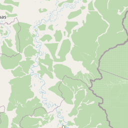
Sierra del Divisor National Park landscape and geographic character

The landscape of Sierra del Divisor National Park is characterized by the dramatic contrast between the flat Amazon floodplain and the distinctive ridge systems and peaks that give the park its name. The Sierra del Divisor mountain range rises from the surrounding lowland forest as a series of isolated hills and dramatic peaks, with Cerro El Cono standing out as the most visually striking feature. This pyramidal mountain, with its steep slopes ascending to a sharp summit, creates a unique landmark visible across the Amazon plain. The park encompasses a variety of terrain including lowland rainforest, hill forest on the slopes of the Sierra del Divisor, and seasonal wetlands associated with river systems that flow through the protected area. The Ucayali River, one of the major tributaries of the Amazon, flows along the southern boundary of the park, creating a natural corridor and providing access to the regional center of Pucallpa.

Sierra del Divisor National Park ecosystems, habitats, and plant life

The nature of Sierra del Divisor National Park reflects the biodiversity richness of the Amazon basin, encompassing multiple habitat types from lowland rainforest to the unique environments found on the slopes of the Sierra del Divisor. The park supports extensive areas of primary forest that have not been significantly altered by human activity, providing critical habitat for species adapted to old-growth Amazon environments. The elevation differences created by the Sierra del Divisor ridge system support distinct ecological zones, with different forest compositions found at various altitudes. The park lies within a region recognized for its high species diversity, including numerous endemic species found only in this part of the Amazon. The protection of this large contiguous area of forest provides essential connectivity between habitats and supports the ecological processes that maintain Amazon biodiversity.

Sierra del Divisor National Park wildlife and species highlights

The wildlife of Sierra del Divisor National Park reflects the exceptional biodiversity of the Peruvian Amazon, with the protected area providing habitat for numerous species characteristic of lowland tropical forests. While specific species inventories are limited in the available sources, the park's location within the Amazon basin places it within one of the most species-rich regions on Earth. The large contiguous forest area supports populations of wide-ranging species that require extensive habitat, including large mammals such as jaguars, tapirs, and various primate species that depend on connected forest corridors. The diverse forest strata, from the forest floor to the canopy, support different species assemblages including ground-dwelling animals, arboreal species, and the rich birdlife that characterizes Amazon ecosystems.

Sierra del Divisor National Park conservation status and protection priorities

Sierra del Divisor National Park represents a significant conservation achievement for Peru, protecting a substantial area of Amazon forest that had previously lacked formal national park status. The park's establishment in 2015 reflects growing recognition of the importance of protecting intact Amazon ecosystems as part of global climate regulation and biodiversity conservation. As an IUCN Category II protected area, the park is managed primarily for ecosystem conservation while also providing opportunities for scientific research and environmental education. The large size of the protected area ensures that ecological processes can continue with minimal human interference, supporting natural population dynamics and species movements. The park connects to broader conservation landscapes in the Peruvian Amazon and contributes to regional efforts to maintain biodiversity corridors across the Amazon basin.

Sierra del Divisor National Park cultural meaning and human context

Sierra del Divisor National Park holds cultural significance for indigenous peoples of the Amazon region, particularly in relation to Cerro El Cono, the distinctive pyramid-shaped peak that rises from the surrounding forest. This mountain is honored by local indigenous communities as an Apu, a sacred mountain spirit in the Andean and Amazonian belief systems. The recognition of Cerro El Cono as a sacred site reflects the deep connection between indigenous Amazonian communities and the natural landscape. The park's location in a region traditionally inhabited by Amazonian peoples means that its establishment intersects with questions of indigenous land rights and traditional resource use, themes that are central to conservation efforts throughout the Peruvian Amazon.

Top sights and standout views in Sierra del Divisor National Park

The highlights of Sierra del Divisor National Park include its dramatic mountain landscape that breaks the otherwise flat Amazon plain, the sacred pyramid peak of Cerro El Cono, its vast extent of preserved Amazon forest, and its recent establishment as one of Peru's newest national parks. The park protects a unique combination of lowland Amazon rainforest with upland forest on the Sierra del Divisor slopes, creating habitat diversity within a single protected area. The proximity to Pucallpa, the largest city in the Ucayali Region, provides access opportunities for visitors interested in exploring this remote Amazon wilderness.

Best time to visit Sierra del Divisor National Park

The best time to visit Sierra del Divisor National Park follows the general patterns of the Peruvian Amazon, with the dry season from May to October typically offering easier access to trails and more comfortable conditions for exploration. The wet season from November to April brings higher rainfall and flooding of low-lying areas, which while creating different landscapes and wildlife viewing opportunities, can limit access to some parts of the park. Temperature patterns remain consistent year-round in the Amazon, with warm and humid conditions prevailing. Visitors planning trips to the park should consult with local operators and the park management authority for current access conditions and any visitor regulations.

Park location guide

Geography guide, regional context, and park location map for Sierra del Divisor National Park

Sierra del Divisor National Park park geography, regions, and map view in Peru
Understand where Sierra del Divisor National Park sits in Peru through a broader geographic reading of the surrounding landscape, nearby location context, and its mapped position within the national park landscape.

How Sierra del Divisor National Park fits into Peru

Peru is a megadiverse country in western South America with a population of over 34 million. It spans three distinct geographic regions: the Pacific coastal desert in the west, the Andes mountains running north to south, and the Amazon rainforest in the east. The country has one of the longest histories of civilization in the world, tracing back to the Caral-Supe civilization of the 10th millennium BCE, and was home to the Inca Empire before Spanish colonization in the 16th century.

Wider geography shaping Sierra del Divisor National Park in Peru

Peru is located in western South America along the Pacific coast. The country encompasses three major geographic regions: the coastal desert plains along the Pacific, the Andes mountain range extending from north to southeast, and the Amazon basin rainforest in the eastern interior. It shares borders with Ecuador and Colombia to the north, Brazil to the east, Bolivia to the southeast, and Chile to the south.

Map view of Sierra del Divisor National Park

Use this park location map to pinpoint Sierra del Divisor National Park in Peru, understand its exact geographic position, and read its mapped placement within the surrounding landscape more clearly.

Pigeon | © OpenStreetMap contributors

Location context for Sierra del Divisor National Park

Loreto RegionUcayali Region
Park atlas

Trace the geographic spread of protected landscapes across the vast Peruvian Amazon and its diverse terrain

Explore Other National Parks and Protected Areas Near Sierra del Divisor National Park
Continue your exploration from Sierra del Divisor National Park by browsing other national parks and protected areas across Peru's Amazonian regions, comparing their unique lowland forests and distinctive mountain landscapes. Examine the regional context and conservation efforts that connect these vital protected zones, understanding their role in preserving the vast biodiversity of the Amazon basin.
National parkPasco Region

Yanachaga, Chemillén National Park: Protected Area in Pasco Region, Peru

Mapped terrain, Pleistocene refuge, and rich biodiversity.

Yanachaga, Chemillén National Park, a national park situated in Peru's Pasco Region, preserves over 122,000 hectares of mountainous cloud forest and rainforest ecosystems. Its landscape is characterized by dramatic canyons and steep forested slopes, creating significant altitudinal variation from 460 to 3,643 meters. Recognized as a Pleistocene refuge, the park shelters ancient forest remnants and harbors exceptional biodiversity, including hundreds of bird species and iconic mammals, offering rich context for geographic and protected-area exploration.

Area
1,220 km²
Established
1986
IUCN
II
National parkCajamarca Region

Cutervo National Park: Peru's Oldest National Park Atlas and Protected Landscape

Andean Montane Forests and Mapped Geography of a Pioneering Protected Area

As Peru's oldest national park, established in 1961, Cutervo National Park offers a unique glimpse into the protected geography of the northern Peruvian Andes. Located in the Cajamarca Region, it preserves diverse Andean montane forests and páramo grasslands across a significant elevation gradient from 1,550 to 3,500 meters. This page details the park's landscape, including its role as a headwater conservation area and its position within a critical South American ecoregion, providing rich context for geographic and protected-area exploration.

Area
82.14 km²
Established
1961
IUCN
II
National parkLoreto Region

Yaguas National Park: A Vast Protected Amazonian Landscape in Peru's Loreto Region

Mapping unique transboundary conservation and tropical biodiversity.

Yaguas National Park represents a monumental addition to Peru's protected lands, safeguarding an immense area of Amazonian rainforest within the Loreto Region. Its designation as a national park underscores its ecological importance as part of a critical international conservation corridor. This page provides detailed geographic context, showcasing the park's mapped boundaries, its characteristic lowland tropical forest terrain, and its role in preserving the rich biodiversity of the Amazon basin.

Area
8,689 km²
Established
2018
IUCN
II
National parkAmazonas Department

Amacayacu National Natural Park: Amazonian Flooded Forest and Protected Landscape Atlas

Mapped protected area boundaries and regional geography in Amazonas, Colombia.

Discover the intricate landscape of Amacayacu National Natural Park, a key protected area within Colombia's Amazonas Department. This page offers detailed geographic context, focusing on its vast Amazonian rainforest, the dynamic Amazon River influence, and the unique ecology of its flooded forest terrain. Explore mapped park boundaries, key river systems like Tarapoto Lake, and the protected zones crucial for Amazon river dolphin and primate habitats, providing a rich atlas view of this vital natural reserve.

Area
2,935 km²
Established
1975
IUCN
II
National parkEcuador

Podocarpus National Park: Ecuador's Diverse National Park and Protected Landscape

Discover elfin forests, paramo, and over 100 lagoons.

Podocarpus National Park, situated in southeastern Ecuador, stands as a prime example of a protected natural area at a unique biogeographic crossroads. This national park spans dramatic elevational zones, from montane rain forests to high-elevation paramo ecosystems dotted with more than 100 lagoons, offering rich mapped landscape exploration. Its significance lies in the convergence of four distinct ecological systems, contributing to exceptional biodiversity and a rich tapestry of natural terrain.

Area
1,462.8 km²
Established
1982
IUCN
II
National parkZamora Chinchipe

Yacurí National Park: Protected Andean Lakes and Volcanic Landscape in Zamora Chinchipe

Discover highland geography and the ancient Inca Trail.

Yacurí National Park is a key protected landscape in Ecuador's southern Andes, celebrated for its remarkable collection of over 46 high-altitude lakes set within dramatic volcanic terrain. Situated in Zamora Chinchipe province, the park preserves a vital stretch of the Inca Trail, complete with archaeological sites. This national park offers a rich exploration of Andean geography, páramo ecosystems, and significant cultural heritage, making it a cornerstone of the region's protected areas.

Area
431 km²
Established
2009
IUCN
II
National parkPeru

Güeppi-Sekime National Park: Protected National Park Atlas in Peru

Mapped landscape and regional geography of this Amazonian protected area.

Güeppi-Sekime National Park is a prominent protected area in Peru, recognized as a national park safeguarding a substantial expanse of tropical forest. Its landscape is characterized by diverse terrain, including rolling hills and seasonally inundated lowlands, vital for a rich tapestry of flora and fauna. The park's strategic location on the Ecuador border underscores its importance for transboundary conservation and ecological connectivity within the western Amazon basin. This page offers detailed information on its protected area identity, geographic context, and the mapped natural features that define this significant conservation landscape.

Area
2,036 km²
Established
2012
IUCN
II
National parkPeru

Cerros de Amotape National Park: Peru's Protected Pacific Tropical Forest Atlas

Explore mapped boundaries and diverse terrain of this unique landscape.

Cerros de Amotape National Park stands as a significant protected area within Peru, meticulously preserving remnants of the Tumbes-Piura dry forests and Pacific tropical forests. Situated within the Cordillera de los Amotapes, the park features a dynamic landscape from riverine habitats to elevated mountain terrain. This park detail page offers an atlas-style view, focusing on its geographic context, mapped protected boundaries, and its importance as a conservation corridor for unique biodiversity.

Area
1,515.61 km²
Established
1975
IUCN
II

Common questions about visiting, size, designation, and location context for Sierra del Divisor National Park

Sierra del Divisor National Park FAQs for park facts, access, geography, and protected area context
Find quick answers about Sierra del Divisor National Park, including protected-area facts, park geography, trail and visitor context, and how the park fits into its surrounding country and regional landscape.
MoriAtlas Explorer

Continue Your Protected Areas Search Across the Global Atlas

Deepen your exploration by continuing the structured search for national parks and protected areas worldwide. Utilize the comprehensive filtering capabilities to compare different conservation landscapes and refine your understanding of global park geography. Discover more about the distribution and characteristics of protected natural areas.

Global natural geography