Mori Atlas logo
National parkYanachaga–Chemillén National Park

Discover mapped terrain, diverse ecosystems, and Pleistocene refuge status within this national park.

Yanachaga–Chemillén National Park: Protected Landscape in Peru's Pasco Region

(Parque Nacional Yanachaga-Chemillén)

Yanachaga–Chemillén National Park is a vital protected area in Peru's Pasco Region, encompassing 122,000 hectares of rugged mountain terrain shaped by deep canyons and steep forested slopes. Established to preserve its unique rainforests and cloud forests, this national park represents a critical Pleistocene refuge, harboring ancient forest ecosystems and exceptional biological diversity across its extensive altitudinal span. Explore the mapped boundaries and varied ecological formations that make this park a significant atlas entry for natural landscapes in South America.

Cloud ForestPleistocene RefugeBirdwatchingPeruPasco RegionMountain Forests

Yanachaga–Chemillén National Park

National park

Park overview

Structured park overview, official facts, and landscape profile for Yanachaga, Chemillén National Park

Yanachaga, Chemillén National Park park facts, protected area profile, and essential visitor context
Review the core facts for Yanachaga, Chemillén National Park, including designation, size, terrain, visitor scale, habitats, and operating context in one park-focused overview.

About Yanachaga, Chemillén National Park

Yanachaga–Chemillén National Park occupies a critical position in Peru's protected area network, safeguarding the upper watersheds of the Palcazu, Huancabamba, and Pozuzo river tributaries. The park's mission extends beyond pure biodiversity conservation to include the preservation of areas traditionally used by the Yanesha (also known as Amuesha) indigenous communities who have inhabited this region for generations. The Yanachaga mountain range forms the backbone of the park, with its dominant landscape consisting of forest-covered mountains dissected by dramatic canyons. The terrain is exceptionally rugged, with both the eastern and western flanks of the Palcazu River characterized by steep inclines and rocky slopes cloaked in dense vegetation. This dramatic topography creates numerous microclimates and ecological niches, contributing to the park's remarkable biological richness. The park's location in central Peru places it at a biogeographic crossroads where Amazonian lowland forests meet Andean cloud forests and high-altitude puna grasslands, resulting in a complex mosaic of habitats that supports extraordinary species diversity.

Quick facts and research context for Yanachaga, Chemillén National Park

Located in central Peru's Pasco Region, Yanachaga–Chemillén National Park protects 122,000 hectares of cloud forest and rainforest across the Yanachaga mountain range. The park's terrain is characterized by forest-covered mountains crisscrossed by deep canyons, with elevation gains of over 3,000 meters from the valley floors to the highest peaks. Established on August 29, 1986 under decree 068-86-AG, the park is managed by Peru's National Service of Protected Areas (SERNANP). The buffer zone surrounding the park is home to three distinct human populations: the indigenous Yanesha people on the eastern flank, European-origin settlers particularly concentrated in the Oxapampa-Pozuzo valley on the western flank, and Andean immigrants from the central highlands.

Park context

Deeper park guide and search-rich context for Yanachaga, Chemillén National Park

Yanachaga, Chemillén National Park history, landscape, wildlife, and travel context
Explore Yanachaga, Chemillén National Park through its history, landscape character, ecosystems, wildlife, conservation priorities, cultural context, and seasonal travel timing in a structured park guide built for atlas discovery and search intent.

Why Yanachaga, Chemillén National Park stands out

Yanachaga, Chemillén National Park is best known for its exceptional biodiversity and its status as a Pleistocene refuge. The park protects one of the most diverse bird communities in Peru, with 527 recorded species including the striking Andean cock-of-the-rock, colorful toucans, and distinctive mountain guans. The mammalian fauna includes apex predators such as the jaguar and puma, along with the endangered spectacled bear. The park's cloud forests shelter ancient tree species including Podocarpus, Cedrela, and Juglans neotropica, while its position at the intersection of Andean, Amazonian, and highland ecosystems creates a unique biogeographic meeting point. The presence of endemic species such as the frog Ctenophryne barbatula, known only from this park, further emphasizes its global conservation significance.

Yanachaga, Chemillén National Park history and protected-area timeline

Yanachaga–Chemillén National Park was established on August 29, 1986 through decree 068-86-AG, representing Peru's commitment to preserving the unique cloud forest ecosystems of the Yanachaga mountain range. The creation of the park responded to growing recognition of the region's exceptional biological significance and the need to protect the watersheds that sustain both natural ecosystems and local communities. The establishment also acknowledged the historical presence of indigenous Yanesha communities whose ancestral lands and traditional practices are integral to the region's cultural landscape. Management responsibility was assigned to SERNANP, Peru's National Service of Protected Areas, which continues to oversee conservation efforts and coordinate with local stakeholders. The park's designation as an IUCN Category II protected area reflects its primary objective of preserving natural ecosystems while allowing for sustainable use where appropriate.

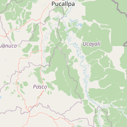
Yanachaga, Chemillén National Park landscape and geographic character

The landscape of Yanachaga–Chemillén National Park is defined by the dramatic topography of the Yanachaga mountain range, which rises steeply from the surrounding valleys to form a complex terrain of ridges, canyons, and forested slopes. Forest-covered mountains dominate the visual character of the park, with the canopy generally continuous except where high mountain grasslands break the vegetation cover at the highest elevations. Deep canyons cut through the range, creating steep-walled valleys that channel the numerous streams descending from the upper catchments. The terrain is notably rugged on both the eastern and western flanks of the Palcazu River, where slopes drop away sharply from the ridgelines. This combination of elevation change, aspect variation, and topographic complexity produces a highly heterogeneous landscape that supports diverse ecological communities across short distances.

Yanachaga, Chemillén National Park ecosystems, habitats, and plant life

The ecological character of Yanachaga–Chemillén reflects its position at the intersection of three major biogeographic systems: Amazonian lowland rainforests, Andean cloud forests, and high-altitude puna grasslands. This convergence creates an extraordinary diversity of habitats within the park's boundaries, ranging from premontane forests at lower elevations through mid-elevation cloud forests to paramo-like grasslands at the highest points. The forests are dominated by diverse tree species including Retrophyllum rospigliosii, Podocarpus oleifolius, and the economically valuable Cedrela odorata and Juglans neotropica. Palm species such as Euterpe precatoria and Oenocarpus bataua are common in lower-elevation areas, while the understory features species like Phytelephas macrocarpa. The park's status as a Pleistocene refuge means that these forests represent ancient ecosystems that persisted through the climatic upheavals of the Ice Age, allowing for the accumulation and preservation of species diversity over millennia.

Yanachaga, Chemillén National Park wildlife and species highlights

Yanachaga–Chemillén National Park supports a remarkable vertebrate fauna, with the bird community being particularly diverse, comprising 527 recorded species that represent the richest avifauna in the region. Notable bird species include the yellow-throated toucan, the Andean cock-of-the-rock with its brilliant orange plumage, and various species of mountain guans. The mammalian fauna includes apex predators such as the jaguar and puma, along with the distinctive spectacled bear, which is the only bear species native to South America. Other mammals present include the white-tailed deer, jaguarundi, ocelot, lowland paca, Northern pudu, and the common woolly monkey. The reptile community includes both Cuvier's dwarf caiman and spectacled caiman, while amphibian diversity includes the endemic frog Ctenophryne barbatula, which is known only from this protected area.

Yanachaga, Chemillén National Park conservation status and protection priorities

The conservation significance of Yanachaga–Chemillén National Park derives from its role as a Pleistocene refuge, a geographic area where forest ecosystems survived the climatic extremes of the Ice Age while surrounding regions transformed into grassland. This historical isolation allowed species to persist and diversify, creating the exceptional biological richness observed today. The park protects critical watersheds for the Palcazu, Huancabamba, and Pozuzo rivers, whose headwaters originate within the protected area. The presence of indigenous Yanesha communities within the buffer zone adds a cultural dimension to conservation efforts, as traditional land management practices have shaped the landscape over generations. The protection of this cloud forest environment also contributes to carbon sequestration and climate regulation, adding global significance to local conservation objectives.

Yanachaga, Chemillén National Park cultural meaning and human context

The cultural landscape surrounding Yanachaga–Chemillén National Park reflects a complex interplay of indigenous heritage, colonial settlement, and internal migration. The Yanesha (Amuesha) people represent the original inhabitants of the region, traditionally occupying the eastern flank of the Yanachaga mountain range within the Palcazu basin. European settlers, particularly those of Germanic origin, arrived during the colonial and post-colonial periods and concentrated in the Oxapampa-Pozuzo valley on the western flank of the range. Andean immigrants from the central highlands of Peru have also settled in the buffer zone, creating a culturally diverse population surrounding the park. This cultural complexity adds depth to the park's significance, as the protected area encompasses territories of importance to indigenous communities whose relationship with this landscape spans centuries.

Top sights and standout views in Yanachaga, Chemillén National Park

The extraordinary biodiversity of Yanachaga–Chemillén National Park makes it one of Peru's most significant protected areas for wildlife observation and ecological study. The park's 527 bird species create exceptional birdwatching opportunities, particularly for observing the Andean cock-of-the-rock and various trogon species. The presence of jaguar, puma, and spectacled bear offers the possibility of encountering South America's most iconic large mammals in their natural cloud forest habitat. The elevational gradient from 460 to 3,643 meters allows visitors to experience multiple ecosystems within a relatively short distance, from premontane forest trails to high-altitude grassland viewpoints. The park's Pleistocene refuge status provides a compelling ecological narrative for visitors interested in understanding how ancient forest ecosystems persisted through geological time.

Best time to visit Yanachaga, Chemillén National Park

The optimal time to visit Yanachaga–Chemillén National Park corresponds to the dry season in central Peru, typically from May through September, when precipitation is reduced and trail conditions are most favorable. During these months, cloud forest visibility improves and wildlife activity patterns become more predictable, enhancing observation opportunities. The wet season from October to April brings higher rainfall, which while creating lush forest conditions, can make trails slippery and some higher-elevation routes more difficult to access. Temperature varies significantly with elevation, with warm conditions in the lower valleys and cooler temperatures at higher elevations, so visitors should prepare for a range of conditions. The transition periods of late April and early October often offer a balance between favorable weather and reduced visitor numbers.

Park location guide

Geography guide, regional context, and park location map for Yanachaga, Chemillén National Park

Yanachaga, Chemillén National Park park geography, regions, and map view in Peru
Understand where Yanachaga, Chemillén National Park sits in Peru through a broader geographic reading of the surrounding landscape, nearby location context, and its mapped position within the national park landscape.

How Yanachaga, Chemillén National Park fits into Peru

Peru is a megadiverse country in western South America with a population of over 34 million. It spans three distinct geographic regions: the Pacific coastal desert in the west, the Andes mountains running north to south, and the Amazon rainforest in the east. The country has one of the longest histories of civilization in the world, tracing back to the Caral-Supe civilization of the 10th millennium BCE, and was home to the Inca Empire before Spanish colonization in the 16th century.

Wider geography shaping Yanachaga, Chemillén National Park in Peru

Peru is located in western South America along the Pacific coast. The country encompasses three major geographic regions: the coastal desert plains along the Pacific, the Andes mountain range extending from north to southeast, and the Amazon basin rainforest in the eastern interior. It shares borders with Ecuador and Colombia to the north, Brazil to the east, Bolivia to the southeast, and Chile to the south.

Map view of Yanachaga, Chemillén National Park

Use this park location map to pinpoint Yanachaga, Chemillén National Park in Peru, understand its exact geographic position, and read its mapped placement within the surrounding landscape more clearly.

Pigeon | © OpenStreetMap contributors

Location context for Yanachaga, Chemillén National Park

Pasco Region
Park atlas

Compare protected landscapes and trace their geographic spread across Peru's central cloud forest and mountain regions.

Explore Nearby National Parks and Protected Areas Surrounding Yanachaga–Chemillén National Park
Continue your exploration from Yanachaga–Chemillén National Park by browsing other national parks and protected areas located in Peru's Pasco Region and adjacent Andean ecosystems. Deepen your understanding of regional park geography, comparing diverse mountain forests, cloud forest biomes, and connected conservation landscapes.
National parkPeru

Sierra del Divisor National Park: Peru's Sacred Amazonian Protected Landmark

Explore dramatic mountain terrain and protected lowland rainforest.

Sierra del Divisor National Park in Peru is a vital protected area conserving over 1.35 million hectares of Amazon rainforest. Characterized by the unique Sierra del Divisor mountain range and the sacred pyramid peak of Cerro El Cono, the park offers a distinct landscape within the broader Amazon basin. As one of Peru's newer national parks, it represents a significant commitment to preserving critical biodiversity corridors and understanding the geographic context of protected lands in a region facing environmental pressures.

Area
13,544.8 km²
Established
2015
IUCN
II
National parkCajamarca Region

Cutervo National Park: Peru's Oldest National Park Atlas and Protected Landscape

Andean Montane Forests and Mapped Geography of a Pioneering Protected Area

As Peru's oldest national park, established in 1961, Cutervo National Park offers a unique glimpse into the protected geography of the northern Peruvian Andes. Located in the Cajamarca Region, it preserves diverse Andean montane forests and páramo grasslands across a significant elevation gradient from 1,550 to 3,500 meters. This page details the park's landscape, including its role as a headwater conservation area and its position within a critical South American ecoregion, providing rich context for geographic and protected-area exploration.

Area
82.14 km²
Established
1961
IUCN
II
National parkPeru

Bahuaja-Sonene National Park: A Major Amazon Frontier National Park in Peru's Geography

Explore its mapped protected landscape and diverse terrain.

Bahuaja-Sonene National Park is an extensive national park situated on the Amazon frontier in southern Peru, encompassing a crucial transition zone between lowland rainforest and higher-elevation forest ecosystems. Its diverse topography, from river valleys to mountainous slopes, creates varied natural landscapes. The park's protected boundaries are integral to the regional conservation strategy, offering a unique lens through which to study the mapped geography and ecological significance of this vast Amazonian protected area.

Area
10,914.2 km²
Established
1996
IUCN
II
National parkZamora Chinchipe

Yacurí National Park: Protected Andean Lakes and Volcanic Landscape in Zamora Chinchipe

Discover highland geography and the ancient Inca Trail.

Yacurí National Park is a key protected landscape in Ecuador's southern Andes, celebrated for its remarkable collection of over 46 high-altitude lakes set within dramatic volcanic terrain. Situated in Zamora Chinchipe province, the park preserves a vital stretch of the Inca Trail, complete with archaeological sites. This national park offers a rich exploration of Andean geography, páramo ecosystems, and significant cultural heritage, making it a cornerstone of the region's protected areas.

Area
431 km²
Established
2009
IUCN
II
National parkEcuador

Podocarpus National Park: Ecuador's Diverse National Park and Protected Landscape

Discover elfin forests, paramo, and over 100 lagoons.

Podocarpus National Park, situated in southeastern Ecuador, stands as a prime example of a protected natural area at a unique biogeographic crossroads. This national park spans dramatic elevational zones, from montane rain forests to high-elevation paramo ecosystems dotted with more than 100 lagoons, offering rich mapped landscape exploration. Its significance lies in the convergence of four distinct ecological systems, contributing to exceptional biodiversity and a rich tapestry of natural terrain.

Area
1,462.8 km²
Established
1982
IUCN
II
National parkPeru

Cerros de Amotape National Park: Peru's Protected Pacific Tropical Forest Atlas

Explore mapped boundaries and diverse terrain of this unique landscape.

Cerros de Amotape National Park stands as a significant protected area within Peru, meticulously preserving remnants of the Tumbes-Piura dry forests and Pacific tropical forests. Situated within the Cordillera de los Amotapes, the park features a dynamic landscape from riverine habitats to elevated mountain terrain. This park detail page offers an atlas-style view, focusing on its geographic context, mapped protected boundaries, and its importance as a conservation corridor for unique biodiversity.

Area
1,515.61 km²
Established
1975
IUCN
II
National parkLoreto Region

Yaguas National Park: A Vast Protected Amazonian Landscape in Peru's Loreto Region

Mapping unique transboundary conservation and tropical biodiversity.

Yaguas National Park represents a monumental addition to Peru's protected lands, safeguarding an immense area of Amazonian rainforest within the Loreto Region. Its designation as a national park underscores its ecological importance as part of a critical international conservation corridor. This page provides detailed geographic context, showcasing the park's mapped boundaries, its characteristic lowland tropical forest terrain, and its role in preserving the rich biodiversity of the Amazon basin.

Area
8,689 km²
Established
2018
IUCN
II
National parkAmazonas Department

Amacayacu National Natural Park: Amazonian Flooded Forest and Protected Landscape Atlas

Mapped protected area boundaries and regional geography in Amazonas, Colombia.

Discover the intricate landscape of Amacayacu National Natural Park, a key protected area within Colombia's Amazonas Department. This page offers detailed geographic context, focusing on its vast Amazonian rainforest, the dynamic Amazon River influence, and the unique ecology of its flooded forest terrain. Explore mapped park boundaries, key river systems like Tarapoto Lake, and the protected zones crucial for Amazon river dolphin and primate habitats, providing a rich atlas view of this vital natural reserve.

Area
2,935 km²
Established
1975
IUCN
II

Common questions about visiting, size, designation, and location context for Yanachaga, Chemillén National Park

Yanachaga, Chemillén National Park FAQs for park facts, access, geography, and protected area context
Find quick answers about Yanachaga, Chemillén National Park, including protected-area facts, park geography, trail and visitor context, and how the park fits into its surrounding country and regional landscape.
MoriAtlas Explorer

Continue Your Protected Areas Search Across the Global Atlas

Deepen your exploration by continuing the structured search for national parks and protected areas worldwide. Utilize the comprehensive filtering capabilities to compare different conservation landscapes and refine your understanding of global park geography. Discover more about the distribution and characteristics of protected natural areas.

Global natural geography