Mori Atlas logo
National parkBahuaja-Sonene National Park

Discover its mapped protected boundaries, diverse terrain, and unique Amazonian landscape.

Bahuaja-Sonene National Park: A Vast Amazon Frontier National Park in Peru

(Parque Nacional Bahuaja-Sonene)

Bahuaja-Sonene National Park represents a critical protected area on the Amazon frontier of southern Peru, spanning over a million hectares of varied tropical and subtropical forest. This vast national park protects a significant ecological transition zone, featuring a dramatic range of elevations from river terraces to steep mountain terrain. Understanding Bahuaja-Sonene National Park through its mapped geography and protected landscape identity reveals its importance within the South American atlas and the broader Madre de Dios conservation corridor.

Amazon rainforestTropical forest protected areaTransboundary parkLarge national parkAmazon wildlife habitatPeruvian protected area

Bahuaja-Sonene National Park

National park

Park overview

Structured park overview, official facts, and landscape profile for Bahuaja-Sonene National Park

Bahuaja-Sonene National Park park facts, protected area profile, and essential visitor context
Review the core facts for Bahuaja-Sonene National Park, including designation, size, terrain, visitor scale, habitats, and operating context in one park-focused overview.

About Bahuaja-Sonene National Park

Bahuaja-Sonene National Park represents one of the most significant protected areas in the Peruvian Amazon, established to conserve the biological diversity and ecological processes of the southeastern Amazon frontier. The park's location in the transition zone between the Amazon lowlands and the Andean foothills creates a unique mosaic of habitats, from alluvial floodplains along the major rivers to steep forested slopes and ridge systems. This topographic diversity supports a wide range of forest types and ecological communities, making the park important for maintaining connectivity between lowland and higher-elevation ecosystems.

The establishment of Bahuaja-Sonene reflected growing recognition in the 1990s of the need to protect the Madre de Dios region's extraordinary biodiversity while providing a framework for sustainable management of its natural resources. The park was created alongside the adjacent Tambopata National Reserve to form a complementary protected area network that could support both conservation and controlled sustainable use. The park's buffer zone includes areas of active sustainable development, where communities engage in activities compatible with conservation objectives. Management of the park focuses on maintaining ecological integrity while addressing the complex challenges of protecting a large, remote area bordering regions with significant development pressures.

Quick facts and research context for Bahuaja-Sonene National Park

Bahuaja-Sonene National Park is located in the Puno and Madre de Dios regions of southeastern Peru, with its nearest major settlement being Puerto Maldonado. The park occupies roughly 1.09 million hectares of Amazon forest and was established on July 17, 1996 under Peruvian law. Elevations within the park range from 500 meters in the lowland forest zones to approximately 2,450 meters in the higher terrain. Key rivers including the Heath, Tambopata, and Candamo flow through the park, providing critical aquatic habitats. The park is managed by SERNANP, Peru's national protected areas service, and shares its eastern border with Bolivia's Madidi National Park.

Park context

Deeper park guide and search-rich context for Bahuaja-Sonene National Park

Bahuaja-Sonene National Park history, landscape, wildlife, and travel context
Explore Bahuaja-Sonene National Park through its history, landscape character, ecosystems, wildlife, conservation priorities, cultural context, and seasonal travel timing in a structured park guide built for atlas discovery and search intent.

Why Bahuaja-Sonene National Park stands out

Bahuaja-Sonene is best known for its role as a vast Amazon frontier protected area that spans the transition between lowland tropical rainforest and higher-elevation forest ecosystems. The park is recognized for protecting significant populations of large Amazonian mammals including jaguar, puma, and the South American tapir, as well as the critically important habitat for the harpy eagle, one of the largest and most powerful raptors in the Americas. The park also protects crucial watersheds for rivers that flow into the Madre de Dios basin, and its transboundary position linking it with Madidi National Park makes it a cornerstone of regional conservation strategy.

Bahuaja-Sonene National Park history and protected-area timeline

Bahuaja-Sonene National Park was established on July 17, 1996, through Peruvian legislation that designated the area as a national park with IUCN Category II protection. The creation of the park was part of a broader expansion of Peru's protected area system during the 1990s, responding to both international conservation priorities and domestic concerns about preserving the country's Amazon biodiversity. The park was carved out of a larger landscape that had previously included various forms of temporary protection status, reflecting the complex administrative history of land use planning in the Madre de Dios region.

Management authority for the park rests with SERNANP, the Servicio Nacional de Áreas Naturales Protegidas por el Estado, Peru's national protected areas service. The establishment process involved coordination between national authorities and regional governments in both Puno and Madre de Dios regions, addressing the transboundary nature of the protected area and its connections to Bolivia's protected area system. The park's creation was supported by the recognition that the region contained exceptional biodiversity value that warranted formal protection, while also acknowledging the presence of local communities and the need to balance conservation with sustainable development considerations.

Bahuaja-Sonene National Park landscape and geographic character

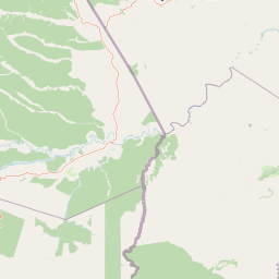
The landscape of Bahuaja-Sonene National Park is characterized by a diverse topography that includes river terraces, rolling hills, and steep mountainous terrain. The elevation gradient from approximately 500 meters along the major river valleys to over 2,400 meters in the park's higher zones creates a dramatic variation in landforms and visual character. The Heath River, Tambopata River, and Candamo River are the primary watercourses traversing the park, each carving their way through the forest and creating varied riparian environments. The river valleys feature fertile alluvial soils and periodically flooded wetlands, while the intervening slopes support dense forest cover that becomes progressively more stunted and moss-draped at higher elevations.

The visual character of the park shifts dramatically across this elevation range, from the tall, humid lowland rainforest with its massive emergent trees to the more open canopy and thinner-statured forest found in the higher terrain. The park's western portions, closer to the Andean foothills, tend toward steeper terrain and more broken relief, while the eastern areas transitioning toward Bolivia feature more gently undulating land. This topographic complexity creates numerous microclimates and habitat variations that contribute to the park's ecological diversity.

Bahuaja-Sonene National Park ecosystems, habitats, and plant life

The ecological character of Bahuaja-Sonene reflects its position in the Amazon biodiversity hotspot, supporting extraordinarily diverse plant and animal communities across its elevational range. The lowland forests feature massive Brazil nut trees, ceibas, and a dense understory of palms and broad-leaved species. The park contains representatives of numerous Neotropical tree families, including Virola, Cedrela, Spondias, and Ficus, creating forest stands of remarkable structural complexity. The riparian zones along the major rivers support distinct communities adapted to periodic flooding, while the higher-elevation forests have different species assemblages adapted to cooler, moister conditions.

The forest ecosystems of the park function as critical habitat corridors connecting lowland Amazonian biodiversity with higher-elevation Andean ecosystems. This connectivity is ecologically significant because it allows species to migrate and maintain genetic exchange across elevational gradients in response to climate fluctuations. The park's location relative to the Tambopata-Candamo river system creates additional ecological value, as these waterways serve as biological highways for numerous species and connect the protected area to the broader Madre de Dios landscape.

Bahuaja-Sonene National Park wildlife and species highlights

The wildlife communities of Bahuaja-Sonene include numerous species of conservation significance, reflecting the park's role as a core protected area within the Amazon basin. The park supports important populations of large predators including jaguar, puma, and the lesser-known bush dog, representing the full suite of Neotropical felids and canids. The South American tapir and marsh deer are among the larger herbivores present, while the giant otter maintains populations along the major river systems. The maned wolf, another distinctive South American canid, inhabits the more open forest zones within the park.

The avifauna of the park is particularly notable, with the harpy eagle representing the most iconic resident species. This powerful raptor nests in the emergent trees of the lowland forest and hunts primarily in the canopy, making the park's large trees essential for its conservation. The park also supports populations of macaws, including both blue-and-yellow macaw and scarlet macaw, which are spectacular elements of the forest bird community. Toucans, cracids such as the horned curassow, and numerous waterbirds complete the diverse avian community. The river systems provide critical habitat for species like the Neotropic cormorant and jabiru, while smaller birds including hummingbirds and the swallow-tailed hummingbird add to the park's ornithological richness.

Bahuaja-Sonene National Park conservation status and protection priorities

Bahuaja-Sonene National Park serves as a cornerstone of conservation strategy in the Peru-Bolivia border region, functioning as part of a transboundary protected area network that includes Madidi National Park in Bolivia. This network represents one of the most significant conservation achievements in the Amazon, protecting millions of hectares of contiguous forest and maintaining ecological connectivity across an international boundary. The park's large size and relative isolation have helped preserve relatively intact ecosystems, though management challenges remain significant given the remote location and limited infrastructure.

The conservation value of the park is enhanced by its elevational range, which allows it to protect both lowland Amazonian species and those adapted to higher-elevation conditions. This topographic diversity means the park can serve as a refuge for species shifting their ranges in response to climate change, providing resilience to the broader regional ecosystem. The park also protects critical watersheds that feed the Madre de Dios river system, with implications for both biodiversity and downstream water resources. However, the park faces ongoing pressures from illegal logging, mining activities, and the broader development context of the Madre de Dios region, requiring continued vigilance and management investment.

Bahuaja-Sonene National Park cultural meaning and human context

The cultural context of Bahuaja-Sonene National Park is closely tied to the history of human settlement in the Madre de Dios region, though the park itself is primarily valued for its ecological rather than cultural heritage. The park's buffer zones include areas where indigenous and settler communities maintain traditional livelihoods that intersect with conservation objectives. The region's history involves complex interactions between indigenous peoples, rubber extractors, and later settlers, creating a cultural landscape that overlays the ecological systems now protected within the park boundaries.

The park's position on the Peru-Bolivia border also connects it to broader regional dynamics of indigenous land use and territorial management that cross international boundaries. These transboundary cultural connections reflect the historical movement of peoples and the continued presence of indigenous communities on both sides of the border. Management approaches in the park and adjacent protected areas increasingly recognize the importance of engaging with these communities and incorporating traditional knowledge into conservation planning.

Top sights and standout views in Bahuaja-Sonene National Park

Bahuaja-Sonene stands out as one of Peru's largest and most ecologically significant national parks, protecting a critical transition zone between Amazon lowlands and higher-elevation forest. The park's transboundary connection to Bolivia's Madidi National Park creates a protected area complex of continental importance, safeguarding one of the most biodiversity-rich regions in the Amazon. The presence of harpy eagle, jaguar, and giant otter populations makes the park a priority site for large mammal and raptorial bird conservation. The elevational range from 500 to 2,450 meters supports extraordinary habitat diversity within a single protected area, while the major river systems provide additional ecological and visual character.

Best time to visit Bahuaja-Sonene National Park

The optimal time to experience Bahuaja-Sonene National Park is during the dry season, typically from May through October, when reduced rainfall makes wildlife more accessible along river corridors and trail conditions are more favorable. The wet season, from November to April, brings more frequent rainfall that can restrict movement through the forest and along waterways, though it also creates dramatic displays of lush vegetation and filled rivers. The shoulder seasons of April-May and October-November offer transitional conditions that may combine advantages of both periods, though they can also present variable weather patterns.

Park location guide

Geography guide, regional context, and park location map for Bahuaja-Sonene National Park

Bahuaja-Sonene National Park park geography, regions, and map view in Peru
Understand where Bahuaja-Sonene National Park sits in Peru through a broader geographic reading of the surrounding landscape, nearby location context, and its mapped position within the national park landscape.

How Bahuaja-Sonene National Park fits into Peru

Peru is a megadiverse country in western South America with a population of over 34 million. It spans three distinct geographic regions: the Pacific coastal desert in the west, the Andes mountains running north to south, and the Amazon rainforest in the east. The country has one of the longest histories of civilization in the world, tracing back to the Caral-Supe civilization of the 10th millennium BCE, and was home to the Inca Empire before Spanish colonization in the 16th century.

Wider geography shaping Bahuaja-Sonene National Park in Peru

Peru is located in western South America along the Pacific coast. The country encompasses three major geographic regions: the coastal desert plains along the Pacific, the Andes mountain range extending from north to southeast, and the Amazon basin rainforest in the eastern interior. It shares borders with Ecuador and Colombia to the north, Brazil to the east, Bolivia to the southeast, and Chile to the south.

Map view of Bahuaja-Sonene National Park

Use this park location map to pinpoint Bahuaja-Sonene National Park in Peru, understand its exact geographic position, and read its mapped placement within the surrounding landscape more clearly.

Pigeon | © OpenStreetMap contributors

Location context for Bahuaja-Sonene National Park

Madre de Dios RegionPuno Region
Park atlas

Trace the mapped geography of Peru's vast Amazon frontier, exploring connected protected areas and their diverse landscapes.

Compare National Parks and Protected Areas Near Bahuaja-Sonene National Park and its Regional Landscapes
Explore other national parks and protected areas neighboring Bahuaja-Sonene National Park, tracing Peru's Amazon frontier and its critical transboundary conservation landscapes. Compare these diverse protected zones to understand their regional geographic context and their collective contribution to the Amazon's vast biodiversity and unique forest ecosystems.
National parkArica-Parinacota Region

Lauca National Park: Mapped Volcanic Terrain and High-Altitude Protected Landscapes

Explore the geography of this Arica-Parinacota Region national park.

Lauca National Park is a significant protected area in Chile's Arica-Parinacota Region, offering a unique glimpse into the dramatic geography of the high Andes. Its landscape is characterized by imposing volcanic formations, including Parinacota Volcano, and expansive altiplano terrain. This national park serves as a vital protected landscape, inviting detailed exploration of its mapped boundaries, diverse ecosystems, and remarkable natural features for those interested in geographic context and conservation.

Area
1,379 km²
Established
1970
IUCN
II
National parkPotosí Department

Torotoro National Park: Paleontology and Karst Landscape Exploration in Bolivia

Discover prehistoric footprints within dramatic Andean canyon geography.

Torotoro National Park in the Potosí Department is a protected area distinguished by its rich paleontological significance and unique semi-arid mountain terrain. Featuring dramatic canyon systems plunging hundreds of meters deep, the park showcases thousands of Cretaceous dinosaur footprints alongside its complex karst topography, complete with caves and sinkholes, offering a profound glimpse into both ancient life and sculpted natural geography.

Area
165 km²
Established
1989
IUCN
II
National parkPasco Region

Yanachaga, Chemillén National Park: Protected Area in Pasco Region, Peru

Mapped terrain, Pleistocene refuge, and rich biodiversity.

Yanachaga, Chemillén National Park, a national park situated in Peru's Pasco Region, preserves over 122,000 hectares of mountainous cloud forest and rainforest ecosystems. Its landscape is characterized by dramatic canyons and steep forested slopes, creating significant altitudinal variation from 460 to 3,643 meters. Recognized as a Pleistocene refuge, the park shelters ancient forest remnants and harbors exceptional biodiversity, including hundreds of bird species and iconic mammals, offering rich context for geographic and protected-area exploration.

Area
1,220 km²
Established
1986
IUCN
II
National parkPeru

Sierra del Divisor National Park: Peru's Sacred Amazonian Protected Landmark

Explore dramatic mountain terrain and protected lowland rainforest.

Sierra del Divisor National Park in Peru is a vital protected area conserving over 1.35 million hectares of Amazon rainforest. Characterized by the unique Sierra del Divisor mountain range and the sacred pyramid peak of Cerro El Cono, the park offers a distinct landscape within the broader Amazon basin. As one of Peru's newer national parks, it represents a significant commitment to preserving critical biodiversity corridors and understanding the geographic context of protected lands in a region facing environmental pressures.

Area
13,544.8 km²
Established
2015
IUCN
II
National parkChuquisaca Department

Iñao National Park and Integrated Management Natural Area: Bolivia National Park and Protected Landscape

Explore the Serranía del Iñao's geography and conservation role.

Iñao National Park and Integrated Management Natural Area is a protected territory located within Chuquisaca Department, Bolivia, centered on the prominent Serranía del Iñao mountain range. This page offers detailed geographic context and an atlas perspective on the park's landscape, its role as a national park, and its contribution to regional conservation efforts in the Andean foothills.

Area
2,630.9 km²
Established
2004
IUCN
II
National parkAmazonas Department

Amacayacu National Natural Park: Amazonian Flooded Forest and Protected Landscape Atlas

Mapped protected area boundaries and regional geography in Amazonas, Colombia.

Discover the intricate landscape of Amacayacu National Natural Park, a key protected area within Colombia's Amazonas Department. This page offers detailed geographic context, focusing on its vast Amazonian rainforest, the dynamic Amazon River influence, and the unique ecology of its flooded forest terrain. Explore mapped park boundaries, key river systems like Tarapoto Lake, and the protected zones crucial for Amazon river dolphin and primate habitats, providing a rich atlas view of this vital natural reserve.

Area
2,935 km²
Established
1975
IUCN
II
Protected areaGran Chaco Province

Aguaragüe National Park and Integrated Management Natural Area: Bolivia's Easternmost Sub-Andean Protected Landscape

Explore its mapped mountain geography and ecological diversity.

Aguaragüe National Park and Integrated Management Natural Area is a crucial protected area in Bolivia's Gran Chaco Province, defined by the Serranía del Aguaragüe mountain range. This landscape offers a unique opportunity to explore a geographic transition zone where Southern Andean Yungas montane forests converge with Dry Chaco ecosystems. The park's protected boundaries encompass a rugged mountain backbone rising from the lowlands, representing a vital segment of Bolivia's Sub-Andean geography and protected natural areas.

Area
1,083.07 km²
Established
2000
IUCN
II
National parkLoreto Region

Yaguas National Park: A Vast Protected Amazonian Landscape in Peru's Loreto Region

Mapping unique transboundary conservation and tropical biodiversity.

Yaguas National Park represents a monumental addition to Peru's protected lands, safeguarding an immense area of Amazonian rainforest within the Loreto Region. Its designation as a national park underscores its ecological importance as part of a critical international conservation corridor. This page provides detailed geographic context, showcasing the park's mapped boundaries, its characteristic lowland tropical forest terrain, and its role in preserving the rich biodiversity of the Amazon basin.

Area
8,689 km²
Established
2018
IUCN
II

Common questions about visiting, size, designation, and location context for Bahuaja-Sonene National Park

Bahuaja-Sonene National Park FAQs for park facts, access, geography, and protected area context
Find quick answers about Bahuaja-Sonene National Park, including protected-area facts, park geography, trail and visitor context, and how the park fits into its surrounding country and regional landscape.
MoriAtlas Explorer

Continue Your Protected Areas Search Across the Global Atlas

Deepen your exploration by continuing the structured search for national parks and protected areas worldwide. Utilize the comprehensive filtering capabilities to compare different conservation landscapes and refine your understanding of global park geography. Discover more about the distribution and characteristics of protected natural areas.

Global natural geography