Why Aguaragüe National Park and Integrated Management Natural Area stands out
Aguaragüe is best known for protecting the easternmost Sub-Andean mountain range in Bolivia, a dramatic landscape of forested ridges that rises sharply from the surrounding Chaco lowlands. The park is notable for spanning a critical ecological transition zone, where Southern Andean Yungas montane forests meet the Dry Chaco, creating a diversity of habitats within a relatively compact protected area. The Serranía del Aguaragüe itself forms a biogeographic island of cloud forest and montane woodland surrounded by arid lowland ecosystems, making it especially significant for conservation. The protected area's dual designation combining national park strict protection with integrated management natural area zoning also represents a thoughtful approach to balancing conservation with sustainable use in this mountainous frontier region.
Aguaragüe National Park and Integrated Management Natural Area history and protected-area timeline
Aguaragüe National Park and Integrated Management Natural Area was established on April 20, 2000, through Bolivia's national protected areas framework. The creation of this protected area reflected the growing commitment in the late 1990s and early 2000s to expand Bolivia's network of national parks and protected territories. The selection of the Serranía del Aguaragüe for protection recognized the ecological distinctiveness of this Sub-Andean range and its importance as a biodiversity corridor. Administration of the protected area was assigned to the Servicio Nacional de Áreas Protegidas (SERNAP), Bolivia's national protected areas service. The designation of portions of the area as an Integrated Management Natural Area rather than strict national park allowed for the recognition of existing land uses and community presence while establishing conservation zoning that permits sustainable activities in designated zones.
Aguaragüe National Park and Integrated Management Natural Area landscape and geographic character
The landscape of Aguaragüe National Park is dominated by the Serranía del Aguaragüe, a prominent north-south mountain range that forms the easternmost major Sub-Andean uplift in Bolivia. The range rises abruptly from the surrounding Chaco lowlands, creating dramatic topography with steep slopes, narrow valleys, and ridgeline crests. The elevation gradient from the lower foothills to the higher peaks creates significant variation in terrain, vegetation, and microclimate. Rock outcrops and cliff faces characterize portions of the steeper terrain, while the valleys below support more developed soils and denser forest cover. The range acts as a barrier to moisture-laden winds from the east, creating moist conditions on its upper slopes that support cloud forest development, while the western rain shadow effects contribute to the transitional nature of the lower elevation vegetation.
Aguaragüe National Park and Integrated Management Natural Area ecosystems, habitats, and plant life
The ecological character of Aguaragüe is defined by its position at the intersection of two major Neotropical biomes. The Southern Andean Yungas ecoregion dominates the higher elevations and eastern-facing slopes, characterized by montane evergreen forests, cloud forest formations, and high biodiversity. These forests receive significant moisture from easterly winds and support a rich assemblage of plant and animal species adapted to humid mountain conditions. In the lower portions and western slopes, the Dry Chaco ecoregion extends into the park, bringing drier conditions, thorn forest, and xerophytic vegetation. This blending of Yungas and Dry Chaco ecosystems within a single protected area creates unusual ecological diversity and provides habitat for species from both biomes. The montane forests of the Yungas are recognized as a biodiversity hotspot, and the protection of these forests within Aguaragüe contributes to the conservation of this threatened ecosystem.
Aguaragüe National Park and Integrated Management Natural Area wildlife and species highlights
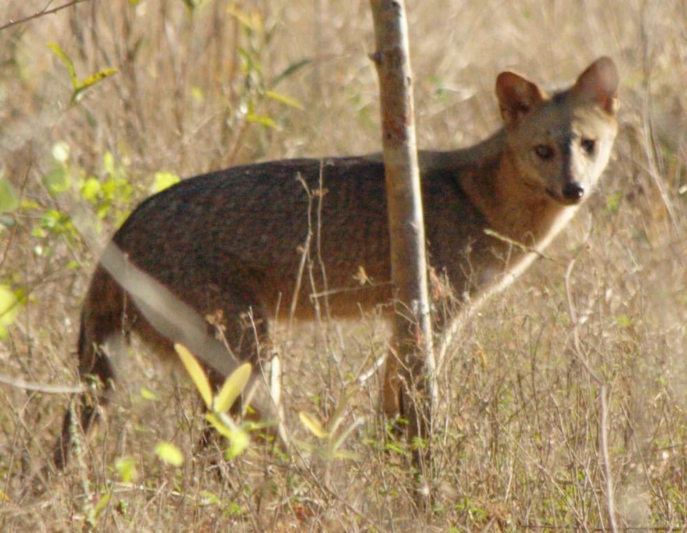
The wildlife of Aguaragüe reflects the park's position at the ecological crossroads between Andean and Chaco faunas. The montane forest environments support species characteristic of the Yungas, while the lower elevation woodlands contain species more typical of the Dry Chaco. The presence of the crab-eating fox (Cerdocyon thousand) in the park is documented through photographic records, indicating that this canid species occupies the transitional environments within the protected area. The diverse habitats created by the elevation gradient and the blend of forest types support a range of vertebrate species, though detailed species inventories for the park are limited in the available source material. The protected status of the Serranía del Aguaragüe provides important habitat continuity for species requiring intact forest environments along the Sub-Andean corridor.
Aguaragüe National Park and Integrated Management Natural Area conservation status and protection priorities
Aguaragüe National Park and Integrated Management Natural Area contributes significantly to Bolivia's protected areas network by conserving a unique mountain ecosystem that would otherwise face pressure from logging, agriculture, and grazing. The protection of the Serranía del Aguaragüe preserves critical habitat within the Southern Andean Yungas, an ecoregion recognized for its high endemism and conservation importance. The integrated management approach applied to much of the protected area represents a practical conservation model that attempts to balance strict protection with sustainable use, recognizing that many mountainous landscapes have historical human presence. The park's position at the eastern edge of the Sub-Andean system means it serves as an important conservation node in the broader network of protected areas that follow the Andean mountain chain, supporting connectivity for species that require elevational migration or expanded ranges.
Aguaragüe National Park and Integrated Management Natural Area cultural meaning and human context
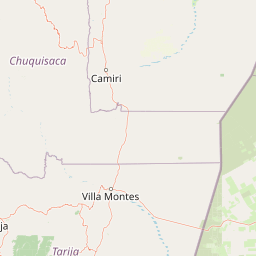
The Aguaragüe protected area exists within a region of Tarija Department that has historical human presence and ongoing land use. The integrated management natural area designation within the park reflects the practical reality of community presence and traditional land use practices in portions of the territory. The Gran Chaco Province where the park is located has been inhabited by various communities whose livelihoods have historically depended on the surrounding lands. While the national park zone receives stricter protection, the broader protected area framework attempts to accommodate both conservation objectives and sustainable community activities.
Top sights and standout views in Aguaragüe National Park and Integrated Management Natural Area
The defining highlight of Aguaragüe is its dramatic mountain landscape rising from the Chaco lowlands, protecting the easternmost major Sub-Andean range in Bolivia. The park's unique ecological position at the transition between Southern Andean Yungas montane forests and Dry Chaco creates unusual biodiversity within a single protected area. The dual-zoned approach combining strict national park protection with integrated management natural area provides a model for balancing conservation with sustainable use. The Serranía del Aguaragüe forms a biogeographic island of humid forest surrounded by arid lowlands, making it especially significant for endemic species and ecological study.
Best time to visit Aguaragüe National Park and Integrated Management Natural Area
The best time to visit Aguaragüe National Park would typically be during the dry season months from May to October, when visitor access is easier and trail conditions are more favorable. The park's subtropical mountain environment experiences wet and dry seasons, with the wet season from November to April bringing heavier rainfall that can affect road access and trail usability. Visiting during the dry season offers clearer views from the ridgelines and more comfortable conditions for hiking and exploration. The higher elevations may experience cooler temperatures year-round due to the mountain environment.