Mori Atlas logo
National parkChaco National Park

Discover mapped boundaries and terrain within the Eastern Chaco's unique protected ecosystem.

Chaco National Park: Argentine Protected Landscape and Regional Geography

(Parque Nacional Chaco)

Chaco National Park represents a vital protected area within Argentina's Chaco Province, preserving a significant sample of the Eastern Chaco ecosystem. This national park features a warm, lowland terrain characterized by diverse landscapes including scrubland, savanna, wetlands, and small lake systems, covering 150 square kilometers. It stands as a critical conservation site for the iconic quebracho trees and boasts remarkable biodiversity across its varied natural environments, offering a distinct focus for atlas-driven geographic discovery.

National ParkArgentinaChaco ProvinceGran ChacoQuebracho ForestsWetlands

Chaco National Park

National park

Park overview

Structured park overview, official facts, and landscape profile for Chaco National Park

Chaco National Park park facts, protected area profile, and essential visitor context
Review the core facts for Chaco National Park, including designation, size, terrain, visitor scale, habitats, and operating context in one park-focused overview.

About Chaco National Park

Chaco National Park represents Argentina's commitment to preserving the Gran Chaco ecosystem, one of South America's largest and most ecologically significant forest regions. The park occupies a transitional zone in northeastern Argentina where the humid Chaco transitions toward more arid western conditions. Its 150-square-kilometer extent, while modest compared to the broader ecosystem, provides critical protection for forest types that have been severely reduced by agricultural expansion and logging. The park's creation in 1954 aimed to safeguard representative samples of the Eastern Chaco's unique combination of tall forests, savanna corridors, and wetland systems. These lowlands experience pronounced seasonal variation, with summer bringing substantial rainfall that transforms marshy areas into extensive wetland complexes while the dry season creates more open savanna conditions. The quebracho forests that give the ecosystem its name once dominated vast areas of Santa Fe Province and the western half of Chaco, but intensive exploitation for timber and tannin extraction over approximately a century devastated these stands. The park preserves what remains of this historically significant forest type, offering visitors and researchers glimpses of an ecosystem that shaped regional history and economy.

Quick facts and research context for Chaco National Park

Chaco National Park is situated in the province of Chaco in northeastern Argentina, representing one of the southernmost extensions of the Gran Chaco ecosystem. The park was established in 1954 under Argentina's national parks administration and holds IUCN Category II protection status. The landscape features warm lowlands receiving annual summer rainfall between 750 and 1,300 millimeters, supporting diverse habitats ranging from dry scrubland to permanent wetlands. The park protects remnants of quebracho forests that were once widespread across the region before extensive logging operations depleted them.

Park context

Deeper park guide and search-rich context for Chaco National Park

Chaco National Park history, landscape, wildlife, and travel context
Explore Chaco National Park through its history, landscape character, ecosystems, wildlife, conservation priorities, cultural context, and seasonal travel timing in a structured park guide built for atlas discovery and search intent.

Why Chaco National Park stands out

Chaco National Park is best known for its protection of the Eastern Chaco's quebracho forests, particularly the quebracho colorado chaqueño (Schinopsis balansae), a tree species renowned for its exceptionally hard wood and high tannin content. The park preserves multiple distinct environments including scrubland dominated by quebracho species, savanna habitats, swamp areas, and small lagoon systems. Its wildlife includes notable species such as cougars, yacare caimans, capybaras, black howler monkeys, and South American tapirs, alongside more than 340 recorded bird species. The presence of Mocoví and Toba indigenous communities within the park adds significant cultural dimension to its conservation value.

Chaco National Park history and protected-area timeline

Chaco National Park was established in 1954 through the Argentine national parks administration as part of a broader effort to protect representative samples of the country's diverse ecosystems. The park was created specifically to preserve remaining stands of quebracho colorado chaqueño (Schinopsis balansae), a species whose valuable timber and tannin-rich bark had made it a primary target of the regional logging industry since the late 19th century. The exploitation of quebracho trees drove much of the economic development in the provinces of Santa Fe, Chaco, and Corrientes, with the dense wood used for railway sleepers, construction, and charcoal production while the bark supplied tannins for the leather industry. By the mid-20th century, the once-extensive quebracho forests had been dramatically reduced, motivating the creation of protected areas to preserve what remained. The park's establishment also recognized the importance of the broader Chaco ecosystem with its diverse habitats supporting both wildlife and indigenous communities.

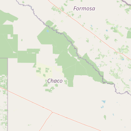
Chaco National Park landscape and geographic character

The physical landscape of Chaco National Park exemplifies the characteristic terrain of the Eastern Chaco region, featuring warm lowlands with minimal topographic variation. The terrain consists primarily of flat or gently undulating plains with scattered elevated areas that provide subtle relief across the otherwise uniform elevation. The park contains several distinct landscape zones: extensive scrubland areas dominated by thorny vegetation and hardwood trees, open savanna zones with scattered canopy trees and dense grassland understory, permanent and seasonal swamp regions where water accumulates during the wet season, and small lagoon basins that retain water throughout the year. The Río Negro (Black River) flows through the park, providing a permanent watercourse that supports riparian forest communities distinct from the surrounding terrain. The overall impression is of a green, humid wilderness where dense forest patches alternate with more open savanna and wetland areas, creating a mosaic landscape typical of the Chaco ecosystem.

Chaco National Park ecosystems, habitats, and plant life

The ecological character of Chaco National Park reflects the humid Chaco ecoregion, one of the most biodiverse forest ecosystems in South America. The park's vegetation includes several distinct forest types: quebracho-dominated forest where red quebracho (Schinopsis lorentzii) and white quebracho (Aspidosperma quebracho-blanco) form the canopy, algarrobo (Prosopis alba) woodlands in wetter areas, and lapacho (Tabebuia species) occurring in scattered locations. These forest types support complex ecological communities adapted to the pronounced seasonal rainfall patterns, with wet summers bringing abundant moisture and dry winters creating more challenging conditions. The wetlands and lagoons represent particularly important habitat components, providing permanent water sources that support aquatic species and attract wildlife during the dry season. The scrubland environments contain specialized plant communities adapted to periodic disturbance and drier conditions within the broader humid Chaco matrix. This ecological diversity supports the park's significance as a biodiversity refuge in a region where agricultural conversion has dramatically reduced natural habitat.

Chaco National Park wildlife and species highlights

Chaco National Park supports a rich fauna assemblage reflecting the diversity of the Gran Chaco ecosystem. The park's large predators include cougars (Puma concolor), which hunt prey species throughout the forest and savanna habitats. The wetland environments provide crucial habitat for yacare caimans (Caiman yacare) and capybaras (Hydrochoerus hydrochaeris), South America's largest rodent, both commonly observed in and around the park's lagoon systems. Additional mammalian species include armadillos, South American tapirs (Tapirus terrestris), and plains viscachas (Lagostomus maximus). The black howler monkey (Alouatta caraya) inhabits the forest canopy, its distinctive calls echoing through the woodland. Bird diversity is particularly remarkable, with more than 340 species recorded in the park, reflecting the varied habitats from forest interiors to wetland margins and savanna clearings. This avian richness includes both resident species and migratory visitors that utilize the park's habitats seasonally.

Chaco National Park conservation status and protection priorities

Chaco National Park plays a vital conservation role as one of the few protected areas preserving the Eastern Chaco ecosystem. The park was established specifically to protect remaining quebracho forests that had been severely depleted by a century of intensive exploitation for timber and tannin extraction. This conservation focus remains central to the park's purpose, as the quebracho colorado chaqueño represents a keystone species whose forest type once dominated vast areas of northeastern Argentina. Beyond protecting forest habitats, the park preserves the entire mosaic of Chaco environments including savanna, scrubland, and wetland systems, each supporting distinct ecological communities. The presence of indigenous communities (Mocoví and Toba) within the park adds cultural conservation dimensions, recognizing the long human presence in this ecosystem and the traditional relationships between local peoples and the land. The IUCN Category II designation reflects the park's primary objective of preserving natural ecosystems while allowing sustainable visitor use.

Chaco National Park cultural meaning and human context

Chaco National Park contains living indigenous communities of the Mocoví and Toba peoples, whose ancestors inhabited the Chaco region long before the establishment of protected areas. These communities maintain cultural practices and traditional relationships with the park's landscapes, using natural resources in ways that reflect generations of accumulated knowledge about the local environment. The presence of indigenous peoples within a national park context presents both opportunities and challenges for park management, requiring balance between conservation objectives and recognition of indigenous rights and traditional land use. The Mocoví and Toba communities represent the human dimension of the Chaco ecosystem, adding cultural depth to the park's natural values. Their traditional activities may include hunting, gathering, and agricultural practices that have shaped, and been shaped by, the distinctive Chaco environment over centuries.

Top sights and standout views in Chaco National Park

The park offers visitors experiences centered on its distinctive Chaco environments: exploring quebracho forest trails where massive trees with their characteristic rough bark dominate the canopy, observing wildlife at lagoon viewpoints where caimans and capybaras congregate, and walking through savanna landscapes where seasonal changes create shifting vistas. The Río Negro provides opportunities for river observation from the suspension bridge referenced in park documentation. The visitor center and camping area offer base facilities for exploring the network of trails that traverse different habitat types. Birdwatchers find exceptional opportunities among the 340-plus species, while visitors interested in cultural heritage can engage with the park's indigenous community context.

Best time to visit Chaco National Park

The optimal visiting period for Chaco National Park generally corresponds to the cooler dry season from April through October, when lower temperatures make outdoor exploration more comfortable and wildlife becomes more concentrated around remaining water sources. The wet summer months (November through March) bring higher temperatures and more humid conditions, though this period also triggers landscape changes as rainfall fills wetlands and transforms the savanna into greener terrain. Wildlife viewing improves during the dry season as animals concentrate around permanent water sources, while bird activity remains high year-round. Visitors should be prepared for the Chaco's pronounced seasonal contrasts, with summer heat and potential flooding in low-lying areas versus winter's more visitor-friendly conditions.

Park location guide

Geography guide, regional context, and park location map for Chaco National Park

Chaco National Park park geography, regions, and map view in Argentina
Understand where Chaco National Park sits in Argentina through a broader geographic reading of the surrounding landscape, nearby location context, and its mapped position within the national park landscape.

How Chaco National Park fits into Argentina

Argentina is a federal republic located in the southern cone of South America, bordering Chile, Bolivia, Paraguay, Brazil, Uruguay, and the Atlantic Ocean. With an area of 2,780,085 km², it is the second-largest country in South America and the eighth-largest globally. The capital and largest city is Buenos Aires, and the official language is Spanish. The country claims sovereignty over the Falkland Islands, South Georgia and the South Sandwich Islands, and a portion of Antarctica.

Wider geography shaping Chaco National Park in Argentina

Argentina occupies the southern portion of South America, sharing the Southern Cone region with Chile to the west. The country borders Bolivia and Paraguay to the north, Brazil to the northeast, Uruguay and the South Atlantic Ocean to the east, and the Drake Passage to the south. The Andes mountain range runs along the western border, while the Pampas plains dominate the central region. Argentina also claims territories in Antarctica.

Map view of Chaco National Park

Use this park location map to pinpoint Chaco National Park in Argentina, understand its exact geographic position, and read its mapped placement within the surrounding landscape more clearly.

Pigeon | © OpenStreetMap contributors

Location context for Chaco National Park

Chaco Province
Park atlas

Compare surrounding Gran Chaco landscapes, mapped geography, and diverse regional protected areas.

Discover Related National Parks and Protected Areas Near Chaco National Park
After exploring Chaco National Park, browse other national parks and protected areas across Argentina's Chaco region and adjacent lowland terrain. Explore how these diverse conservation landscapes connect geographically and contribute to broader protected area coverage.
National parkCorrientes Province

Mburucuyá National Park: National Park in Corrientes Province, Argentina

Iconic yatay palm savannas and diverse wetland ecosystems.

As a key national park within Argentina's Corrientes Province, Mburucuyá National Park offers a unique atlas-scale view of ecological convergence. It preserves expansive yatay palm savannas, critical wetland habitats within the Iberá Wetlands, and lush subtropical forests. The park's boundaries define an area where the Humid Chaco, Espinal, and Selva Paranaense biomes meet, creating a landscape of exceptional biodiversity and geographic significance for regional conservation and mapped exploration.

Area
176 km²
Established
2001
IUCN
II
National parkSantiago del Estero Province

Copo National Park: A Vital Dry Chaco Protected Landscape in Argentina

Explore its mapped boundaries and endemic forest ecosystems.

Copo National Park represents a significant conservation effort within Santiago del Estero Province, protecting a representative segment of the Dry Chaco biome. This national park preserves the iconic quebracho scrubland, a habitat that has been drastically reduced province-wide, serving as a critical refuge for endangered species like the jaguar and maned wolf. The park's landscape features warm climate conditions and characteristic forest formations dominated by the Santiago red quebracho, offering a unique opportunity to study and appreciate a vital, yet vulnerable, regional ecosystem. Its protected status underscores its importance for understanding Argentine protected areas and landscape ecology.

Area
1,181.18 km²
Established
2000
IUCN
II
National parkParaguay

Ypoá National Park: Paraguay's Protected Wetland Landscape and Lake Ecosystem

Explore mapped boundaries and significant bird habitats in the Ñeembucú region.

Ypoá National Park is a critical protected area in Paraguay, renowned for its extensive wetland ecosystems dominated by Lake Ypoá. This national park encompasses a rich mosaic of marshlands, riparian forests, and aquatic vegetation, making it a significant habitat for numerous bird species, including several rare and endemic types. Its designation as a Ramsar Wetland underscores its ecological importance, offering a unique lens for understanding landscape context and protected-area geography within South America.

Area
1,000 km²
Established
1992
IUCN
II
National parkFormosa Province

Río Pilcomayo National Park: Protected Humid Chaco Wetland Landscape & Geography

Explore mapped boundaries and unique floodplain terrain in Formosa Province.

Río Pilcomayo National Park represents a significant protected natural area within Argentina's Formosa Province, characterized by the unique ecosystems of the Humid Chaco. The park's landscape is defined by extensive floodplains, marshes, lakes, and forests, all influenced by the Pilcomayo River's dynamic hydrological cycle. As a Ramsar site, it safeguards crucial habitats, including those for the endangered jaguar, and showcases iconic Caranday palm savannas. This detailed atlas entry provides insights into its mapped geography and the vital protected landscape it preserves.

Area
518.89 km²
Established
1951
IUCN
II
National parkEntre Ríos Province

Predelta National Park: Mapped Boundaries and Protected Wetland Geography in Entre Ríos

Explore the unique river island ecosystems and dynamic delta landscape.

Predelta National Park stands as a critical protected landscape at the initial stages of the vast Paraná Delta, located in Argentina's Entre Ríos Province. This national park is defined by its intricate network of lagoons, natural levees, and forested islands, showcasing a transition zone where the river fragments into a complex wetland ecosystem. Understanding Predelta National Park involves exploring its mapped geography, its role in the Paraná River's delta formation, and its significance as a protected natural area vital for regional biodiversity and ecological processes.

Area
24.58 km²
Established
1992
IUCN
II
National parkTucumán Province

Aconquija National Park: Southern Andean Yungas Protected Landscape in Tucumán Province

Explore its montane forest and mapped geographic context.

Aconquija National Park is a significant federal protected area located in Tucumán Province, Argentina. This national park is dedicated to conserving the diverse Southern Andean Yungas montane forest ecosystem, characterized by a dramatic elevational gradient. Its landscapes transition from cloud forest to high alpine terrain, offering a unique opportunity to study and appreciate a well-preserved montane environment within a critical geographic region. Discover the mapped extent and ecological importance of this protected area.

Area
499.94 km²
Established
1995
IUCN
II
Protected areaGran Chaco Province

Aguaragüe National Park and Integrated Management Natural Area: Bolivia's Easternmost Sub-Andean Protected Landscape

Explore its mapped mountain geography and ecological diversity.

Aguaragüe National Park and Integrated Management Natural Area is a crucial protected area in Bolivia's Gran Chaco Province, defined by the Serranía del Aguaragüe mountain range. This landscape offers a unique opportunity to explore a geographic transition zone where Southern Andean Yungas montane forests converge with Dry Chaco ecosystems. The park's protected boundaries encompass a rugged mountain backbone rising from the lowlands, representing a vital segment of Bolivia's Sub-Andean geography and protected natural areas.

Area
1,083.07 km²
Established
2000
IUCN
II
National parkCórdoba Province

Quebrada del Condorito National Park: Mapped Protected Landscape and Biological Island Ecosystem

Argentina National Park in Córdoba Province

Quebrada del Condorito National Park is a federally protected area in Argentina's Córdoba Province, established to safeguard a significant portion of the Sierras Pampeanas mountain ecosystem. The park's rugged terrain, including deep gorges and high-altitude plateaus, creates a distinct biological island environment supporting a wealth of endemic species. Its geographic isolation and dramatic landscape make it a unique focus for protected-area discovery and understanding Argentina's natural geography.

Area
373.44 km²
Established
1996
IUCN
II

Common questions about visiting, size, designation, and location context for Chaco National Park

Chaco National Park FAQs for park facts, access, geography, and protected area context
Find quick answers about Chaco National Park, including protected-area facts, park geography, trail and visitor context, and how the park fits into its surrounding country and regional landscape.
MoriAtlas Explorer

Continue Your Protected Areas Search Across the Global Atlas

Deepen your exploration by continuing the structured search for national parks and protected areas worldwide. Utilize the comprehensive filtering capabilities to compare different conservation landscapes and refine your understanding of global park geography. Discover more about the distribution and characteristics of protected natural areas.

Global natural geography