Mori Atlas logo
National parkBahuaja-Sonene National Park

Discover its mapped protected boundaries, diverse terrain, and unique Amazonian landscape.

Bahuaja-Sonene National Park: A Vast Amazon Frontier National Park in Peru

(Parque Nacional Bahuaja-Sonene)

Bahuaja-Sonene National Park represents a critical protected area on the Amazon frontier of southern Peru, spanning over a million hectares of varied tropical and subtropical forest. This vast national park protects a significant ecological transition zone, featuring a dramatic range of elevations from river terraces to steep mountain terrain. Understanding Bahuaja-Sonene National Park through its mapped geography and protected landscape identity reveals its importance within the South American atlas and the broader Madre de Dios conservation corridor.

Amazon rainforestTropical forest protected areaTransboundary parkLarge national parkAmazon wildlife habitatPeruvian protected area

Bahuaja-Sonene National Park

National park

Park overview

Structured park overview, official facts, and landscape profile for Bahuaja-Sonene National Park

Bahuaja-Sonene National Park park facts, protected area profile, and essential visitor context

Review the core facts for Bahuaja-Sonene National Park, including designation, size, terrain, visitor scale, habitats, and operating context in one park-focused overview.

About Bahuaja-Sonene National Park

Bahuaja-Sonene National Park represents one of the most significant protected areas in the Peruvian Amazon, established to conserve the biological diversity and ecological processes of the southeastern Amazon frontier. The park's location in the transition zone between the Amazon lowlands and the Andean foothills creates a unique mosaic of habitats, from alluvial floodplains along the major rivers to steep forested slopes and ridge systems. This topographic diversity supports a wide range of forest types and ecological communities, making the park important for maintaining connectivity between lowland and higher-elevation ecosystems.

The establishment of Bahuaja-Sonene reflected growing recognition in the 1990s of the need to protect the Madre de Dios region's extraordinary biodiversity while providing a framework for sustainable management of its natural resources. The park was created alongside the adjacent Tambopata National Reserve to form a complementary protected area network that could support both conservation and controlled sustainable use. The park's buffer zone includes areas of active sustainable development, where communities engage in activities compatible with conservation objectives. Management of the park focuses on maintaining ecological integrity while addressing the complex challenges of protecting a large, remote area bordering regions with significant development pressures.

Quick facts and research context for Bahuaja-Sonene National Park

Bahuaja-Sonene National Park is located in the Puno and Madre de Dios regions of southeastern Peru, with its nearest major settlement being Puerto Maldonado. The park occupies roughly 1.09 million hectares of Amazon forest and was established on July 17, 1996 under Peruvian law. Elevations within the park range from 500 meters in the lowland forest zones to approximately 2,450 meters in the higher terrain. Key rivers including the Heath, Tambopata, and Candamo flow through the park, providing critical aquatic habitats. The park is managed by SERNANP, Peru's national protected areas service, and shares its eastern border with Bolivia's Madidi National Park.

Protection and recognition

Tracking terrestrial boundaries and transboundary protection history since 1996.

Bahuaja-Sonene National Park Protection Status and Designation Geography

Map-based explorer records trace the official terrestrial protection status and conservation history of Bahuaja-Sonene National Park. Verifying the transboundary designation and the 1996 legal establishment helps researchers assess the broader geographical framework of the protected area.

Protection details

Protection scope
Terrestrial
Designated year
1996
Transboundary protection
Yes
Park context

Deeper park guide and search-rich context for Bahuaja-Sonene National Park

Bahuaja-Sonene National Park history, landscape, wildlife, and travel context

Explore Bahuaja-Sonene National Park through its history, landscape character, ecosystems, wildlife, conservation priorities, cultural context, and seasonal travel timing in a structured park guide built for atlas discovery and search intent.

Why Bahuaja-Sonene National Park stands out

Bahuaja-Sonene is best known for its role as a vast Amazon frontier protected area that spans the transition between lowland tropical rainforest and higher-elevation forest ecosystems. The park is recognized for protecting significant populations of large Amazonian mammals including jaguar, puma, and the South American tapir, as well as the critically important habitat for the harpy eagle, one of the largest and most powerful raptors in the Americas. The park also protects crucial watersheds for rivers that flow into the Madre de Dios basin, and its transboundary position linking it with Madidi National Park makes it a cornerstone of regional conservation strategy.

Bahuaja-Sonene National Park history and protected-area timeline

Bahuaja-Sonene National Park was established on July 17, 1996, through Peruvian legislation that designated the area as a national park with IUCN Category II protection. The creation of the park was part of a broader expansion of Peru's protected area system during the 1990s, responding to both international conservation priorities and domestic concerns about preserving the country's Amazon biodiversity. The park was carved out of a larger landscape that had previously included various forms of temporary protection status, reflecting the complex administrative history of land use planning in the Madre de Dios region.

Management authority for the park rests with SERNANP, the Servicio Nacional de Áreas Naturales Protegidas por el Estado, Peru's national protected areas service. The establishment process involved coordination between national authorities and regional governments in both Puno and Madre de Dios regions, addressing the transboundary nature of the protected area and its connections to Bolivia's protected area system. The park's creation was supported by the recognition that the region contained exceptional biodiversity value that warranted formal protection, while also acknowledging the presence of local communities and the need to balance conservation with sustainable development considerations.

Bahuaja-Sonene National Park landscape and geographic character

The landscape of Bahuaja-Sonene National Park is characterized by a diverse topography that includes river terraces, rolling hills, and steep mountainous terrain. The elevation gradient from approximately 500 meters along the major river valleys to over 2,400 meters in the park's higher zones creates a dramatic variation in landforms and visual character. The Heath River, Tambopata River, and Candamo River are the primary watercourses traversing the park, each carving their way through the forest and creating varied riparian environments. The river valleys feature fertile alluvial soils and periodically flooded wetlands, while the intervening slopes support dense forest cover that becomes progressively more stunted and moss-draped at higher elevations.

The visual character of the park shifts dramatically across this elevation range, from the tall, humid lowland rainforest with its massive emergent trees to the more open canopy and thinner-statured forest found in the higher terrain. The park's western portions, closer to the Andean foothills, tend toward steeper terrain and more broken relief, while the eastern areas transitioning toward Bolivia feature more gently undulating land. This topographic complexity creates numerous microclimates and habitat variations that contribute to the park's ecological diversity.

Bahuaja-Sonene National Park ecosystems, habitats, and plant life

The ecological character of Bahuaja-Sonene reflects its position in the Amazon biodiversity hotspot, supporting extraordinarily diverse plant and animal communities across its elevational range. The lowland forests feature massive Brazil nut trees, ceibas, and a dense understory of palms and broad-leaved species. The park contains representatives of numerous Neotropical tree families, including Virola, Cedrela, Spondias, and Ficus, creating forest stands of remarkable structural complexity. The riparian zones along the major rivers support distinct communities adapted to periodic flooding, while the higher-elevation forests have different species assemblages adapted to cooler, moister conditions.

The forest ecosystems of the park function as critical habitat corridors connecting lowland Amazonian biodiversity with higher-elevation Andean ecosystems. This connectivity is ecologically significant because it allows species to migrate and maintain genetic exchange across elevational gradients in response to climate fluctuations. The park's location relative to the Tambopata-Candamo river system creates additional ecological value, as these waterways serve as biological highways for numerous species and connect the protected area to the broader Madre de Dios landscape.

Bahuaja-Sonene National Park wildlife and species highlights

The wildlife communities of Bahuaja-Sonene include numerous species of conservation significance, reflecting the park's role as a core protected area within the Amazon basin. The park supports important populations of large predators including jaguar, puma, and the lesser-known bush dog, representing the full suite of Neotropical felids and canids. The South American tapir and marsh deer are among the larger herbivores present, while the giant otter maintains populations along the major river systems. The maned wolf, another distinctive South American canid, inhabits the more open forest zones within the park.

The avifauna of the park is particularly notable, with the harpy eagle representing the most iconic resident species. This powerful raptor nests in the emergent trees of the lowland forest and hunts primarily in the canopy, making the park's large trees essential for its conservation. The park also supports populations of macaws, including both blue-and-yellow macaw and scarlet macaw, which are spectacular elements of the forest bird community. Toucans, cracids such as the horned curassow, and numerous waterbirds complete the diverse avian community. The river systems provide critical habitat for species like the Neotropic cormorant and jabiru, while smaller birds including hummingbirds and the swallow-tailed hummingbird add to the park's ornithological richness.

Bahuaja-Sonene National Park conservation status and protection priorities

Bahuaja-Sonene National Park serves as a cornerstone of conservation strategy in the Peru-Bolivia border region, functioning as part of a transboundary protected area network that includes Madidi National Park in Bolivia. This network represents one of the most significant conservation achievements in the Amazon, protecting millions of hectares of contiguous forest and maintaining ecological connectivity across an international boundary. The park's large size and relative isolation have helped preserve relatively intact ecosystems, though management challenges remain significant given the remote location and limited infrastructure.

The conservation value of the park is enhanced by its elevational range, which allows it to protect both lowland Amazonian species and those adapted to higher-elevation conditions. This topographic diversity means the park can serve as a refuge for species shifting their ranges in response to climate change, providing resilience to the broader regional ecosystem. The park also protects critical watersheds that feed the Madre de Dios river system, with implications for both biodiversity and downstream water resources. However, the park faces ongoing pressures from illegal logging, mining activities, and the broader development context of the Madre de Dios region, requiring continued vigilance and management investment.

Bahuaja-Sonene National Park cultural meaning and human context

The cultural context of Bahuaja-Sonene National Park is closely tied to the history of human settlement in the Madre de Dios region, though the park itself is primarily valued for its ecological rather than cultural heritage. The park's buffer zones include areas where indigenous and settler communities maintain traditional livelihoods that intersect with conservation objectives. The region's history involves complex interactions between indigenous peoples, rubber extractors, and later settlers, creating a cultural landscape that overlays the ecological systems now protected within the park boundaries.

The park's position on the Peru-Bolivia border also connects it to broader regional dynamics of indigenous land use and territorial management that cross international boundaries. These transboundary cultural connections reflect the historical movement of peoples and the continued presence of indigenous communities on both sides of the border. Management approaches in the park and adjacent protected areas increasingly recognize the importance of engaging with these communities and incorporating traditional knowledge into conservation planning.

Top sights and standout views in Bahuaja-Sonene National Park

Bahuaja-Sonene stands out as one of Peru's largest and most ecologically significant national parks, protecting a critical transition zone between Amazon lowlands and higher-elevation forest. The park's transboundary connection to Bolivia's Madidi National Park creates a protected area complex of continental importance, safeguarding one of the most biodiversity-rich regions in the Amazon. The presence of harpy eagle, jaguar, and giant otter populations makes the park a priority site for large mammal and raptorial bird conservation. The elevational range from 500 to 2,450 meters supports extraordinary habitat diversity within a single protected area, while the major river systems provide additional ecological and visual character.

Best time to visit Bahuaja-Sonene National Park

The optimal time to experience Bahuaja-Sonene National Park is during the dry season, typically from May through October, when reduced rainfall makes wildlife more accessible along river corridors and trail conditions are more favorable. The wet season, from November to April, brings more frequent rainfall that can restrict movement through the forest and along waterways, though it also creates dramatic displays of lush vegetation and filled rivers. The shoulder seasons of April-May and October-November offer transitional conditions that may combine advantages of both periods, though they can also present variable weather patterns.

Monthly climate preview

Long-term temperature averages and precipitation trends in the protected southern Amazon basin

Bahuaja-Sonene National Park Climate Normals and Monthly Weather Patterns

Climatological data at a representative elevation of 574 meters indicate warm temperatures averaging between 22 and 27 degrees Celsius, with lower daily precipitation during mid-year months. Comparing the complete twelve-month profile provides precise historical baselines for average daily maximums, minimums, and rainfall variations across the region.
Annual mean24 °C
22 °C26 °C
Jan24°
Feb23°
Mar23°
Apr23°
May22°
Jun22°
Jul23°
Aug25°
Sep26°
Oct26°
Nov25°
Dec24°
Warmest month
September

26.2 °C

Coolest month
June

22.4 °C

Wettest month
February

9.3 mm/day

Driest month
July

1.3 mm/day

Park location guide

Geography guide, regional context, and park location map for Bahuaja-Sonene National Park

Bahuaja-Sonene National Park park geography, regions, and map view in Peru

Understand where Bahuaja-Sonene National Park sits in Peru through a broader geographic reading of the surrounding landscape, nearby location context, and its mapped position within the national park landscape.

How Bahuaja-Sonene National Park fits into Peru

Peru is a megadiverse country in western South America with a population of over 34 million. It spans three distinct geographic regions: the Pacific coastal desert in the west, the Andes mountains running north to south, and the Amazon rainforest in the east. The country has one of the longest histories of civilization in the world, tracing back to the Caral-Supe civilization of the 10th millennium BCE, and was home to the Inca Empire before Spanish colonization in the 16th century.

Wider geography shaping Bahuaja-Sonene National Park in Peru

Peru is located in western South America along the Pacific coast. The country encompasses three major geographic regions: the coastal desert plains along the Pacific, the Andes mountain range extending from north to southeast, and the Amazon basin rainforest in the eastern interior. It shares borders with Ecuador and Colombia to the north, Brazil to the east, Bolivia to the southeast, and Chile to the south.

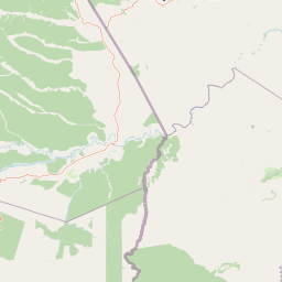
Map view of Bahuaja-Sonene National Park

Use this park location map to pinpoint Bahuaja-Sonene National Park in Peru, understand its exact geographic position, and read its mapped placement within the surrounding landscape more clearly.

Pigeon | © OpenStreetMap contributors

Location context for Bahuaja-Sonene National Park

Madre de Dios RegionPuno Region
Natural feature types

Explore the Geographic Landmarks and Natural Features of Bahuaja-Sonene National Park

Continue your geographic research by examining the specific natural landmarks and terrain types associated with Bahuaja-Sonene National Park. This indexed atlas supports a deeper understanding of the park's topography and river networks within the broader Madre de Dios conservation region.
Recorded earthquake history

Review Recorded Seismic Events Near Bahuaja-Sonene National Park

Explore the curated earthquake history associated with the protected landscapes of Bahuaja-Sonene National Park. This MoriAtlas collection offers a transparent view of historical seismic data, allowing for direct reference of event magnitudes and locations relative to the park boundaries.

Bahuaja-Sonene National Park Earthquake History

Catalogued events

23 events

Strongest magnitude

Magnitude 6.9

Most recent event

Apr 30, 2026

This history includes earthquakes recorded inside the park or within 50 km of its borders

Park atlas

Trace the mapped geography of Peru's vast Amazon frontier, exploring connected protected areas and their diverse landscapes.

Compare National Parks and Protected Areas Near Bahuaja-Sonene National Park and its Regional Landscapes

Explore other national parks and protected areas neighboring Bahuaja-Sonene National Park, tracing Peru's Amazon frontier and its critical transboundary conservation landscapes. Compare these diverse protected zones to understand their regional geographic context and their collective contribution to the Amazon's vast biodiversity and unique forest ecosystems.
National parkLa Paz Department
Park boundaries overlap#1 closest

East

Madidi National Park: National Park Protected Landscape and Geographic Atlas Entry

Explore mapped boundaries and regional context in La Paz Department.

Madidi National Park is a designated national park situated in Bolivia's La Paz Department. This detail entry offers a focused perspective on its protected landscape, its specific geographic setting, and its role within the larger atlas of natural areas. Understand the park's mapped boundaries and its contribution to the regional geography, providing a foundation for structured discovery of Bolivia's protected lands.

Area
18,957.5 km²
Established
1995
IUCN
II
Relief
Mixed relief
Wildlife reservePando Department
20 km away#2 closest

Northeast

Reserva nacional de vida silvestre amazónica Manuripi: Protected Amazonian Wilderness

Map and geographic context of Pando Department wildlife reserves

Spanning over 700,000 hectares, this wildlife reserve safeguards representative Amazonian ecosystems. Explore the hydrological network of the Madre de Dios and Manuripi river basins, ancient Brazil nut stands, and diverse wetland formations that define this significant regional protected area.

Area
7,470 km²
Established
1973
Relief
Lowland
Climate
Tropical
Wildlife reserveMadre de Dios Region
39 km away#3 closest

West

Amarakaeri Communal Reserve: Protected Geography and Amazonian Forest Mapping

Wildlife reserve in the Madre de Dios Region of Peru

Covering a large block of Amazonian forest, the Amarakaeri Communal Reserve marks the transition between flat lowland drainage basins and the rising slopes of the Peruvian Yungas. This protected area stands as a hallmark of indigenous-led conservation within the Madre de Dios Region, preserving natural terrain that ranges from dense riverine forests to Andean cloud forest vegetation. The reserve is also anchored by the Harakbut Face, a unique natural landmark formed by centuries of regional erosion.

Relief
Mixed relief
Climate
Tropical
Access
Access unknown
Scope
Terrestrial
National parkMadre de Dios Region
111 km away#4 closest

Northwest

Manu National Park: A National Park with Mapped Boundaries in Madre de Dios Region

Explore its protected landscape and regional geography.

Gain a detailed understanding of Manu National Park, a key protected area situated in Peru's Madre de Dios Region. This page offers in-depth information on its geographic context, allowing for focused exploration of its mapped terrain and its identity as a national park. Understand how this protected landscape contributes to the regional geography and provides a solid anchor for atlas-based research and discovery.

Area
17,162.9 km²
Established
1973
IUCN
II
Relief
Mixed relief
Protected areaBolivia
About 123 km away#5 closest

South

Área Natural de Manejo Integrado Apolobamba: Protected Landscape Geography and Andean Terrain

High-altitude glacial geography and Andean-Amazonian transition zones

Located in the department of La Paz, this protected area features a rugged landscape defined by tectonic uplift and Quaternary glaciation. It safeguards critical high-Andean habitats, including peatlands and Polylepis woodlands, while providing a essential refuge for vicuña populations within its steeply dissected mountain topography.

Area
4,837.43 km²
Established
1972
Relief
Mountain
Climate
Alpine
Protected areaBeni Department
About 176 km away#6 closest

Southeast

Área Protegida Municipal Rhukanrhuka: Mapping Amazonian Biodiversity and Riverine Terrain

A transitional protected landscape in the Beni Department of Bolivia

Spanning a vast transition from Andean slopes to the Llanos de Moxos floodplain, Área Protegida Municipal Rhukanrhuka protects a dynamic mosaic of white-water rivers, gallery forests, and tectonic lakes. This significant municipal reserve serves as a refuge for threatened species and sustains indigenous Maropa communities within its borders, anchoring an essential conservation corridor in the northern Amazon.

Area
8,594.51 km²
Established
2019
Relief
Lowland
Climate
Tropical
National parkPeru
189 km away#7 closest

Northwest

Alto Purús National Park: Peru's Protected National Park Landscape

Mapped boundaries and regional geographic context.

Investigate Alto Purús National Park, a designated national park within Peru. This detailed page provides essential context for understanding the park's geographic location, its protected status, and its role within the broader landscape of western South America. Explore the mapped features and regional setting that define this important conservation area.

Area
25,106.9 km²
Established
2004
IUCN
II
Relief
Mixed relief
Biosphere reserveBolivia
About 226 km away#8 closest

Southeast

Reserva de la Biosfera y Tierra Comunitaria de Origen Pilón Lajas Protected Landscape Atlas

Mapping the Andean Amazonian transition in northern Bolivia

Spanning from high mountain ridges to the river plains of the Beni, this protected area features a unique vertical gradient of ecosystems including cloud forests and terra firme. It represents a significant model for indigenous co governance and biodiversity protection within the broader Andean and Amazonian geographic context.

Area
4,000 km²
Established
1992
Relief
Mountain
Climate
Tropical

Common questions about visiting, size, designation, and location context for Bahuaja-Sonene National Park

Bahuaja-Sonene National Park FAQs for park facts, access, geography, and protected area context

Find quick answers about Bahuaja-Sonene National Park, including protected-area facts, park geography, trail and visitor context, and how the park fits into its surrounding country and regional landscape.
MoriAtlas Explorer

Continue Your Protected Areas Search Across the Global Atlas

Deepen your exploration by continuing the structured search for national parks and protected areas worldwide. Utilize the comprehensive filtering capabilities to compare different conservation landscapes and refine your understanding of global park geography. Discover more about the distribution and characteristics of protected natural areas.

Global natural geography