
Mori Atlas logo
Protected areaÁrea Natural de Manejo Integrado Apolobamba

Tracing the altitudinal transition from towering glacial summits to humid Yungas cloud forests

Área Natural de Manejo Integrado Apolobamba: Mapping the Protected Landscapes of the Bolivian Andes

Spanning a dramatic altitudinal range from the high peaks of the Cordillera de Apolobamba exceeding 5,400 meters down to the lush Yungas cloud forests, this protected area serves as a vital biogeographic bridge in Bolivia. The terrain compresses diverse environments including glacial U-shaped valleys, high-altitude bofedales, and dry inter-Andean slopes into one significant conservation corridor. This geography supports essential vicuña populations and acts as a convergence zone for Andean, Yungas, and Amazonian ecological influences.

andespunacordillerayungascloud forestmontane forest
A stylized vector illustration of a mountain valley featuring a winding river, green grassy foreground, rocky slopes, and snow capped mountains in the distance under a cloudy sky.

Área Natural de Manejo Integrado Apolobamba

Protected area

Park overview

Structured park overview, official facts, and landscape profile for Área Natural de Manejo Integrado Apolobamba

Área Natural de Manejo Integrado Apolobamba park facts, protected area profile, and essential visitor context

Review the core facts for Área Natural de Manejo Integrado Apolobamba, including designation, size, terrain, visitor scale, habitats, and operating context in one park-focused overview.

About Área Natural de Manejo Integrado Apolobamba

The Área Natural de Manejo Integrado Apolobamba is a major protected landscape in the La Paz department of northwestern Bolivia, covering close to 4,837 square kilometers across the provinces of Bautista Saavedra, Franz Tamayo, and Larecaja. It occupies a key portion of the Cordillera de Apolobamba and the adjacent Cordillera de Akamani, where Andean peaks rise above 5,400 meters and then drop sharply toward the eastern Yungas slopes. This pronounced relief creates one of the most pronounced elevation gradients within Bolivia's protected-area system, ranging from roughly 1,000 meters in the lower forested valleys to the glacial zone of the high cordillera.

The park's identity is shaped by the convergence of three major ecological worlds: the high Andean puna with its bofedales, glacial valleys, and mountain wetlands; the transitional montane forests that include cloud forests and Polylepis woodlands; and the lower moist forests of the Yungas that descend toward the Amazon basin. Ecologically, the area falls primarily within the Yungas and Northern Puna ecoregions, with patches of inter-Andean dry forest adding further habitat diversity. The convergence of Andean and Amazonian influences, combined with such a steep altitudinal gradient, supports exceptionally high species diversity and numerous biogeographic contact zones.

Apolobamba also has a strong functional role within the broader Bolivian conservation landscape. The park adjoins the Madidi National Park to the north, and together the two areas help protect a continuous corridor of Andean and Yungas ecosystems extending from the high cordillera to the lowland Amazon headwaters. Apolobamba's watersheds feed both the endorheic Titicaca/Desaguadero system via the Suches River and the Amazon basin via the Mapiri and Tuichi rivers, giving the park significance well beyond its boundaries for downstream water, sediment, and biodiversity dynamics.

The protected area is also deeply connected to high-Andean cultural traditions, including extensive traditional use of highland pastures for camelid herding, particularly vicuña and alpaca. The dimensions around 2,500 meters and above, together with the bofedales and grasslands of Ulla Ulla and surrounding puna, support grazing economies and rural communities whose livelihoods remain tightly linked to the health of the Andean ecosystems. As an "Integrated Management Natural Area", Apolobamba reflects a model that aims to balance strict conservation of fragile ecosystems with the sustainable use of landscapes and species, including the regulated management of vicuña populations and traditional land uses.

Quick facts and research context for Área Natural de Manejo Integrado Apolobamba

Apolobamba is a Bolivian integrated management natural area located in the La Paz department, occupying parts of the provinces of Bautista Saavedra, Franz Tamayo, and Larecaja. Established in 1972 and substantially expanded in 2000, the area covers roughly 4,837 square kilometers of high Andean terrain. It lies adjacent to the Madidi National Park, sharing a long northern boundary, and together the two areas anchor one of the largest continuous blocks of protected Andean and Yungas ecosystems in Bolivia.

The area is defined by the Cordillera de Apolobamba and the broader Cordillera de Akamani, with elevations ranging from approximately 1,000 meters in the lower Yungas to over 5,400 meters on the highest summits. Its three main watersheds, the Suches, Mapiri, and Tuichi rivers, link the park simultaneously to the endorheic Altiplano/Lake Titicaca system and to the Amazon basin via the Beni River. The area preserves one of the largest vicuña populations in Bolivia and is recognized for its floristic richness, with roughly 1,700 vascular plant species recorded across a wide range of vegetation types.

Protection and recognition

Documented terrestrial protection scope and historical designation records for the protected area

Área Natural de Manejo Integrado Apolobamba Protection Status and Designation History

Terrestrial protection status for Área Natural de Manejo Integrado Apolobamba includes official designation history established in the year 2000. Verified records outline the management scope and conservation parameters associated with this protected landscape.

Protection details

Protection scope
Terrestrial
Designated year
2000
Transboundary protection
No
Park context

Deeper park guide and search-rich context for Área Natural de Manejo Integrado Apolobamba

Área Natural de Manejo Integrado Apolobamba history, landscape, wildlife, and travel context

Explore Área Natural de Manejo Integrado Apolobamba through its history, landscape character, ecosystems, wildlife, conservation priorities, cultural context, and seasonal travel timing in a structured park guide built for atlas discovery and search intent.

Why Área Natural de Manejo Integrado Apolobamba stands out

Apolobamba is best known for protecting one of the most important vicuña populations in Bolivia and for being a major stronghold of high-Andean puna, glacial landscapes, and Andean camelid conservation, tracing its conservation lineage from the historic Ulla Ulla reserve. The area equally stands out for the abrupt meeting of high cordillera and Yungas cloud forests, producing a striking landscape transition within a single protected area. Beyond large camelids, Apolobamba is recognized for its extraordinary biodiversity, particularly its avifauna, with more than 500 recorded bird species distributed across altitudinal zones from the semi-humid high Andes to lower subtropical montane forests. The park is also notable as a transition zone where Andean, Yungas, and Amazonian faunas overlap, creating an unusually rich biogeographic contact area between major South American ecological regions.
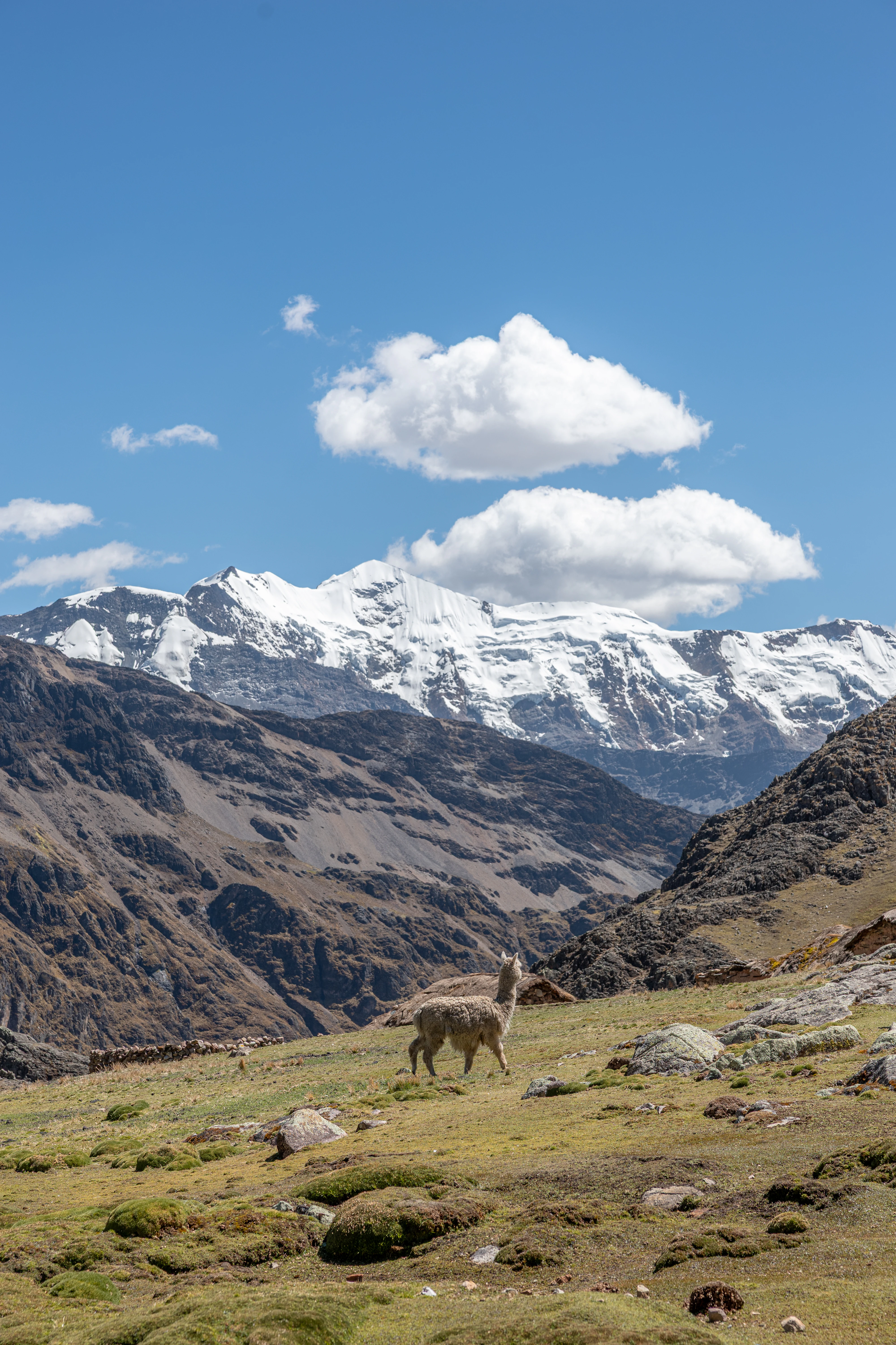
A llama standing on a grassy rocky hillside with snow-covered mountain peaks and a blue sky with white clouds in the background
A llama stands on a rocky highland pasture with the snow-capped peaks of the Apolobamba range rising in the background under a blue sky with scattered clouds

Área Natural de Manejo Integrado Apolobamba history and protected-area timeline

The history of Apolobamba as a protected area begins in 1972, when an early protected designation was established to safeguard high-Andean ecosystems and vicuña populations. That initial designation, focused on the Ulla Ulla highlands and surrounding puna, eventually evolved into the present-day Área Natural de Manejo Integrado Apolobamba. The current protected area was formally created through Supreme Decree 25652, issued on 14 January 2000 under the government of Hugo Bánzer Suárez, substantially expanding the original reserve footprint to encompass close to 4,837 square kilometers.

This expansion effectively converted the original Ulla Ulla Faunal Reserve into a much larger integrated management area that links the high Andean puna with the eastern Andean slopes and Yungas forests. The recategorization allowed for a more flexible management model that recognizes both strict conservation of fragile ecosystems and the sustainable use of areas traditionally inhabited and used by local communities. The history of Apolobamba is thus closely intertwined with the legacy of Ulla Ulla as a pioneering Bolivian reserve for vicuña conservation, and with broader shifts in Bolivian protected-area policy toward integrated management categories during the late 1990s and early 2000s.

Área Natural de Manejo Integrado Apolobamba landscape and geographic character

The landscape of Apolobamba is defined by an extremely steep and rugged relief that compresses a wide range of Andean environments into a relatively compact geographic space. Elevations ascend from about 1,000 meters in the eastern Yungas valleys to peaks above 5,400 meters in the Cordillera de Akamani and the broader Cordillera de Apolobamba. Much of the protected area lies above 2,500 meters, and most of its terrain is shaped by strong slopes, deep dissection, and the combined influence of tectonic uplift, Quaternary glaciation, and ongoing river erosion.

Four broad physiographic zones can be recognized within the area. The Andean Zone runs as an elongated belt of high summits, volcanic massifs, snow-covered peaks, and steep eastern slopes plunging toward the Amazon basin. The Sub-Andean Zone consists of folded and eroded ancient sedimentary rocks that produce irregular hills and narrow valleys. The Andean Piedmont features extensive alluvial fans and dejection cones that descend gradually toward the lowlands, while the Alluvial-Lacustrine Plain includes low terraces, paleo-channels, and marshy surfaces tied to the complex fluvial dynamics of the area.

Geomorphologically, the Cordillera de Apolobamba itself is dominated by glacial and periglacial landforms, with U-shaped valleys, lateral and frontal moraines, pronounced escarpments, and slopes frequently steeper than 30 degrees. To the west lies the Ulla Ulla Altiplano, characterized by glacial and fluvio-glacial deposits, moraines, dejection cones, peatlands, and high-altitude lagoons. In areas such as Charazani, Tolacota, and Putina, the landscape mixes peri-glacial mountain forms, detrital deposits, cultivated terraces, and active glacial erosion. The result is a mosaic of structural, denudational, fluvial, glacial, fluvio-glacial, and even biologically originated landforms, among which the high-altitude bofedales (peatlands) form a distinctive feature on flat surfaces where the water table approaches the surface.
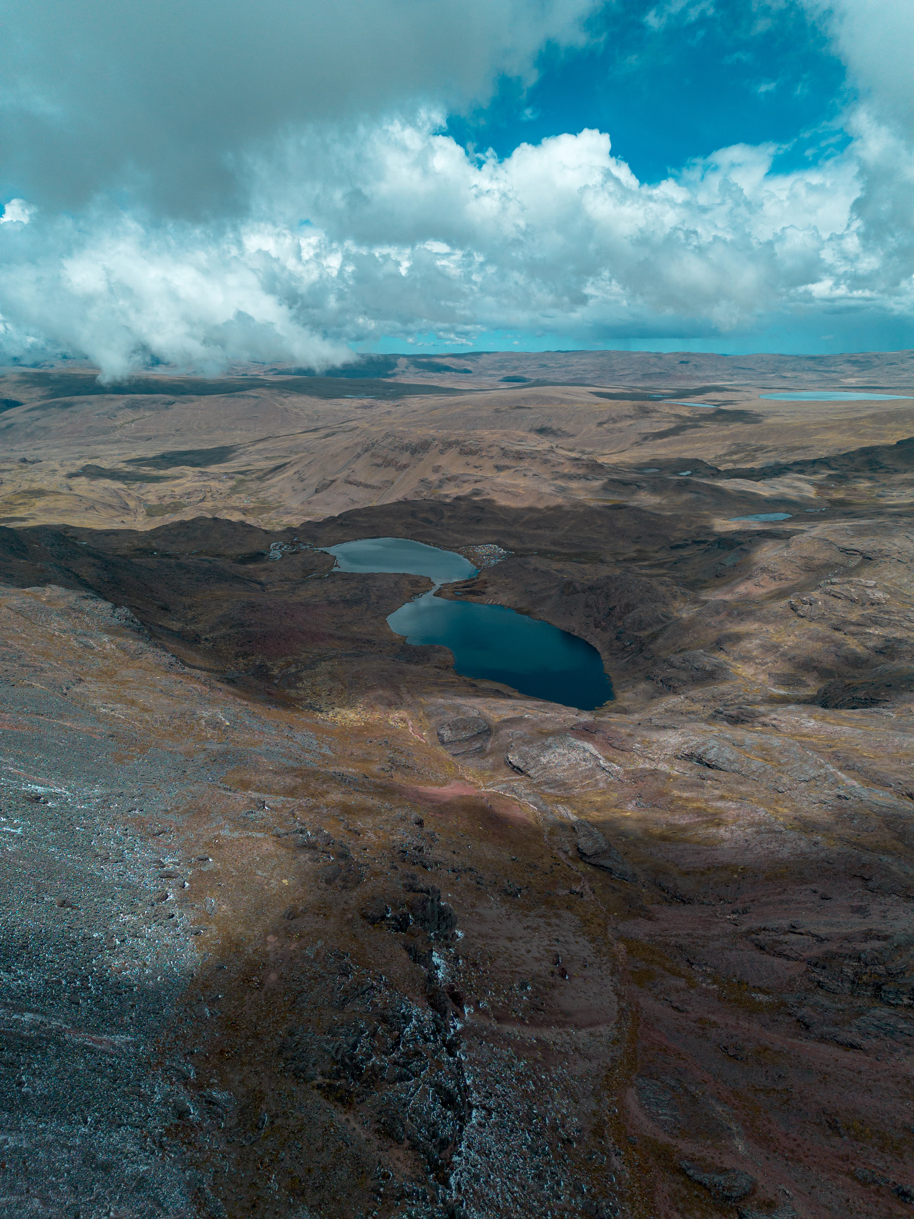
A high angle view of a rugged brownish landscape featuring two small blue lakes nestled in a depression under a partly cloudy sky.
Aerial view of high altitude lakes in the Apolobamba landscape.

Área Natural de Manejo Integrado Apolobamba ecosystems, habitats, and plant life

Apolobamba supports an exceptionally rich and complex ecological profile, owing to its steep altitudinal gradient and the convergence of Andean and Yungas biogeographic influences. The area falls mainly within the Yungas and Northern Puna ecoregions, with smaller contributions from the Inter-Andean Dry Forests ecoregion. Within this framework, the vegetation transitions from high Andean and subnival formations, through puna grasslands, bofedales, and Yungas páramo, down to inter-Andean dry valleys, Polylepis woodlands, montane cloud forests, humid montane forests at multiple elevational belts, dry montane forests, mountain savannas, and riparian woodlands along rivers and streams.

Botanical studies, intensified after the 2000 recategorization of the protected area, have recorded roughly 1,701 species of vascular plants distributed across about 735 genera and 180 families, a figure that significantly exceeds earlier inventories. The humid montane forests and the Yungas páramo host the highest concentrations of species, while Polylepis woodlands and high-Andean grasslands add further ecological distinctiveness. The flora also includes new records for science, narrowly endemic taxa, and at least 12 species classified under some threat category by the IUCN or under CITES, particularly tree ferns, forest species, and cacti.

Ecological pressures within the park are significant. Overgrazing, recurrent burning, agricultural expansion, extraction of firewood and timber, and mining activities all affect the vegetation, with impacts especially visible in Polylepis woodlands, puna grasslands, and montane forests. At the same time, the altitudinal and biogeographic complexity of Apolobamba produces habitat heterogeneity that supports exceptionally rich fauna, making the park a key conservation reference for the northwestern Andean-Yungas transition in Bolivia.
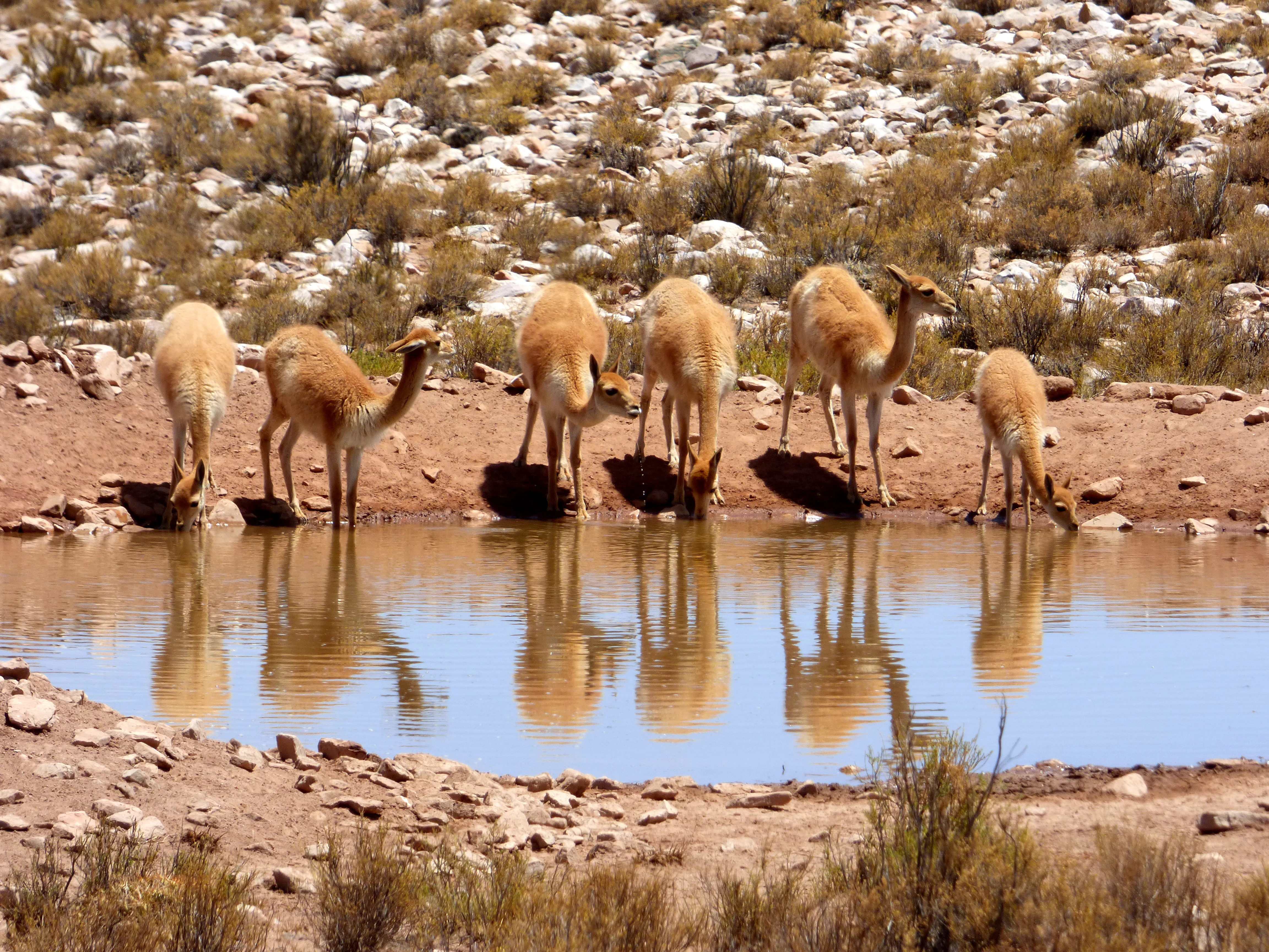
A group of six vicuñas standing at the edge of a small body of water, drinking, with their reflections visible in the water against a rocky, arid background.
A herd of vicuñas drinking from a waterhole in the arid landscape of Apolobamba.

Área Natural de Manejo Integrado Apolobamba wildlife and species highlights

Apolobamba functions as a major biogeographic crossroads where Andean, Yungas, and Amazonian faunas overlap, producing high species diversity and numerous distribution limits within a single protected area. Mammal studies have documented close to 90 species, including conservation-priority species such as the taruca (Andean deer), puma, jaguar, vicuña, and spectacled bear (jucumari), alongside notable records of the Andean white-tailed deer and the mountain paca. The high-Andean portion of the park serves as an important refuge for species that are poorly represented or in poor conservation status in other Bolivian protected areas.

The avifauna is particularly rich, with around 508 recorded species distributed across three main ornithological zones: the semi-humid high-Andean belt, the montane forest of the eastern slope, and the lower subtropical montane forest. Species richness increases toward lower elevations, with the lower humid montane forests hosting the highest diversity, while Polylepis woodlands and Yungas páramo support a smaller but ecologically distinctive set of species. The area harbors range-restricted and globally noteworthy birds such as the Royal Cinclodes, a high-Andean passerine of strong conservation interest.

Herpetofauna in Apolobamba is less well studied but includes amphibians from families such as Bufonidae, Dendrobatidae, Hylidae, and Leptodactylidae, as well as reptiles from the orders Sauria and Ophidia, comprising lizards and snakes typical of high-Andean and transitional environments. The ichthyofauna is split between two major systems: native species such as Orestias agassii and Trichomycterus inhabit the Lake Titicaca basin on the Suches side, while the eastern slope supports fish adapted to steep Andean rivers. Uncontrolled introduction of rainbow trout into multiple water bodies has negatively affected native fish populations and stands out as one of the main conservation concerns for the park's aquatic ecosystems.
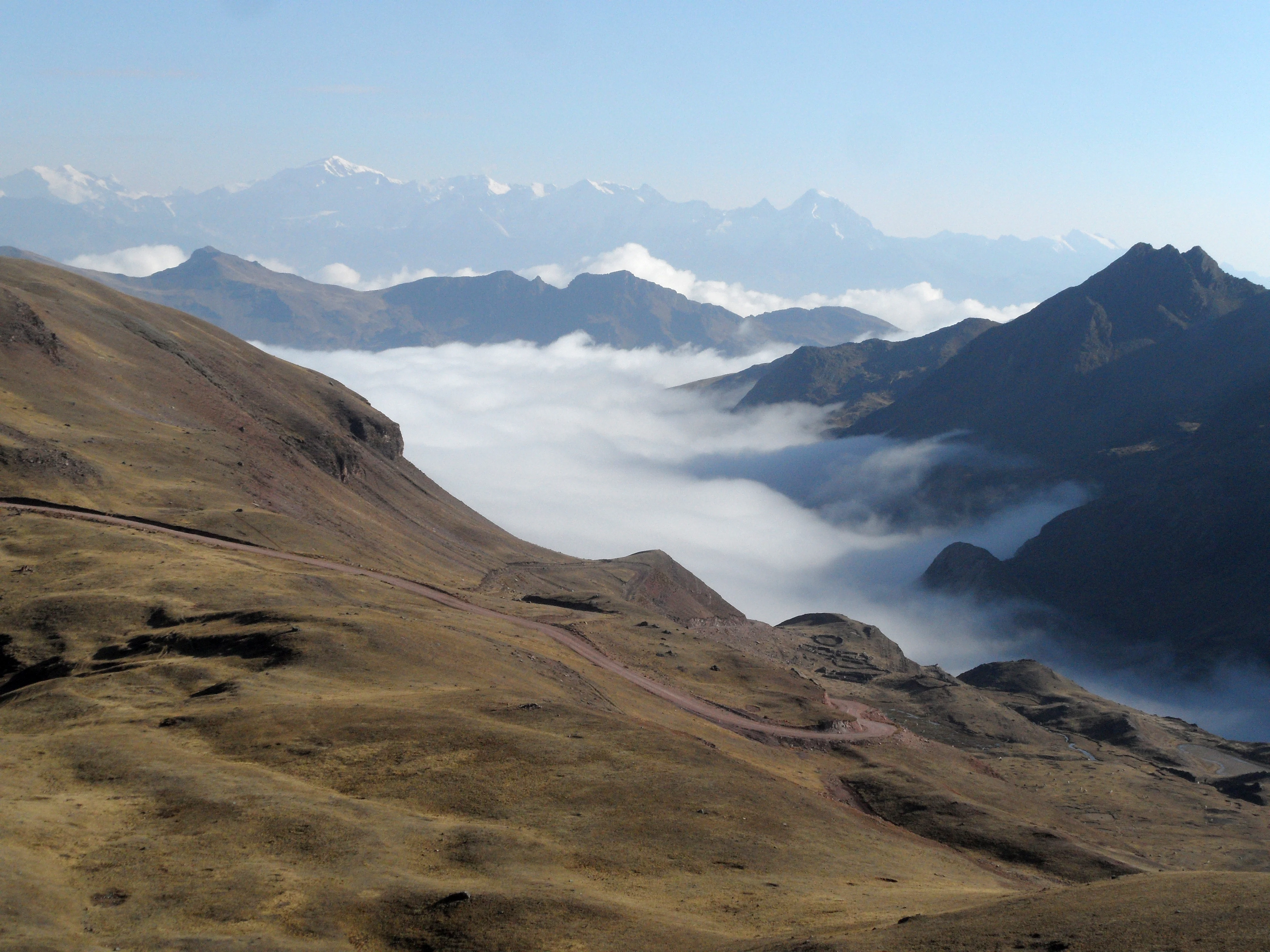
A wide landscape view of high-altitude brownish hills with a winding dirt road, overlooking a valley filled with white clouds and distant snow-capped mountain peaks.
Panoramic view of the Cordillera de Apolobamba with a sea of clouds filling the valley below.

Área Natural de Manejo Integrado Apolobamba conservation status and protection priorities

Conserving Apolobamba matters because the area protects an unusually complete altitudinal gradient of Andean and Yungas ecosystems, including habitats that are otherwise under strong pressure elsewhere in Bolivia. The park safeguards large extensions of high-Andean puna, bofedales, Polylepis woodlands, montane cloud forests, and humid lower montane forests, all within a continuous landscape that connects with the Madidi complex to the north. This makes Apolobamba a critical node in one of the most important conservation corridors in the Tropical Andes.

At the species level, the park is especially significant for the conservation of the vicuña, hosting one of Bolivia's most important populations inherited from the former Ulla Ulla reserve. It is also a refuge for threatened mammals such as the taruca, the Andean white-tailed bear (jucumari), the Andean white-tailed deer, and wide-ranging carnivores like the puma and jaguar, whose persistence requires extensive connected habitats. The avifauna includes range-restricted species such as the Royal Cinclodes, while the flora includes at least 12 species under threat assessments from the IUCN and CITES, including tree ferns, forest trees, and cacti.

The area's conservation challenges are substantial. Overgrazing, recurrent burning, agricultural expansion, extraction of firewood and timber, and mining activities place pressure on Polylepis woodlands, puna grasslands, and montane forests, while the introduction of rainbow trout into Andean lakes and rivers threatens native fish faunas. As an Integrated Management Natural Area, Apolobamba explicitly aims to reconcile strict ecological protection with the sustainable use of landscapes and species, including traditional camelid grazing and regulated vicuña management, making conservation outcomes closely tied to the well-being of local high-Andean communities.

Área Natural de Manejo Integrado Apolobamba cultural meaning and human context

Apolobamba is deeply intertwined with high-Andean cultural traditions rooted in camelid herding and mountain agriculture. Communities in the highland municipalities such as Pelechuco, Charazani, and surrounding areas have long relied on the puna grasslands and bofedales for grazing llamas, alpacas, and sheep, with vicuña management adding an additional layer of cultural and economic significance inherited from the historic Ulla Ulla reserve. The park's western sector reflects this Andean highland identity with gently undulating plains, glacially influenced deposits, and traditional land-use patterns, while its eastern sector represents a more abrupt Andean landscape with steep valleys and younger topography.

The protected area's status as an Integrated Management Natural Area explicitly acknowledges the presence of these communities and the importance of maintaining sustainable traditional land uses alongside strict ecological protection. Local livelihoods are tightly connected to the seasonal dynamics of the puna, the health of bofedales, and the availability of high-altitude pastures, making the cultural landscape inseparable from the ecological one. Apolobamba thus represents not only a major natural reserve but also a living high-Andean cultural landscape where traditional knowledge and biodiversity conservation intersect.

Top sights and standout views in Área Natural de Manejo Integrado Apolobamba

Apolobamba stands out for combining extreme altitudinal diversity, from Yungas forests around 1,000 meters to peaks above 5,400 meters, with the protection of one of Bolivia's most important vicuña populations. Its position adjoining Madidi makes it a key anchor of a large Andean-to-Amazon conservation corridor, while its geography spans the divide between the Titicaca endorheic system and the Amazon basin via the Beni River watershed.

The area is also distinguished by exceptional plant and bird diversity, with roughly 1,700 vascular plant species and over 500 bird species documented across altitudinal gradients that meet Andean, Yungas, and Amazonian influences. From glacial U-shaped valleys and moraines in the Cordillera de Apolobamba to bofedales, Polylepis woodlands, cloud forests, and dry inter-Andean valleys below, Apolobamba packs an unusually broad spectrum of Andean habitat types into a single, strongly contrasting landscape.

Best time to visit Área Natural de Manejo Integrado Apolobamba

Seasonal conditions in Apolobamba strongly shape both landscape character and ecological experience. Most rainfall in the area concentrates during the austral summer, roughly December through March, when the southward shift of the Intertropical Convergence Zone brings wetter, more vegetated conditions to the Yungas slopes and intensifies flows in rivers such as the Mapiri and Tuichi. During these months, lower montane forests appear lush and waterfalls and river discharges are at their highest, while higher Andean areas may become cloudier and access more challenging.

The austral winter, broadly May through August, brings a marked decrease in atmospheric moisture and precipitation. Glacial and high-altitude landscapes become more visible under clearer skies, and high-altitude bofedales and pastures retain water supplied by glacial melt and slow hydrological responses, particularly in the Suches basin. For visitors interested in stable conditions, clearer mountain views, and Andean highland landscapes, the drier season tends to provide more accessible conditions, while those focused on the Yungas forests and river dynamics may find the wet season more rewarding.

Monthly climate preview

Long-term representative temperature and precipitation patterns across the elevation

Área Natural de Manejo Integrado Apolobamba Climate Normals and Weather by Month

Representative coordinates record measured monthly air temperatures alongside long-term daily precipitation rhythms for Área Natural de Manejo Integrado Apolobamba. Examining the complete twelve-month climatology profile reveals comprehensive variations in temperature and moisture normals.
Annual mean13 °C
12 °C15 °C
Jan14°
Feb14°
Mar14°
Apr13°
May12°
Jun12°
Jul12°
Aug12°
Sep13°
Oct14°
Nov15°
Dec14°
Warmest month
November

14.5 °C

Coolest month
July

11.6 °C

Wettest month
February

6.3 mm/day

Driest month
July

1.1 mm/day

Park location guide

Geography guide, regional context, and park location map for Área Natural de Manejo Integrado Apolobamba

Área Natural de Manejo Integrado Apolobamba park geography, regions, and map view in Bolivia

Understand where Área Natural de Manejo Integrado Apolobamba sits in Bolivia through a broader geographic reading of the surrounding landscape, nearby location context, and its mapped position within the national park landscape.

How Área Natural de Manejo Integrado Apolobamba fits into Bolivia

Bolivia, officially the Plurinational State of Bolivia, is a landlocked country in central South America. It features diverse geography including the Andean mountain range, Amazonian plains, Gran Chaco, and the Pantanal wetland. The country has a population of approximately 11.4 million and is administratively divided into nine departments, with La Paz as the seat of government and Sucre as the constitutional capital.

Wider geography shaping Área Natural de Manejo Integrado Apolobamba in Bolivia

Bolivia is located in central South America, bordered by Brazil to the north and east, Paraguay to the southeast, Argentina to the south, Chile to the southwest, and Peru to the west. The country is divided between a western Andean region and tropical lowlands to the east and north. It includes the Amazonian plain, Gran Chaco, temperate valleys, the high-altitude Altiplano plateau, and part of the Pantanal wetland along its eastern border.

Map view of Área Natural de Manejo Integrado Apolobamba

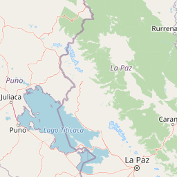
Use this park location map to pinpoint Área Natural de Manejo Integrado Apolobamba in Bolivia, understand its exact geographic position, and read its mapped placement within the surrounding landscape more clearly.

Pigeon | © OpenStreetMap contributors

Visualizing high Andean peaks, glacial valleys, and Yungas cloud forests

Área Natural de Manejo Integrado Apolobamba Photos and Landscapes

Examine the rugged terrain and dramatic altitudinal gradients spanning snow-covered cordillera summits down to moist Amazonian slopes. Visual documentation reveals high-altitude bofedales, glacial moraines, and the protected habitats supporting regional vicuña populations.

A llama standing on a grassy rocky hillside with snow-covered mountain peaks and a blue sky with white clouds in the background

A close-up view of a gray and yellowish-green lizard with textured scales resting on gray rocks, with dry grass and moss in the background.

A high angle view of a rugged brownish landscape featuring two small blue lakes nestled in a depression under a partly cloudy sky.

A group of six vicuñas standing at the edge of a small body of water, drinking, with their reflections visible in the water against a rocky, arid background.

A wide landscape view of high-altitude brownish hills with a winding dirt road, overlooking a valley filled with white clouds and distant snow-capped mountain peaks.

A wide landscape view of a turquoise lake surrounded by rocky terrain and snow-capped mountains under a blue sky.

Park atlas

Compare surrounding high Andean puna, glacial cordillera peaks, and Yungas forest reserves.

Other Parks Near Área Natural de Manejo Integrado Apolobamba And Connected Protected Landscapes

Browsing other parks near Área Natural de Manejo Integrado Apolobamba reveals contiguous conservation corridors spanning high-altitude bofedales and Amazonian slopes. Extending regional geographic comparison clarifies how neighboring protected landscapes share similar altitudinal gradients and wildlife habitats.
National parkLa Paz Department
About 12 km away#1 closest

Northeast

Madidi National Park: National Park Protected Landscape and Geographic Atlas Entry

Explore mapped boundaries and regional context in La Paz Department.

Madidi National Park is a designated national park situated in Bolivia's La Paz Department. This detail entry offers a focused perspective on its protected landscape, its specific geographic setting, and its role within the larger atlas of natural areas. Understand the park's mapped boundaries and its contribution to the regional geography, providing a foundation for structured discovery of Bolivia's protected lands.

Area
18,957.5 km²
Established
1995
IUCN
II
Relief
Mixed relief
National parkPeru
About 123 km away#2 closest

North

Bahuaja-Sonene National Park: A Major Amazon Frontier National Park in Peru's Geography

Explore its mapped protected landscape and diverse terrain.

Bahuaja-Sonene National Park is an extensive national park situated on the Amazon frontier in southern Peru, encompassing a crucial transition zone between lowland rainforest and higher-elevation forest ecosystems. Its diverse topography, from river valleys to mountainous slopes, creates varied natural landscapes. The park's protected boundaries are integral to the regional conservation strategy, offering a unique lens through which to study the mapped geography and ecological significance of this vast Amazonian protected area.

Area
10,914.2 km²
Established
1996
IUCN
II
Relief
Mixed relief
National parkLa Paz Department
About 154 km away#3 closest

Southeast

Cotapata National Park and Integrated Management Natural Area: A Protected Landscape in La Paz Department, Bolivia

Explore its mapped boundaries and regional geographic context.

Delve into the protected landscape identity of Cotapata National Park and Integrated Management Natural Area, situated within the La Paz Department of Bolivia. This entry provides essential geographic context, focusing on its mapped protected area status and its contribution to the regional landscape, ideal for atlas-based exploration and understanding Bolivia's conservation network.

Area
600 km²
Established
1993
IUCN
II
Scope
Terrestrial
National parkLa Paz
About 157 km away#4 closest

Southeast

Parque Nacional Tuni Condoriri: Geographic Atlas of the Cordillera Real Protected Landscape

High-altitude mountain terrain and glacial lake systems in Bolivia

Spanning elevations between 4,500 and 6,200 meters, Parque Nacional Tuni Condoriri represents a primary example of high-Andean topography. The landscape is defined by the serrated Condoriri massif, a series of interconnected glacial lakes, and expansive high-altitude grasslands. This protected area remains a focal point for understanding the hydrological and geological processes shaping the mountain environments of the La Paz region.

Area
91.75 km²
Established
1942
Relief
Mountain
Climate
Alpine
A pale, soft-toned watercolor illustration of a calm river landscape with rolling hills in the background and sparse trees along the banks.
Biosphere reserveBolivia
About 174 km away#5 closest

East

Reserva de la Biosfera y Tierra Comunitaria de Origen Pilón Lajas Protected Landscape Atlas

Mapping the Andean Amazonian transition in northern Bolivia

Spanning from high mountain ridges to the river plains of the Beni, this protected area features a unique vertical gradient of ecosystems including cloud forests and terra firme. It represents a significant model for indigenous co governance and biodiversity protection within the broader Andean and Amazonian geographic context.

Area
4,000 km²
Established
1992
Relief
Mountain
Climate
Tropical
Protected areaBeni Department
About 185 km away#6 closest

Northeast

Área Protegida Municipal Rhukanrhuka: Mapping Amazonian Biodiversity and Riverine Terrain

A transitional protected landscape in the Beni Department of Bolivia

Spanning a vast transition from Andean slopes to the Llanos de Moxos floodplain, Área Protegida Municipal Rhukanrhuka protects a dynamic mosaic of white-water rivers, gallery forests, and tectonic lakes. This significant municipal reserve serves as a refuge for threatened species and sustains indigenous Maropa communities within its borders, anchoring an essential conservation corridor in the northern Amazon.

Area
8,594.51 km²
Established
2019
Relief
Lowland
Climate
Tropical
A horizontal watercolor painting of a river landscape with lush green vegetation in the foreground and soft, hazy hills in the background.
Protected areaBeni
About 256 km away#7 closest

Northeast

Área protegida municipal Pampas del río Yacuma: Protected Area and Wetland Geography

A large-scale municipal sanctuary in the Bolivian Amazon

This significant protected area encompasses the expansive floodable savannas of the Llanos de Moxos. Its mosaic of forest islands and riverine wetlands provides a critical refuge for endemic species and iconic Amazonian wildlife. The geography is shaped by the Yacuma River, creating a seasonal environment that bridges indigenous heritage with modern conservation land management.

Area
6,164.53 km²
Established
2007
Visitors
16K annual
Relief
Lowland
A minimalist watercolor painting depicting a soft green landscape with rolling hills in the background and a flat, grassy foreground.
Wildlife reservePando Department
About 277 km away#8 closest

North

Reserva nacional de vida silvestre amazónica Manuripi: Protected Amazonian Wilderness

Map and geographic context of Pando Department wildlife reserves

Spanning over 700,000 hectares, this wildlife reserve safeguards representative Amazonian ecosystems. Explore the hydrological network of the Madre de Dios and Manuripi river basins, ancient Brazil nut stands, and diverse wetland formations that define this significant regional protected area.

Area
7,470 km²
Established
1973
Relief
Lowland
Climate
Tropical

Common questions about visiting, size, designation, and location context for Área Natural de Manejo Integrado Apolobamba

Área Natural de Manejo Integrado Apolobamba FAQs for park facts, access, geography, and protected area context

Find quick answers about Área Natural de Manejo Integrado Apolobamba, including protected-area facts, park geography, trail and visitor context, and how the park fits into its surrounding country and regional landscape.
MoriAtlas Explorer

Continue Your Protected Areas Search Across the Global Atlas

Deepen your exploration by continuing the structured search for national parks and protected areas worldwide. Utilize the comprehensive filtering capabilities to compare different conservation landscapes and refine your understanding of global park geography. Discover more about the distribution and characteristics of protected natural areas.

Global natural geography